projects

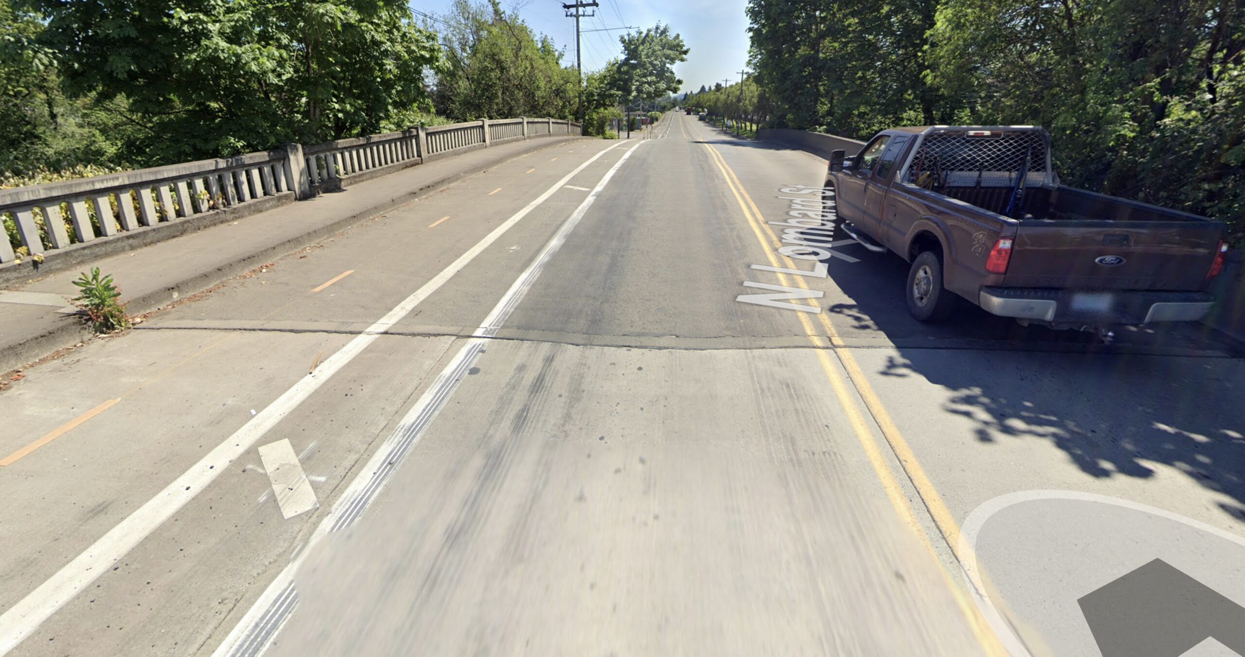
New bridge on N Lombard would come with grade-separated bike lane
A key connection to industrial jobs and the 40 Mile Loop path system is poised for an upgrade.

Updates to Hawthorne, NW Broadway will create more space for cycling and transit
Two of Portland’s most vital bikeways are on the cusp of big changes.
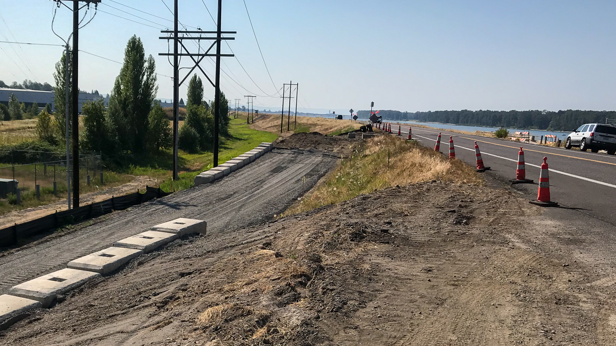
Work has begun on new section of Marine Drive bike path
Slow but steady progress to close gaps.

County shares plans to address cycling safety during major road closure
Signs, enforcement and outreach.
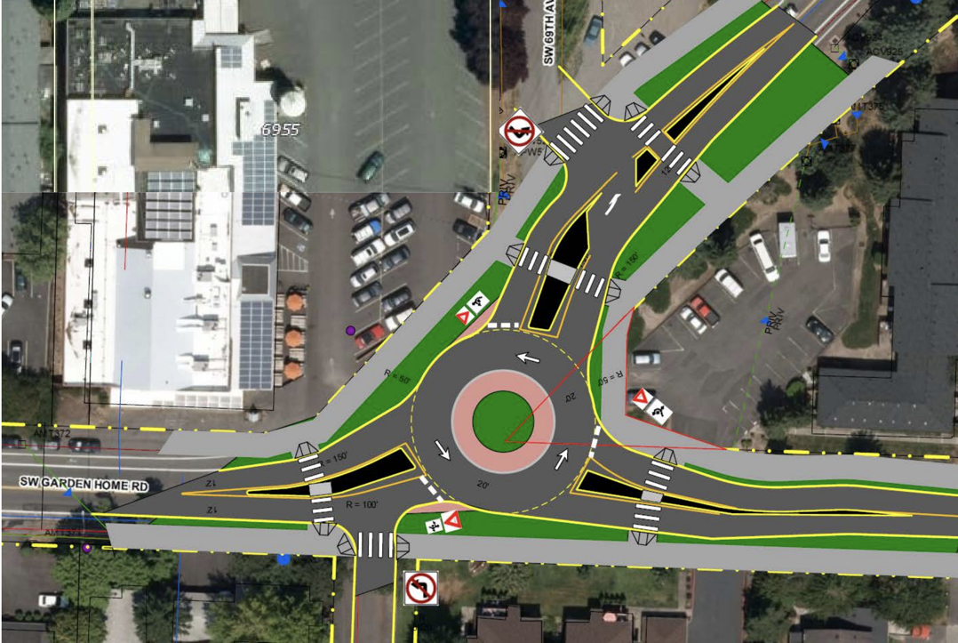
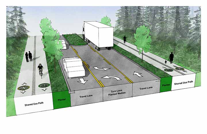
SW Multnomah/Garden Home project is an opportunity for a better bikeway
Can we make a roundabout safe for biking?
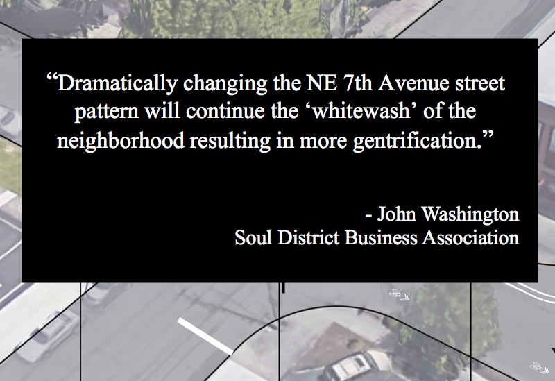
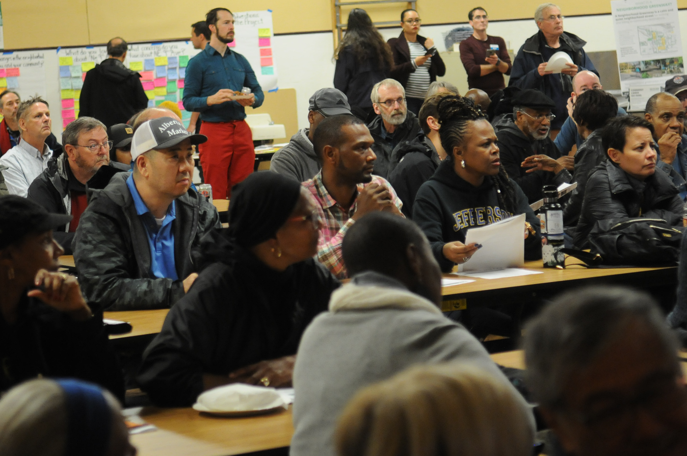
PBOT expands ‘engagement with black community’ to hear concerns around greenway project
It’s not just how many people speak up, it’s who speaks up.
City releases $2 million project list that includes cycle-track in northwest, crossbikes, and more
A lot of little things can add up to one big thing.

Fate of traffic calming on Lincoln-Harrison hangs in balance at open house tonight
So far, the nos have it.
To boost business, Beaverton will build separated bikeways on Western Ave
Updating a road by creating less space for motor vehicles.

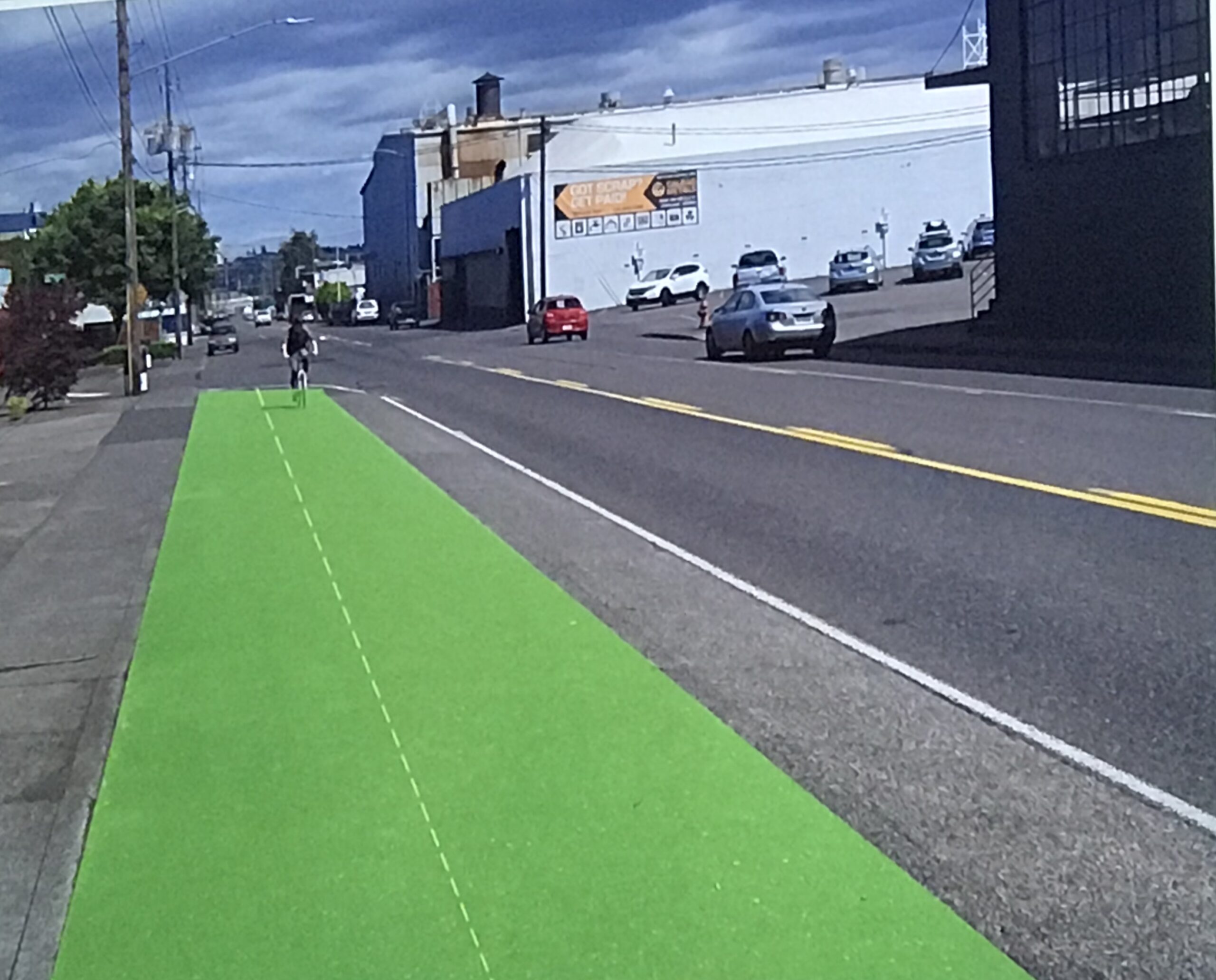
First look: New protected bikeway on SE Morrison
Go ahead, you can now bike with ease on inner SE Morrison.