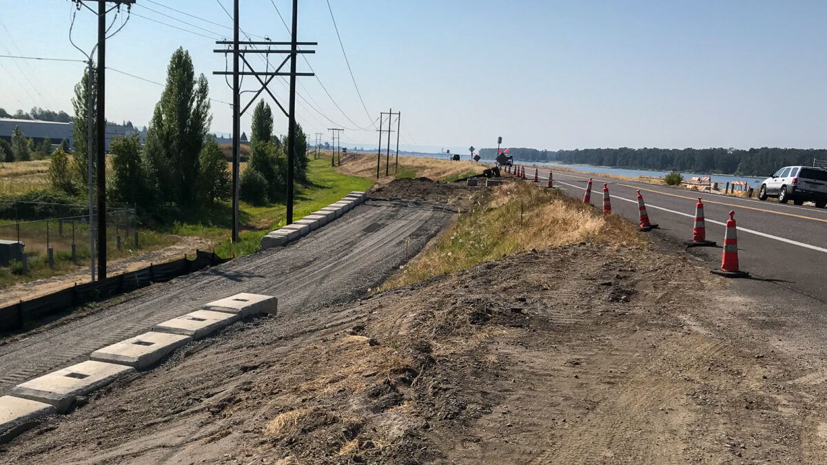
(Photos: J. Maus/BikePortland)
The City of Portland has embarked on a project that will give bicycle riders more separation from auto and truck drivers on Northeast Marine Drive.
Marine Drive straddles the Columbia River, is part of the fabled 40-Mile Loop and is a crucial east-west cycling connection to east Multnomah County and the Gorge. Unfortunately it’s also one of the city’s most dangerous roads. A designated “High Crash Corridor,” the Portland Bureau of Transportation has struggled for many years to reduce crashes, fatalities, and injuries to people who use it. Through Vision Zero and other programs, PBOT has reduced speed limits and installed automated speed cameras in an effort to slow drivers down and help them make better decisions.
The walking and rolling path on Marine Drive has nerve-wracking gaps east of I-205 that force bicycle riders to share this notorious roadway with other road users.
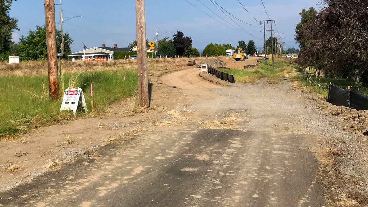
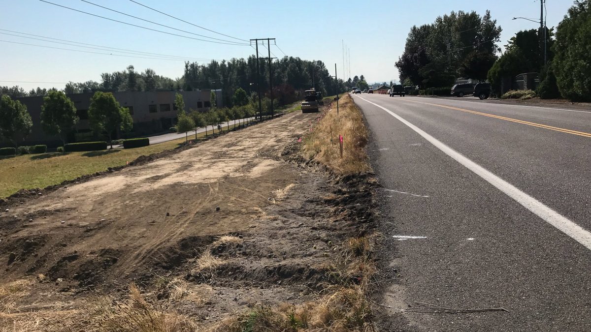
As we reported last year, PBOT has cobbled together about $1.8 million dollars to add better bike lanes (they’ll be buffered from 112nd to 185th), a traffic signal (at 122nd), flashing beacons (where the path crosses the road near 138th and 185th), and a new section of path. Earlier this week I checked out the progress on the new path.
Advertisement
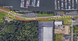
The new path starts west of 185th. As you can see in our expertly prepared graphic (LOL), PBOT will add one of the new flashing beacons to better connect two existing segments of the path. The new segment will connect back to the main road at 185th. Unfortunately this project won’t close the remaining 0.6 mile gap east of 185th that remains before you get to the path at Interlachen Lane/Blue Lake Park. (Note that 185th is the Portland city limit.)
I look forward to seeing other parts of this project completed soon.
You can learn more about the gaps that remain on Marine Drive (and progress that has been made to close them) between Kelley Point Park and the Sandy River in this excellent presentation (PDF) by 40-Mile Loop advocate Jim Sjulin.
— Jonathan Maus: (503) 706-8804, @jonathan_maus on Twitter and jonathan@bikeportland.org
Never miss a story. Sign-up for the daily BP Headlines email.
BikePortland needs your support.


Thanks for reading.
BikePortland has served this community with independent community journalism since 2005. We rely on subscriptions from readers like you to survive. Your financial support is vital in keeping this valuable resource alive and well.
Please subscribe today to strengthen and expand our work.
This is great. I work near 185th, and taking that left turn onto Marine Drive is terrible. Closing the gap between 185th and Interlaken will be huge when that eventually happens.
The gap between I-205 and 122nd is still the biggest issue, though. The traffic counts are so much higher in that section.
Nice…it will make it more of a restful ride.
[Though the level of the path may reduce the “Territorial Views” that the top of the dike shoulder area had provided cyclists…when they were not having to scan for rear approaching traffic…]
How about the plans for just west of NE 33rd?
Amen to that!
Hopefully this turns out better than the south side stretch from 122-140. It gets mossy-slick in the winter, and is a pain to use. Funny, page 59 of that linked PDF presentation shows 2 foot+ tall grass growing out of a crack in the middle of the path from the lack of use of that stretch. Having to slow down and then ride down, then back up, with some turns and no views makes that stretch worth skipping.
The lowest section of this trail has been paved for years, but was isolated, so cyclists never used it. I actually run on it quite often, and I’ve never noticed issues with wet moss. We have had a lot of issues with campers, though, and random people dumping truckloads of garbage down there. At one point last year, we came across a group of people unloading an entire box truck full of stuff in broad daylight. I flagged down a Fairview Police cruiser and he drove over and busted them right away. It was pretty great.
Wow…crazy that folks still dump truck loads of junk in broad daylight in public AND in Oregon!
Not really…and wet moss is prob worse for skinny bike tires / 2-whl vehicles than for foot traffic…
As a woman who rides alone I never would in the past nor future ride that section. I never felt safe where out of view long before the issues with the homeless. Getting onto & off of it at 122 & the other end isn’t very safe either with cars turning. I think 185 may be the same in that regard. Just easier on the road where can be seen.
If drivers were just just forced to drive the speed limit things would be so much better.
Is the path open during this work?
There really isn’t much of a path in the section they are working on now. Just stay on Marine Drive in this section, as you did before. Everything to the west is still open.
The city/state knows this road is highway 84 v2.0. they know people speed and yet, they make it wide and fast. They could drop jersey barriers down the middle and then drop them on the shoulders between bikes and cars. People would slow down. People only slow when there is risk to their life and limb.
What a disappointment! The idea was awesome … the delivery was almost perfect, but Multnomah Co. has let us down again! No sooner than the work crews chased the homeless out of that area the homeless moved right back in when they were done. My wife and I commuted to the airport by bike often to get to work on non rainy days and this was a safe addition to our commute. On our days off it was used as a part of our daily rides to the Alberta district for coffee or on our way to Banks on the trail to Vernonia. Now we don’t commute to the airport on bikes at all and we put our bikes in my 1992 F-250 massive gas consuming V8 (7-9 mpg) and drive 30 to 50 miles to find safer areas to ride. In fact this great idea of having so many bike paths in and around Portland has made it easier for the Homeless to live and commute. It is their super highway and they make their “Exit” off ramps at any point on the bike route/trail systems wherever they’re deemed fit.
If you have travelled the “40 mile loop” in the last 20 months you will know exactly what I am speaking of. Hypodermic needles, used condoms, used tampons, human deifications, 3/4 inch x 16 inch latex strands (these go with the needles), quart and gallon jugs with amber/yellowish fluids in them, furniture, mattresses, broken garden chairs, all and every description of garbage you can think of and broken up vehicles of all descriptions that just sit on those trails leaking into the soils around them … Yep this is not good! Maybe I have not researched enough about this issue, but no one is speaking of the Ecological damage that is occurring due to the homeless situation.
The Colombia Slough from Fairview Lake and Blue Lake and the wetlands that surround them have strict standards and guidelines of how one can build or not build. Excruciating work, time, energy and money has been put in place to preserve and encourage cohabitation to all that exist in these areas. What was explained to us as homeowners on Blue Lake by Multnomah County and State officials was “All areas around YOU homeowners are very sensitive soils. Anything you put into your lake will eventually go down stream and potentially ruin very sensitive ecosystems that contribute to the wellbeing of our watersheds, rivers and oceans.” So as a concerned homeowner on Blue Lake I convinced our board and Metro to purchase Solar Powered water circulators so to reduce our nutrient load in Blue Lake so that we would not have to use or drastically reduce the use of harmful chemicals. That was 4 years of fighting Metro and finally we shared the cost of a $150K practical solution. Although for what reason?
Now we have the homeless right on top of those “all so sensitive ecosystems”! Years of recovery and nurturing all in these areas for WHAT? We are going right back to the 70’s! Those folks that fought for Mother Earth and got into politics are now no where to be found! No body in power is speaking of this issue and nobody gives a crap about what the homeless are truly doing to our once safe water ways. As Chief Seattle once said “The Earth is our Mother. Whatever befalls the earth befalls the sons of earth. If men spit upon the ground, they spit upon themselves” We need to stop spitting and find a solution for this issue!