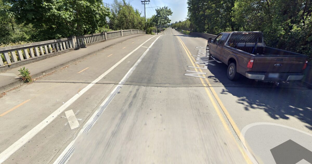
A key connection to industrial jobs and the 40 Mile Loop path system is poised for an upgrade.
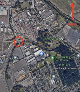
At a meeting of the Portland Bureau of Transportation Freight Committee this morning, the city unveiled preliminary plans to rebuild the Burgard Road Bridge. The bridge is located about 1.25 miles north of downtown St. Johns on Lombard Street (it becomes Burgard north of the bridge). It goes over railroad tracks just south of Terminal Road. Back in May a train derailment damaged bridge supports.
According to PBOT Project Manager Zef Wagner, the project emerged when staff examined the city’s Transportation System Plan for major projects that needed to be more shovel-ready in case new funding opportunities arise.
The bridge, which was built in 1930, is the only connection for cars and trucks to the Rivergate industrial area other than Columbia Boulevard. If the bridge was closed from age concerns or damage, the detour around it would be three miles.
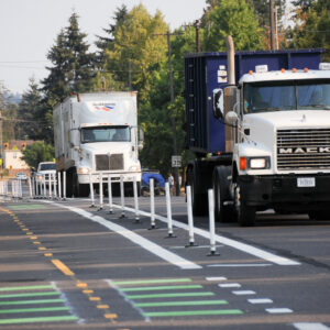
Bicycle riders know this bridge as a key connection to thousands of port-related industrial jobs and a gateway to Kelley Point Park, Smith & Bybee Lakes, and beyond. In 2018 this section of Lombard received an update when PBOT striped a two-way bike lane separated by plastic delineator wands. Unfortunately the bridge is still a very high-stress spot because of wide freight trucks that come rumbling by. Streets in this area are often littered with vehicle debris, gravel, and those aforementioned wants after they get uprooted by errant drivers (see photo above).
Advertisement
Even PBOT’s Wagner acknowledged that it could better. “It just delineators, it’s not that robust,” he told PFC Committee members this morning.
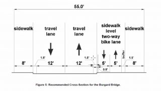
PBOT wants to replace it with a longer (to level out the current grade) bridge that’s 55-feet wide. As you can see in the cross-section there would be two 12-foot wide lanes, an 8-foot wide sidewalk on both sides, and about 10-feet for a two-way bikeway on the east side (same location as today). In a move to improve the bikeway, PBOT would move it up onto the same level as the sidewalk. This grade separation is important given the wide freight loads that move through the area.
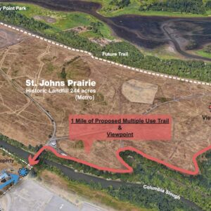
Just a bit east of this bridge, Metro is working on a new carfree bridge over Columbia Blvd that will connect Pier and Chimney parks to a natural area between Smith & Bybee Lakes and the Columbia Slough.
At this point PBOT’s estimated cost of the new bridge is $10-15 million. No funding has been identified.
— Jonathan Maus: (503) 706-8804, @jonathan_maus on Twitter and jonathan@bikeportland.org
— Get our headlines delivered to your inbox.
— Support this independent community media outlet with a one-time contribution or monthly subscription.



Thanks for reading.
BikePortland has served this community with independent community journalism since 2005. We rely on subscriptions from readers like you to survive. Your financial support is vital in keeping this valuable resource alive and well.
Please subscribe today to strengthen and expand our work.
What is the information on the carfree bridge? The link went to social media.
I this is what you’re looking for: https://www.portland.gov/parks/construction/bridge-over-columbia-boulevard
sorry rick. I meant to link to this https://bikeportland.org/2019/09/18/planning-begins-on-carfree-bridge-over-columbia-blvd-and-new-path-through-st-johns-prairie-305051
It should be noted that this bridge was heavily damaged in a train derailment back in May:
https://www.oregonlive.com/portland/2020/05/train-derails-in-n-portland-prompting-road-closure.html
The two-way bikeway is closed and riders are either forced into the road or onto the sidewalk in this section. I would imagine this is a big reason for the discussions on a replacement right now.
yes of course! I forgot i wanted to add that. adding it now.
I’d say another reason for the timing is that in case Biden should get elected, there will be a greater expectation by city governments for more federal funding for railroad grade-separation infrastructure, among other things. It’s not an Amtrak route now, but it could be.
This spur serves the port for freight access. Why would it ever have an Amtrak route on it? (not sure if your post is a joke)
Quite serious. The old Pioneer Amtrak line used the Sullivan’s Gulch UP alignment, but it’s single-track most of the way, and this other track is double.
This section is double, but the remaining portion into Union Station is mostly single-track, as are many sections between St. John’s and Troutdale, where the tracks rejoin. Plus, this routing is significantly longer, and UP has added sidings to the Gulch route east of Gateway.
It’s all probably moot, because I think there are too many single-track sections on the UP route through the Gorge to support daily Amtrak service. Major capital would be needed to double-track much of the route.
Shouldn’t the railroad be the source of funds?
I would assume that they had to pay the city for the damage. I didn’t see any follow-up articles.
I wonder if there are insurance $$ from a derailment like that, or if “the railroad was there first” types of concerns make the bridge cost fall to the city
FWIW part of the project is likely to build the new bridge in such a way to allow railroad company to add another set of tracks.
Last I was on it, the 2-way bike lane is detoured to the sidewalk, so that cars can drive in the former bikelane due to the damage. I assume that situation is permanent until replaced? Or has it been (can it be) repaired?
That’s just a temporary situation while they repair the specific damage from the train derailment. The separated bikeway should be back pretty soon. This article is about a future reconstruction project.
I understand the new project. I was wondering if the existing bridge could be repaired at all, or if it was fatally damaged and thus the reason for the replacement.
Good to know why. I’ve been taking the lane here because 1. always take the lane and 2. I HATE that two way bike path, errr I mean road debris collector and or you find kooks swerving all over the place. Get rid of that whole path – the road is beyond wide even with a selection of dystopian motor homes strewn about. lastly, way harder to jump on the wheel of a slow moving truck if you’re in that god forsaken bike lane.
Just to be clear that bike path is the worst… in case my feelings were not clear.
THE WORST.
WORST. UUUGH.
Me and my family love the path. In addition to riding to Kelly Point, his preschool is actually on Lombard across from Pier Park. That path is the only way I can bike him there comfortably (or could, before the pandemic).
Ok. So if you have a separate bike lane… Why an 8′ wide sidewalk on both sides? Just askin. I could see it if bikes & peds were expected to share…but…??
Also, anyone else just not like the idea of having *both* bike directions on the same side of the road? Just seems…. wrong to me.
I noticed on invest.gov that public funding in the amount of 13.9M has been allocated for Burgard Bridge.