Buy This 1896 Portland Bike Map
Imagine a time — 126 years ago — before cars existed in Portland and bicycles were cutting edge technology. These wondrous machines offered people the freedom to venture far beyond the city under their own power with unprecedented speed and ease. Now you can own the map that captures this historical moment!
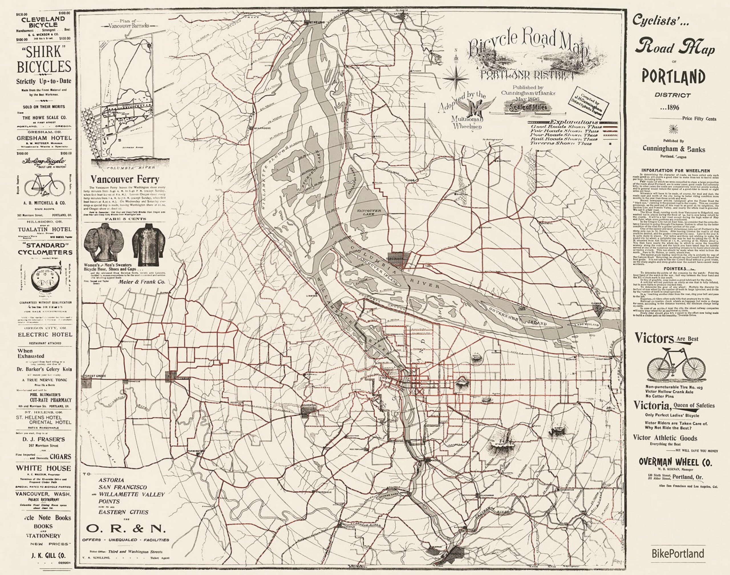
This remarkable Cyclists’ Road Map of Portland District was first printed in 1896 (that’s not a typo) and was endorsed by the Multnomah Wheelmen cycling club. It was sold at the Oregon Historical Society gift store in the 1970s and then sold for a few years by the Bicycle Transportation Alliance (now The Street Trust) before it went out of print sometime in the 2000s.
BikePortland has resurrected this map and it is now available for purchase. We’ve teamed up with Portland-based map seller Transit Maps to offer everyone this special piece of history. Buy one today for just $40 and get free shipping.
This map includes several amazing details that give you a window into this important moment in our history. A perfect gift for: transportation nerds, map geeks, bike advocates, bike lovers, or anyone who appreciates forgotten history.
Specs:
- 24″ tall by 30″ wide.
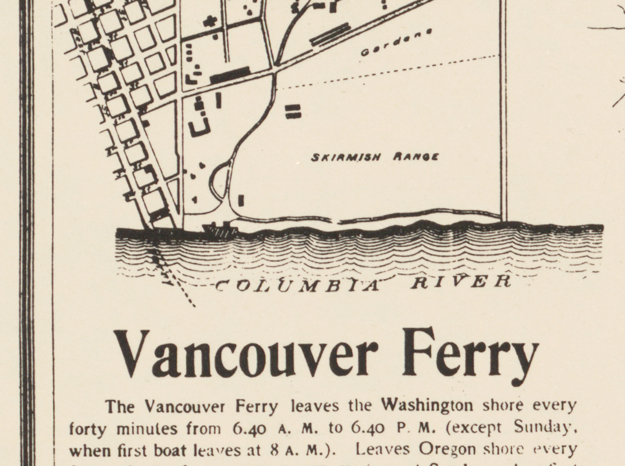
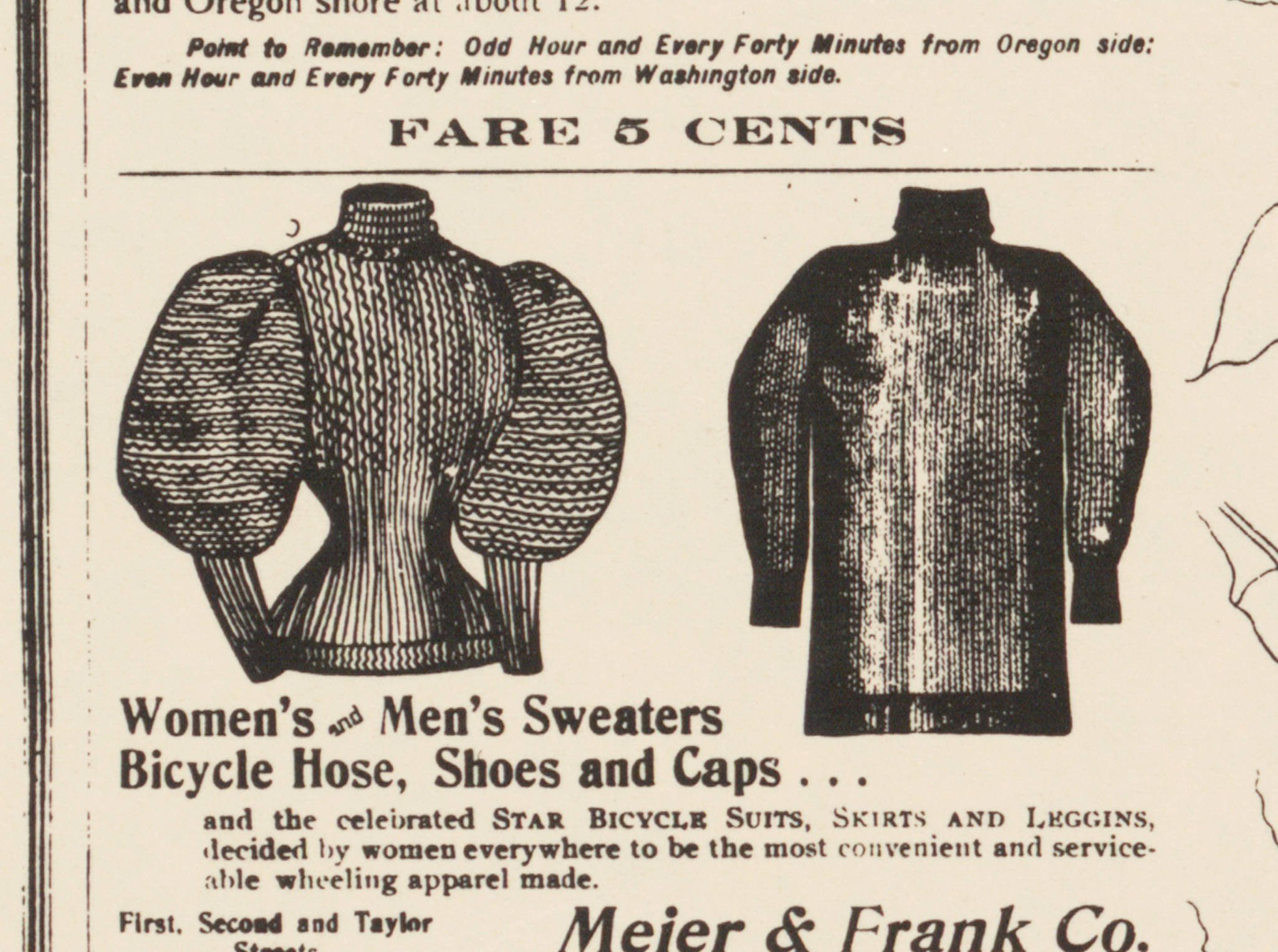
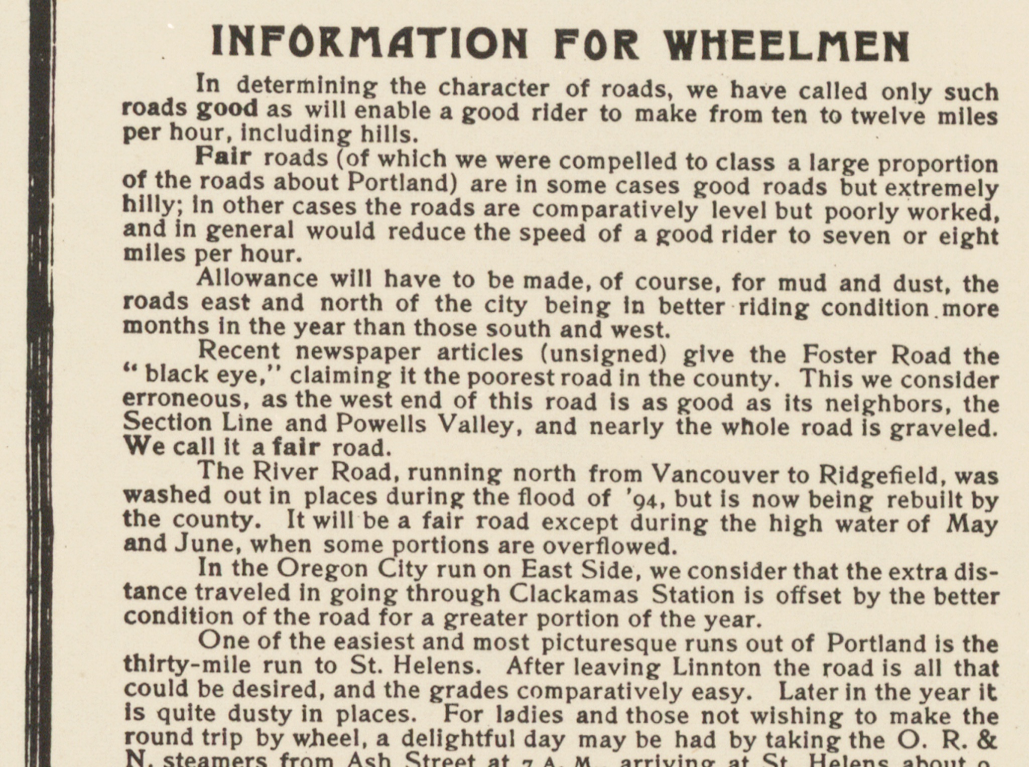
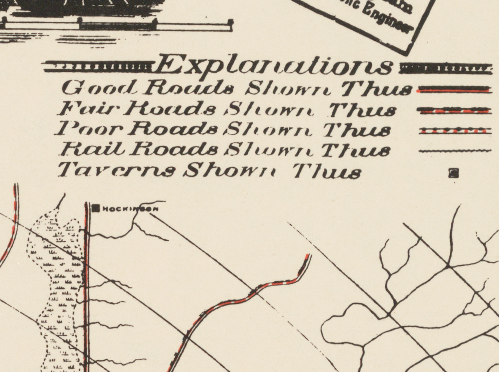
- Map highlights include: location of taverns marked, ads targeting cyclists, Vancouver Ferry information, “Information for Wheelmen” sidebar, and more.
- Each poster is printed on-demand using fully archival, UltraChrome inks on Moab Lasal Matte, a beautiful, brilliant white, 230gsm (11 mil) alpha cellulose paper which is acid- and lignin-free.
- Each print is carefully inspected, wrapped in pH-neutral paper, then rolled and placed in a sturdy chipboard tube for shipping.
Details: