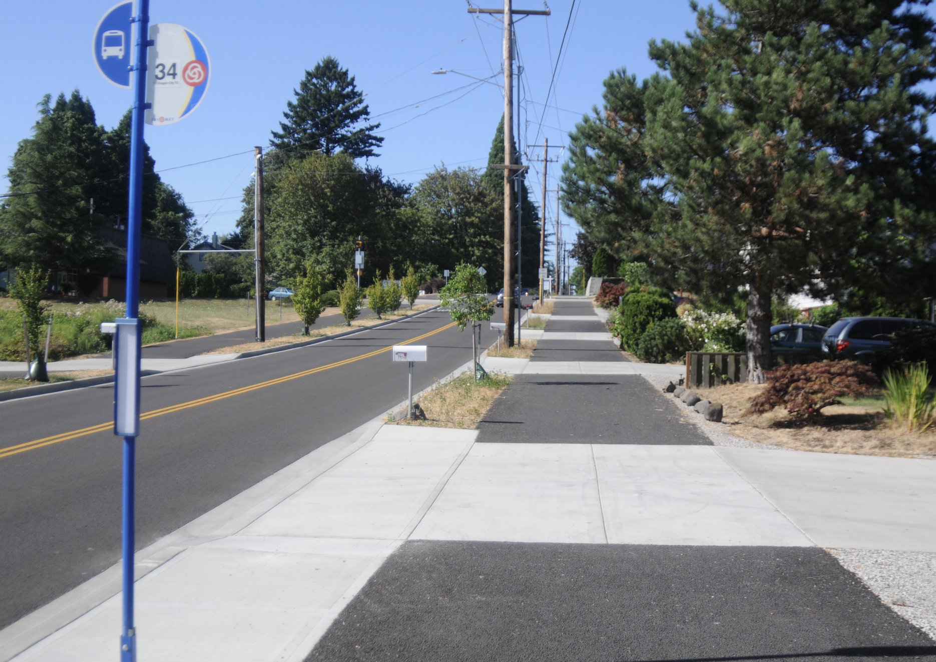
First look at freshly paved Bethany Creek Trail

Despite it not being officially open yet, these local kids found their way onto the path and were having a great time pedaling and picking blackberries.
(Photos: Jonathan Maus/BikePortland)
Despite it not being officially open yet, these local kids found their way onto the path and were having a great time pedaling and picking blackberries.
(Photos: Jonathan Maus/BikePortland)
When Tesla Motors revealed plans for a showroom in Portland last May we feared the worst. The location of the showroom (4330 SW Macadam Avenue) on the west side of the Willamette River just south of Portland’s burgeoning South Waterfront district, was smack-dab in the middle of an annoying gap in a key multi-use path.
[Read more…]
A new path now connects Sellwood to Milwaukie, making the one-mile distance between them feel much shorter.
[Read more…]
The proposed Salmonberry Trail, a path that would connect Washington County to the Pacific coast through the forest along a defunct rail line, has an official name and is about to get a full-time executive director.
Previously referred to as the “Salmonberry Corridor,” the trail also has an 11-member decision-making body with formal power to start raising the unknown millions that’d be required for the 86-mile proposal.
The Salmonberry Coalition will celebrate those milestones at its annual meeting next month. The public event is 10 a.m. to noon on Friday, Oct. 9, at Stub Stewart State Park.
Though it’s possible to get between central Gresham and the Springwater Corridor by bike lane, there’s never been a truly comfortable link between the two, or first-rate bike connection between Gresham’s central business district and the dense Rockwood area. That’s about to change.
Gresham is building a wide new paved path alongside the MAX tracks between the Cleveland Avenue station, at the eastern end of the Blue Line, and the Ruby Junction station where many TriMet trains stop their runs to go out of service.
Three years after Lake Oswego pulled out of a plan to upgrade its little-used riverside trolley line into a high-speed streetcar, the idea of turning the tracks into a biking-walking path is back in discussion.
This time, the idea is being driven by recently reelected Lake Oswego City Council member Jeff Gudman, who embraced the idea after hearing about it repeatedly from Lake Oswego residents during his campaigns.
“As I was doing my door to door, any number of people would say to me that they really like the idea,” Gudman said in an interview Thursday. “Some wanted streetcar, bike and ped. Others wanted just bike and ped.”
As the Oregonian’s editorial board reported Thursday, this week Gudman won his colleagues’ approval for a study of the legal issues surrounding a riverside trail.
When you stitch together the long-term bike plans of every city in the area, connect a few dots and put it all on one map, you get something pretty spectacular.
As the metro area’s rugged east side races to build its recreational bike network, the gentler, flatter west side is showing how persistence (and a steady stream of money) can pay off.
The farmland west and north of Hillsboro would get a 15-mile off-road paved path connecting the Hillsboro Central MAX station directly to the Banks-Vernonia Trail, making one of the region’s easiest bike-to-nature trips even easier, under a plan that’s starting to roll forward this month.
Please note: As of 10/28, the City of Portland has notified us that the path won’t be opened to the public until November 8th. We regret any confusion.
The Oregon Department of Transportation and the Portland Parks & Recreation Bureau have teamed up on a major new biking and walking path along the Columbia Slough in north Portland. The path — which has just been paved between N Denver and Vancouver avenues — is known as the Columbia Slough Trail.
The new path is about 10-feet wide with gravel shoulders and it hugs the Columbia Slough for about 1.2 miles. It offers access to lots of wildlife (tons of birds) and views of Mt. St. Helens, Mt. Adams, and Mt. Hood. From the path you can also see the Portland Meadows racetrack and watch big tractors and trucks at work on several industrial sites (I mention this for those of you with little ones). In addition to entry points at Vancouver and Denver avenues, there’s also a spur out to N Schmeer at Whitaker Road. This creates a much-needed connection for north Portland residents who frequent the Hayden Meadows shopping area (which includes a big hardware store among other things).
I rolled out there today and took a bunch of photos…[Read more…]