With all of Portland’s bike infrastructure projects to discuss, exciting developments in our neighboring cities don’t always get the attention they deserve. With this in mind, I headed down to Milwaukie yesterday to check out the relatively new SE Linwood Avenue multi-use paths, and I was impressed by what I saw.
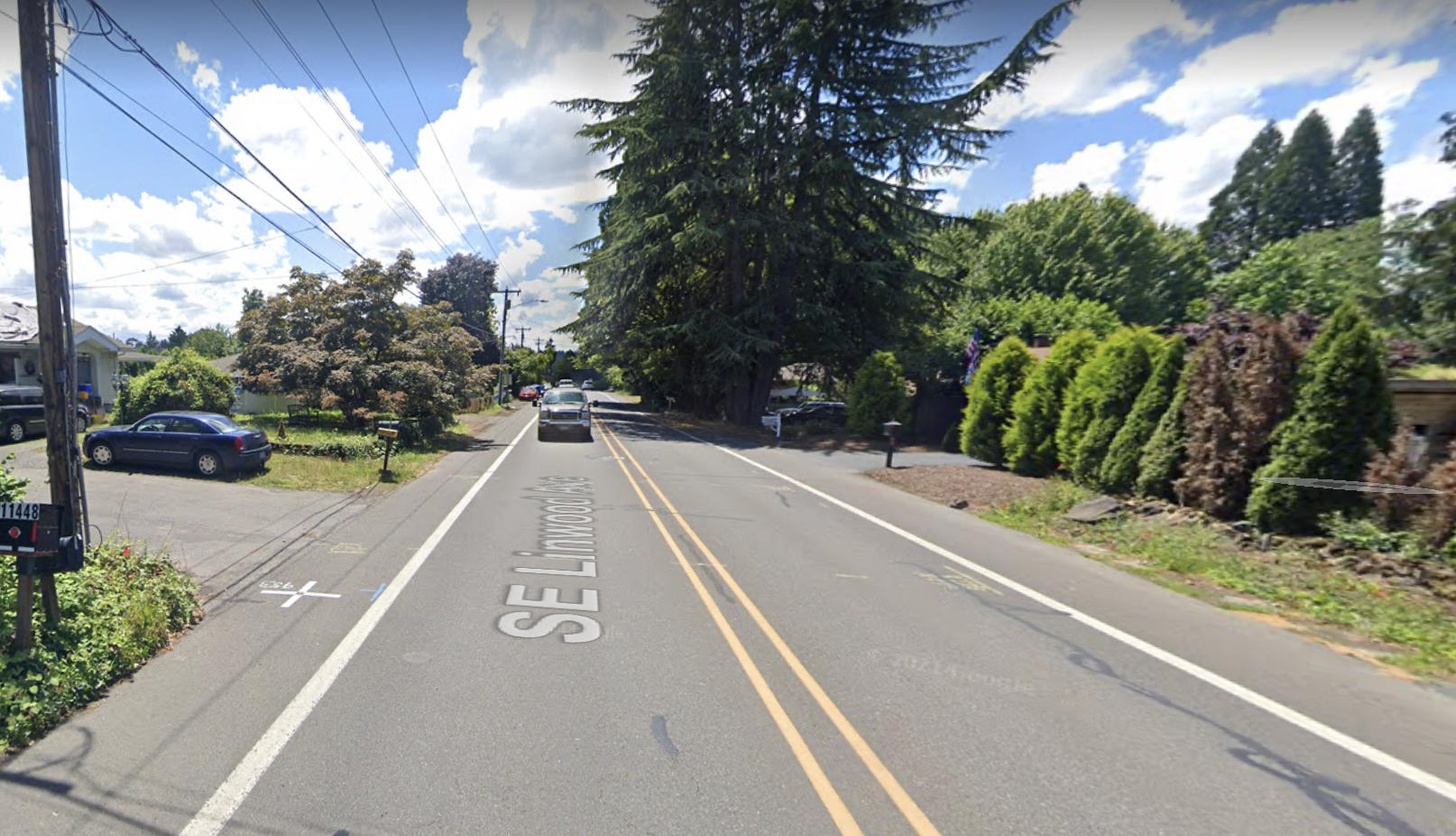
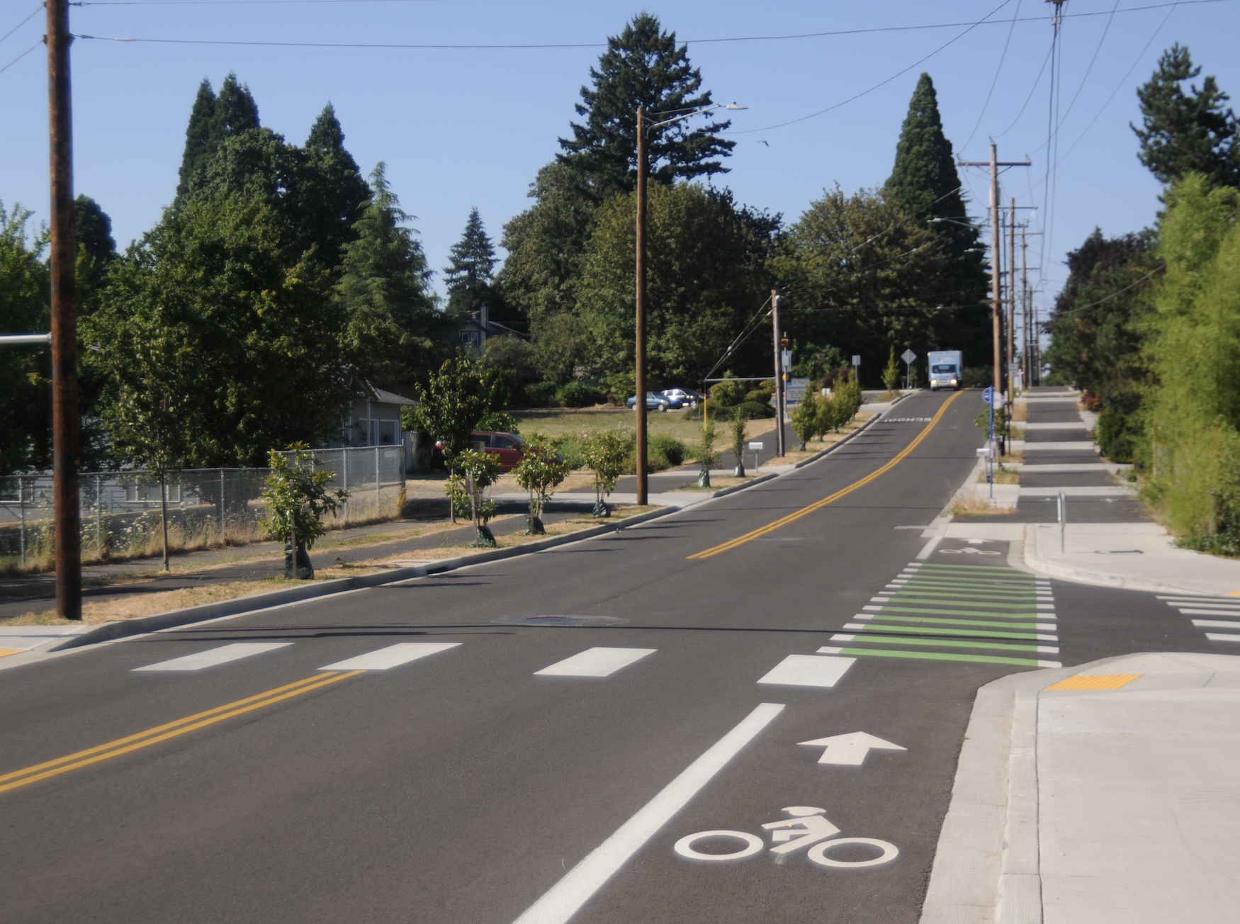
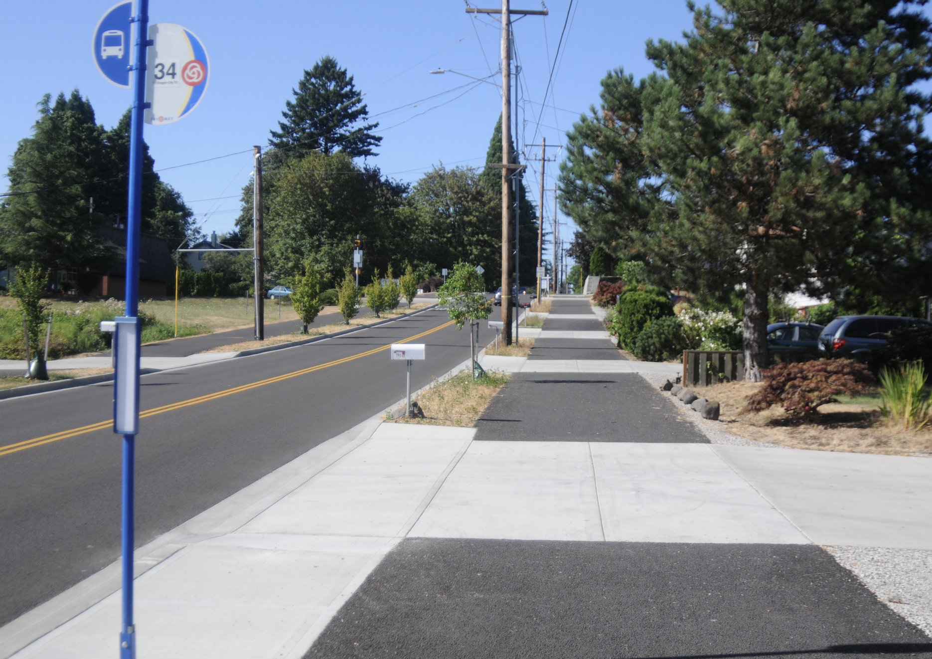
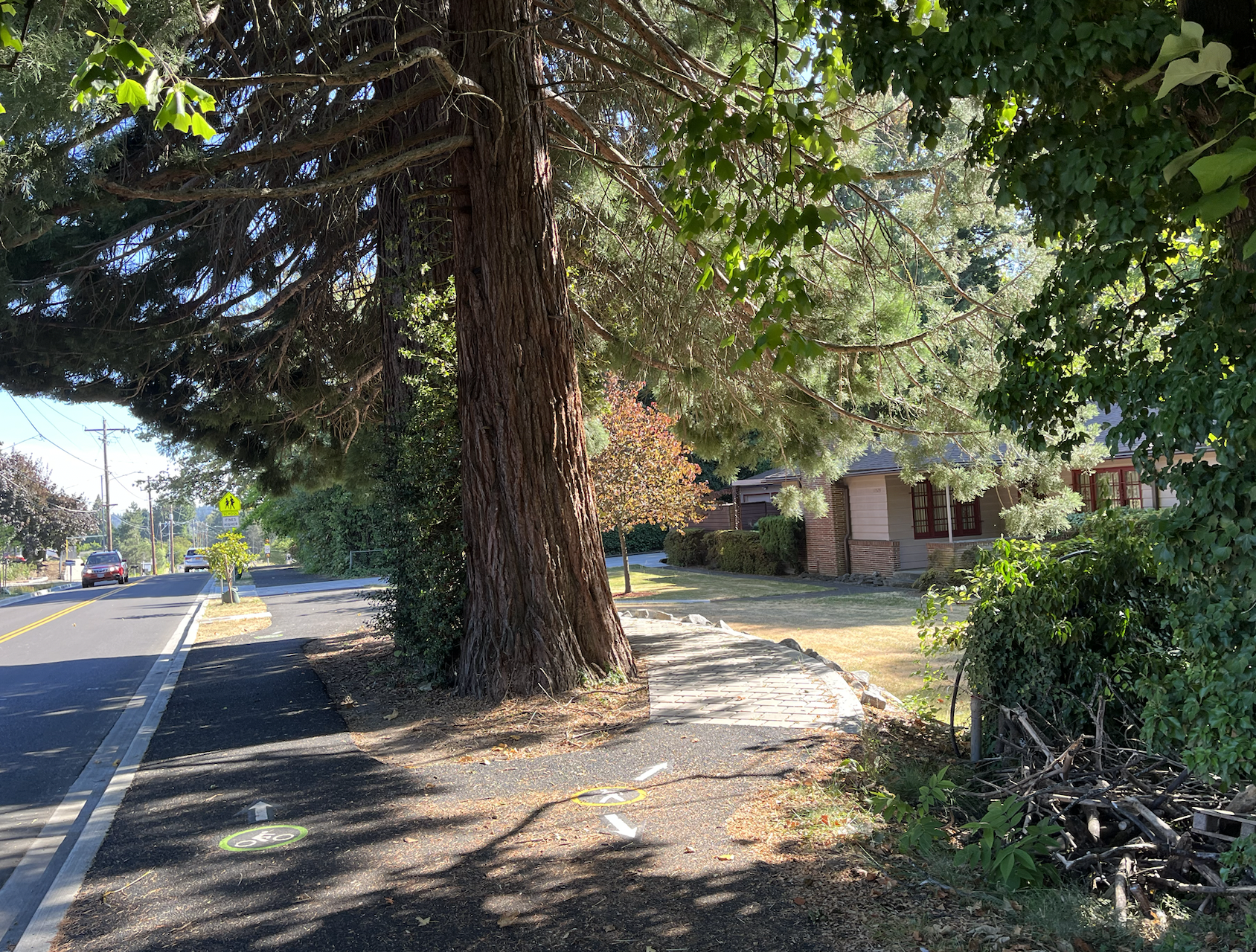
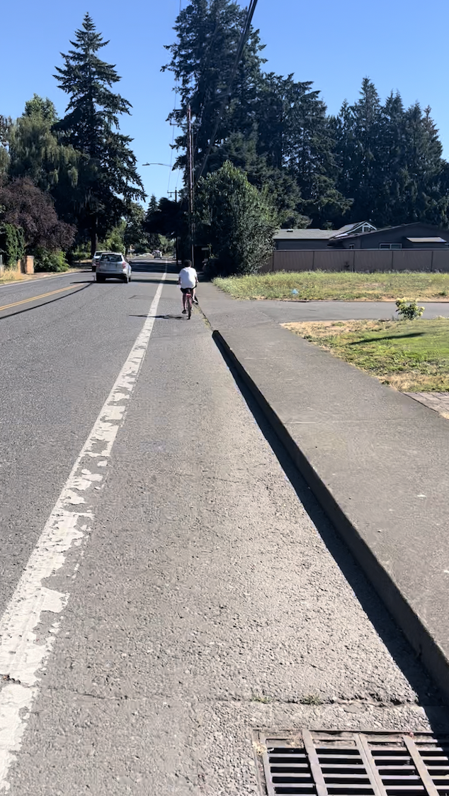
Linwood Ave is located in the easternmost part of Milwaukie about a mile and a half west of 82nd Ave. It’s a street with one vehicle lane in each direction, and while it isn’t an extremely busy corridor by Portland standards, it’s one of only a few streets that goes straight from Johnson Creek Blvd to SE Railroad Ave/Harmony Road. The 10-foot wide multi-use paths, which debuted last November, are located on both sides of the street, and have enough room for people walking and biking to share the path.

This $3.3 million project was partially funded by Milwaukie’s Safe Access for Everyone (SAFE) program, which aims to improve safety for people using active transportation in the city. The city also received a grant from the Oregon Department of Transportation’s Safe Routes to School (SRTS) program to build the paths on Linwood Ave, which is home to Linwood Elementary/Sojourner School. The SRTS program is intended to get kids and parents using active transportation to get to school instead of driving, and projects like this one can make all the difference for people wary about their kids biking or walking to school.
From Johnson Creek Blvd at the exit of the Springwater Corridor Trail to SE Monroe Street, SE Linwood Ave does not feel like a safe place for people biking. There is a small bike lane on the side of the road with nothing but a thin line of paint separating people biking from adjacent car traffic, and the lane is uneven with grates and cracks in the pavement. In contrast, the multi-use path from Monroe Street to Harmony Road is smooth, wide and physically protected from car traffic with planting strips and trees.
This is the main problem with the Linwood Ave path: it’s less than a mile long. The stretch of street it’s located on is home to a school, a community garden and several churches, and it’s great that there is now a safe way to walk and roll right up to those places. But a lovely new path only does so much if it’s isolated in a neighborhood of otherwise dangerous streets.
I saw this play out on my ride. There were several kids running a lemonade stand on Linwood just north of the start of the path, where the bike facilities are negligible. I asked them if they use the new path, and they said yes and that they feel safer and more comfortable on it than other parts of the street. I saw a boy biking from the north to get the the lemonade stand to see his friends, and it made me nervous to see him riding in such a thin, unprotected bike lane.
I also saw a long line of cars idling in a pickup line at Linwood Elementary, spilling out onto the street. While old driving habits die hard and it might take more than a path to convince people to stop driving to school, I think people would be more inclined to use the path if it extended out further. A seamless transition from the Springwater Corridor trail to this path would be great, and would mean people could very well get from northern and western parts of Milwaukie without spending very much time on a street at all.
There is a Clackamas County project on the books to extend this path all the way up to the Springwater Corridor trail. Because Linwood north of Monroe is technically located in Southgate CPO, an unincorporated part of Clackamas County, the county has jurisdiction over this part of the street. However, although this project was planned for completion by November 2022, construction has still not begun.
Steve Adams, the Milwaukie city engineer who worked on this project, told me the “main reason the city constructed this path way was to encourage parents and children to ride or walk to school,” and although he and other planners worked hard on the paths, he hasn’t seen them utilized very much since they opened.
“I certainly hope it takes off and becomes a new way for people to get around,” Adams said.


Thanks for reading.
BikePortland has served this community with independent community journalism since 2005. We rely on subscriptions from readers like you to survive. Your financial support is vital in keeping this valuable resource alive and well.
Please subscribe today to strengthen and expand our work.
The points about the street being isolated from the surrounding network are well-put.
As for the street itself, it appears the new MUPs (and the part where the bike lane is in the road) make the street wider than it used to be. I’m not opposed to that given what it accomplished, but not knowing the history of this project I’m curious how that came about: Did they just eminent domain parts of everyone’s property? Did they pay off the property owners? Was the ROW wider than what the street had previously occupied? Was it coupled with sewer work or something?
Could be lessons for other projects!
I don’t think they widened the street at all. Having the curbs closer to the vehicles creates a sense of a narrower lane, which in turn makes many drivers slow down. I drive on this street maybe once every week or two and I think that they have actually slowed traffic down building it this way compared to using regular at-grade bike lanes. I live on another busy street in Milwaukie that was recently widened to add bike lanes and the widening has actually increased speeds.
I live on Linwood. To answer Ivan’s question, they used the easements, and took about 12-15 feet from everyone’s front face. Easements are on any city lot pretty much anywhere for sidewalk, utility right of way, or in this case, paths. Mostly they are required to be used in a certain way for new construction (e.g. sidewalks). Here they did a big unified push to get these paths in using the easement. People forget they are there until the city comes knocking with a plan like this. The main point of the plan was the paths, but they did better crossings and stormwater improvements also. I don’t think they did any sewer work, but they did repave.
In some areas, they worked around trees, but they took out quite a few hedge fences. Lots on the west side of the street were larger, so probably felt it less, but some of the east side lots lost good chunks of lawn and/or their privacy hedge. Milwaukie has another project like this underway on Home Ave, I think. I think Home includes some replacement sewer pipe, so maybe Linwood did too.
In my opinion, the most annoying thing about the project is the car diverter to prevent left turns between Linwood and Monroe. It’s utterly useless and just forces pointless detours thru neighborhood streets.
The route is short, and it does not connect to Springwater. The best path from Linwood to Springwater is to use Monroe and Stanley. Agree that Linwood between King and JC/Springwater is unsafe, and uncomfortable to ride. It does get quite a lot of local traffic from nearby residents both with and without dogs. Even seen a few kids using it to get to school.
It will see more use if it connected more cleanly to Springwater or a new n/s corridor. Milwaukie has some concept designs in mind for Monroe I hear. Making Monroe more bike friendly would really help it forward.
I like to use Wichita Ave from Springwater to King Ave.it is less traffic, flatter, and more shades than Stanley Ave or Linwood.
Witchita is great, but it is also fairly short. The good thing about Stanley is that it crosses King and you can continue South all the way to Rail Road Ave. Eventually, there is going to be a path built along the North side of Rail Road as well.
Thanks for the detailed back-story!
It is worth pointing out that Milwaukie has more than just ‘concept designs’ for Monroe, it has been awarded some serious money which will turn Monroe into a great bike and pedestrian corridor. It is supposed to be complete by the end of 2024 and it will be the biggest bike and pedestrian improvement Milwaukie has seen in years, stretching the entire East/West span of the city from the riverfront to Linwood (2.2 miles). The county has already made some improvements to Monroe, east of Linwood which allows easier bike connections to the 205 bike path and will lengthen the Monroe Neighborhood Greenway to approx 4 miles.
They installed the diverter at Linwood and Monroe to reduce cut-through traffic on Monroe and reduce vehicle levels so that it is safer a safer street for the neighborhood, cyclists, and pedestrians. I completely hear that it is annoying to drivers, but folks in the neighborhoods should see less cut-through traffic (which is a plus for livability) and those who were cutting through can look to King or Rail Road as alternative routes.
“With all of Portland’s bike infrastructure projects to discuss, exciting developments in our neighboring cities don’t always get the attention they deserve.”
Yes I agree Taylor. And also, often the neighboring cities have a superior bicycling infrastructure.
How is the terminus with Harmony Road handled? I’m not familiar with the area but guessing that southbound Linwood to eastbound Harmony would be a popular movement.
(Sorry for the late comment.)