Are you interested in joining our well-rounded crew of talented and diversely-skilled mechanics? At Joe Bike, we pride ourselves on providing excellent service and communication with every customer. We like making personal connections and finding solutions to meet customer needs and budgets. Our team also knows how to have fun and enjoys collaborating on projects. We offer competitive wages based on experience, paid time off, health benefits, and a retirement plan.
How to Apply
If this sounds like you, please send an email to info@joe-bike.com with your resume and answer the following questions to help us get to know you:
1. What are your best mechanical strengths when working with bikes, and what areas are you less confident in?
2. Our bike shop is a busy and dynamic environment. How would you prioritize your time when deciding between working on bikes, helping customers with test rides and product selections, and working on cleaning, organizing, and completing side projects around the store?
3. What is your ideal bike shop environment and why?
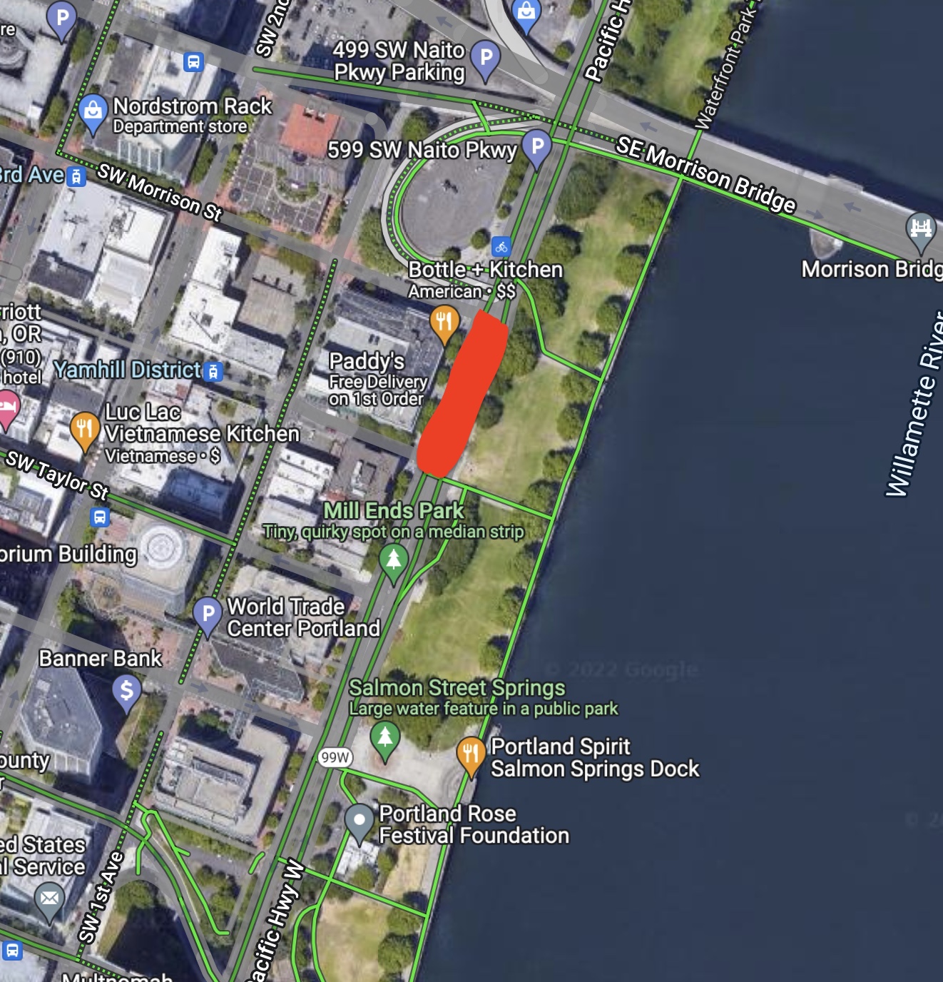
On Monday, July 25 from 10 a.m. to 2 p.m. the northbound lanes of Southwest Naito Parkway between Southwest Morrison Street and Southwest Yamhill Street will temporarily close. A contractor working on the Morrison Bridge will need to put equipment in this section of the road while crews remove graffiti on the bridge. Drivers, cyclists and pedestrians will need to use alternative routes. The Morrison Bridge Paint Project began in January 2022 and will continue until fall 2023. For information: https://www.multco.us/morrisonpaint
On Thursday, Oregon approved the largest rollback to parking mandates in modern US history.
The unanimous vote by the state’s land use commission came through an unusual channel: an administrative action, ordered by the governor, that breathed new ambition into the broadly written land use laws that have gradually shaped Oregon for 50 years.
The law in question gives the state board the power to set land use rules that, among other things, “minimize adverse social, economic, and environmental impacts and costs.”
As Sightline has been arguing for decades, including in a new series over the last year, parking mandates create those costs. Lots of them.
Beginning January 1, 2023, Oregon is scheduled to do more to cut those costs than any other US state or Canadian province. In some situations—within a half-mile of relatively frequent transit, for homes of 750 square feet or less, and for homes meeting affordability targets—minimum parking mandates will no longer apply for jurisdictions within Oregon’s eight largest metro areas. This doesn’t prevent parking lots from being built, but it does remove the current prevailing requirements to construct a specific number of stalls: one stall per bedroom, for example, or three per 1,000 square feet of retail space.
Advertisement
Farther from transit, jurisdictions in the state’s eight largest metro areas will have more flexibility in how to gradually make driving less necessary. In all, 48 cities and 5 counties representing about two-thirds of the state’s population are subject to the reforms. By the end of June 2023, the affected cities and urbanized unincorporated areas will need to choose from a branching menu of options on how to manage parking. In every case, jurisdictions will be able to comply simply by making off-street parking fully optional.
The commission did decide to give the Portland metro area a bit of additional flexibility. Its regional government is allowed to come up with its own parking rules, but the state commission must sign off that they are at worst equivalent to the statewide rules.
After several rounds of delays to the reform timeline, the Land Conservation and Development Commission (LCDC) unanimously voted Thursday for the sooner of two deadlines for putting the new rules in place.
Advertisement
“Science is dictating that we should be acting now,” said Barbara Boyer, an LCDC member and family farmer outside McMinnville, Oregon.
The proposal had drawn support from a coalition of 41 organizations that advocate for affordable housing, the environment, local businesses, and better transportation.
The new parking rules are part of a larger package called “Climate-Friendly and Equitable Communities” that industry groups, including the Oregon Home Builders Association and Oregon Association of Realtors, oppose. Though those groups hadn’t singled out the parking reforms for much criticism, they objected to other parts of the package. Meanwhile, various cities have also objected, arguing that the new rules are too prescriptive and would take considerable resources to implement.
But assuming these new rules survive legal challenge, people looking to build new homes and businesses, or dreaming of renovating an older building, can look forward to deciding for themselves how much parking their property needs. In many cases, it will be the first time since the 1950s that property owners are able to do so.
What will this mean for other Oregonians? Probably not much, for a while. But as the years go by, here are five things they might start to notice.
Advertisement
1. Vacant buildings will come back into use
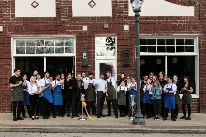
Employees celebrate the opening of Atlas the Restaurant in a newly renovated historic building in Fayetteville, Arkansas. Until Fayetteville removed commercial parking mandates in 2015, it would have been illegal to use the building as a restaurant without special permission. Photo: Atlas the Restaurant. Used with permission.
Employees celebrate the opening of Atlas the Restaurant in a newly renovated historic building in Fayetteville, Arkansas. Until Fayetteville removed commercial parking mandates in 2015, it would have been illegal to use the building as a restaurant without special permission. Photo: Atlas the Restaurant. Used with permission.
One of the most visible ways a passerby might notice the elimination of parking mandates is that formerly vacant buildings might quickly get a makeover. Even in small cities like Fayetteville, Arkansas, city leaders are keeping their local economy vibrant by eliminating parking requirements. Keep your eyes on these types of buildings:
Historic properties: Buildings constructed prior to parking requirements pose a particular problem for redevelopment. There is often no way these buildings can comply with modern parking mandates without a lengthy and expensive process to get an exception from the city. Oregon’s new parking rules bring these buildings back into play.
Change-of-use properties: What can someone do with an office building left vacant by a pandemic? Maybe not much, if the parking lot is too small. For decades, cities zoning codes have defined different parking ratios for nearly every type of business.Any time a property owner wants to change a building’s use, they have to check whether the existing parking lot meets the zoning code’s mandates for the intended new use. For example, a retail store might require more parking than an office, and a restaurant more than a retail store. With parking requirements out of the way, business owners who want to adapt will find many more properties available.
Advertisement
2. Businesses will start sharing underused parking lots
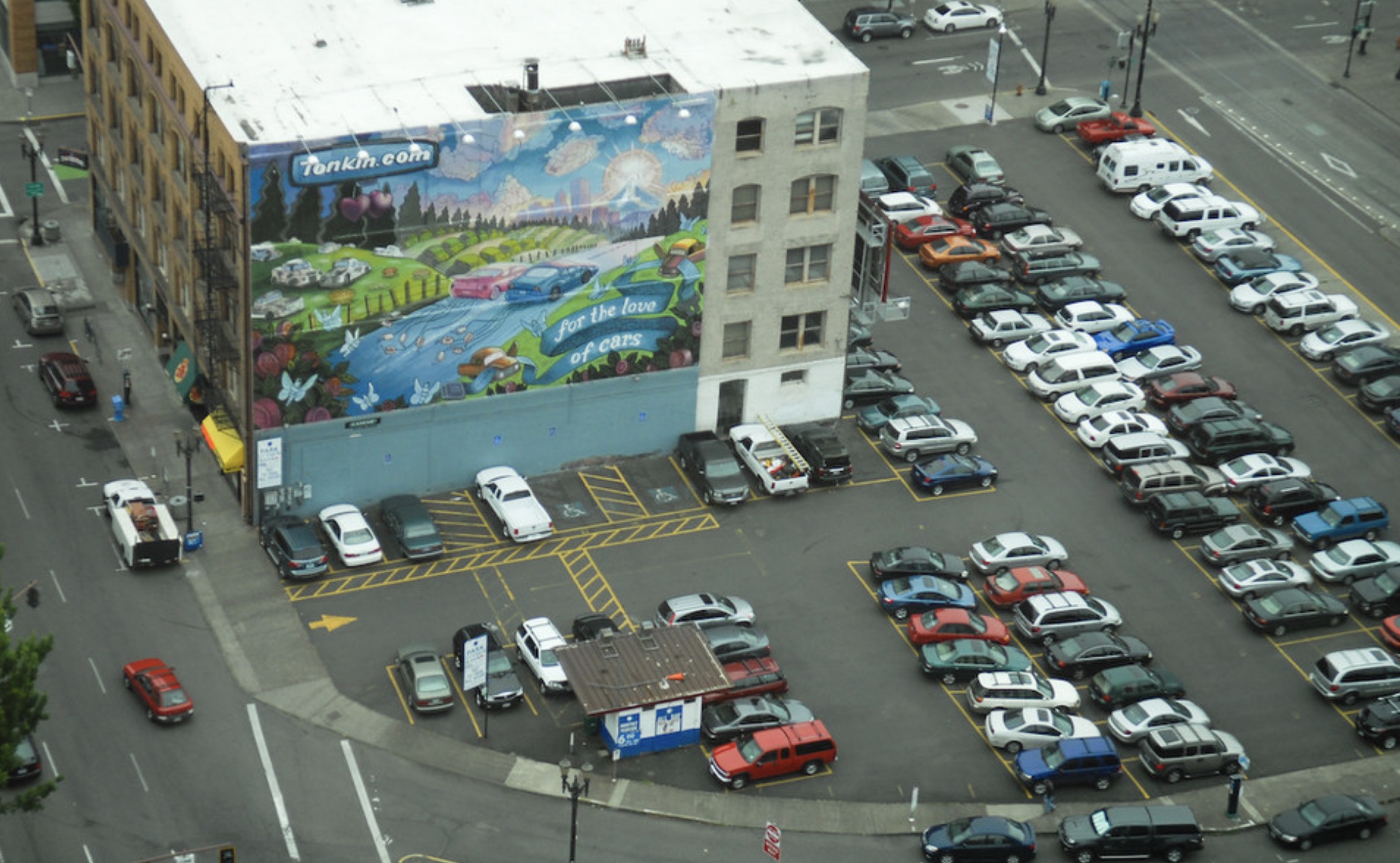
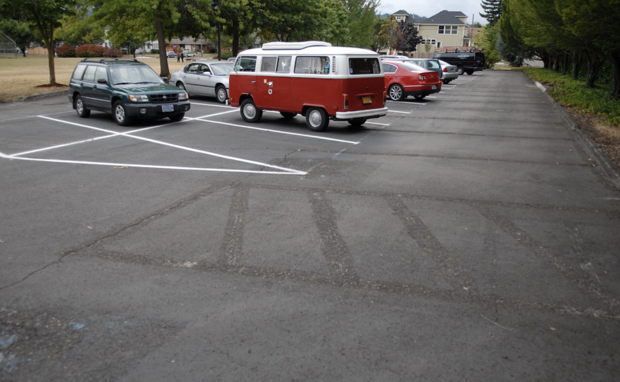
An unused parking lot managed by the Hollywood Vintage store in Portland, 2014. Photo: Michael Andersen for BikePortland.org.
How does eliminating parking mandates benefit the numerous half-empty parking lots that already exist? Now freed from parking requirements, owners of these lots can start renting out extra space, creating a virtuous cycle that keeps money in the local economy.
These arrangements are already happening in Ecorse, Michigan, a suburb of Detroit, where parking mandates were eliminated in 2020. Nani Wolf, the planning and zoning administrator for the city, shared a recent example where a developer hoped to renovate a historic building as an event space. There was no parking on-site.
The town did not legally require any parking, but the developer didn’t want to create a nuisance for neighbors. So Wolf helped connect the developer with an adjacent business with a large parking lot the new event-space owners could rent. “That made turning the obsolete building into a functional building possible,” she said.
The cost-sharing helps on multiple levels. First, the new owner doesn’t have to pay to construct new parking, saving them anywhere between $10,000 to $60,000 per space. It also lets neighboring businesses turn unused parking spots into rental income. This new market for parking spaces keeps money local, explained Wolf. Supporting and attracting new businesses is a top priority for Ecorse, which adopted a new zoning code after the town’s top employer, US Steel, announced in late 2019 that its plant would cease operating.
Advertisement
3. Projects will start construction faster
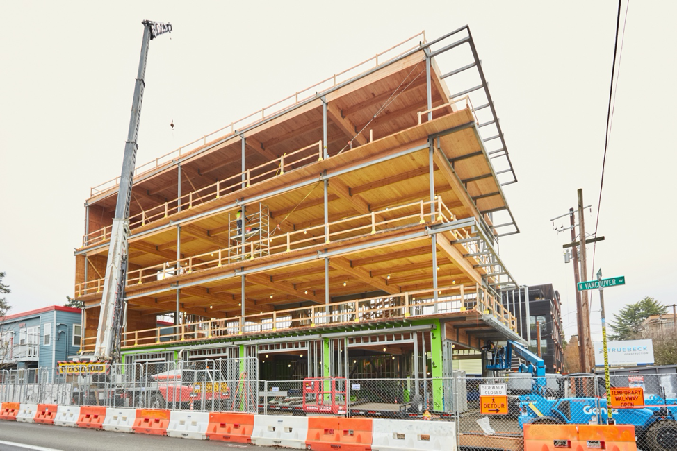
Mixed-use construction in Portland. Photo: Truebeck Construction. (Creative Commons)
In a city with parking mandates, you’ll be sure to find city planners hunched over their desks calculating how many parking spots each new building proposal requires according to the latest zoning code, then comparing that to the number of spaces in submitted plans. If the proposed building comes up short, there are sure to be follow up meetings with the developer, paperwork for variances, and often appearances before the zoning board or city council. That’s if everything goes smoothly.
“Parking is always the first thing that comes up with people objecting to the project,” said Nick Sauvie, executive director of the Portland-based affordable housing developer ROSE Community Development. When new development is politically contentious, a project might take months or years to win approval from neighborhood groups and public bodies.
A lot of this work can simply disappear once cities decide to get out of the business of inspecting parking lots. This can save time and money for both city staff and developers alike. As Oregon works to double its housing construction over the coming decades to alleviate its severe shortage of homes, reducing delays for things like parking will help.
Advertisement
4. Cities will actually start doing something about crowded curbs
In the West End neighborhood of Vancouver, garage spaces sat empty despite chronic shortages of curb parking—until the city raised the price of street parking permits. Photo by Gordon Price of Viewpoint Vancouver.
Spending less time micromanaging private parking lots will still leave city planners plenty to do. Now, they’ll be able to focus on a truly public issue: on-street parking.
In most of the United States and Canada, curbside parking is currently a free-for-all. If you can afford to show up alongside almost any street with a $10,000+ machine, you’re allowed to occupy that real estate for almost as long as you like, free of charge—no matter if a nearby resident, worker, delivery van, or customer needs it more.
Parking mandates address this problem with the subtlety of a sledgehammer. Annoyed by crowded curbs? No problem, parking mandates say. We’ll just make urbanization illegal.
In some crowded places, meters and permits will also raise public money that can be used to improve walking, biking, or transit.
Meanwhile, in less crowded areas, the current free-for-all will continue to work just fine.
Because buildings take a while to build, Oregon cities will have at least a few years before the new rules have any actual effect on curbside parking. In the meantime, hope and expect that cities will start considering their options. The state land use agency says it’s eager to help with both cash and technical information.
“This is where the real work really begins,” state planner Kevin Young told the land use commission Thursday. “We’re not going to be successful if local governments aren’t.”
Advertisement
5. More parking lots will get built
(Photo: Jonathan Maus/BikePortland)
You read that right.
Despite all this, the Oregon of 2032 will probably have more parking spaces than the Oregon of 2022. The new rules put a few new costs and limits on the size of new lots and garages but mostly just within designated “climate-friendly areas.” And because cars will remain extremely useful, parking spaces will keep getting built whether they’re mandatory or not.
“I applaud the flexibility that this provides to the private sector to provide the parking where it’s most needed,” LCDC Chair Anyeley Hallova said Thursday.
To those of us who dream of quieter, cleaner, greener, freer cities whose public spaces have been fully reclaimed from cars, it can seem inadequate to just make parking optional. Meanwhile, to those of us who would feel imprisoned without cars and enough parking to make them useful, it can be hard to envision a world where cars are truly less necessary.
But parking reforms like Oregon’s don’t actually presume that a better world is possible. Their work is deeper. They allow better worlds to be possible.
To reduce dependence on the car, Oregonians still need to make it pleasant to walk and bike, to fund mass transit, to start neighborhood businesses, and to create homes and jobs near one another. If they can’t, then today’s parking reforms will have little effect one way or another.
Instead, what these reforms do is give Oregonians a better chance to do all those things. They give Oregonians new opportunities to succeed.
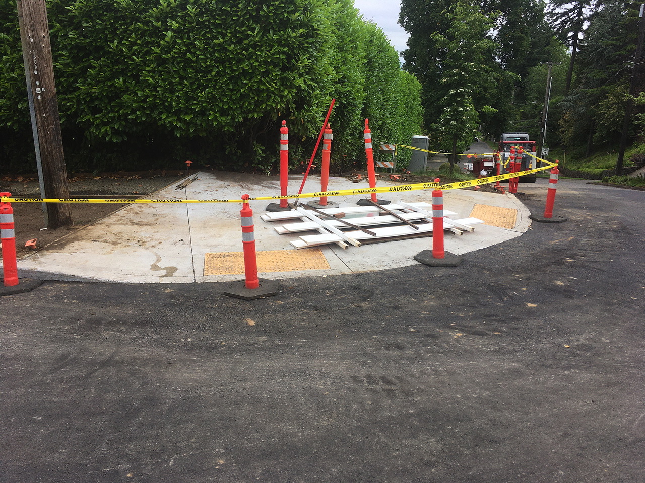
On Tuesday, BikePortland reported about the third attempt to build a new ADA ramp at the corner of SW Spring and 16th Streets, July 2022. (Photo credits: Southwest Hills Residential League)
The next day that recently built ramp was demolished.
The ADA ramp at SW Spring and 16th Streets was torn down Wednesday and will be rebuilt a fourth time. We profiled this corner the day before as an example of ongoing construction problems with new ADA ramp requirements triggered by the Bureau of Environmental Service’s (BES) Goose Hollow Sewer Repair Project.
Advertisement
In addition to the Spring Street ramp (above), the newly built ramp at the corner of SW Montgomery Dr and Roswell Ave was also demolished this week.
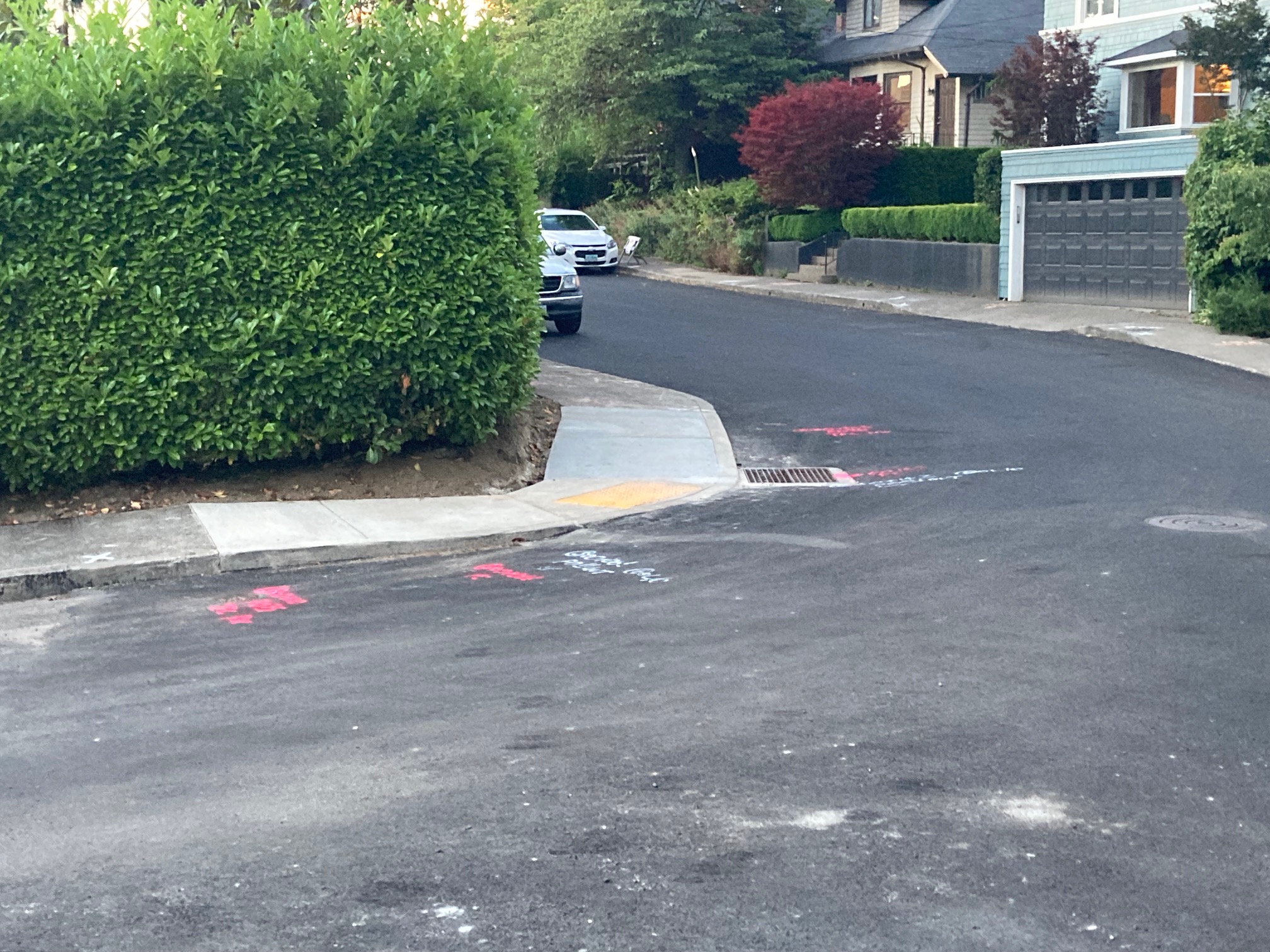
Newly completed ramp at the corner of SW Montgomery Drive and Roswell Avenue, July 12, 2022. (Photo credit: Lisa Caballero/BikePortland)
Corner of SW Montgomery Drive and Roswell Ave on July 20th. (Photo credit: Lisa Caballero/BikePortland)
BikePortland reached out to BES for help in understanding why these builds have been so problematic. Aaron Abrams, the Community Outreach Program Manager at BES responded this morning:
Thanks for your article about the ADA ramp at SW 16th and Spring… Work at this location has proved to be challenging for the City and the contractor. The varying slopes at this corner have led to some struggles in meeting ADA specifications.
Ultimately, completing work at this location is the contractor’s responsibility; however, the City is working closely with the contractor to make sure the ramps meet ADA specifications according to PBOT standards… The contractor is required to meet design specifications that comply with federal requirements for the ramps. BES will only be paying the contractor for finished work that passes inspection. We will not be paying for attempts that don’t meet standards. Ultimately, BES ratepayers will only pay for a product that meets federal requirements and has been approved by the City. We understand how this work has disrupted that location and are confident that as we work with the contractor going forward, work will be completed successfully to restore that corner.
Advertisement
Yesterday I happened by the Roswell ramp pictured above while crews were completing the form for the new concrete pour. A PBOT employee was present as the group checked the slopes of each element of the form. There was a surveying tripod across the street. Clearly it was exacting work.
I also noticed at both the Roswell Avenue and Spring Street locations that the initial design of a single ramp on the diagonal had changed in subsequent builds to separate ramps for each street, in other words, two ramps per corner. A Directive from the City Engineer addresses the one versus two ramp design issue:
The City’s preference is to build two single curb ramps at a corner, rather than one diagonal ramp. However, FHWA provides for a variety of curb ramp types and configurations. Constructing one diagonal curb ramp at a corner instead of two single ramps at a corner constitutes a variance from the City’s criteria and requires approval of the PBOT ADA Technical Advisor.
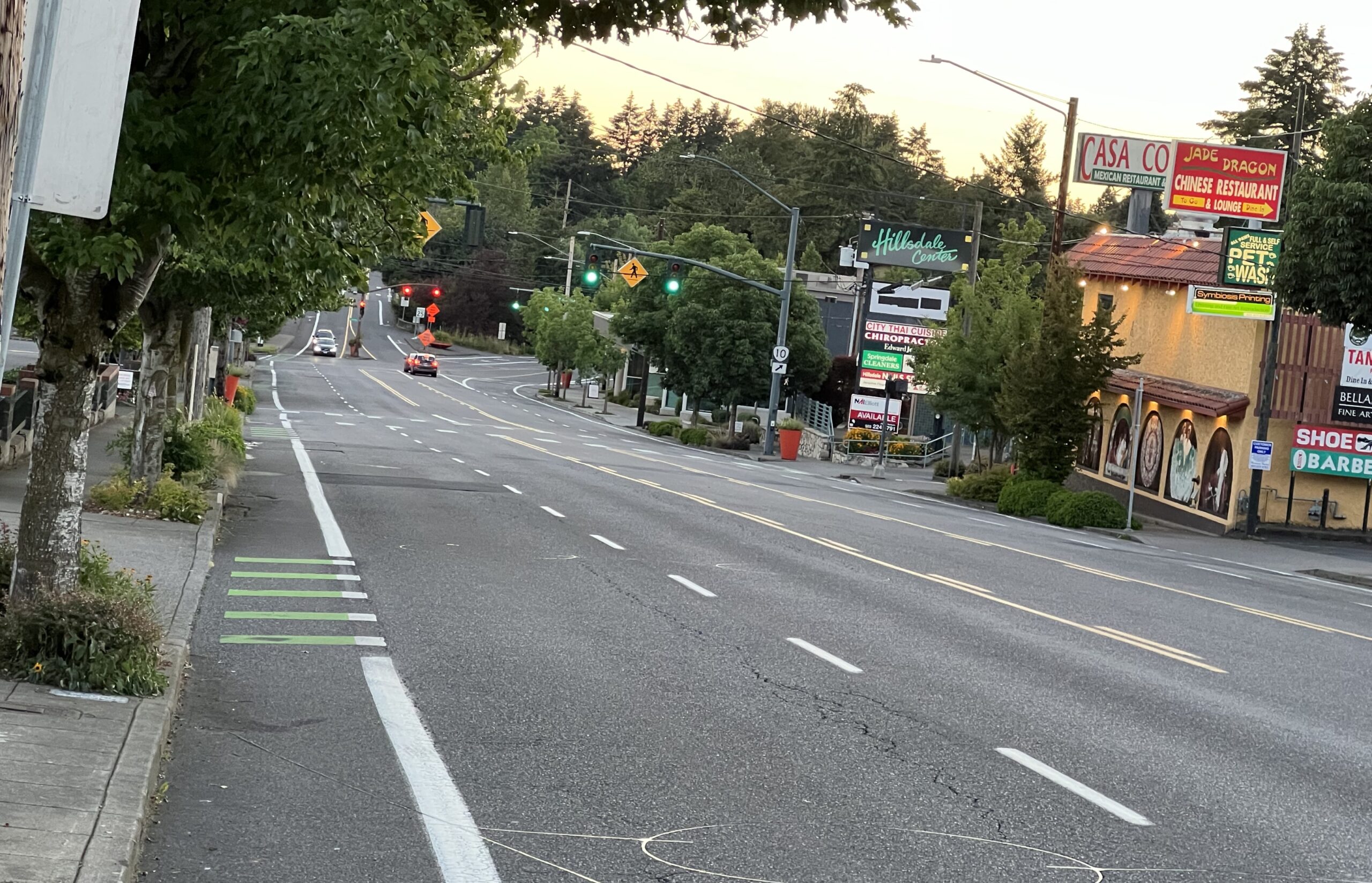
Some local groups feel dedicated space for buses on this stretch of SW Capitol Highway will have unacceptable impacts on car users. (Photo: Jonathan Maus/BikePortland)
It’s also one of the only bus priority projects that has faced organized and sustained pushback from the neighborhood it would serve. Several local community groups oppose the project as planned and want PBOT to delay its implementation. Before we get into that, here’s what I learned at Tuesday’s meeting…
Advertisement
Why is this project needed?
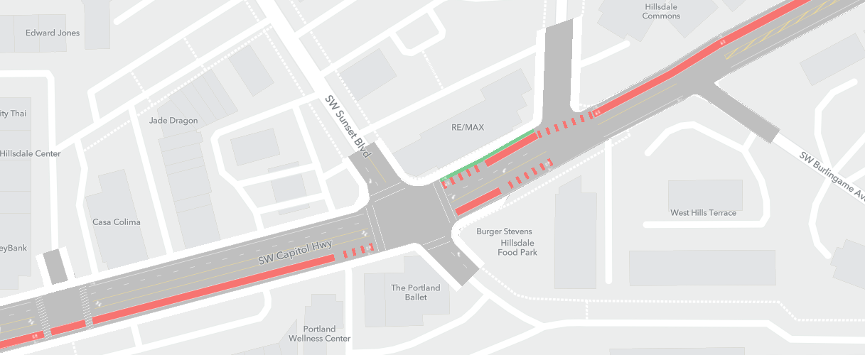
(Source: PBOT)A portion of the Hillsdale Rose Lane project as viewed in the Remix application.
Because of the topography of the west hills, westside bus routes funnel through a couple of key passes, one of which is the east end of Capitol Highway as it connects to Barbur Blvd. Falbo explained that bus lines 39, 44, 45, 54, 55, 56, 61, 64 and 92 all travel this segment. Pre-covid, more than 28 buses per hour passed through the area during peak times.
The purpose of the Rose Lane network is to prioritize buses and street cars so that transit users move more quickly and reliably through congestion. Falbo emphasized that the Rose Lanes are an “interconnected system, and that improvements on one part of the network can have really amazing impacts and benefits with users and lines on other parts of the system.” Riders of bus route 44, for example, pass through Hillsdale on their way to Williams Ave in northeast Portland nearly eight miles away.
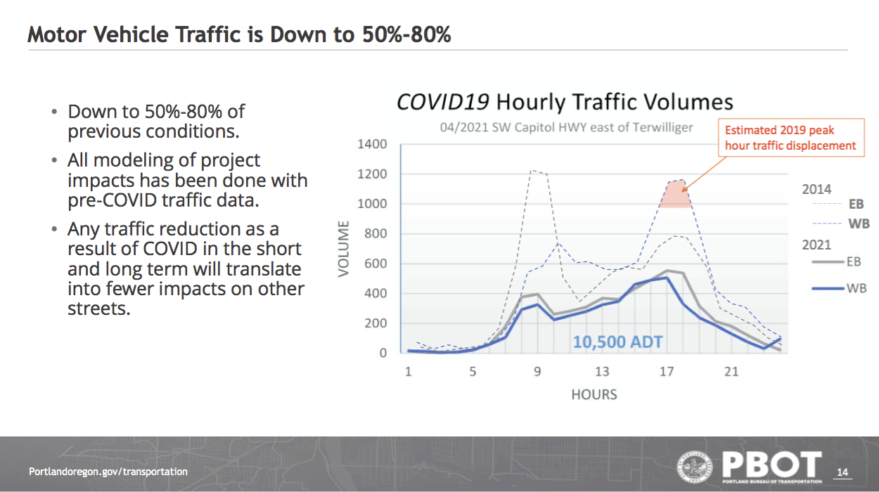
In a detailed Monitoring and Mitigation Memo, PBOT explained that it will be rolling out the Hillsdale project using a four-step approach: pilot, monitor, modify and make permanent. The traffic monitoring portion will include locations on both major and local streets. Although post-covid traffic levels have dropped 50 to 80 percent, Falbo made the point that “this is a good time to do a project like this, where people will have time to adjust their behavior as that traffic returns.”
Advertisement
The Opposition
PBOT faces some pushback on the project, but it’s likely to move ahead regardless. (Photo: Jonathan Maus/BikePortland)
“There are some trust or credibility issues toward PBOT”
Observers beyond southwest Portland might find it puzzling that SWT and SWNI, two groups which in the past have been quite supportive of walking and active transportation, are aligned with this requested delay.
To better understand what might be the dynamic of the situation, I spoke recently with HNA member and bike activist Eric Wilhelm who explained that, “There are some trust or credibility issues toward PBOT. Neighbors have been complaining for years about cut-through traffic—years before the Rose Lane plan was even started—yet PBOT has not responded to the issues on those narrow local streets with no sidewalks.” Wilhelm does not support the petition for delay.
Advertisement
Other points of discontent I have gleaned from various zoom calls and exchanges over the past year include underfunding of the Southwest in Motion plan relative to other “in motion” plans and a history unfulfilled infrastructure improvements going back decades (for example, a never-built sidewalk along Capitol Highway between Sunset and Terwilliger).
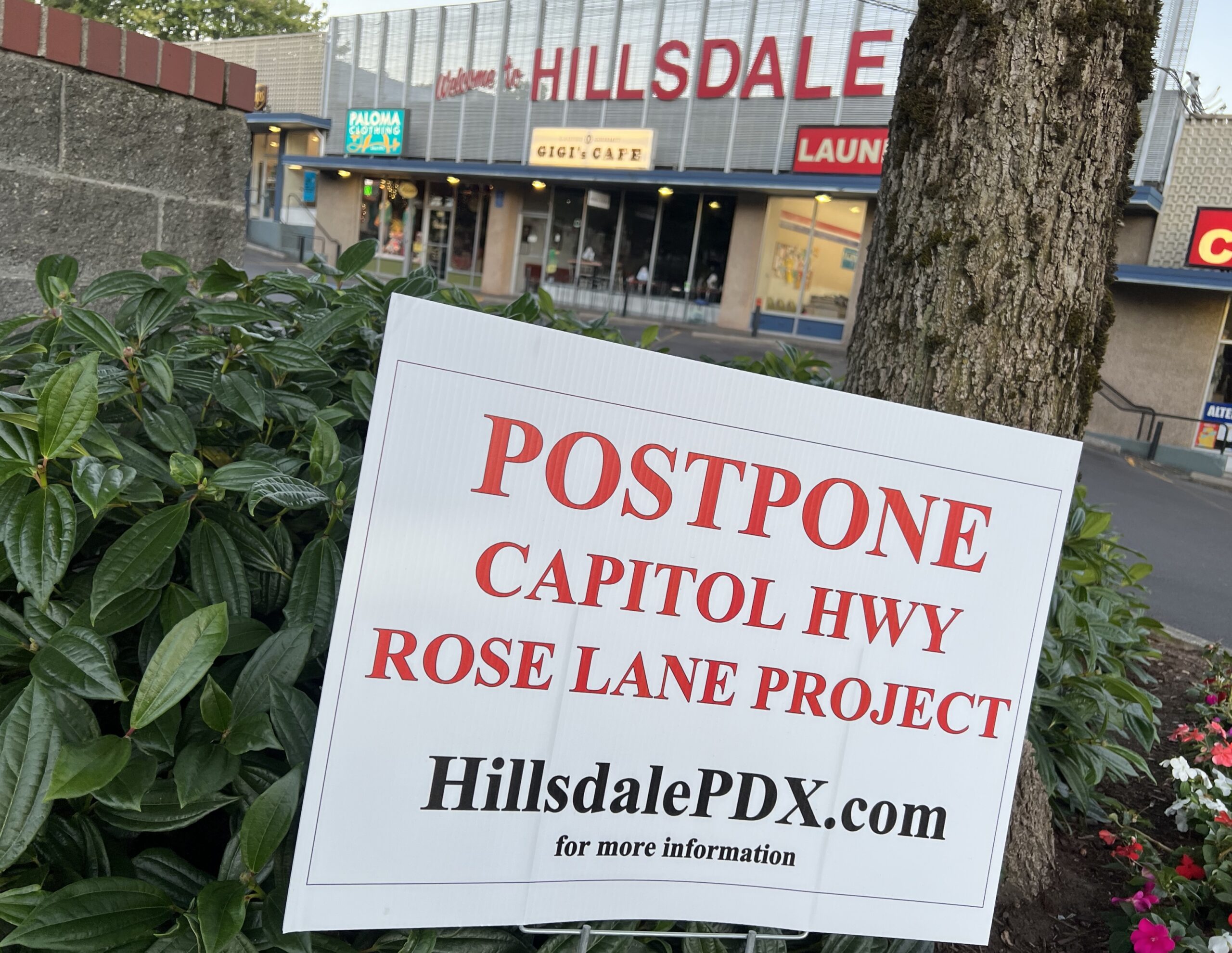
As Falbo and others have noted, criticism of the project is coming from an area focused on the Hillsdale Town Center (where many businesses have signs in their windows supporting a delay) but that support for the project is diffuse across the city.
Even near Hillsdale, though, there are prominent transportation activists who support the new Rose Lane. Bicycle Advisory Committee (BAC) member David Stein, for example, just commented on BikePortland that “the Rose Lane project proposed in the area would be a marked improvement.” And the BAC has written a letter in support of the project.
PBOT is well-girded to ride out local objections to the Rose Lane Project. Their online materials are extensive and informative. With the Hillsdale project in particular, their March 2022 PBOT memo in response to questions from the HNA and HBPA was impressive in its thoroughness and detail.
The Pedestrian Advisory Committee presentation is the last of an extensive outreach effort made over the past year and a half. Falbo ended the presentation by requesting a letter of support from the committee, which they seemed open to providing.
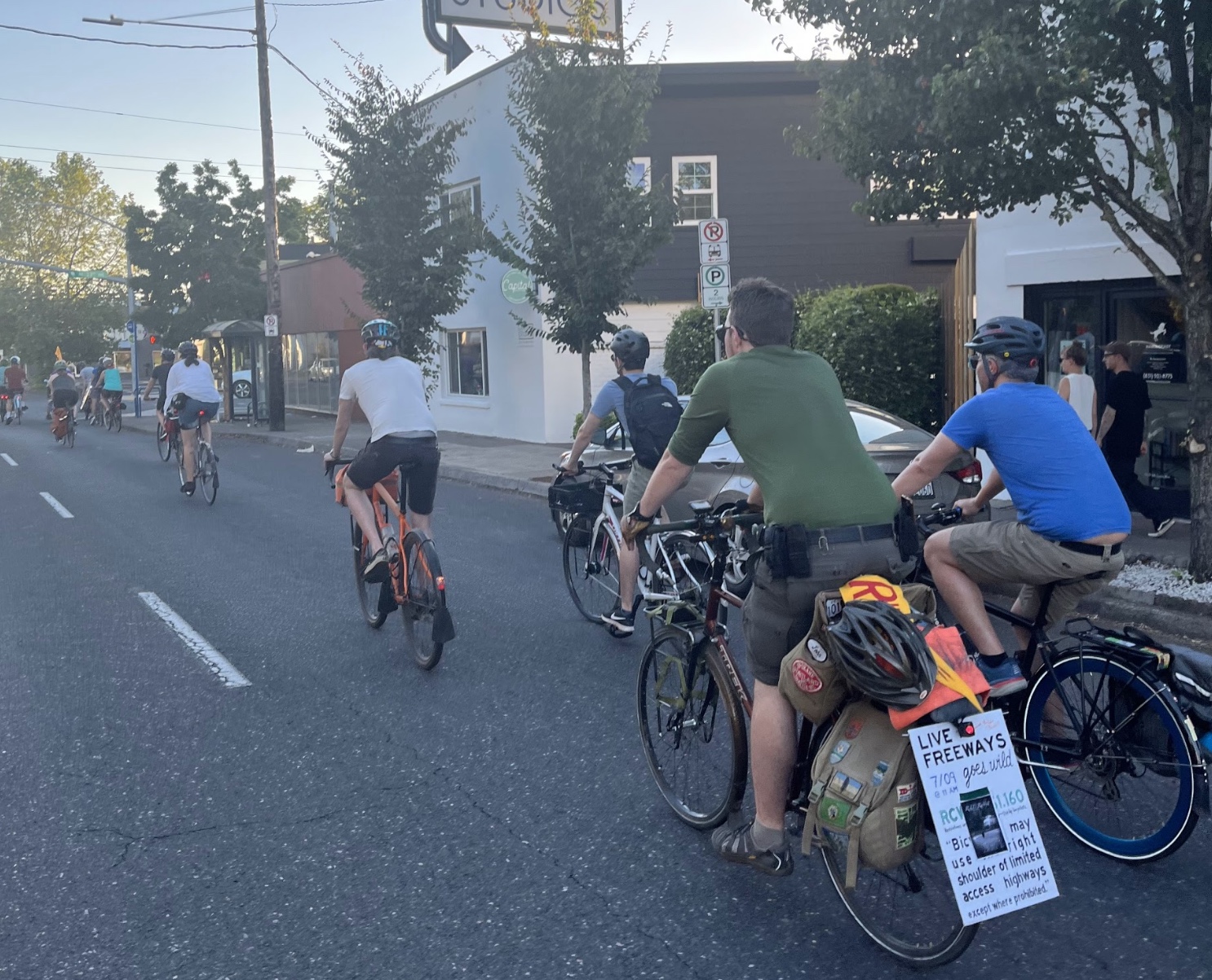
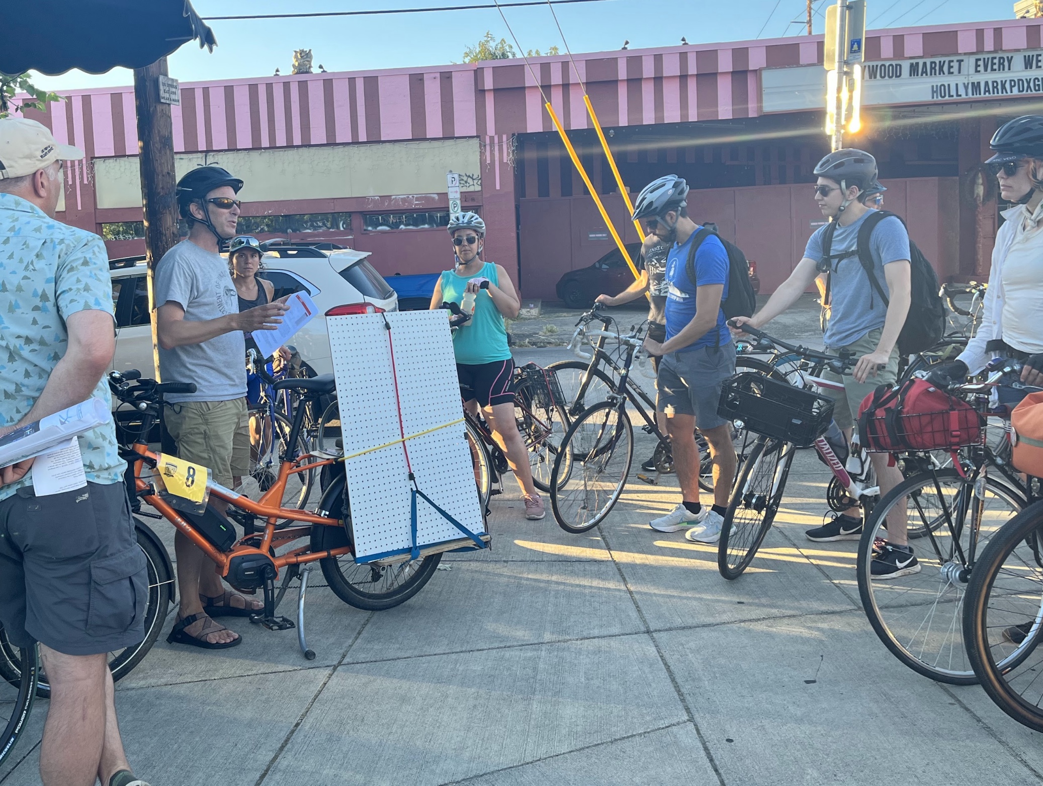
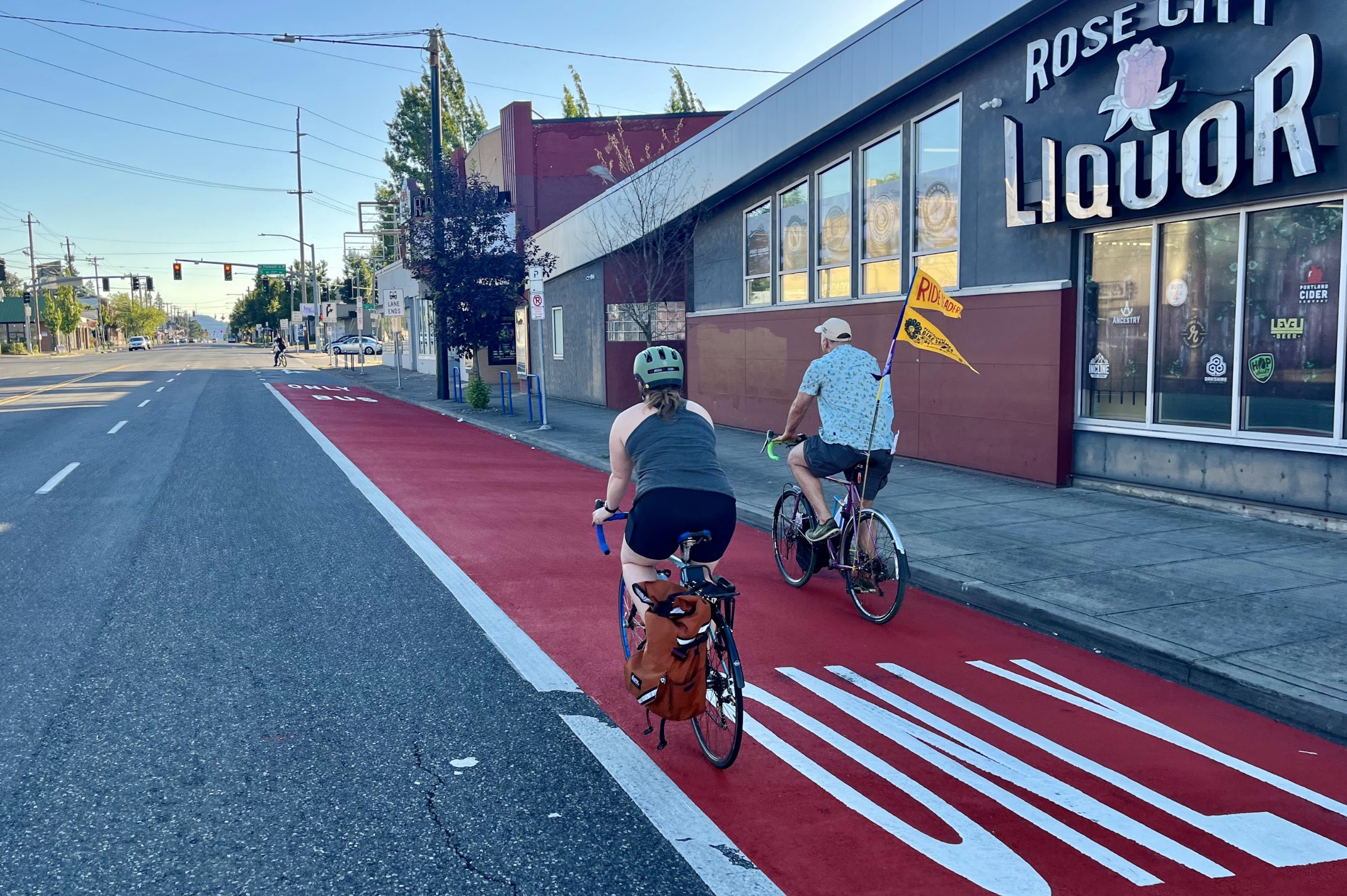
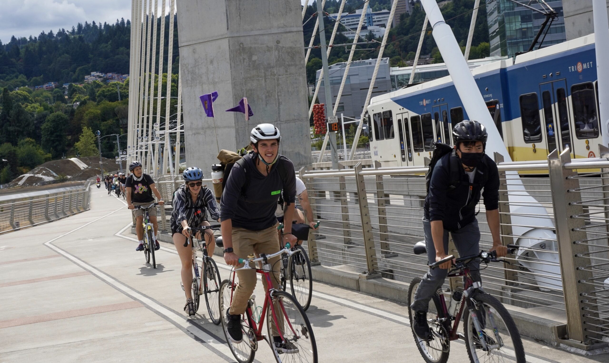
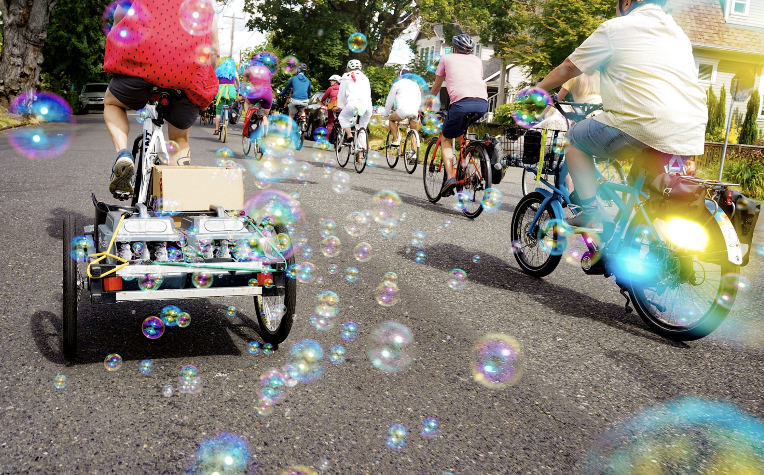
Ride co-leader Ted Labbe.New bus lanes.Ride co-leader Ted Labbe.Taking the lane on Sandy!(Photos: Taylor Griggs/BikePortland)
“We are the figurative sand in the gears of the automobile-dominated Sandy Blvd of today, and we’re actively making it better for tomorrow.”
– Ted Labbe, ride co-leader
Is Sandy Boulevard the ‘worst street ever‘ or a misunderstood corridor with the potential to be great? The answer will depend on who you talk to; but there’s no question it needs work. What began as a Native American trail as the quickest way to get from the Willamette River to the Sandy River, turned into an automobile cruising hot-spot in the mid-20th century and is now a wide arterial that cuts diagonally through Portland neighborhoods leaving a trail of complicated intersections and risky decisions for bicycle riders in its wake.
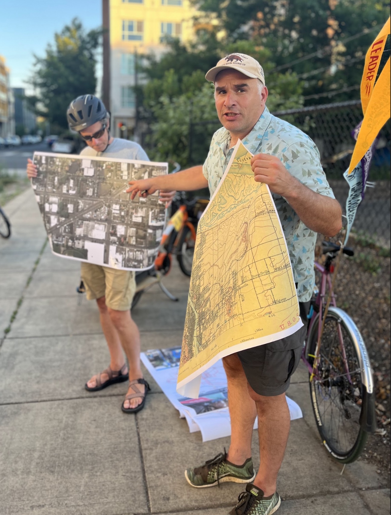
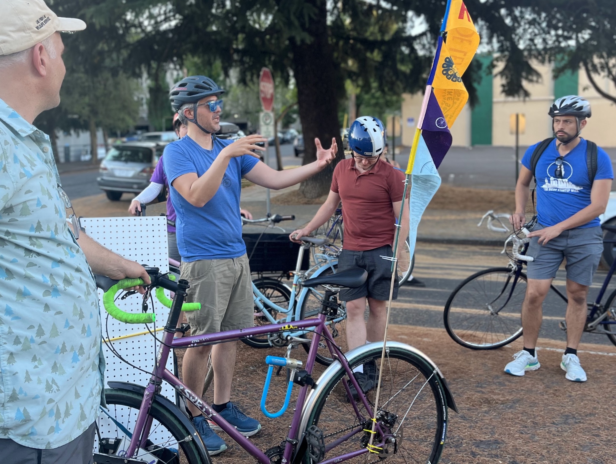
But there are those with a sweet spot for Sandy. Among them is Ted Labbe, a sustainable urban planning advocate who directs the Urban Greenspaces Institute and is on the board of re-greening group Depave. On a Pedalpalooza ride down the diagonal corridor Thursday evening, Labbe encouraged cyclists to take up space on a car-centric street and ask the city for what we deserve from Sandy.
“We are the figurative sand in the gears of the automobile-dominated Sandy Blvd of today,” Labbe said as we took off from the Roseway Parkway to head southeast. “And we’re actively making it better for tomorrow.”
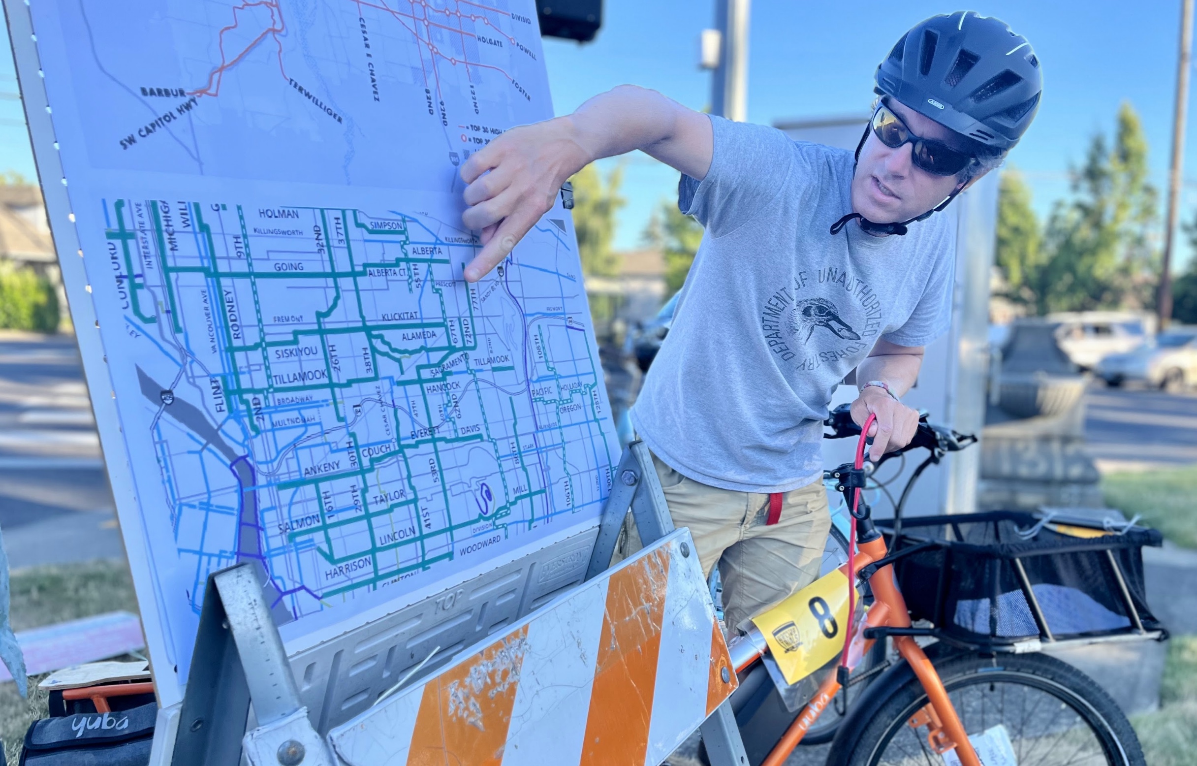
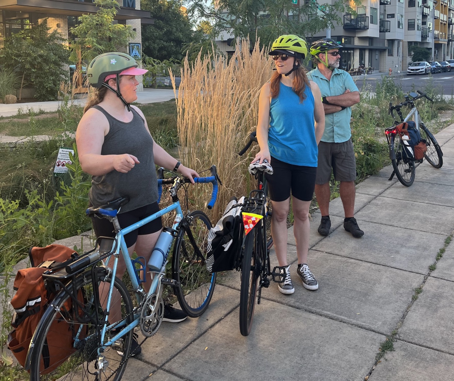
Colleen Mitchell explained the role of streetside bioswales.Adam Zucker and his maps.PBOT’s Zef Wagner holds court.
I was a little nervous going into this ride. As much as I can see the benefits in getting comfortable biking on Sandy, which offers a much quicker route from Portland’s Central Eastside to outer southeast than you can get on the greenways, I prefer to take the long way if it means I can relax a little.
But with Labbe and a group of other riders leading the way, I began to change my tune.
Engineer Adam Zucker, who led the ride along with Labbe, shared insights on Sandy’s stormwater gardens, which are hidden amidst the car traffic but designed to create some much-needed greenery on an otherwise barren corridor. Rain gardens are an art form Portland seems to have really nailed down – there are over 3,600 throughout the city – and once you start noticing this urban ecology that can thrive against all odds, you’ll start seeing them everywhere.
Advertisement
Since a jurisdictional transfer turned it over from the Oregon Department of Transportation in 2003, Sandy is controlled by the City of Portland, a fact that should make it easier to make safety-related changes in the future. But there are still roadblocks preventing that from happening as quickly as it should.
“We might have aspirations of a complete Sandy, but there’s jostling for control within the bureaus,” Labbe said.
Speaking of which, Labbe was able to nab some bureau representation for the ride – Zef Wagner with Portland Bureau of Transportation and Colleen Mitchell from the Bureau of Environmental Services. They seemed optimistic about the two departments working together.
Wagner shared updates about projects to make Sandy more accessible to people walking, biking and taking the bus along the corridor. For instance, there’s the plan in motion to improve the intersection at NE Alameda, 57th and Sandy with an eastbound driving ban and signal changes to help speed up bus service and prevent drivers from cutting through the Alameda Neighborhood Greenway. It’s a small change, but more like it could add up.
Advertisement
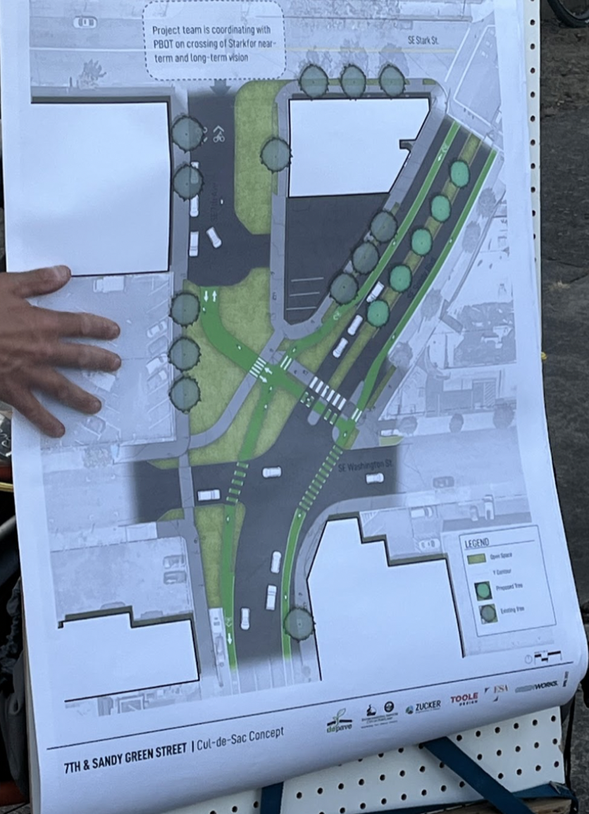
Standing in a future green plaza on SE 7th and Sandy.
Concept for SE 7th and Sandy project.
“We can make incremental improvements to the greenway network to discourage automobiles from utilizing those streets to the extent they do and make it more inviting to people biking,” Labbe said.
With so many smart, invested people putting work into making Sandy Blvd a better place to be, why is it still a scary place to walk and bike? This was a big theme of the ride: how fast should we expect to see progress on a street like Sandy? Are incremental measures enough?
We ended the ride at SE Sandy and 7th Ave, at a little triangle of street Depave is working to turn into a public plaza with green space and enhanced safety for active transportation. It’s a small strip of pavement just blocks from an interchange for a massive freeway that our state transportation department has plans to expand, surrounded by multiple high crash streets.
As we stood there among traffic whizzing by, talking about the future we want to see for this city, I noticed people looking at us. Perhaps they were amused or curious – but perhaps they were re-thinking what streets like Sandy could be.
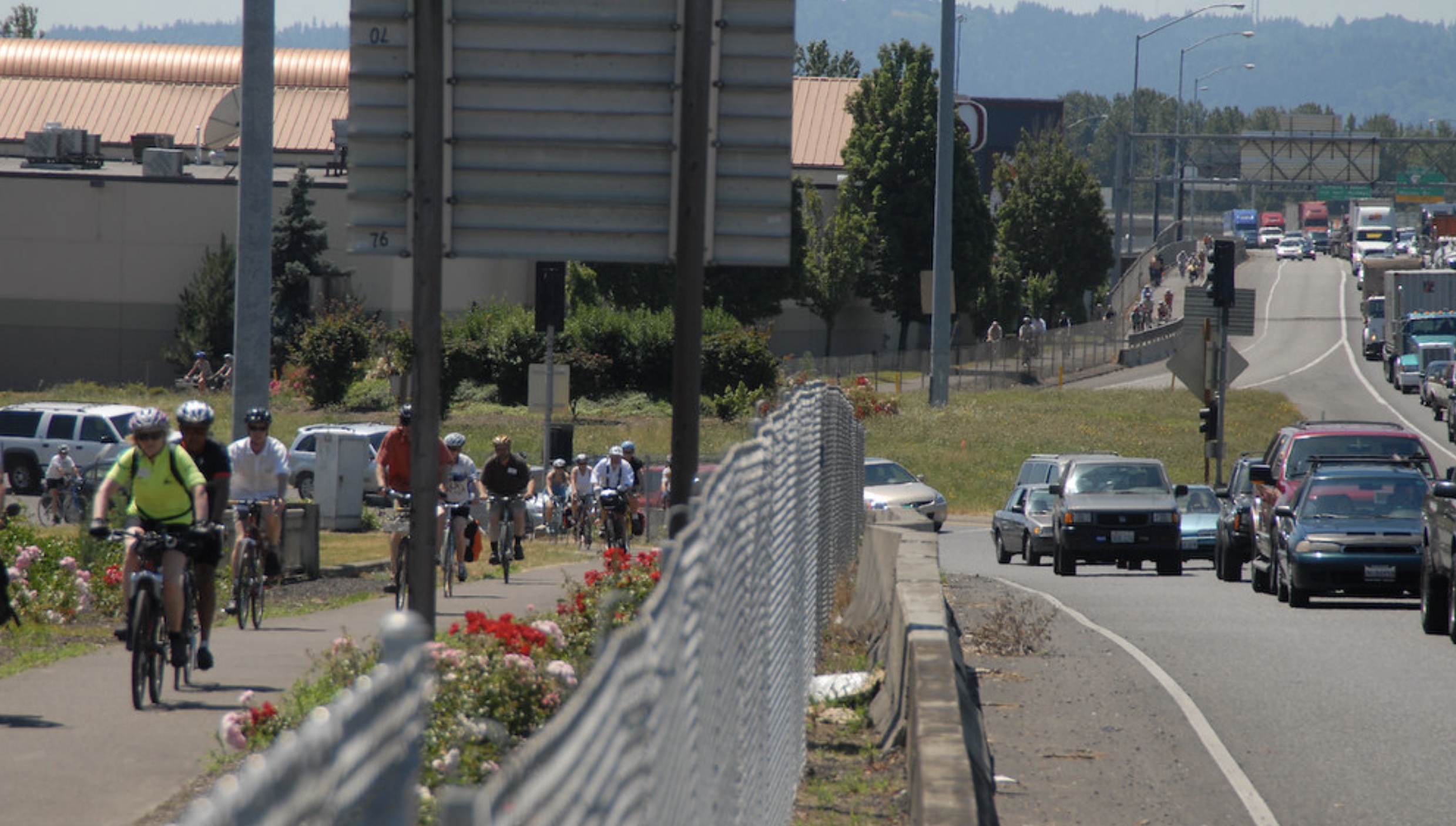
The IBRP team says they want to make the replacement bridge accessible to all modes of transportation. But with such a high incline to get up to the bridge, advocates say that’s impossible. (Photo: IBRP)
In response to climate and transportation activists who are wary of expanding I-5, both Interstate Bridge Replacement Program (IBRP) leadership and politicians who voted ‘aye’ on the project have gestured to a consolation prize. IBRP planners – correctly – point out that the current bridge is unfriendly to people using active transportation, given the small path dedicated to biking and walking with dangerous gaps and little protection against the three lanes of car traffic in either direction. They say the vehicle lane expansion is just part of the project, and that it will also include improved facilities for people to walk, bike and roll between Portland and Vancouver.
But what good is nice infrastructure if it’s too steep to easily use?
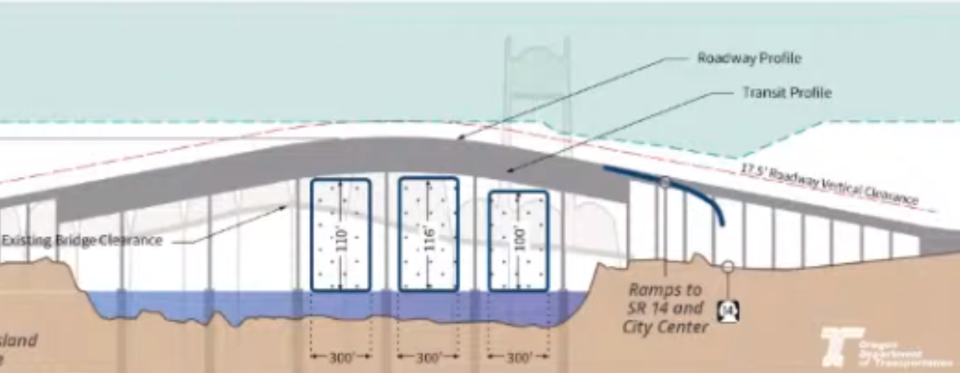
Just before Portland-area government agencies were set to vote on the IBRP’s Locally Preferred Alternative, the U.S. Coast Guard wrote a letter to project staff saying the replacement bridge design will need to provide at least 178 feet of vertical space so large ships can pass underneath. Transportation advocates already bristled at the idea of asking bicyclists to climb 116 feet as called for in the LPA design. An additional 50+ feet of height makes the situation even more dire.
Advertisement
The Problem With a Tall Bridge
The grade of the Tilikum isn’t ideal, but your mind can focus on the quiet and pleasant views, instead of the pain in your legs. (Photo: Jonathan Maus/BikePortland)
Engineers have two options to ensure bridges have manageable grades: go low or go long. Biking across the existing I-5 bridge is far from ideal, but because it has a lift span to accommodate shipping vessels, at least it’s not very high off the ground (about 72-feet high). Getting from the ground to the bridge doesn’t require a significant climb, and the bridge doesn’t extend too far past the river.
With a fixed height of 178 feet, however, a bridge would have to be very long – about two miles – in order to meet the grade requirement of 4%. This would have an especially profound impact on downtown Vancouver, which is located just on the other side of the bridge. Even a 116-foot-tall bridge will require completely new infrastructure. And a 4% climb over two miles is nothing to scoff at in itself.
As a comparison, Portland’s Tilikum Crossing has an average incline of just under 5% for about a third of a mile, and this can feel difficult to traverse on tired legs. But the Tilikum Crossing, devoid of car traffic, makes up for the climb. I can’t imagine pedaling across a freeway bridge for two miles with the roar of traffic in your ear could provide that same balance.
To transportation and climate activists, this is just another example of the IBRP hastily pushing forward with a freeway expansion with not enough attention paid to the needs of people who aren’t in cars.
Advertisement
The Skeptics
Ahead of the City of Portland vote to support the bridge, members of the Portland bicycle and pedestrian advisory committees wrote a joint letter (PDF) to city leadership to hold off on supporting the project until they can make sure the height will “accommodate the 8-80 year old cyclist and allow for wheelchair users to access the bridge without significant effort.” The letter says mockups of the project area “gloss over the impact of height,” which makes it difficult to fully evaluate the sufficiency of walking, biking and rolling facilities.
When Just Crossing Alliance issued an action alert asking Metro at Portland City Council to force the IBRP to include more bridge design options in the LPA, the first point on their list was that it have, “gentler grades for freight and people walking, rolling and biking.”
IBR program leaders maintain the bridge will be manageable for people walking, biking and rolling – and also say they’ll be able to negotiate with the Coast Guard to keep it at 116 feet. But economist and IBR data watchdog Joe Cortright thinks they’re downplaying the seriousness of the Coast Guard’s requirement.
Advertisement
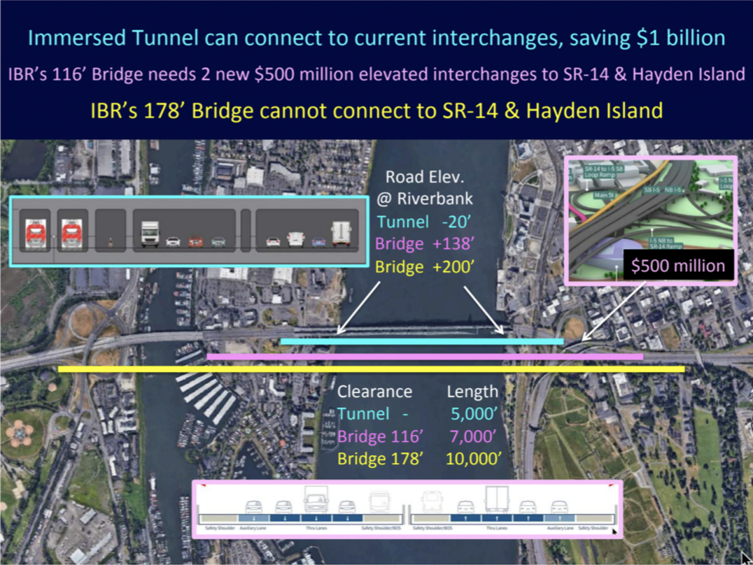
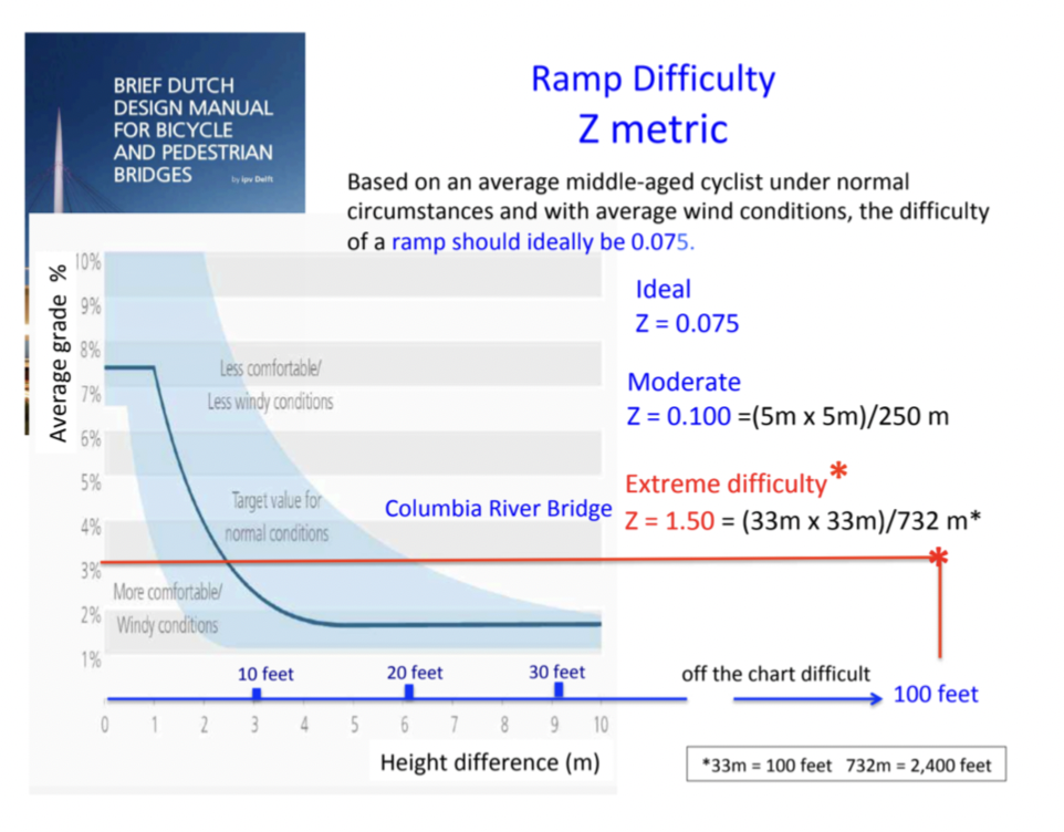
A graphic from Bob Ortblad demonstrates how long a 116 or 178 foot bridge would have to be in order to accommodate the required incline. (Source: Bob Ortblad)Ortblad’s graphic based on a Dutch Design Manual for Bicycle and Pedestrian Bridges (Source: Bob Ortblad)
“The Coast Guard’s conclusion makes it clear that it is strongly committed to maintaining the existing river clearance, that it won’t approve a 116 foot bridge, and that the economic effects of this would be unacceptable,” Cortright wrote in City Observatory earlier this month. “Still, the [Oregon and Washington State Departments of Transportation] are equivocating, implying that the Coast Guard decision has no weight…and implying that the Departments of Transportation and not the Coast Guard are the ones who determine the minimum navigation clearance.”
IBR administrator Greg Johnson says they can’t use a different design like a tunnel or lift feature – both of which the Coast Guard suggests as feasible alternatives – citing logistical problems that critics dispute.
Retired engineer Bob Ortblad, one of the IBRP’s most outspoken critics, has been strongly advocating for an immersed tube tunnel concept in part because he says it solves the incline problem. Ortblad has investigated Dutch design manuals for best practices in designing bridges suited to bicyclists, and he found that considering the height and length of the IBRP, they would deem the strenuousness of this bridge unfathomable. According to the Dutch, an average grade of 4% is only acceptable if the bridge is 10 feet off the ground. Anything taller than that should max out at under 2%.
Any improved active transportation facilities will gather dust if the bridge is too high. A would-be Vancouver to Portland bike commuter may peer up at a path 178 feet in the air and decide it’d just be easier to drive a car.
“Activists hate it and business community hates it and therefore we absolutely must be moving in a direction that makes the most sense.”
– Jo Ann Hardesty, Portland City Commissioner
On Thursday, the Interstate Bridge Replacement project received the approval of state lawmakers and the heads of all of the regional authorities, giving it the green light to move forward into the environmental review process with their Locally Preferred Alternative (LPA) design.
A theme of compromise was threaded throughout many of the remarks made before the go-ahead was given.
“We must be on the right track, because activists hate it and business community hates it and therefore we absolutely must be moving in a direction that makes the most sense,” Portland’s Jo Ann Hardesty said in advance of her vote as part of the project’s Executive Steering Group. Metro President Lynn Peterson echoed her. “We can’t get hung up on the perfect. The perfect is not within reach because everybody’s is a different perfect,” she said, calling the LPA the “perfect Venn diagram” of where everybody could compromise.
Many state lawmakers, particularly on the Oregon side, were also ready to embrace the idea of compromise at a meeting of the Joint Interim Committee on the Interstate 5 Bridge Thursday. “I have a significant number of people in my community, and in my district, who think that the auxiliary lane is too much,” Senator Lew Frederick said. “So, that’s the kind of balance, the kind of compromise that we’re looking at.”
But even as some electeds on the Washington side voiced concerns about the inclusion of light rail, the idea of tolling, and what they believe as a lack of new capacity in the draft design, Oregon State Senator Brian Boquist contended that it was his chamber that the IBR program should be focused on outreach to. “Most people I talk to [in my caucus] remain concerned of the fact that it doesn’t look like one auxiliary lane will work, and it doesn’t look like capacity going forward is going to work,” he said. Unlike the other groups, the legislative committee didn’t take a formal vote on moving ahead. Washington has already provided its requested $1 billion allocation, with Oregon expected to make a similar allocation in 2023 to keep the project on schedule.
Advertisement
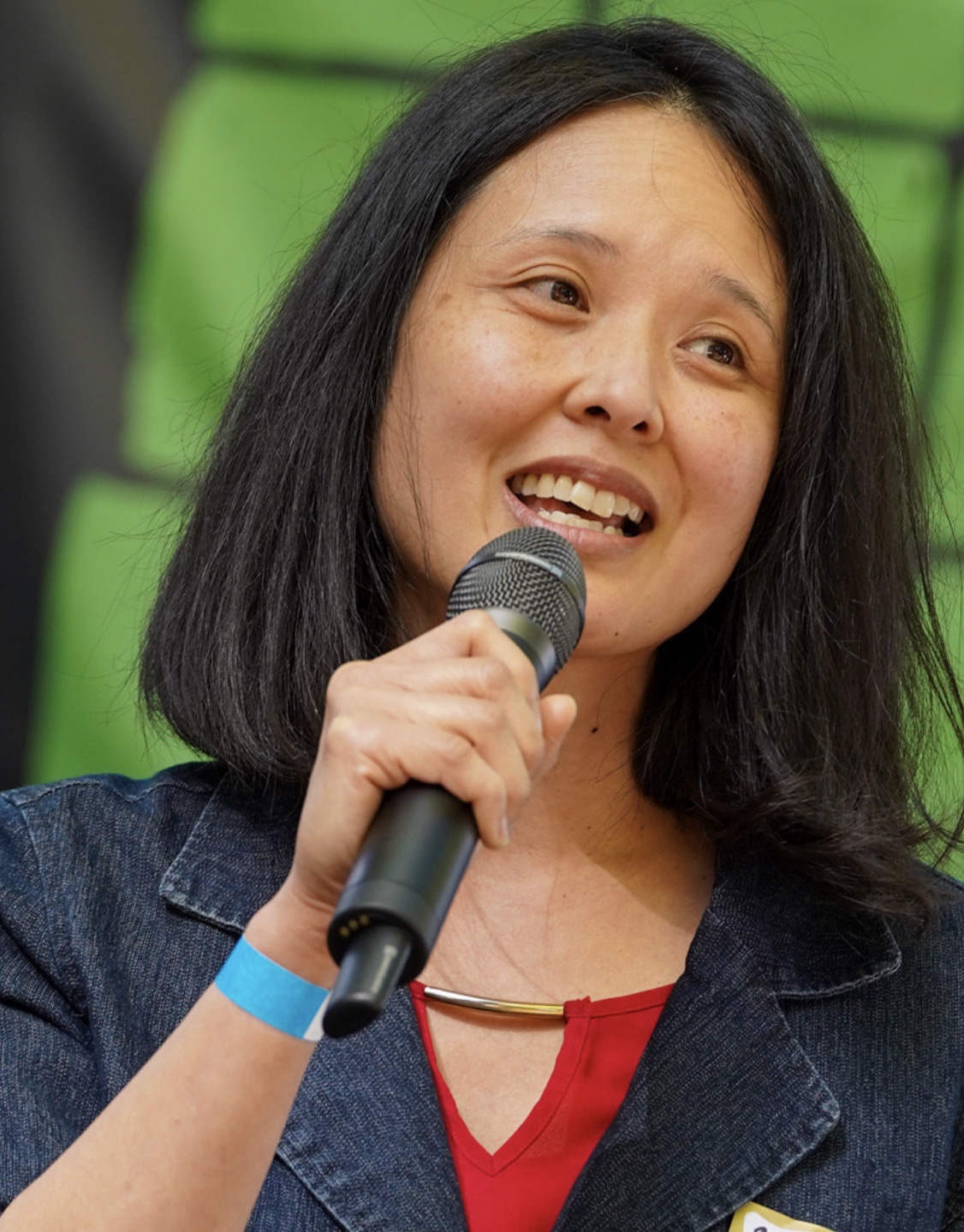
State Rep Khanh Pham (Photo: Jonathan Maus/BikePortland)
Distinguishing herself from the rest of the group of legislators was Oregon House Rep Khanh Pham, who has become an outspoken skeptic of the direction the IBR is headed. In contrast with her colleagues, Pham was trying to look underneath the information being handed to the legislative committee, including asking questions about the recent letter from the U.S. Coast Guard stating that reducing the current 178 foot clearance provided by the current bridge isn’t acceptable.
“I just can’t support moving forward with the draft EIS without including at least one alternative that would address the Coast Guard’s requirements,” Pham said at the hearing. “Last time around [when the project was called the Columbia River Crossing] when we tried to get the Coast Guard to move it delayed us for a one year and we ultimately did have to change the design which cost us millions.”
Pham’s skepticism centered on finances.
“If we don’t get the finances right for this, it will have impacts on a whole list of other transportation projects in our state. And as a community organizer, who has worked with so many communities asking for safety, investments like crosswalks — you know, things that may seem mundane but have real impacts on our communities — and have always been told ‘there’s not enough money, sorry, we can’t do it, there’s no money for that.’ As a legislator now I’m seeing that there is money, but it’s allocated for different things.”
In response to Pham’s questioning about the Coast Guard, IBR Administrator Greg Johnson revealed that if the height of the proposed bridge is raised, that could lead to a “distasteful” decision to remove the interchanges at either Hayden Island or SR 14 on the Vancouver waterfront.
Raising the bridge even more could mean an even tougher incline for bicycle riders and other non-car users and bigger impacts on downtown Vancouver and Hayden Island, which are already set to see an incredibly impactful new highway wall constructed as part of the project.
Advertisement
Even with the lower bridge height that the Coast Guard is currently pushing back on, Hayden Island and downtown Vancouver are set to see a big wall of highway.
The height of the bridge deck is just one issue that will be further worked through by the IBR team as the project goes through a Supplemental Environmental Impact Statement (SEIS) process over the next two years or so.
We’ll also see more details — including how the bike and pedestrian path will be designed and what the light rail element of the project will look like. And lobbying over the number of lanes and capacity concerns from all sides will not go away.
As this megaproject moves forward, whether or not the fact that no one appears to be completely happy with it will be good or bad for the project’s fortunes, remains to be seen.
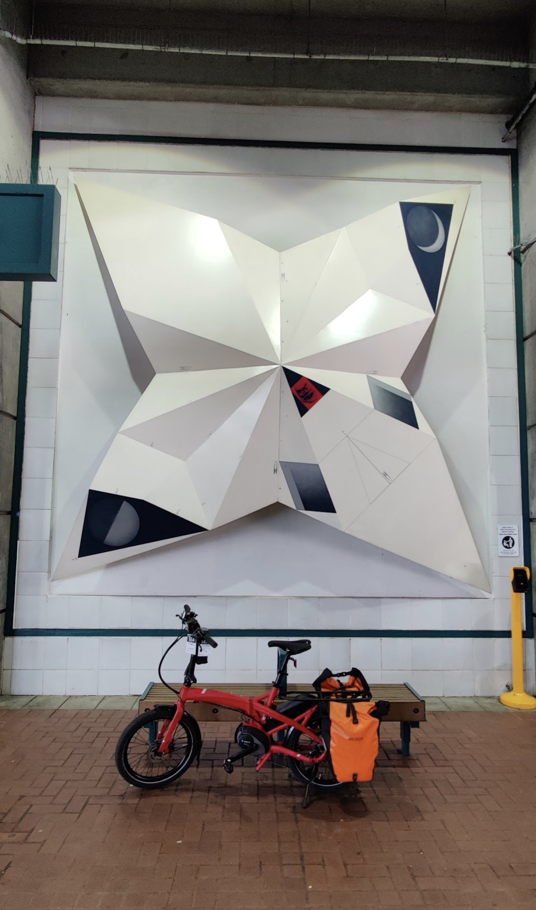
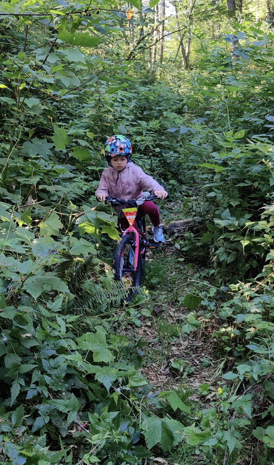
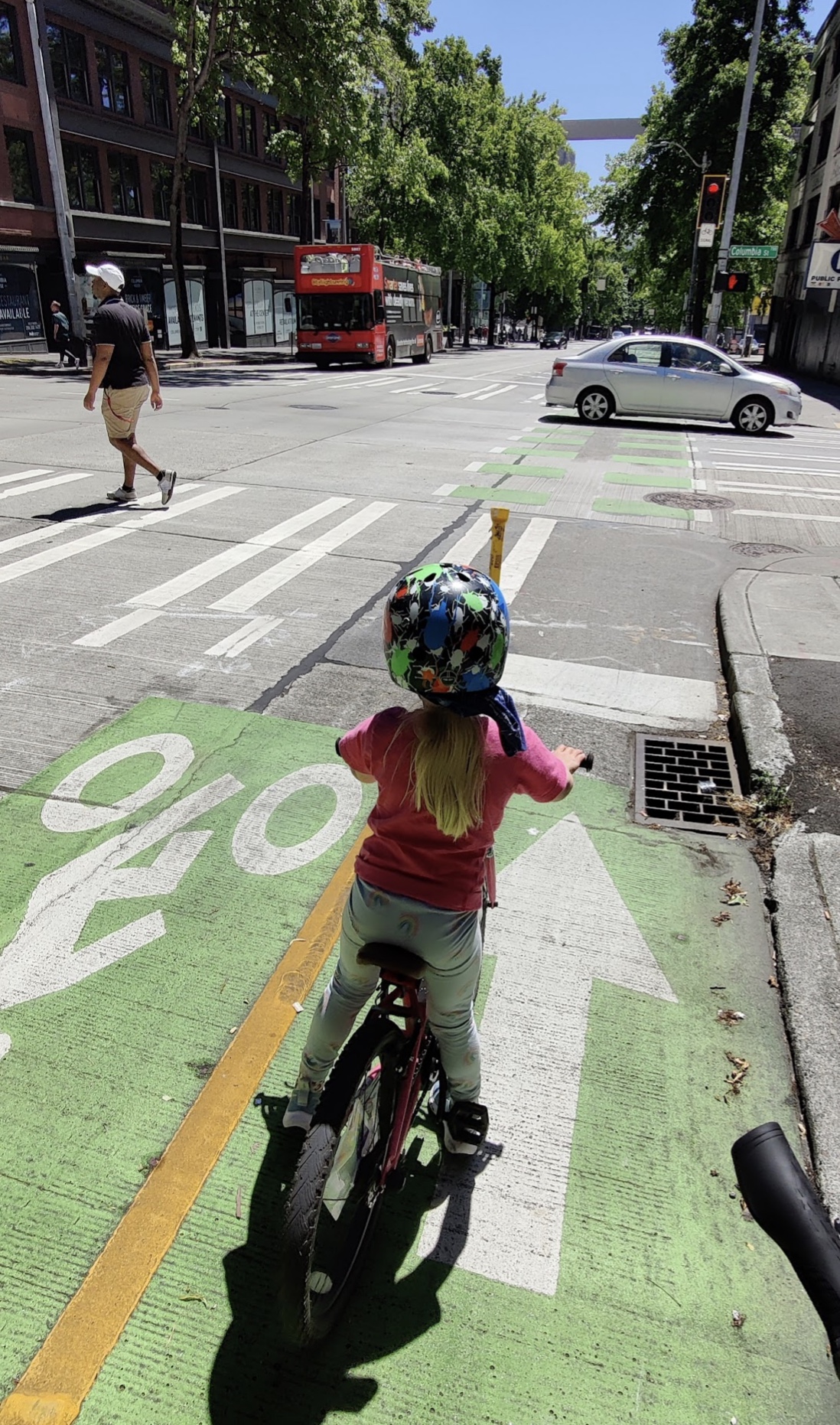
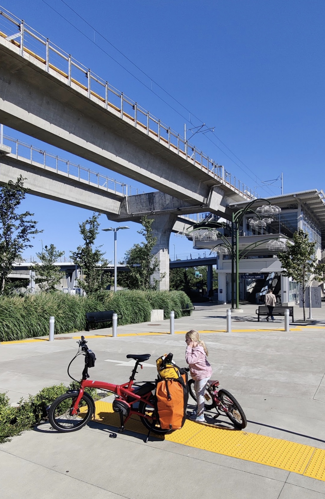
Waiting for a bike-free bus.Union Station in Portland.Art by Sonya Ishii in a Link station.Overgrown trail recommended by Google Maps en route to Mukilteo Ferry.Downtown Seattle bikeway.
The alarm clock on my phone buzzed and made chirping sounds as I rubbed my eyes. It was 5:00 am and we had an Amtrak train to catch at Portland’s Union Station. My panniers and backpack were loaded the night before with all of our gear for the four day trip. I just needed to get our six-year-old up and on her bike to ride to the Trimet bus stop.
This was going to be our first carfree trip to visit my parents in Seattle and the first visit since the start of Covid.
The 43 bus to Portland is the closest bus route for us but unfortunately it only offers three buses in the morning with hourly service. Only the 6:17 AM bus (with about an hour ride and one transfer) would get us to the train station in time for our 8:20 AM departure. Taking the 43 would be convenient but also a gamble. Trimet bus racks only hold 2 bikes and we had 2 bikes to get to Portland. If one other person was using the bike rack we would not be able to board. The next bus wouldn’t be for an hour, too late for us to make our Amtrak train. Not wanting to take that gamble we decided to ride two miles to Pacific Highway and catch the #12 bus which has frequent service, every 15 minutes for most of the day. This was our safest route in case of canceled buses (which has been happening often due to a Trimet driver shortage) or full bike racks.
Advertisement
You may know from previous articles that I primarily ride an e-Bullitt cargo bike hauling our kid in the front box and towing her bike behind when she isn’t riding on her own. As much as I’d like to take our box bike up north, it’s too long and too heavy to put on the bus rack. It’s also over Amtrak’s 50 pound weight limit, so I contacted Barb at Splendid Cycles to ask about borrowing a loaner bike for the trip. I was so happy to hear back that they did have an e-bike that was under 50 pounds that I could take on an extended test ride!
The Tern Vektron Q9 is a folding e-bike with a Bosch mid-drive motor. My panniers would clip on the rear rack just fine and there was more room for an additional bag on top of the rack. I picked up the Tern the day before our journey and it was ready to help haul our luggage to the train station. (Thanks Splendid Cycles crew!)
Back to the morning of our departure…
Bus to Union Station in Portland
At the baggage car the workers told us to remove the e-bike battery from the bike and carry it on, which I missed in the instructions online.
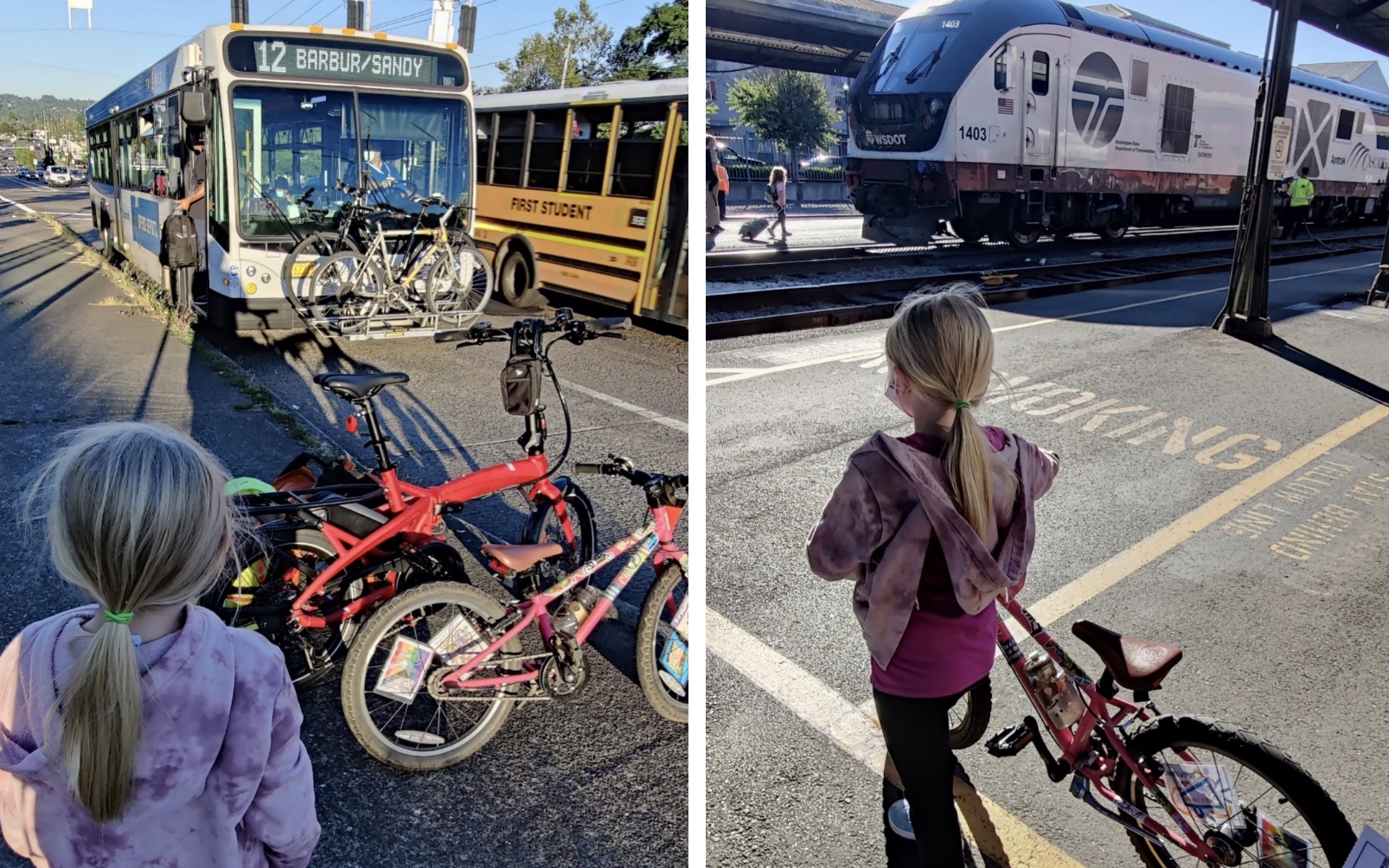
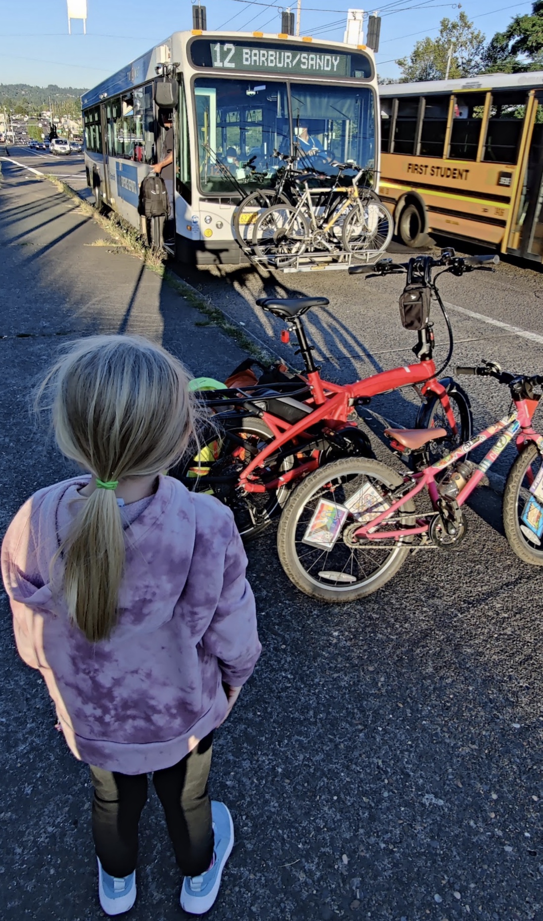
As we rode to the bus stop on Pacific Highway we were excited to start this journey. I hadn’t been on a passenger train since I was a kid and this would be our daughter’s first heavy rail experience. We arrived at the bus stop at 6:30 am and prepped our bikes for the bus, pulling the panniers off and staging the bikes near the bus stop pole. I opened the Trimet Hop Fastpass app on my phone to triple check that we had money loaded on the card. With the morning sun to our backs we looked West on ODOT’s Highway 99 scanning past the hundreds of single occupancy vehicles looking for the #12 bus. We spotted it a few blocks away and breathed a sigh of relief.
The bus wasn’t canceled! But wait, what was this? I squinted my eyes and stood still. Was there a bike on the front of the bus? “OH NO!” I exclaimed. “What? What? WHAT!” our daughter yelled over the sounds of car exhaust and tire noise. As the bus driver pulled in just 500 feet away at the bus stop just before ours, I could see that the bus bike rack was folded down and there was a bike loaded. Then I noticed a person that hailed the bus also had a bike! Did I make the wrong choice in taking the 12 over the 43? We waved the driver off and pulled the bikes away from the curb as the bus rolled past us with a full bike rack. I frantically checked the trip planner on the Trimet app for the next bus. 15 minutes and it was not showing canceled. But what if the next bus also has a bike on the rack? What if the bus gets canceled at the last minute?
My mind raced. Should we start riding our bikes to the train station? We could make it in time if we had our box bike but with the kid rolling on her own two wheels the trip would definitely take over an hour. We would just have to wait for the next #12 and hope for the best. If we missed the next bus we would probably miss our passenger train. I clenched my teeth as we waited. I checked the arrival time on my phone repeatedly. 12 minutes. 8 minutes. 2 minutes. Due. My stress level was elevated by the stench of car exhaust as my tunnel vision focused on the highway. There it was! The next bus! Squinting again I could see that the bus bike rack was folded up and empty! “HOORAY!” I yelled as we moved the bikes closer to the curb. What a huge relief! WHEW!
Advertisement
After the bus stopped we signaled to the driver that we would be loading bikes and folded the rack down by squeezing the handle in the center. The Vektron easily loaded onto the rack as did the kid’s 20” Cleary Owl. We stepped on board, holding my phone to the scanner to pay the fare and off we went on our way downtown.
West Burnside and SW 6th was our stop. It was a short, seven-block bike ride to Union Station. We dismounted and rolled our bikes through the doors of the historic structure that originally opened February 14th, 1896. Checking in was much easier than at the airport. We walked to the baggage department, I showed my ticket on the Amtrak app and we received paper tags for our bikes. That was it! My panniers and backpack were carry-on and there was no security checkpoint. When departure was announced we stood in a short line, exited the building and rolled our bikes to the baggage car at the rear of the train.
At the baggage car the workers told us to remove the e-bike battery from the bike and carry it on, which I missed in the instructions online. It was not a big deal on the Tern as the battery was easily removed (don’t forget your key!) but if you have a child seat or other accessories mounted to your bike this may be a difficult task, especially with the stress and haste of needing to board a sold-out train. Be prepared and maybe remove your battery much earlier. The next task is to lift your bike about 4 feet up to the level of the baggage car floor. The Vektron was about 45 pounds so not an easy task but doable for me. I’m surprised that Amtrak doesn’t have a ramp to make this easier, perhaps in the future. We scooped up our bags and boarded the full train.
On Amtrak to Seattle
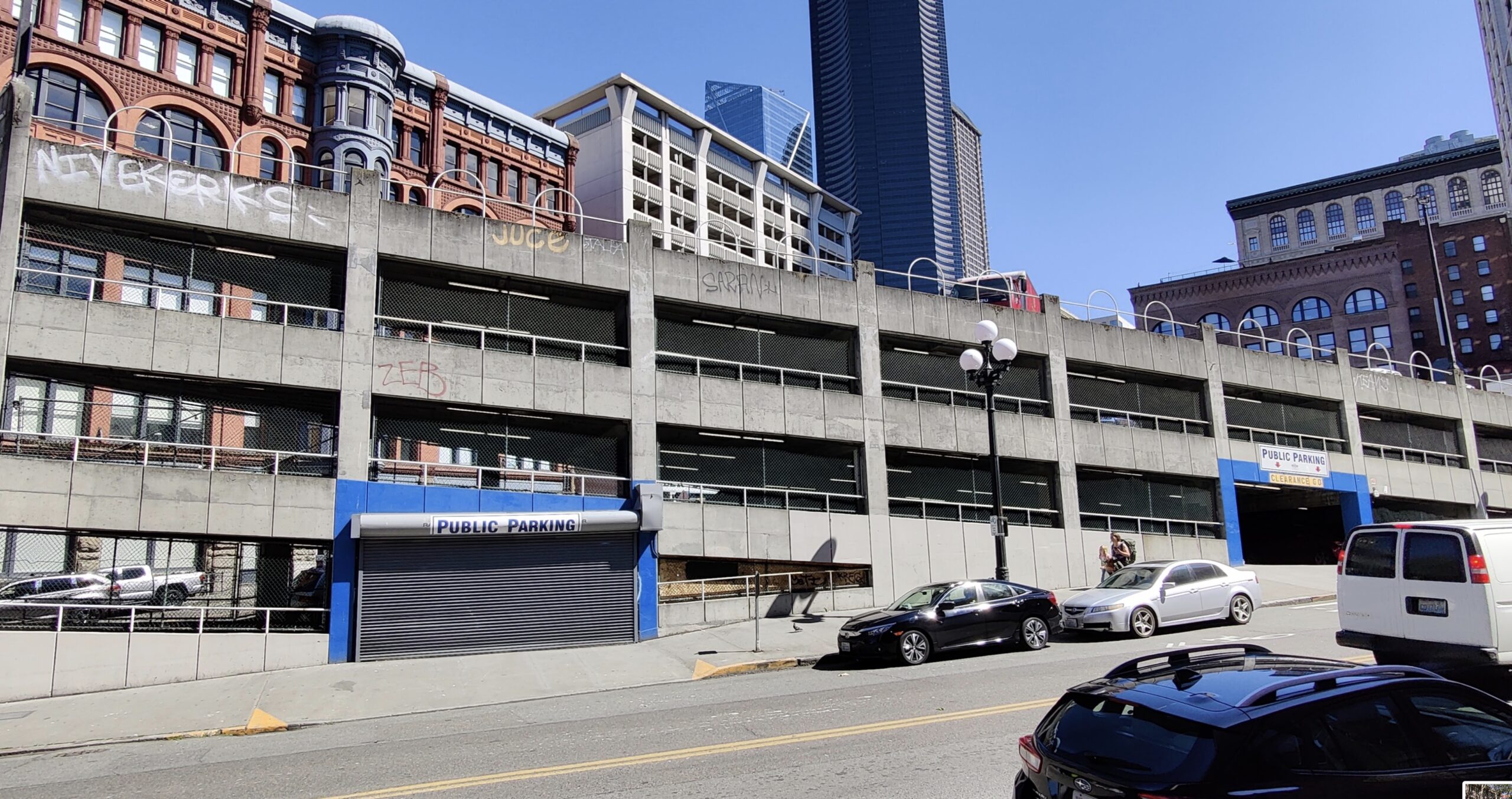
Car parking in Seattle.
It was an uneventful departure as we rolled through the Pearl District on our way to cross the Columbia River to our first stop in Vancouver, WA. Picking up passengers at the 6 stops along the way only took a few minutes at each location, it’s a very fast process. I enjoy staring through the windows watching the world go by. We brought plenty of reading materials and coloring/activity books to keep the kid occupied.
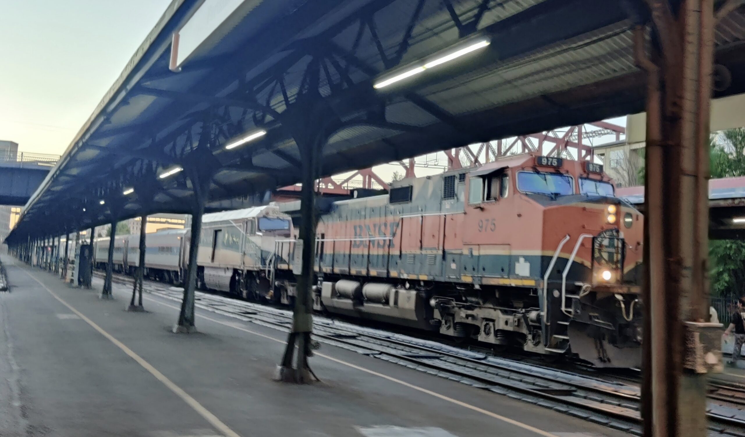
There is a 120 vac outlet at each window seat so be sure to bring your charger and cable for your devices. Now that I think about it you could charge your e-bike battery if needed! It was nice to have a dining car with a decent selection of food and drink available. Being able to stand up and walk the length of the train was helpful for the 3-4 hour ride. Speaking of time, I learned that Amtrak passenger trains must yield to heavier and much longer freight trains. We had a 30 minute delay near Centralia, Washington as we waited for a miles-long freight train to clear the track and turn off into a rail yard.
As we passed through JB Lewis McChord and Tacoma, WA I was blown away by all of the car infrastructure we could see through the windows: car storage, car repair shops, car fuel stations, car lube bays, car dealerships and car washes. (Did I mention car storage?) I thought back to how many times we have made this same trip in a giant pickup truck burning many gallons of diesel fuel and getting road rage in the gridlock on I-5. It was so nice to be able to read a book and relax as the miles rolled by.
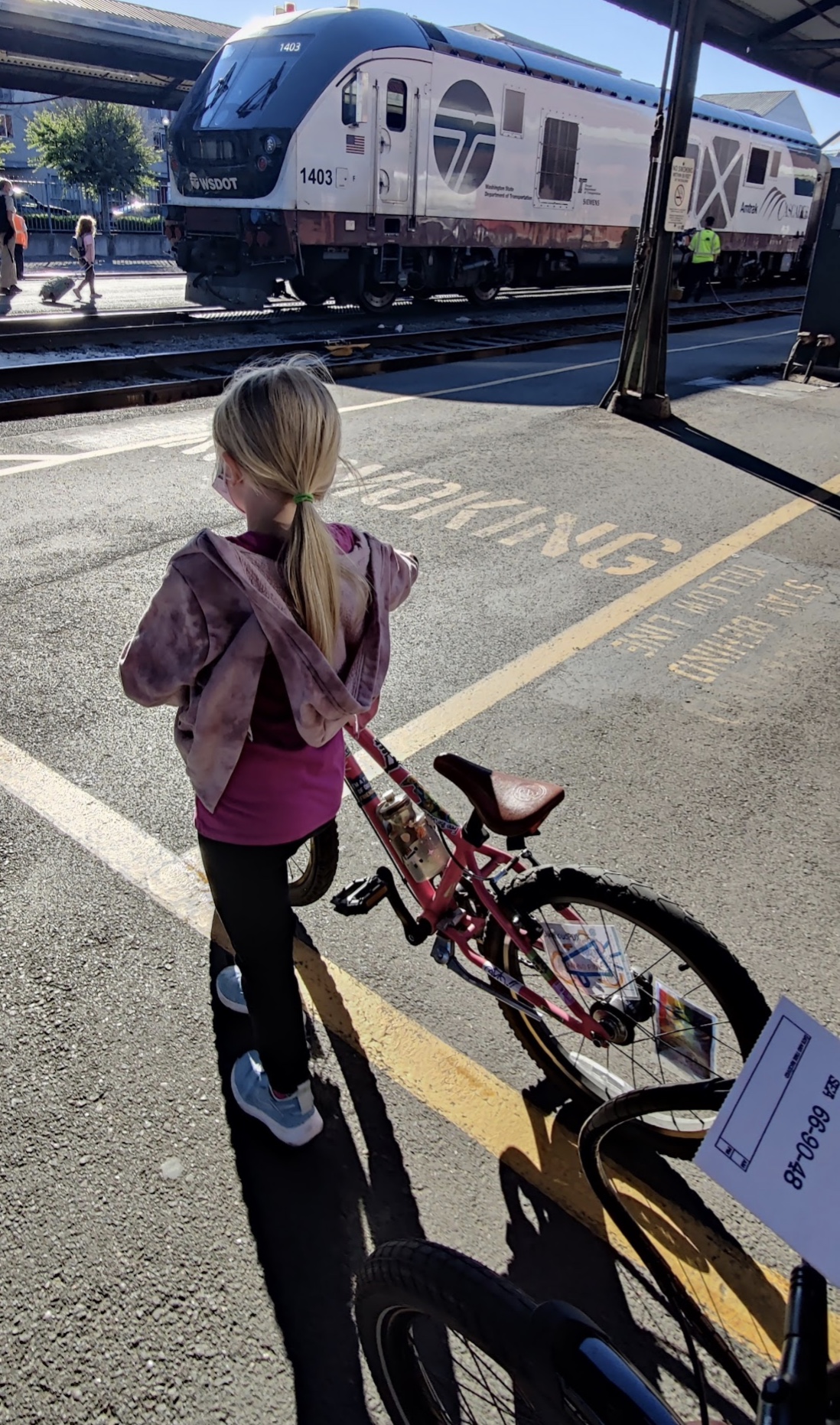
We arrived at Seattle’s King Street Station at 12:15 pm, walked to the baggage car, presented our paper baggage tickets and claimed our bikes. Snapping the panniers onto the rear rack of the bike took five seconds as we walked our bikes through the train station and out the front doors. Our final destination was Everett, WA. (30 miles North of Seattle) After a short 2 block ride to the International District / Chinatown light rail station we purchased our Sound Transit Link tickets from the vending machine.
Advertisement
On the Link
I tried to figure out the apps for the Puget Sound regional transit agencies before our trip. I downloaded “Transit Go Ticket” from King County Metro and the ORCA app. I looked at the Everett Transit website. It was overwhelming and I couldn’t figure out the transfers between agencies. A paper ticket from the machine seemed to be the easiest at the time. The first elevators that we saw were broken and blocked by barricades. (I guess it’s not just a Portland thing!) Riding to the other side of the block revealed another elevator that was functioning.
The first Link train arrived very quickly! Looking through the windows I could see that the train was packed! It looked like standing room only, no way we were going to fit two bikes in there. Especially with that being our first time on the Link. I was unfamiliar with where the bikes go, how they hang on the hooks and also a newbie with taking the Tern on light rail. I decided to relax for 15 minutes and wait for the next train to gather my thoughts and make a game plan on how to board. This gave us a few minutes to explore the station and enjoy the wonderful origami art sculptures by Artist Sonya Ishii. The next train arrived in the station and the doors opened revealing completely empty cars! Woo Hoo! We rolled our bikes on and I hung the 20” bike on the bike hook. I started to pull the panniers from the Tern so that I could hang it as well but then noticed a sign informing us that one bike could remain in the space on it’s wheels with the rider standing with it.
The doors closed and we were on our way. Now, I’ve been on the MAX (Portland’s light rail) plenty of times. That Link train train acceleration is way faster! The bike almost fell over taking me with it but I saved it. Then the deceleration is hard as well! I quickly figured out that not only did I need to hold on tight but I also needed to squeeze the front brake of the bike while standing on the foot of the kickstand! I wanted to take pictures of the amazing art in the other stations but I couldn’t relax my stability stance for one second! Rotating my head like an owl I was able to keep an eye on our kid sitting behind me.
The train filled quickly. Most of the route is underground but transitions to elevated track near the end at Northgate Station. Two more working elevators later we were on the street looking for our next bus.
Advertisement
Bus to Everett
Sound transit uses a bay system which was very helpful. I knew that we needed the 512 bus to Everett but instead of looking for the tiny bus number on the bus stop sign from a distance, the app told me to look for a larger bay number. The larger bay number signs are easier to see from a distance especially at a transit mall or park-and-ride. Multiple bus routes stop at each bay, or section of curb. I scanned the signs and found our bay number and our bus was already there! “That’s our bus!” I exclaimed and we jogged with our bikes. People were boarding as I signaled the driver and lowered the bike rack. These buses are not only double decker, they have triple bike racks! Once again I pulled the panniers and loaded the bikes. I gave our paper light rail tickets to our kid then realized that these tickets may not transfer to the bus. I asked the driver as I frantically checked my wallet for cash. “Are these light rail tickets good for this bus?” The driver looked at the tickets in the hands of our six-year-old. “I’m not sure. Just have a seat.” they instructed.
The kid really wanted to sit in the upper level of the bus but I had two panniers and a backpack with a bike helmet flopping around. I didn’t want to navigate the narrow stairs with our luggage. I also wanted to be able to keep an eye on our bikes. The express buses are also fast. Traveling between the park-and-rides, the buses use left lane exits on I-5 to avoid car traffic. Between Northgate station and the future Lynnwood City Center Station you can see more elevated light rail tracks under construction. It looks amazing and will reduce the number of single occupancy vehicles on I-5.
Arriving at the South Everett park-and-ride we reloaded our gear on the bike and planned the last leg of our trip. Maps wanted to take us and our bikes on a busy street but panning around the map I spotted an Interurban Trail right next to the park-and-ride. (Why wouldn’t Google maps recommend this route over a busy street?) A six mile bike ride and we arrived at our destination at 2:30 pm.
Our multi-modal route beat the two train route by 4 hours.
Advertisement
We Finally Made It!
Grand Avenue Bike/Ped Bridge in Everett that we missed!
Recap: Bike, bus, bike, Amtrak, light rail, express bus and bike. Tigard, Oregon to Everett, Washington. 175 miles in 8.5 hours. There is an Amtrak route that goes all the way from Portland to Everett but this is a 2 train trip with a 5 hour layover in Seattle. Our multi-modal route beat the two train route by 4 hours.
Unfortunately over the next two days we experienced more map disappointments. Wanting to ride bikes to Everett’s Jetty Island Ferry, Google Maps recommended a terrible route on Washington State Highway 529. I spotted an old pedestrian bridge at 25th Street and a sidewalk that looked much safer so we took the bus and walked instead.
On our two mile walk we discovered that there is a big beautiful new ped/bike bridge with working elevators (the Grand Avenue Park Bridge) that connects to a multi-use path leading to the ferry. That would have been an amazing bike ride but we missed it because we didn’t know it was there. The next day we wanted to ride bikes to the Mukilteo Ferry. Maps recommended a trail to keep us off of a busy street and I double checked it with Ride with GPS. There were so many stairs! Then the trail reduced to an overgrown singletrack where I was actually bushwacking the pokey plants with a stick! Ha! Ha! That made for quite the adventure but greatly increased our travel time.
How can we improve these maps? Can we get wayfinding signs to direct people to these new walk/roll/bike infrastructure projects?
Advertisement
The Reverse Trip
After hanging with family for a few days it was time to go home. We kissed our goodbyes and off we went in reverse order. We discovered that our earlier rush to get on the 512 express bus was unwarranted. This route has Ultra Frequent Service! (Every 10 minutes!) As we rode our bikes to the South Everett park-and-ride, the bus was pulling up. No biggie as we knew the next one was coming in 10 min. This gave us time to unload our baggage and get our new ORCA card ready! We found out that you need a physical card along with the app. The past two days we paid all of our Everett Transit fares in quarters because we couldn’t figure out the ORCA card thing. Problem solved!
We were first aboard the southbound Link train so boarding was a breeze. Ridership was high once again as the train was standing room only on the way to Seattle. Someone made a comment to me during our stay that “Nobody rides the light rail” but I think they meant that they don’t ride the light rail.
We had a couple of hours before our Amtrak departure so we grabbed lunch at Tat’s Deli across from the sinking ship parking garage on Yesler Way. Occidental Square had games set up near the playground with giant Connect 4, Ping Pong, giant chess, bean bag toss and other games which was cool to see in the downtown core. Then we rode up the green cycle track on 4th Ave to the Seattle Public Library. There are some amazing buildings to look at and some big hills! While the kid is a climbing machine on her bike I was glad to have the e-assist on the Vektron especially with all of our luggage and an additional bag of gifts from Grandma and Grandpa on the rear rack. We had a blast riding around downtown Seattle but it was time to catch a train back to Portland.
Once again checking our bikes at baggage was super easy. We walked our bikes through the train station and to the baggage car. I remembered to remove the battery earlier, saving a minute or two. We had no problem finding two seats together on the sold-out train.
After two stops in Tukwila and Tacoma, we were cruising southbound with the sun shining on us through the window when suddenly, CLICK! The lights went out, the AC turned off and everything got very quiet. We were still rolling but we were slowing down. Slower. Slower. We coasted for a few minutes. An overhead sign above the bathroom illuminated in red the words “TOILETS CLOSED” but people were still going in and out. I wondered what they experienced there in the dark. A single white emergency light was on near the front of the train car.
It seemed like we started moving under power again but very slowly. Luckily we made it to the Olympia/Lacey station where the announcement was made that we could get off of the train and take a break while the crew tried to fix the train. I was thankful that the crew was able to get us to a station where there were snacks, bathrooms and grass with trees. If we had been stuck in the woods and not able to get off of the train that would have been worse for sure.
After 30 minutes or so the announcement was made that our train’s engine was broken and we would need another. At this point most people deboarded and some even hailed a ride-share car and left. City transit buses were coming through regularly but I didn’t see anyone get on. I believe that I heard Amtrak was going to send a bus to come get us but an engine was on the way to connect to our train and continue the journey by rail. As the rescue engine approached we were all asked to get back on the train so the workers could do the disconnecting and reconnecting. (Even though I really wanted to watch!)
The freight engine that powered us back to Union Station.
As we waited on board a long freight train slowly passed us on the right then stopped. After some back and forth motion I assumed that this was our rescue freight train dropping off one engine. A slight bump confirmed that something had definitely arrived. A few minutes later the freight train on our right appeared to start moving again but it was actually our train moving! Everyone erupted in cheer! After a two-hour stop we were on our way. The new arrival times were calculated and announced as we learned that a freight train engine cannot travel as fast as a passenger train engine. (Or at least the way this train was now configured we couldn’t travel as fast.) Our new arrival time was now 9:00 pm instead of 5:30 pm.. This sent everyone scrambling and scrolling to figure out their next steps. I heard people canceling dinner reservations, arranging rides and instructing people to pick up food. Some even made plans to stay in Portland rather than continue southbound on the late train.
As for us, it was a race to see if we would make the 44 bus or the 12. Of course we would rather take the 43, but once again it’s only hourly during rush hour with no weekend service. 44 being more desirable than 12 as it would get us closer to home but infrequent service would push us to take the 12 to Barbur Transit Center and ride bikes the last 1.5 miles.
The sun had just set as we boarded the bus but we made it home with a sliver of blue sky showing. The kid was a champ and did an amazing job on this very long multi-modal day.
The next day I folded the Vektron and loaded it into our bucket bike to return it to Splendid Cycles. Thank you so much to Barb and the Splendid crew! Would we do it again? YES! Next time we’ll explore the new (to us) Sounder Train N line from Everett to Seattle and have our ORCA card ready!
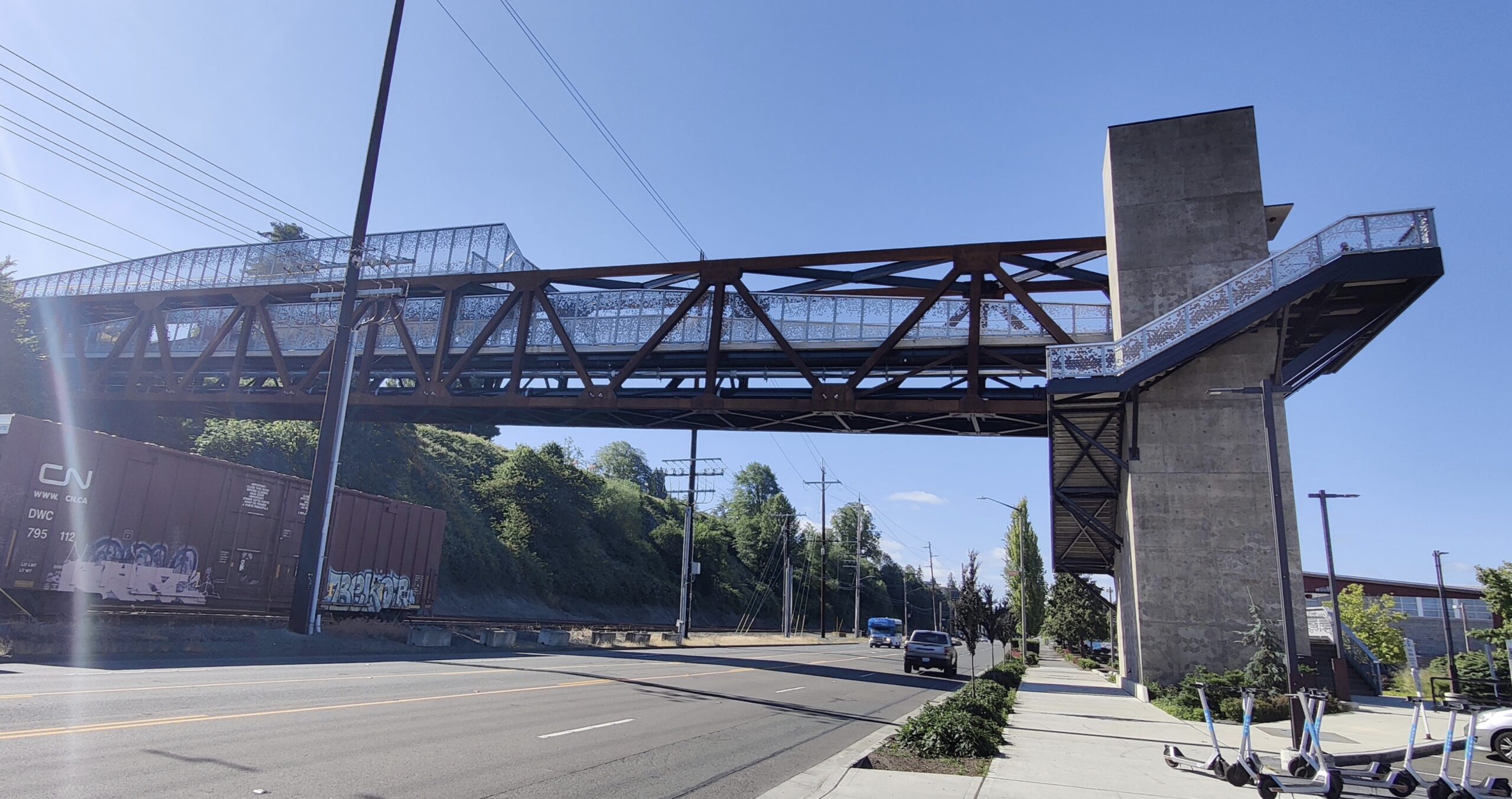
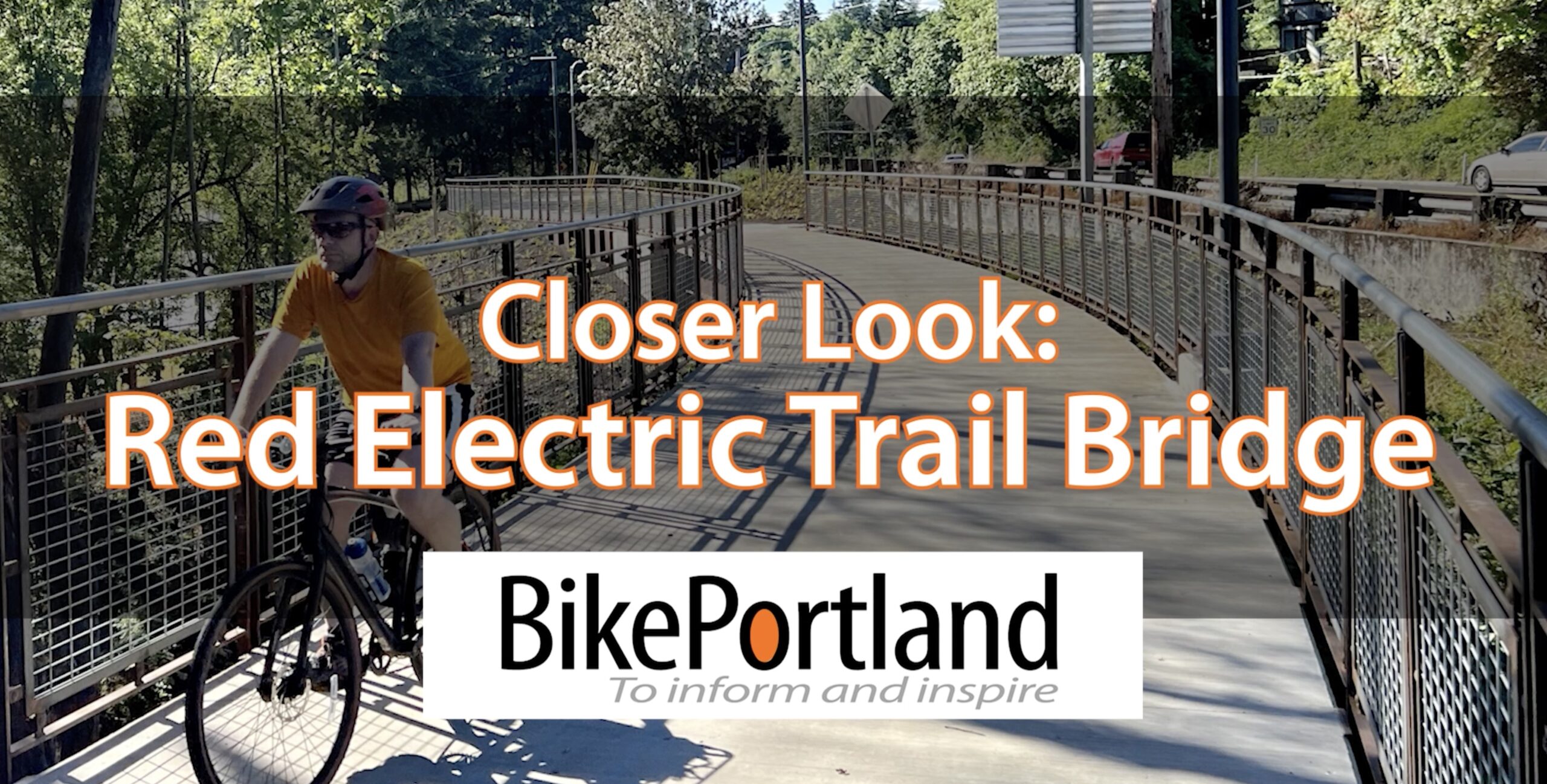
I know there are a lot of new carfree bridges opening up in Portland right now so I’ll excuse you if you’ve fallen behind (haha); but if you haven’t rolled over to the Hillsdale neighborhood in southwest Portland to check out the new Red Electric Trail Bridge, you are missing out on one of the coolest new pieces of infrastructure in the city.
On the other hand, if you can’t see it in person, the video I just uploaded is the next best thing.
I was excited when I saw Lisa Caballero’s report and photos last month, but I was even more impressed when I rode it myself a few days ago. It checks all the boxes: it’s flat, aesthetically pleasing, easy to find, and well-connected to existing routes. I was there on a weekday afternoon and saw a steady stream of people walking on it. I love that there’s an apartment complex on one side, and business destinations on the other.
Advertisement
The value of this bridge is also amplified because it is just one of many steady improvements in the active transportation network made by PBOT in the nearby area. As we’ve chronicled, there has been slow-but-steady progress in taming Beaverton-Hillsdale Highway, the major arterial at the new bridge’s northern end.
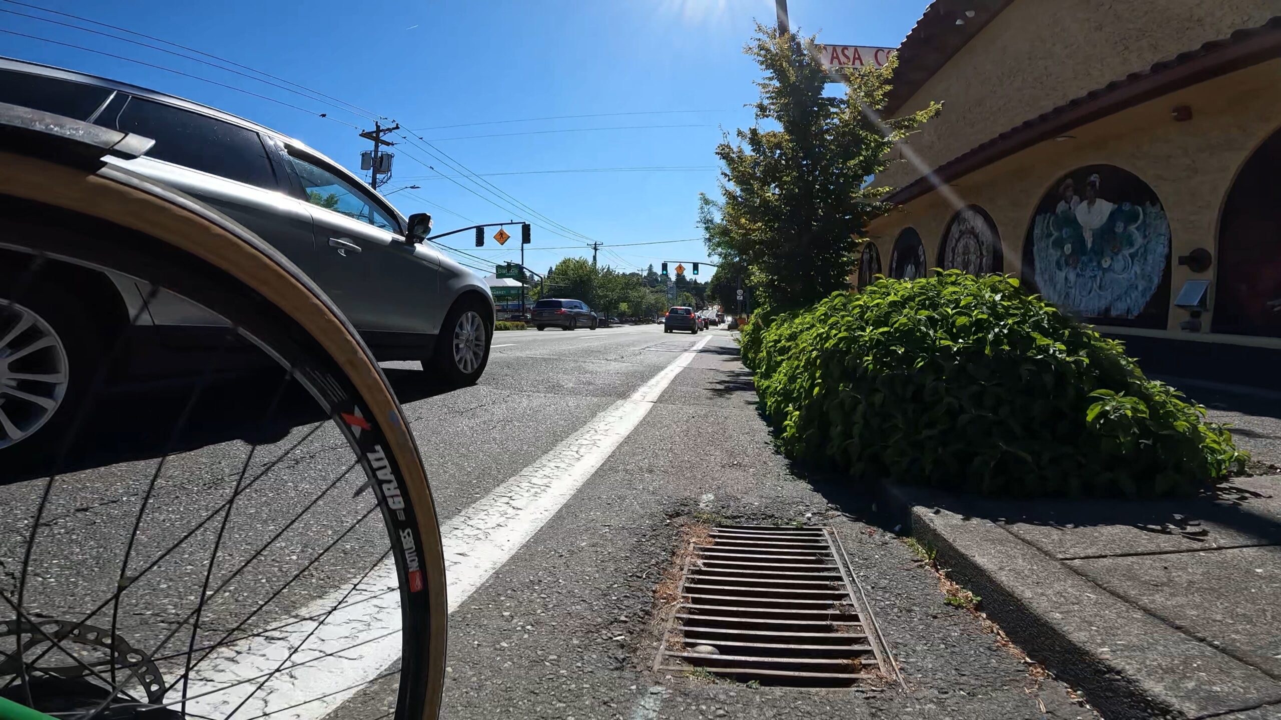
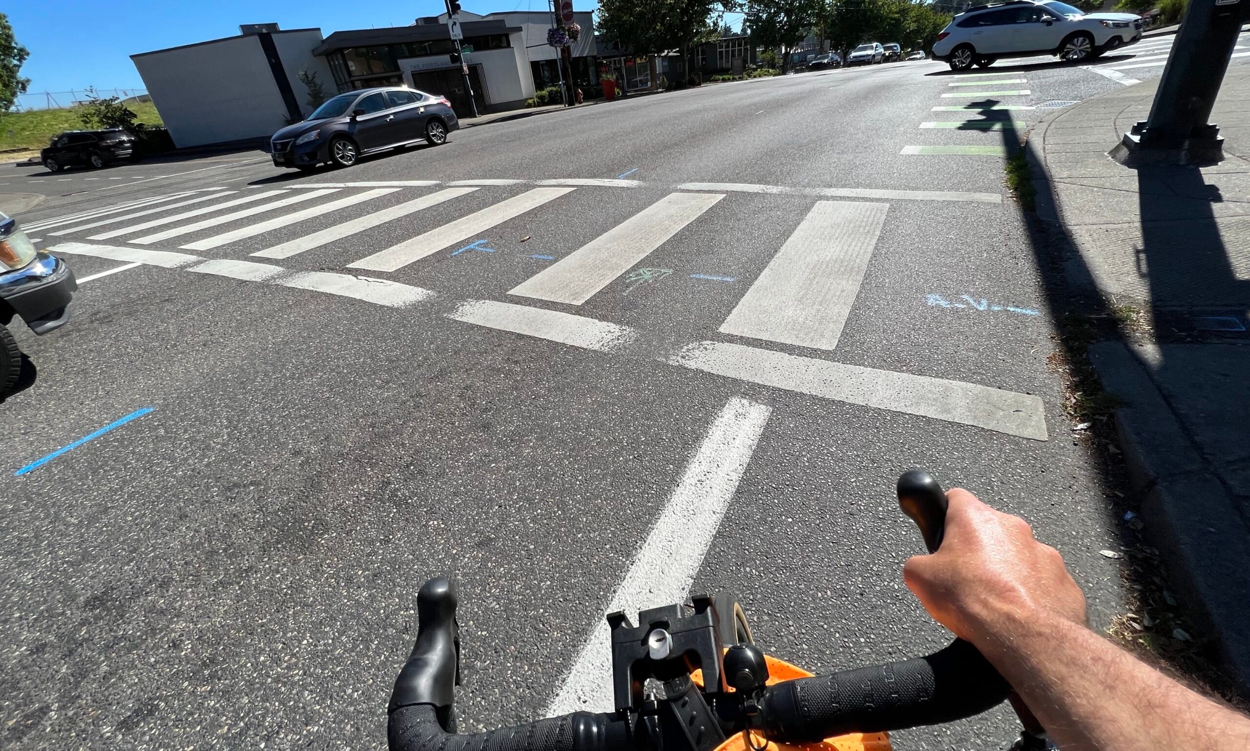
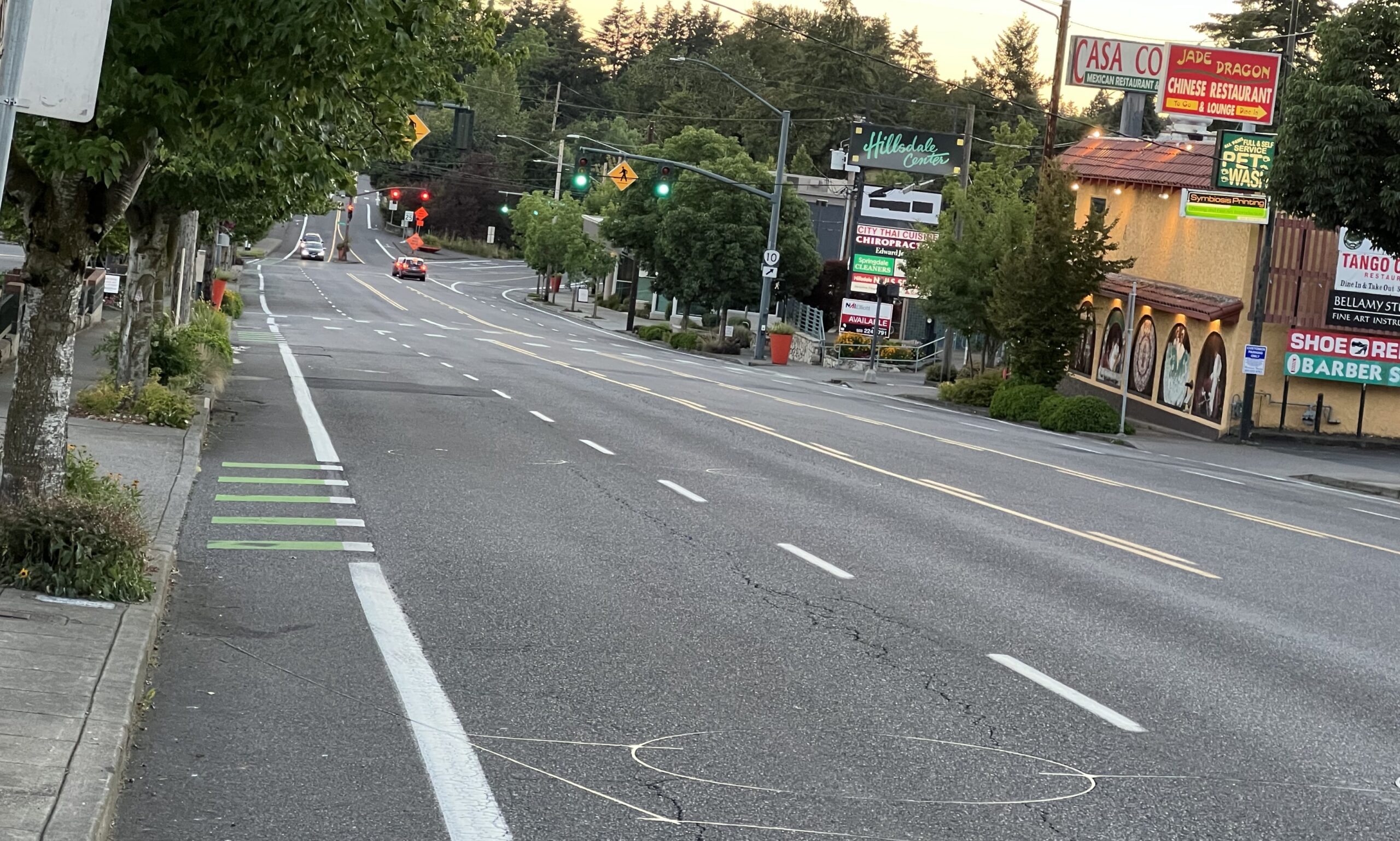
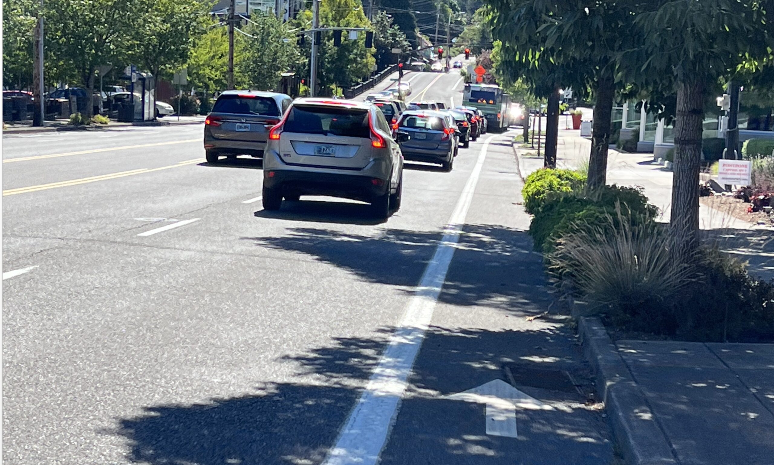
Hopefully this bridge creates momentum for further changes in the nearby commercial district. As I rode home on SW Capitol Highway through the Hillsdale shopping center, I was shocked at how terrible that street is. As you can see in the photos below, there are five lanes of roaring car traffic and just tiny, unprotected bike lanes made even worse by storm drain grates and wide driveways.
(Photos: Jonathan Maus/BikePortland)
If PBOT wants to get the full return on their $4.7 million bridge investment and get more people cycling and walking, they must reduce driving space on that section of Capitol Highway and add more space for bike riders and other types of non-car users. But that’s a conversation for another post.
I know it’s just Thursday, but I read an article recently that said in today’s upside-down, work-from-home-and-hybrid-office world, Thursday is the new Friday. That’s not good for the news publishers (haha!), but it’s good news for everyone else.
If you want to get a jump on your weekend planning, scroll down for our event and ride picks. But first… Today’s Weekend Guide is sponsored by the Electrify Expo that’s happening up in Seattle Saturday and Sunday. It’s where all the cool e-kids will be. More info on that and lots more below…
Friday July 22nd
Social Service Ride – 1:00 pm at Director Park (SW) Our friends at BikeLoud PDX are doing rides that expand the genre far beyond frivolous fun and nerdery. On this ride they’ll tour social service providers downtown in an effort to expand perspectives and introduce bike folks to the people who help unhoused Portlanders. More info here.
Saturday July 23rd
**Featured Event**Electrify Expo – 10:00 am to 5:00 pm at University of Washington (Seattle) Don’t miss the largest electric vehicle expo in North America. This event will be your one-stop-shop for all things EV, including bikes, boards, scooters and much more. Take the train and make a weekend out of it, and don’t forget to swing by the booth of local bike biz Vvolt. More info here.
Vancouver Courthouse Criterium – All day in downtown Vancouver (WA) Here’s a great excuse to venture over the Columbia and explore the many charms of Vancouver. Check out the I-5 Bridge, hang out on their excellent riverfront (and ponder why Portland is so far behind), then pedal a bit north to watch some fast and exciting bike racing. If you’re racing-curious, they’ll even have a criterium clinic at 9:00 am. More info here.
Advertisement
Asian Snacks and Friendship Ride – 10:30 am at Peninsula Park (N) The return of this popular ride will be an easy pedal where you’ll stop by several markets to try fun Asian snacks. More info here.
Beaverton Bike Ride – 4:00 pm at Merlo Rd/185th MAX Station (Beaverton) Join Beaverton City Councilor Kevin Teater on a jaunt on off-street paths to the Beaverton Night Market. Expect an 11-mile ride with a family-friendly route and pace. More info here.
Sunday July 24th
**Featured Event**Electrify Expo – 10:00 am to 5:00 pm at University of Washington (Seattle) Don’t miss the largest electric vehicle expo in North America. This event will be your one-stop-shop for all things EV, including bikes, boards, scooters and much more. Take the train and make a weekend out of it, and don’t forget to swing by the booth of local bike biz Vvolt. More info here.
MTB Clinic – 9:00 am at Rocky Point Trails (Scappoose) Join the NW Trail Sisters for this intermediate-advanced skills clinic where you’ll get instruction on how to nail the trails with confidence. Pre-reg required and they ask for a $10 donation to NW Trail Alliance. Open to all who identify as female and non-binary. 18+. More info here.
Grilled By Bike – 12:00 at Ladd Circle (SE) Tis the season! This classic get-together ride is just what it sounds like. These folks just love attaching grills to their bikes (in every manner you can imagine) and cooking stuff. They also happen to be some of the nicest people you’ll meet. Or should I say meat. Bring a grill, or bring something to grill. More info here.
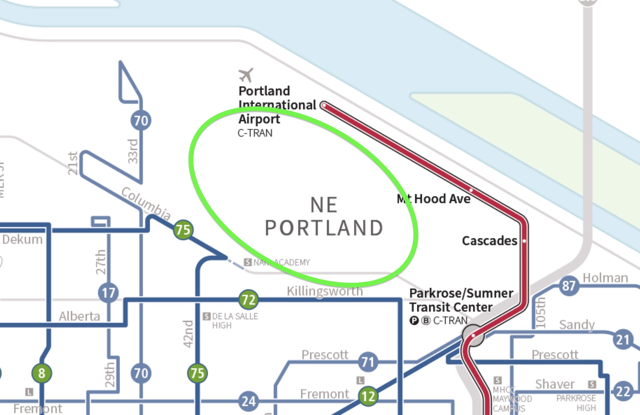
TriMet service map with area served by shuttle (very rough approximation) circled in green by BikePortland.
Amid a historic driving shortage and massive service cuts by TriMet, Multnomah County is stepping further into the transit business with the launch this week of a new shuttle aimed at a key job center in northeast Portland.
According to a statement by the County on Tuesday, their free ACCESS shuttle will help people connect to jobs in the industrial area south of the Portland Airport and north of Columbia Boulevard:
This service is meant to provide a much-needed transit connection to jobs in the Alderwood-Cornfoot-Columbia area from nearby neighborhoods. Prior to launching this new service, there was no transit available in this area that has a substantial number of jobs. At a time when transportation costs are at an all-time high, this shuttle will provide people with a free option to reach work and other destinations in this area.
Advertisement
The shuttle provides hourly service every weekday during the AM and PM peak periods. It serves stops from NE Cully Blvd and Prescott to NE 105th and I-205 near the Parkrose/Sumner Transit Center where riders can make connections to and from the MAX Red Line and TriMet bus lines 12, 71, 72, 73 and 87, as well as C-TRAIN Line 65.
The area this new shuttle serves is home to well over 10,000 jobs and — as we’ve reported in the past — is a mobility desert due to it only being served well by people using cars.