(Photos: M.Andersen/BikePortland)
This post is part of Gap Week, a special series made possible by our sponsors and subscribers.
Portland has a problem: like most U.S. cities, it’s been losing middle-wage jobs, especially the kind you can get without a fancy degree.
Many of the middle-wage, blue-collar jobs that remain are spread in industrial centers along the rivers with limited public transit access. And one of the most important clusters is one in Northeast Portland that many Portlanders know well: Portland International Airport.
Including airport and airline workers, groundskeepers and staff at on-site hotels and restaurants, the airport employs 10,000 people. (For comparison’s sake, downtown’s central business district – south of Burnside, north of Jefferson – contains about 45,000 jobs, mostly with white-collar duties.) That’s not to mention thousands of others who work on industrial-zoned lands nearby or at the big Cascade Station retail complex just to the east.
And as a recent city study shows, these jobs draw overwhelmingly on an area with virtually no north-south public transit service: East Portland.
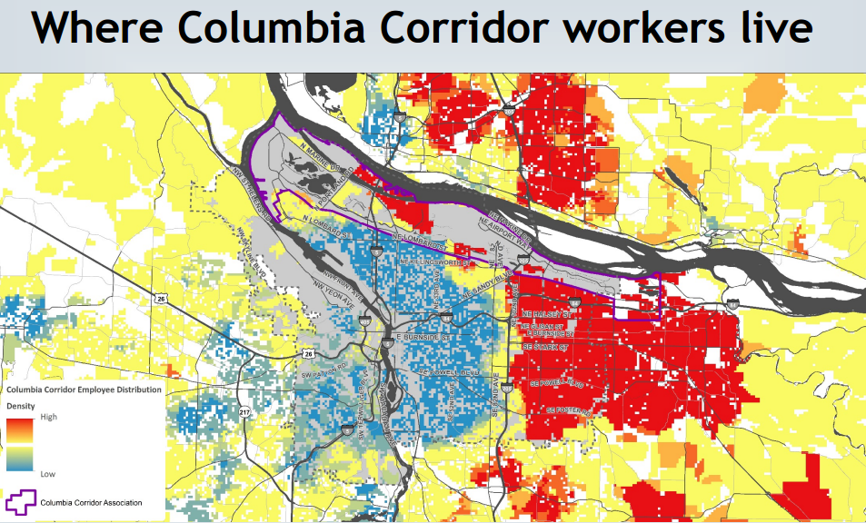
Though the MAX Red Line runs to the airport terminal, its frequency peters off fast in the evenings. And there is no other bus service to the airport area, in part because the jobs there are so spread out that it’s hard to reach them on foot from a bus stop.
If only there were some type of ultra-low-cost personal vehicle that could help lower-income Portlanders reach the sorts of jobs that could make them middle-income Portlanders.
Network context
As we reported in 2014, there are several plans afoot to improve bike access to the airport from the south. But according to Zef Wagner, an associate planner with the Portland Bureau of Transportation, one stands out as achievable in the relatively near future: Cully-Columbia-Alderwood.
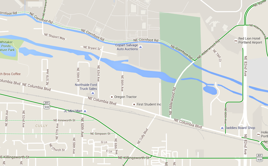
South of Killingsworth, Cully Boulevard has one of the city’s nicest bike lanes. It’s elevated and parking-protected, and it connects to various east-west bike routes including Killingsworth, which offers a rideable (though stressful) crossing of Interstate 205. The city recently recognized Cully’s importance by striping a new bike lane on Cully between Killingsworth and Portland Highway.
Advertisement
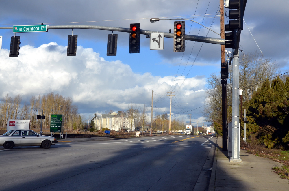
North of the Columbia River Slough is another fairly good network, including Alderwood Road and Cornfoot Road, which plug into decent biking connections around the airport area.
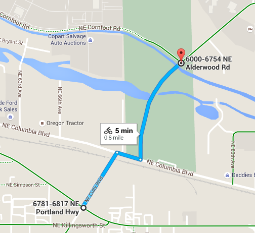
For people on bikes, the big problem is the stretch of Cully and Alderwood between Portland Highway and Cornfoot, including about two blocks of Columbia Boulevard.
Existing conditions
The above photo is looking south down Cully from Portland Highway — note the decently wide curbside bike lanes connecting south across Killingsworth in the background.
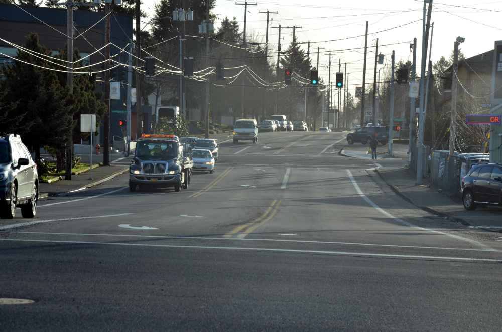
But back up a bit and Cully’s bike lanes become narrow striped shoulders…
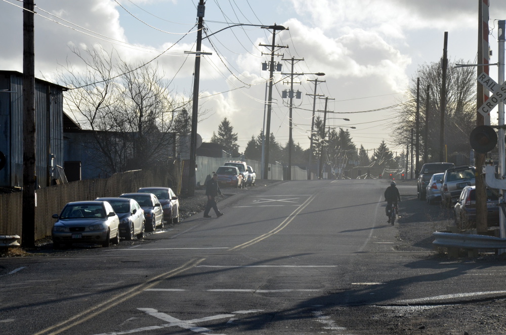
…which at points become unrideably narrow and torn-up shoulders across the entrances to several industrial yards:

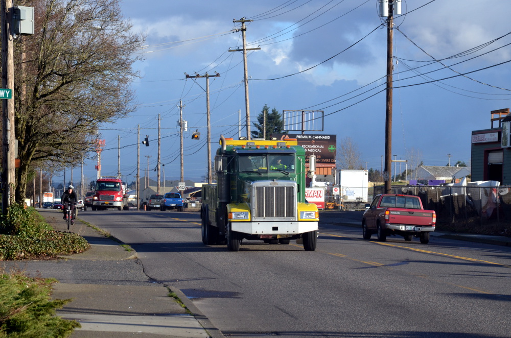
In the background of the north-facing shot above, you can see the T intersection where Cully meets Columbia Boulevard. Columbia is a picture-perfect road-dieted street here: a fairly constant flow of traffic in one lane in each direction with a center turn lane. It’s safe and efficient to drive on, but nobody left room for bikes on Columbia.
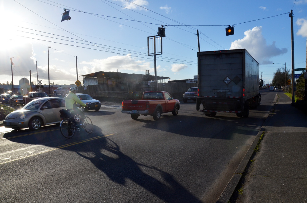
Traffic moves at 35 to 40 mph; at one point on my visit I saw a pickup use the center turn lane to make a blind pass around a big truck it had been following. (For his trouble, the man driving the pickup got to proceed at the same 35 mph in front of the big truck instead of behind it.)
Street corners meet Columbia at shallow angles, making it hard to know who’s about to turn and inviting people to take the corners at speed.

Despite that, I was a little bit surprised to see three people biking on this two-block stretch of Columbia in the 15 minutes I was there at about 3:30 p.m. Thursday. Even with fast-moving trucks everywhere and no infrastructure, it’s such a useful connection that bold riders already use it.

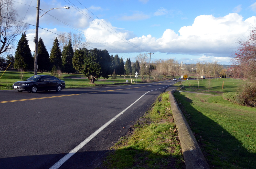
The key street north of Columbia is a half-mile stretch of Alderwood that crosses two branches of the Columbia Slough and connects to Cornfoot. Here’s what the street looks like just north of Columbia (facing north):
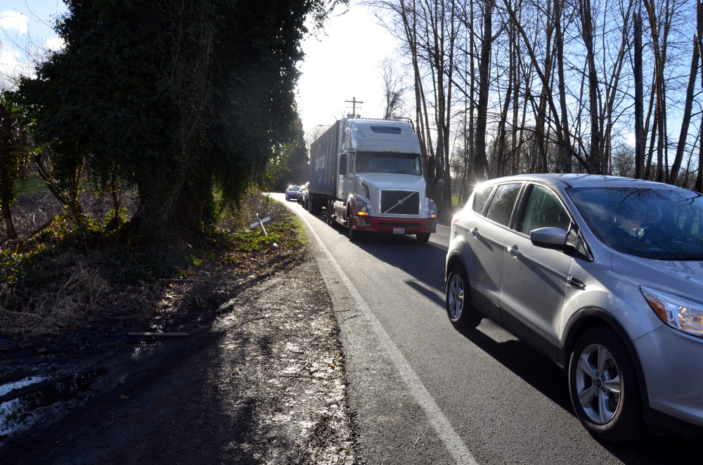
Even the shoulders vanish as the road goes through a patch of woods:
But just north of those woods, Alderwood meets up with Cornfoot and gets a bike lane that goes all the way to the airport.
The missing link here is a four-fifths-of-a-mile stretch on these three streets that could connect the whole airport area to Northeast Portland’s neighborhoods:
What the future holds
More than any of the other gaps we’ve focused on this week, the solution to this problem is money.
Appealing, comfortable bike links here would require two new signalized crossings: Cully/Columbia and Alderwood/Columbia. (Cully currently has flashing yellow lights; Alderwood just has a stop sign.) All three streets would also require shoulder repairs and bikeways — ideally buffered or separated from traffic, given the speed and size of the autos here.
Fortunately, some of the money is already on the way, and the rest of the project is a decent candidate for more money.
City spokeswoman Hannah Schafer said in an email Tuesday that the Port of Portland (the public agency that runs the airport) has already received funding for a new signal at Alderwood and Columbia. Sidewalks and bike facilities on part of Columbia will be part of that project.
“There is strong interest at both the City and Port in finding funding for the other signal at Cully/Columbia, and one upcoming possibility is the next round of Regional Flexible Funds,” Schafer continued. “RFF projects must benefit Active Transportation and/or Freight—and this project would benefit both.”
“If both traffic signals were built, we would have bicycle facilities for that two-block segment,” Schafer said.
That leaves the stretches on Cully and Alderwood.
Alderwood has the best prospects: a $2.5 million multi-use path between Columbia and Cornfoot is project #40027 on the city’s proposed transportation system plan project list. It’s slated to be built in the next 10 years, but isn’t funded yet.
The battered stretch of Cully between Portland Highway and Columbia Way is a lower priority for the city. It’d cost $4 million and is also on the proposed TSP project list (it’s #40037), but not until after 2026.
These short connections are expensive. But again, they have a lot of payoff in affordable job access, which makes them good candidates for outside grants. If the city keeps these projects on its TSP list or accelerates the one on Alderwood — public testimony is being accepted until March 22 — Portland could get a vastly improved bike connection to its airport.
Stay tuned for the conclusion of Gap Week, where we’ll share readers’ submissions of their own worst bike lane gaps.
— Michael Andersen, (503) 333-7824 – michael@bikeportland.org
BikePortland can’t survive without paid subscribers. Please sign up today.


Thanks for reading.
BikePortland has served this community with independent community journalism since 2005. We rely on subscriptions from readers like you to survive. Your financial support is vital in keeping this valuable resource alive and well.
Please subscribe today to strengthen and expand our work.
these aren’t the types of gaps I was thinking of when anticipating Gap Week… these are more like large pieces of missing infrastructure rather than a simple gap… a VERY large gap, which describes the majority of most any US city…
these gaps are well mapped, unlike the actual gap on Lombard at 42nd…
Yeah, this one is bigger than the other three we’ve looked into, though the really crucial part of it is just those two blocks and crossings on Columbia.
Isn’t the private golf course (Colwood?) between Columbia Blvd and Cornfoot slated for redevelopment ?
It is supposed to be moving to a combination of wetlands, city parks, and industrial zoning. I have seen it proposed that long term a bike/ped bridge be built to connect the new cully park to the park that will be built on the golf course, but I think that is years away.
The portion of Cornfoot north of Columbia Blvd is where the Post Office is going to go. Unsure about south of Cornfoot.
As one of the bold that rides this section of Columbia and Alderwood, I appreciate you drawing attention to the gap. I use this route fairly frequently to get to Cascade Station, the Post Office and the airport. I’m always reminded of how vulnerable I truly am when I’m on Columbia, waiting in the middle lane to turn.
Alderwood is one of my favorite short stretches. The sloughs and wooded areas are beautiful. On my rides through there I’ve had the pleasure of seeing herons, cranes and coyotes to name a few.
Any thoughts on how to get the powers that be to do something about people parking on the Cully cycle track?
Just keep calling the city’s parking enforcement hotline 503-823-5195.If it’s after 7 pm, call the police non-emergency number. I live in the neighborhood and I’m amazed at the amount of people who do this on an almost daily basis.
Nobody calls it Portland Highway… It’s Lombard.
That has always confused me!
Yeah, I usually do too, even on this stretch … but the city went with “highway” so I followed their lead.
if the city jumped off a bridge…
nevermind… c(:
/s
tgif!
It’s officially named NE Portland Hwy once you get east of about 11th Ave. Go ahead and lobby ODOT to rename it if you want.
Glad you pointed this one out. While I’m in the tiny minority of folks who bike to the airport to catch a flight, I know this is a critical connection for airport workers. It’s pretty jarring to ride on the best cycletrack in the city on Cully and then suddenly be dumped into a gravelly shoulder just before reaching Columbia.
I took some cycle tourists to the airport (and back) through this route. It was somewhat hair-raising, especially since they were equipped with panniers and unable to sprint through gaps.
Craziness. Also, given the number of bikes in the bike cages at the airport, it appears quite a few workers use it.
So, the identified problem is money… Well, ok. Lets fo with that…
Would the $300,000 Hales gave to the mountain biking master plan committee closed this gap or any others identified this week?
Are these serious gaps in the bike lane network more or less important than figuring out how mountain bikers can have their fun within the City?
That was from a different bucket of money that would not be available for use to build bike lanes. That’s the thing about budgets, sometimes the money is not fungible, it can only be used for certain things.
I take the 42nd overpass to 47th to Cornfoot all the way to Alderwood. No reason to bike on Columbia or any part of Cully. Cornfoot isn’t the widest and has truck traffic, but overall volume is so low enough that it isn’t an issue. But more safer options more better.
Google maps routed me onto Cornfoot once, and I found it so stressful that I will go a couple of miles out of my way to avoid it. I suppose much depends on weather and time of day.
I’ve done both routes and the Cornfoot truck traffic inspired me to avoid the route in the future. I also found the Cornfoot route to be less direct than Cully coming from the west. It is nice there are some options.
I agree. However, it seems like truck traffic has really increased on weekdays.
Colwood is going to be redeveloped as the new USPS facility, right?
Why are we building signals at Alderwood/Columbia, instead of using the city-owned land to shift Alderwood to the west so it lines up directly with Cully. Offset intersections like this are terrible for general traffic flow, pedestrians, and cyclists. Lining up these roads should be the top priority. The new signalized intersection (just one intersection) can have proper facilities for all users.
As I understand it, the preferred USPS site is at the northwest corner of Cornwood and Alderwood, so north of the area described here. As that plan goes forward it’ll definitely be an opportunity to invest in nearby streets.
This is definitely going to change traffic patterns in the area … and it’s going to further increase the area’s importance as a source of decent-paying blue-collar jobs.
They’ve been pushing the mud around this site for years…good to know that’s where the mail is going. Cornfoot will get a whole lot more traffic and potholes if this is the USPS site!
While I don’t work at the airport or anywhere else, I’ve found it tricky and demanding to bike the seven miles from my Sabin house to Cascade Station. It would be awesome to be able to take Cully directly, diagonally, through to Alderwood.
I mean, IKEA has parking for about fifty bikes. Mine has always had the entire two rows of wave racks to itself.
Anne, if you’re headed to ikea, have you tried going east on Going neighborhood greenway, then getting on Prescott around the 70s (not a great bike connection but tolerable) crossing 82 and i205 to the path, then north to Alderwood, back under freeway and up to ikea/east end of Cascade Station? It’s a fairly direct route.
Yes. In fact, that’s the way I finally figured out to go, after one single time trying the bike lane on Killingsworth. Terrifying!
The next time, I used the sidewalk. And in all subsequent times, I’ve used pretty much the route you describe, though there’s a lot of unintuitive dinking around, and it took three or four trips for me to really figure it out.
It’s a pleasant enough ride, but I can’t help noticing that Cully + Alderwood point like a diagonal arrow right at Cascade Parkway. It would only save me, personally, maybe 3/4 mile each way, but it feels so much more direct.
Indeed. It’s also difficult to walk there, many of the connections lack pedestrian infrastructure. I guess the engineers thought all the peds would take the MAX?
I used to ride this route pretty frequently, and I *hated* this gap. It really discouraged me from riding in any less than ideal conditions.
The no-shoulder part of Alderwood through the woods was definitely through the worst- the traffic was always speeding and would pass you dangerously close. My strategy was to wait for a red light and then blast through as fast as I could to try to make it all the way before the next light cycle. Hard to do that going uphill, though.
You’re right about Alderwood. I love the scenery and when there are no autos behind you it’s serene. However, I also ride fast to the light at Cornfoot because of too many close call passes, the semi-blind curve in the road and aggressive drivers.
Heading South I usually get off my bike and walk the steepest part of the hill, staying far to the right. Not because I can’t make the grade but because I can’t do it quickly. I generally only ride through there in the day; I’m bold but not bold enough to bike it when visibility is limited.
The red line hours are a real bummer. Not only does it serve the airport but a large transit center(Parkrose/Sumner)
Also, I live in Cully and ride to the airport to travel sometimes. These gaps being fixed would hopefully encourage more people who live in the area to travel there by bike to catch their flights.
Doesn’t this gap pass through the planned site for the new Post Office facility? How does bicycle infrastructure factor into that development?
No, the proposed site for USPS is north of Cornfoot. That section of Alderwood already has bike lanes, and a bike path is planned along Cornfoot as part of the redevelopment.
what’s a “fancy” degree?
Guess my logistics degree is fancy.
maybe my masters degree is fancy, I don’t know. does anyone know I have a non-fancy education? and does anyone know if that’s a good thing or a bad thing? are we anti-education now?
Is there anything else planned for the other end of Confoot (47th Ave & Cornfoot)? I work just off Air Trans way and Cornfoot and its an easier straight shot down 47th to Cornfoot, but 47th is so beat up from heavy truck traffic.
Cornfoot its self is in really bad shape between Alderwood and 47th. For us airport workers who work on the south side (Air Guard, Horizon Air and all the Cargo guys) Cornfoot is the only way to get to work.
However the heavy truck traffic and narrow beat road prevents people from riding unless they fall into the strong category. Nearest bus stop is up at Columbia and 47th.
The TSP calls for a full street improvement on 47th (sidewalks, bike lanes, rebuilt pavement), and a multi-use path along the north side of Cornfoot.
I was run off the road by a Waste Management truck on Cornfoot and I doubt I’ll ever ride that route again.
Cully-Columbia-Alderwood used to be my commute route, and man… Sitting in the center lane of Columbia trying to turn left as Semis are blasting past on either side was always the scariest thing I’d have to deal with on that ride.
I never understood why it was so terrible as Cully (as stated, super nice bike lane) leads you directly to this death wish of an area.
There is a signposted bike route running from the MAX station at the airport via the south side of Airport Way that runs under I-205 to the I-205 trail at about 105 Av. The connection to Cascade Station and the airport is not signposted from the trail. For northbound traffic on the trail, this is the last exit before the Glenn Jackson Br. to Vancover. Maps suggest that ths is the preferred connection for peds / bikes in and out of the Cascade Sfation/PDX area. No destinations are posted for those coming out of that area onto the I-205 trail.
JM writes “Though the MAX Red Line runs to the airport terminal, its frequency peters off fast in the evenings.”
I’d suggest service is better than he implies. On weekdays MAX Red Line runs every 15 minutes between 6am and 10pm, with half hour service for about an hour before and after. I would say “in the late evenings.”
If there is a gap in service, it for the end of 2nd shift and start of 3rd around midnight, but its tough to know for sure those start and end times as they vary a great deal from outfit to outfit. And those shifts come and go.
My take, for those who make this commute and want ideas (life can’t stop while waiting for ODOT to improve things): The above gap describes the most direct route my commute WOULD have taken for the 4 years that I biked to work from Wilshire Park area to near Cascade Station every day. However, during rush hour I generally avoided that route for all the reasons expressed above (the rough patch on Cully between Killingsworth and Columbia is the least of those problems- at least traffic is light on that section). Going to work I usually took a route that included eastbound Killingsworth starting at 72nd (at least the presence of a bike lane gave me the visual security of separation from cars and trucks – if not a real one) to the jug handle ramp to Northbound 82nd. Going home (slightly longer) I usually took the more easterly route past BikeTires Direct to westbound Killingsworth (making my L-turn homeward at 72nd). Going home I also at times made use of the sidewalk along Columbia after cutting south from Alderwood through the warehouse area to emerge at Heald College (be careful at rush hour because of truck traffic but still better than the more direct Alderwood route). That was fairly pleasant because I biked on a small bridge over the slough and past a lake filled with ducks near the Radisson Hotel). I often saw rabbits and occasionally coyote.
On nice days I would take a much longer, more circuitous route which avoided all of these…and included the treed bike path along the slough to NE 105 Ave. It had problems to but generally light traffic.
btw – the Cully-Columbia-Alderwood connection needs a traffic light for cars as well as bikes and pedestrians. It is scary for ALL.
My coworkers thought I was a bit insane but my before and afterwork bike rides were my favorite parts of the day. Take care out there!
I took this route to the airport last year and it was fairly early in the morning so it wasn’t too bad. I took this route again on Thursday to catch a flight that put us on the route during rush hour. It was terrible! Crossing Columbia was sketchy and I would guess that it would have caused some riders to turn back. Once on Alderbrook/Cornfoot people were flying by us. Another time when I am wondering why there are streets where a 45 mph speed limit is in place. At the very least there needs to be a signaled crossing at Columbia for this to be considered a bike route.
Reading this is chicken soup for my soul. I’ve worked near Cascade Station for about 15 years and the Cully/Columbia/Alderwood intersection has been a huge obstacle for my intended bike commute. Standing awkwardly on Columbia watching the trucks fly by and then darting across between semis is not my idea of fun – let alone subjecting myself to the Columbia Bvld turn lane. These improvements cannot happen fast enough.
It’s hard to believe that this article and the attached comments are eight years old. They’re still pretty current. It’s crazy that a place as important as the airport, with the cluster of employers around it, is still so poorly served by transit and especially by bike routes. People find their way eventually but those ways are indirect and not at all clear to visitors.
If Portland, as a city, were serious about bike travel we’d have spent the twenty million dollars years ago to make the connections. We’d have trained digital mapping services to lead people on a safe and direct route into the city and into the neighborhoods where they live. We’d have a stable of e bikes with pannier racks posted up outside the baggage carousels.