Traffic safety-related changes near the Hillsdale town center have reached a critical mass; this corridor feels calmer than it used to, and the numbers support the perception.
With its crash reduction numbers and positive safety trends, Hillsdale and PBOT make a case for the effectiveness of persistent incrementalism.
The Portland Bureau of Transportation (PBOT) has been gradually making changes in the area over the past several years, but it is easy for gradual change to go unnoticed, particularly when it’s incremental improvement—no fanfare, no ribbon-cutting, just a steady build-up of small fixes. So I thought I would sing the song of incrementalism, as it has played out near Hillsdale.
First came the speed cameras, located on the 3600 block of Beaverton-Hillsdale Highway. These were Portland’s very first fixed speed safety cameras and they were installed in August 2016 as part of an eight-camera pilot program. The results were immediate and profound. The percentage of Hillsdale-bound drivers exceeding the 40 mph speed limit decreased from 77% to 30%. But even more dramatic was the drop in drivers traveling over 50 mph; it fell by 93%, from 7.7% to 0.5%.
Advertisement
At a recent Southwest Neighborhoods Inc Transportation Committee meeting, Clay Veka, PBOT’s manager of High Crash Corridor safety programs, pointed out that PBOT twice narrowed Beaverton-Hillsdale travel lanes in the years before and after the camera installation. These narrower travel lanes might also contribute to traffic calming and could be confounding the safety effect of the camera, “I’m not sure how to parse out the effects,” Veka said.
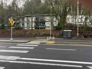
That point is well-taken and would particularly apply to crash data. But over the years PBOT has also regularly taken speed readings from a pneumatic tube they locate about 450-feet east of the eastbound camera. It is notable that one-and-a-half football fields past the camera slower driving speeds persist. In fact, I calculated the impressive speed reductions cited above from that same distant tube.
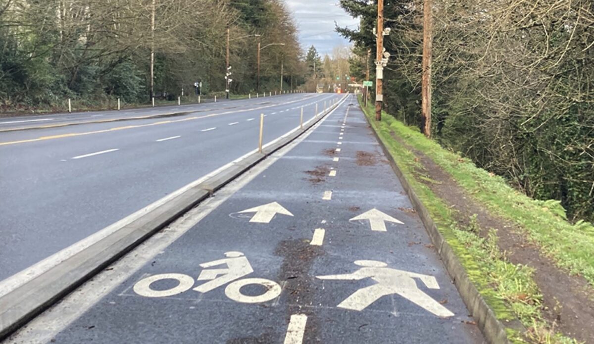
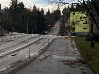
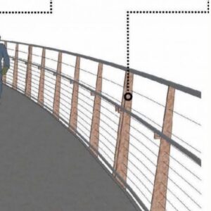
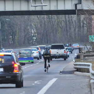
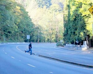
The second of the lane width reductions Veka referred to came in 2019, when PBOT launched its Beaverton-Hillsdale Highway Safety Demonstration Project between 39th Ave and Dosch/30th Ave. The Demonstration Project included further widening the 2013 buffered bike lane to include a pedestrian track and raised curb protection with candles (top photo). As part of the same project, PBOT installed a pedestrian refuge island with a flashing beacon near SW 35th Ave, and new ADA ramps.
Advertisement
The project wrapped up just a few months ago with the curb extension at SW Dosch Rd, and the removal of Dosch’s right-turn lane onto Beaverton-Hillsdale Highway. The speed limit has also been lowered to 35 mph from 40.
Excuse the pun, but some of this is pretty pedestrian stuff, boring even. These needs have been identified by many PBOT plans through the years, like the PedPDX and Southwest in Motion processes, and the High Crash Corridor Safety Plan, among others.
And yet, after this interminable planning, PBOT does seem to have arrived at safety. Last month, they reported a 30% reduction in crashes resulting in serious injury or death since the installation of the speed cameras. 30% is a big deal.
There have also been other changes in the area, with more to come, like the Red Electric bridge and possibly a Rose Lane. But my favorite improvement is the left-turn calming noses at the intersection of SW Sunset Blvd and Capitol Highway. The noses are part of the 2019 Left-turn Calming Pilot Project under Vision Zero.
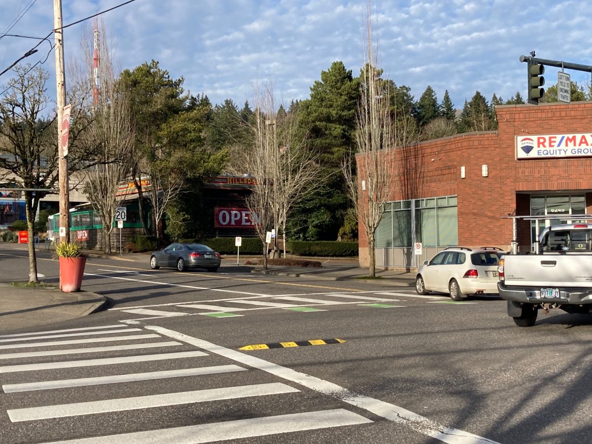
The idea behind the noses is that they protect people in crosswalks by nudging left-turning drivers into making a safer crosswalk approach. No longer able to easily cut the corner, drivers are forced to both slow down and meet the crosswalk straight-on, which makes it easier for the driver to see a person walking. The program successfully met its evaluation criteria and PBOT announced in January that they haven’t had any pedestrian deaths at the pilot intersections.
While I was studying the noses, Joe Minato joined me. Minato is a science teacher at Ida B. Wells High School (formerly Wilson High) and he usually commutes to work by bus or bicycle. He told me he “was thrilled” when he saw the noses and called them “an elegant and inexpensive solution,” adding that “as a citizen and a taxpayer” he appreciated their effective and low-cost design. Later I learned that the left-turn calming project was paid for by our recreational cannabis tax; I’m 100% certain that no Minato tax monies contributed to that program.
The Hillsdale area seems to have benefited from the synergy between a number of PBOT initiatives with various funding streams. It is not possible years later to tease apart their effects and assign safety credits, nor can PBOT afford a well-controlled study of every incremental improvement it makes. But with its crash reduction numbers and positive safety trends, Hillsdale and PBOT make a case for the effectiveness of persistent incrementalism.
— Lisa Caballero, lisacaballero853@gmail.com
— Get our headlines delivered to your inbox.
— Support this independent community media outlet with a one-time contribution or monthly subscription.


Thanks for reading.
BikePortland has served this community with independent community journalism since 2005. We rely on subscriptions from readers like you to survive. Your financial support is vital in keeping this valuable resource alive and well.
Please subscribe today to strengthen and expand our work.
To be clear the separated cycletrack spans from Dosch (30th) to 39th? Why did they put it on the North side of the road if it is to tie into the Red Elec Trail?
My guess is that they were not considering the Red Electric Trail. The trail isn’t completely connected yet, and in this area it follows the small residential streets south of B-H Hwy–a seasoned commuter will stay on B-H Hwy for speed and directness.
From the eastbound buffered lane you will be able to join the Red Electric bridge from 30th Ave by taking Bertha. Also, the protected track on the north side of the road also serves pedestrians, so they may also have been considering pedestrian needs.
Maybe some informed BP commenters have a better explanation.
1. This project was also about leveraging funds from BES. They were doing storm water work in this section of BH Hwy, especially along the stream area. And PBOT could tag on to improve ped/bike infrastructure. 2. This is part of BH Hwy high crash corridor treatment and ped access to buslines etc, so not linked to Red Electric Trail.
Hello again eawriste. I just heard from a reader with more information about the project.
He confirmed that the Red Electric Trail was not part of the discussion and that the purpose of the northside multi-use path was to create a pedestrian walkway, the southside already has one.
Regarding David Hampstead’s comment below about cement sidewalks, I’ll need to write another article about that–and stormwater too. Real briefly, cement is expensive, it’s impermeable and southwest Portland doesn’t have adequate stormwater facilities to handle the run-off. It’s one (and only one) of the reasons the southwest has the worst sidewalk coverage, by far, of any area in the city, and why new development very often isn’t required to build sidewalks. It’s a frustrating issue and a sore point with a lot of SW activists.
What you don’t see in the photo at the top of the article is that Fanno Creek runs in the bottom of that ditch to the right, and in back of me is a wetland area and pond. So stormwater always enters any discussion of sidewalks.
I actually prefer this design to a sidewalk at least in the interim until PBoT finds a predictable funding source. It provides a minimal amount of separation for both peds/cyclists using a lot less money. This design could easily be standardized as an interim project with protected intersections on a variety of roads to target safety on high crash corridors such as BHH (and other stroads in E Portland).
Beaverton-Hillsdale is the prototypical road for a two-way cycletrack: a relatively small number of cross streets, a long-ish corridor where many people are going straight through from one end to the other, and relatively flat. Glad to see this. I’m strongly of the belief that a large number of relatively low-cost projects like this, rather than a smaller number of higher-cost solutions such as permanent Better Naito, will have a more measurable impact on our bike-friendliness as a city.
That being said, although these changes are great to see, there’s still a long way to go in southwest. In particular, safe north-south connections north of Beaverton-Hillsdale are completely nonexistent from Terwilliger all the way to 78th. That’s a LONG way without any safe routes! I don’t feel comfortable under the current conditions biking on Dosch or Shattuck. Geography certainly constrains the existence of such routes, but I wonder if there’s any way that bike/pedestrian infrastructure could be added to either. If it’s possible, I think they should be high priorities within PBOT. Even if these aren’t feasible, a small number of short low-cost neighborhood greenways could really help improve connectivity, such as 45th between Hamilton and Beaverton-Hillsdale.
Scholls Ferry between Beaverton-Hillsdale and Highway 26 is low-hanging fruit. The road currently has one southbound and two northbound lanes. The road certainly works for drivers southbound without any major delays (apart from the Six Corners intersection which is its own can of worms), and it’s not a major trucking route. Converting a northbound lane into a two-way cycletrack would really help solve connectivity issues in the area too. As far as I can tell, the road is split between MultCo and WashCo jurisdiction so it would require some cooperation between the two, but I’ve been very encouraged by WashCo in particular lately and I hope they pursue something there.
Hello NoName: There’s no two-way cycletrack on BHH. It’s a one-way track on the north side of the highway with two lanes, one for cycling (on the inside) and one for walking (on the outside). Look at that photo more closely.
I actually don’t like this design at all – feels unsafe to me, since I could easily clip the curb with my front tire and go down. I always ride in the pedestrian lane and look ahead for peds; I slip into the bike lane to pass peds and then return to the ped lane, so the bike lane is kind of like a passing lane for me. I’m sure I’m not using the design as intended but it works for me and seems to work for the few other users I encounter.
Yes, Fred this is how I would use it as well. But practically speaking it also serves as a two-way. Design intention and reality often part ways with inadequate infrastructure. Lots of one-way PBLs and sidewalks become two way cycletracks because there are no other safe places to ride.
Oh yes, taking a closer look you’re indeed correct. It’s still better than that status quo I think, but I take back most of my praise of PBOT for this project. Just when I think I can finally praise something PBOT’s done, I’m shown to be in error with my assessment…
Doesn’t change my view that this is an ideal corridor for a two-way cycletrack, however 🙂
I find it ironic that PBOT criticized ODOT for years about its pedestrian lanes on outer Powell (now being replaced with real sidewalks), and now PBOT is doing exactly the same thing on BH.
I’ll be frank and say that from my observations, although ODOT does fewer active transportation projects than PBOT does, the ones it does do are of far higher quality.
Thanks for the great coverage Lisa.
I know that this is farther out, but it’s SW adjacent. There’s a project underway in Beaverton to connect the gaps in the Fanno Creek trail between Scholls Ferry Rd and 92nd along Allen. More info https://storymaps.arcgis.com/stories/f5324d2210834171a7f3b9447e78c3c5
Wow great design. I need to get out there. Any effort for a connection across 217?
That roundabout is an unneeded project.
I love roundabouts as much as anyone, but I agree that this seems like a silly place for one. I don’t see what it adds over having just the HAWK beacon; seems like a poor use of funds.
I would agree, but vehicles seem to be very confused about Hawk signals. Most of the time okay, but I’ve seen near misses several times at Hall and Fanno Creek, as cars don’t come to a stop after the signal goes to a blinking red if they don’t see a user of the crossing.
Maybe there could be one of those skinny yellow pedestrian crossing signs, that are about 3 feet tall put in the middle of the road at this location.
Good to know, thank you!
Good changes. Too bad all the progress on BHH has been in the city of Portland. As soon as you get to the WashCo border and the devilish Five Corners area you’re in trouble.
Also, eastbound, just a block or two before Portland’s buffered bike lanes appear, is the narrowest bike lane I’ve heard of anywhere on the Planet: right in front of KeyBank. Insultingly, when they redeveloped the site, rebuilt the sidewalk and repaved in front of Key 7-8 years ago, they kept the bike lane at its ridiculous something-like-21″ inch width.
I hope we can eventually engage WashCo, Beaverton and ODOT (this is a state highway) to improve the Beaverton section of BHH. It’s by far the fastest and flattest way between Portland and Beaverton. Would be nice if it were safe to bike it the whole way.
“At a recent Southwest Neighborhoods Inc Transportation Committee meeting, Clay Veka, PBOT’s manager of High Crash Corridor safety programs, noted caveats about interpreting the effect of the speed safety cameras. First, PBOT hasn’t quantified at what distance from a camera speed reductions begin to fade…”
PBOT did this analysis for the speed cameras installed on SE Division and found that the speed reduction rapidly faded outside of the immediate vicinity of the cameras. From my perspective, this raises questions about the efficacy of this form of traffic-calming.
Thank you for the comment, Soren–you made me look 🙂
I reviewed my notes from the SWNI TC meeting and realized that I should not have attributed the lack of quantification of speed fading to Veka, just the hard to “parse” quote. I’ve rewritten that, thank you.
However, I poked around for the SE Division study you mention, and I can’t find it. Which doesn’t mean it wasn’t done, I just can’t find it. I did find a chart that shows that the Division camera seems to be less effective, speed reduction-wise, than the cameras at other locations. My guess is that there is an art to placing these, I think it is very well-placed on B-H Hwy. I also suspect that the cameras achieve things besides just speed reduction, for example, they can rouse a driver out of torpor before they enter a town center.
A good source of information I did find was the report to the OR legislature that PBOT is required to file on the speed cameras. https://www.oregonlegislature.gov/citizen_engagement/Reports/2019-PBOT-Fixed%20Photo%20Radar%20System.pdf
Also, PBOT is expanding the fixed camera program, it seems that most people locally, nationally, and internationally think they work. PBOT is also discussing rotating the actual camera through decoy boxes so as to have an effect over a greater distance.
Good story. I have used this stretch of road every day for the past fifteen + years. Nice to see this road getting a little safer.
Do you know if the plastic wands affect the ability for street sweepers to get in and clean the area? I’m pretty sure their is mulchy leaf slime from last fall in some stretches of this upgraded area.
If you see problems in the bike/ped lanes, call 823-SAFE to report it to PBOT. People tend to think, “oh, they must know,” and then not call. But it’s just a phone call, it’s easy.