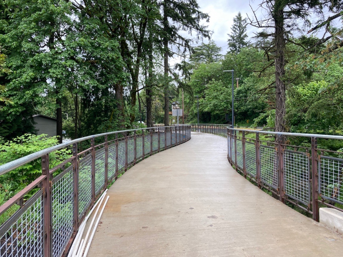
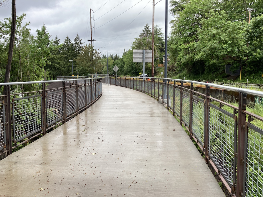
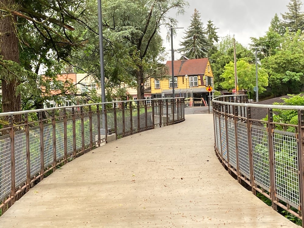
The Red Electric Bridge appears to be completed. It has not yet been officially opened, but people are already using it, and boy is this bridge a beauty.
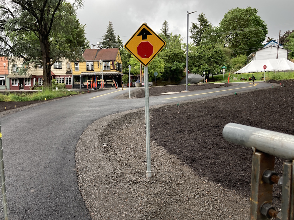
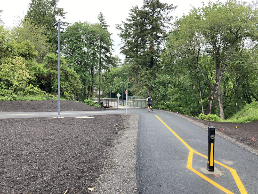
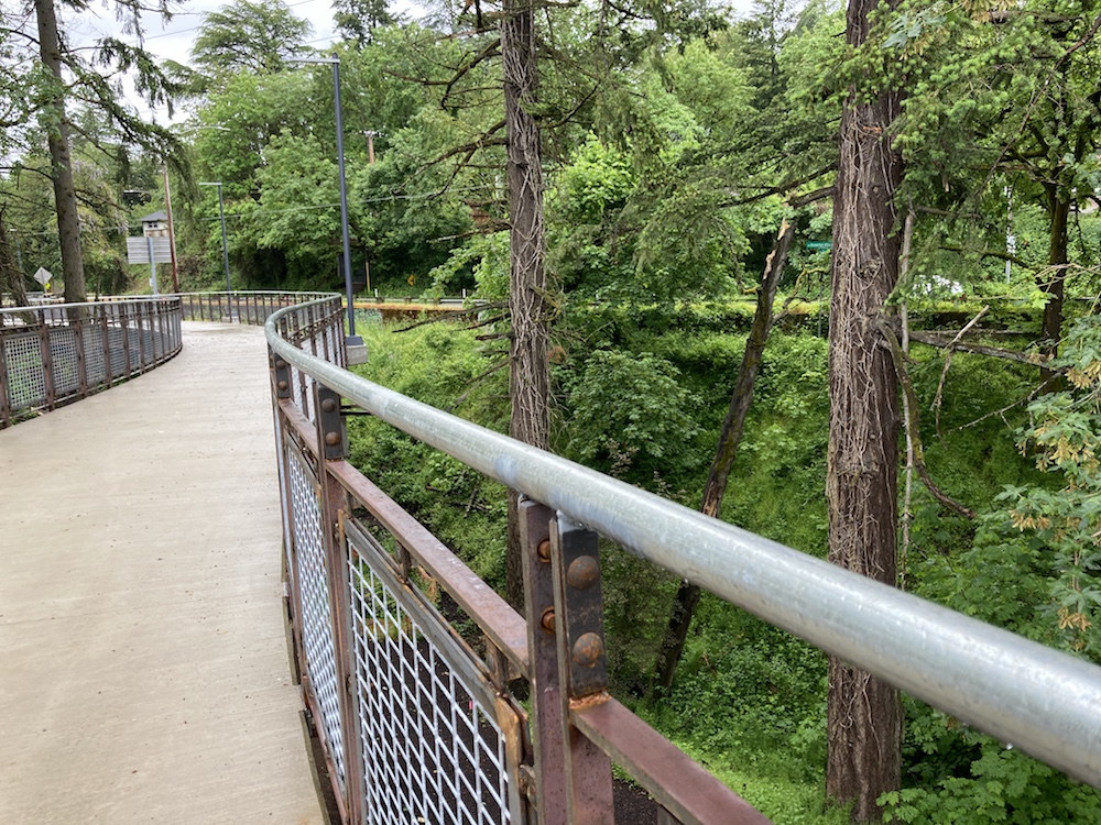
I visited early Sunday morning and took photos in the drizzle. The first set starts at the east end, on SW Capitol Highway, and continues as I walk west to what locals call “Little Bertha.”
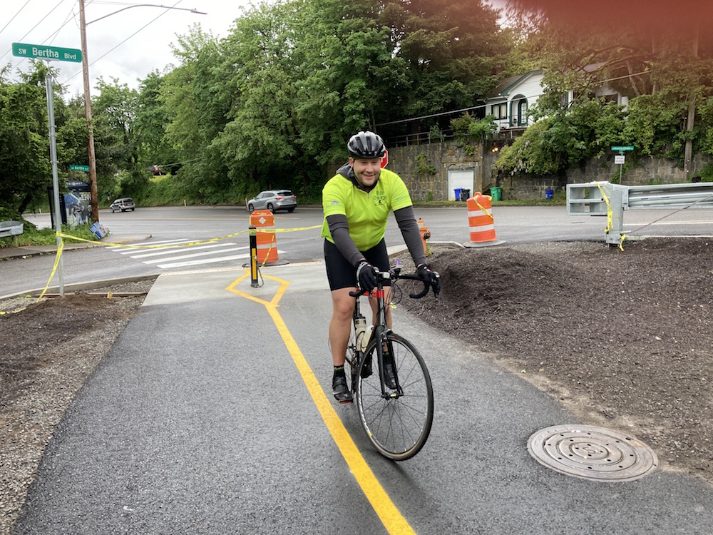
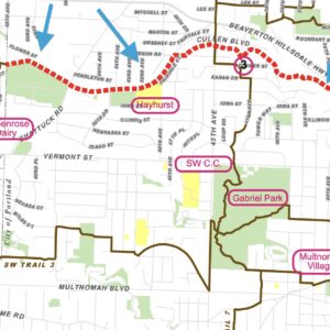
Toward the west end I met Andrew, who was about to make his maiden ride. The bridge route curves right toward Beaverton-Hillsdale Highway (for connectivity reasons, apparently), but the Red Electric trail itself continues to the left along the Little Bertha Greenway.
And then I turned around and walked back.
For more background on the bridge see our story from January, 2021 and also our walk-through of the Red Electric Trail with Don Baack.





Thanks for reading.
BikePortland has served this community with independent community journalism since 2005. We rely on subscriptions from readers like you to survive. Your financial support is vital in keeping this valuable resource alive and well.
Please subscribe today to strengthen and expand our work.
Had a long conversation with a PBOT rep a few weeks ago (I live near the bridge and have been following its progress). The rep explained there’s roughly 20,000 sq ft of landscaping to come, and that the bridge would likely open officially when that’s done, at month’s end. My take: 30 days is not alot of time to undertake that amount of planting. So, we wait. N.B. have not ridden on the structure yet, as I don’t want to get yelled at by an official. 🙂 But yes, you can easily walk it, coming through the fenced-off area on foot.
Has all of that gravel parking lot been removed on Capitol? It was leased to one or more of the restaurants across the street on Capitol. If so, I wish THPRD in WashCo would learn from this project instead of spending so much money and time on new car parking lots.
Some of it is still there, about half. It’s been used as a staging area.
What will happen to it after construction is done?
I don’t know.
This is very cool, but I can’t help but wonder – how the heck are you supposed to head west down BHH from this bridge? It dumps riders out onto the Eastbound bike lane, and you’d have to cross four lanes of car traffic to get to the westbound bike lane…
I used to commute on BHH through Hillsdale daily and this honestly feels like a bit of a bridge to nowhere, all things considered.
Yes. It’d be nice to have a fancy bridge over Fanno Creek on SW 25th from Bertha to BHH, but it still took over a dozen years for Portland to give a permit to build that new staircase on 25th. This Red Electric Trail will eventually give a parallel route to bike from Oleson Road by Dover and Alpenrose Dairy from the bridge in this article. However, the route needs SWTrails’ recommendation of a safe crossing of Barbur Boulevard to connect to SW Slavin Road which would allow people to get to SW Corbett Avenue. Portland keeps finding some lousy crossing ideas of getting across Barbur for the Red Electric Trail.
Yes. FWIW, in my conversation with the PBOT rep, this was their main critique of not of the bridge, but the separated bike lane design. His solution (which could still happen, perhaps with effort): make the bike lane on BHH two way heading west to at least that first intersection at SW 30th. Then cyclists heading west could at least get that far, cross BHH with the light, and continue. Interim solution, which is available now: head west on Little Bertha after coming off the bridge, also to SW 30th, then make a less optimal left hand turn.
There are a couple links in the article, and also the “Related Posts” at bottom about the Red Electric Trail, we have covered it extensively. A BHH bike commuter passing through Hillsdale should stay on BHH.
NS (in comment above) hit the nail on the head: this really is a Bridge to Nowhere. It doesn’t help anyone cycling get anywhere more quickly or efficiently. In this sense the project is a perfect encapsulation of Performative Portland: Do something that looks good and allows you to *SAY* you are doing everything you can to encourage cycling while not actually making cycling any better. The bridge will mainly be a nice place for neighbors to walk their dogs.
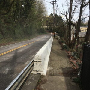
I have one other beef with this project: the repaving of the bike lane on SW Capitol Hwy is crappy. We see this problem all the time in Portland construction projects, where the paving contractor makes sure not to touch (or will replace and steamroll) the asphalt in the car/truck lane and then throws some asphalt over the dirt in the bike lane and packs it down by hand. The result is a potato-chip-wavy surface that only gets wavier over time (see the bike lanes on SW Multnomah heading out to Garden Home). But that’s okay – it’s just bikes using that surface. No one holds a contractor accountable for doing a good job for bikes.
The east-bound bicycle lane on BHH isn’t the best one when it meets essentially a slip lane that goes to Bertha Boulevard. The bridge allows people riding a bicycle or other device to avoid BHH yet connect to Capitol which has seen the most amount of construction of any street in SW Portland over the past decade. This bridge will allow people to access the future Red Electric Trail if Portland does build it so that people can fully avoid Barbur Boulevard and all of BHH in Portland city limits. I understand the frustration with worn-out bike lane surfaces, though.
The idea is to continue on “little” Bertha Blvd to 30th at least. It’s considered a neighborhood greenway and we (SW Trails) are waiting for the official greenway treatment (speed bumps, sharrows, permanent signage). We had hoped that the bridge would land further down on Bertha rather than the corner of BHH Hwy for exact that reason. But also keep in mind that this not just a bike bridge, but a pedestrian bridge, too, and gives a critical connection for people walking from this end of Hillsdale, as well as Hayhurst and Bridlemile neighborhoods to the Hillsdale restaurants, stores, library, highschool etc.
My understanding is that the bridge fills a gap in the planned Red Electric Trail connecting Hillsdale in the east and Raleigh Hills and Fanno Creek Trail in the west.
The bridge we might say solves a short term pedestrian problem, and a longer term cycling problem. It happens there are alot of apt buildings in this corridor and high school students at Ida B. Wells are going to use this bridge alot. It solves the problem of Hillsdale. But you are right in the sense that this bridge, right now, is not exactly going to solve a problem for cyclists. (It will for me, personally, but I am statistically insignificant. Ha.)
I’m not following you Gregor. The biggest vision for the Red Electric trail is that it provides a continuous, low stress route from Garden Home to the waterfront. That’s what Don Baack has in mind. A large segment of that route is being studied by the city to solve some right of way issues.
The bridge is a short connector across a ravine for those larger routes. Yes, it will provide immediate relief for people in all those neighborhoods to the west who don’t have sidewalks or a family-friendly active transportation route to Hillsdale town center.
Yes, that’s my view. The bridge is part of the longer term vision, which is far from being realized, for cyclists. But it doesn’t solve a cyclist problem right now, in the short term. It’s not a breakthrough, and is not likely to see high cyclist traffic. But for pedestrians, the bridge will have a far more immediate effect, with higher use.
It depends on how you define “cyclist,” if the cyclist is a 12 year old who lives in Hayhurst and wants to buy an ice cream cone at Hillsdale shopping strip, the bridge is a “right now” solution.
People who have a miles long commute, want to go fast, and are keeping an eye on commute time will stay on BHH. The Red Electric trail is a “family friendly route,” not necessarily the fasted one.