🎄🚨: BikeCraft is back! Our holiday gift bazaar happens Wednesday, 12/17 at Migration Brewing on N Williams Ave.
See full vendor list here.

City ordinance would ban camping on some bikeways and crack down on ‘chop shops’

City contracted crews clear out an alleged bicycle chop shop on SE Alder in May 2022. (Photo: Taylor Griggs/BikePortland)

“Everyone is sick of the open-air chop shops that have been allowed to operate around here with impunity.”

– Bryan Hance, Bike Index

At Portland City Council tomorrow (6/7) Mayor Ted Wheeler will call a vote on an ordinance that would ban camping in Portland between 8:00 pm and 8:00 am. It’s part of a major shift on homelessness at City Hall following years of Covid-related restrictions on how the city can address encampments and a political swing among commissioners and the general public that not enough progress has been made to reduce the number of people sleeping outside.

The new camping restrictions are highly controversial, and many people worry that they will unfairly criminalize an already highly vulnerable population of Portlanders. And according to Street Roots, this approach is doomed to fail. Despite this, Wheeler is pushing forward and the conventional wisdom is that he has the votes to pass it.

There are two provisions in the ordinance that relate directly to bicycling. The first is where people will be prohibited from camping. And the second is what they’ll be able to possess while doing so.

If the ban goes through, people will no long be able to camp: overnight on a pedestrian plaza; in the “pedestrian use zone” which is defined by the, “area of the sidewalk corridor on City sidewalks intended for pedestrian travel or access to public transit”; in a park; within 250 feet from a preschool, kindergarten, elementary or secondary school, or a childcare center;  within 250 feet from a safe parking site, safe rest village, or sanctioned camping location designated by the Mayor; within 250 feet of lot or parcel containing a construction site; in the public right-of-way along “High Crash Network Streets and Intersections” identified by the Portland Bureau of Transportation; or within 250 feet of an Environmental overlay zone, River Natural overlay zone, River Environmental overlay zone, Pleasant Valley Natural Resource overlay zone, or a special flood hazard area.

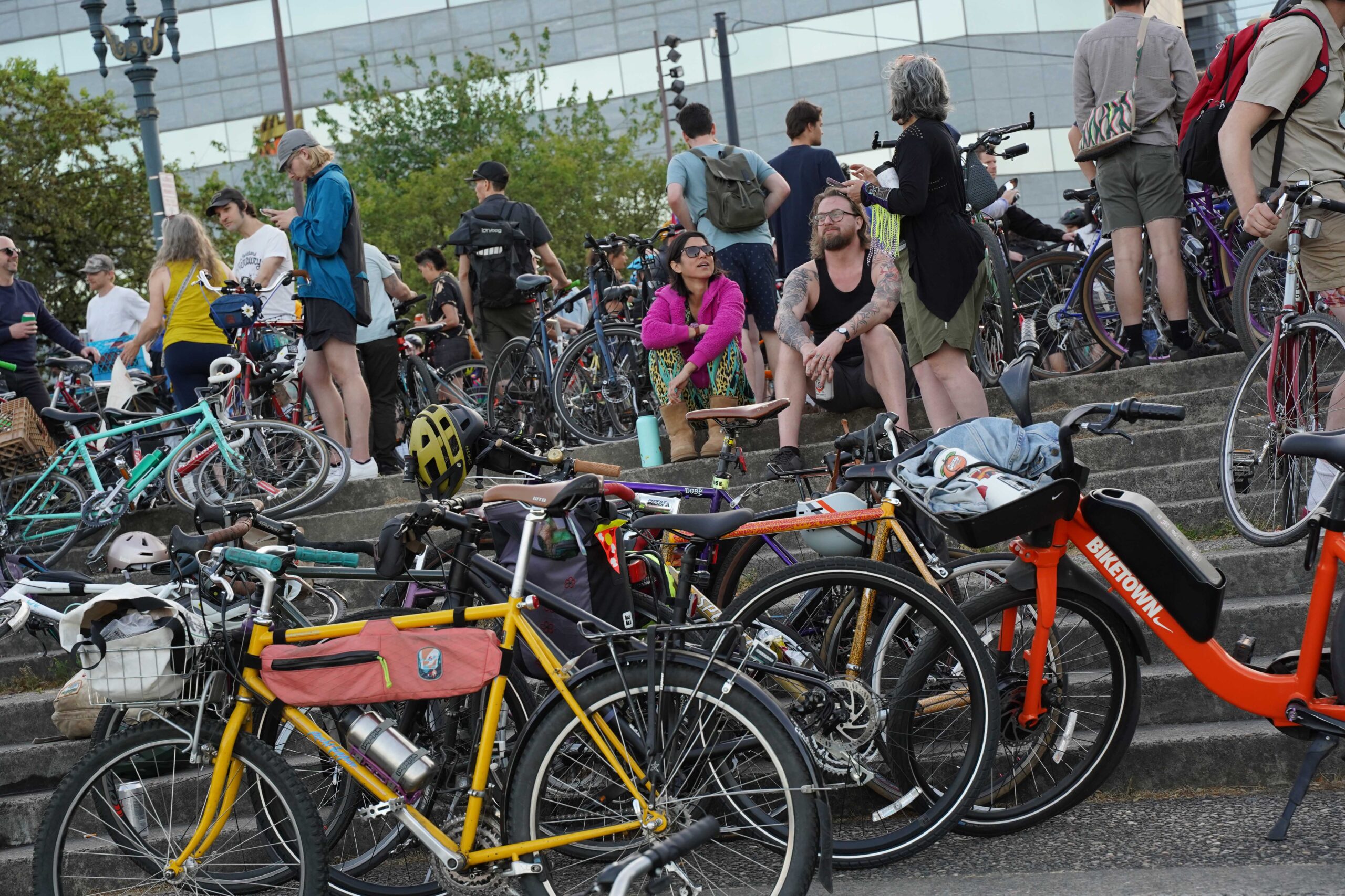
These areas include many places where there are bike lanes and bike paths. The ordinance doesn’t include specific language about off-street bicycle paths like the I-205 path or the Springwater Corridor — both of which have become home to hundreds of people in the past several years. However, the environmental overlay zone language is notable because it could mean that the City of Portland will be able to enforce no-camping zones along the Springwater and Eastbank Esplanade paths along the Willamette River, the Columbia Slough path, Marine Drive bike path, and others.

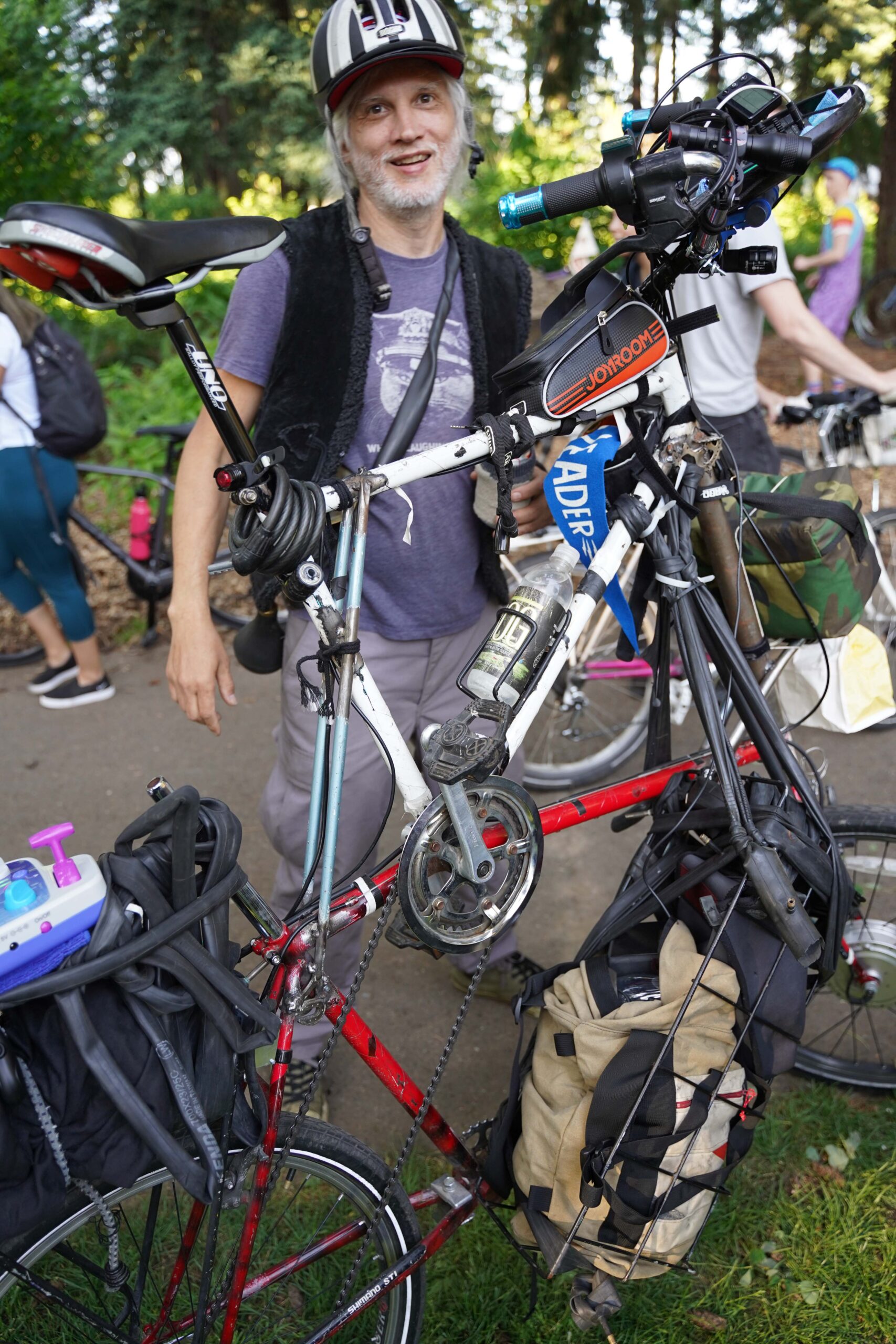
The other part of the ordinance that caught my eye was a specific restriction about the ownership of bicycles. Under the new rules, people who live outside will not be able to,

“Assemble, disassemble, sell, offer to sell, distribute, offer to distribute, or store three or more bicycles or two or more automobiles, a bicycle frame with the gear cables or brake cables cut or an automobile with the battery or one or more tires removed, two or more bicycles or automobiles with missing parts, or five or more bicycle or automobile parts.”

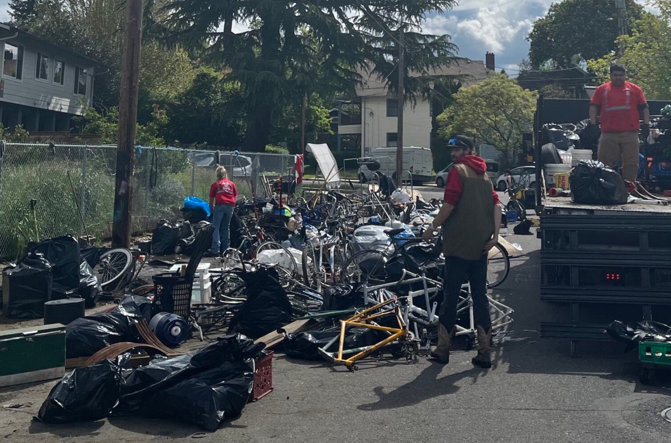
This is an attempt to address “chop shops” where people process many stolen bicycles in order to obscure their identity and prepare them for resale. Chop shops have a long history in Portland. The Police Bureau and city service providers have recovered hundreds (thousands?) of bikes from homeless camps over the years.

In May 2022, neighbors filed multiple complaints about what they believed to be a large chop shop operation on SE Alder near 30th. That encampment — along with dozens of bike frames and parts — was ultimately cleared away.

But determining what is stolen and what is the property of people who live in tents is not easy and Police have had trouble navigating the issue of stolen bikes in homeless camps in the past. In 2013 we reported that despite appearances, the police cannot just assume every bike in a camp is stolen. “The issue is more complicated than you might think,” PPB Sgt. Brian Hughes told BikePortland. “Just because they’re living outside and have a lot of bikes, doesn’t mean they’re bike thieves. They’re entitled to work on a bike just as much as anyone anywhere else.”

Royal Johnson, president of the Timberwolves Cycle Recovery group that helps people get stolen bikes back, told us he’s just happy to see some steps being taken in the direction of more enforcement. “I think that this policy could be beneficial if it actually brings results,” he shared with us in a message last week. “Bike thieves and chops only exist because their is no accountability as long as this stays consistent and there are no loopholes it would be great.”

And Bryan Hance from Bike Index, a site that lists stolen bikes and allows people to register serial numbers, is skeptical the new ordinance will change anything:

“It’s hard to believe there is going to be any actual enforcement. The cynical side of me says this won’t make much of a difference, but at least there’s some sort of acknowledgement of the issue. Everyone is sick of the open-air chop shops that have been allowed to operate around here with impunity.”

According to Wheeler, the ordinance requires written warnings before any penalty is doled out. And people will only receive a citation after two documented warnings. After that, violation of the ordinance could result in criminal penalties and fines.

Read the full ordinance here.

Find a Pedalpalooza ride near you with this handy map

Screenshot of map. View interactive version below.

Excited to take part in the daily rides going on as part of Pedalpalooza right now, but don’t have a lot of time to get to the start location? Curious which parts of Portland are host to the most meet-up spots?

A new map created by Portlander Aaron Kuehn can help. Aaron just shared this cool map that lists all Pedalpalooza rides by location of where they start. You can click each pin and find the name of the ride, date and time, and a link to the ride listing on the official Pedalpalooza calendar.

This excellent resource can not only come in handy when making plans, it also helps tell us where most of the bike fun culture happens in Portland. As we strive to extend the bike fun beyond the central city and inner neighborhoods, we can look to fill Pedalpalooza ride deserts with more bike fun in the future!

Check the map below or via the link here.

See full screen

City recommends major transportation and land use changes for lower southeast

Time to get lower southeast out of the mud. (Photo: City of Portland)
Plan focus area (approximate).

One of the most underdeveloped parts of Portland has taken a big step toward catching up to the rest of the city.

After two years of planning and public outreach, the City of Portland has released a draft plan for how they’d like to hasten development of the lower southeast — an area that includes the Brentwood-Darlington, Lents, Ardenwald-Johnson Creek, Mt Scott-Arleta, and Woodstock neighborhoods.

With a mix of land use and transportation changes, the idea behind the Lower SE Rising Area Plan is to boost neighborhood businesses, create more — and more affordable — housing, and make it easier to walk, bike and take transit. The ultimate goal is to give people the opportunity to meet daily needs without having to drive. Last week the Bureau of Planning and Sustainability (BPS) and the Bureau of Transportation (PBOT) released a draft version of the plan and it’s our first look at what city planners recommend for helping this part of the city catch up to the rest of Portland.

Portland’s lower southeast wasn’t annexed into Portland until 1986 and prior to that it was “yellowlined” — a federal designation on loan maps right above “redlined” that made it hard to get home loans. There are some good bones from historic rail service (both urban streetcar and proximity to the former train that ran on the Springwater Corridor), but for the most part lower southeast remains behind other parts of Portland when it comes to business access and active transportation infrastructure.

“Lower SE Portland shares many physical characteristics with East Portland: gravel streets and missing sidewalks; a disconnected street network and limited bus service; and few neighborhood stores, restaurants, and other conveniences, so that residents must drive to meet their daily needs,” reads the draft plan.

To lift up the area, BPS and PBOT recommend a two-part strategy of zoning code changes and transportation projects.

Land use and zoning

On the land use side, BPS proposes a new business district around SE 72nd and Flavel that would, “serve as a hub for commercial services with additional housing options” and “fill in a substantial gap in access to services in this area of Portland.” That district would be part of a new neighborhood center that would extend east along Flavel to 82nd. This would help give the Brentwood-Darlington neighborhood something on par with how 72nd feels just to the north at Woodstock and at Foster. Currently the Flavel/72nd intersection is bordered by parking lots and/or car-related businesses and low-density housing.

The city also proposes zoning code changes to the area around 82nd and Flavel that would allow for mixed-use instead of the commercial and light-industrial uses it has today in order to, “encourage a small commercial hub that is more pedestrian oriented and allows businesses in mixed-use buildings with housing on upper floors.”

Example of how zoning changes could impact SE 72nd Ave.

72nd would become a much more prominent and pedestrian-oriented street as part of this plan. The current “neighborhood center” and “pedestrian district” that exists on the street at Foster would be extended south to include the Mt. Scott Community Center and Arleta Triangle (which not boasts a public plaza). The city is also proposing to allow 3-4 story buildings along SE Woodstock instead of the 2-3 stories allowed today. And around the new public plaza at the Arleta Triangle, the plan recommends a zoning change that would allow for commercial and mixed-use developments to, “support its emerging role as a community hub.”

52nd would also see changes if the proposals in the plan are adopted. It would become a “neighborhood corridor” (along with 72nd), which opens it up to zoning changes that would allow more housing, neighborhood businesses and small, 2-3 story multi-family developments.

Transportation

To support the land use changes, the city is also proposing transportation improvements to make it more attractive to walk, bike and take the bus. Since the area was annexed so late and historically underinvested in, then went from being dominated by streetcars in the early 20th century to being car-centric by the 1950s, it still lacks sidewalks and bike lanes on many streets. The plan uses a combination of changes to busy streets (52nd, 72nd, and Woodstock) and neighborhood greenways to, “bring every corner of the Plan Area within a few blocks of a safe and low-stress walking and biking route, focusing on the Brentwood-Darlington neighborhood.”

Using a standard approach used elsewhere in the city, PBOT would build more neighborhood greenways to act as alternate routes to busy streets, then create safer crossings when the streets intersect.

PBOT is also leaving the possibility of bike lanes on the busy streets open. “Given the narrow busy streets in this district, where a Corridor Improvement project calls for enhanced bike lanes, parking removal on one or both sides of the street will often be necessary,” the plan states. The plan recommends which streets should have new or enhanced bike lanes, though in most cases no cross sections for these streets are included.

Like similar “In Motion” plans in other parts of the city, PBOT has recommended a set of transportation projects split into Tier 1 and Tier 2. One of the Tier 1 projects (estimated cost $800,000) would fill sidewalk gaps, improve crossings, and “enhance” existing bike lanes on 52nd Ave between Flavel and Duke. This section of 52nd is slated for repaving in 2025 — a project that “will be the key near-term opportunity” to make these changes a reality.

Another Tier 1 project is a $9.7 million upgrade to SE Woodstock between 52nd and I-205 that would tackle the dangerous off-set intersection at 69th, add protected bike lanes, and more.

The list of nine Tier 1 corridor improvement projects have an estimated cost of over $22 million. The seven recommended Tier 1 neighborhood greenway projects — with new greenways on Tolman and on 60th playing starring roles — have a total estimated cost of $6.1 million.

The plan also makes recommendations for bus service expansions and includes details on how to fund and implement all the projects.

What’s next

The plan is currently in “discussion draft” form which is a final step to garner public feedback before the “proposed draft is released.” That’s expected to happen in August when there will also be a public hearing at the Planning Commission before a final adoption by Portland City Council. Comments on the current draft are being accepted through June 23rd.

This is a thorough and (thoroughly) exciting plan for a part of town that has been left behind for too long! Take time to check out the plan and share your comments. Get all the links you need to learn more and comment here.

Comment of the Week: Pedalpalooza—for the joy of riding together

Welcome to the Comment of the Week, where we highlight good comments in order to inspire more of them. You can help us choose our next one by replying with “comment of the week” to any comment you think deserves recognition. Please note: These selections are not endorsements.


This year’s Pedalpalooza kickoff was one of the event’s biggest crowds Jonathan has seen. A whole lot of people needed to grab some fun.

One of them was stalwart BikePortland commenter “John.” He left his impassioned social commentary at the side of the road for a while and went out and had a good time. His comment captures what just might happen when you step out of your routine.

Here’s what John had to say:

I was there with my family, it was a great time! I haven’t done many group rides but I’m always surprised just how easy going it is. When I ride solo I have a tendency to ride fast so going anywhere, you know, feels like exercise. While this kind of ride just feels like a super relaxing stroll and yet we still went from Alberta park to the waterfront. My kid was pretty into all the fun costumes and things like bubbles and bells and all of it.

It really is great seeing just how many people in the photos are smiling as they ride. Not because they see the camera, it’s just that the ride puts a smile on your face.

And thank you corkers!


Thank you for the inspiration John! Read his comment under the post here. And don’t miss BikePortland’s photo gallery and video from the event.

Monday Roundup: New bike film, Montreal and Denver’s big moves, and more

Welcome to the week. Here are the most notable stories our writers and readers have come across in the past seven days…

cyclepath bike shop

This week’s Roundup is brought to you by Cyclepath Bike Shop (NE Martin Luther King Jr. Blvd and Brazee), who welcomes you into their space with excellent service, group rides and clinics, bikes and parts, and a warm and friendly vibe.

And now, let the Roundup begin…

How to do carfree: Montreal walks-the-walk when it comes to being a city that puts people first. A new initiative will ban cars on major sections of 10 downtown streets in an effort to boost businesses and livability. (Montreal Gazette)

Science knows: New research using biometrics and machine learning proves what many of us have understood forever: That humans hate being around cars in cities and are much happier when streets do not have cars on or near them. (Scientific American)

What Earl thinks: In a new interview, Portland Congressman Earl Blumenauer opines on e-bike rebates, Portland’s cycling decline, and why the bike lanes on Pennsylvania Ave are his favorite piece of infrastructure. (Slate)

Ticket timing: Seattle PD failed to process automated cameras quick enough and their expiration means the city will lose crucial revenue for safety projects. (The Urbanist)

Dangerous driving epidemic: In Washington D.C., a council member held a six-hour roundtable discussion about dangerous drivers and found there’s, “a lack of coordination among enforcement agencies, a lack of strategy, and a lack of urgency.” (DCist)

Environmentally irresponsible: A provision tucked into the debt ceiling deal worked out by Biden and Congress includes language some fear could gut the power to hold massive freeway projects accountable for environmental impacts. (Streetsblog)

Bicycling prizes: Bloomberg Philanthropies announced that a city in Brazil has won $1 million and nine others won $400,000 in a contest that awarded the best bicycling infrastructure project ideas. (The Guardian)

Video of the Week: This new film, The Engine Inside, partially funded by Shimano and bike advocacy group People for Bikes, looks fantastic! (Notable that Portland is not (yet!) on the screening tour.)


Thanks to everyone who shared links this week!

See the Pedalpalooza Kickoff Ride video and get inspired for #BikeSummer

You’ve seen the photos and maybe you were even on the ride… But you need to watch this video if you want to get hyped for Bike Summer.

See fun footage of last night’s ride and hear from folks what rides they are looking forward to. You’ll also hear from a few ride leaders (including actors with Bike Play!) who share what they’ve got planned.

Here are the maps that will help decide Portland’s new city council districts

How should we split it up? See the latest district maps below.

We hope you did your homework and read our latest charter reform story yesterday, because today Portland’s Independent Districting Commission (IDC) released its Draft District Plan Report. The document shows the three official draft districting maps that will aid the city in deciding geographic boundaries for the new City Council districts. It is with these districts that Portlanders will vote for 12 new commissioners in the November 2024 election and the new districts will go into effect January 1, 2025.

The maps are named Alder, Cedar and Maple. Below are the official maps and a brief explanation of each one:

The Alder map is built around preserving established neighborhood boundaries. This map divides the central city among three districts, using the Willamette River and I-84 as boundaries, to promote broad engagement with central city issues and economic opportunities and distribute significant assets and institutions among multiple districts. Neighborhoods in lower southeast share a district with demographically and socioeconomically similar communities on the west side of the river and are connected by the Sellwood and Ross Island bridges.

The Cedar map is built around prioritizing transit corridors.This map uses transit corridors such as NE Sandy, SE 12th Ave, 82nd, and MAX lines to prioritize the role of these arterial roadways in influencing the use of public space and notions of neighborhood on the eastern side of the city. Neighborhoods in the central eastside and inner southeast that are bordered by the Willamette to the west and major transit lines to the east (bus and MAX) share a district with neighborhoods on the west side of the river.

The Maple map is built around keeping much of the central city together, as defined by the city’s Central City 2035 Plan, while preserving historic Albina and adding several inner eastside neighborhoods. The central ci ty includes the city’s most densely populated and urbanized neighborhoods, where residential and commercial uses are tightly interwoven. Eastside neighborhoods with high percentages of renters (Central Eastside, Buckman, Kerns) share a district with westside renter-heavy neighborhoods (Goose Hollow, Old Town, University, South Waterfront) as well as other westside neighborhoods.

The document also includes summary statistics for each map as well as a list of key differences between them:

Crossing the Willamette River
The Alder map crosses in lower southeast only.
The Cedar map crosses in the central eastside and southeast.
The Maple map crosses in the central eastside only

Boundary between N/NE and SE/central districts
The Alder map uses neighborhood organization boundaries.
The Cedar map uses Sandy Blvd
The Maple map uses both (Rose City Park is in one district, while Roseway is divided by Sandy Blvd)

Based on extensive community input so far, all of the maps share certain features:

  • All communities east of I-205 are in a single district
  • The Parkrose, David Douglas, Reynolds, and Centennial school districts (the four non-PPS school districts) are in a single district
  • Neighborhoods along the northern part of Portland are in a single district, with the exception of neighborhoods in the Parkrose school district
  • The north and south sides of Columbia Boulevard are in a single district
  • Historic Albina in N/NE Portland is preserved in a single district
  • All communities west of the Willamette River are in a single district
  • The western border of the easternmost district runs along I-205 and 82nd to accommodate the Jade District and Lents neighborhood

The committee seeks and responds to community input. The report lists eight upcoming public meetings, as well as an email address where you can submit comments. Learn more at the District Commission’s website.

Pedalpalooza Kickoff Ride Photo Gallery

A few of the thousands (?) or riders on NE Alberta Street. (Photos: Jonathan Maus/BikePortland)

Y’all really turned out tonight.

What an amazing way to kickoff three months of free bike fun. One of the biggest crowds I’ve seen in all these 18 or so years. Overheard so many people saying it was their first Pedalpalooza ride — and even a few folks said it was their first group ride ever.

We rolled from Alberta Park, south to Going and then down 7th, eventually making our way over to 15th to cross through Lloyd and then onto the Blumenauer Bridge and over to the Burnside Bridge via Couch. The end at Salmon Springs to connect with Thursday Night Ride was definitely the biggest group of bikes I’ve ever seen on the Waterfront. The crowd was thick from the Hawthorne Bridge all the way to the fountain. I mean thick! So fun. So many smiles and friends.

Huge kudos to the organizers and volunteers and corkers and all the beautiful Portland people who rolled out! You are all so inspiring and wonderful. Enjoy the photos and check back tomorrow for some fun videos.

Draft maps give first look at Portland’s new council districts

Portland’s Independent Districting Commission (IDC) has selected three draft maps of potential City Council voting districts to present to the public. These are the maps that will set new geographic boundaries for the four city council districts under the new form of government and will be in effect for the November, 2024 election.

At a three-hour work session Wednesday night, each plan was presented by a sponsoring commissioner who then fielded questions from the other commissioners. The group could choose to present one or more maps to the public in a series of meetings to be held in July, and ended up deciding to put forward all three.

Last night’s meeting was far from perfunctory. The usual Portland political tensions, such as how or whether to honor established neighborhood boundaries, were given voice by several committee members. The group was ably guided by the facilitator and the decision to forward all three maps came in a close 8-5 vote.

The 13-member, volunteer commission was appointed by Mayor Wheeler from a pool of 282 applicants and approved by the City Council at the end of January. They have spent the past four months immersed in the nuances of drawing districts, and face a deadline of September 1st to present a final, publicly-vetted draft map to City Council. If a super-majority of nine of the 13 commissioners approve the final draft map, it will go into effect. Otherwise, it goes to City Council for a vote.

Before the September deadline, the committee will hold at least two public hearings in each proposed district, for a total of eight public meetings.

The committee intends to publish the draft maps on Friday (6/2), and the plan is to annotate them with notes explaining the reasoning behind their boundaries, and to include some discussion from last night’s meeting. Several committee members expressed concern that without background and explanatory text the public might not be aware of the criteria required for drawing districts or the issues the various boundaries address.

The Commission

Screen Shot of grid of participants from the Independent Districting Commission
Screenshot from Independent Districting Commission meeting Wednesday night.

The commission itself is an impressive and highly qualified group of people. I felt like I was watching the Tour de France of Zoom meetings. The IDC is one of three committees described by last fall’s charter reform amendment to transition Portland from its current century-old commission form of government to a system of geographic district representation.

Portlanders can be confident that this group has taken seriously their historic responsibility to draw the boundaries of the city’s first geographic districts.

The vote on which maps to present to the public came at the end of an arduous meeting in which commissioners made clear that they had grappled with the intricacies of ensuring fair representation in Portland. Here are some of the issues that the commission has considered.

What makes districting in Portland unique

There is no perfect map.

– Members of the Independent Districting Commission

Several commission members had attended an information session about districting presented jointly by the North Star Civic Foundation and Common Cause earlier this month, in which two districting experts shared their experiences from Los Angeles and the Bay area. The idea of city assets figured largely in that conversation, and it was an aspect of drawing districts that I, and perhaps some commissioners, hadn’t considered before: distribution of assets.

Distribution of assets

What is a city asset? It can be an institution, like museums, universities, zoos, sports venues, parks. But it can also be a location. One fun example from LA was the route of the Rose Bowl parade, which offered city councilors representing those districts a high-profile opportunity to appear before the public, waving from a float.

The gist was that having city assets in one’s district brings visibility, power and connections to a representative. Designing districts so that assets are distributed somewhat evenly between representatives fosters cooperation and collaboration.

The North Star/Common Cause information session made a lot of sense, but there were limits to its relevance to Portland. A reality of our city is that most assets are concentrated west of the Willamette River: the largest universities, the art museum, the big concert and theater venues, biggest park, biggest employer, zoo, civic stadium, central library. The distribution of assets in our city is lopsided.

This becomes particularly relevant when deciding which section east of the Willamette should be joined to a west side district to reach required population parity between districts (the west side does not have a large enough population to comprise a single district without an area from the east side joining it). The concern is that “asset-packing” in a single district might bring advantages to the representatives of a particular district.

The difficulty is that the close-in, east-side-of-the-river areas are also asset-rich. Moreover, some neighborhoods, like St. Johns apparently, really don’t want to join the west side.

A largely white city

Portland is one of the whitest cities in the United States and, with the exception of the Asian population, the city’s people of color (POC) are distributed somewhat evenly throughout the city. We don’t have highly ethnic enclaves.

The ranked choice voting in multi-member districts method itself is an attempt to bring fair, proportional representation to people and views which cannot be corralled into a particular geographic location. It is not possible in Portland to create a majority minority district. Because of this, many people repeatedly lose their voice in our current at-large voting system.

For example, these maps from the DistrctR tool (which is being used by the IDC) show

1) the distribution of the 11% of the Portlanders who identify as Hispanic. As you can see, there isn’t a single Hispanic neighborhood, the population is distributed throughout the city.

2) The Black population at 5.7% is, to a lesser extent, also spread throughout the city.

3) The 8% Asian population is more concentrated east of E 82nd St, and also in downtown.

These distributions led to discussions last night about which neighborhoods should or shouldn’t be divided between separate city council districts. A lot of time was spent talking about what is called the Jade district, an area in east Portland with a high concentration of Asian businesses.

One commissioner mentioned that he had been in contact with APANO (Asian Pacific American Network of Oregon) and Duncan Hwang (Metro Councilor and Community Development Director of APANO), and had learned that, counter-intuitively, the Jade Business district leaders were fine with being split across two districts. The rationale being that it would give the community the ear of six, rather than just three, city council representatives.

Geographic barriers, population and culture

All of those concerns layer on top of the history and geography of the city. The main reason there is not more of a concentrated Black neighborhood is because residents of lower Albina were displaced by: the alignment of Interstate 5 through the heart of their neighborhood; the destruction of housing due to planned Legacy-Emmanuel Hospital expansion and; the construction of Lloyd Center. That destruction was followed by years of gentrification.

Geographically, the river is a natural boundary, but the population west of it is not large enough to be a district on its own. The river is also a political/cultural boundary, with one of the few resentments still socially acceptable to publicly express being animosity toward the west side. So it is understandable that some eastsiders are not eager to join a largely westside district.

What the IDC needs from you

Several commissioners repeated the phrase that “there is no perfect map” and emphasized that the draft maps were a starting point for further discussion. Borders can be tweaked, and the Commission seeks public feedback. Many times during last night’s meeting commissioners recognized that they needed to find out what people think, that the IDC doesn’t have all the answers.

That’s where you come in. Find a July meeting, fool around with DistrctR, write a letter. The draft maps should be released tomorrow, and most likely the IDC will begin receiving a torrent of advice. Stay tuned for a follow-up.

Weekend Event Guide: Pride, Pedalpalooza Kickoff, Pioneer Century, and more

(Photos: Jonathan Maus/BikePortland)

Welcome to the weekend! Here’s our weekly selection of rides and events worth your time.


This week’s guide is sponsored by the Pioneer Century Ride, this Saturday June 3rd. Choose from three routes (33/63/103 miles) that will take you on quintessential rural Oregon backroads in the shadow of Mt. Hood.

Online registration available through today (Thursday, 6/1) at midnight. Otherwise, you can register on-site. Register here.


Thursday, June 1st

Pedalpalooza Kickoff Ride – 5:30 pm at Alberta Park (NE)
This is it! The big ballyhoo to kickoff three months of free bike fun. Rolls out at 6:30 pm and route heads south to the waterfront. More info here.

Friday, June 2nd

Cully Neighborhood Bike Fair – 2:15 to 5:15 pm at Rigler Elementary School (NE)
The Portland Bureau of Transportation hosts this event that’s great for families and anyone looking to get their bike tuned up for cycling season. Come get free swag, get help teaching the kids how to ride, and other fun activities. More info here.

Pride Ride! – 4:00 pm at Director’s Park (SW)
Join The Street Trust on this fun annual ride that celebrates Pride Month and World Bicycle Day. Ride is led by drag queen Poison Waters and is an easy, 1.5-mile route that ends with a dance party. More info here.

Saturday, June 3rd

Ride the Dirt Wave at Klootchy Creek Trails – All weekend in the Coast Range
Two days of riding on excellent singletrack and flow trails at an up-and-coming MTB destination right off Highway 26 before the Cannon Beach/Seaside turnoff. Affordable prices get you guided rides and other hospitality. More info here.

Pioneer Century – All day in Canby
One of our region’s classic event rides, hosted by the Portland Bicycling Club. Three routes to choose from and all the gorgeous views and hospitality you could dream of. More info here

Irvington Yard Sale Ride – 9:00 am at Irving Park (NE)
Meet up with bikey folks and then traverse the beautiful streets of Irvington to find treasures galore. Meet up for tacos at the end to share your loot. More info here.

New to Portland Walk – 4:00 pm at PSU Library (SW)
Nonprofit Oregon Walks has organized a group walk aimed at folks who want to learn more about downtown Portland. Led by PSU student. More info here.

Oregon City Loop – 5:30 pm at Something Cycles (E Burnside & 8th)
Join Some Sorta Cycling Club as they roll south for a loop to Oregon City for a food cart dinner and then back again. This is an intermediate ride. More info here.

Sunday, June 4th

Stub Stewart MTB Ride – 9:30 am at Stub Stewart State Park
NW Trail Alliance and River City Bicycles invite you for a social shred session on the excellent trails out at Stub. They’ll be grillin’ and chillin’ after a morning or riding. Make a day out of it! More info here.

They Should Call it Van-cool-ver – 10:00 am at Posie’s Bakery & Cafe (N)
Looking for a bit more serious of a ride, but with a fun group of folks who like discovering new places? Roll out with Selzter.CC an, “inclusive, moderately-paced cycling club,” as they roll north and discover the charms of Lacamas Lake in Vancouver. More info here.

Asian Snacks and Friendship Ride – 10:00 am at Buckman Field (SE)
This ride was so popular it has come roaring back with a new route that will hit Asian-American-owned businesses that sell yummy snacks and treats. Easy route. Picnic at the end! More info here.

Practice Biking on a Carfree Street – 2:00 – 4:00 pm on SW Bond Avenue
This novel get together is organized by a certified cycling instructor and BikeLoud PDX volunteer who wants to help you gain confidence in your biking skills — just in time for Pedalpalooza. Practice turning, signaling, shoulder checks, and more. Organizer is even willing to help teach your 9-15 year old kids how to ride. More info here.

Watch ODOT’s new safe bicycle passing PSA

Just in time for peak travel season, the Oregon Department of Transportation has released a new public service announcement (PSA) video to educate drivers on how to safely pass a bike rider.

The 30-second animated video was created and released by ODOT’s Traffic Safety Office.

Here’s the text of the narration, followed by my thoughts on the video below the jump:

“You know how your sideview mirror says ‘objects are closer than they appear’? Well, when you’re on a bicycle, passing vehicles can feel even closer. So when you’re passing someone on a bike, keep in mind the size of your vehicle. Remember to slow down and leave extra space. We call it ‘fall distance.’ It’s the room riders need in case they should fall. Also, people in bicycles can take the whole lane if they need to. So you’ll need to hold back patiently until it’s safe to pass. Because here in Oregon, we all want to get there safely.”

Oregon’s Bicycle Passing Law

As far as government PSAs go, it actually looks pretty cool and does a good job laying out the issues around safe passing. One thing that bothered me was how the cars and trucks in the video had blacked-out tint on the windows. I realize that was probably an aesthetic choice by the animators, but it reinforces a really bad — and illegal! — behavior that is unfortunately all too common. It’s odd that they would show solidly tinted windows, especially in a video about passing, where seeing the person inside the car is often an important part of doing it safely.

The other part of this video that stood out to me was the explanation of “fall distance.” I think they did a great job of this both visually and in the narration. I don’t recall hearing that “fall distance” phrase before, but it’s a catchy and helpful way to educate people about our unique safe passing law (unlike most states, we don’t have a specific distance).

And it’s too bad that they couldn’t have waited a bit to incorporate something about the big revision to Oregon’s safe passing law that just passed this week. One reason Senate Bill 895 was created was to help clear up confusion in the public about what drivers are able to do in “no passing” zones on rural roads. A video like this would have been the perfect place to demonstrate that scenario and kickstart public education around it.

Hopefully this gets played a lot at DMVs on local TV newscasts, and so on.

Watch the video below and let us know what you think.