The intersection getting a makeover. This illustration shows the car traffic detour routes for the next 4-6 weeks. (Source: PBOT)
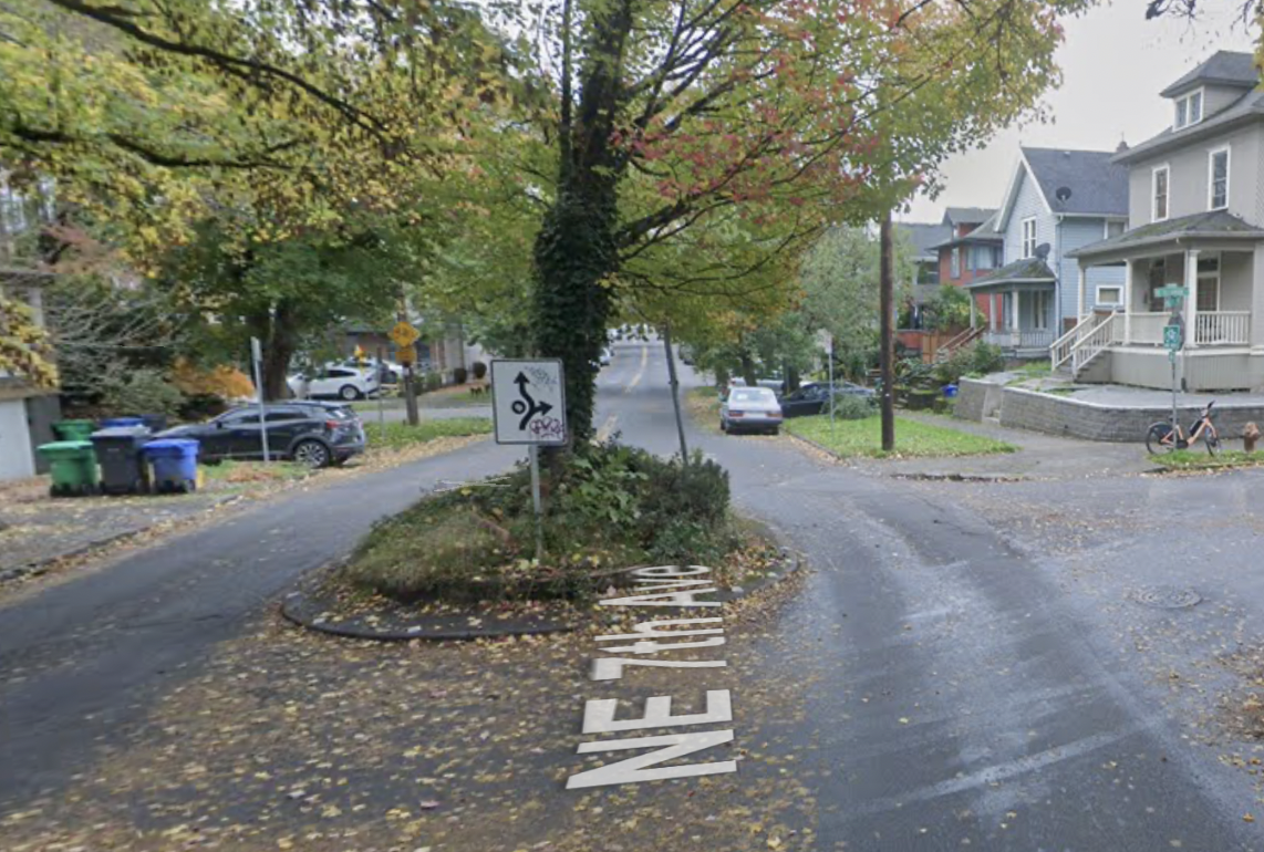
Say your goodbyes to the big tree and traffic circle at NE 7th and Tillamook because the City of Portland is about to remove it.
The traffic circle is good at calming traffic, but it also reduces visibility and often creates unexpected behaviors when people cut it the wrong-way and/or don’t adhere to proper yielding etiquette.
Tillamook is also a popular east-west bike street and PBOT thinks removing the traffic circle from this offset jog with 7th will make the intersection less stressful. This project’s also means the area surrounding the intersection will be closed to car traffic for 4-6 weeks.
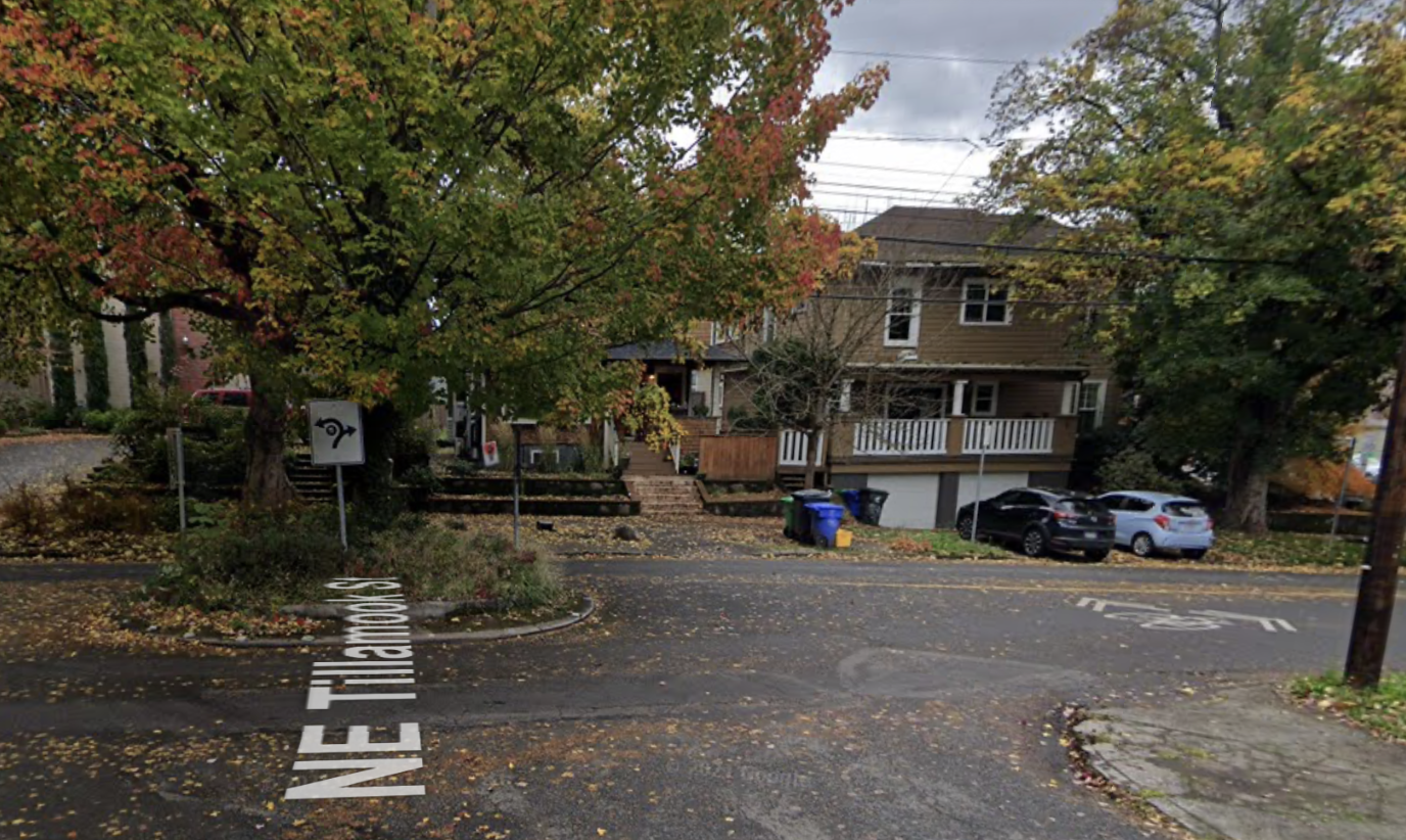
Below are two more views of what the 7th and Tillamook intersection looks like now today:
Looking east on NE Tillamook at NE 7th Ave NE 7th south of the Tillamook intersection
According to a map PBOT released with this project announcement Thursday, they will install a “two-way bicycle lane” on Tillamook one block east and west of this intersection. We aren’t clear if that’s just during the construction zone or exactly what this will look like, but we’ll report back when we learn more.
The changes at this intersection may seem small, but it’s important to have as little friction as possible on this north-south corridor. The city just spent $19 million on this bridge, so people need to be able to get there!
It will be interesting to see how people respond to the intersection being closed to car traffic. Tillamook is a greenway, which ostensibly means it should be very low-car already, but this closure will give people walking, biking and rolling a chance to see what navigating the area is like when they don’t have to avoid car traffic. (People on Twitter are already calling on PBOT to make it carfree permanently!)
Construction on this project will start on Tuesday and go until next month. Stay tuned for updates as the Blumenauer Bridge corridor continues to unfold.
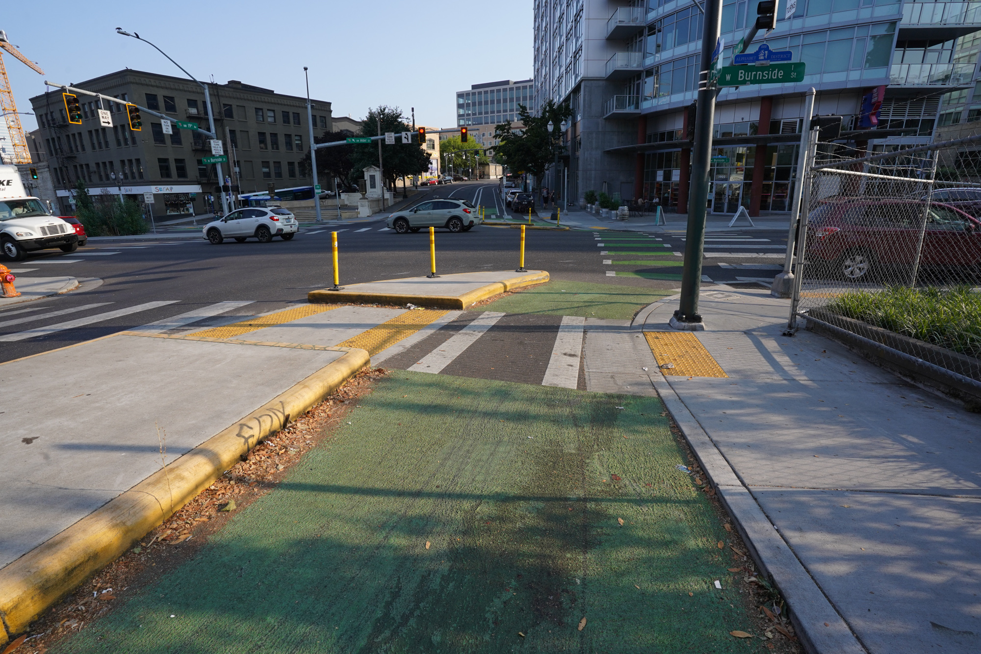
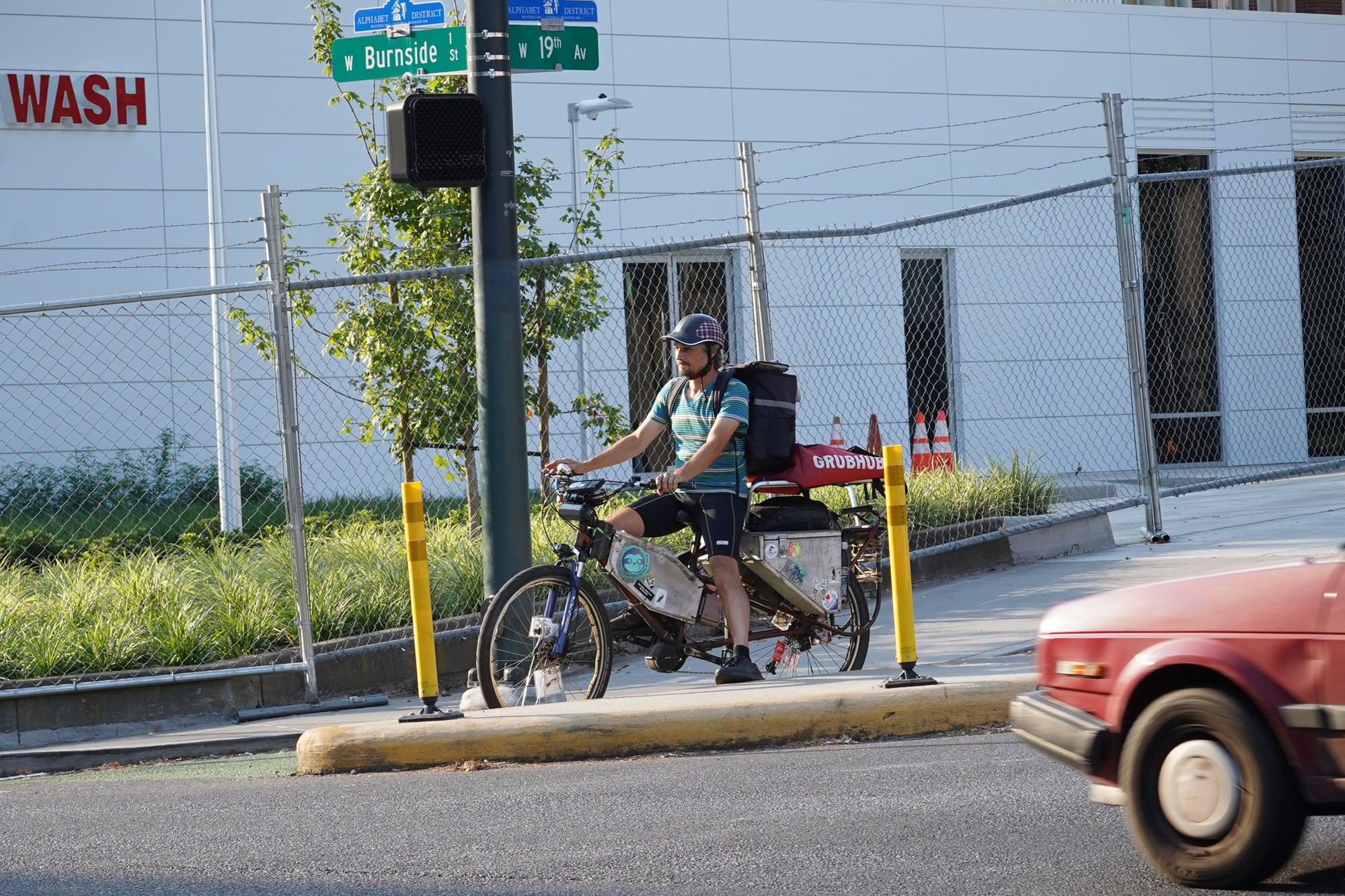
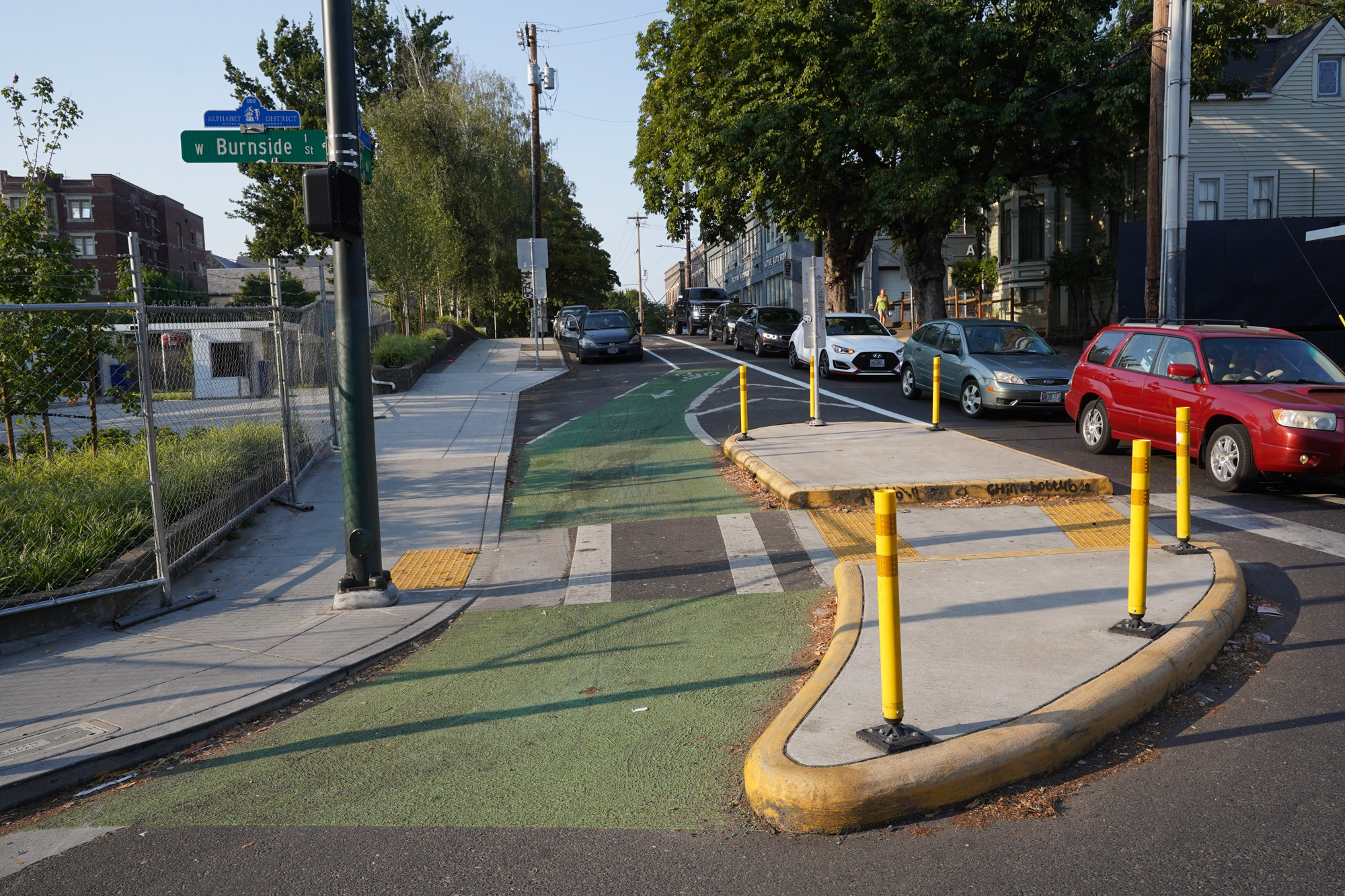
Before (view is north on W 19th from Burnside.)After. (Photos: Jonathan Maus/BikePorltand)
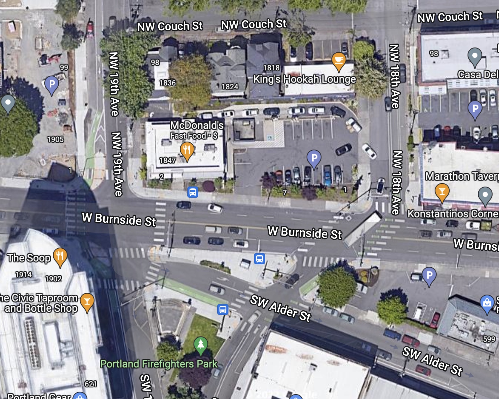
The City of Portland’s West Burnside Multimodal Project wrapped up in 2018 and I’m afraid to say after a few initial stories in 2016 we never followed up on it. So let’s remedy that, shall we?
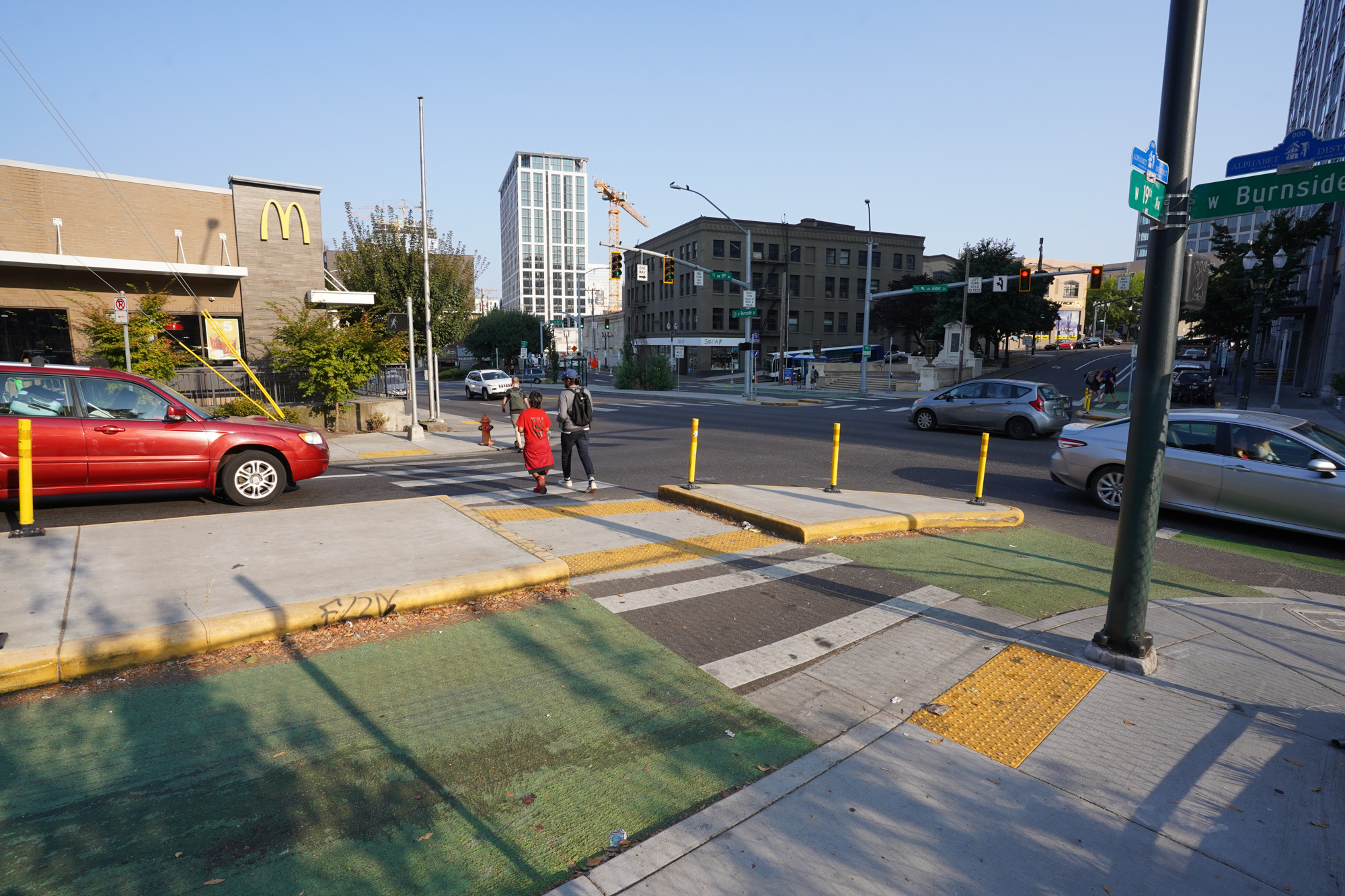
One of the more interesting elements of the project is the protected intersection on 19th. It’s a one-way street southbound that connects folks from the Pearl District and northwest neighborhoods into the Providence Park (where the Timbers and Thorns play), Goose Hollow, and downtown area. As the Portland Bureau of Transportation has made it a better bikeway over the years, the crossing of Burnside — a busy, four-lane arterial — has become a glaring gap in their vision for a safer network.
Adding to the issues at this location is a major break in the grid with SW Alder breaking off from Burnside west of 19th at a diagonal, and with 18th curving across the arterial. There’s also a major bus line and lots of foot traffic and business driveways to deal with. Suffice it to say there’s a lot going on here.
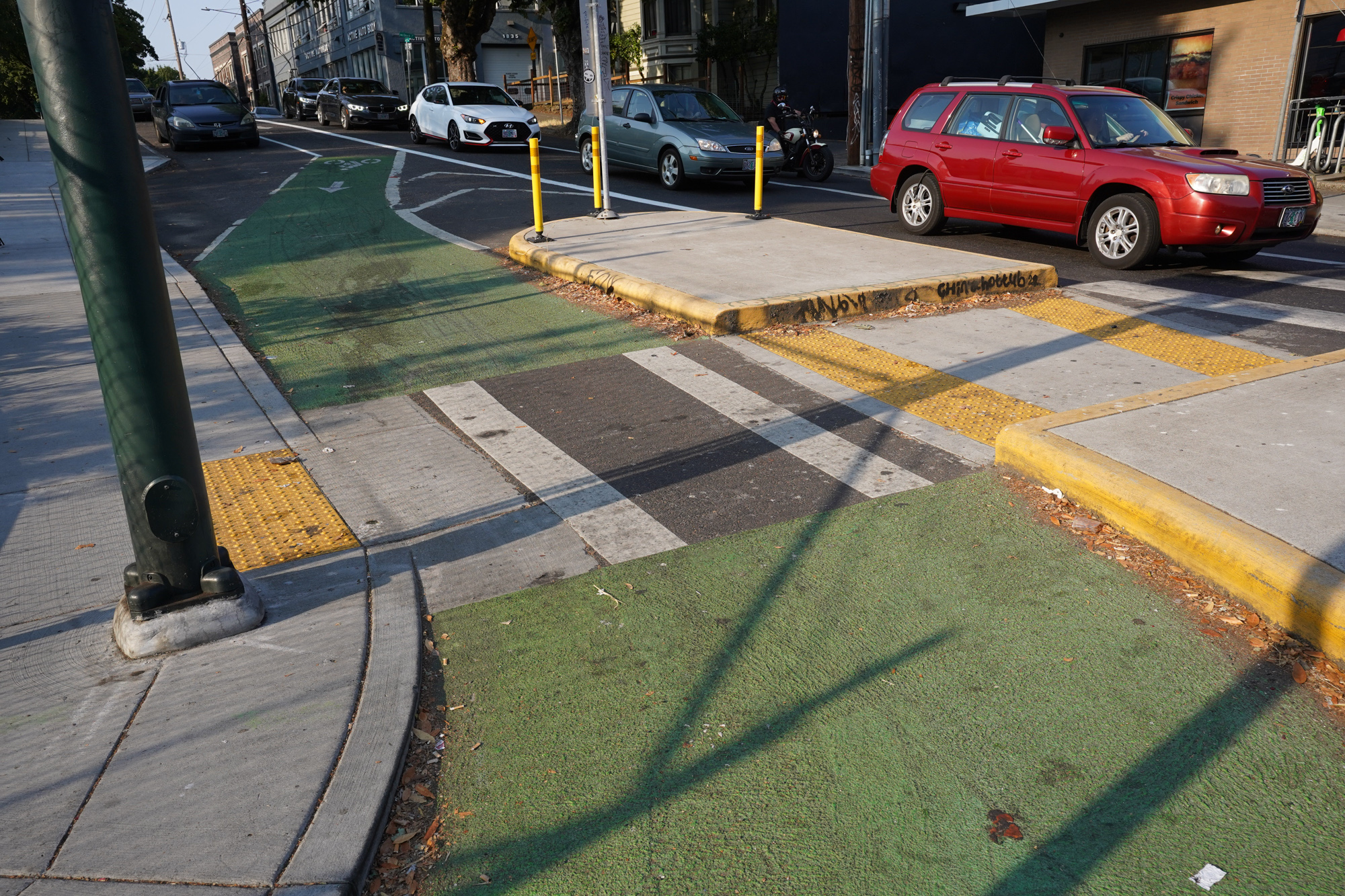
Looking north from 19th across Burnside.Looking northwest from 19th across Burnside.Looking southeast across Burnside from 19th.Looking south across Burnside.Southwest corner of W 19th and Burnside. Looking east toward SW Alder.Southwest corner of W 19th and Burnside.Southwest corner of W 19th and Burnside.Northwest corner.
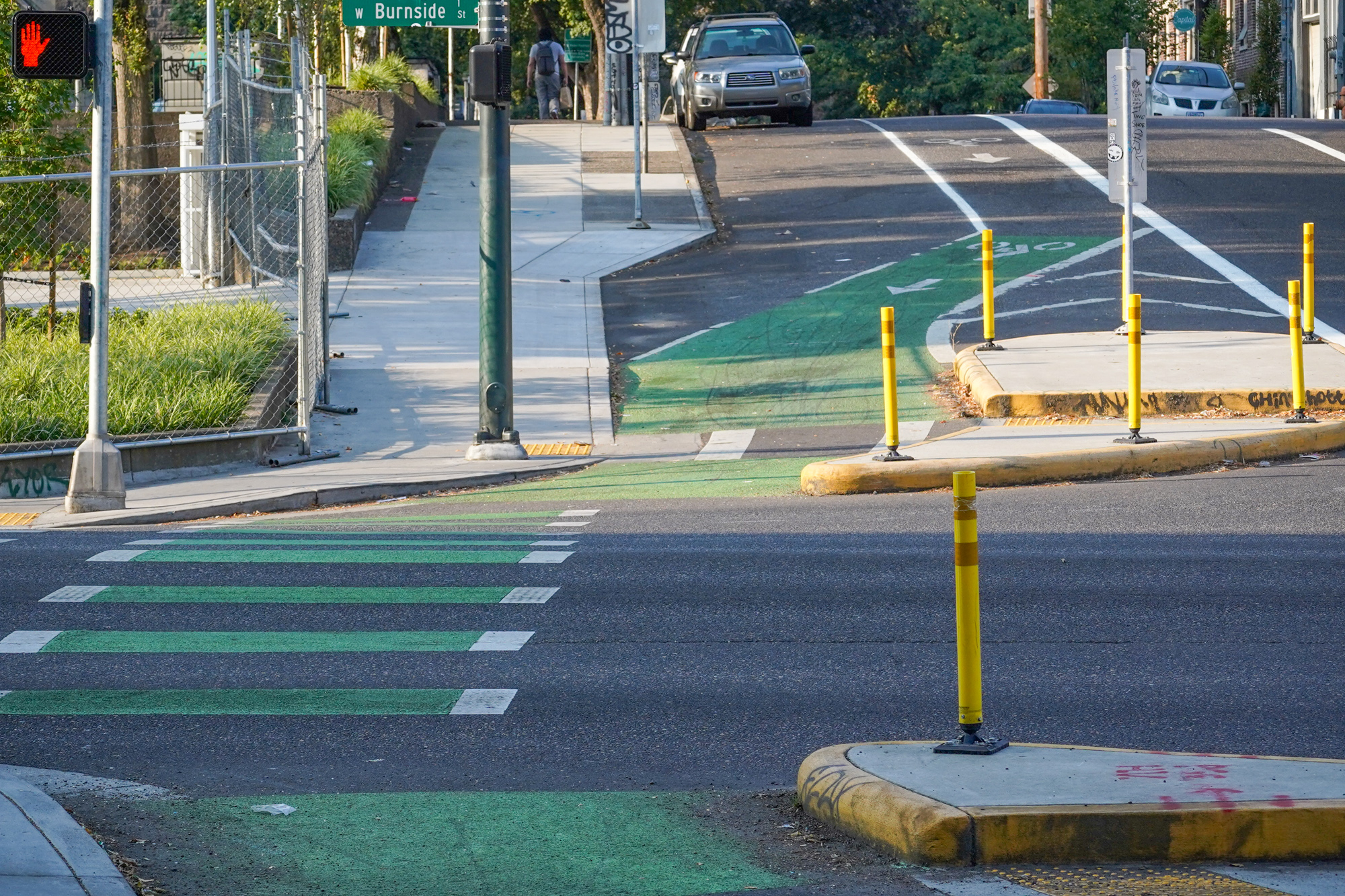
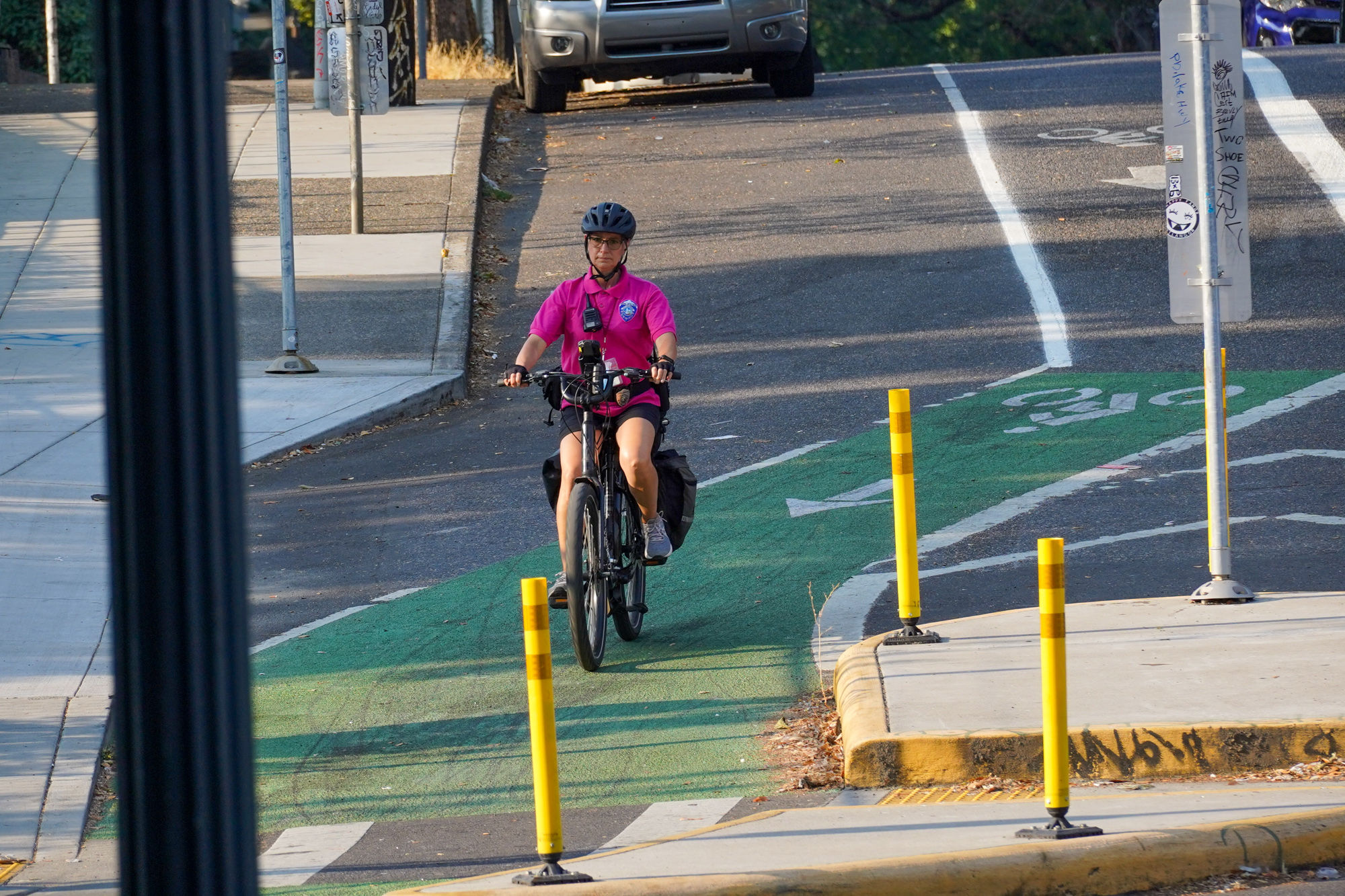
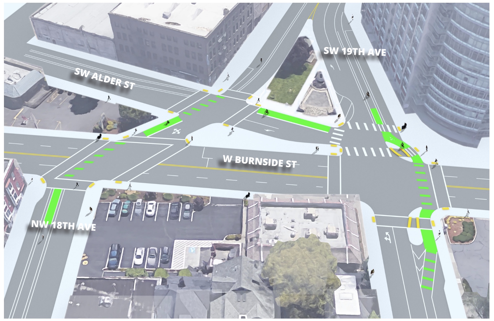
PBOT’s method of creating some sanity at this intersection included protected bike lanes, medians, and a bunch of striping changes.
On 19th, they installed two large concrete median islands on both corners on the western end of the intersection. The idea is that bicycle users and walkers now have more protected space and shorter crossing distances at these corners where there is a high-volume of right-turning drivers and a relatively wide cross-section. They’ve also added green coloring and “cross-bike” treatments to further highlight the bikeway.
I found it to work reasonably well when I was out there a few days ago. The transition from southbound on 19th to eastbound on Alder (and the brand new bus/bike lane) wasn’t as smooth as it could have been however. There was a bit of confusion in which signal to use and with people coming off Burnside at a high rate of speed, there’s a chance for mix-ups. Overall, I like having curbs, medians, and colored bike lanes because I think it scares drivers a bit and forces them to slow down and take notice of other road users.
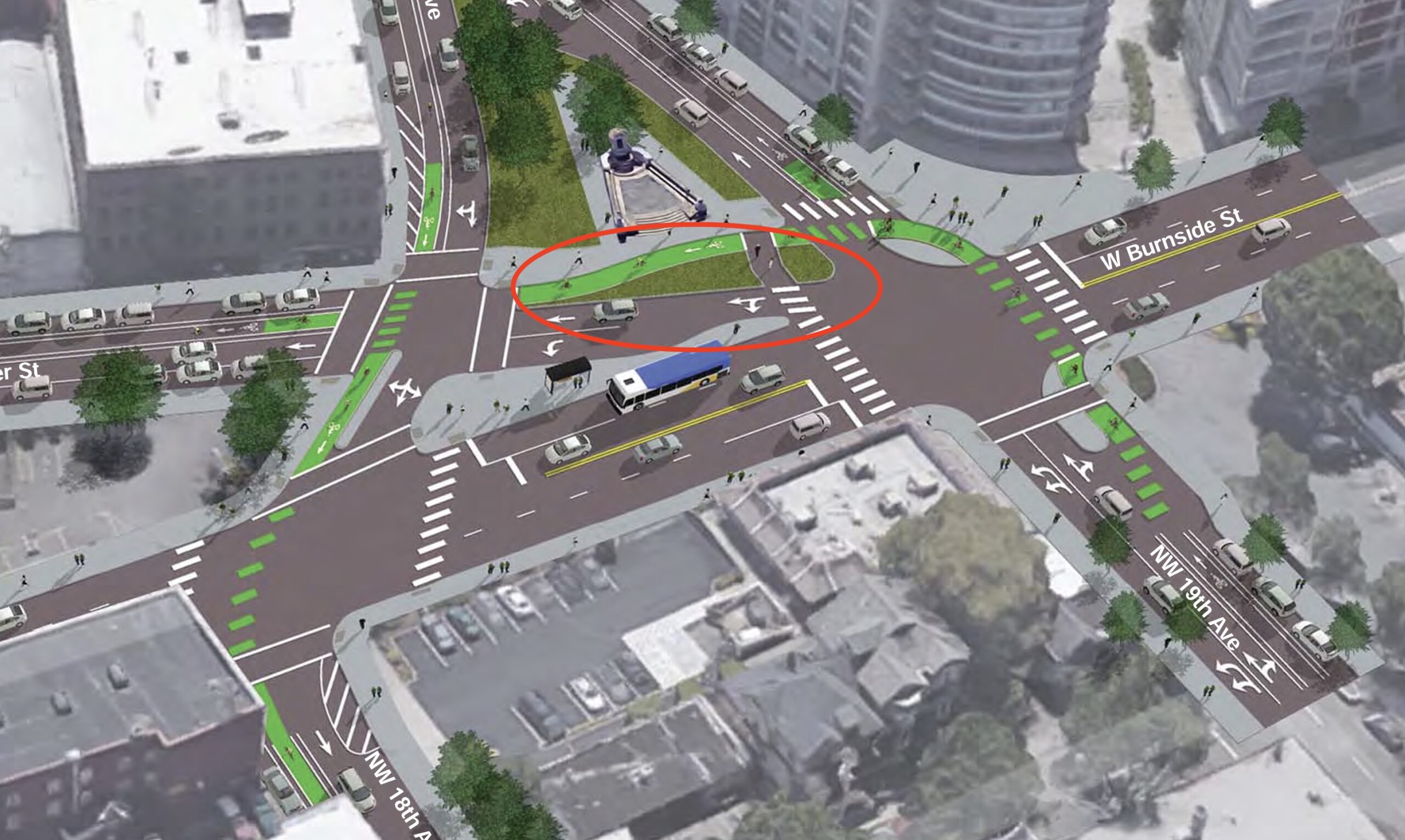
As I researched this post I saw that the initially preferred design (above left) from PBOT included a large grassy median space (circled) on SW Alder just east of 19th. Unfortunately that didn’t make it to the final design. I asked PBOT why. They said because SW Alder has limited right-of-way,
“The project team determined that that space was more valuable to the north given the projects goals of increasing safety and access across and along W Burnside, a High Crash Corridor. The final design enlarged and extended west the floating island between W Burnside and Alder, allowing for accessible pedestrian access to the transit stop from the west side while also permitting pedestrians to walk continuously along the south side of W Burnside without detours (which they were unable to do prior to the project).”
“I used to bike it often and really think it improved driver behavior here. Given it was retrofit the issue I’ve seen is because it’s a standard width lane many drivers think it’s a right turn lane.”
Love it :), I just wish there was signal separation, or at least a leading bike/ped interval. Ideally it would come from curbside lanes on 18/19th so there wouldn’t be an awkward shift right at the intersection.
“This is such an awful intersection, getting right hooked all the time, to me a classic example of good intentions and bad design.”
“Since it’s installation I’ve seen more people nearly get hit by right turning on to burnside cars. The angle the car now has to turn leaves the cyclist bombing down a hill to be in the vast majority of vehicles blind spot.”
“I use it all the time. It’s great!”
“Personally, I experience some confusion there as a cyclist and delivery driver. I’ve witnessed motorists using the wrong lanes for heading south, or turning onto Alder. McDonalds feeds its post-drive-thru traffic right into it as well. As stated above, it’s green and a bike lane so I’ll take it over nothing, but regardless of my transportation mode I approach it with some trepidation.”
What do you think? Do you ride this? If so, what do you think about it?
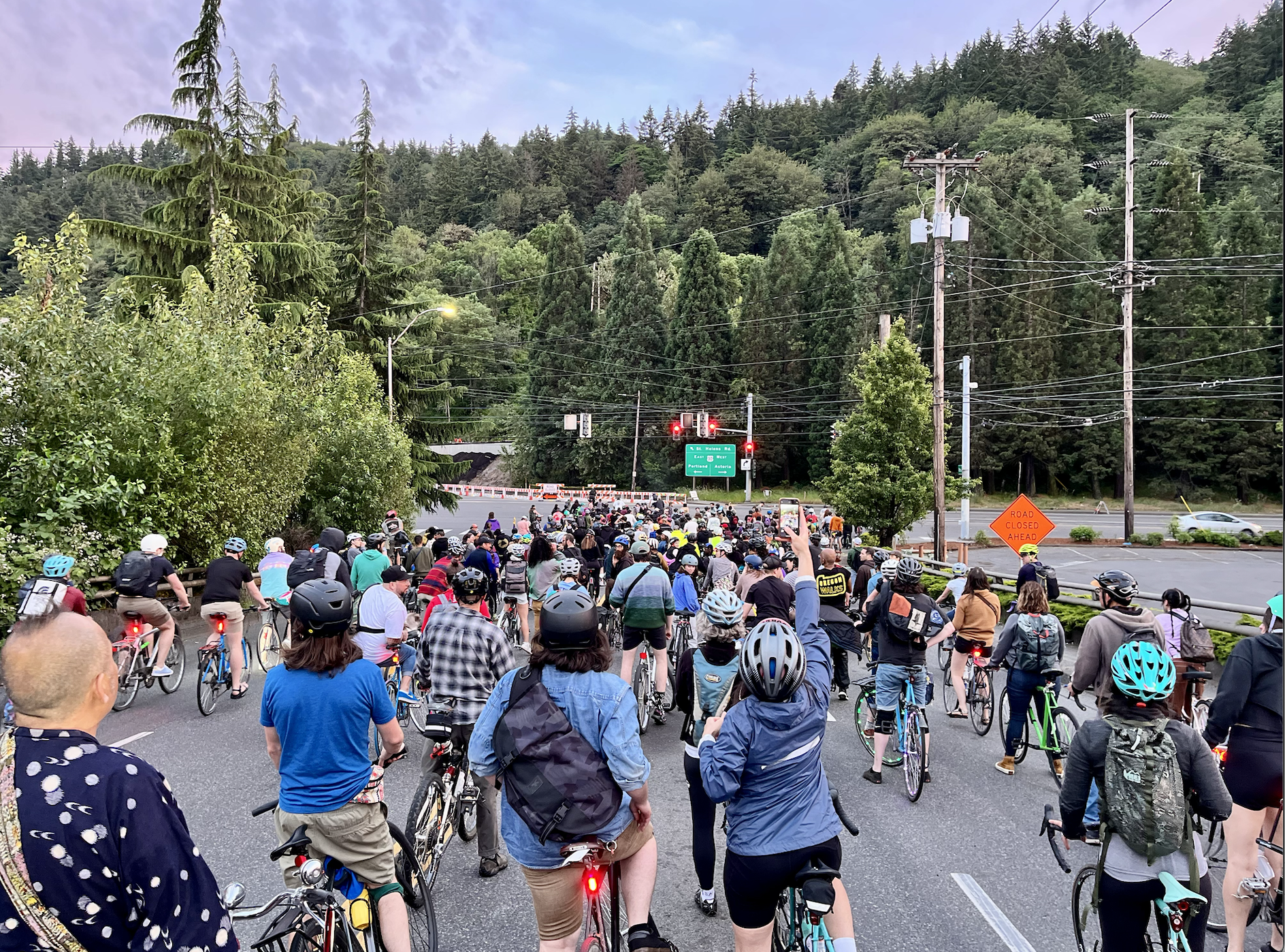
I’ve never been a summer person, and have historically gritted my teeth to get through July and August and return to the coziness of winter. But this year, I embraced the sweat and mosquitos and general fatigue that comes with summer for the first time in my life. If I was feeling low-energy, guess what? There was a Pedalpalooza ride starting in 30 minutes, and if I went, I could instantly feel better.
“I feel more optimistic about the future after seeing people from all across Portland experience so much joy from riding bikes, and now I know so many more people to wave to when I see them biking out in the wild.”
Me at the Pedalpalooza Kickoff Ride. (Photo: Eric Stewart)
During a big, exciting Pedalpalooza ride, it can feel like the majority of Portlanders are in on the secret that riding bikes is one of life’s greatest joys; that ride leaders and people who cork on MLK Blvd have as much political and social power as the mayor himself. This celebration of fun and togetherness is an obvious social good, and its energy is contagious.
But then a car driver revs their engine at you while you’re biking at a crosswalk – or you hear news of yet another tragic and needless death from traffic violence on our streets – and you snap back to reality.
Even so, Pedalpalooza changed the way I think about the city I live in. I feel more optimistic about the future after seeing people from all across Portland experience so much joy from riding bikes, and now there are so many more people to wave to when I see them biking out in the wild.
In my recap of this year’s Pedalpalooza kick-off ride, I added a disclaimer to my enthusiasm, writing that “I won’t evangelize bicycling as the fix to all of the world’s woes.” But three months later, I’m not sure I stand by that. It’s not just the bicycling – it’s the sense of community and joy that comes out of riding across the Burnside Bridge with hundreds of other people on a summer evening as the sun sets over the Willamette River. It’s the knowledge that if you need people to help you move across town by bike, they’ll show up to help you.
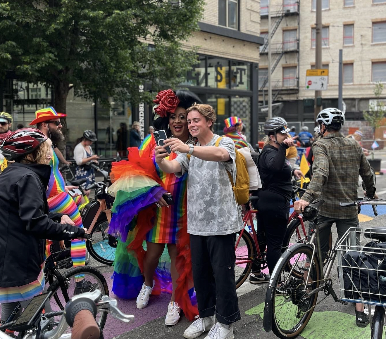
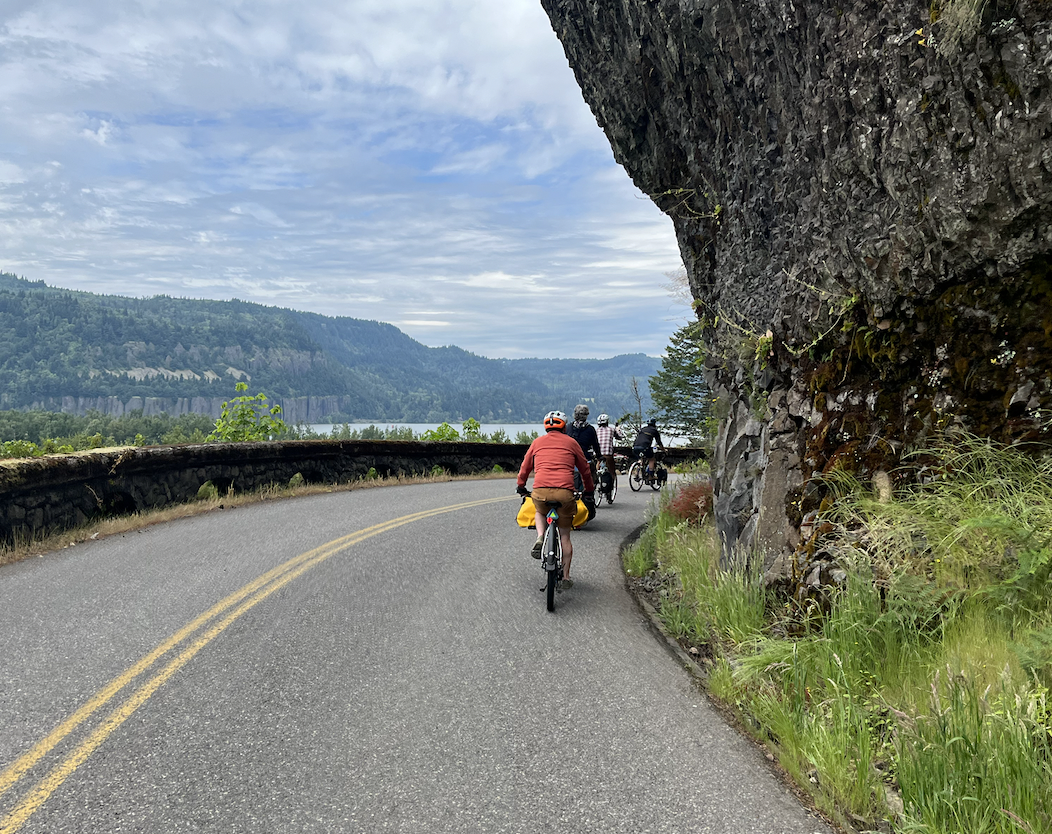
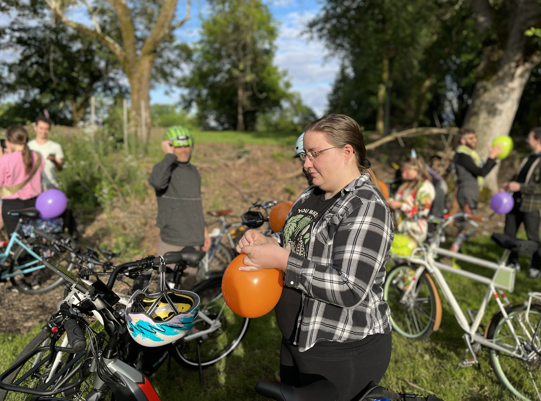
Poison Waters and Holden Regnier at the Pedalpalooza Pride Ride in JuneKylie Griggs at the Prom RideThursday Night Ride Headed to Multnomah Falls!Multnomah Falls rideBirthday Ride
“Join us!” you’ll hear Pedalpalooza riders call out to people standing on the street watching the group of cyclists pass. The invitation is sincere. And they might not join right then, but they’ll know they’re welcome to in the future – and the next time they’re bored or uninspired on a hot summer afternoon, perhaps they’ll check the ride calendar and turn their day around.
So… what were your favorite rides this summer? Any big ideas for next year?
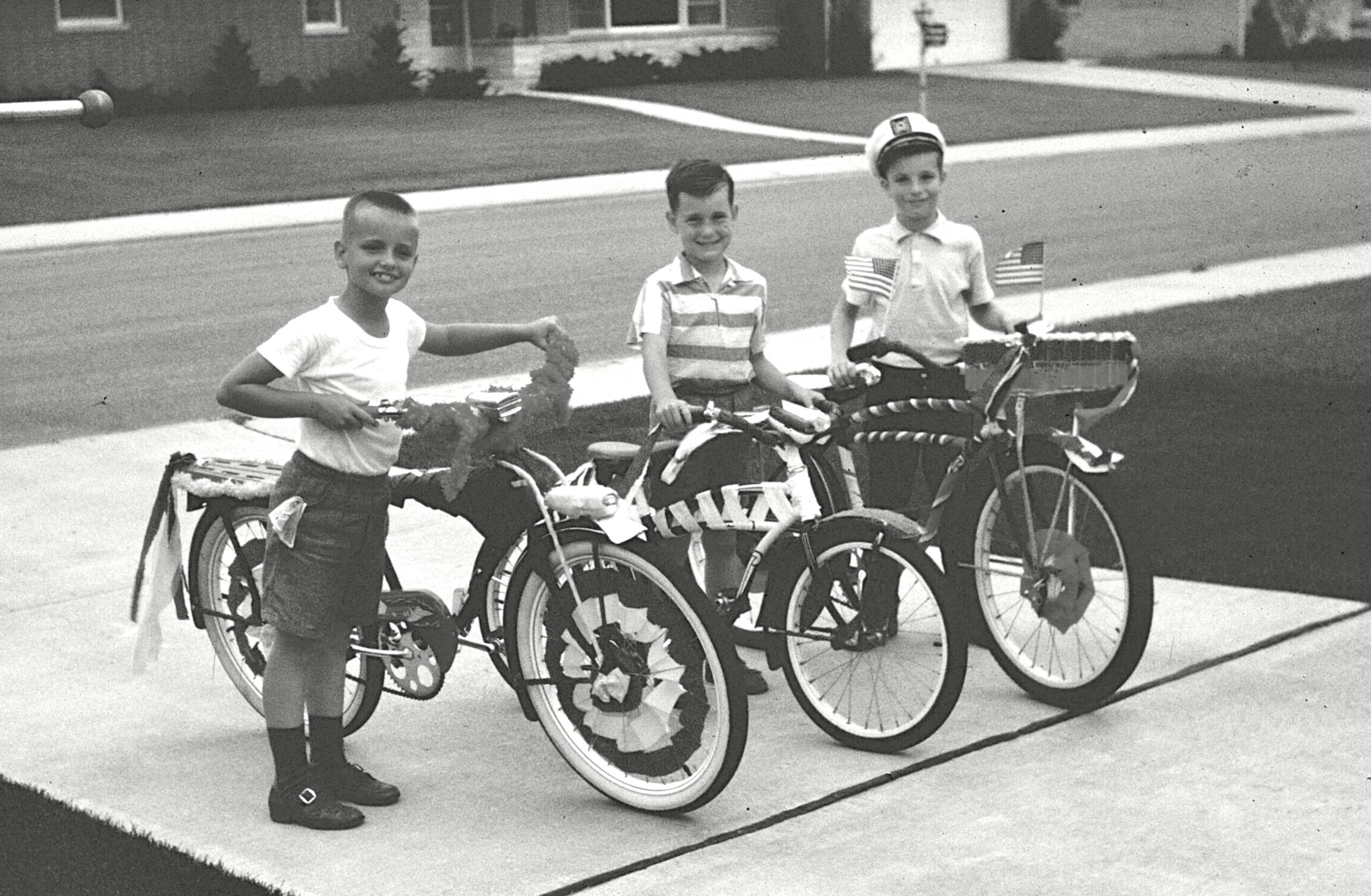
Keith Liden (left) in 1958 at eight years old, with a tricked out bike.
Keith Liden at the Bicycle Advisory Committee tour of SW Portland last week.
Keith Liden is a southwest Portland-based active transportation advocate and land use planner who has been a regular participant in local transportation circles ever since he caught the bug on the advisory committee for the city’s first Bicycle Master Plan, adopted in 1996.
And a few years ago, he completed a 25-year stint on the Portland Bureau of Transportation’s (PBOT) Bicycle Advisory Committee (BAC). Liden would have gladly continued to serve but was term-limited out.
BikePortland caught up with Liden at last weekend’s southwest BAC tour, and invited him to reflect on his years of advocacy and the next steps forward to making Portland a better biking city.
BikePortland: The world is such a different place than it was in the mid-nineties. Can you comment on the arc of transportation changes you have seen over the past 28 years?
Portland said “no” to the Mt. Hood Freeway and built the first light rail line instead. For a planner and active transportation advocate, it was euphoric, and the sky was the limit.
Liden: Well, it’s been longer than 28 years. I first lived in Portland in 1974. I just loved this place after being raised in the Chicago suburbs. Perfect size, lots of positive energy, Goldschmidt as mayor, etc. Portland said “no” to the Mt. Hood Freeway and built the first light rail line instead. For a planner and active transportation advocate, it was euphoric, and the sky was the limit.
We seemed to reach our peak during the Bud Clark/Vera Katz days (with Earl Blumenauer on City Council), although momentum for bike improvements continued under Sam Adams. Since then, Portland appears to have lost its mojo. Could you imagine us making the equivalent decision of squashing the Mt. Hood freeway in favor of MAX today?
SW Corridor is a telling example of where we are now. Southwest Portland needs significant active transportation investment to support light rail. Instead, the plan emphasized park and ride along with active transportation eyewash, like calling sharrows on a collector street a full-flown bike facility, to make the project look worthy of a funding match from the Federal Transit Administration.
In comparison to our inspired transit projects from the past, SW Corridor was a real letdown. There was definitely more concern about auto throughput than pedestrians, cyclists, and transit patrons. It’s too bad because with serious planning and investment, I believe it could have been a game changer for southwest. Obviously, the project didn’t receive voter approval, and it’ll be years before it resurfaces – if at all.
We obsess over making driving wonderful any time of day, allocate our transportation funding accordingly, and wonder why more folks aren’t riding bikes and walking on substandard or non-existent facilities. Give me a break!
BikePortland: What are some pressing next steps bike advocates should push for today?
Liden: We need to push for active transportation funding that is commensurate with our planning aspiration to have a 25% bicycling mode split by 2035. However, as a region, we don’t put our money where our mouth is. Bicycle and pedestrian funding is a tiny fraction compared to what is provided to enhance auto capacity and transit. We obsess over making driving wonderful any time of day, allocate our transportation funding accordingly, and wonder why more folks aren’t riding bikes and walking on substandard or non-existent facilities. Give me a break!
BikePortland: And completing bike networks?
Liden: This is a significant problem in southwest. PBOT certainly makes improvements to the bike network here, but too often they are isolated and disconnected, and networks are only as good as their weakest links. To get the most from its investment, PBOT must focus more on connectivity.
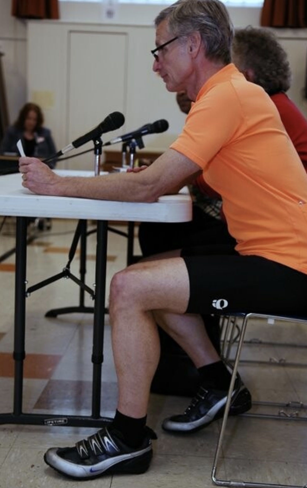
Liden testifying at a budget hearing in 2007. (Photo: Jonathan Maus/BikePortland)
BikePortland: You’ve done a lot of committee work, and I know accountability is an issue for you. Do you have any thoughts to share about that?
Liden: Boy, we could spend a long time on this one! Large bureaucracies like the city can be difficult to manage under the best of circumstances.
Off the top, I think we have two major types of accountability problems. First, there are the silos. Each city bureau is a silo, and in the case of PBOT, so are the departments. In too many cases they don’t communicate or work together as they should. In particular, if a plan wasn’t created within your silo, your bureau or department often doesn’t feel obligated to care or help implement it even though it’s a citywide plan.
Second, once a plan is adopted, the staff typically goes off to implement as they see fit with minimal public interaction other than to announce the next improvement project. SWIM, as an example, is a supposedly short-range plan that will nevertheless take many years to implement due to insufficient funding. Southwest residents should have an opportunity to participate with staff in project prioritization. After all, we are the customer.
BikePortland: Do you have any final thoughts?
Liden: We need to understand why the bicycling mode split has declined. Beginning with the 1996 Bicycle Master Plan, the city adopted the “build it and they will come” philosophy—and it worked. The bicycling mode split steadily climbed.
However, around 2013-2015, the bicycling mode share began to decline. Covid and new work/commuting patterns complicate our understanding of what’s going on, but we need to discern why more people aren’t riding. Our system is certainly better than it was in 2015, so why don’t we see an upward trend? I believe Metro, Portland, and other governments in the region should sponsor a comprehensive survey to understand what is keeping people from riding. The survey should focus not on those who are riding now, but the “interested but concerned” category who are not riding but would be given the right conditions. This knowledge could be used to improve our investment strategy. It could make future efforts more focused and effective.
Ashlee McGill was standing at that TriMet bus stop on the right.
“McGill was an innocent bystander walking in the area when she was struck by an out-of-control vehicle.”
– Portland Police Bureau
Note: This article contains opinions.
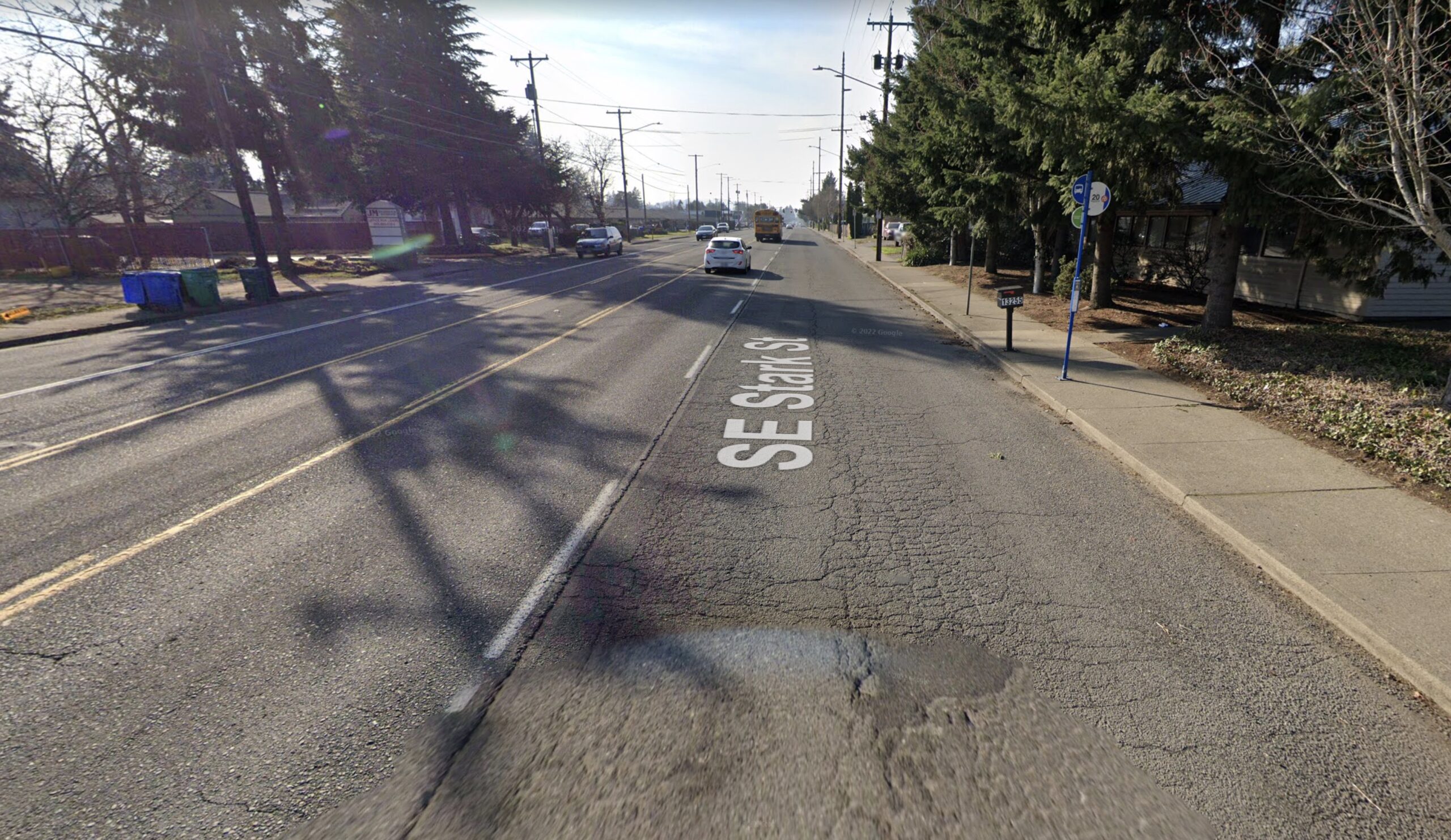
Last night dozens of people gathered on Southeast Stark near 133rd to remember Ashlee McGill. The 26-year-old was standing on the sidewalk, waiting for the Line 20 bus around 5:30 am this past Saturday when she was hit and killed by someone driving a car.
Police initially assumed the deceased person they found at the scene was the driver. But in an updated statement released Thursday they shared that upon further investigation, McGill was just an “innocent bystander…. struck by an out-of-control vehicle.” Local news stories confirm that McGill was just waiting for a bus to take her home. PPB also says the driver who hit her was racing another driver prior to the crash that killed McGill.
It’s just the latest tragedy caused by the tragic mix of illegal street racing and deadly road designs that make it possible.
(BikePortland graphic using PPB and PBOT data)
SE Stark is a drag strip. It’s tailor-made for doing one thing: going fast in a car. Nothing excuses what these criminal drivers do, but we are fooling ourselves if we think road design doesn’t play a factor in these terrible outcomes.
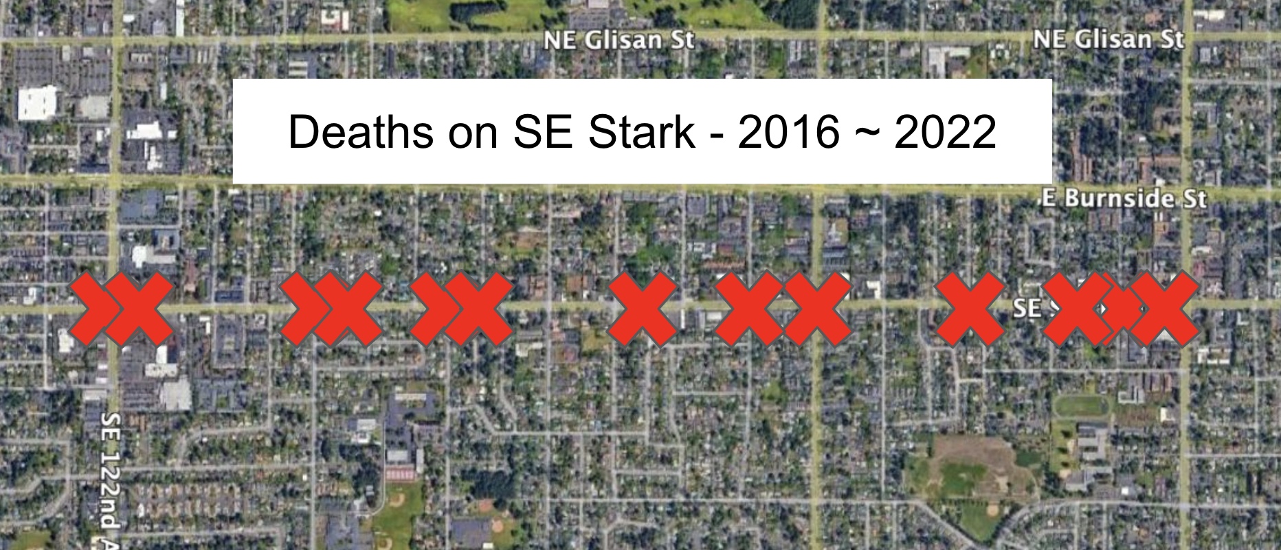
Since 2016, thirteen people have died in traffic crashes on SE Stark in just a 1.8 mile section between SE 122nd and SE 160th. 13 people. Dead. On the same stretch of road. And these weren’t drivers just making a mistake on a tricky stretch of road. The profile of Stark in this location is wide, straight, and the visibility is excellent. Reading through the causes of these deaths almost all of them were some combination of criminal negligence, hit-and-run, or drunk and reckless driving. Or in this latest case, street racing.
The City of Portland is well aware of these dangers. According to the Portland Bureau of Transportation, Stark is a designated high crash corridor where high speeds are common. If the 13 deaths mentioned above, seven of them were people walking. PBOT says speed was about three times more common a factor in pedestrian crashes on SE Stark Street as it is citywide.
PBOT lowered the speed limit on this section of Stark to 30 mph in April 2018. They also deployed photo radar vans after the changes and worked with Portland Police Bureau to enforce the lower speeds. But it hasn’t been nearly enough. Nine people have died since the speed was lowered.
Nine people have died in the past four years on this section of Stark. We are on pace to see five more people killed by the time this project wraps up.
These were just PBOT’s first moves to tame Stark. They’ve got $20 million lined up to do more. Their plan is to spend half the money on new pavement and the other half to add bike lanes, signal upgrades, ADA ramps, two protected intersections, better crossings, more street lights, and so on. The Outer Stark Safety Project will go from SE 102nd to Portland’s eastern border with Gresham at SE 162nd. Open houses for the project were held in 2019 and PBOT had planned to install some of the initial elements this past spring.
But in a phone call with PBOT Interim Communications Director Hannah Schafer this morning, I learned that the project hasn’t started yet. PBOT is still finalizing the project scope with their consultant and the design phase of the project will begin this fall. Schafer said construction won’t begin until 2024.
Nine people have died in the past four years on this section of Stark. We are on pace to see five more people killed by the time this project wraps up.
Can you tell the difference between the before and after?
And will the changes even do anything? The new cross-section proposed by PBOT looks a lot like the current one. There will still be five lanes for driving. Yes they’ll be narrower and we’ll have protected bike lanes instead of parking lanes, but the overall space for driving won’t change that much. It will still be very easy to speed — even to race — on the new SE Stark we will have waited over six years for and spent $20 million on.
I worry that even though PBOT means well, their designs for these east Portland arterials are much too timid. Despite all the back-patting at ribbon cuttings, the aggressive, dangerous, criminal, dysfunctional driving behaviors will remain. I’ve been saying this for many years, but I still see the same approach where we focus efforts on improving conditions for walkers and bikers, but we fail to grab the bull (drivers) by the horns. The politics to “improve bike and ped safety” are easy. The politics to make it harder for people to drive like they’re in a car commercial, are not.
We design streets to be safe for politicians, and to be unsafe for people. This must change.
UPDATE, 2/16: Portland Police have arrested the driver who killed Ashlee McGill. The driver has been charged with Manslaughter. More info on PPB press release.
Get out and ride this weekend! (Photo: Jonathan Maus/BikePortland)
What an amazing Bike Summer we just had! While Pedalpalooza is technically over, the rides and events will continue forever. Because that’s just how we roll. Don’t miss our selections for the next three days below…
As you make plans, consider grabbing a Gorge Pass. It’s just $40 for unlimited rides for you and your bike on any of the Columbia River Gorge transit shuttles. Find bike routes and custom itineraries at GorgePass.com/bikes.
Friday, September 2nd
Biketown for All Ride – 6:00 pm at Moda Center (NE) Come and get signed up for Portland’s reduced-fare bike share program and/or learn more about how it’s helping more people get rolling. More info here.
Cyclocross Playground – 6:00 to 7:30 pm at Rose City Park (NE) A beginner-friendly ‘cross clinic led by the wonderful Mielle Blomberg. Come for the skills and learning, stay for the cold drinks and chance to win free entry at an upcoming race. More info here.
Saturday, September 3rd
Multnomah Falls Ride – 8:00 am at Gateway Transit Center (NE) Led by an experienced rider from Portland Bicycling Club, this jaunt into the Gorge will take you onto the Historic Highway, where car users need a permit but ride riders don’t! More info here.
Word is Bond Community Walk – 10:00 am at Japanese American Historical Plaza (NW) A 5K walk to illuminate stories of Black Portlanders, led by Black Portlanders. Get educated and get healthy at the same time. More info here.
Sunday, September 4th
Het Meer Cyclocross Race – All day at Vancouver Lake Park (WA) Cross is here! Kick off the first local race with a bang by rolling over the river to Vancouver Lake to watch and/or race this classic course that features the legendary Sand Pit of Doom. More info here.
Rocky Point Trails Ride – 4:30 pm at Rocky Point Trails Area (NW) NW Trail Alliance and River City Bicycles are teaming up to lead you on a two-hour shred of the super-fun and always-improving Rocky Point Trails out in Scappoose. More info here.
Have fun out there this weekend! And remember to check out the Gorge Pass and thank them for supporting our work.
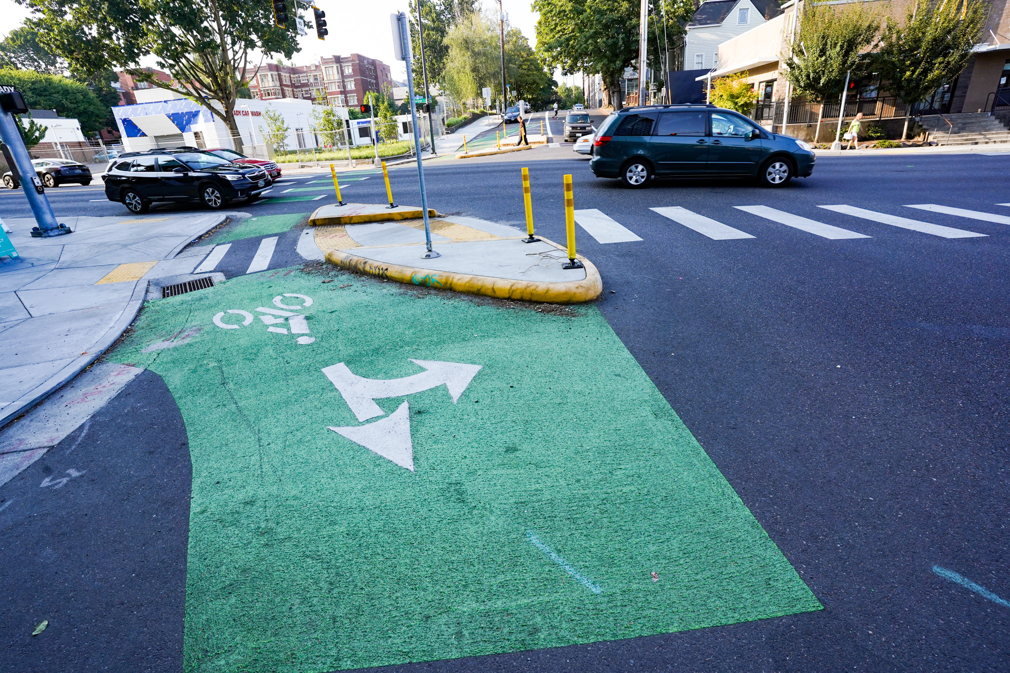
Looking east on SE Hawthorne from 30th. (Photo: Jonathan Maus/BikePortland)
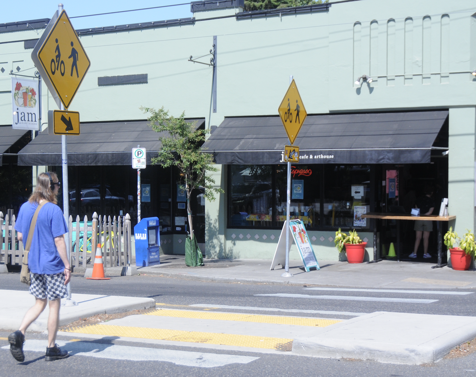
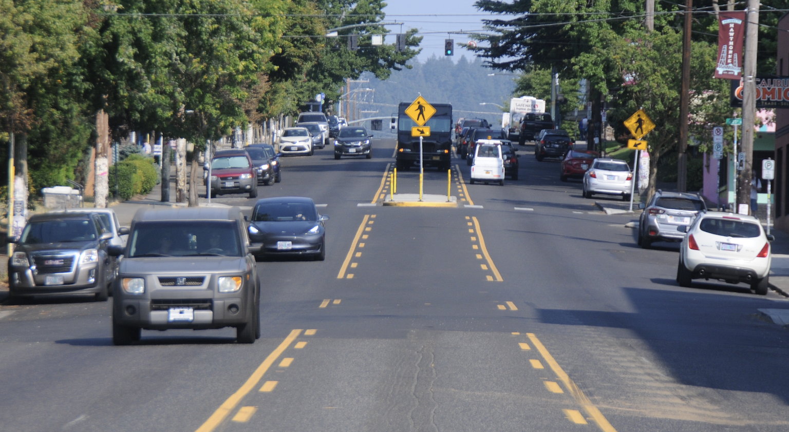
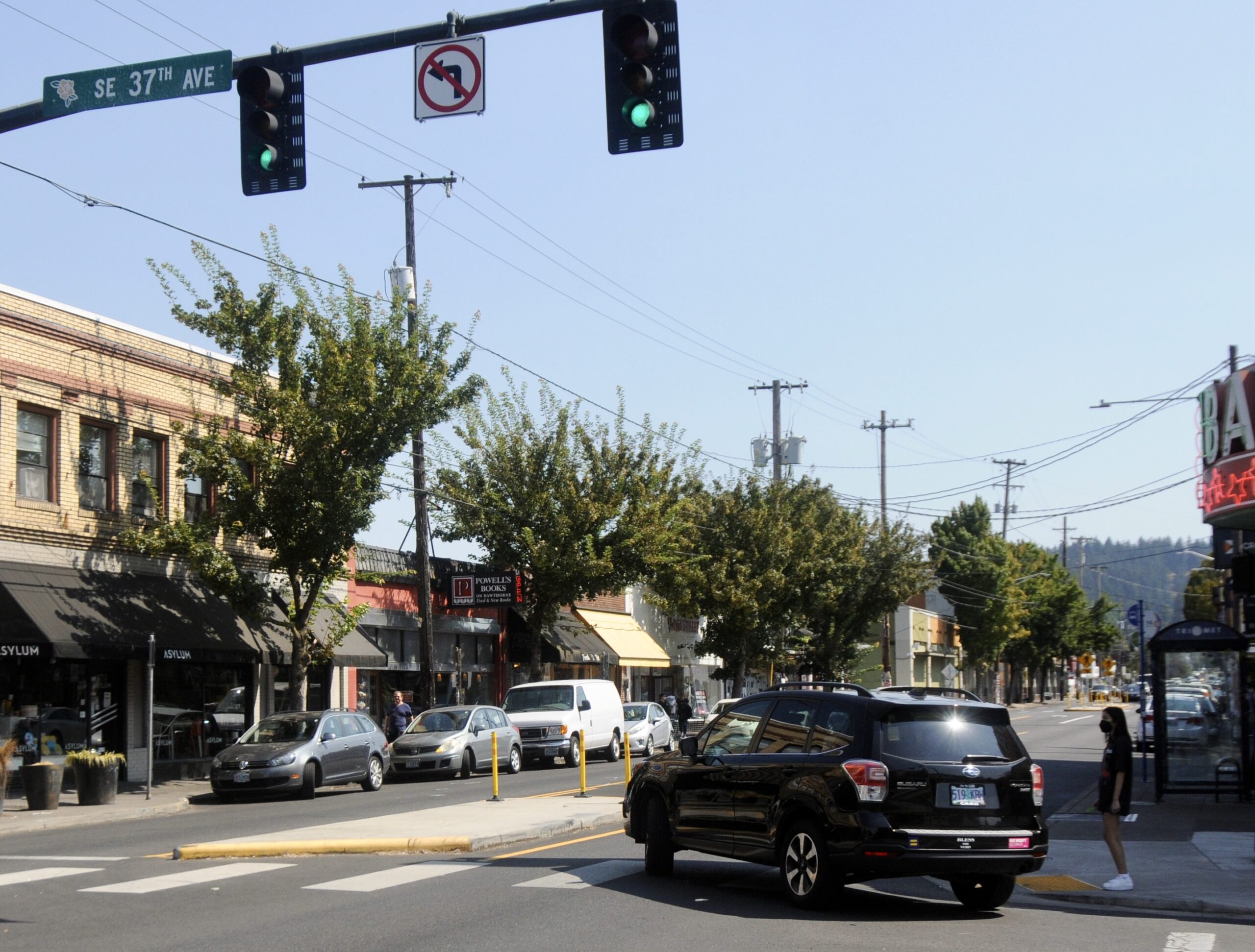
Southeast Hawthorne Boulevard, with its plethora of artsy thrift shops, cafes and bars, may be one of the first streets to come to mind when you think of quintessential Portland. Hawthorne is always buzzing with activity and people walking up and down the street, perhaps enjoying a cup of coffee from Grand Central Bakery, lugging bags of books to sell at the Hawthorne Powell’s outpost or simply grabbing groceries at Safeway, Fred Meyer or New Seasons.
PBOT’s big response came in the form of the ‘Pave and Paint’ project they debuted last fall on Hawthorne from 23rd to 50th avenues. In addition to a full repaving, the project brought new crossing treatments with increased signage and visibility measures to the street, as well as a reduction in the number of lanes and reduced speed limit (to 20 miles per hour).
Looking west at SE 34th. (Photo: Jonathan Maus/BikePortland)Looking east toward 37th. (Photo: Jonathan Maus/BikePortland)Looking west at 46th or so. (Photo: Jonathan Maus/BikePortland)Looking west from Calle Cesar Chavez. (Photo: Jonathan Maus/BikePortland)Crossing at 32nd. (Photo: Taylor Griggs/BikePortland)Looking east from 23rd. (Photo: Taylor Griggs/BikePortland)Looking east from SE 29th. (Photo: Taylor Griggs/BikePortland)Corner of Hawthorne and 37th. (Photo: Taylor Griggs/BikePortland)
While significant, the project was a letdown for many who wanted PBOT to go even further and add dedicated bike lanes.
But how successful are the treatments PBOT did make? I went over to Hawthorne yesterday to ask people what they think of the new streetscape almost a year after it was completed.
“I don’t want to push [my son] out in front of me. It doesn’t really feel super safe. But it’s an improvement.”
-Sarah, a neighbor in the Richmond neighborhood
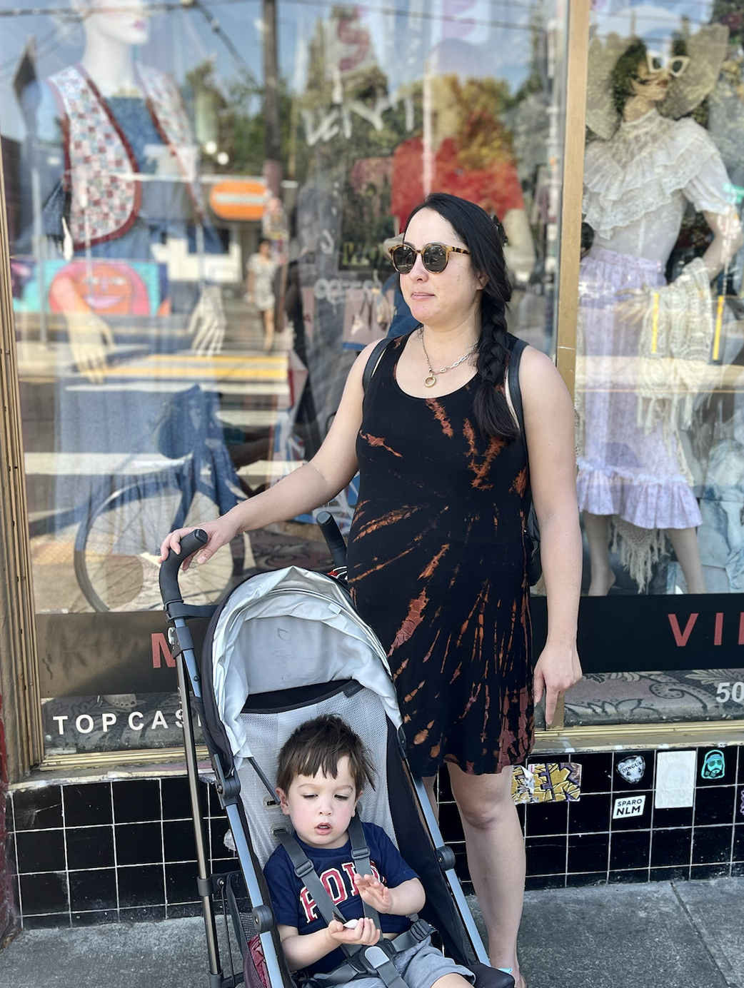
Sarah and her son.Sierra, carrying precious cargo (two small children in a stroller).ZachEmily and her dog Owen.
Though opinions differed, the general consensus was that the new Hawthorne is better than the old one – but it could be a lot better. The first person I talked to, Emily (and her dog Owen), was heading into Safeway at Hawthorne and 28th. Emily has lived in the area for several years, and she said she avoids walking on Hawthorne except when she has to.
“Cars don’t stop,” Emily told me. “People will see me standing [at a crosswalk], but like three cars will pass by before anyone stops for me.”
Sarah, who was walking while pushing her young child in a stroller further east on Hawthorne near 36th, told me she likes the median treatments at the crosswalks, which give people crossing a chance to safely rest and look both ways before crossing the street. But that’s only if people driving actually stop for her – and that’s not a given.
“Most people just don’t want to stop,” Sarah said. “I don’t want to push [my son] out in front of me. It doesn’t really feel super safe. But it’s an improvement.”
Though I watched and waited for a while, I didn’t see very many people biking on Hawthorne. This isn’t unusual – it’s often a very unpleasant experience to even cross the street by bike, let alone attempt to ride any substantial distance on it. I did spot one person biking on the sidewalk: Zach, who works nearby and bikes this street often. He spoke highly of the Hawthorne bike lane concept, and said he’d recently been hit by someone driving a car on the easternmost part of the street, injuring his leg.
“Bike lanes would’ve helped, 100%,” Zach told me.
Finally, I chatted with Sierra, who works as a nanny in the neighborhood and was crossing Hawthorne with two babies in a stroller. Sierra said she walks around the neighborhood with the kids every day, and she would like to see more designated crossings on the street.
“As a driver, It’s annoying [to have all these crosswalks],” Sierra said. “But as a walker, I need it.”
Been a pedestrian for 38 years and finally got got by a Volkswagen while crossing Hawthorne at 38th. The driver took @PBOTinfo ‘s fancy new zebra crossing as a suggestion, I guess. pic.twitter.com/OEjgtSAtzt
Up until a few weeks ago, I lived one block south of Hawthorne on Cesar Chavez Blvd, and I echo the thoughts of people I talked to today. Over time, I grew more confident when dealing with the people driving who didn’t want to stop for me – but the most I had to protect (other than myself) while crossing Hawthorne is ice cream from Fred Meyer, not kids in a stroller.
You shouldn’t have to be a seasoned traveler to feel empowered enough to use your right-of-way at a crossing on a street like Hawthorne. It should be a no-brainer that people driving will stop. Unfortunately, that’s not the case – even at intersections with medians and very visible signs. And especially after PBOT redesigned the street with a specific focus on pedestrian safety.
Just ask 38-year old Portlander Nicole Funke. Just two weeks ago, she was walking across Hawthorne at 38th and was hit by a driver. “The driver took PBOT’s fancy new zebra crossing as a suggestion, I guess,” she posted to Twitter from the hospital while forcing a smile behind a mask and neck brace.
Hawthorne is a street for strolling. Someone living nearby can get the majority of their needs met in less than a 10 minute walk, and yet people driving cars still feel entitled to dominate the road. And if this street, located in a walkable (and wealthy) part of Portland, still has these kinds of problems, where’s the hope for improving big arterials in east Portland like 82nd or 122nd Ave?
That’s the question I asked myself as I watched people navigate Hawthorne.
What do you think of the changes on Hawthorne? How do you think we can further improve this street for people walking and biking?
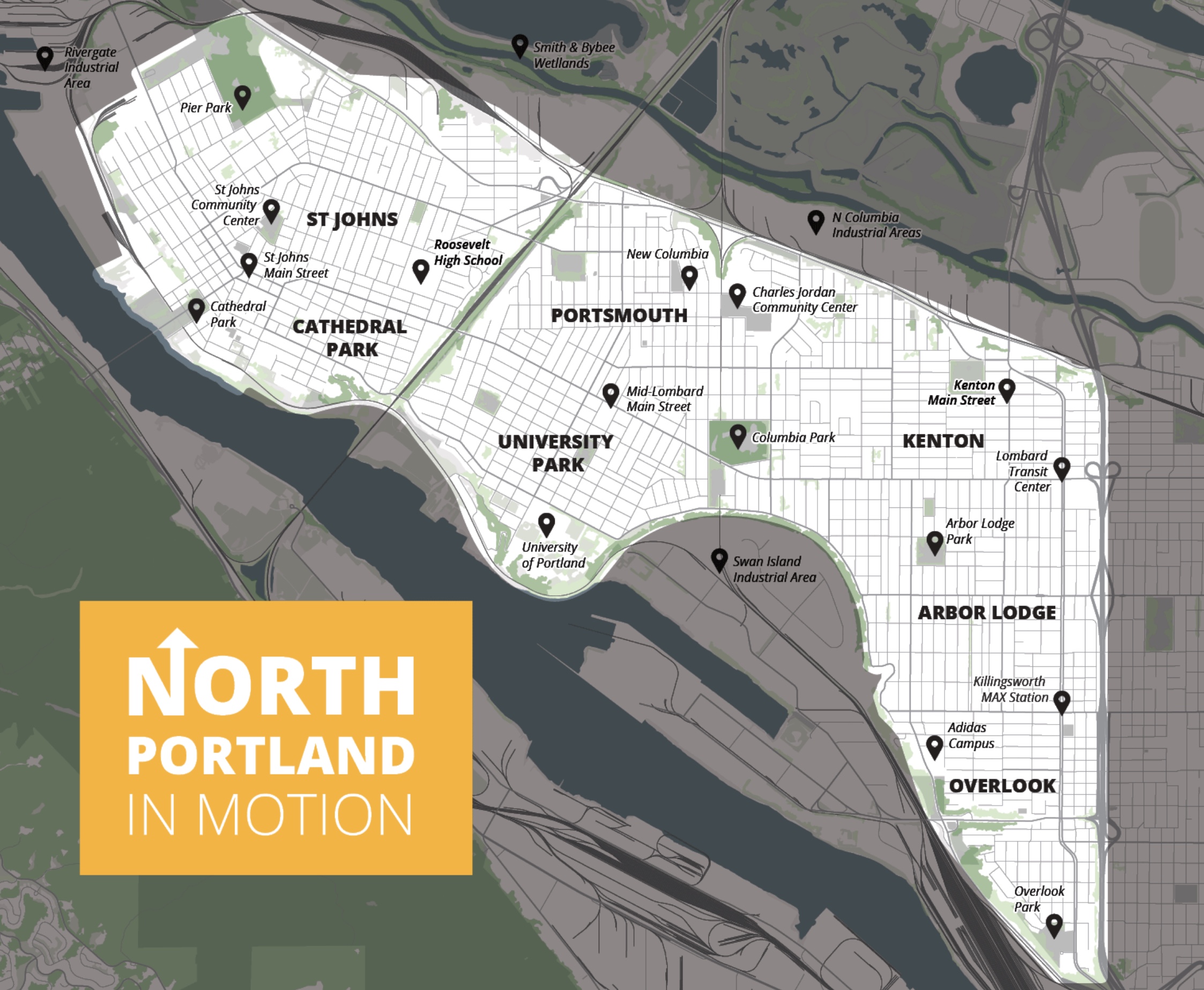
One of the proposed projects would build a new path on this stretch of Columbia Blvd to connect the Peninsula Crossing Trail to the Columbia Slough. (Photo: Jonathan Maus/BikePortland)
Plan map
The big reveal is here!
The Portland Bureau of Transportation has spent the last 16 months learning about the needs and nuances of our city’s northern peninsula and they just released a list of projects they’d like to build in order to make it nicer for biking, walking, and taking transit.
North Portland in Motion is a planning process that launched in April 2021. After doing a bunch of outreach, PBOT said in a statement today that, “We have consistently heard that North Portlanders would like to see an emphasis on safer speeds, crossings and biking options for community members of all ages.”
Also today, they launched an online open house that shares 38 different projects to accomplish those goals. The projects are broken into four categories: Corridor Improvements, Critical Connections, Neighborhood Greenways, Public Spaces and Mobility Hubs. There’s a map (below) where you can click and learn about each one.
There are several very exciting projects on the list. Imagine if we got:
new bike lanes on N Willamette Blvd from the railroad cut to downtown St. Johns;
a new north-south neighborhood greenway on N Montana between Alberta and Rosa Parks Way (as an alternative to Interstate Ave);
new bike lanes on N Interstate between Killingsworth and Lombard;
traffic calming and safer crossings on N Portsmouth between Willamette and Columbia;
or a new path along Columbia to (finally!) connect the end of the Peninsula Crossing Trail.
And beyond traditional infrastructure projects, they’ve also included six potential plaza and “mobility hub” locations:
Downtown St. Johns Plaza
Charleston Street Plaza
New Columbia Mobility Hub
University of Portland Mobility Hub
Downtown Kenton Mobility Hub
Arbor Lodge Park Plaza
Slide from PBOT open house.
It’s all possible with this plan. Of course, there won’t be any money directly tied to NPIM; but PBOT has a track record of spending money (as it becomes available) as directed by these “In Motion” plans (*See exciting update below. There is money!). The adoption of a plan like this also helps create the political urgency required for funding to appear — so it’s a positive feedback loop all around.
*UPDATE, 12:20 pm: Turns out, PBOT actually does already have money lined up for this. So far they’ve set aside $500,000 from the Fixing Our Streets (gas tax) program, $100,000 from their Pedestrian Network funding program, and $80,000 from the Missing Links program. That’s $680,000 to jumpstart NPIM. PBOT tells me they plan to spend this money in the first two years after the plan is adopted.
How do we tell PBOT which ones to build first? Visit the online open house and make your priorities and insights known.
PBOT will take this feedback, mesh it with their other core values (like equity, feasibility, and so on), run it all up the political flagpole and come up with a “Top Tier” project list later this fall.
According to their latest timeline, they’ll continue to refine the project list and find funding sources from fall through spring of 2023 and then get the plan passed by council that summer.
If it all goes according to plan, I bet we could see some of the best projects in NPIM get installed early next summer. So get to that open house and help make it happen. The open house closes September 30th.
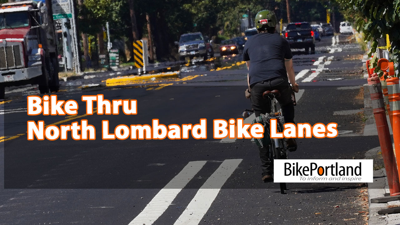
Yes I realize I’ve already covered the new bike lanes on Lombard; but I feel like this video gives you another important perspective on what they are like.
Have you ridden them yet? Are the new lanes enough for you to make this part of your personal bike network? Or will you stick to the sidewalk?
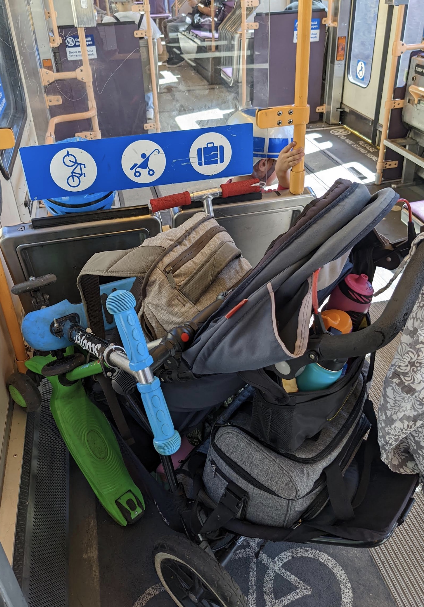
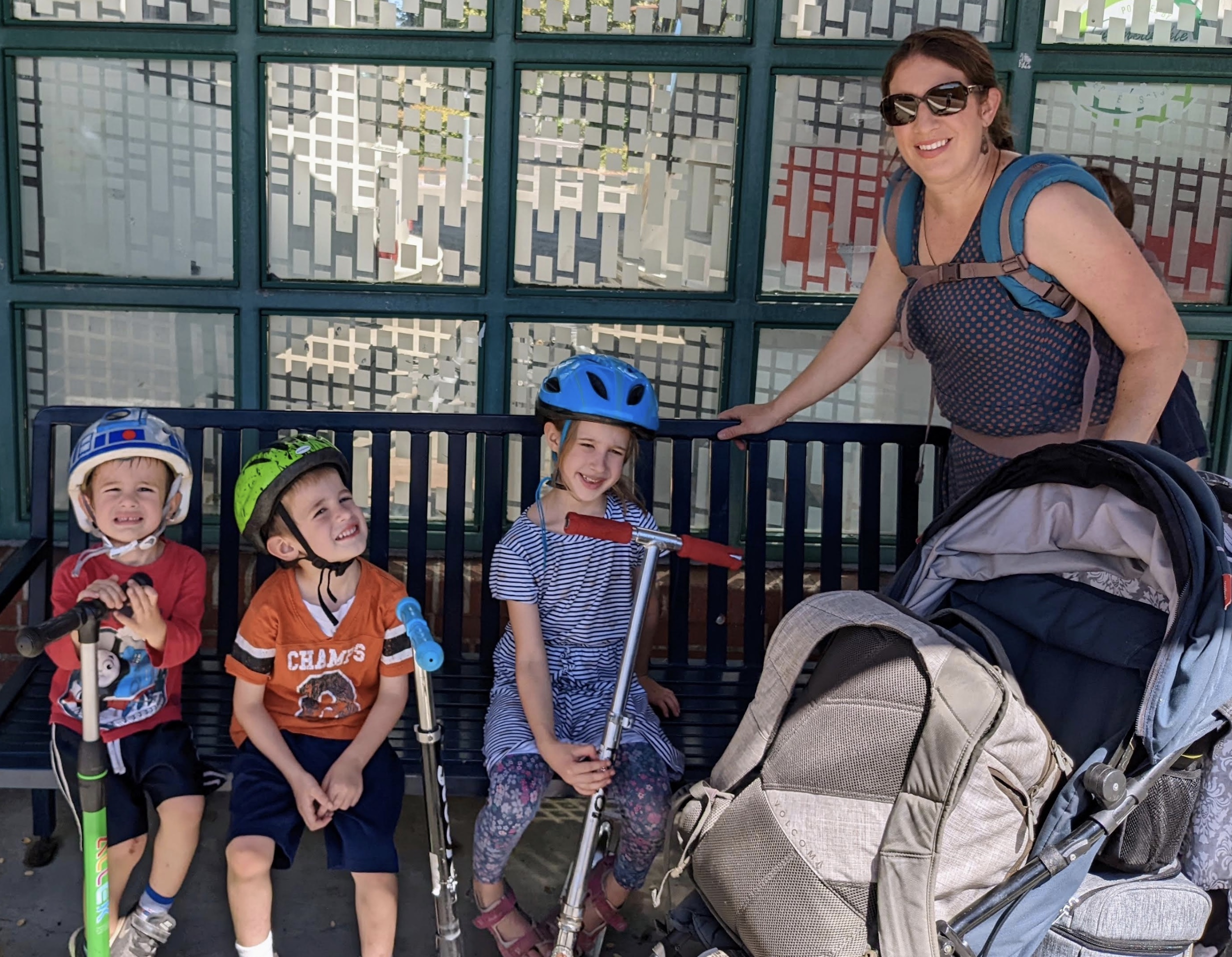
As Shawne recounts, part of his trip was dependent on getting a bus with an empty bike rack, because he and his daughter both had bikes, and Trimet buses are only equipped to carry two bikes at a time. Thus, his trip was not only dependent on an empty bus rack, but also on him having only two people in his traveling group. Such a family trip, it would seem, is limited to families of two. This is the case for almost all multimodal trips that combine bikes with Portland area transit. Buses, including Trimet’s new FX line only carry two bikes at a time. MAX trains can carry more bikes, with train cars equipped with two bike hooks at each end, and the possibility of squishing in an extra kid bike, or using (when empty) handicapped spaces for bikes. Thus, in circumstances of an empty MAX, it could be possible to travel together with four bikes on the low-floor trains, with two hanging from the hooks, and two in the wheelchair spaces.
Still, that doesn’t accommodate a family as large as mine. With five kids and one or two adults, we’d be needing space for six or seven bikes.
This uncomfortable truth is why the Gorge Express buses caught my attention: they are equipped to carry nine bikes at a time. Does this mean, Gorge Express aside, I should give up on multimodal travel dreams? Is multimodal a no-go for big families? Or are there solutions for families like mine?
Our big-family transit needs are mass transit needs
As I’ve mused over this big-family transit conundrum, I’ve begun thinking about the mass usage of multimodal transit. Our current system of two-bikes-per-bus doesn’t take mass usage seriously. It feels like a token system, which is actually reliant on the idea that few people will seek to use it. Workers certainly can’t try to take a bike on a heavily traveled morning bus commute, as Cornelius Mayor Dalin explained a while back.
If we are serious about encouraging multimodal travel, we have to think about ways to make it accessible and workable for mass usage, making it a reliable option for big families and large numbers of commuters. What would that mean? How could that be done?
My first question is, why aren’t all buses equipped to carry nine bikes? For many commutes, a nine-bike carrying capacity would make multimodal trips a realistic, rather than very tenuous, option. (Even our big family could do it!) Still, that’s only nine standard bikes, and a lot of bike-loading time, slowing down bus trips.
Cargo bikes, especially box bikes, are obviously not an option for taking on the bus or train – though I fantasize about the last MAX cars being emptied of seats to allow cargo bikes to roll on and ride during non-peak hours, and accommodating standing-room people rides during the peak. A cargo-bike MAX car would be life-changing. But I recognize that we need to be thinking about systems that work for the masses, not just for me personally. In Amsterdam, where almost everyone bikes, buses don’t permit regular bikes at all, but only foldable bikes carried on as hand-luggage. The token system of a two bike rack would be ridiculous in such a bike-heavy city. Instead, I am told that there are large bike parking facilities at transit hubs, along with easy, frequent, and accessible bike rental options, so that multimodal bike-transit trips typically mean parking your personal bikes, then renting at your destination stop, including family cargo bike rentals.
What works in Amsterdam might not be the solution for Portland (I think most of us around here are pretty attached to our personal bikes, so that rental bikes feel like a hard pill to swallow, but maybe that’s an adjustment we need to make). And what we should do today, in the “meantime” between current usage and hoped-for-mass usage, may also look different from future days where mass options exist or are mandatory.
At the moment, I’m dreaming of a small family fleet of foldable bikes for multimodal family trips. That’s not in our current budget, and I still have children too little to fold and carry their own bikes, or even to ride independently. I can’t take my cargo bike on the MAX, which is my only bike that can carry my infant. That pretty much eliminates the multimodal options for us….except for a little extra creativity.
Using what we have right now: Our first multimodal family trip
I wanted to attend the recent Sunday Parkways via MAX and with rolling options for the kids when we arrived, so this is the option we came up with: Compact Double Stroller + 3 Scooters, all fit into the space of one hanging bike!
Which means, we just made our first ever multimodal family trip! It was a bit of a dance, getting everyone on and off, and I’ll be the first to admit that a stroller isn’t a great scooter companion (my apologies to everyone at Sunday Parkways who had to contend with me following slowly behind scootering children). But I’m happy that we did it. In the future, I hope to get a MAX-friendly bike outfitted with a child seat, or two (handlebar seat and back rack–has anyone managed such a bike on the MAX? Send photos, please.) And then, I guess we need skateboards or mini-bromptons for the rest… Wouldn’t it be fun to be a folding-bike family? Maybe someday…
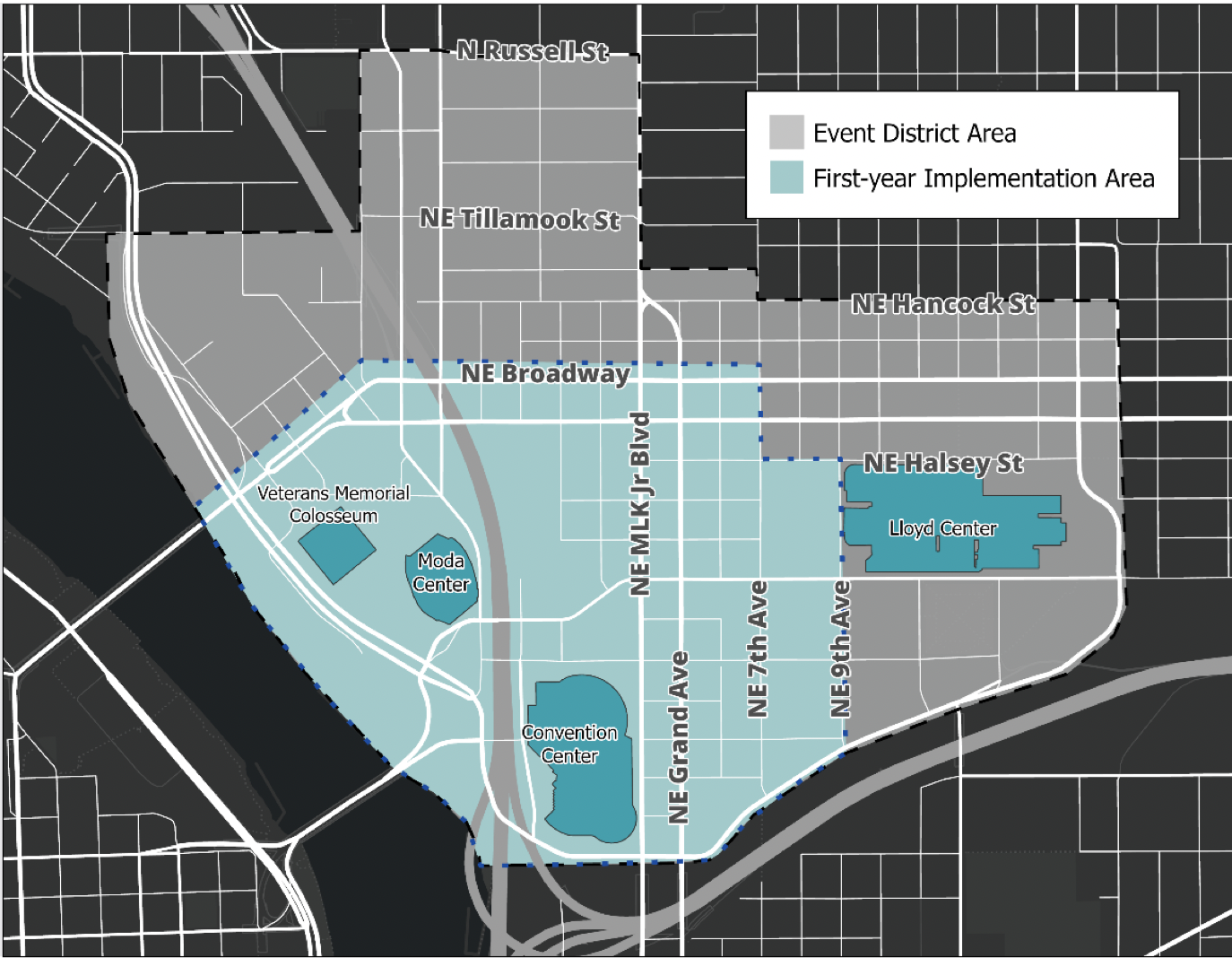
The Lloyd Event District map. Eventually, the whole area outlined will be included in the fee increase – but for now, PBOT will stick to just the area colored blue. (Source: PBOT)
PBOT says this is to “encourage less driving and more use of public transit, biking, and other means of transportation.”
There are many transit options people can use to travel to the Lloyd District and attend a Trail Blazers game at the Moda Center or an event at the Convention Center. The Lloyd is one of the city’s top transit hubs – all MAX light rail lines pass through the area and it’s a hotspot for TriMet buses and the streetcar . Yet people still choose to get to their by car. With a new increase in parking fees, the Portland Bureau of Transportation (PBOT) hopes to change that.
Starting in September, PBOT will implement an event parking area in the Lloyd, raising the price of on-street car parking from $1.20 to $3 an hour during large events with more than 10,000 people in attendance, such as concerts and basketball games. PBOT says this is to “encourage less driving and more use of public transit, biking, and other means of transportation” and “relieve pressure on people who live in the area, reducing traffic, and making it easier for residents and other visitors to find on-street parking.”
The event rate will apply from 8 am to 10 pm during large events that start at 5 pm or earlier and from 5 to 10 pm during large events that start after 5 pm. Right now, parking meters in the Lloyd east of NE Grand Ave only run until 6 pm, including during large events, so people who park on that side of Grand to attend an evening basketball game may be able to park for free. The increased rate will also apply on Sundays when there is an eligible event – right now, meters in the Lloyd don’t run on Sundays at all.
However, the new policy will also change the meter hours on non-event days to end at 6 pm in the entire district, including in the area west of Grand Ave, which currently runs until 10 pm. It will also increase some meter parking windows in the district from 2 hours to 5 hours.
Event district parking has been in place around downtown’s Providence Park since 2011, where it costs $4 an hour to park a car on the street during Portland Timbers and Thorns games. Proponents of the Lloyd District event parking area have been advocating for the same treatment to the area surrounding the Moda and Convention Centers for years, but Portland City Council only agreed to go forward with it this past April.
Local car parking reform advocates say the Lloyd District is particularly egregious for its abundance of car parking, both on and off the street. While this fee increase won’t solve every car parking problem plaguing the area, advocates say this kind of demand management is necessary for pushing people toward alternative modes of transportation.
But some people weren’t thrilled about the parking fee increase. In April, Oregonian editor Brad Schmidt prompted an impassioned Twitter discussion when he tweeted about the event parking district plan, calling it a “money grab.” From Schmidt’s perspective, PBOT should have first tried simply increasing the meter hours and charging normal rates from 6-10 pm and on Sundays before increasing the fee to $3. Others had the opposite opinion and called on PBOT to increase the fee even more.
PBOT is open about using parking revenue to manage the bureau’s budget deficit. In July, parking fees citywide were raised $0.20, with extra revenue devoted to funding a new Transportation Wallet program to increase access to multimodal transportation for low-income Portlanders. The extra revenue generated from parking in the Lloyd District will also go toward this program.
Another point of contention is due to the fact that the fee increase in the Lloyd District will apply to everyone who happens to be using on-street parking during applicable hours, not just the people attending the events. To mitigate some of this concern, PBOT will allow Lloyd Center residents with vehicles to opt-in to a no-citation list with parking enforcement during event days.
Regardless, the new fee increase won’t send people scrambling. The Lloyd District is rife with parking garages and lots: if residents or frequent visitors of the transit-rich, walkable area feel they need to drive a car, they’ll still have a place to put it.
Like UCLA urban planning researcher (and father of the modern parking reform movement) Donald Shoup foretold, the numbers show that pricing on-street parking according to demand – instead of subsidizing it like cities have been doing up until now – can be an effective tool for reducing car dependency. People won’t like it, because they’re used to parking their cars for free or very cheap. But if we want to get people out of their cars and onto transit, bikes and other sustainable modes of transportation, something’s gotta give.
The first event that will activate the event district parking fee increase is the Rose City Comic Convention on September 9th. After that, the rates will be in effect about 90 days a year – you can check out PBOT’s calendar of events that will trigger the fee increase on their project website.
(August. 24, 2022) Help shape the Portland Bureau of Transportation Budget choices! The Portland Bureau of Transportation (PBOT) is currently accepting applications for its Bureau and Budget Advisory Committee (BBAC). The committee advises PBOT Director Chris Warner on the direction of the budget and bureau priorities.
The BBAC application deadline has been extended to September 5, 2022.
The BBAC is a 24-member committee. Members meet monthly and serve a two year term, which may be renewable.
To be eligible for the advisory committee, members must live, play, worship, go to school, work and/or do business in the City of Portland.