Big crowds flocked to carfree streets in Multnomah Village for Sunday Parkways on September 11th, 2023. (Jonathan Maus – BikePortland)
The City of Portland will put on three Sunday Parkways events this year. The Portland Bureau of Transportation announced the dates and location last Friday.
The events will be held in east Portland on May 19th, the Cully neighborhood on June 16th and in southwest on September 22nd. For the uninitiated, Sunday Parkways are open streets events that began in 2008. We were inspired by the Ciclovias in Bogota and were one of the first cities in North America to launch such an ambitious event. That first year we had just one event and it was a massive hit. PBOT expanded it to three Sundays in 2009 and by 2010 we were doing five events per year — including a route in northwest.
PBOT organized five Sunday Parkways events each year through 2019. Then we skipped two years due to the pandemic and returned with just two events in 2022. We’ve had three events per year since.
Finding funding for Sunday Parkways is a perennial issue. PBOT has had to hold donation drives and plead with City Council to keep it funded. Currently, the events are made possible thanks to grants from Kaiser Permanente and other sponsors. The Portland Clean Energy Fund has also provided a lifeline for the program as Sunday Parkways was part of a $112 million injection into PBOT announced back in December (but still not finalized).
Check out more details (via PBOT) about each of this year’s three events below…
East Portland – May 19th
The East Portland 3.3-mile down-and-back route will feature Gateway Discovery Park, Ventura Park, and Lincoln Park. More details here.
Northeast Cully – June 16th
The Northeast Cully 6.2-mile looped route rises significantly as one travels from north to south stopping along the way at Fernhill Park, Kʰunamokwst Park, Wellington Park, and Roseway Parkway. More details here.
Southwest Portland – September 22nd
The Southwest Portland route will feature a 2-mile multi-modal route along with a separate 1.5-mile walking route. Start anywhere on either route and bike, walk, or roll as you explore the four featured stops. More details here.
Here’s to another great Sunday Parkways season! I just wish we could figure out a way to spread the love and have them in more parts of the city more often. A measly 15 hours of carfree streets per year after 16 years of success just doesn’t seem right.
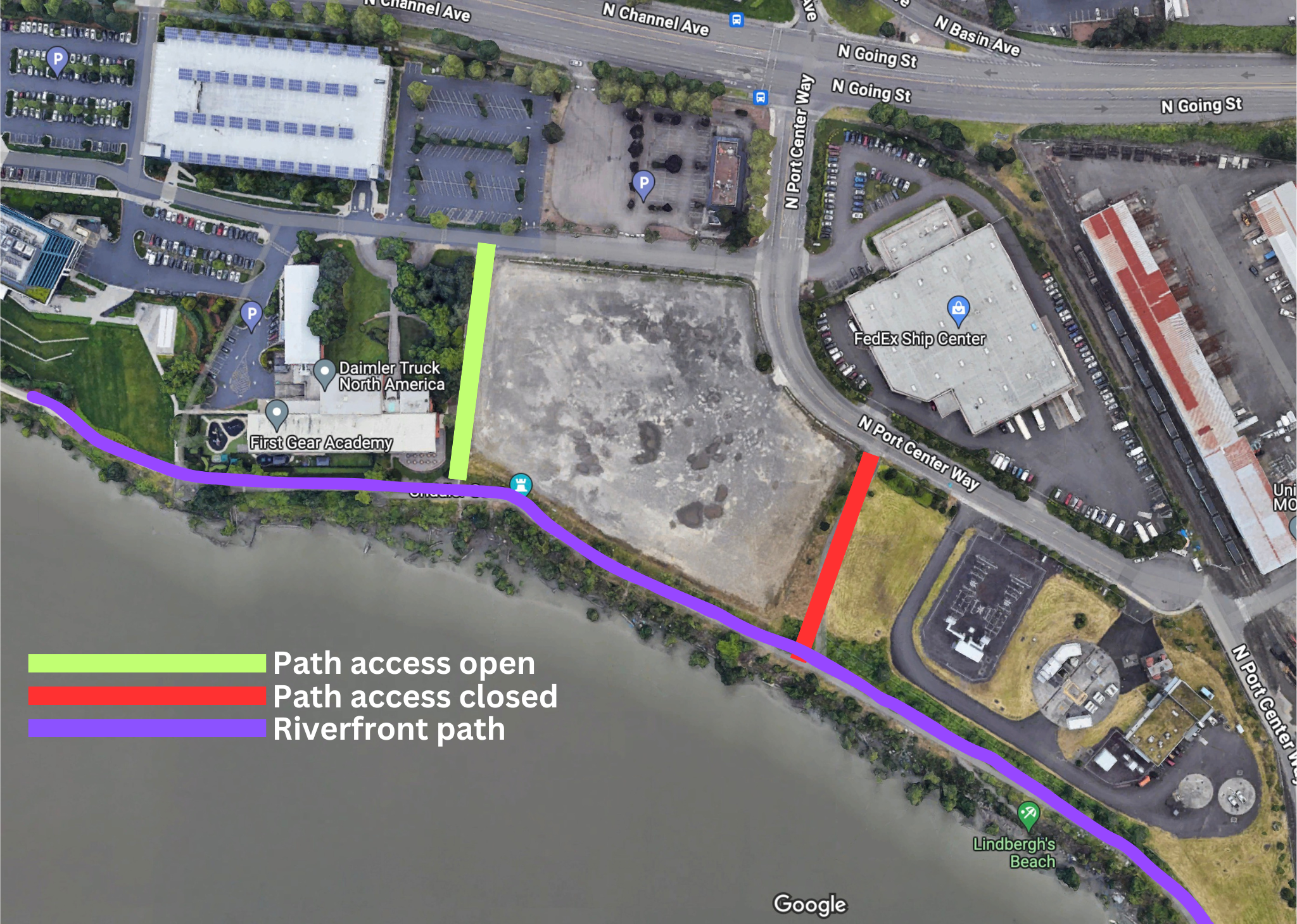
View of the path looking west from N Port Center Way. (Steve – @Intersection911 on X)
People driving cars on what are supposed to be carfree paths for bicycling and walking has become a majorproblem in Portland in recent years. As tents and other temporary housing structures have sprung up on public right-of-ways adjacent to multi-use paths, it has become increasingly common for people who live in the camps to drive cars right up to their front doors. The presence of cars is unexpected for path users and can obstruct people from safely using these areas.
To deal with this tricky issue, government agencies erect barricades to keep the cars out, but those barricades often end up compromising access for law-abiding users of the paths as well. We saw this happen on the Columbia Slough path in 2022 when Portland Parks & Recreation erected large cement Jersey barriers to keep drivers off the path.
Today I confirmed yet another path where public access has been restricted due to concerns about campers and cars: The “Going to the River” path on Swan Island that opened in 2006 and provides a connection to the Willamette Riverfront via N Going Street and Port Center Way.
After coming across a photo shared by @Intersection911 on X earlier today, I contacted Portland Parks & Recreation to inquire about the situation. The photo showed what looked like a complete blockage to the path entrance from Port Center Way just south of Going Street/Channel Ave. This is the path folks take to access Lindbergh’s Beach. It’s a connection to about a mile of continuous, carfree, paved riverfront path between the Union Station Railyards and a boat ramp at the northern end of the Daimler Trucks North America campus. I recommended this route to families in a 2020 post about riding on Swan Island.
Today I learned the Portland Bureau of Environmental Services has jurisdiction over this path. BES Public Information Officer Diane Dulken confirmed that they erected these concrete barriers to prevent automobile access to the path about nine months ago. When they installed the barriers they left room an opening for other users like bike riders, walkers, wheelchair users, and so on. “But an unknown person or persons further blocked the path, as you are pointing out in the photo,” Dulken shared with BikePortland today.
Dulken said BES has no plans to remove the barrier because it is “working to protect the public from illicit driving on the river pathway.” Here’s more from Dulken:
“Safety at this site continues to be our top priority. There is a considerable amount of unsanctioned camping in the area and the site has had a history of people camping along the pathway and beach, and driving illegally and dangerously along the pathway, posing an unacceptable risk to people walking, rolling, and biking. Since the barriers have been placed, that driving has stopped.”
Dulken said the public can access the river and path via another entry point about one-tenth of a mile away. The path is to the northwest of the location in the photo and is located about 400-feet west of Port Center Way along the eastern edge of the Daimler Truck First Gear Academy school (see map graphic above). BES says they don’t own that path and I’m still trying to find out who does. I’ll update this post with that information soon.
Albina Vision Trust Strategic Communications Director JT Flowers (left), along with ODOT Rose Quarter Project Manager Megan Channell and ODOT Urban Mobility Office Director Brendan Finn at an Oregon Transportation Commission meeting in Medford Thursday, March 14th. (Photo via YouTube screenshot)
“The Albina Vision Trust has consistently proven to be both the backbone and the wings behind this project.”
– JT Flowers, Albina Vision Trust
An unlikely partnership between a state agency and a Portland-based nonprofit that could have vast implications for the future of the Rose Quarter took a big step forward last Thursday.
At a meeting of the Oregon Transportation Commission in Medford, Albina Vision Trust and the Oregon Department of Transportation received official approval to develop a work plan for how the future cover over I-5 will be governed. Specifically, the resolution passed unanimously by the five OTC members says that AVT and ODOT now have 60 days to hammer out a plan that determines, “If AVT can have access and rights to the future lease(s) and/or easement(s) for developable air rights on the Project’s highway cover and ownership and development rights for surplus property associated with the Project.” And if current laws and regulations don’t allow AVT to be granted those rights, the plan will determine how to change the law to make it possible.
It’s an unprecedented step that’s likely to put AVT in the driver’s seat of the $450 million investment into lower Albina — the largest federal grant ever received by ODOT — and that sets into motion the largest redevelopment project of its kind in America today.
It’s the latest in a string of eye-popping wins by AVT, a nonprofit that launched in 2017 with a bold idea to recreate the bustling community that once thrived in lower Albina before construction of I-5 and other developments displaced hundreds of Black Portlanders. In February, AVT convinced Portland Public Schools to relocate their headquarters and sell their building to the nonprofit, who plans to build 1,000 units of “working class housing” at the location. And shortly after that move, AVT won $25 million from the Oregon Legislature for the PPS project. The $450 million grant from the US DOT’s Reconnecting Communities and Neighborhoods grant program was coupled with an additional $38 million City of Portland grant to rebuild and redesign NE Broadway and Weidler from 7th to the Willamette River through the Rose Quarter project area.
Now, as you’d expect for an organization with this many accomplishments under their belt, AVT is leaning into their power. AVT’s Strategic Communications Director JT Flowers told members of the OTC Thursday that his group, “Has consistently proven to be both the backbone and the wings behind this project.”
Just five years ago, AVT used that backbone to publicly challenge ODOT because of the agency’s initial reluctance to invest in highway covers that would be robust enough to hold multi-story buildings. That squabble seemed very far in the rear-view mirror Thursday, as Flowers sat next to ODOT Urban Mobility Office Director Brendan Finn and Rose Quarter Project Director Megan Channell at the OTC meeting. The trio beamed as they shared news of the federal grant and shared their work plan proposal with transportation commissioners.
“I think the project is a prime example for how community building and partnership goals are well aligned with transportation infrastructure investment,” said Channell, “and we see the Rose Quarter project as an opportunity to be a national model for how it can be a ‘yes, and’ instead of just an ‘either, or'”
No one at Thursday’s meeting uttered the word “freeway” or mentioned anything about ODOT’s plans to significantly widen I-5 between I-84 and the Fremont Bridge. However, Channell might have been referring to it when she said, “It wasn’t that long ago that we were having different conversations in front of you and we were not in alignment on a project design, nor did we have the project partnerships to move forward. So I feel like we’ve worked very hard to incorporate the perspective of our partners of our community, and believe that we now have the right project for the region and for the moment.”
Does the “right project for the moment” include more freeway lanes that will encourage more driving and all the negative consequences that comes with more vehicle miles traveled?
What happens below the new Albina remains to be seen. For now, AVT is focused on making sure they get to decide what happens on the seven acres above it.
“Together, we can redefine what government-community partnership looks like and set a new national precedent,” Flowers said at the meeting. “One that uses development to heal rather than harm.”
*This post is from Erin Bailie. She writes our New to Portland column. Find previous installments here.
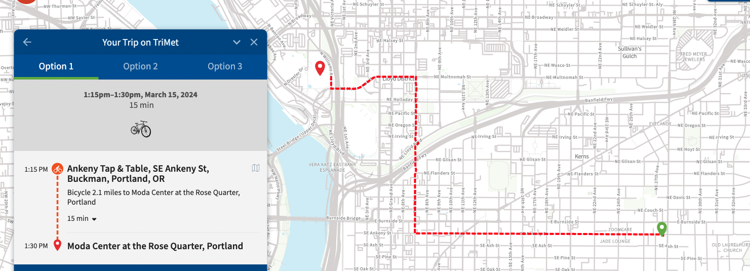
Last week, I went to my first Blazers game. I asked a few folks at Bike Happy Hour for advice on riding to the game and where to lock a bike at Moda Center. Several folks immediately pulled out their phones to show me their favorite routes and parking spots, and I quickly realized that everyone seemed to open a different app to show bicycle navigation around the city.
There’s not just one way to find your way around Portland, as exemplified in the variety of apps folks referenced at Bike Happy Hour. In today’s post, I’ll share a few tools I’ve found helpful.
A few notes on my approach:
For each tool, I mapped the same route (from Bike Happy Hour in Kerns to Moda Center in Rose Quarter) so I could have a steady comparison.
Some of these services offer additional features for a monthly subscription fee, but everything you see here is based off of free versions.
I’ve got a generous data plan on my phone, but I’ve tried to account for how each app works with no data connection.
This blog has heavy overlap with my day job (usability research). I wish I could say ‘I’m sorry if this gets too nerdy’… but I’m not sorry. I love this stuff.
How it works: The Portland Bike Map is a detailed map of bike infrastructure across the city. The map encompasses the entire city, including detailed sections for downtown. It uses color-coded lines to note 10 distinct types of bike infrastructure – from shared roadways to multi-use paths (paved and unpaved!). It even notes “difficult connections” and one-way sections.
Low-data friendly?: Yes, via a physical paper map or by downloading a 3.38MB PDF while connected to Wifi.
Ideal for: Planning your route before you head out the door. The map offers a bird’s eye view of infrastructure options in an area. I like to use the map to plan a leisurely ride and know what alternatives exist for getting to my destination. In fact, I used this map to plan my trip to Powell Butte a few weeks ago.
Not ideal for: On-the-go route-finding. It’s just a map, there are no point-to-point directions. I also find it hard to use on a mobile screen, because I usually need to zoom way out to see my whole route.
(Erin Bailie – BikePortland)
Neighborhood Greenway signs
Cost: free
Format: street signs and on-pavement markings
How it works: Neighborhood Greenways are a network of shared roadways on low-speed, low-traffic streets. Greenways often have protected crossings for major intersections and diverters to stave off vehicle traffic. You’ll know you’re on a Neighborhood Greenway by the orange bicycle fixture on the street sign and the on-street painted sharrow markings. Green signage at intersections with other Greenways helps you navigate to your desired destination.
Low-data friendly?: Yes! No data needed.
Ideal for: Just about everything! I’ve only found one downside, which I’ve mentioned below
Not ideal for: The signs show the next-closest neighborhood. This means that if you’re traveling several miles, you’ll need to know the names of the neighborhoods along the way so you can pick the right direction to go. It’s similar to choosing a direction on the interstate – the sign will say the next-closest destination in any direction. If your destination is farther than that, you’ll have to know which direction to choose. [Or, if you’re looking for a sneaky upside, it’s this: using Neighborhood Greenways exposes you to all the areas in between point A and point B.]
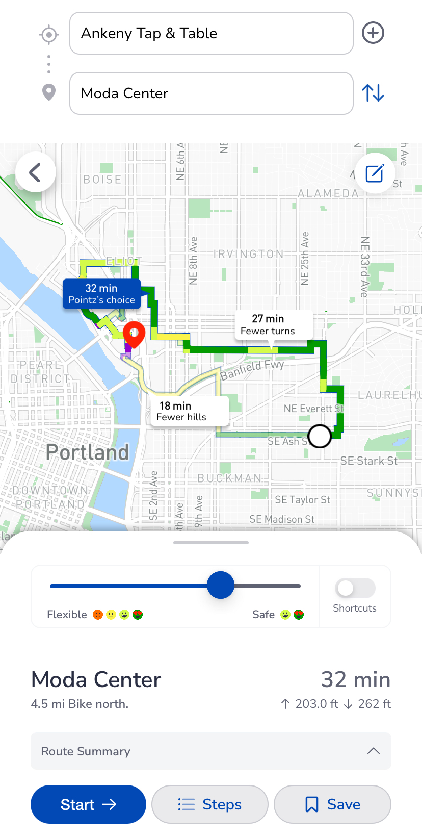
How it works: Pointz is a bicycle mobility app which offers point-to-point routing.
Low-data friendly?: No. Cellular connection needed for routing.
Ideal for: On-the-go navigation, with on-screen or audio turn-by-turn directions. You can toggle your preferences for street safety, avoiding hills, taking shortcuts, etc. to develop the right route for you. I use Pointz when I don’t want to think very much about which way is best to go.
Not ideal for: Folks without a mobile data plan. Pointz does rely on mobile data to compute routing.
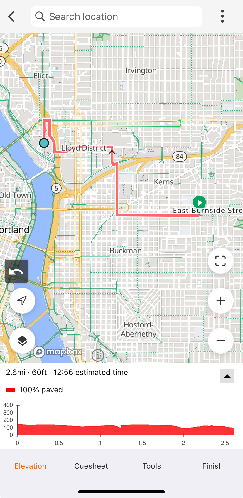
How it works: RideWithGPS is a powerful route planner, and it creates GPS files that you can upload to a bicycle computer (like a Garmin or a Wahoo).
Low-data friendly?: If the route is saved while connected to Wifi, yes.
Ideal for: Planning, drawing, and sharing routes – and discovering routes published by others – to be run on a GPS computer. RideWithGPS has a powerful route planning tool which selects the best route between two selected points. Premium tiers offer heatmaps, which make it easy to see how other cyclists tend to get around in a certain area.
Not ideal for: On-the-fly navigation or mobile-only use. Though RideWithGPS does technically support routing on mobile, I find it really easy to “mis-click” on the wrong thing while trying to scroll around the phone screen. There’s no way to explore alternatives routes if you don’t like the one that’s suggested.
How it works: Google Maps shows maps, businesses, bike infrastructure, and transit all in one app. It can provide turn-by-turn navigation and makes it easy to compare transportation options for a trip.
Ideal for: To be honest, just about everything… until it’s not. Google Maps has the largest breadth of capabilities, and it’s easy to have it be a go-to app for all transportation decisions, especially if you’re comparing multiple transportation modes.
Low-data friendly?: Yes, maps can be saved locally to the phone while connected to Wifi.
Not ideal for: I’ve got two points of frustration with Google Maps – inaccurate bike infrastructure data, and the absolutely bonkers way that they display transit time for public transportation.
Allow me to explain:
Google Maps likes to think areas are a lot more bikeable than they are. Take, for example, SE Belmont Street in the Tabor area. Google Maps shows a dotted green line – indicating a “bicycle friendly road”, usually meaning a Neighborhood Greenway. If you’ve ridden Belmont in this area, you’ll know it’s not a neighborhood greenway, and is in fact a bit of a thoroughfare between Tabor and Montavilla. The wide shoulder is filled with debris and Trimet buses whiz by. “BIcycle friendly”, not so much. For this reason, I’d cross-check with Pointz or the Bike Map whenever possible.
When showing how long a trip will take on transit, Google Maps has a strange habit of showing total time actively riding on transit instead of total trip time. That means if the bus arrives in 5 minutes and the ride is 20 minutes, Google Maps shows the trip (and your arrival time!) as 20 minutes, not 25 minutes. Honestly, this boggles my mind, because Google shows the realtime arrival – if they have the data in their system, why not incorporate it?
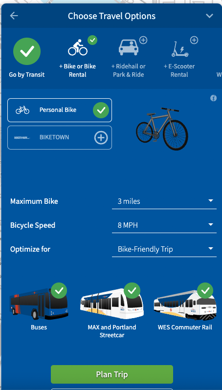
How it works: Enter your starting and ending location, and select what types of transit you would like to use. You can select additional modes such as bicycle or scooter rental, which the planning tool will factor into the overall trip time. Trimet will show you trip options, including price and trip time.
Ideal for: Planning ahead and comparing multi-modal options. The routing is similar to Google Maps, but the ability to select what transportation type you use in addition to Trimet gives much more flexibility than Google Maps. They even offer a bicycle-only routing option.
Low-data friendly?: No, requires internet connection.
Not ideal for: There is no option for turn-by-turn directions that follow your trip in real-time, or automatic re-routing. If you use this tool for on-the-fly navigation, you’ll have to commit the route to memory.
Word of Mouth
Last but not least, word of mouth and community input is a great way to learn how to get around. I’m surprised and grateful for how readily folks offer recommendations. I also enjoy riding on Shift rides which help me see new parts of the city.
Bike Portland readers, which tools do you use regularly to plan your rides around town?
Why are some places more popular for bicycle users than others? How important is infrastructure versus other factors such as proximity to destinations, connectedness to other infrastructure, and so on? What’s parts of town have the most bicycling hot-spots?
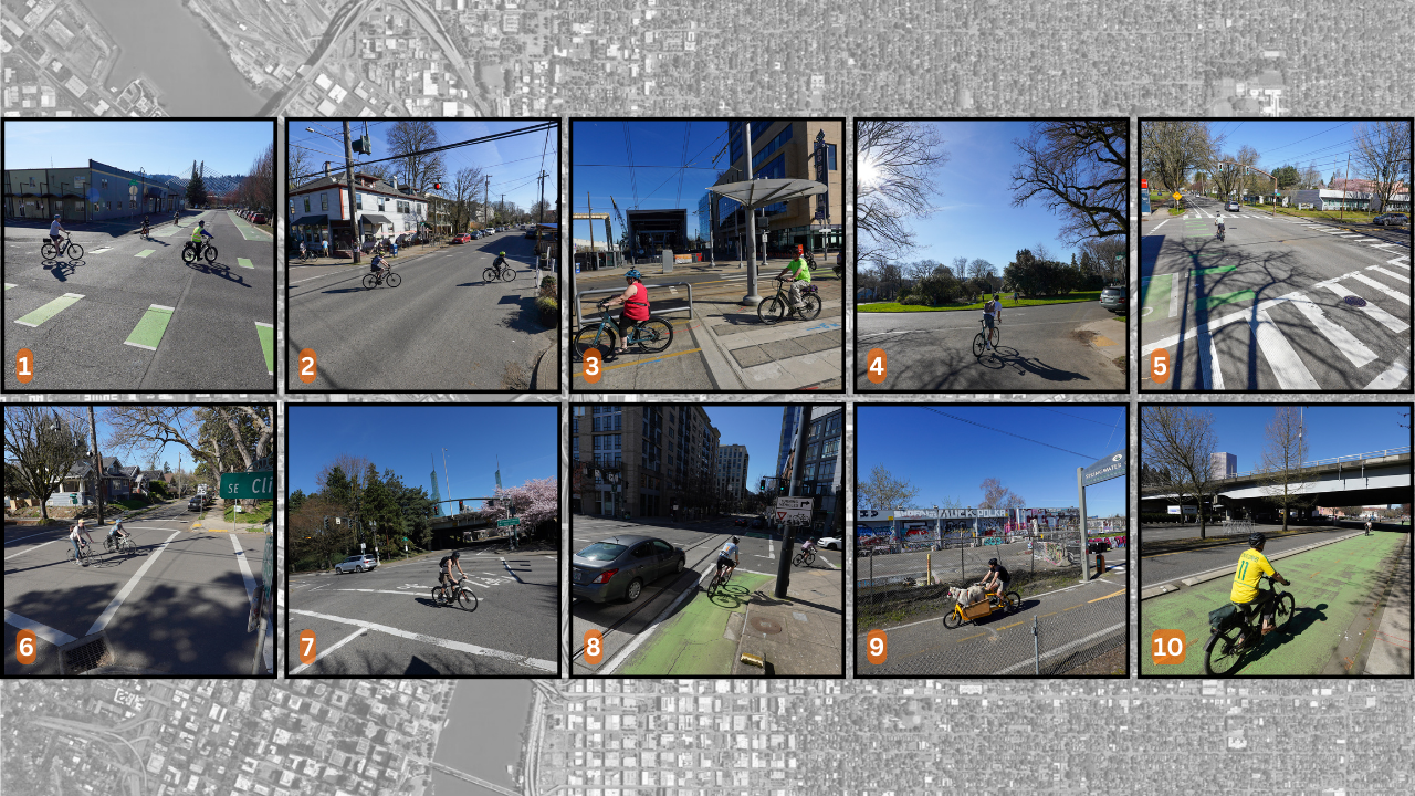
I’ve been poking around the 2023 City of Portland Bicycle Count Report and thought it’d be fun to share the top ten highest traffic locations. So on Sunday I grabbed my 13-year-old son and we visited all 10 locations. I got one of the spots incorrect so I had to roll over there this morning, but otherwise, all the photos (and forthcoming video) were shot on March 17th. These numbers come from a publicly accessible spreadsheet created by the City of Portland.
Check out the top ten below, peruse the area on the Google map, then ask yourself: why do so many people bike here?
10. SW Naito at Morrison Bridge – 2,060 daily riders
Since hardly anyone rides the Morrison these days, this number is definitely more of a reflection on Naito Parkway’s new bikeway than anything else. It’s a bummer the pandemic shifted so many folks out of the central city, because Naito is poised to carry much heavier volumes and the design has held up very well (except for the green color which is very faint in some locations). The spot near the Morrison Bridge is two directions for bike traffic and protected from one narrow travel lane by low curbs. A wide sidewalk gives folks on foot a place to be without getting in the path of bike riders. Given how much we love Better Naito, I’m glad to see it crack into the top 10.
9. SE Springwater Trail (S of Ivon) – 2,115 daily riders
There are three Springwater locations in the top 11. The top-ranked spot is just a block or so north of this location, where the path meets SE Ivon Street. I bet Splendid Cycles (on the corner) is the only bike shop in town with two top ten traffic locations within a few blocks of its shop.
8. NW Lovejoy & 9th – 2,135 daily riders
The only location in northwest, this is right at the bottom of the Lovejoy ramp that connects to the Broadway Bridge. The improvements of nearby greenways on Johnson and Marshall have certainly helped boost this number. This is a key route used by riders throughout the city who are headed to long rides in the West Hills, Highway 30, and beyond. It will be interesting to see how traffic changes once the Broadway Corridor project is complete.
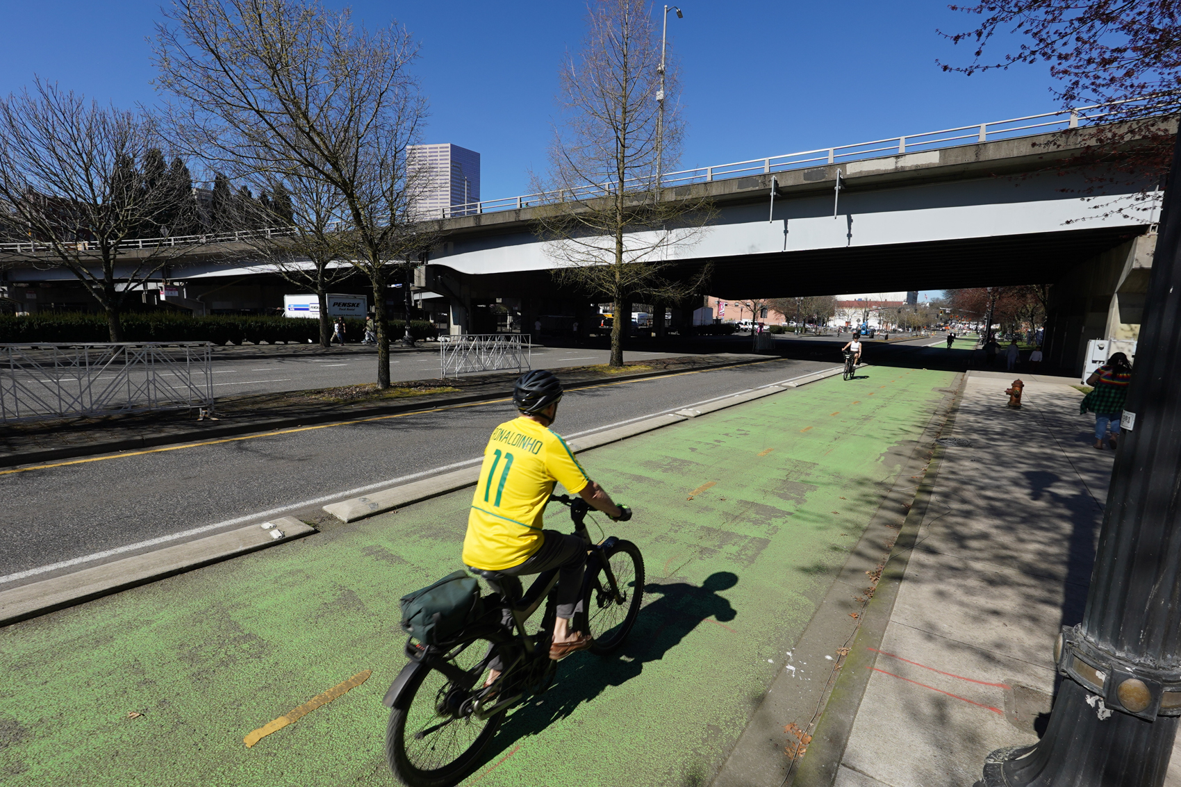
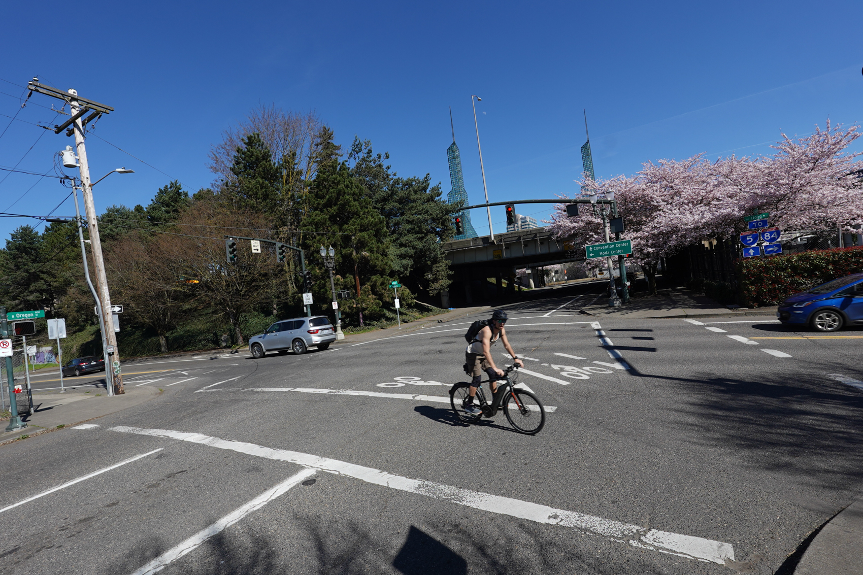
7. N Interstate Ave/NE Lloyd Blvd & NE Oregon St – 2,140 daily riders
Looking east toward the Convention Center across North Interstate from N Oregon.
Peace Park! This location likely has a special place in everyone’s heart. It’s an iconic biking spot. Maybe it’s the cool bike traffic signal (imported from the Netherlands) or how you are straddling the Rose Quarter, the Convention Center, the Steel Bridge, and the Esplanade all at the same time. This is a part of a key connection between downtown and North Williams Ave.
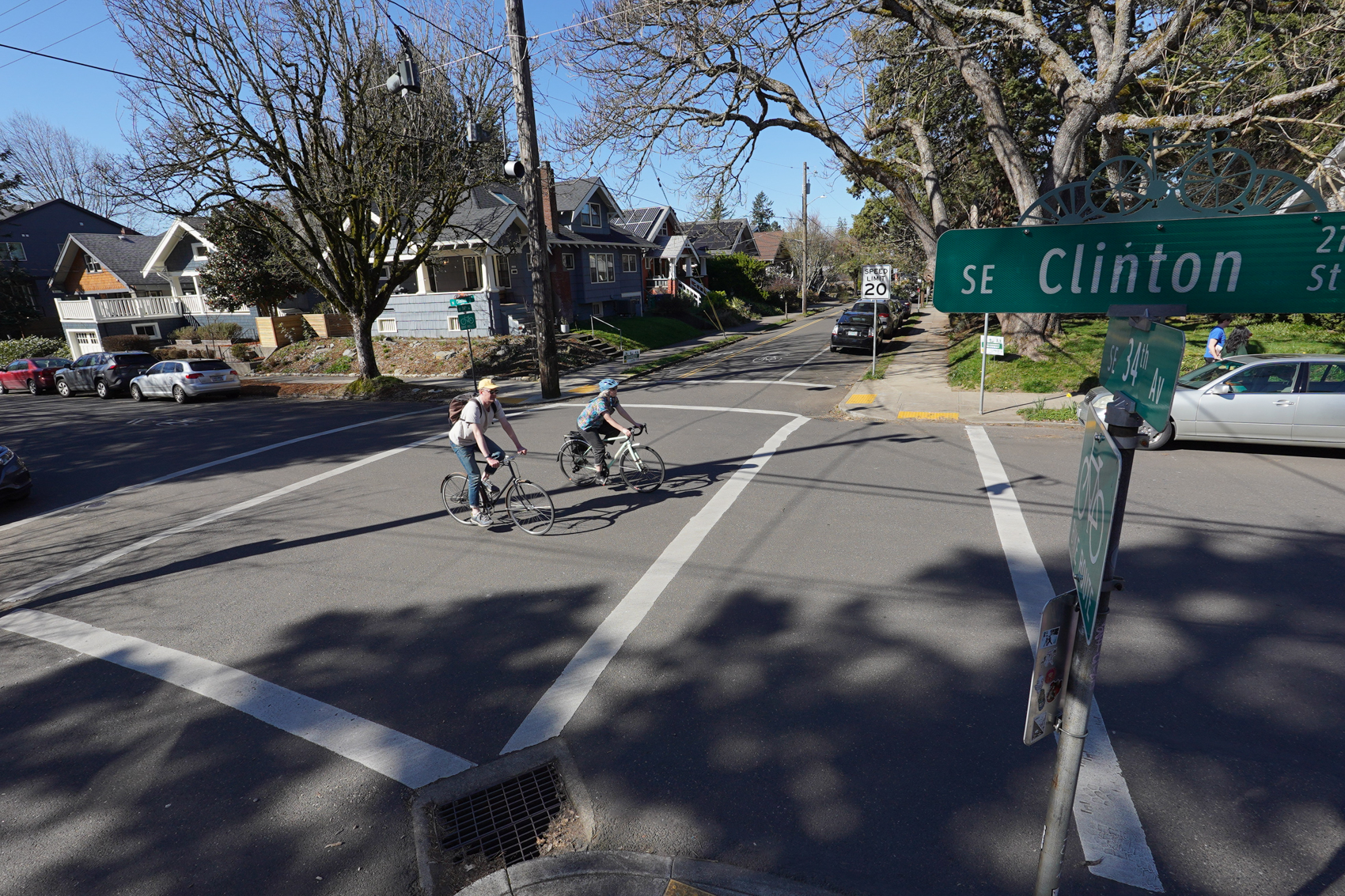
6. SE Clinton & 34th – 2,190 daily riders
Looking north across Clinton from 34th.
This is one of two spots in the top ten for the legendary SE Clinton St. neighborhood greenway. As my son and I biked to this spot he said, completely on his own, “This is a nice neighborhood, dad. It’s so quiet here.” There’s a market on the corner and it’s just one block from lots of cool stuff on SE Division. Recent traffic calming and diversion upgrades have made Clinton even better in recent years. Sit on this corner on a beautiful day and have your faith in Portland restored as bikers of all ages and persuasions roll past calmly.
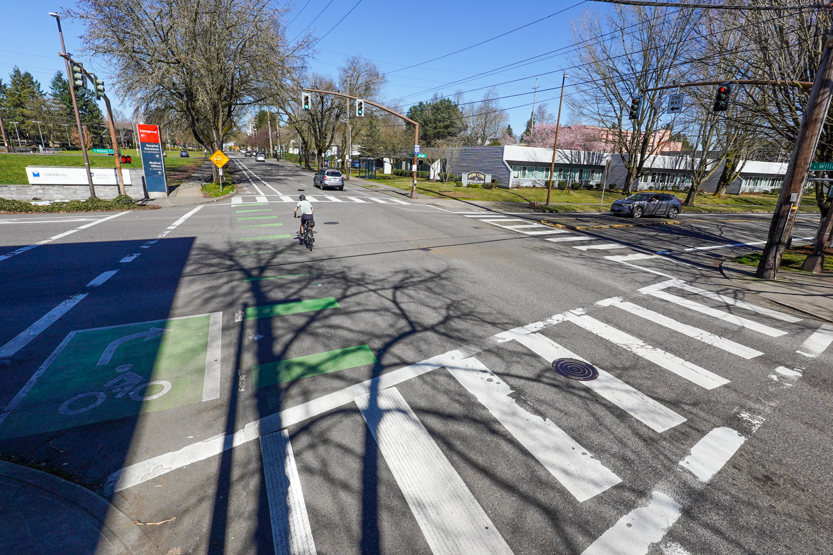
5. N Williams & Russell – 2,245 daily riders
Looking north on Williams from Russell.
Of course Williams is in the top four. I’ve called Williams the best bicycling street in Portland and I still think it deserves that title. It’s a very rare example of a commercial district street with a dedicated bikeway. This is a few blocks south of the busy sections of the street, before too many riders have turned off. This might be the #1 spot in a few years once the Williams & Russell project is built.
4. SE Harrison & Ladd (Circle) – 2,375 daily riders
One of six southeast locations in the top ten, Ladd Circle Park is a highlight of so many great biking memories — from the humble commute to the zany Ladd’s 500. Maybe the most pleasant spot on this entire list. No dedicated bike infrastructure here, just organic traffic calming thanks to shared-lane markings, roundabouts, relatively narrow streets, and locals who know to always expect bike traffic.
3. S Moody & Gibbs – 2,455 daily riders
Looking east toward the river from the Gibbs Street elevator.
Smack dab in the middle of what I always think of as the Portland petri dish of urban planning, this location is eye-popping. Consider this: It’s adjacent to North America’s largest bike valet, Oregon’s largest employer, one of only two aerial tramways in the U.S., and a streetcar line. If you haven’t watched traffic here from the tram or Gibbs Bridge elevator, you are not a true Portland transportation nerd. (Yes I realize it was not ideal to to visit this on a Sunday when it’s pretty dead.)
2. SE Clinton & 26th – 2,625 daily riders
Looking south on 26th at Clinton.
The only reason I don’t give Clinton the title of “best bike street” is because it doesn’t have a dedicated bike lane. But I should probably reconsider that. With two spots on the top ten, Clinton is really showing the power of PBOT’s greenways to attract bikes. This spot at 26th is always bustling and full of life with the iconic Clinton St. Theater, great bars and restaurants, and even a bike-friendly physical therapy office (hi Kevin!).
1. SE Caruthers & 4th – 3,415 daily riders
Looking west on SE Caruthers at SE 4th/Water Ave.
The only spot to break the 3,000 rider barrier this shows the power of the carfree paths on the Esplanade and Springwater to attract riders. Three spots in the top 11 are within two blocks of this spot. I can’t wait for the day when this location isn’t on the top 10 list because we’ve completed the Esplanade-Springwater path connection and folks don’t have to ride on surface streets here. It’s notable that this is #1 without any high-quality bike infrastructure (I realize it’s a gap between two carfree paths). There’s only paint, but it feels safer because it’s such a popular route.
What do you think? Any surprises? What can we do to replicate these conditions in more places?
Note: Below is an excerpt from the counts report about how PBOT got these numbers:
“These summer counts were conducted by 114 volunteers between June 6 and September 28 on either a Tuesday, Wednesday, or Thursday. Volunteers counted during the two-hour peak time for people biking. At most locations that is 4-6 p.m. Locations on one-way roadways going into the City Center were counted during the a.m. peak, from 7-9 a.m. Using a standard traffic engineering rubric, these two-hour peak counts are assumed to account for approximately 20% of all daily bicycle trips at each location, making it possible to extrapolate a full weekday estimate of the number of people biking at each site.”
This week’s comment came in six days ago, in response to our short post about Governor Kotek ditching regional tolling plans. Jonathan’s post didn’t read any tea leaves or probe the deeper reasoning behind the Governor’s decision—abandoning tolling just seemed like another change flying in on the whirlwind.
(Offhand, to me, it seemed one of a piece with her urban growth boundary loosening, part of her push to incentivize a market-based approach to getting more housing built—let ‘em live further away, and don’t charge ‘em for it!)
WRF, who self-describes as a rare “transportation professional … against tolling in our region,” offered up some some hope in the form of alternatives to tolling, and also a critique of it.
I honestly feel like I’ve been in the minority the last few years as a transportation professional being against tolling in our region.
While I’m all in favor of finding ways to reduce trips by SOVs and improving modal options through better infrastructure for transit, biking and walking, I’ve felt that tolling as proposed just incentivized finding alternative routes using the region’s arterials and collectors. For those that need to drive, I would much rather find ways to keep them on our interstate than to have them in the mix with vulnerable users on bikes and on foot.
If the goal is to make driving more expensive, there are better and more equitable ways.
A road-usage charge would be my first choice to replace an aging gas tax. Let’s go back to charging people for how much they drive on whatever road they choose to go on. Let’s tie it to inflation so we don’t end up where we are currently with funding not keeping pace with the costs of construction. Place a road tax on tires (and tie it to inflation as well). The larger the tire, the more the tax. Also, tax studded tires heavily. This will hit vehicles that buy oversized tires and will make EVs pay just the right amount more, since they tend to go through tires more quickly than lighter vehicles.
The revenue from these fees should be split with cities and counties, similar to the gas tax.
I also feel that registration and titling fees need to be reassessed when the 2025 legislature looks into transportation funding. Right now, EVs are charged almost twice as much as a pickup truck for titling and over 2.5 times as much for registration. Let’s quit incentivizing older, less fuel-efficient vehicles while at the same time punishing people that buy EVs. Let’s charge all vehicles the higher rates. Also, keep the road maintenance funds coming from a road-usage charge and make the fees at the DMV pay for the operation of the DMV.
Thank you WRF! There were many good comments in this thread, and WRF’s comment inspired some interesting responses, enjoy reading them all.
Welcome to the week. Even though the sun isn’t supposed to last, the good vibes are unstoppable.
Here’s what our community has been talking about for the past seven days…
Putting out fires: Bike advocates and shop owners are worried that a new law in San Francisco aimed at e-bike battery safety has gone too far and will snuff out more than fires. (The San Francisco Standard)
A smarter warning: A new product called Copilot uses a mix of software and AI to go several steps beyond radar detection and sounds like the most advanced rear camera/light warning system on the market. (Ars Technica)
$100K track bike: The Factor bikes that will be used by the Australian Olympic track cycling team in the upcoming Paris games cost $97,979. (The Guardian)
Police hate competition: The lesson we should learn from the cancelation of automated enforcement camera program in Sacramento is to not let police anywhere near the program. (CBS News)
Why fight for better cities? After a Republican governor’s excellent comments on zoning reform went viral, it sparked a debate in urbanist circles about how far they’re willing to go to embrace someone with a very conservative, right-wing voting and policy history. (Streetsblog USA Opinion)
Bigger car, bigger fees: Another way we could get drivers of massive cars to pay more to use the roads is by hitting them where they park. (The Guardian)
Housing done right: It’s not just a biking boom that makes Paris so wonderful, it’s their focus on affordable, city-owned public housing and the walkable urbanism and “mixed society” the city creates through their role as landlords. This is how you built a great city! (NY Times)
Mature cyclists: Folks in the later stages of their lives are flocking to cycling vacdations because it’s more immersive and fun than sitting behind the wheel of a bus or an RV. (Conde Nast Traveler)
It’s all in your head: Next time you’re on a hard ride or dying up a climb, think about how some smart folks think fatigue is more about how your brain perceives it and not just how your legs and lungs perceive it. (Rouleur)
E-bike library: Buying an electric bikes brings up a lot of questions and even anxiety in some people, so being able to borrow one first via a neighborhood lending library just makes sense. Turns out e-bike libraries are all the rage. Who’s starting one in Portland? (Streetsblog USA)
E-bike incentives: With the hope that some of you out there are working on an e-bike purchase subsidy for Oregon in a future legislative session, here’s how the sausage is being made in California. (Streetsblog Cal)
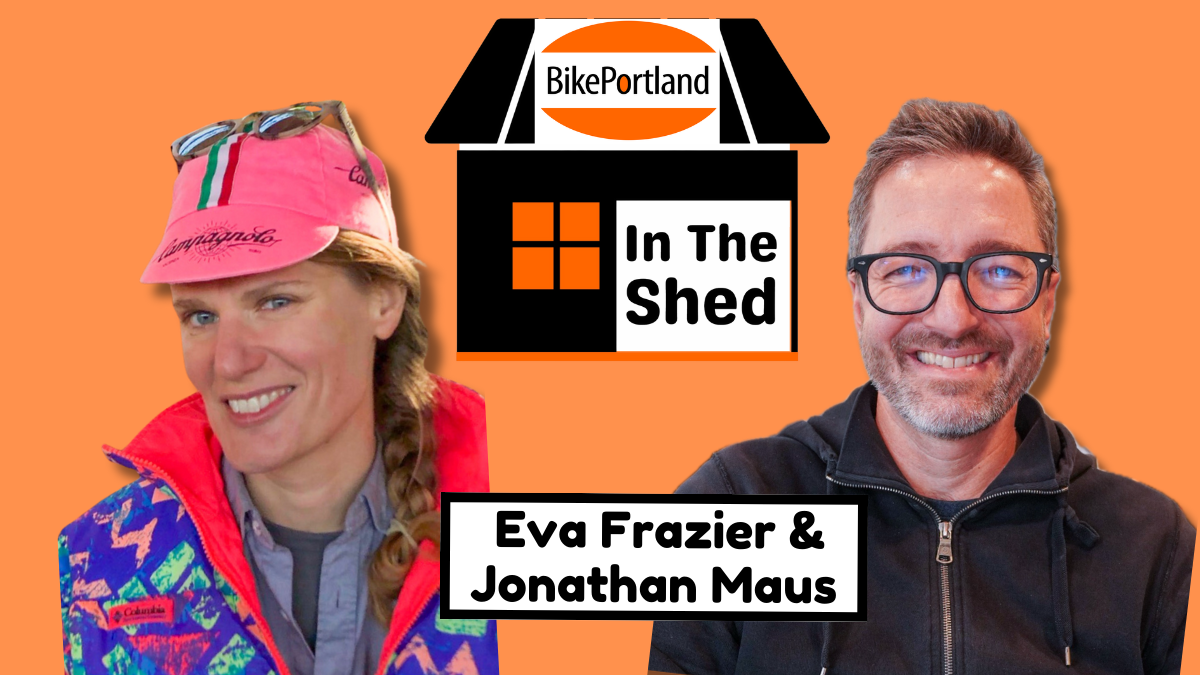
In this episode, she shares a bit about her magical time in the land of small cars, ancient roads, and wine tasting in Tuscany. Get this: Eva walked 98 miles in two weeks! That either sounds like a dream or a nightmare depending on if you have comfortable shoes.
We talk about the latest Portland Bike Count report and I share the top 10 (actually 11) busiest bike intersections in the city. Eva shares her dream of operating bicycle vending machines on high traffic corridors, and then things devolved from there.
We touched on tolling, freight lobbyists, my theory on what will happen with the I-5 Rose Quarter project, and much more.
Thanks to Brock Dittus of Sprocket Podcast fame for our fantastic theme music. Listen in the player above or wherever you get your podcasts. Thanks for listening!
What if you and your fellow Portlanders had a direct impact on what city funds were spent on? I’m not talking about lobbying politicians and then hoping they do what you want; I’m talking about true direct democracy where you come up with a project idea, work with your peers to flesh it out, get support for it from a vote of the people, then get it funded and implemented.
That’s the promise of participatory budgeting (PB), and a local effort to have it become an official part of the city of Portland’s budget process launched on Thursday.
The Community Budgeting for All campaign is gathering signatures to get PB on the ballot in November. The effort is being led by nonprofits Next Up, East County Rising, and Participatory Budgeting Oregon and their campaign wants to put at least 2% of the city’s General Fund budget — an estimated $15.6 million — into the hands of the people. Yesterday I interviewed one of PB Oregon’s staffers, Maria Sipin, to learn more about the initiative and how PB is different than the way we currently do things. (Watch our conversation below.)
As a former transportation planner with the Oregon Department of Transportation, Sipin saw first-hand that what gets funded often doesn’t reflect what people on the ground actually want and need. “What I personally like about it is in a PB process, you don’t end up with highway projects… people put forward projects in this process that have never been funded in the past, but should have. It addresses community safety, basic needs and all kinds of things that might have been overlooked.”
Don’t people already influence budgets by voting for elected officials and taking part in the budget process?
“Electing people is a form of democracy, but it’s not direct democracy. We can ask our elected officials to take action, but it doesn’t really require them to do something within a given amount of time,” Sipin answered. “It’s the legally binding aspect of PB that really can demonstrate people’s power and government’s ability to implement something that the people want.”
Asked for a specific example of a project like that, Sipin described school streets.
“[A type of project] that comes up a whole lot in spaces I’m in is keeping cars from approaching the school at a close distance and being able to save local streets for walking and biking safely and not dealing with the commotion of drop-offs and pick-ups of SUVs confronting their children at forehead height,” Sipin said. “If there was an appetite to create that type of street environment and PBOT said it could be feasible, you would work with PBOT, community orgs, parents, schools — to design a proposal.”
One thing I learned from talking with Sipin is that a big element of PB is community empowerment — not just in the form of controlling funds, but giving people the knowledge and experience about what things cost and how to develop high-quality funding proposals. I’ve found through doing BikePortland all these years that once you inform and empower people, amazing things can happen. And it’s a two-way street: regular folks like you and I would be engaged at a deeper level and city staff would learn what we want in an unfiltered way. But unlike a typical budget process where city staff and elected officials hold all the power, in PB, the scale of power tilts toward the people.
Below is a description of the process taken from the campaign website at CommunityBudgetingforAll.com, followed by the initiative language filed with the city auditor’s office:
Instead of typical backroom deals and ignored public testimony, residents would collaborate in the community and with City staff to develop and fund solutions. Portlanders would have a recurring avenue to bring forward problems, build skills, and relationships, and craft shared goals and solutions in partnership with City staff.
Official language of the initiative as recorded by Portland City Auditor, 11/21/23.
If it sounds like there’d be too many cooks in the kitchen, Sipin said a key part of a good PB process is one where the structure of decision-making is clearly laid out at the start. Professional facilitators are brought in to make sure things run smoothly, and a committee of delegates and city staff vet projects to make sure they’re feasible.
Another interesting wrinkle is that all Portlanders would be eligible to vote on projects — not just eligible voters. That means about 200,000 Portlanders — who aren’t currently on voting rolls — could have a say in how funds are spent.
Sipin says once people learn and participate in the process, PB becomes a tool that builds real community power. “PB is meant to be consistent and not a one time thing. Being able to witness this and be part of it, it’s really powerful,” she said. “And this is why some cities, once they put PB into place, it just becomes part of their democracy from here on out.”
Portland would become one of the last major west coast cities to institute a PB process, as the idea has caught on in many other cities around the U.S. and the globe (a portion of the European Union budget is allocated using PB principles). If this campaign can gather about 41,000 signatures by July and if voters support the ballot measure in November, the program would begin in the 2026-2027 fiscal year and the process would begin no later than July 2027.
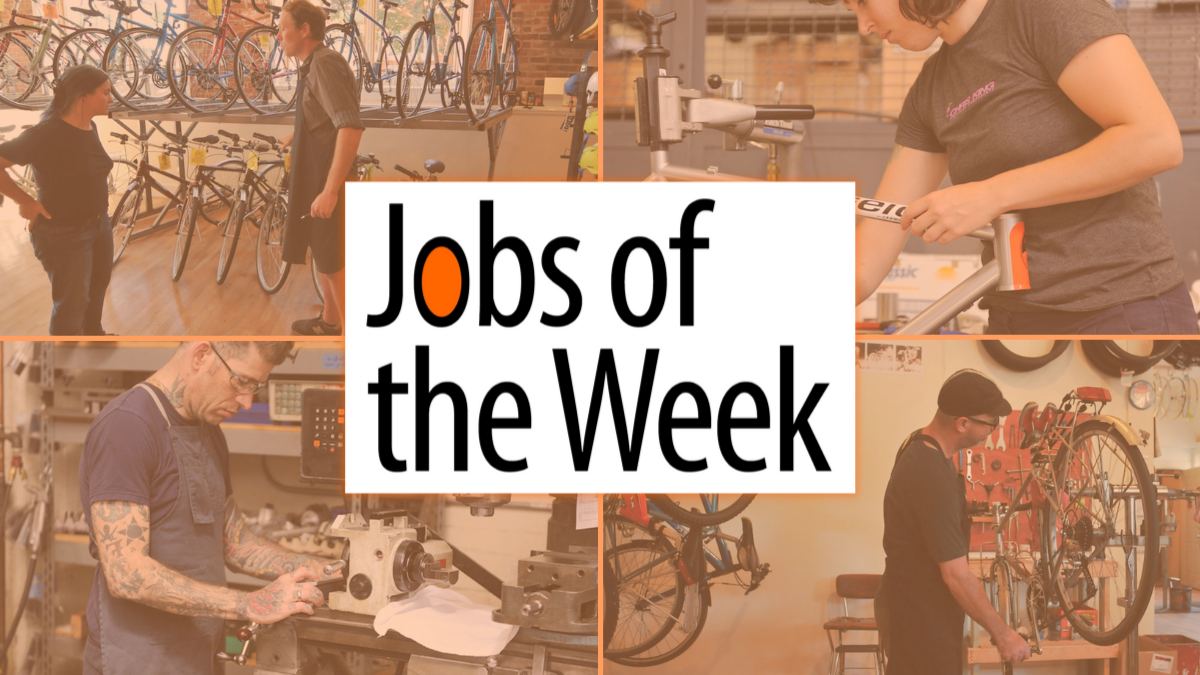
Need a job? Want a better job? Just looking for a change? You are in the right place. Don’t miss these recent job announcements. Remember, you can always stay abreast of jobs as soon as they get listed by signing up for email updates.
These are paid listings. And they work! We’ve helped hundreds of people find great jobs and great staff members. If you’d like to post a job on the Portland region’s most popular bike and transportation news platform, you can purchase a listing online for just $100. Learn more at our Job Listings page.
Where will the paths take you this weekend? (Jonathan Maus/BikePortland)
Sun! You want it. We got it.
You also want fun things to do. We got those too…
Friday, March 15th
Climate Curious Happy Hour – 5:30 to 7:30 pm at Upright Brewing (N) Talk about the big redevelopment of the Lloyd Center with folks in-the-know, with a focus on making sure it makes people and the planet healthier. Panel and Q&A hosted by EcoLloyd. More info here.
Saturday, March 16th
Beaverton Farmers Market Ride – 9:30 am at Tigard Public Library (West Side) A family-friendly ride where I can guarantee a kiddo or two and a 7-mile route led by one of the best people you’ll ever meet. And it’s between a library and a farmers market. It simply doesn’t get better than this! More info here.
Gaza Sunbirds Solidarity Ride – 12:00 noon at Grant Park (NE) Roll out at 1:00 but come early for crafts and hangs to show support for Palestinians struggling for survival. You’ll get plugged into local activist groups. More info here.
Last Day of the Beer Ride – 1:00 pm at Earthlab Libations (SE) Beer lovers unite! This is a last call for “Tour de Brew” and Earthlab has invited Threshold Brewing and Upright Brewing as special guests. Fun ride with unique beers, brewery tour, followed by food from Taco Gang and bike movie. More info here.
Die Hard Romance Ride – 7:00 pm at Laurelhurst Park (NE) The 80s, the music, the masculinity! If you love 80s action movies, come out and have some fun with friendly folks. More info here.
Sunday, March 17th
The Goat Ride – 4:00 pm at Irving Park (NE) It’s a rite of spring to see early blossoms, murders of crows, and our furry friends with four stomachs. This ride is sure to put you in touch with Portland’s wild beauty in its many forms. More info here.
Volcano Loop – 10:00 am at Sellwood Park (SE) What better way to spend St. Patrick’s day then with a ride up and over a volcano! Joint PBC experienced ride leaders for a roll to Mt. Tabor. More info here.
— Don’t see an event? Please tell us about what’s going on in your neighborhood by filling out our contact form, or just email me at maus.jonathan@gmail.com if it’s easier.
Last week Jonathan texted me that he “would really love to see more women using our comments section.”
Little did he know that men and women communicating is something I, for decades, have spent a lot of time thinking about. It probably started with that 1981 Gloria Steinem piece,Men and Women Talking, and continued with the excellent 1990 book by linguist Deborah Tannen, You Just Don’t Understand: Women and Men in Conversation.
It’s a fascinating topic to me. The wrinkle of internet message boards is that most people comment anonymously, so you don’t know their sex. The structure of a Zoom call changes things too, profoundly, especially in terms of interruption.
My short answer to Jonathan was that more women than he thinks do already comment to BikePortland. Women, like men, can and do pick anonymous, gender-neutral user names. The deeper question for me is, why do we assume that everyone is a man?
And I mean the “we.” Just a couple days ago, an occasional commenter posted on one of our stories. “Oh good, so-and-so posted, I like his comments,” thought I. Meanwhile, I had also just received an email from this person in my home email account—nothing to do with BikePortland. I know this person, she is a woman! But it took me a day before I realized the woman in my email box was the same person in the BikePortland comments, despite the fact that her gender-neutral username was practically the same.
How does this happen?
I think many people expect a female commenter to fit into a certain voice, or trope. If you don’t fit into that, the assumption is that you are a man. The molds are “I as a woman experienced xyz;” the face of the cause/disease; the victim; the newbie in need of advice.
In the case of BikePortland, the email address that commenters sign in with identifies some people as women despite their gender-neutral, outward-facing identity. We’ve featured comments from women as Comment of the Week. Did you notice?
It’s still true, though, that BikePortland gets many more comments from men than women. But why assume that is something that needs to be fixed? Why is the male behavior considered the norm? We have five to ten commenters (all men I’m pretty sure) who write a lot, maybe even more than I do. Read them or not, agree with them or not, I appreciate that several of them write link-rich posts which can be informative. I think of them as BikePortland’s Greek chorus—a chorus which doesn’t sing together or agree with each other, but there they are.
So some percentage of men think the world needs to hear from them a lot. Fewer women are like that. (Did you know that hens can crow? Great big cock-a-doodle-dos as good as a rooster? I nearly fell off my tree stump when I heard that come out of a non-aggressive hen who apparently needed to establish dominance over a new bird I had just introduced into the flock.)
Anecdotally, my perception is that most of the women who comment on BikePortland do it precisely, when there is something they specifically can add to the discussion. Comments from women tend to be few, focused and on-topic.
I agree with Jonathan, though, it would be nice if we had more comments from women.