
(Photos by Jonathan Maus/BikePortland)
With so many people hopping on bikes these days, there’s a growing demand for fun and safe places to ride them. This is the first of a series of mini-guides that will introduce (or re-introduce) you to some of Portland’s best cycling destinations.
Swan Island. Sounds dreamy doesn’t it? Almost tropical. This little patch of land just two miles (as a crow flies) from the trendy shops on Northwest 23rd Avenue, is a study in contrasts: Beautiful natural sights next to behemoth industrial buildings; quiet, carfree bike paths next to loud highways full of huge trucks.
But don’t let that scare you! While Swan Island is woefully disconnected from our cycling route network and will never reach its potential until we build more safe cycling infrastructure, I still recommend putting it on your ride rotation — even if you have young kids in tow.
Read on for our bike-centric mini-guide to Swan Island.
What it is

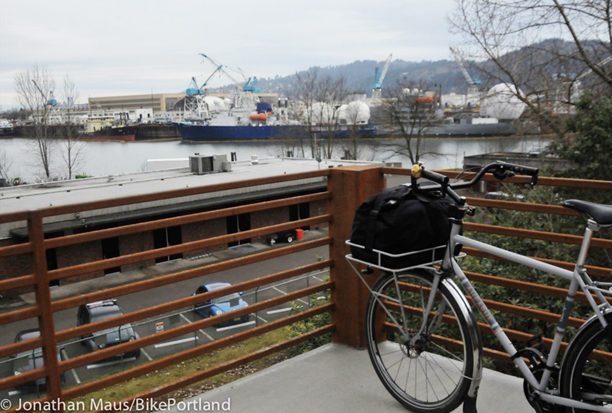
Swan Island is part of the Overlook Neighborhood and sits along the Willamette River about 1.5 miles north of the Fremont Bridge. It was connected to the east bank of the river in the 1920s and was Portland’s first airport. Fun fact: Aviation legend Charles Lindbergh spoke at the airport’s opening and the main beach is named after him. Post-airport, Swan Island was converted into shipbuilding yards in the 1940s and has been a major hub of industrial businesses ever since. Among them are the national headquarters of Daimler Trucks North America and Vigor Industrial, whose employees use a fleet of cool cruisers and work bikes to get around their sprawling campus.
Swan Island used to be home to one of the region’s Transportation Management Associations (TMA), a state-sanctioned nonprofit tasked with boosting biking, walking and transit. Similar to TMAs in Lloyd and Washington County it had dedicated staff that advocated for safer infrastructure. Unfortunately funding dried up in 2015 or so and it’s no longer in service.
Swan Island could play a key role in the future North Portland Greenway path that’s been in development since 2006. Once completed the path will connect the Eastbank Esplanade to Cathedral Park in St. Johns along the Willamette River.
Advertisement
Where it is and how to get there
(Our recommended route to the path along Lindbergh’s Beach on Swan Island.)
If you look at a Google map of Portland and turn on the “Bicycling” layer you’ll see a tantalizing strip of dark green lines that denote “trails” along Swan Island’s southern shore. That path (I prefer the word “path” over “trail”) affords beautiful views of the downtown skyline, Forest Park and the river.
Unfortunately Swan Island is completely cut off from the rest of our cycling network. It’s an island on an island.
The other big problem: North Going Street.

You probably know Going Street as the dreamy neighborhood greenway that runs through the Alberta and Cully neighborhoods. This is not that Going. Between I-5 and Swan Island, Going is a no-going zone for bike riders. It’s five wide lanes full of big trucks and fast drivers. Before you even think of exploring Swan Island you need to open up a map and know what you’re dealing with (it pains me to have to write that).
Swan Island has three access points, and only two of them are actually legit and legal.
From the north, you can get down there from Willamette Boulevard near University of Portland via the Waud Bluff Trail. Opened in 2013, this path isn’t much to get excited about from a cycling perspective. Yes it provides access to Swan Island, but it does so with a steep path and a big flight of stairs that you have to walk your bike down. That makes it very tough and/or unusable for people with disabilities and people with cargo bikes or trailers.

The Waud Bluff Trail dumps you onto North Basin Avenue which has no bike lane. From the end of the path you need to ride 1.5 miles south to the intersection with Going. Cross over onto Port Center Way and just past the McDonald’s you’ll find the entrance to the riverfront path on your right.
Our recommended route to Swan Island (see map above) is via the wide sidewalk along Going Street. You can get on this sidewalk from Interstate Avenue or via the North Concord neighborhood greenway. If coming from Concord, it’s only accessible on the north side of Going and you have to find the hidden little break in the soundwall just beyond the ramp up to the overpass.

Once on the sidewalk, your first challenge is to cross the ramp to North Greeley Avenue. Once safely across that, your next mission is to get across the slip-lane to Basin Avenue and use the signals to cross Going and head south on Port Center Way. Just past the McDonald’s you’ll find the entrance to the riverfront path on your right.

Then there’s the fabled “Cement Road” which offers access to Swan Island from the south. This road is patrolled and owned the railroads and Ash Grove Cement and is technically off-limits. However, many brave souls feel the sometimes harsh treatment of private security guards and rail tracks is worth it. There have been off-and-on talks over the years to formalize and improve public access on this road but it hasn’t happened yet.
Of these three options I prefer Going Street. Keep in mind that Swan Island is pretty quiet and dead on the weekends, so traffic hazards are greatly reduced.
Advertisement
You made it!
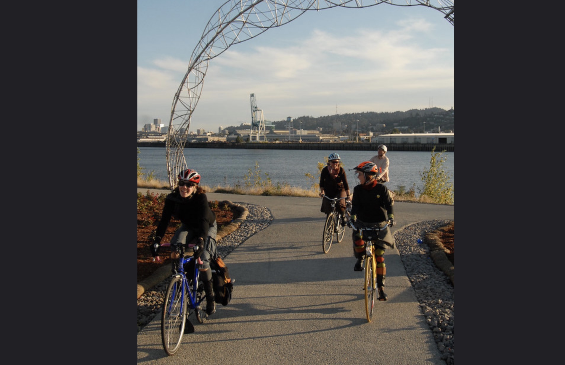

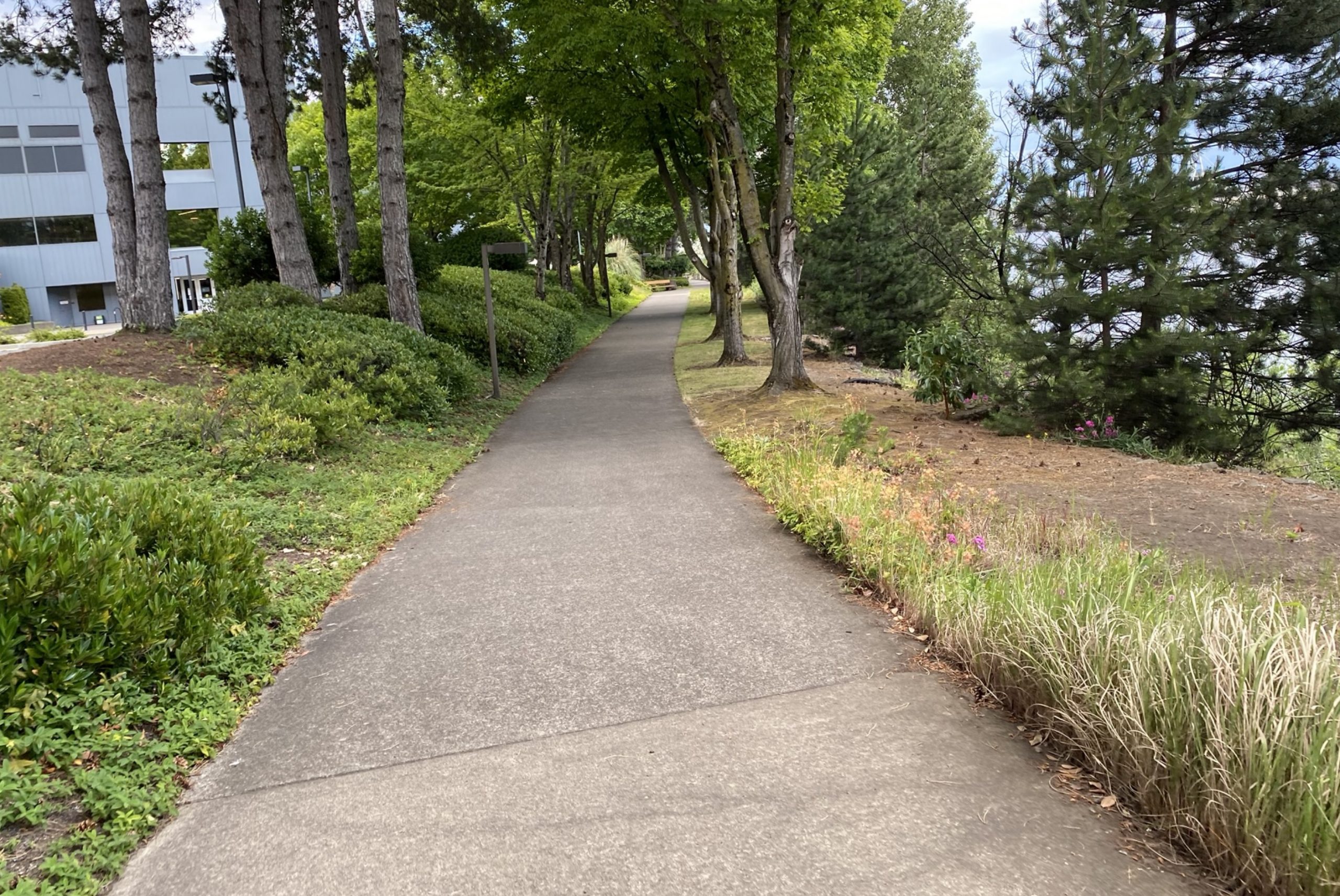
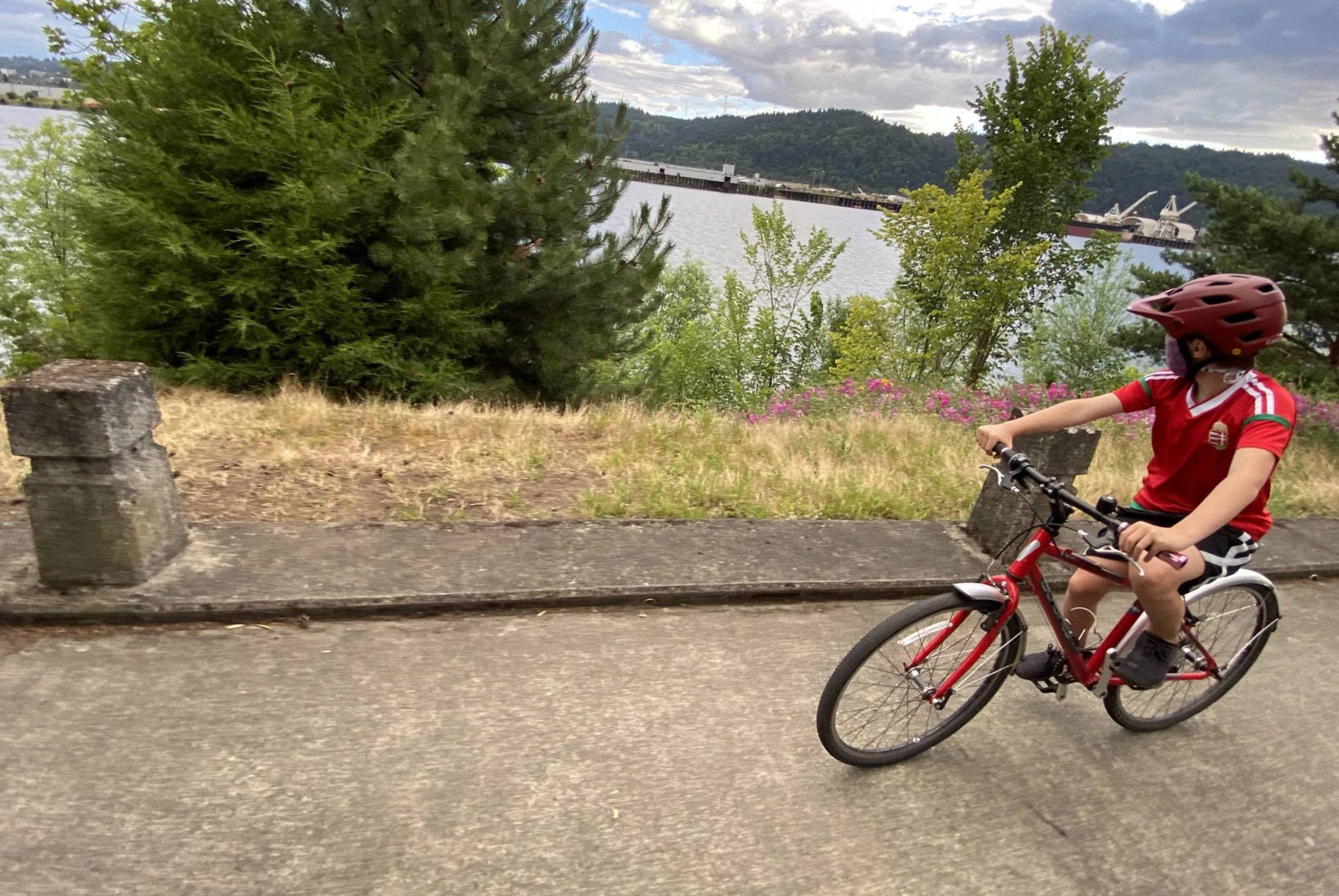
Once you get on the path, it’s quite nice. From end-to-end it’s about a mile long. For most of its length you’re right along a beautiful beach full of driftwood and nooks to explore. The northern end is right on the Daimler campus and there are several places to stop and have a picnic or just hang out and appreciate the trees and quiet.
Our friend Becky Jo took her kids there recently and posted about it on the Forums: “The beach is similar to Cathedral Park or Pier Park beach… fishy, a little trashy, industrial views of Port of Portland to Gunderson Marine, but we caught a skink and saw a dragonfly emerge from juvenile to adult, and there’s some real rabbits complete with fake coyote on the Daimler lawn.”
I was just down there a few weekends ago with my nine-year-old and we also had fun climbing on logs, exploring the beach, and taking our time on the path. We saw a few people living in beachfront tent homes, but they just kept to themselves and didn’t mind us hanging out nearby. If you head down there, see if you can spot the three coyotes that live on the Daimler campus.
If you have tips to share about biking to/on Swan Island, please share them in the comments. And stay tuned for more guides to local biking destinations.
View our recommended route to Swan Island via Ride With GPS.
— Jonathan Maus: (503) 706-8804, @jonathan_maus on Twitter and jonathan@bikeportland.org
— Get our headlines delivered to your inbox.
— Support this independent community media outlet with a one-time contribution or monthly subscription.
")


Thanks for reading.
BikePortland has served this community with independent community journalism since 2005. We rely on subscriptions from readers like you to survive. Your financial support is vital in keeping this valuable resource alive and well.
Please subscribe today to strengthen and expand our work.
Thanks for this great guide. But the part that made me sad was looking at the related articles along the bottom of the page and seeing this title and date.
Mayor Hales in Union Pacific/Cement Road access talks: “Going very well”
May 24, 2013
Yeah right? Hales was good at talking. It was the doing he had trouble with.
And I just learned that the Swan Island TMA closed! (Ahhhhgggg….It was such the model.)
Ah, my old stomping grounds! In Mr. Hales defense, he did convene a meeting with UPRR…including a VP from Omaha. Earl B. was there along with a rep from Daimler. The railroad agreed to allow a study of an optional route that would have taken out their existing bypass rail line along Greeley. The price tag, $25M, even scared us at npGreenway!
The Ash Grove Cement Road is there and is used by bike commuters to Swan Island. The most risky aspect is the 5 poor-angle rail crossings, not the RR police; if you are stopped, just say “Sorry Officer, I didn’t see the No Trespassing sign!” It is very small! Access it from Tillamook and N. River Street. Its all paved.
re Waud Bluff Trail. When I proposed it almost 20 years ago, the cost was estimated to be $250K; final price on completion in 2013 was almost $3M! So no, we did not get everything we wanted, but its a hell of lot better and safer than then old abandoned service road.
With apologies to the less abled among us, most bikers need an occasional upper body effort, and the stairs do have bike troughs or rails.
Thanks for highlighting one of Portland’s secrets. Learn more at http://www.npGreenway.org
Thanks for this post showing folks how to reach and ride the Swan Island section of the npGreenway Trail. The more riders, walkers, runners and other human-powered users of the trail, the more interest generated and the more energy for the vision of creating an off-road trail reaching all the way from the East Esplanade (Steel Bridge) to Kelley Point Park. Portland deserves this world class off road trail. Presently, road riders can reach this section of the trail, as outlined in the article, via N. Going or Waud Bluff but families may want to drive with bikes on car racks to enjoy the gorgeous section behind Daimler’s world headquarters with wide riding space and amazing views of downtown. It’s worth the trip!!
To learn more about the ongoing work to create the npGreenway Trail, check out this link: npgreenway.org.
+1 for the Hungary shirt.
My grandma was 100% Hungarian. I grew up with a lot of goulash for dinner.
I have cycled for the past 15+ years to Swan Island. Before the Waud Bluff trail was built, I used to access the island by taking the ramp from Greeley down to the sidewalk on Going. And I used to leave the island by taking Going up the hill (really hairy!) and then the on-ramp to Greeley (super-hairy!). But PBOT has now removed that option, so I now get to Swan Island via the Waud Bluff trail and leave the same way.
Cycling on Swan Island is pretty terrible – I usually take the right lane and put my head down and pedal as fast as I can. You have to take the lane b/c there are deep potholes next to the curb, every 20-30 feet, which will puncture your bike’s tires if you hit them just right. The sidewalks are rideable in some places but they disappear regularly.
When I pull my trailer, the RR overcrossing from Waud Bluff trail is a pain – requires two trips (one for bike and one for trailer). But if you are going to the north end of Swan Island, it’s the way to go b/c the cycling on the island itself is so unpleasant – especially at 3pm! Guys getting off their shifts are quite impatient to go 70+ mph down Greeley so they can sit in traffic on I-5.
I don’t know enough about the greenway project, but if it would allow for off-road cycling across Swan Island, I’m all for it. I’m interested in using my bike for transportation to, within, and from Swan Island; I’m less interested in using the trails for recreation.
I thought legal access to Cement Rd. was a dead cause after NPGreenway supported the Greeley routing that is in progress. Is there reason to think otherwise?
npGreenway supports the safety improvements that PBOT is making on N Greeley BUT N Greeley, a truck route, is not The North Portland Willamette Greenway Trail. The npGreenway board still supports a trail closer to the river.
There is a fourth (and best IMO) way of getting to SI. I’m not sure about the legality but, the fourth option is paralleling the train tracks that head north-south below the waud bluff bridge. In your photo looking down the stairs from the bridge, you can see the tracks and “trail” off to the left of the fence. This route is very rough but passable/fun for a CX or MTB. If you’re riding south, you can start at Cathedral Park, ride past the lower UP fields, and eventually get onto SI. This connects to Basin which is a scary road to ride on with speeding UPS truck and others but there is a sidewalk on the east side of the street. Just be careful for all the driveways.
my partner discovered there is a strava segment for that railway “path” that has some funny name, and we even ran into another cyclist riding (walking :)) there when we made our way down it the other week. She was on a gravel bike and I was on 28mm road tires and we still managed to ride most of it though the gravel is chunk-ay!
Josh,
What’s going on on Greeley as nothing to do with the Willamette Greenway Trail. Its a PBOT safety project, not a Greenway Trail project.
npGreenway did agree to back off on promoting the Ash Grove Cement Road in exchange for BPOT gaining access to the Albina Yard to study a trail option that ran on the WEST side of Greeley, partially on RR property. The cost of a new bridge over 8 RR tracks…no room on the existing Going Street viaduct…as well as ROW acquisition ran the tab to about $25M for a mile of trail that would be OK, but not great!
So that option has quietly died, and my view is that we already have a trail…20′ wide pavement…from River Street (funky) to Port Center Way. We just haven’t convinced UPRR to let the public use it. Note that the Ash Grove Cement Road (so called because it serves their facilities along the River) was open to the public when a recent RR derailment damaged the Going Street viaduct. I know that many people, in cars and on bikes, not to mention a few UPS drivers, quietly use it. Just be sure to pay attention to the five tricky rail crossings and enjoy the ride! Oh, and if you are stopped, apologize to Officer Bender and turn around.
I ride the cement road everyday, one bad crash on the tracks taught me to go slow through certain sections, but its pretty calm, not many trucks, UPRR employees don’t seem to mind but the section under the fremont bridge is a little sketchy due to potholes and camp debris.
After taking my life into my own hands today and trying to leave Swan Island via Going Street, I wonder if anyone can tell me what I SHOULD have done. I was trying to get onto Greeley headed south toward Interstate/Rose Quarter and made the mistake of just taking the ramp from Going onto Greeley south. Only then did I realize the protected bike lane was on the OTHER side of Greeley and I was now stuck out in traffic with no way to turn around or get over to the other side.
I ended up having to ride in traffic down to where the right lane splits off for I-5 and then cross over that lane in backed-up traffic to get onto the left lane ramp down to Interstate Ave. I hadn’t seen any obvious way to continue on up Going to get onto the southbound protected lane, so should I have just stayed in traffic in Going eastbound? How then do you get to the bike lane, as it seems like you’d again have to cut across a traffic lane coming off Greeley northbound onto Going eastbound?
Or is it all just as nightmarish as it seems, and the only safe way to leave is on the Waud Bluff side?
Leaving Swan Island: use the sidewalk on the N side of Going to the Greeley St. (Northbound) on-ramp. Take the sidewalk up the onramp, and use the ped signals to gain the bike path on W. side of Greeley. Sub-optimal, but safe once you gain the sidewalk. Or continue on the Going sidewalk to the bike overpass on Concord to continue S. on Concord and eventually to Interstate where the Greeley St. path comes out. This route is safe form auto traffic but features lots of urban campers. They have always been friendly to me.
Great info – thank you!