
*This post is from Erin Bailie. She writes our New to Portland column. Find previous installments here.
Last week, I went to my first Blazers game. I asked a few folks at Bike Happy Hour for advice on riding to the game and where to lock a bike at Moda Center. Several folks immediately pulled out their phones to show me their favorite routes and parking spots, and I quickly realized that everyone seemed to open a different app to show bicycle navigation around the city.
There’s not just one way to find your way around Portland, as exemplified in the variety of apps folks referenced at Bike Happy Hour. In today’s post, I’ll share a few tools I’ve found helpful.
A few notes on my approach:
- For each tool, I mapped the same route (from Bike Happy Hour in Kerns to Moda Center in Rose Quarter) so I could have a steady comparison.
- Some of these services offer additional features for a monthly subscription fee, but everything you see here is based off of free versions.
- I’ve got a generous data plan on my phone, but I’ve tried to account for how each app works with no data connection.
- This blog has heavy overlap with my day job (usability research). I wish I could say ‘I’m sorry if this gets too nerdy’… but I’m not sorry. I love this stuff.
OK. Here we go…

City of Portland Official Bike Map
- Find it at: Portland.gov/transportation
- Cost: free
- Format: paper and digital (desktop and mobile)
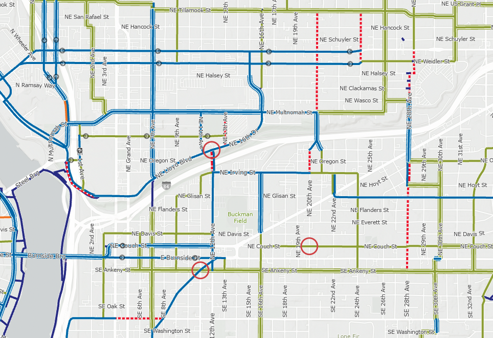
- How it works: The Portland Bike Map is a detailed map of bike infrastructure across the city. The map encompasses the entire city, including detailed sections for downtown. It uses color-coded lines to note 10 distinct types of bike infrastructure – from shared roadways to multi-use paths (paved and unpaved!). It even notes “difficult connections” and one-way sections.
- Low-data friendly?: Yes, via a physical paper map or by downloading a 3.38MB PDF while connected to Wifi.
- Ideal for: Planning your route before you head out the door. The map offers a bird’s eye view of infrastructure options in an area. I like to use the map to plan a leisurely ride and know what alternatives exist for getting to my destination. In fact, I used this map to plan my trip to Powell Butte a few weeks ago.
- Not ideal for: On-the-go route-finding. It’s just a map, there are no point-to-point directions. I also find it hard to use on a mobile screen, because I usually need to zoom way out to see my whole route.

Neighborhood Greenway signs
- Cost: free
- Format: street signs and on-pavement markings
- How it works: Neighborhood Greenways are a network of shared roadways on low-speed, low-traffic streets. Greenways often have protected crossings for major intersections and diverters to stave off vehicle traffic. You’ll know you’re on a Neighborhood Greenway by the orange bicycle fixture on the street sign and the on-street painted sharrow markings. Green signage at intersections with other Greenways helps you navigate to your desired destination.
- Low-data friendly?: Yes! No data needed.
- Ideal for: Just about everything! I’ve only found one downside, which I’ve mentioned below
- Not ideal for: The signs show the next-closest neighborhood. This means that if you’re traveling several miles, you’ll need to know the names of the neighborhoods along the way so you can pick the right direction to go. It’s similar to choosing a direction on the interstate – the sign will say the next-closest destination in any direction. If your destination is farther than that, you’ll have to know which direction to choose. [Or, if you’re looking for a sneaky upside, it’s this: using Neighborhood Greenways exposes you to all the areas in between point A and point B.]
Pointz
- Find it at: BikePointz.com
- Cost: free
- Format: a mobile app
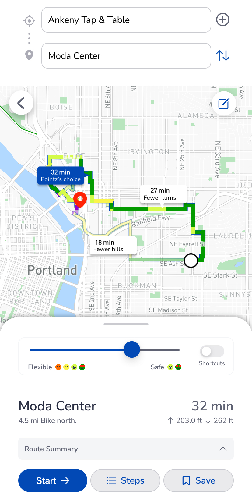
- How it works: Pointz is a bicycle mobility app which offers point-to-point routing.
- Low-data friendly?: No. Cellular connection needed for routing.
- Ideal for: On-the-go navigation, with on-screen or audio turn-by-turn directions. You can toggle your preferences for street safety, avoiding hills, taking shortcuts, etc. to develop the right route for you. I use Pointz when I don’t want to think very much about which way is best to go.
- Not ideal for: Folks without a mobile data plan. Pointz does rely on mobile data to compute routing.
Ride With GPS
- Find it at: RideWithGPS.com
- Cost: free, with premium licenses available
- Format: mobile app and website
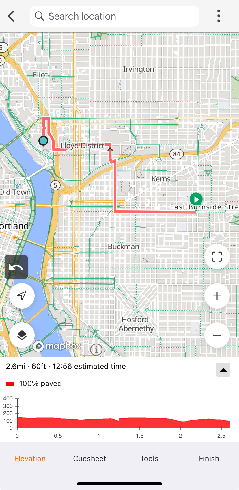
- How it works: RideWithGPS is a powerful route planner, and it creates GPS files that you can upload to a bicycle computer (like a Garmin or a Wahoo).
- Low-data friendly?: If the route is saved while connected to Wifi, yes.
- Ideal for: Planning, drawing, and sharing routes – and discovering routes published by others – to be run on a GPS computer. RideWithGPS has a powerful route planning tool which selects the best route between two selected points. Premium tiers offer heatmaps, which make it easy to see how other cyclists tend to get around in a certain area.
- Not ideal for: On-the-fly navigation or mobile-only use. Though RideWithGPS does technically support routing on mobile, I find it really easy to “mis-click” on the wrong thing while trying to scroll around the phone screen. There’s no way to explore alternatives routes if you don’t like the one that’s suggested.

Google Maps
- Find it at: Google.com/maps
- Cost: free
- Format: a mobile app and website
- How it works: Google Maps shows maps, businesses, bike infrastructure, and transit all in one app. It can provide turn-by-turn navigation and makes it easy to compare transportation options for a trip.
- Ideal for: To be honest, just about everything… until it’s not. Google Maps has the largest breadth of capabilities, and it’s easy to have it be a go-to app for all transportation decisions, especially if you’re comparing multiple transportation modes.
- Low-data friendly?: Yes, maps can be saved locally to the phone while connected to Wifi.
- Not ideal for: I’ve got two points of frustration with Google Maps – inaccurate bike infrastructure data, and the absolutely bonkers way that they display transit time for public transportation.


Allow me to explain:
- Google Maps likes to think areas are a lot more bikeable than they are. Take, for example, SE Belmont Street in the Tabor area. Google Maps shows a dotted green line – indicating a “bicycle friendly road”, usually meaning a Neighborhood Greenway. If you’ve ridden Belmont in this area, you’ll know it’s not a neighborhood greenway, and is in fact a bit of a thoroughfare between Tabor and Montavilla. The wide shoulder is filled with debris and Trimet buses whiz by. “BIcycle friendly”, not so much. For this reason, I’d cross-check with Pointz or the Bike Map whenever possible.
- When showing how long a trip will take on transit, Google Maps has a strange habit of showing total time actively riding on transit instead of total trip time. That means if the bus arrives in 5 minutes and the ride is 20 minutes, Google Maps shows the trip (and your arrival time!) as 20 minutes, not 25 minutes. Honestly, this boggles my mind, because Google shows the realtime arrival – if they have the data in their system, why not incorporate it?
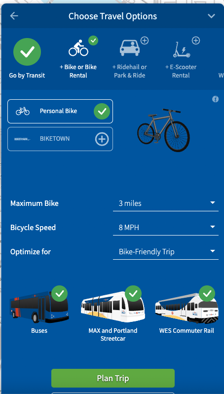
TriMet Trip Planner
- Find it at: TriMet.org
- Cost: free
- Format: mobile and desktop website
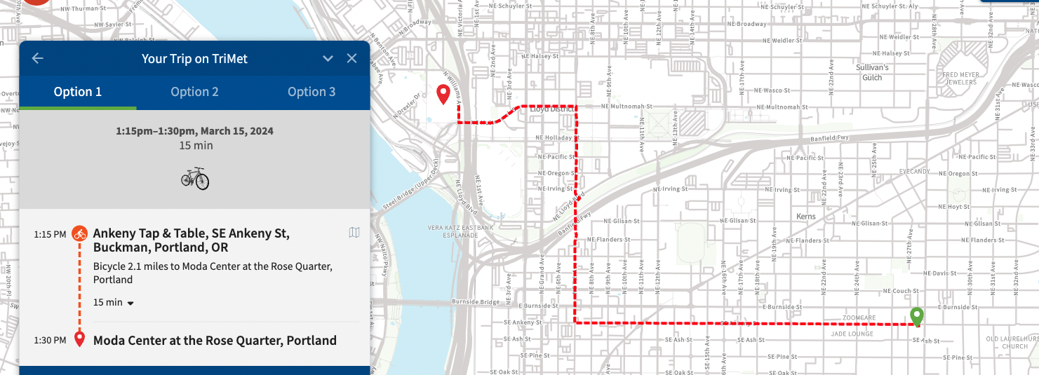
- How it works: Enter your starting and ending location, and select what types of transit you would like to use. You can select additional modes such as bicycle or scooter rental, which the planning tool will factor into the overall trip time. Trimet will show you trip options, including price and trip time.
- Ideal for: Planning ahead and comparing multi-modal options. The routing is similar to Google Maps, but the ability to select what transportation type you use in addition to Trimet gives much more flexibility than Google Maps. They even offer a bicycle-only routing option.
- Low-data friendly?: No, requires internet connection.
- Not ideal for: There is no option for turn-by-turn directions that follow your trip in real-time, or automatic re-routing. If you use this tool for on-the-fly navigation, you’ll have to commit the route to memory.

Word of Mouth
- Last but not least, word of mouth and community input is a great way to learn how to get around. I’m surprised and grateful for how readily folks offer recommendations. I also enjoy riding on Shift rides which help me see new parts of the city.
Bike Portland readers, which tools do you use regularly to plan your rides around town?


Thanks for reading.
BikePortland has served this community with independent community journalism since 2005. We rely on subscriptions from readers like you to survive. Your financial support is vital in keeping this valuable resource alive and well.
Please subscribe today to strengthen and expand our work.
BikeLoudPDX has taken the PBOT arcgis map a few steps further…
https://bikeloudpdx.maps.arcgis.com/apps/webappviewer/index.html?id=01cd4931576046659808a2fe257846fc
This map includes high crash corridors, traffic signals, bike lane striping, buffer striping, shared lane markings, STOP signs, speed humps, crosswalks, bike detection stencils, bike corrals, bike signs, and neighborhood greenway signs and an easter egg or two…
I think this is an underrated issue in the neighborhood greenway wayfinding that I definitely recall from when I first moved to town. Greenways also sometimes have poor/missing signage at places where the route jogs between streets and that can be a real pain if you miss a turn.
I’m glad to know other face this challenge too. When I’m in a new area, I so often miss a turn when the greenway zig zags. Ugh. I’m not sure what the culprit is, but better signage and newer, less-worn paint would help.
I would like to suggest a caveat for the greenway bike signs: The font is really small and they are mounted very high, making them nearly useless at night. Most of the greenways have wildly inconsistent lighting along the route, and the signs were not placed in locations where they are adequately lit by streetlights. The signs were designed using standards developed for cars so the retroreflective white paint would be adequately illuminated by car headlights. Bike headlights are not nearly as bright, and many have a cut-off they prevents light from shining up. Add to this that many street signs along greenways are in the dark, covered by vegetation, faded to the point of illegibility, or missing, and navigating a greenway with a frequents dead-ends and zigs/zags on a dark and rainy night can be a fraught experience. For a ride with a lot of turns, I will often make a route using ridewithgps and googlemaps, then jot down a cue sheet (simple list of turns) to keep in a jacket pocket.
Google Maps gives transit info based on what time you should ideally walk to the stop. So it’ll be like “your trip will take 25 minutes based on leaving at this time”.
To be fair, it also skews the driving time as well. It doesn’t account for walking to your car, maneuvering it into the street, and then driving. It also doesn’t account for finding parking. A true apples-to-apples comparison of transit vs driving should either show only the transit ride time or include the time it takes to retrieve your car and find parking.
It also gives the best case traffic scenario when you set departure/arrival times.
None of the above. In my experience, google, pointz, and ride with GPS often avoid existing infrastructure that would make for a comfortable and efficient ride. Google maps is particularly bad at bicycle route finding and will inexplicably select routes (or across) busy collectors/arterials when a neighborhood greenway or bike lane is a few blocks away.
The only tool I use (other than my memory) is the online Portland bicycle map:
https://pdx.maps.arcgis.com/apps/webappviewer/index.html?id=b51534aa6e1f4dd4ad4d83c4a084d9a6
It is by far the most accurate route map but it’s also not particularly user friendly while on the move. I typically take screen shots of where I want to go and have them ready to flip through for easy route finding.
If PBOT were genuinely interested in promoting alternatives to the bloody car they would have created a bicycle/micromobility routing app many years ago.
If PBOT were genuinely interested in promoting alternatives, they’d make every street safe enough that one wrong turn wouldn’t put you in a deadly situation.
I think that the PBOT map has serious flaws too though – chief among them being that buffered and protected bike lanes are the same functional class. Any map that says the infrastructure on NE 7th around Broadway is the same as the infrastructure is on Naito is hard for me to take seriously. I mean Better Naito may as well not even exist on this map given that there is no transition noted between areas north and south of the Steel Bridge. I think there’s also something confusing in the delineation between “Neighborhood Greenway” and “Shared Roadway” for someone not super tuned in – and by PBOT’s definitions why would any neighborhood road not be labeled “Shared Roadway”?
I also take issue with the classification of SE Milwaukie as a difficult connection between Mall and Inslee, while the crossing of McLoughlin at the light at 17th doesn’t even get a “difficult intersection” circle. If PBOT really thinks it’s more pleasant to ride across 170 feet of 6 lane highway traffic than it is to cross a bridge wide enough that they allow car parking on it’s no wonder that bike ridership has stagnated/declined in the city.
That map is fine, probably better than any other source online. But the presence of issues like at Milwaukie/McLoughlin/17th speaks volumes to how PBOT approaches cycling. Since SE 17th was redone for the MAX Orange line, and they installed buffered bike lanes that has become the “natural” route through Brooklyn to Sellwood. And while there are certainly benefits (including the bridge over Powell if you are coming from the north), there are genuine drawbacks too. I live in Brooklyn, so am not often riding through the neighborhood without stopping, but it’s frustrating to me that there isn’t a good bike route through that crosses over both deadly ODOT roads in the area. And the fact that this drawback of SE 17th isn’t even marked – leading a layperson to believe that miserable crossing of McLoughlin at SE 17th doesn’t even meet the threshold for “stressful” drives me up the wall.
A few other places that stand out to me on the PBOT bike map as eyebrow raising: S Corbett varies between orange, red dashed, and green in places that have no real bearing on the bikeability of specific segments – the difficult section should be around the I5 off ramp; Barbur from Hamilton to Bertha should really be a “difficult connection”, that’s one of the only stretches of road in the city I would tell someone to avoid at all costs; NE 102nd is marked as an off-road path when crossing I-84, definitely shouldn’t be; and there’s surely more. Maybe my larger point should just be that the best way to figure out if a place makes sense for you to ride in is by riding it (but also don’t be discouraged!)
A good point and something that would especially impact less confident bicycle riders.
a few years back, this website started or promoted an effort to review Portland’s bike routes and flag gaps or dangerous intersections. That was an amazing and valuable resource for a while. If anyone knows if that maps is accessible, please share a link!
I use google maps. If it is in an area I am unfamiliar with I’ll use street view to make sure it is sane, and line it up with the Portland official bike map so see if there are alternatives.
I never use turn by turn directions and at this point I know how to comfortably get around most of the inner neighborhoods. But because I am going off memory, I tend to avoid greenways that aren’t straight because even though signage is normally enough to not get lost on the greenway, I still get very turned around.
I too use Google Maps, but when I’m visiting a large city I observe other (local) cyclist’s behavior: If a route has nice facilities but no riders, quite likely the facility doesn’t go anywhere useful (or fun) – many cities build such facilities. If on the other hand a see lots of users on a street with few or no facilities, I can usually assume the route is pretty safe, comfortable, and a hidden gem. For routes that fall in between, I watch what others do on turns, which certain signals need to be stopped at and others to ignore, and how to handle local car traffic. I use my eyes, ears, touch, and even my sense of smell to help my brain navigate.
I’d also suggest Apple’s Map app. You can select the bike icon once you enter your destination and you’ll be directed on bike friendly routes. I’ve found it to be very reliable and I especially like to use the audio turn by turn instructions so I don’t need to continually check my progress and my turn directions.
Google map can be awful (not sure if the other apps are the same), the amazing bike crossing of Clinton and 39th/cesar Chavez doesn’t show up on the map!!! it tells you to CROSS CESAR CHAVEZ A BLOCK NORTH, with NO TRAFFIC LIGHT!!! do they want to kill people??? I’ve reported this to them several times and they haven’t fixed. I am assuming because west side is “one way”/closed to cars so they assume the whole rode is closed. this is a tragedy for people who aren’t familiar with the area.
It does the same at Lincoln/Caesar Chavez! It will route you on to Harrison instead of the signalized intersection with on Lincoln.
This happens when trying to cross Powell as well. I’ve experienced it in the 70s most often. It’s a straight-up Frogger suggestion by Google Maps.
Where did you end up parking you bike? By the box office? I’m too nervous to leave mine there during a game. I wish we still had those old fiberglass cages that went over the whole bike, they were by PGE Park.
Yep, I learned from others that there’s a large set of bike racks behind the Box Office. I’ll put the GPS point at the bottom of this comment in case anyone needs reference. There were 40-50 other bikes parked there, so clearly it’s a popular spot! I just wish the Moda Center / Blazers website had more specifics on bike parking. They certainly have enough info about parking a car…
https://maps.app.goo.gl/NSfkbkQUnafgtXtJA
If I need directions to ride somewhere I use Google and Apple Maps and they both are generally fine but they can occasionally take you on some adventures you weren’t expecting. Most of the time, I use the general idea of where I am going and take the greenways to get there and then fine tune it when I get closer. That works much better once you get to know the city a bit.
I use Ride With GPS because I can plan routes in the city and save them in offline mode. If I get lost in an unfamiliar area (especially happens on group rides at night) and need to find my way home, I open one of the offline maps on my phone and pinpoint my location so I can figure out the best way home. The offline map doesn’t have to exactly cover the area of Portland I’m in – it allows me to pan the map and see other parts of the city including home and wherever I’m located at the time. RWGPS has a lot of useful (and new) features and but I really appreciate that it keeps me from getting lost at night. I also use offline maps location finding on my gravel rides, especially when I’m on unfamiliar trails.
I love this descriptive set of options for navigating the city. Thanks for sharing!
I tend to toggle between bikepointz, google, and the city bike map.