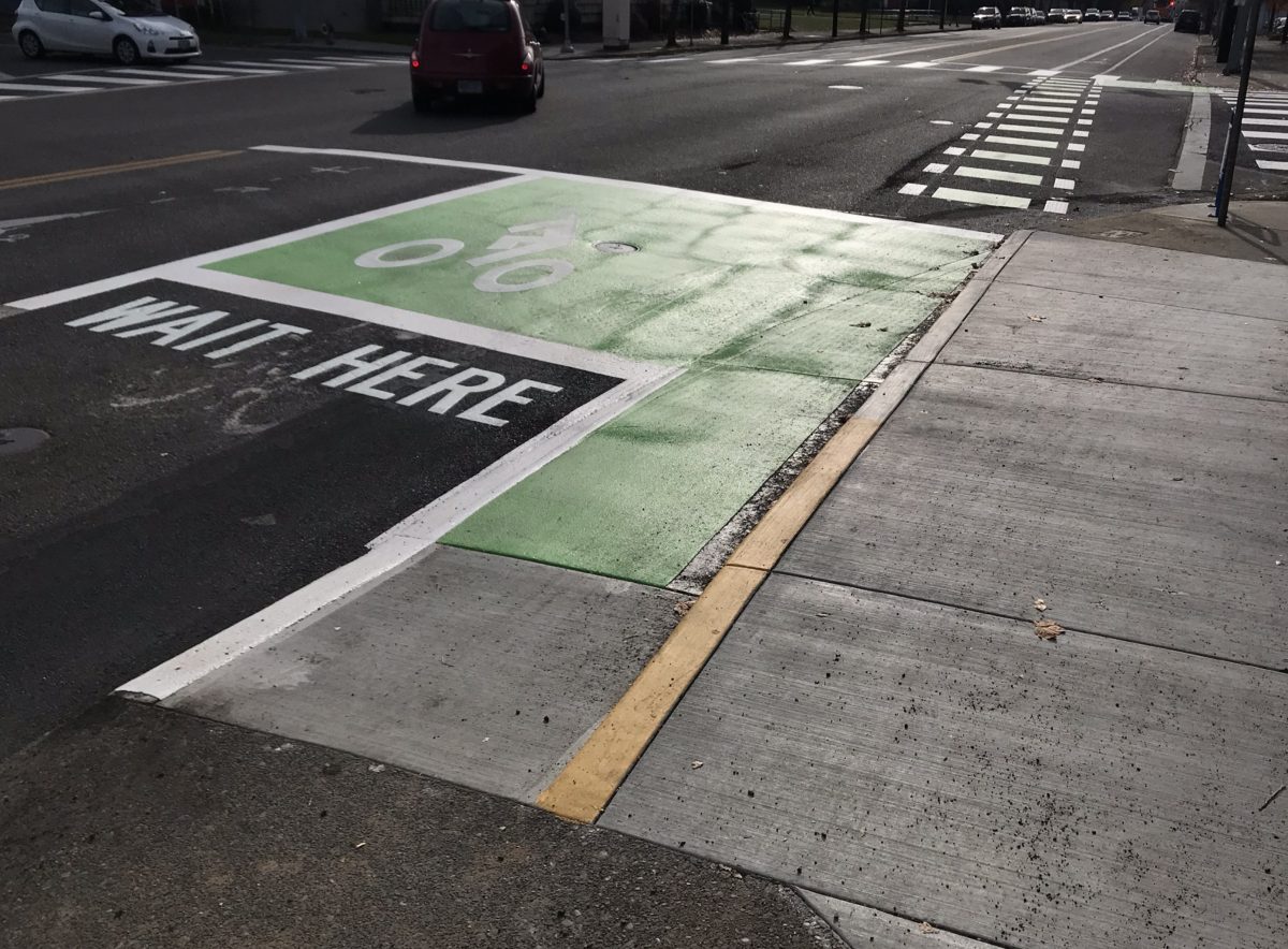
(Photo: J. Maus/BikePortland)
With an unprecedented number of projects in the pipeline, it’s hard to keep up with all the work being done by the Portland Bureau of Transportation these days.
In an effort to keep you updated, here’s the latest on several projects you might be wondering about.
NW in Motion (NWIM)
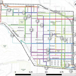
The public review draft of PBOT’s NW in Motion plan is ready for your feedback. NWIM is PBOT’s tool to organize and prioritize the projects and policies needed to make the northwest quadrant a nicer place to walk and bike. This part of town is undergoing massive change and it’s vital that we build a strong foundation to make sure that it transportation network can keep up.
PBOT will host an open house tomorrow (Thursday, 11/14 at Chown Hardware) where you’ll be able to view the plan and talk to PBOT staff about NWIM. The open house will also have info on several other NW projects including: the Flanders Bridge over I-405, the NW Flanders Bikeway (NW 1st Ave to NW 24th Ave), the Couch/Burnside/I-405 Improvements Project, and the Zone M Parking Permit Program.
NE 12th Avenue Overcrossing
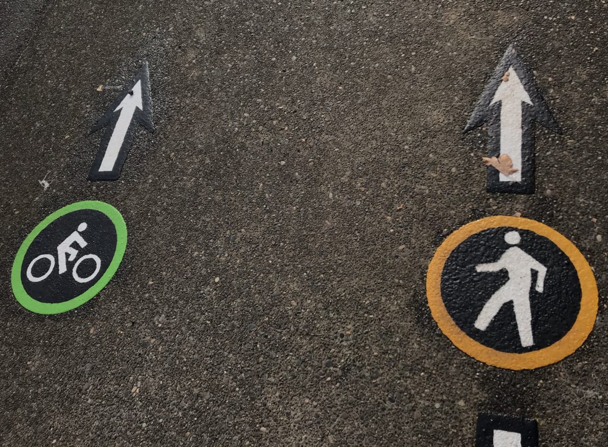
Eight years ago PBOT hosted a sometimes thorny conversation around how to improve safety and operations of 12th Avenue where it goes across I-84. While we wait for the Blumenauer Bridge, 12th remains a crucial north-south bikeway connection between Lloyd and the central eastside.
In September 2011, a committee decided on a host of bikeway updates that just materialized last week. Here’s what PBOT shared with me last week about the changes:
We added a new ramp at the southern end of the westside sidewalk for easy bicycle access back to the roadway and a bike box where people bicycling can wait for the eastbound signal at NE Irving Street. We also installed a bike box with signal loop detection so people bicycling can continue east along the bike lanes on Irving. Eastbound cyclists on NE Lloyd Boulevard can use a ramp to get up on the sidewalk and continue southbound across the NE 12th Avenue bridge. We also installed a bike box on Lloyd at NE 11th Avenue so that people riding westbound on Lloyd Boulevard will be able to stay right in the bike box along the north side of Lloyd Boulevard and execute a two-stage turn onto the shared pathway on the NE 12th Avenue overcrossing.
This is a significant change that better defines roadway space and eliminates the shared-lane environment we used to have.
Also notable is that PBOT has formally closed the northern east-west crossing of NE 12th and Irving.
Advertisement
NE 47th Avenue
PBOT has begun work on a $7.7 million project that will rebuild NE 47th Avenue between Columbia Boulevard and Cornfoot Road. 47th is currently in very bad shape with some sections in the city’s bottom 1% in terms of pavement condition. It has no shoulders, sidewalks, or bike lanes, and is very dangerous due to industrial businesses and frequent truck and freight traffic.
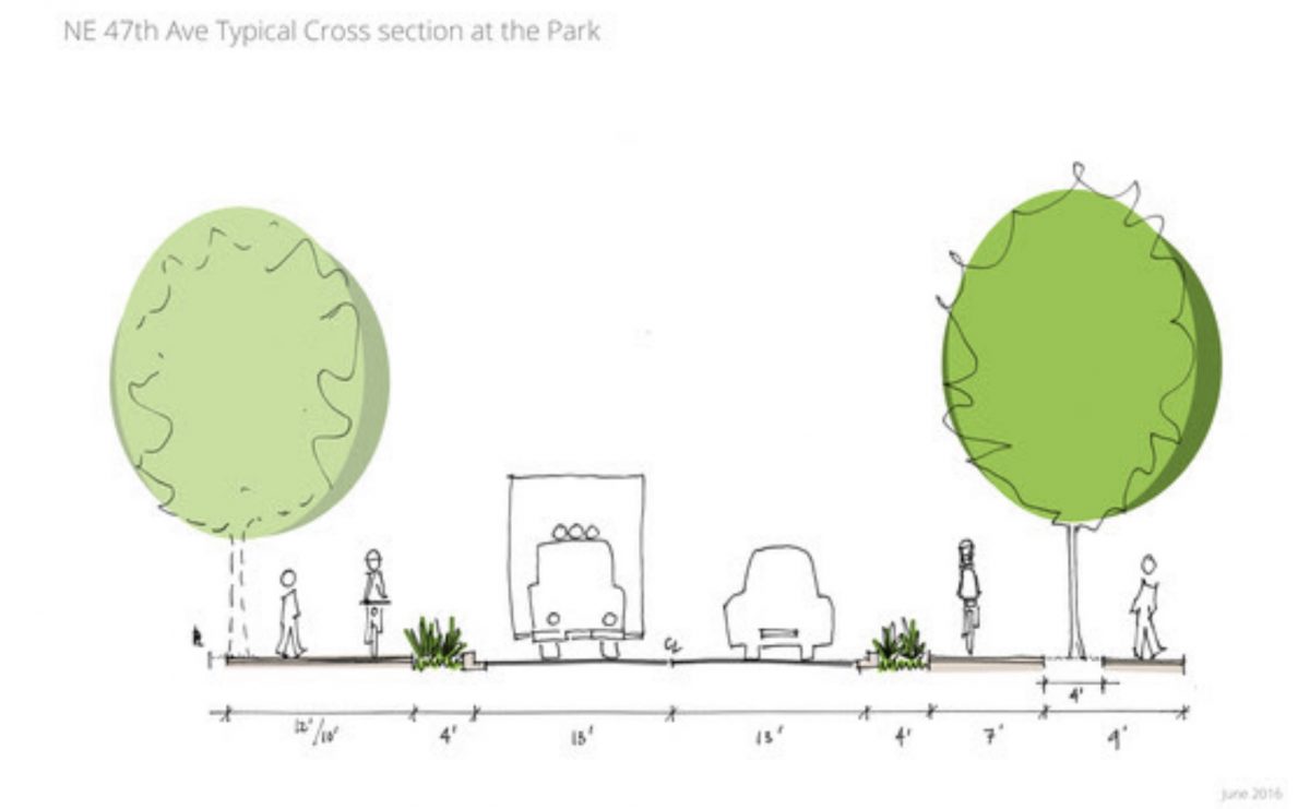
PBOT plans a full reconstruction of the road that will come with paths for walking and biking on both sides of the street. Part of the funding ($900,000) comes from the Portland Parks & Recreation bureau who wants to improve access to the recently upgraded Whitaker Ponds Nature Park. 47th will also get new street lighting and a rapid-flashing beacon near the park entrance.
The new cross-section will have two, 13-foot wide lanes that will be physically separated from the biking and walking paths. The paths will be 17-feet wide on the west side of the street and 17 to 22-feet wide on the east side. PBOT says the project should be completed by late summer, early fall of 2020.
SW in Motion
SW in Motion is PBOT’s, “short-term prioritization, refinement, and implementation strategy for planned active transportation investments in Southwest Portland.” With $750,00 already allocated for a mix of bike lanes and safer crossings, the final draft of the plan finally has a City Council date. First slated to be adopted back in September, PBOT Commissioner Eudaly pulled it from the agenda at the last minute, saying, “I didn’t have adequate time to fully review the final proposal, connect with community members, and address any remaining concerns…it’s vitally important that we get it right.”
The new city council date is December 5th. Review the final draft on the project website.
Advertisement
Safer Outer Stark
PBOT is nearing the end of a public process to identify and prioritize projects that will improve safety on SE Stark between 108th and 162nd (city limits). This is one of the most dangerous streets in Portland and is on the High Crash Corridor list for all modes. With project design due to begin in 2020, PBOT has scheduled an open house for Monday, November 18th. Learn more on the project website.
SW Bond
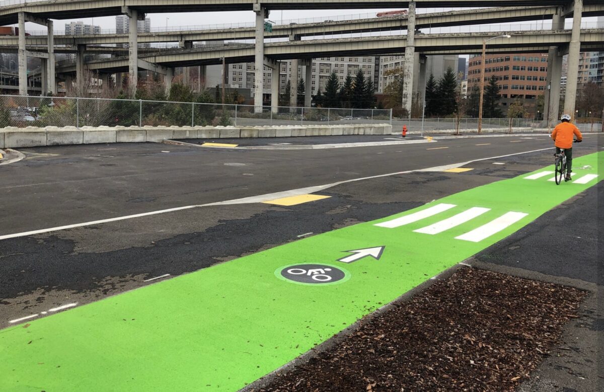
A new street opened in Portland today. As of this morning PBOT is allowing traffic on a section of SW Bond between the Marquam and Tillikum Crossing bridges — but only if you’re not in a car or a truck.
SW Bond is opening in phases and PBOT has decided to open a short section of it to bikers, walkers, and other low-impact vehicle users. It will remain carfree until OHSU completes an extension of SW Meade sometime next year. Once completed, SW Bond will be the northbound, one-way couplet to SW Moody. The cross-section has 38-feet of space for driving that includes two 11-foot travel lanes and two 8-foot wide parking lanes. There’s also a 6.5 foot bike lane separated from the sidewalk by trees and from parked cars by a three-foot buffer.
Learn more about the project on PBOT’s website.
— Jonathan Maus: (503) 706-8804, @jonathan_maus on Twitter and jonathan@bikeportland.org
— Get our headlines delivered to your inbox.
— Support this independent community media outlet with a one-time contribution or monthly subscription.





Thanks for reading.
BikePortland has served this community with independent community journalism since 2005. We rely on subscriptions from readers like you to survive. Your financial support is vital in keeping this valuable resource alive and well.
Please subscribe today to strengthen and expand our work.
pbot’s obsession with putting bike lanes on the sidewalks & through transit stops & adding extra convoluted turns is pretty worrisome imo, especially since the law requires their usage
“eliminates the shared-lane environment we used to have.”
Also, I don’t think that putting a bike lane on a narrow sidewalk often full of students really qualifies as an end to a shared lane environment.
If you’re ever in NW, check out the redesigned intersection at 17th and Front. The inbound bake routing is a MESS. I can’t figure out how a bike rider is supposed to turn right. 1) Merge into vehicle lane and turn? 2) Follow the green stripe up onto the side walk and then ride along the sidewalk until the next curb cut lets you back out onto the cross street? 3) Follow the green stripe up onto the sidewalk but then ride back out into the crosswalk to make the right hand turn? What are right turning vehicles supposed to do if I choose option 3?
I’m beyond confused.
Love to see a platinum/titanium/diamond walking status city closing crosswalks and emulating ODOT.
it is more like unobtanium
I can appreciate the effort being made at 47th, because like the article alludes to, the road surface is as bad as on any street in Portland (I’m talking about you, NE Mason between 60th and 72nd!), but seriously, the greenway that is NE 47th – heading south from Columbia on the Lombard viaduct towards Ainsworth – is one of the scariest quarter miles I regularly use. Cyclists are required to take the lane on a relatively steep little uphill that goes blind just about the time that a car using the road gets up a decent head of steam – and there is absolutely no shoulder to dive to. My head is on a swivel and I get my bike as close to the centerline of the road as practical in order for drivers to get the best chance to see me, and I am constantly thinking of avoidance situations when I see a driver coming up behind me fast…
I’m glad I’m a pretty strong and confident rider. I would never recommend this section to someone who’s skittish behind the handlebars.
That bridge and the approaches are being replaced in the next couple years, and will include fully separated sidewalks and bike lanes. The sharrows are just a temporary measure until the bridge is reconstructed. They do not indicate a “greenway”, just indicating it’s a place that bikes are likely to ride. A street is a greenway only when the sharrows are on a local street.
Anyone have any updates on improvements to the crossings at Ankeny/SE 7th or 16th/E. Burnside? I remember (I think) seeing mention of projects at these locations but haven’t seen or heard anything in awhile. These crossings are both part of my daily commute and they are, to put it generously, a nightmare. Any information is appreciated!
Any word on the 4M?
From what I remember, I think PBOT has officially going to design on the project. There are issues that have arisen from the community due to driving concerns near David Douglas and something about how local drivers navigate the area if they don’t want to be on Division or Stark.
more PBAC-rubber-stamping of delay in east portland, while the “placemaking” infrastructure of real estate speculators is celebrated and prioritized (:cough: greenloop :cough:).
All substandard. Meh.
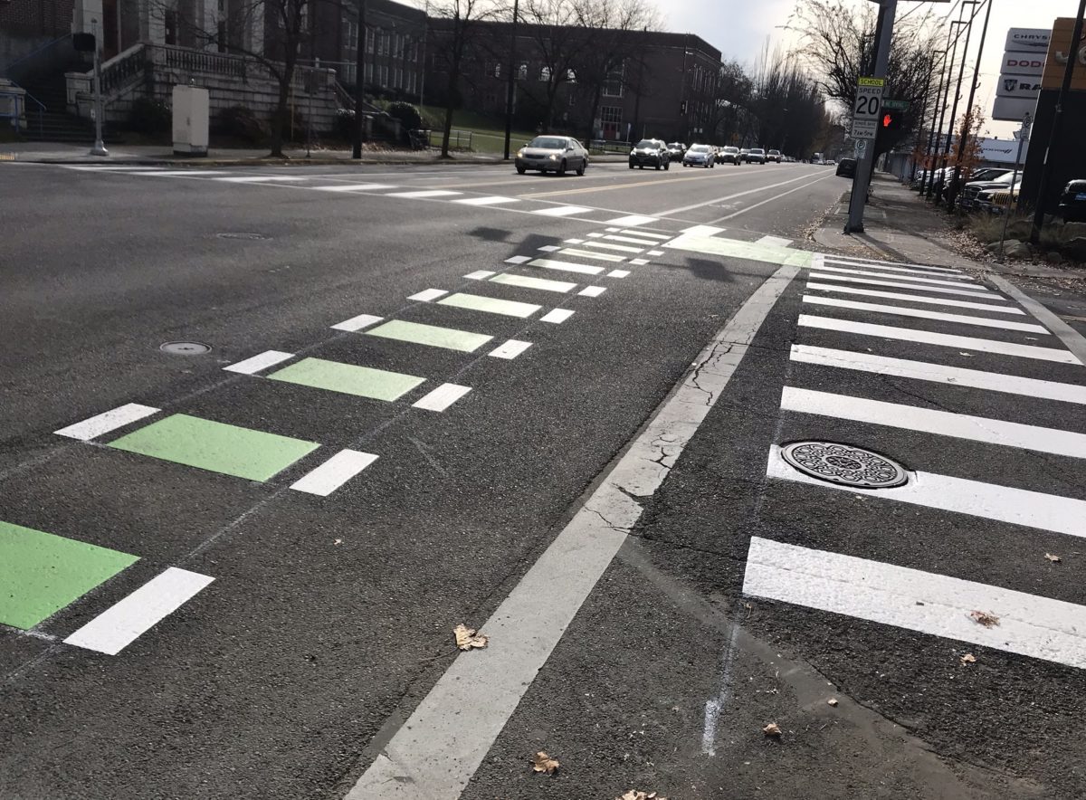
So much green paint. And yet the Going greenway crosses MLK without any kind of light or beacon. Priorities man.
green MMA: $5/SF
Rapid flash beacon, 3 poles for one crossing, $60,000.
Pedestrian Hybrid Beacon: $200,000.
Full signal: $320,000.
Going at MLK 10-year crash data: 54 crashes, 37 injury (68%); 3 bike, two ped;
Crash rate 0.54 per million entering vehicles (PBOT typically does not investigate CR <1)
Data for actual priority setting, in case facts matter.
There is already a funded project to add lights at Going & MLK, but it takes time to design and construct something of that magnitude. Green paint is easily applied and highly effective.
So true. We don’t need bike signals, separated bike lanes, or traffic calming. Just splash a little green paint here and there and, PRESTO, problems solved.
I bike across this on my commute, and I really wonder how we’re supposed to get on the sidewalk to use this southbound. It’s a relatively narrow and regularly trafficked sidewalk up until you get to the bridge, and there’s not a great curb cut for bikes to get onto the sidewalk when we’re coming from the west or north.
Agreed. I appreciate the ramp down to street level at the south end but how are we supposed to get up onto the sidewalk ? There is no obvious way. Miss the ped ramp and then you’re stuck in mixed traffic without a sharrow.
PBOT also did not install a no turn on red at the SB approach of 12th & Irving. If you install a bike box you are supposed to prohibit right turns on red per MUTCD and I believe also NACTO guidance says this too.
There’s also a project in progress at NE 9th & Killingsworth. Raised curbs around a median island + crosswalks. Hopefully it will encourage motorists to yield to peds & bikes crossing Killingsworth. IMO this is the only intersection within the NE 9th bikeway project that is an issue.