 This is the third in a three-part series about the biking potential of the Lloyd District. Read the first two here.
If 1,597 new homes were about to land in the space where, seven years ago, new homes in the Portland metro area would have been most likely to land, they would be the biggest news story in the area.
In the rural outskirts of east Vancouver (yes, that counts as Portland metro), beloved farms would be shutting down. Work crews would be widening intersections and stripping away street parking to make room for more turn lanes. For miles around, residents and businesses would be bracing themselves for traffic paralysis.
But in the next few years, 1,597 homes are lined up to land somewhere else instead: right in the middle of Portland.
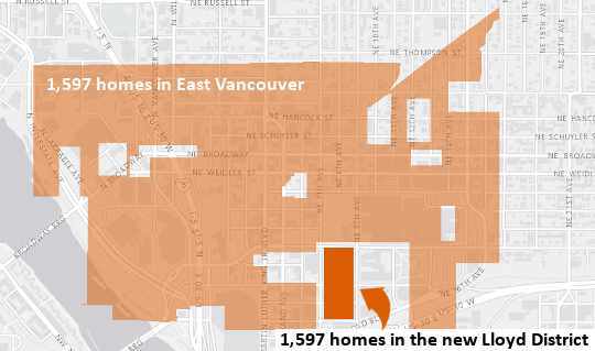
The fact that this is happening with relatively little fanfare or controversy, at least not yet, speaks to the virtues of cities. The new apartments planned by American Assets Trust in the heart of the Lloyd District, both in the new Hassalo on Eighth project and its even bigger second phase, immediately to the south, represent 100 acres of exurban farmland that won’t be paved, miles of sewer mains that won’t be laid, thousands of police patrols that taxpayers won’t need to cover because all those households will be living on just eight city blocks.
When people move into Portland’s inner east side, about 20 percent of their trips around town are going to happen not in cars, as they would have in the outer suburbs, but on bicycles.
But the general lack of controversy over the Lloyd District’s building boom is built on something shakier, too.
It’s the assumption that when people move into Portland’s inner east side, about 20 percent of their trips around town are going to happen not in cars, as they would have in the outer suburbs, but on bicycles.
The assumption is reasonable. Portland’s history proves beyond a doubt that when the city builds bikeways, Portlanders use them. As we reported last week, Portland was so successful at building bikeways in the late 1990s that in the decade that followed, the city created 24,000 jobs for its residents without adding a single new car commute to its roads.
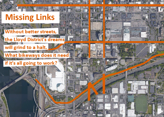
There’s every reason to believe that as it fills in, the Lloyd District could do something similar. But there’s a catch: the Lloyd District needs to stop being one of the hardest central east-side neighborhoods to bike in and out of, especially north and south.
Today, the local business group Go Lloyd estimates that 7.4 percent of commutes to the district happen on bicycle — not bad, but less than nearby neighborhoods and far below what’s needed.
To improve that ratio, the district needs to make its bikeways comfortable, intuitive and direct enough that thousands of the area’s workers and residents will choose to use them at least some of the time.
Local transportation experts agree that to make biking mainstream, the district needs, at the least:
1) A comfortable crossing of Interstate 84 to inner Burnside and Southeast
2) A comfortable bike connection north to Fremont, Alberta and beyond, with the gentlest slope possible
3) A direct and comfortable bike route west into downtown
4) A well-connected link to the east, where many of its workers live
Here’s the good news: the city has a detailed plan for the fourth item and is moving rapidly to plan the first three. The question for the future success of the Lloyd District is when and whether anyone will actually build them.
City eyes a major outside grant
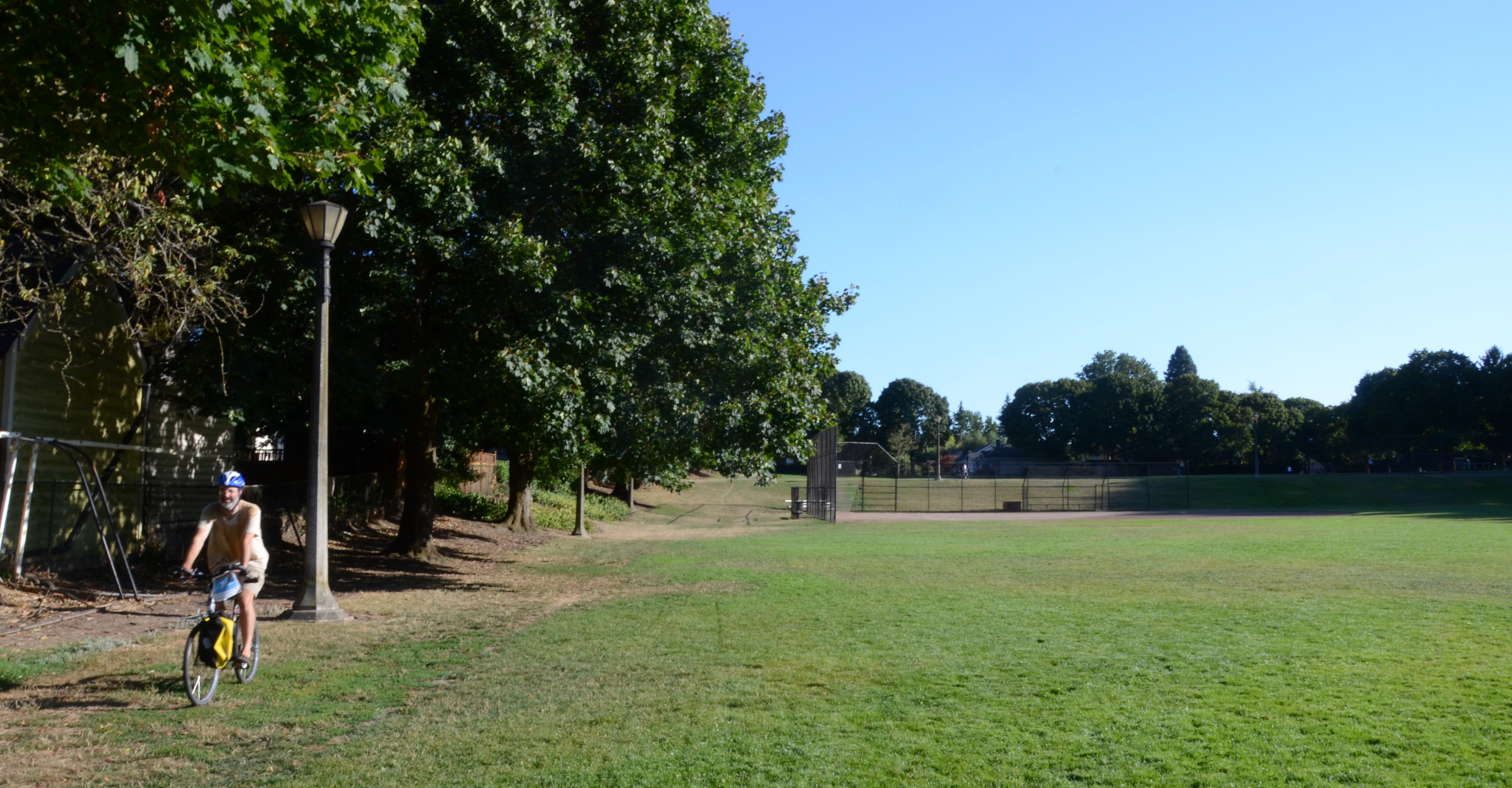
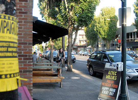
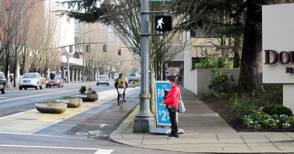
(Photos: M.Andersen/BikePortland unless noted)
In 2009, inner north and northeast Portland, including the Lloyd District, had a chance to build a complete modern biking network all at once.
Metro applied for what was then a new federal program called TIGER grants. Its proposal would have brought in $38 million to build 40 miles of neighborhood greenways, plus raised bike lanes on Vancouver and Williams and a handful of buffered bike lanes.
The city said it would be enough to bring the quadrant’s biking rate from 15 percent to 35 percent.
Metro didn’t get that grant. One of the standout applications that did win in that first TIGER round: the Indianapolis Cultural Trail, now recognized as the country’s only connected downtown network of protected bike lanes and the force behind an economic renaissance for downtown Indianapolis.
Six years later, a city official said this week, Portland seems to be getting ready for a second try. Mark Lear, a funding expert with the Portland Bureau of Transportation, said Tuesday that the city is evaluating “a number of projects in the Lloyd District that could eventually be a future grant request, including a TIGER request.”
It’d be a bundle of biking and walking improvements that follows the path blazed by the city’s East Portland in Motion and Southwest in Motion plans. Lear said other money sources, including local ones like development fees, could be better fits than the federal grants — assuming the the projects can find support from the Lloyd District and its neighbors.
“PBOT over the next few months is going to be working aggressively with the district to help prioritize the most important transportation projects,” Lear said.
This is the city’s first public mention of this effort, and it’s great news.
Let’s help write the project list.
The Lloyd’s biggest leap
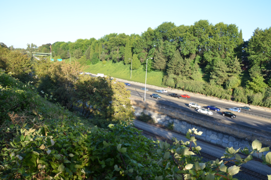
The keystone of a bikeable Lloyd District would also be the project that solves inner-east Portland’s biggest biking challenge: crossing Interstate 84.
The obstacle: 380 to 515 feet of air across Sullivan’s Gulch, including a set of railroad tracks and seven lanes of freeway.
If a bridge were built without carrying cars or trucks, it would be tens of millions of dollars cheaper and the connection would instantly become the best north-south crossing of the freeway within city limits.
“It’d be a game changer,” said Carl Larson, engagement manager for the Bicycle Transportation Alliance. “I describe it as MLK for people walking and biking.”
“It’s not something that will build itself,” said Rick Williams, the former longtime director of Go Lloyd. “It’s going to be $15 to $20 million. But there’s high support for it.”

Where would the money come from? A price tag that big would require outside grants for sure. But as long as the bridge didn’t include cars, 100 percent of the local match could come not from the city’s precious general revenue but from system development charges — the fees the city charges developers to cover the cost of the new trips their projects create.
Portland doesn’t require SDCs to actually be spent near the developments that pay them. But since Hassalo on Eighth has already spent half a million dollars on transportation SDCs, and with other new Lloyd projects lining up to add to that total, there’s a strong case to be made that this would be the perfect way to spend them.
For Andrew Neerman, a resident of the nearby King neighborhood who serves as vice chair of his neighborhood association, the current options for crossing 84 on a bike in the area — Grand, MLK, 12th — stopped being options the day his son was born.
“It’s easy for me to ride alone, but in terms of taking a family ride down there, there’s just no way. I would never do that,” Neerman said. “I want to be able to ride from northeast to southeast with my baby safely. It’s just as simple as that. … If we’re ever going to achieve the mode share in the bike plan, we have to do projects like this.”
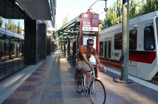
A neighborhood greenway north: Could diverters make 7th pleasant?

If a biking-walking bridge crosses I-84 at 7th or 9th avenue, the Lloyd District would never again be the district bikes avoid. It’d be the district that every bike trip between inner Northeast and Southeast Portland would want to go straight through.
There’s just one problem: which streets would all those bike trips use to get to the bridge?
Today, the stretch of Northeast Portland between Rodney and 28th is one of the biggest expanses of the city where there aren’t even any immediate plans for a single marked north-south bikeway.
Immediately north of the Lloyd, some people take 7th, despite busy rush hours and traffic islands that squeeze cars and bikes together. Some take 11th despite an awkward jog at Fremont.
The city’s official plan is to someday convert either the passing or parking lanes on 9th Avenue to bike lanes immediately west of Lloyd Center Mall. (Removing the extra passing lanes would also make 9th much more walking-friendly.)
North of Broadway, 9th would become a new neighborhood greenway running right into the middle of Irving Park, curving beneath this row of neglected lampposts, and continuing all the way to Dekum:
It’s an appealing vision. But there are problems.
Here’s one: stoplights. They cost a quarter-million dollars each, and a 9th Avenue greenway might need them at Fremont, Prescott and Alberta.
Here’s another: 9th Avenue through the Lloyd, though underused today, will get much busier if it shoulders most of the new auto traffic in and out of the Lloyd.
“There’s over 5,000 parking stalls that can be accessed off 9th Avenue,” said Owen Ronchelli, executive director of Go Lloyd. “We’ve got six or seven loading docks that come out of there with big trucks. We’ve got two bus lines on there. Garbage trucks and all of our major freight deliveries right now occur on 9th.”
Ronchelli was one of several people who said the Lloyd District’s landowners are firmly opposed to bike lanes on 9th Avenue.
Here’s a final problem with 9th: north of the district, it can’t make up its mind whether it’s going uphill or down.

Given that set of problems, Larson and the Bicycle Transportation Alliance have proposed an interesting alternative to 9th: 7th Avenue.
Unlike 9th, 7th Avenue already has full signals at each major street, plus a small commercial node at Knott. And here’s what 7th looks like from the side:

A final advantage of 7th, Williams noted: a bridge between NE 8th and NE 7th would not only be the shortest of the available options, it would run perpendicular to the freeway, creating an iconic advertisement for Portland’s bike-friendliness just as people round the bend into downtown.
There is exactly one problem with a bikeway on 7th. North of Broadway, it’s become a rush-hour alternative to Martin Luther King Boulevard for people in cars. North of the Lloyd, 7th Avenue carries 5,500 cars per day.
The city’s new target for a comfotable neighborhood greenway is 1,000.
Larson says the solution is simple: add traffic diverters to 7th that force rush-hour car traffic to use MLK, just like the city once forced traffic onto Division when it created a diverter at Clinton and Chavez.
“Its parallels to Clinton are a lot, actually,” Larson said. “It has the same treatments too, the circles. It has about the same traffic volume that Clinton did before there were efforts to put in some diversion. And it’s got a big road right next to it.”
Lloyd District landowners feel strongly that 7th Avenue should be the focus of future bike and foot traffic.
“There’s been lots of plans over the years,” said Williams. “7th Avenue has already been established through the Lloyd District as that north-south connector.”
The problem with diverters, of course, is the 4,000 car trips they would remove from 7th. Where would those cars go? What would nearby residents say?
For the city, the path of least resistance would be to leave 9th Avenue as it is south of the district, ask people biking to jog from 7th to 9th on Tillamook, and use cheaper rapid-flash beacons instead of actual stoplights at the bikeway crossings further north.
But Neerman, the King Neighborhood Association board member, said he thinks diverters on 7th wouldn’t be a hard sell.
“Most of the neighbors will buy in in Irvington and King for the simple reason that right now there’s a ton of cut-through traffic just trying to avoid MLK,” he said. “We have a full-on rush hour on 7th these days and there are a lot of Washington plates.”
Broadway: A business district waiting for a boom
Lined with parking lots, auto dealers and fast-food joints, inner Broadway rivals Sandy as Northeast Portland’s least Portland-y street.
But though the width that gave Broadway its name is currently devoted to three lanes of speeding traffic, it’s also home to the sort of businesses that will make life in the Lloyd District practical.
“What I think a lot of people on bikes don’t realize is that there’s so much good stuff on Broadway,” said Larson. “I live off Alberta and it doesn’t have anything useful. Broadway has real places to go to where you can buy useful stuff. There’s banks on Broadway. There’s a bookstore on Broadway. It’s really sad that it’s a business district with so few people, I think.”
Last year, Larson and BTA volunteer Chris Delaney spent months trying to gather support among Broadway businesses for changes to the street. In part, they hoped to advance a longtime dream for many Portlanders: a continuous protected bike lane from the Hollywood area to Portland State University.

(Image by Owen Walz)
“We heard their concerns loud and clear: they are concerned about people driving too fast on Broadway and about people not being able to walk across the street,” Larson said. “They get that that’s bad for their business, and they’re interested in solutions to those problems.”
What they didn’t embrace, Larson said, was a protected bike lane. He said many Broadway businesses hope the extra street space will be used for a streetcar line instead.
A Broadway streetcar line is currently on the city’s long-term vision, but that’s about it.
“I think people need to realize that Broadway doesn’t know what they want to do yet,” said Williams, the former Go Lloyd director. “Broadway is kind of where we were 10 years ago: in the planning phase. And I think the reason things worked so well in the Lloyd District was we all had consensus on specific things.”
Williams and Larson both agreed that if protected bike lanes are going to be built on Broadway and/or Weidler, the suggestion will need to come from businesses and landowners, not the city.
Both of them also agreed on one of the best things the city could do to build consensus about a protected bike lane on Broadway: finish upgrading the nearby one on Multnomah. That’d probably mean adding permanent planters or curbs and curving the bike lanes behind bus stops rather than forcing bike and bus traffic to mix.
“I talk to people on Broadway, some of them really get it and say they really like Multnomah, but some of them are sort of confused by it and say it looks really temporary,” Larson said. “Which it does.”
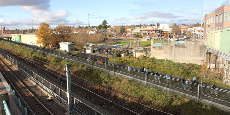
The crown jewel: a Sullivan’s Gulch path

(Photo: Ted Buehler)
The granddaddy of all missing links on Portland’s east side is the Lloyd District project that’s furthest from being built.
Just about everyone involved in the Lloyd District’s current rebirth seems to dream of an off-road bike path through Sullivan’s Gulch running west to the river and east to Gateway.
Lloyd EcoDistrict director Sarah Heinicke said it’d give thousands of East Portlanders a cheap and healthy way to reach jobs in the Lloyd.
One of them: American Assets Trust executive Wade Lange, a Portland native who regularly bike-commutes to the Lloyd from his home on NE 135th and said he’s been awaiting that path for many years.
“I think it would really make a big difference in terms of the viability of serious bike commuting happening in the outer reaches of the city,” Heinicke said.
But three years after Portland approved a detailed plan for the project, it’s essentially in deep freeze. Its project manager, Paul Smith, left Portland for a job in San Jose in 2013. (I ran into Smith at a conference last fall. He said he’d enjoyed Portland but prefers working in a city that actually has money to spend.)
The full path would cost an estimated $40 million, not counting about 600,000 square feet of property acquisition.
That’s expensive — it’s the same as the city’s grant application that would supposedly have brought all of inner north and northeast Portland up to a 35 percent bicycling mode share.
Even so, the trail would already be being built in small pieces, except for one thing: the biggest landowner by far is Union Pacific Railroad.
UPRR seems more open to the idea of working with the city to create a bike path south of Swan Island. But that’s in part because people already bike illegally on the so-called Cement Road through UPRR property; creating a legal route would actually reduce the railroad’s liabilities.
That’s not the case in Sullivan’s Gulch, currently used only by graffiti artists and a handful of urban campers.

Bringing the railroad to the table would require either huge wads of cash or something the railroad wants more, like removing some of the curves in its snaking route through the city.
Until the city or its allies in the state and federal government find one of those things, Multnomah Street will remain the Lloyd’s main biking link to the east, and the Lloyd will keep waiting for something more spectacular.
“I find myself staring out the window of the MAX whenever I take it, thinking, Oh, the trail could go there, you’d have to cut into that hillside, that’d be a little tight but you could make it,” Larson said. “Every time.”
The future of the District
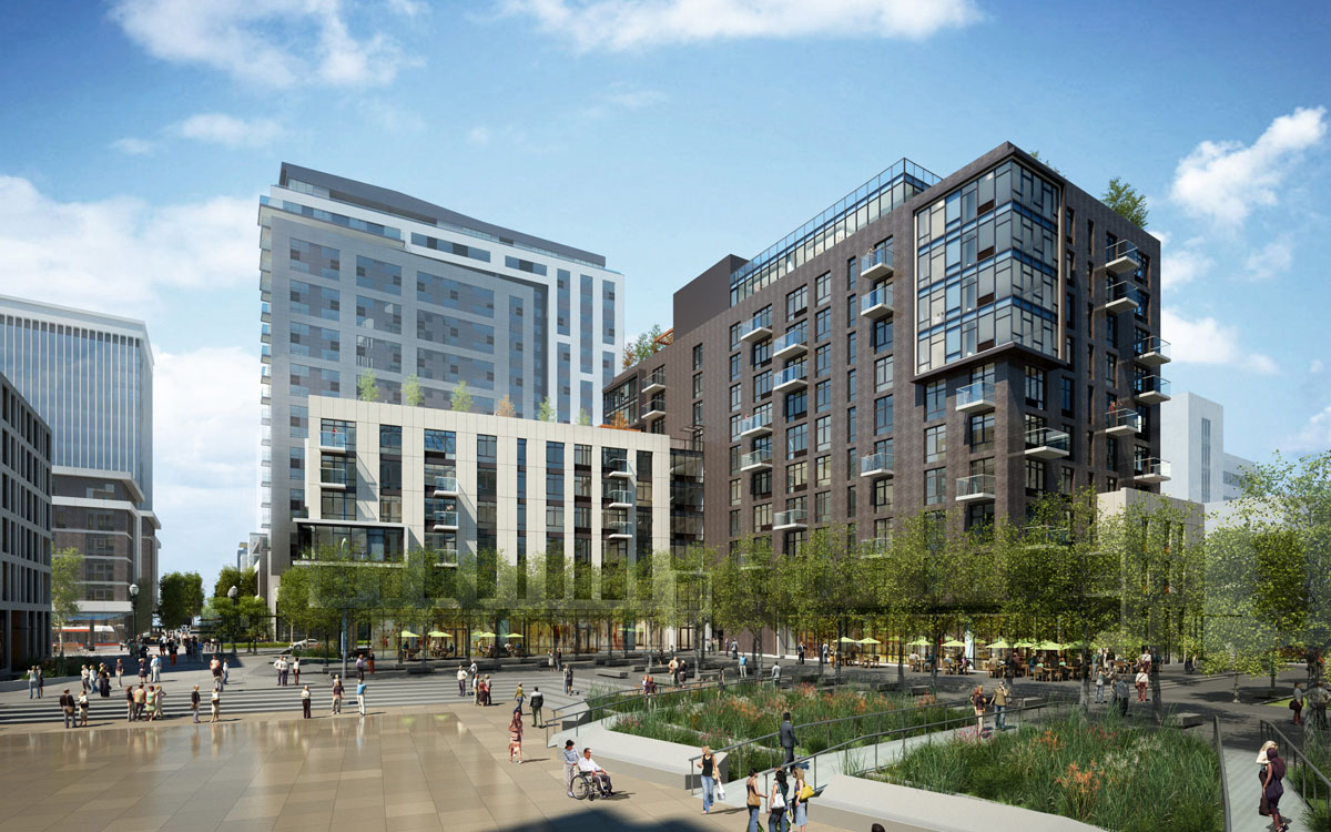
(Image: GBD Architects via NextPortland.com)
Our first article in this series wrote about the Lloyd District’s potential to become the most bike-oriented high-rise neighborhood in the country. Our second wrote about its long, sad history of attempts to build itself around the automobile.
As we wrote at the end of the last piece, the plans now afoot in the Lloyd could fall apart. That might happen even if the area succeeds in making itself bikeable and walkable enough to prevent its streets from clogging with cars.
But if that happens, the list of people who’ll be surprised is getting longer every day.
Twenty years after its landowners made the baffling announcement that their plan to revitalize a struggling business district was to start charging for parking and investing in everything except the automobile, one entrepreneur after another is making bets on the future of the Lloyd.
The most recent announcement came yesterday, when the upscale fresh-food market Green Zebra Grocery announced that it’d become the long-awaited grocery tenant at Hassalo on Eighth.

For years, Hassalo’s developers have been planning to set aside hundreds of parking spaces for a larger grocery store in their underground garage, assuming that no grocer would ever sign a lease without guaranteeing plenty of free car parking.
It didn’t work. Every traditional grocer in town passed on the space anyway.
But Green Zebra CEO Lisa Sedlar, whose business model is built on short-distance trips, said Thursday that she’s asked only for “16 or 20 spots.”
“I would have gone forward with this store without any parking allotted to us,” Sedlar said.
She expects more than half her customers to arrive by transit, bike or foot — more than that if a bridge is built across I-84, NE Multnomah Street’s protected bike lanes are improved and half the bikes in Portland are streaming past her store.
“People think Lloyd District, ugh!” Sedlar said. “And we said, ‘No way, Lloyd District is coming on strong.’ It gets a 99 Bike Score for the neighborhood and the Walk Score is really high as well. … We just think the Lloyd is going to be it.”
— This in-depth series was brought to you by the bike-loving folks at Hassalo on Eighth, the Lloyd District development that is now leasing. We agreed on the subject of the series but they had no control or right to review the content before publication. Learn more about our sponsored content here and read all the articles in the series here.
Correction 3:30 p.m.: An earlier version of this post misspelled Andrew Neerman’s name.


Thanks for reading.
BikePortland has served this community with independent community journalism since 2005. We rely on subscriptions from readers like you to survive. Your financial support is vital in keeping this valuable resource alive and well.
Please subscribe today to strengthen and expand our work.
“Today, the stretch of Northeast Portland between Rodney and 28th is one of the biggest expanses of the city where there aren’t even any immediate plans for a single marked north-south bikeway.”
I live in this area, and getting home is always a “fun” game of pick-the-least-worst-option.
I’ve been pushing for a NE 15th bikeway, but the city has pretty much flat-out said no. A 7th bikeway would be great. – As for the drivers who are currently using it to bypass MLK, they can just wait in traffic on MLK until they realize that riding a bike down a good bikeway is faster and more convenient than sitting in traffic.
Exactly. If the diverter is placed on 7th just west of Irving park, there will be no viable north/south cut-through route between MLK and 15th. I can’t think of another location in the city where a single diverter would have such a drastic effect on cut-through traffic.
If they simply made the traffic circles impossible to get through by car, that would help drastically.
@chris I: That is precisely what I envision. The short stretch of 7th between Ivy and Fremont would be perfect for at least one diverter, as there are no driveways or other access issues. It could also be a full turnaround to protect residents on Ivy from traffic trying to get over to MLK. Either way, adequate signage farther south (at Broadway and again at Knott, I’d imagine) will be crucial. It might be rough at first but people driving cars, especially regular commuters, will adapt quickly to the new reality.
Great piece; thanks Michael!
It’s unfortunate that the city won’t push for a protected bike lane on Broadway unless the businesses push for it first. This seems completely backwards. It should be the city’s job to convince everyone that this project would be a net gain for the city. This whole “business-first” attitude needs to stop.
Because of the close proximity of the wonderful Tillamook, I think protected bike lanes on Broadway should not be a top priority. Reducing car capacity on Broadway will result in more traffic on the now quiet side streets that run parallel to Broadway. Tillamook should be the priority as a first class greenway.
Induced demand works in reverse too. Reduce space for cars and less people will choose to drive.
Induced demand is a euphemism for using sticks instead of carrots. Just don’t see that working when so many people are addicted to cars and there is a grid system close by with numerous alternatives the moment traffic gets worse. Just as I think the Williams/Vancouver project was a mistake (the focus should be on making Rodney a first class greenway) I think Broadway would also be a mistake.
“Just don’t see that working when so many people are addicted to cars ”
Except that it has been observed to work (generally). If you want to take advantage of it (here, specifically) you’d want to get the details right. And not forget that if we pay attention everything we do today is part of a long term strategy, not a bunch of lurches forward and backward.
“The wonderful” Tillamook with stop signs every two blocks and exactly zero destinations for non-residents? We need a better Tillamook, with stop signs turned, improved crossings at 15th and 24th, and diverters, AND we need comfortable access on Broadway.
It’s 3 short blocks north of Broadway. I don’t really get the whole “zero destinations” argument. You ride on Tillamook and turn south to your destination. Not a big deal. A better Tillamook should be the priority IMO. If capacity on Broadway is going to be reduced, I would rather see the addition of the Streetcar do it.
Actually, it is a big deal when you don’t have the exact location of your destination memorized. When driving somewhere that I have a vague idea of the location of, I’m like, “OK, it’s somewhere in the 20s on Broadway, I’ll just drive on Broadway till I see it and then stop and go in.” When biking to the same location, I’m like, “Whoops, better google the location, find the cross street in the area that goes through to Broadway, bike on Tillamook to that cross street, go down the crosss street to Broadway, and then scurry across the street if it’s on the other side of the street.”
It’s a big difference in ease and convenience – which strongly influence how people choose to get around.
Signs on greenways that say where to turn for each business would be a huge step forward, but I would fear a rebellion of greenway residents against signs for businesses large enough for people to read as they ride by….
…and of course not everyone has a destination. Sometimes you’re just looking for something to do.
But yes, I’d say improving Tillamook should be the priority too (if only because improving it would be so cheap!) If you’re loud with PBOT and City Council, maybe you could get it rolled into the planned greenway improvements! After all, the report did say *something* about minimizing stop signs on greenways….
http://bikeportland.org/2015/08/26/council-vote-today-allow-diverters-neighborhood-greenways-156319
Tillamook, Flint to 62nd, is one of the identified legacy greenways on the list after Clinton identified for fall bump money.
I think a protected bikeway on the B/W couplet would be an excellent complement to Tillamook. Tillamook is fine for getting past Broadway, but 3 blocks is too far for getting to destinations on Broadway/Wiedler. In contrast, Ankeny/Couch up to 32nd does offer good connectivity to the business district. What’s more, six lanes of traffic east of Grand is just too much for what should be a highly pedestrian-friendly area. Using the bike lanes on B&W can be just harrowing.
I ride Tillamook every day. I’d love to see shorter delays at 15th and at 33rd, and I’d love to see a few more stop signs flipped, but to be honest, there are zero cyclists that stop at those stop signs if there isn’t cross traffic. On the other hand, if you’re on Broadway, you will almost certainly be stopping at red lights on 28th, 24th, 21st, and bunch of other lights from 16th on in. Unless you’re the type that runs red lights. So yeah, if I don’t have a specific destination on NE Broadway, I’ll be using Tillamook. It’s going to have less delay, and it’s going to be quieter.
(There are lots of other great reasons to right-size Broadway — I just don’t think a protected bikeway is a compelling one.)
By zero, you mean “not zero” – because I do? And even most of those who don’t stop slow down at the stop signs, and I would wager experience increased stress making darned sure that no drivers are coming….
I don’t stop at stop signs going downhill on Clinton because if I do, then it slows me down to the point that drivers will zoom around me at high speed and pass too closely.
It is possible that a Broadway protected bike lane would include more delay than Tillamook. Not sure.
If there were a protected bike lane on Broadway, and I were in a hurry to get somewhere, I would probably still ride on Broadway over Tillamook. I feel more comfortable riding fast on commercial streets than greenways, both because drivers actually stop dependably at cross streets, and because I don’t have to fear hitting a child running into the street unexpectedly after a ball.
Yeah, I could be convinced to ride Broadway instead of Tillamook if it had right turn restrictions, a separate bike phase, and a coordinated green wave. I hope those are all part of the final design. Otherwise it’s more likely I would ride it one or two times, think, “oh, this is cool separated infra” (kinda like I did with Cully and Multnomah) and then go back to riding Tillamook where I can listen to podcasts and not worry about right hooks.
Separated bike infra would be massively more useful to me on Sandy than on Broadway. Broadway’s the low-hanging fruit, though, because it’s pretty clearly overbuilt between 24th and I-5.
Yes, I agree that those are all important. If we had a Broadway like that, and an improved Tillamook, I could see people switching back and forth depending on their mood and the tenor of their journey. Which I think is a healthy thing! I like choices….
Cities in northern Europe have been reversing our timeline and building out greenway-type infrastructure for timid riders because their protected bikeways on major streets are too crowded with bikes and scare people! Someday we’ll get to that level of crowdedness (I guess we have it today on the Hawthorne and the Steel, but only because they’re chokepoints and too narrow.)
Tillamook east of 33rd is a problem. It is recommended for Fire Route status and has a lot of cars related to school and commercial activity. Hancock east of 28th would be a better pathway.
Between 33rd & 37th the paving on Hancock is really rough, with large chunks of exposed aggregate. The city would need to completely repave the street if they wanted cyclists to use that as a route. I’d rather they made a better crossing on Sandy and eliminated the out of direction turn onto Hancock altogether.
I could see Hancock being OK but it would need a dedicated pathway between 42nd and 43rd on what is currently Hollywood Burger Bar property but has no buildings on it. If Hancock got its own signal phase at 43rd & Sandy & Hancock, with right turns prohibited on red for Sandy and 43rd, maybe the path wouldn’t have to extend quite all the way to 43rd? There’s not room for it to extend the last 20 feet or so to 43rd because the Wells Fargo Bank building is close up against the sidewalk.
I never realized there were so many businesses on NE Broadway until I moved to the area and walked down it one day. Every time I traveled through the area I was on a bike and took Tillamook. Was actually kind of shocked to see how vibrant it was. I assumed the situation on inner NE Broadway extended all the way to Hollywood.
I do too.
When I was going to high school at Benson from Kenton about 1960. I was regularly riding on Greeley, Interstate, then Williams and Vancouver and even 7th-Wiedler-15th to get through Loyd district when it was being built.
15th-16th can still be used but not as a protected bikeway or even 20th.
Nice!
great analysis!
The Sullivan’s Gulch trail should not be built. Go check out the Eastbank Esplanade and Springwater Corridor – both multiuser trails are haven for the “don’t want services” homeless campers, bike thieves, and drug addicts. To a lesser extent, the 205 MUP has the same lawlessness issues.
The Sullivan’s Gulch trail would quickly deteriorate into the same situation, and the city would respond with a meek “homelessness is a complicated issue” and little else. There are 12+ that campers, addicts, and thieves would quickly take over.
For a lot less money spent, we could beef up roads on both sides of 84 with buffered/protected lanes, all the way to 205, and not have to deal with another multiuser trail that turns into a corridor of lawlessness and squalor.
I have checked out the Eastbank Esplanade, and the Springwater Corridor. I ride both of them frequently, in fact. Reasonable people can disagree about whether a protected lane is a better investment than an MUP, of course, but the basis of disagreement needs to be based on utility to end users. Despite your complaints about existing MUPs, hundreds if not thousands of people use them on a daily basis. Those people clearly believe that the costs outweigh the benefits.
The Sullivan’s Gulch Trail will not create more homeless people. Therefore, it is arithmetically impossible for the Sullivan’s Gulch Trail to “deteriorate into the same situation,” because it would be distribute what you call “lawlessness issues” over more miles of trail.
I’m afraid I agree. I see the advantages of directness, separation and speed, but all I can think of when I imagine riding it as depicted is, Gee, chain link fence and miles of breathing freeway fumes, what fun! And infrequent exits to add to that exciting sense of risk after dark.
At least the Eastbank and Springwater have the advantages of fresh air and beautiful scenery.
>breathing freeway fumes
And in addition to automobile fumes, diesel locomotive fumes, which are subject to many fewer emissions regulations than are automobiles.
And I meant to say “there are 12+ bridges” – I omitted a word.
Pretty much every neighborhood bordering 84 between I-5 and 205 will have reason to worry about a Sullivan’s Gulch trail. Like the Springwater Corridor, it’ll become a underground highway for moving stolen property.
And down in the gulch there is no connectivity to neighborhood destinations. Along the Springwater there is the recreational aspect of riding along the river, but you are going to Sellwood, Westmoreland or down town.
In a world less fixated with political correctness “urban campers” are homeless squatters and graffiti “artists” are vandals. Nice spin on that however.
I believe the assumption of the Sullivan’s Gulch trail is that it will have connectivity at many locations. You can see a major one in the picture above, at Hollywood TC. I would expect that all overpasses east of 15th would have a connection, and several other streets essentially dead-end into the gulch, and could be easily made into a neighborhood connection.
In general, I think the way to work with UP on this is to help fund double tracking as part of the trail construction. UP has double-tracked several large sections east of I-205 on this line, and is currently double-tracking the area under the MLK/Grand viaducts. Along the gulch, there are a several bridges that would need to be modified to complete the project. The city could fund the bridge and retaining wall work that would both support the gulch trail and then UP could follow up and lay the second track. In many areas, this would elevate the trail above the grade of the rail line, improving the trail experience.
I agree that the Gulch is a bad idea though not for the reasons you give, I like the Esplanade and the Springwater homeless people and all.
The better alternative though it would be a very and long tough slog, is NE Sandy. It’s already got all the basic bones needed in place, as well as commercial, industrial, residential access. That would form an amazing backbone for the further development of the NE bicycle system in such a way that the Gulch trail will never come close to competing with.
I’m not clear on something: would a bike path in the gulch be down at the bottom of the gulch?. How much of a climb is that out of the gulch to reach streets, how long a ramp would be necessary to keep the grade to acceptable levels?
I would suspect (just my assumption) it would mostly run mostly in or near the valley. The cost of a what would essentially be a 6 or 7 mile long bridge or bermed trail to keep it at the top of the ridge would be way above the 40 million dollar mark.
The plans I’ve seen show it half way up the slope of Sullivan’s Gulch hillside:
http://bikeportland.org/2012/02/15/visualizing-the-sullivans-gulch-corridor-67319
The Venn diagram of the Sullivan’s Gulch Trail and NE Sandy bike lanes has a lot of overlap, but isn’t a circle. Both can stand on their merits. The Sullivan’s Gulch trail would connect into the Esplanade really well, and would provide an entirely separated route that would attract people would never cycle on even the best in-roadway route. It would also serve the Lloyd District really well, which is after all the subject of this article. NE Sandy would provide a more direct route into downtown, and would have better access to the growing number of businesses along that street.
I agree easier access to the gulch would draw homeless camps and bike chop shops. I’d want to see the city enforce a rigid no camping, no trash, no leaving stuff rule. I’d also want the path wide enough that police cars could easily patrol it, and with adequate lighting.
Bike police! Lets get more of them instead!
Cops should have e-bikes instead. Don’t get them on an adrenaline high when they might be chasing someone if you don’t have to.
Unfortunately you are probably right. Portland leaders are paralyzed by political correctness. The feelings of the “urban campers” are more important than other citizens having access to clean, safe paths that they…gasp…pay for! Maybe Hales should take a nice long ride the entire length of the Esplanade and up the Springwater out past I-205. Hales, are you man enough?
As if trails make homelessness? Check childhood abuse, lack of affordable housing, etc.
I suspect George H knows this. He’s objecting to the fact that trails render homelessness visible where he might like to ride.
I have a hard time understanding the mall and american asset trusts resistance to bike lanes on 9th. No one parks there meaning the lost revenue to Go Lloyd would be minimal. There are giant parking lots on both sides, one which offers free parking. If nothing more than it is dangerous having people cross 4 car travel lanes and 2 parking lanes. There are signs lining this super block telling pedestrians not to cross which no one pays attention to. People ride their bikes on the sidewalk constantly. How about pedestrian plazas instead of bike lanes? The smokers in front of Lloyd tower would appreciate that.
While I think it is a missed opportunity there are plenty of good (albeit more expense) projects the mall and AAT would support so might as well focus on those.
I didn’t mention this in the post, but it might be worth noting that the city’s 2030 bike plan calls for bike lanes on both 7th and 9th south of Broadway, and neighborhood greenways on both 7th and 9th north of Broadway. Take that as you will.
I’m with you Kiel. The 4 lane design is harms local customers when they are walking far more than it benefits them when they are driving. The street has only 9,000 motor vehicles per day currently, but it’s designed in such a way as to support 40,000.
Owen Ronchelli’s concerns about driveways and truck access seem to be offered up as reasons not to put a bikeway on the street, but those issues are all easily solvable through good design.
Brief notes on 7th Ave as a bikeway: Strava heatmap identifies it as a significant biking route already, which makes sense given the advantages noted in the article. It also has twice as many (8 v. 4) reported incidents on nearlykilled.me in the stretch between Broadway and Alberta, 7 being dangerous/too close passes.
twice as many reported incidents *as Vancouver/Williams*.
Please pardon my botched revision.
7th is really ugly. Imagine the cut-through traffic on Williams with no bike lane. I ride it on my go-fast bike at 15-20mph and still feel pressure from behind, unsafe passes, etc.
Completely agree. I live on 7th and will only ride the reverse commute on it during rush hour – too many near misses, especially with cars trying to squeeze by you around the traffic circles. I would highly support diverters and think traffic calming on the street would be advantageous to the neighborhood, especially as the street passes at least 2 parks (irving & 2 plum), the knott node, and King School.
A new pedestrian bridge over I-5 by SW 52nd Ave is needed long before a new pedestrian bridge over I-84 in the inner part of Portland.
I grew up in that area and I disagree. They both need to be built, but the bridge in Lloyd would see about 10x the bike/ped traffic.
It is past time that people in SW see justice.
The article mentions transportation SDCs, but can Parks SDCs for any of the projects? At a current rate of $5,847 a unit the Parks Bureau receives a lot more money from development than PBOT does. Between Hassalo on Eighth, the Union Apartments, Oregon Square and 1510 NE Multnomah the Parks Bureau will be receiving at least $15 million from Lloyd District developments this decade.
The Parks Capital Plan (https://www.portlandoregon.gov/parks/article/526301) has an indeterminate amount of money allocated to the Sullivan’s Gulch trail, and the 7th Avenue Bridge would form part of the Green Loop. I would think these would be very credible uses of SDC money, especially given that Parks has no plans that I’m aware of to build any new parks in the Lloyd District or Central Eastside.
Good points.
I don’t know what counts for you as a Central Eastside parks project, but this is a big one: http://serapdx.com/projects/washington-high-school-community-center/
When I typed that I was mostly thinking of traditional parks (trees, fields, flowers etc). The Washington High School site is also outside of the Central Eastside as the city defines it (the boundary is 12th), though Washington High School would admittedly serve residents of the area.
Terrific reporting, as always, Michael. That Mao comparing urban to suburban new home land use is really vivid.
Every time I cross the Broadway and Weidler one way system, which I do several times a week at NE 19th, I think of Jeff Speck’s tirade against these ugly conversions in Walkable City. Both streets uses to be two way. Reconverting them to two ways would be a big step towards slowing them down and making the whole area walkable and bikeable. I don’t understand why this possibility is never mentioned or thought of.
And how the City ever gotthat all powerful “consensus” from the owners of the beautiful big houses on Weidler to make their street into a 20-block onramp for the Banfield, I will never know.
Map, not Mao, duh.
When I read Jeff Speck’s book, and didn’t really understand how one way streets could damage an area, until we moved to Portland and I saw Weidler/Broadway. Then I realized EXACTLY what he meant.
I agree that Broadway and Weidler are terrible, but I’m not convinced it’s because they’re one way. NW 10th and 11th in the Pearl are a one way couplet, and are lovely to walk along. I think the problems with Broadway / Weidler have more to do with their excessive number of lanes, limited number of crossing opportunities, lack of appropriately urban buildings and high vehicle speeds. I think all of those issues could be fixed, if the will is there.
“If 1,597 new homes were about to land in the space where, seven years ago, new homes in the Portland metro area would have been most likely to land, they would be the biggest news story in the area.”
Hundreds of new homes are being built in the suburbs too. Oddly, it’s not the “biggest news story in the area”.
“thousands of police patrols that taxpayers won’t need to cover because all those households will be living on just eight city blocks.”
The idea that a couple of thousand people moving into the Lloyd District will require less police protection than a couple of thousand people moving into East Vancouver is just hilarious.
From Metro (US Census numbers) – population growth from 2013 to 2014 (rounded to the nearest thousand):
Multnomah County +11,000 (+10,000 in Portland)
Washington County +6,000
Clark County +8,000
Clackmas County +7,000
People are still moving to the suburbs in considerably greater numbers than they are moving to Portland.
You’re citing countywide growth figures, but we’re talking about huge concentrations of new households in the same area. Hence the Padden Parkway analogy. Also, the figures you share are population, not units. Lots of Lloyd residents will be singles and couples, of course, but we’re talking about 1/3 to 1/2 of Clark County’s entire population growth last year occurring in and around one neighborhood. Hell yes that would be a huge story in that neighborhood.
On the “police patrols” thing: It’s not that people won’t generate police calls, it’s that people won’t need to pay cops to drive in big circles all night every night so they can quickly respond to any calls that come in. Proximity is pretty useful.
Some Washington county politicians, unlike others in the same county, still want more roads and growth and what not.
Straightening UP tracks through Portland sounds like a great idea, whether it’s tied to Sullivan’s Gulch or not. But that Gulch path would be brilliant.
I live in Sullivan’s Gulch and am car-free, so all of this news is terribly exciting!! Great article!!
Something HAS to be done on Broadway/Weidler first of all, to protect the walkers. I was at St. Simon’s coffee today (enjoying my first ever cold brew flight!) and in the 20 or so minutes I sat there, I counted 10 people scurrying across Broadway at unmarked crosswalks. Everytime, my heart gave a lurch. Crossing 3 lanes of speeding traffic is scary! The signaled and marked crosses are too far apart. I know I’m treated much more deferentially in marked crosswalks than unmarked. It’s as if the city cares enough about walkers to mark the crosswalk, then drivers have more respect, too.
Broadway, to reach it’s full potential as a neighborhood hub of large proportions, HAS to start with better treatment of walkers. Nobody can disagree that safe walking as transportation is the basic right of people of all ages. And maybe when walkers start taking back Broadway and humans become the real priority of the district, it will be an easier transition to add protected bike facilities.
I work at the Portland State Office Building at 7th and Oregon. Many employees live in NE within 3 miles, but are correctly cautious about bicycling to work especially when visibility is low. 7th is too narrow, 9th has cracked cement, and many people have fallen on the metro/street car tracks. Construction has provided an artificial speed reducer on Multnomah and 9th. Given the feedback from employees in our building, I don’t see significant increases in bike commuting until there is a safe route to the north, at least from Weidler to Tillamook.
Excellent article Michael! I love the idea of turning 7th into a greenway with a matching non-car straight-across bridge over I-84. True first-class infrastructure.
I agree in general regarding I one-way pairs, but I do not agree with regard to Broadway Weidler. It is much easier to cross Broadway and Weidler without a light at 17th, 19th, or 22nd than it is to cross the two-way section of Broadway at 25th and 26th because you only need a break in traffic from one direction rather than two. It is why almost no cyclists even bother trying at 25th or 26th, and it’s why the stretch of Bway beteen 33rd and 37th is so dead (esp. on the south side). In fact, the most vibrant stretch of Broaday lies between 28th and 14th, and most of that section is one way.
In my view the real shortcoming of a Bway between the river and Hollywood is the fact that it has freeway ramps on both ends (don’t confuse Bway between 39th and 37th with a road; it is a continuation of the Hollywood I84 off ramps), and serves, in between, as a collector for freeway bound traffic.
As a person who crosses 17th and 19th frequently, I would feel much safer with a marked crosswalk, even if it wasn’t signaled. And keep parking away from the curb, bc I have to walk so far into the road to see and for people to see me.
Your trust in a pavement marking to make you safer is misplaced.
21st is an okay crossing option. The bridge has bike lanes and Northbound is connected to some signed bikeways.
Several thoughts:
1. Good article!
2. Too bad nobody thought to save a big chunk of the old Sellwood bridge span to build a bike/ped bridge over I-84.
3. Sullivan’s Gulch is also used by coyotes.I see them occassionally from the Max.
Coyotes are all over the place in middle Portland (or at least around Mt. Tabor).
And the old Sellwood bridge would never pass engineering standards to be used as a bridge again. In Fact, build code prohibits the use of reclaimed steel on new projects.
Maybe if we didn’t give so much of our space away to through traffic speeding to suburbia, we wouldn’t be wringing our hands about getting chump change to spend allowing people to cross the street. Portland’s money is driving away every night, wearing out our pavement on the way.
A few stray observations, in no particular order:
– The giant Convention Center Hotel looks like it’s going ahead. Once it’s built it will result in somewhere around a 1,000 extra visitors staying in the district every night. These are probably people for whom bikeshare will perfect. Let’s hope there’s a good bicycle network for them to use.
– I love the Hotel Eastlund. It’s a huge improvement on the old Red Lion… but why is there no bike parking?
– It would be great if the Multnomah bike lanes could get a huge upgrade, but until then they desperately need repainting. The marking at barely legible at certain places.
– The unprotected bike lanes on Multnomah continue to NE 21st, and then disappear with no connection into the larger citywide bike network. It be great if Multnomah between 21st and 28th could be upgraded into a greenway, to provide a connection to the 20s bikeway. It’s such a low traffic street that I don’t think it would require much more than sharrows and signage.
Is it impractical to improve 12th st and its freeway crossing for cyclists, instead of spending many millions on a new bridge across the gulch?
Suppose one traffic lane were eliminated and replaced with wide bike lanes, perhaps protected or elevated? The intersection of 12th and Lloyd could be improved for cyclists with another signal phase, and Lloyd outdid could be improved. This would bring bike traffic into the Lloyd district on 11th, close to the 8th/Hassalo project, the next project to the south. In the other direction, an improved Lloyd and connection to 13th would bring cyclists to the future large project to the east of the park, where the movie theatre now sits. Either route would give convenient access to the mall.
12th is quite a well connected street, to Couch westbound (toward the Burnside Bridge), Sandy southbound (a good route to the Hawthorne Bridge), and with some work could connect to Ankeney eastbound (for riders headed east). 12th between Lloyd and Sandy is already an easy road to ride, with its flat grade, road diet configuration, and bike lanes.
westbound, not outdid
Speaking of local funding – can someone please find out the $$ amount being collected by the city in SDC’s for the Lloyd Blocks project, and tell us how that money is being spent, since it’s not being spent on…
“…100 acres of exurban farmland that won’t be paved, miles of sewer mains that won’t be laid, thousands of police patrols…” etc. etc.?
Good question. This is actually mentioned briefly in the post, but I’ll go into a little more detail: Hassalo on Eighth brought the city a little over $400,000 in residential transportation SDCs ($615 per unit), plus some more for the commercial space. That was based on a special deal that assumed Hassalo residents will follow the travel habits of residents of the South Waterfront, including the estimated 8% bike+walk and 10% transit mode shares there.
I assume Oregon Square, if/when it happens, will ask for the same break on TSDCs, in which case it’d bring in a little less than $600,000.
The money goes into the city’s SDC stash, which currently has a value in the low tens of millions of dollars, I’m told. That money can only be spent on projects in the city’s transportation system plan, which currently includes the gulch trail but not, as I understand it, any of these other projects. The TSP, and in fact the whole SDC system, is set to be updated this year and next. This is pretty wonky but it’ll be a big deal.
As maccoinnich observed elsewhere in this thread, the big money from SDCs is really in parks.
Excellent info, Michael — thank you. The half-conceived, half-realized protected bike lanes and road diet on Multnomah, and the never-addressed connections to it, would be a good candidate for investment, since it still seems to see so little use. I think it would be worth inquiring what has become of the “NE Multnomah Task Force”, since Rick Williams left the Lloyd TMA/Go Lloyd.
Lloyd needs a giant cap over I-84 and the Himalayan blackberry.
I referred this series to the members of the Go Lloyd Mobility Committee this afternoon. I always thought the articles were well-researched and well-written. What could’ve been, perhaps, will one day be. If you catch this, Michael, thanks again.