A2 Bikes has a restock landing and we need an experienced mechanic to help us build and ship bikes over the next [X] weeks. If you can build a modern carbon road or tri bike from a frameset to ride-ready and you want some immediate hours, read on.
About A2
We’re a small direct-to-consumer brand in Tigard, OR making carbon fiber triathlon and road bikes. We sell two lines, the SP (triathlon) and the Rogue (road/all-road), straight to riders at a2bikes.com. Every bike gets built, tuned, and packed here before it ships. No retail floor, no walk-in repairs. Just builds.
What you’ll do
Build SP and Rogue bikes from frame and components to ride-ready, to spec and torque
Set up SRAM AXS and Shimano Di2 drivetrains, including firmware and shift tuning
Bleed and set up hydraulic disc brakes
Route internal cables and hoses through aero frames and integrated cockpits
Final QC: wheel true, headset and BB check, shift and brake check, bolt torque sign-off
Pack bikes for shipping so they arrive the way they left
What we need
2+ years in a professional shop, or equivalent experience building high-end road/tri bikes
Hands-on experience with electronic shifting (SRAM AXS or Shimano Di2) and hydraulic disc brakes
Comfortable working on carbon frames with a torque wrench and carbon paste
Can work independently off a build sheet without someone checking every step
Nice to have
Triathlon or TT bike experience (base bars, extensions, integrated front ends)
Park Tool, UBI, or similar certification
You ride road or tri and know what a good build feels like
The honest part
This is a part-time, temporary role to get us through this production batch. It is not a path to a full-time job and I don’t want to pretend otherwise. What it is: 5–30 hours a week, flexible scheduling, a small clean shop, and good pay for good work.
Pay: $[24]–$[30]/hr depending on experience
Location: Tigard, OR (on-site)
Start: Immediately
To apply: Email [ajalley@a2bikes.com] with a short note on your experience and the bikes you’ve built. A resume helps but a few sentences about your last three builds help more.
How to Apply
Send an email to AJAlley@a2bikes.com with your resume, cover letter and references.
In this hands-on role, you’ll help keep Walk N Roll’s bicycles safe, reliable, and ready to ride while supporting bicycle education programs for middle and high school students. You’ll use your bicycle mechanic skills to perform maintenance, repairs, and safety inspections; teach youth basic bike maintenance, repair, and safe cycling practices; and guide volunteers and program participants as they repair and refurbish bicycles.
You’ll also support the day-to-day needs of Walk N Roll programs by helping transport and organize bicycles, equipment, and program materials and assisting with outreach and program activities. This is a great opportunity for someone who enjoys working with bikes, engaging with youth and the community, and using their skills to support safe and accessible bicycling.
If you have:
Bicycle mechanic skills.
Ability to educate others.
High level of personal accountability for the quality, safety, and impact of your work.
Experience working with youth.
Ability to create a welcoming environment for people of all races, ages, genders, abilities and backgrounds.
Bicycle safety and handling skills.
Then this position is for you!
This position is partially supported by funding from Washington’s Climate Commitment Act. The CCA supports Washington’s climate action efforts by putting cap-and-invest dollars into work reducing climate pollution, creating jobs, and improving public health. Information about the CCA is available at www.climate.wa.gov.
This is a part-time, 30-hour-per-week position. The anticipated work schedule is Monday through Friday and will include frequent evening and weekend hours to support Walk N Roll programs and activities.
This position is grant-funded through June 30, 2027, with the potential for continuation contingent upon future grant funding.
We would love for you to apply! Please submit a complete electronic application online at www.intercitytransit.com/employment. Your application package must include a letter of interest and resume that clearly explains how you meet the qualifications of the position.
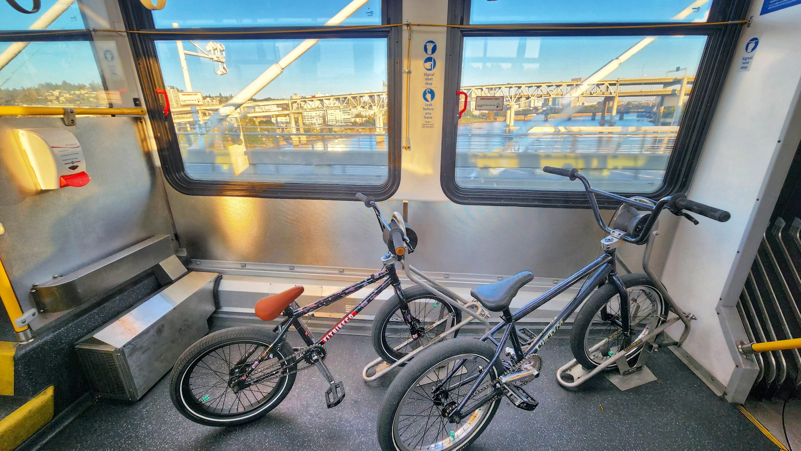
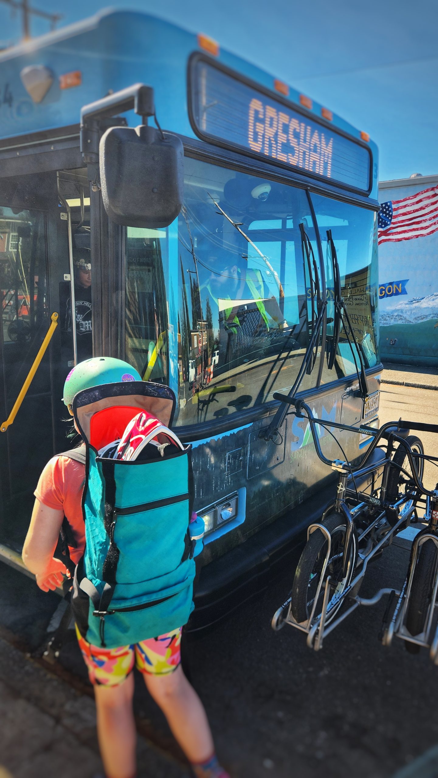
Our bikes happily parked on the FX2 (aka “bendy bus”).
This is the latest installment in Shawne’s Adventures, a somewhat regular column where Tigard resident (and Portland legend) Shawne Martinez shares his carfree adventures — most of which he does with his young (fourth grade) daughter Eliza.
All of our 2026 Summer weekends were booked months in advance. We were so busy with birthdays, events, shows, work and family visits that we didn’t have time to go mountain biking on Mt. Hood or check out do something we’ve had on our list for a long time: explore Cedar Park in Sandy. Then school started and October rolled in. But, thanks to these (human-caused climate change-induced) 80-degree October days, we’ve gotten an extension on summer.
So this past Sunday was wide open for another carfree bicycle adventure with my little one. Let’s go to Sandy, Oregon!
Advertisement
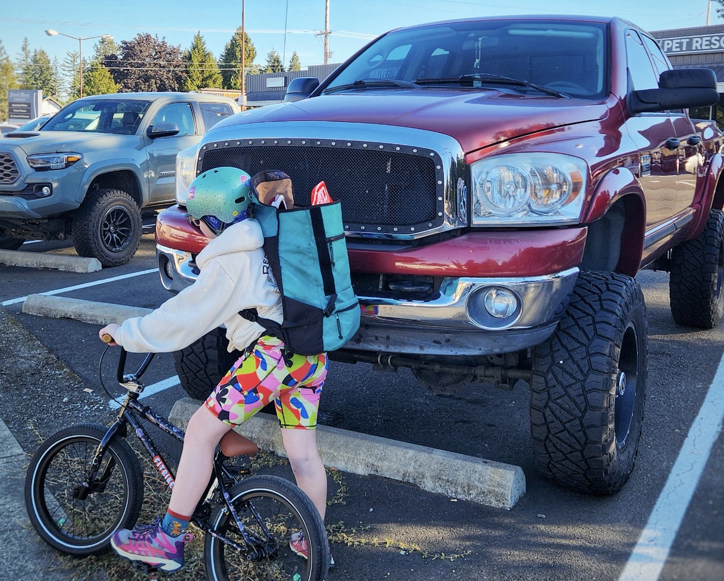
It was tough to get the kiddo out of bed at 6:00 am on a Sunday, but she later agreed that it was worth it. We grabbed our “park bikes” (BMX style bikes for riding at skate parks and pump tracks) and barely made it in time to catch the Line 12 bus to Portland. We wear our regular bike helmets on the street for better visibility and hearing, but bring our full-faced helmets with us in backpacks for the track. Jumping on the FX2 bus downtown is so nice with rear door boarding that leads directly to the bike racks inside the bus. One more transfer at Gresham Transit Center onto the SAM bus to Sandy and we were eating morning donuts at Joe’s without ever having to worry about driving, fueling or smelling a car. (I guess we did have to smell some stinky giant diesel pickup trucks, though.)
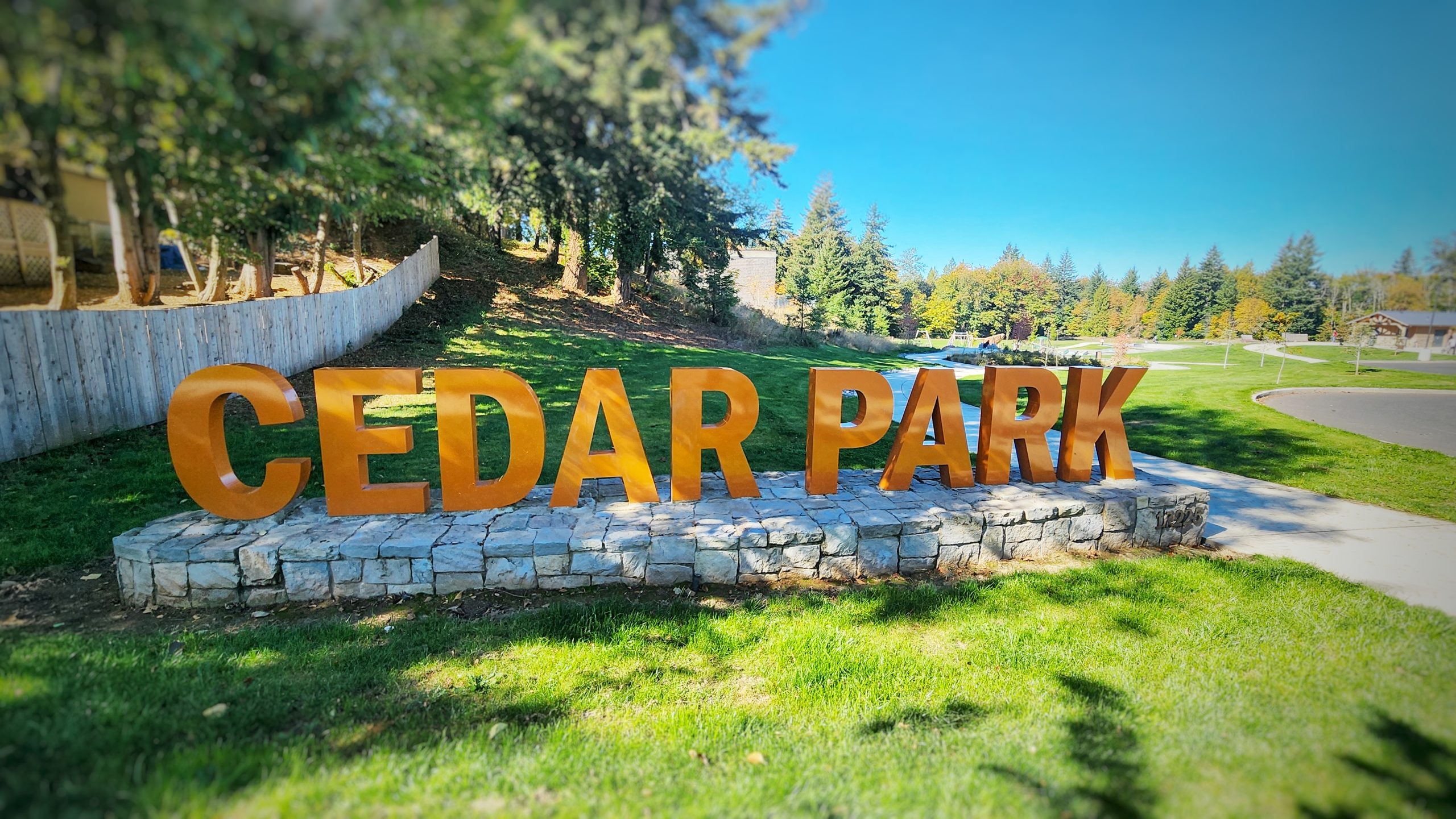
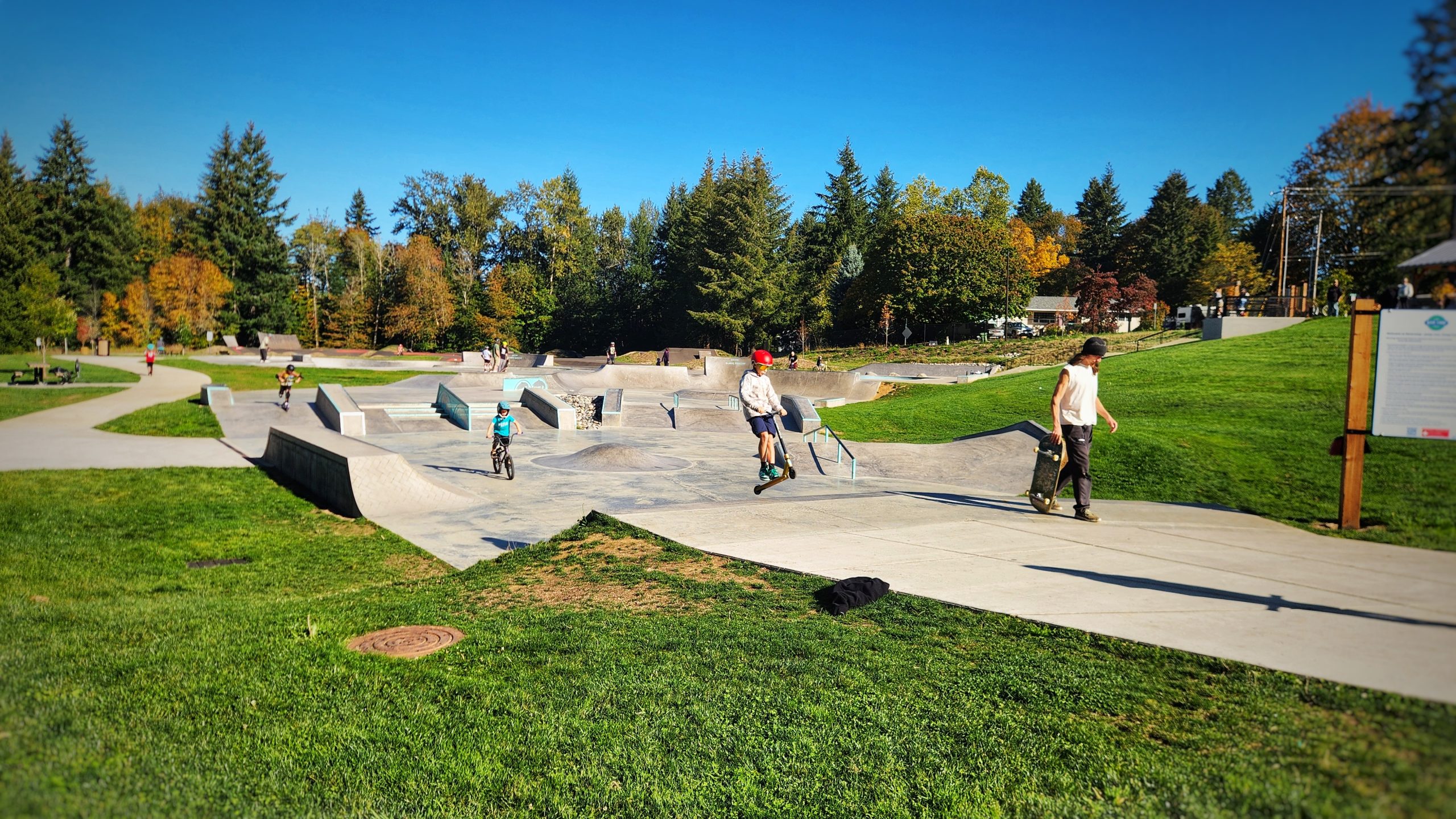
Biking just four blocks north from the donut shop and we were at Cedar Park! I was expecting just a pump track, but there is also a skate park, playground, walking path and bathrooms. This is a big space! Rolling in early, there were just a few people there. We strapped our pads on, swapped helmets and aired up our tires before hitting the track.
Pump tracks are a great workout! Using your full body to pump the bike forward and backwards through the rolling hills of the asphalt track, you can sustain forward motion without ever having to pedal. There’s an advanced course with wooden ramps for getting air and a smaller kid sized pump track. After the first hour, the place started getting more crowded. It was so cool to see so many people sharing the same space while riding skateboards, bicycles and scooters. Everyone got along, took turns and looked out for each other. My kiddo was getting more confident, learning how to launch out of one of the banked turns. A friend from Portland showed up and we started talking.
I looked over at the track just in time to see the rear wheel of my daughter’s bike flying through the air…
I looked over at the track just in time to see the rear wheel of my daughter’s bike flying through the air as the bike flipped forward followed by a shrieking scream. “She just crashed!” I exclaimed as I pedaled as fast as I could through the track and around a berm. My kiddo was on the ground, leg through the triangle of the bike frame and screaming so loud! I carefully moved the bike and tried to calm her while my friend helped. My first-aid training kicked in, and I did a quick assessment. She was very upset and in a lot of pain, but it seemed that it was nothing serious. We pulled all of her gear off and let her calm down on the grass. Having a full-faced helmet, knee pads and elbow pads made a huge difference here. She had some abrasions on one knee (from impact through the pad) and a big bruise on her thigh from getting tangled in the bike frame and impacting the ground.
After many minutes relaxing in the shade, it was time to call it a day and head out to grab lunch in town. There was much limping at first, but after noodles at Double Dragon and a lollipop, we jumped back on the SAM, FX2 and the 12 to get back to Tigard.
There are a few different ways to travel between Gresham and Portland using public transit. You can take the MAX or the 9 bus, but we like the bike racks inside of the bendy buses.
I’m always looking for ways to make Tigard more walkable and bikeable. Knowing that bikes mean business, I think about the bike tourism dollars that we left in Sandy this weekend. I want that for Tigard. After years of volunteering with the Tigard Transportation Advisory Committee and Climate Action Tigard, I’m ready to take my advocacy to the next level by running for Tigard City Council! I would love to bring a pump track to Tigard. Let’s make it happen! Thanks for joining us on another car-free bike adventure. See you out there!
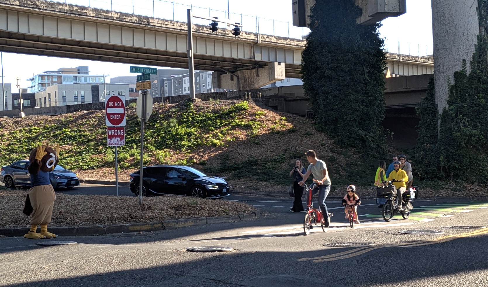
Owly, the International School of Portland’s mascot, waves on morning commuters using the new S Sheridan bike lane. (Photo: Ryan Hashagen)
This article is by consummate mobility advocate Ryan Hashagen. Learn more about his work with Better Block PDX here.
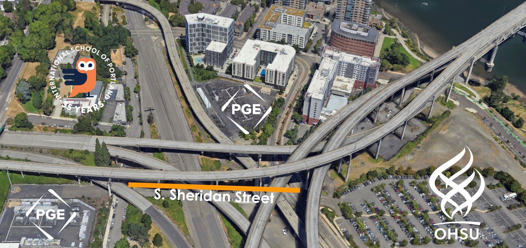
A stretch of road on South Sheridan Street now has a safer route for people walking and biking. The recently completed project, known as Better Sheridan, grew out of a proposal from students, parents and administrators at the International School of Portland (ISP). The goal was straightforward: create a safer way for students, staff and other pedestrians to travel through a part of the South Waterfront neighborhood where sidewalks had abruptly ended.
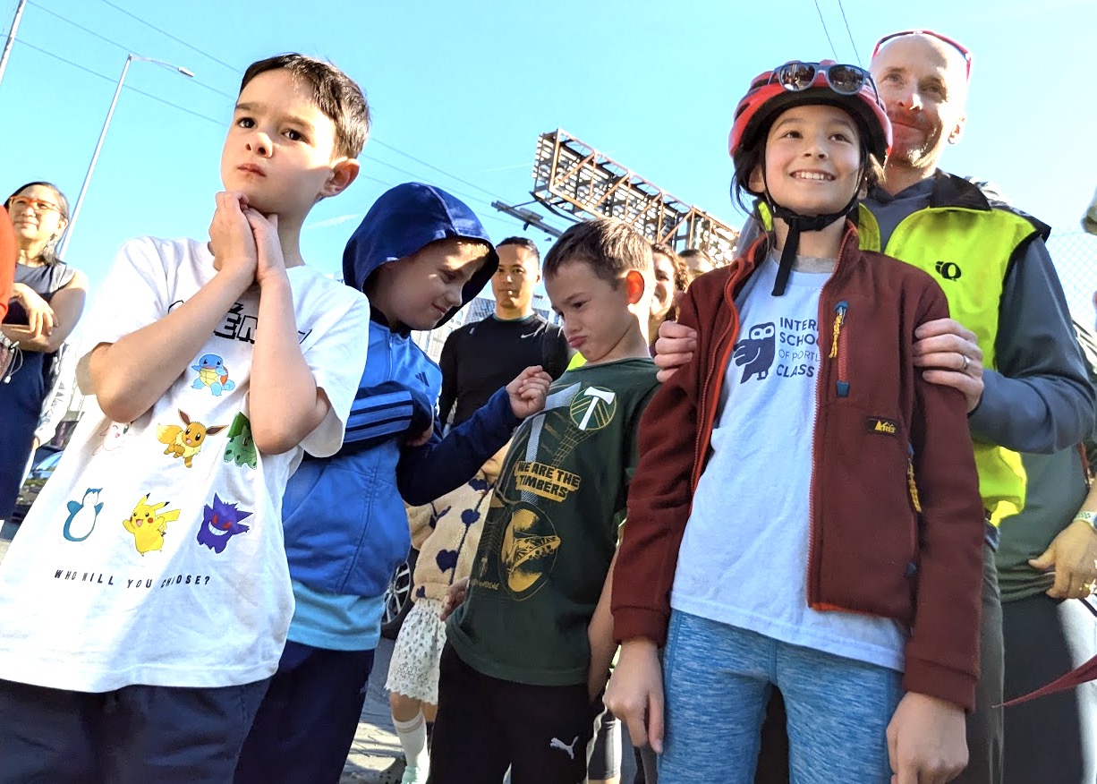
The implementation of the first phase of the project was celebrated last week with a back to school community bike bus that brought together hundreds of International School students, families, faculty, staff, neighbors and community partners.
Councilor Olivia Clark’s office provided financial backing for the project, stating “My office proudly invested $70,000 to the Portland Bureau of Transportation in support of street safety projects like this one. Everyone plays a part in kids traveling to and from school safely. Our streets are safer and work better when we all use them correctly.”
The project was also made possible thanks to a two-year collaboration among International School children, parents, and administration; Portland State University Urban Planning and Civil Engineering Capstone students, neighborhood organizations, and the Portland Bureau of Transportation. The collaboration was coordinated by Better Block PSU, a partnership between PSU’s Transportation Research and Education Center (TREC) and Better Block PDX, a non-profit that promotes grassroots community placemaking and traffic safety projects.
“This morning, hundreds of students, families, faculty, staff, neighbors, and community partners came together to celebrate Phase I of Better Sheridan with one HUGE Bike Bus,” said Bodo Heiliger of the International School of Portland, during last week’s event. “Bikes, scooters, balance bikes, trikes, and lots of cheering. A pretty perfect Portland morning.”
(Source: Better Block PSU)
Students at last week’s celebration. (Photo: Ryan Hashagen)
The celebration marked the culmination of a project that began through the Transportation Research and Education Center’s (TREC) Better Block PSU program at Portland State University. Urban planning students studied the corridor as part of a bike and pedestrian planning course, while civil engineering capstone students later developed a traffic-control plan for the project. PBOT then worked with the students and the community to turn the concept into a quick-build project.
The result is an advisory sidewalk and bike lane along South Sheridan Street that creates a connection between South Moody Street (where streetcar, light rail and the Tilikum Crossing come together) and South Water Street near the International School and other offices.
For students and employees walking through the area, the improvement addresses a longstanding gap in the neighborhood’s transportation network. The project also gave International School students an opportunity to participate in shaping their communities.
“At ISP, we want our students to see themselves as active participants in their communities, working to make the world a better, safer, and more peaceful place,” Heiliger added.
South Sheridan is an unusual piece of Portland’s street system. The road runs beneath what was once Harbor Drive, the waterfront freeway that was removed in the 1970s. A remnant of the former highway remains, including an off-ramp that directs vehicle traffic into the surrounding neighborhood.
Today, the area is surrounded by major transportation infrastructure, including I-5 and the Fremont Bridge. It is also home to the ISP and is used daily by hundreds of students, staff and Oregon Health & Science University students and employees.
Before the project, South Sheridan did not have a continuous sidewalk on either side of the street. Pedestrians—including schoolchildren and OHSU students and
nurses—were forced to navigate a corridor designed primarily around vehicle movement.
The Better Sheridan project brought together a wide range of participants. ISP families and administrators helped develop and advance the idea, while the school worked with OHSU, the South Portland Neighborhood Association and the Downtown Neighborhood Association to build community support.
At Portland State, students in urban planning and civil engineering took the project through successive stages of research and design. Faculty and instructors involved included Drusilla van Hengel, Derek Abe, Evan Kristoff, and myself, Ryan Hashagen.
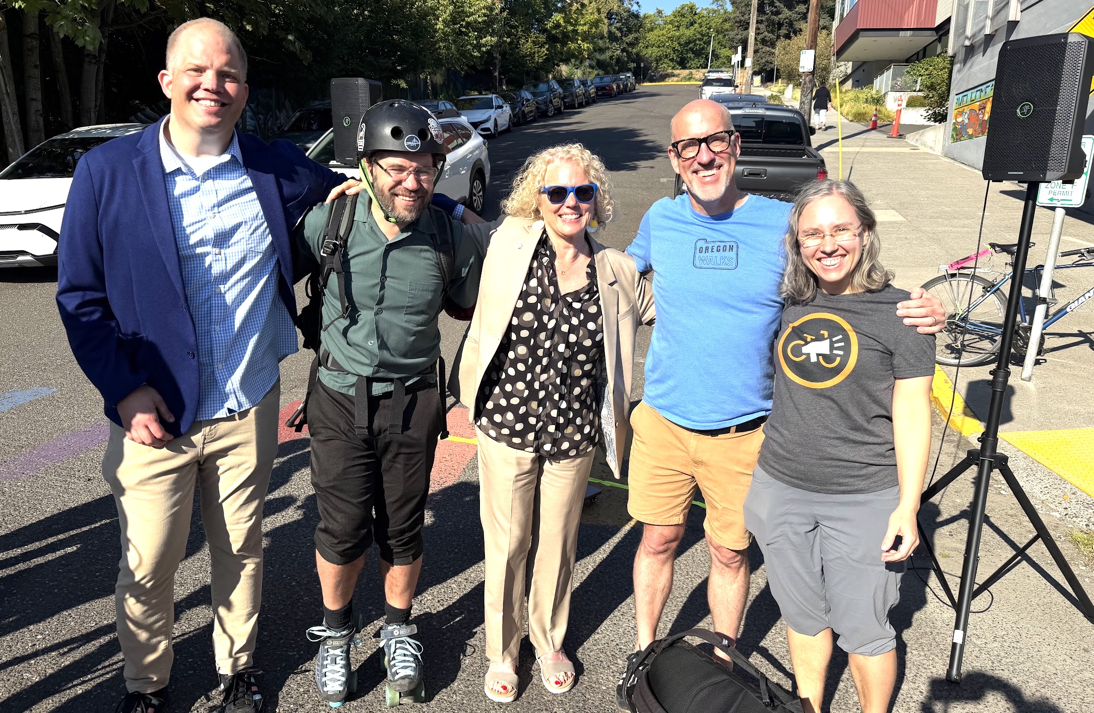
(L to R: Bodo Heiliger, International School of Portland; Ryan Hashagen, Better Block PDX; Olivia Clark, Portland City Council; Mike Dennis, Oregon Walks; Claire Vlach, BikeLoud PDX.)
The Better Block PSU Project Pathway is supported by TREC – the Transportation Research and Education Center – led by Jennifer Dill and John MacArthur, with Nathan McNeil as the Better Block PSU liaison.
The project was eventually handed to PBOT staff, including project managers and traffic engineers William Tabajonda and Patrick Wong, who worked on the design and implementation. Other PBOT staff involved included Liz Hoekstra, Scott Cohen and Abra McNair.
For Heiliger, the project demonstrates what can happen when students, educators, government agencies and community members work together around a shared idea.
“Better Sheridan is a beautiful example of that mission in action,” he said. “People across our school, city, universities, and neighborhood working together to make our little corner of Portland safer, more connected, and more joyful.”
What began as an idea from ISP students ultimately became a built project—giving pedestrians and cyclists a safer way through a corridor shaped for decades by Portland’s highways, ramps and other large-scale infrastructure.
This article is by our resident route master and ride leader Tom Howe. See more of his fun local routes here.
We know how Portland loves its crows… and soon there’s going to be an animated movie about them called Wildwood. What does all this have to do with bicycling and Portland? Well, quite a bit!
The film’s storyline takes place in Portland. In the trailer for the movie, the main character (named Prue) sets out on a rescue mission by bike, with her friend Curtis tagging along. They are determined to find her baby brother after he’s flown away by a large number of crows. Their journey takes them through the streets of Portland and deep into the mysterious Wildwood Impenetrable Forest – a fantastical landscape reminiscent of Portland’s Forest Park, with what looks like hints of inspiration from the Columbia River Gorge. Along the way, they encounter challenges beyond anything they could have imagined as they follow the trail of the crows deeper into the unknown.
As part of a wonderfully creative marketing campaign, LAIKA (the company that made the film) has once again teamed up with local artists and community sponsors, following in the tradition of the beloved Coraline’s Curious Cat Trail statues. This time, 30 larger-than-life, six-foot-tall CROW statues, each uniquely painted and crafted from steel and fiberglass, have taken wing and landed in locations across Portland.
While there is a free paper map (or a $1.49 app) to help you track them down, finding all 30 crows by bike is its own Portland adventure with one-way streets, busy intersections, and sporadic bike paths. It takes a little planning to get from one crow to the next safely, so I’ve created five Ride with GPS routes for self-guided adventures, allowing you to explore at your own pace. I’ll also be leading several fun group rides in collaboration with BikeLoud PDX to help others come ride, explore, and discover something new!
NOTE: The crow statues will be removed from their various locations on October 30. On the weekend of October 31 to November 1, all 30 statues will be displayed together at the Darcelle XV Plaza on Harvey Milk Blvd. They will be auctioned on November 15th at Lewis & Clark College with proceeds supporting the OHSU Doernbecher Children’s Hospital.
Ride With GPS Self-Guided Routes
Wildwood – 25 Crows Downtown – visit all 25 in Downtown on this 9.6-mile route starting at OMSI and taking you back to Steel Bridge.
Or split into two parts of 13 and 12 crow sculptures each.
The remaining crows are located further out, with 3 statues in the West Hills and 2 statues in North Portland.
Wildwood – 3 Crows West Hills – a challenging route! Includes 5.7 miles riding with 800-foot elevation gain plus a 1.5 mile 500-foot elevation change hike on the well-maintained Wildwood Trail to the Bird Alliance (note: bicycles are NOT allowed on the Wildwood Trail, either riding or walking the bike). Route starts at Lincoln High School, goes to the International Rose Test Garden, and then to the Pittock Mansion before looping back to Lincoln High School in downtown Portland. The Pittock Mansion has bike racks for locking bikes if you do the trail walk.
Wildwood – 2 Crows North Portland – a 6.8-mile bidirectional route starting at the crow near the Moda Center and ending at the crow at the St. Johns Library. It mainly follows the North Greeley Multi-Use Path and Willamette Boulevard to get to St. Johns.
Group Rides (organized by BikeLoud PDX):
The downtown route has been split into two parts for Family-Friendly mileage, and will be duplicated on multiple dates:
Sunday Sept 6th 2:30pm start @ Pioneer Square – Part 2 to 12 crows, a continuation of Part 1 ending at the Steel Bridge. Ride details.
After the movie release on October 23rd, we’ll repeat it:
Sunday, October 25th 11am @ OMSI – – Part 1 to 13 crows, ends at Pioneer Square. Ride details.
Sunday, October 25th 1:30pm @ Pioneer Square – Part 2 to 12 crows, a continuation of Part 1 ending at the Steel Bridge. Ride details.
To close out this article, I’d like to quote the question the movie trailer asks us, “How far would you go for those you love?” Putting a cyclist’s twist on it: “How far will you ride for the things you love?” …For the love of crows, the love of art, love of Portland – or simply for yourself. Sometimes the best way to discover what you love is to simply ride toward it.
This article is by Portland resident Carissa Conklin.
I have a faint memory of being a young girl learning to ride a bike in the church parking lot. Falling more than once on the uneven gravel.
With only the encouragement of my parents and older siblings, which was more like tough love, I refused to give up until I could balance on those two wheels. I remember feeling proud of the matching scrapes on my knees that proved I worked for it.
Since then, my only riding experience has come few and far between. I’ve never owned a bike of my own.
All of that changed this June when I walked into Something Cycles in Portland, Oregon on a Friday afternoon to purchase my first adult bike.
I have wanted to get a bike ever since I moved to Portland last June from the coast. I observed friends in the cycling community and was always curious about the glow that seems to permanently radiate around them.
I observed friends in the cycling community and was always curious about the glow that seems to permanently radiate around them.
My life had other plans for me, though.
That July, I started to care for my mother in Eastern Oregon during the last weeks of her life. In August of 2025, my beautiful, incredibly caring mother passed away after a very long and difficult decade-long battle with terminal cancer. I will never be able to put into words what it is like to witness the loss of my mother. I remember moments sitting on the couch with her, showing her bikes on Facebook Marketplace, and telling her that I would be getting a bike soon. It feels good to know that she was a part of the beginning stages of my bike journey.
But after her passing, the intense pain and out-of-this-world loss made it impossible to think about bikes. I decided to let myself walk all of the roads of grief that felt easiest — cheap and free dopamine — I drank tequila, I rolled joints, I avoided moving my body. It felt easier to replace my healthy habits with ones that made the pain a little less jarring.
And then came a new year. After several months of gloom, the magic of a Portland summer presented itself to me. I don’t believe it was just one thing… I think it was a lot of little things that really pushed me out of the darkness. Lying on the lawn at Irving Park and watching the trees sway in the breeze. Shooting hoops at the basketball courts. Finding a sports bar in SE with the perfect vibe. Whatever it was, I was determined to get myself a bike and experience all that Portland has to offer. To get that glow I have always envied.
I tried Facebook Marketplace. I thought since this would be my first adult bike, I might as well not spend too much money.
To be real, I have maybe ridden a bike once or twice since the age of ten. I didn’t know anything about anything. I read Reddits. I talked to friends. I stalked bike people’s Instagrams.
I was influenced by someone who said, “Facebook Marketplace is a great place for a used bike, but if you know nothing about bikes, it might not be the easiest place to start.”
Finally, one of my friends, Dave Coyne (*shoutout* co-owner of Obelisk Brewery in Astoria, Oregon), told me about Something Cycles on East Burnside, run by Nicholas Sorenson.
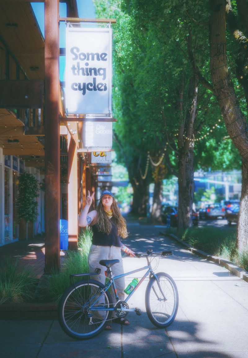
Giddy on my new bike day in front of Something Cycles.
When I walked into Something Cycles, I was greeted by Nick and his adorable shop dog. I told him that I knew nothing about bikes but was ready to jump in. He showed me his lineup, and I don’t know who picked who, but I decided to go with a 90s refurbished MTB. A Specialized “Hard Rock.”
I knew how cool my bike was the minute I saw her. Nick encouraged me to take her back to the parking lot and give her a ride before committing. And, quite frankly, I was shocked I even remembered how to ride.
I did one solid lap and knew she was mine. Nick kindly added a rear rack and mounted some new lights on her, and I was on my way…
I loaded her into the back of my RAV4 and took her immediately to my aunt and uncle’s to show her off. My aunt wanted to name her immediately. I told her I needed more time to get to know her before I was ready to give her a name.
There is nothing quite like the first few rides on a bike. My hands were positioned on the brake levers at all times. The solid stops at every stop sign, even when there wasn’t a car in sight. The obsession over whether my saddle was at the right height.
I can honestly say that getting into cycling has helped me on my grief journey.
I am not going to lie, the first few rides, I thought to myself, “Did I make a huge mistake in getting into this?” And then, one evening after work, I rode my bike to Irving Park, and laid in the lawn like I have so many times. Except, this time, I had my bike leaned against a tree beside me, and the breeze felt just right.
That night on my ride home, I felt a little more confident, and I swear the wind whispered in my ear and told me that my bike’s name was ‘Sasha.’ She has been Sasha ever since.
Personally, the greatest gift biking has given me is the grounding human experience that being on a bike provides. I love how present I feel on the bike. I am more in tune with what is going on around me. I don’t feel a stick on the road if I am driving my car. I don’t huff and puff going up a hill when I drive. It’s nice to be closer to reality and the ground I am crossing. In a way, it taps me into the world in another way, it unplugs me from the matrix. At times it feels like magic.
Since purchasing Sasha, she has rarely left my side. I have only stored her in my apartment’s bike garage for three days while hosting my sister, nephew, and their dog Birdie in my one-bedroom apartment. I was sad not to see her in her designated spot, perfectly propped up against a closet right next to my work desk. I find myself more comfortable when she is around.
I’ve added a chartreuse-colored handle stash cup holder to her handlebars and changed out her saddle for a B17 Brooks classic leather. A set of Shimano PD-GR500 Flat Platform Pedals have been ordered and are on the way.
In the future, I may shorten her handlebars by 20mm on each side and change out her quill stem to an angled option, raising her handlebars by a good inch (all tips given to me by Jason at Endurance PDX, who offers professional bike fittings). I plan on putting some Velo Orange 26” Snakeskin Fenders on her, and will change out her grips for an ergonomic style, but those are projects for another day.
This April, Sasha and I are headed to Ireland. I booked the trip for the week of my mother’s birthday. I can honestly say that getting into cycling has helped me on my grief journey.
Life is made easier from the view of a bike. It forces you to be in the present moment and connected to your soul in a real way. Every time I ride my bike, I know my mom’s energy rides with me and I am grateful.
Whoever wants to get into biking but hasn’t been able to commit to it yet, let this be a source of encouragement. I know you won’t regret it.
— Carissa Conklin is a proud Oregon Coast native currently living in the Irvington neighborhood in Portland, Oregon. When Carissa isn’t biking or writing she enjoys many of the simple pleasures life has to offer: strong coffee, farmers markets, and a good jigsaw puzzle.
Location: East Portland, Oregon Compensation: $63K-$65K annually Schedule: M-F 9-5; occasional work before 9am, after 5pm, and weekends required Term: Grant-funded through 6/30/2029, with the possibility of extension
The Role
The Bike Bus Coordinator is the backbone of Bike Bus PDX’s emerging East Portland bike bus programs! This position will work closely with families, school staff, school districts and community-based organizations to plan, implement and evaluate bike buses.
What You’ll Do
Collaborate with school staff (social workers, counselors, principals), Bike Bus Champions (compensated school-based coordinators) and the PTA to build relationships with families and deliver a community-responsive bike bus program
Recruit and train Bike Bus Champions and volunteers at each school
Design and ride each bike bus route regularly, working with Champions to address issues, relaying safety concerns to city and state stakeholders
Coordinate with the Bike Bus Liaison to develop and deliver school and family outreach materials such as flyers, newsletters and digital materials.
Collaborate with PE teachers and school admin to deliver bike education bicycle fleets
Maintain ride supplies and gear
Organize and execute biannual school-based bike swaps and fairs
Integrate best practices into an open-source ‘Bike Bus Toolkit’
Who You Are
Equity-Focused Organizer: Your heart is in coordinating programs that center families and/or school communities that have been historically underserved. Evidence matters more than job titles.
Experienced Cyclist: You are confident assisting with group bicycle rides that include children and designing routes within urban settings.
Creative Problem Solver: You anticipate bumps in the road, and know what and who to collaborate with to get the job done in a fast-paced and time-sensitive environment.
Punctual Morning Person: You are an early bird who ensures that everyone arrives where they need to be by the ring of the first bell. You bring your all to early morning weekday programs, in addition to occasional weekend events.
Detail-Oriented: You are adept at tracking project details, expense reimbursements, and equipment logistics.
Preferred
Bilingual in English/Spanish, lived experience in the communities we serve; experience with Safe Routes to School or active transportation, bike mechanic skills; First Aid & CPR certifications. We expect strong candidates to be missing some of this.If the core of the role fits you, apply.
How to Apply
We will be accepting applications through September 15, 2026. This posting will remain open until filled.
To apply, please send an email with your cover letter, resume, and the subject line “Coordinator”.
This job description is intended to describe the general nature of the role and is not a comprehensive list of all duties or responsibilities.
Cascadia Action is an equal opportunity employer and values diversity at all levels of the organization. We encourage applicants of all backgrounds, identities, and lived experiences to apply. Reasonable accommodations will be provided for qualified individuals with disabilities. As a nonprofit organization, flexibility, collaboration, and a willingness to support evolving organizational needs are expected.
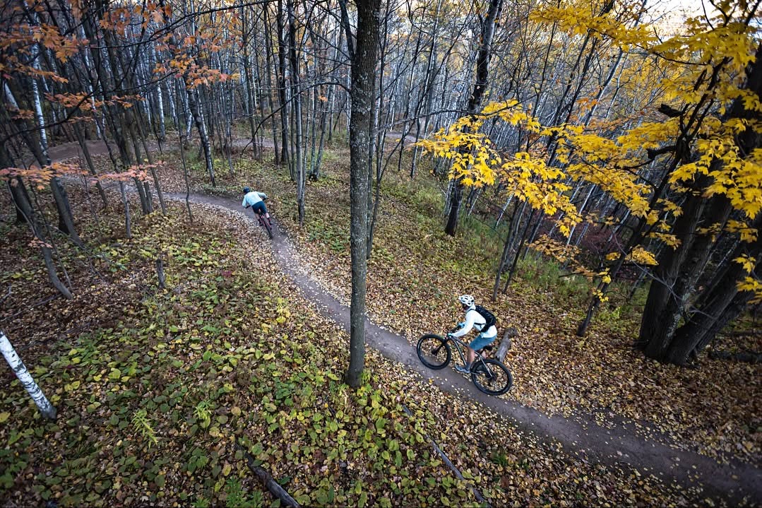
A section of Spirit Mountain Trail in Duluth, Minnesota. This is what urban singletrack really looks like: friends out for a ride in their neighborhood. Not a Red Bull ad. Not massive earthworks. Just a ribbon of dirt through the woods. (Photo provided by author)
This guest article comes from Joshua Rebennack, a trail builder and advocate for urban mountain biking who lives in Central Minnesota. He’s presented to local trail groups and has previously sharedtwo guest articles.
***
A titch over ten years ago, Portland launched the Off-Road Cycling Master Plan (ORCMP). As BikePortland noted at the time, “If at first you don’t succeed, try try again.” After years of false starts, bans by fiat, and protest rides, advocates hoped it would finally deliver real urban mountain biking.
Did it? A decade later, where does Portland stand? On its own and in comparison to peer cities nationwide?
How This Started
This all starts with the River View Natural Area master planning process. After the City bought the property, mountain biking was allowed on existing trails, and the Northwest Trail Alliance (NWTA) even began maintenance with the City’s blessing. But during that master planning process, the shenanigans started.
The City imposed an unnecessary “interior space” rule on the 146-acre site (unnecessary since wildlife impact zones actually exceed the park’s physical dimensions) and designed unsafe, amateurish loops. When this didn’t deter mountain bikers, Commissioners Amanda Fritz and the late Nick Fish banned biking entirely, ensuring the final planexcluded it.
The protest rides and media campaign that followed were surprisingly well coordinated. Mainstream outlets highlighted Portland’s undemocratic meddling and its pattern of blocking mountain bike access. As the brouhaha persisted, Mayor Charlie Hales authorized $350,000 for a citywide master plan, the ORCMP, to be overseen by the Bureau of Environmental Services, given Parks’ long history of anti–mountain bike bias.
Things Do Not Go as Planned
Almost immediately warning signs appeared. The city selected Toole Design Group and Hilride (now defunct) as consultants, neither experienced in citywide urban mountain biking, shared-use singletrack, or the management methods used by the cities that had created trails systems in the decade prior.
The problem deepened when the City failed to vet Project Advisory Committee applicants, allowing anti-mountain bikers to be included. One member, married to a vocal opponent, reportedly shared non-public committee communications with anti–mountain biking groups.
If that wasn’t bad enough, the ORCMP meetings bordered on farce at times. Time was wasted discussing cartoon graphics and abstract equity debates while core issues – shared-trail safety, environmental impacts, and lessons from cities that had already addressed these challenges – were routinely sidelined.
The final blow came with last-minute additions of go/no-go trail areas, specific layouts, and the removal of potential sites. As a trail designer, I can say plainly: none of this belongs in a citywide plan. Such plans should rank and prioritize locations, not dictate designs.
Audio from the meeting where these changes were introduced, and when committee member Kelsey Cardwell questioned them, is difficult to hear. Consultants and staff responded with opaque explanations that amounted to: “We’ve decided. Accept it.”
Even with these negatives, the ORCMP could have been amended or succeeded to reflect nationwide best practices. Sadly, we do not live in that timeline.
The unamended ORCMP languished for seven years before its adoption in March 2023.
NWTA executive director Lisa Olivares said at the time that they “look[ed] forward to continuing our work to support growth in off-road cycling opportunities as presented in the plan.” It’s hard not to be cynical about this statement. While it may be an attempt to find a silver lining, it feels more like a capitulation.
Regardless, one fact remains: a decade after the ORCMP began (and eleven years after the River View Natural Area debacle) Portland’s mountain biking access remains essentially unchanged. While the NWTA often points to Gateway Green as a recent success, that example predates the ORCMP, having been planned in 2015.
What Everyone Else Has Been Doing
Cities other than Portland have not been sitting on their hindquarters during the last ten years. Just a few examples:
Des Moines, IA, hardly known for mountain biking, saw a local group raise funds, win over land managers, defeat well-funded neighborhood opposition, and build a widely praised trail system.
In St. Louis, MO, after years of city resistance, a single advocate partnered with a small Friends group and a local alderperson to secure approval for a one-mile shared-use demonstration trail. Though modest, it became the city’s first, quickly shifting the conversation and prompting discussions of expansion.
There are many other examples, including cities where creating urban trails is easier. The above cases were selected because they required sustained effort, defeating organized opposition, and a willingness to challenge the city directly. Each involved small groups focused on urban singletrack. And every one of them accomplished what Portland has not in the past decade: expanding mountain bike access.
Why Is Portland So Far Behind?
The question is how Portland, already a decade (or more) behind in 2016, could fall another decade behind by 2026. There are three main reasons:
The ORCMP was a trap. Despite the fanfare, the ORCMP has functioned more as a procedural façade than a true plan. It allows the City to claim progress without meaningfully expanding access. That is not just my viewpoint. In a November 22, 2017 guest article, NWTA warned the plan “falls far below” peer cities, excludes most parks while claiming to be comprehensive, and is “absurd.” They called for revisions and partial rewrites. None occurred.
NWTA legitimized a broken process. Given its own criticisms, NWTA’s later endorsement of the same plan is puzzling. Doing so granted unwarranted legitimacy and locked future designs into a framework it found inadequate. The result of the NWTA doing their best Pétain impression is that they are now defenders of a policy that actively disenfranchises their own members.
The Portland Bubble blocks learning. Many lament Portland’s lack of urban mountain biking while ignoring lessons from other cities. Whether from hubris or ignorance, both City staff and local advocates have resisted proven solutions, ultimately strengthening the arguments against urban mountain biking. For instance, during the ORCMP process opponents were somewhat successful in framing urban mountain biking as overly impactful and dangerous. In reality, cities have integrated mountain biking into parks, including natural areas and urban wildernesses, for decades. All while ensuring safe sharing. If you’re unwilling to learn how other cities do that, how can you respond to the false claims made by opponents?
How to Change the Status Quo
If Portland wants real urban mountain biking access, here are three steps to achieve that goal:
Force a reckoning with the ORCMP… or the NWTA. The NWTA should condition its continued support for the ORCMP on meaningful amendments and a credible implementation plan. If those cannot be secured within a reasonable timeframe, it should publicly withdraw its support and begin organized advocacy and protests. If the current board is unwilling to do so, new leadership may be necessary. Either way, accountability must be non-negotiable.
Start small, win early, then scale. Forest Park is the obvious focal point for mountain biking access. But without proven shared-use and conservation practices, expanding access there would be a difficult uphill battle. That is why most cities begin with demonstration trails: small networks that refine management, build trust, and prove outcomes before expanding. Seattle and St. Louis followed this model; Portland should do the same. It’s tempting to chase the biggest prize first. But demonstration trails would make larger projects much easier by proving Portland’s anti-mountain-bikers to be the grifters and charlatans they are.
Break the bubble. If Sioux Falls outperforms Portland in urban singletrack, it is time to acknowledge something has gone horribly wrong. Admitting that truth is the first step toward learning. With outside knowledge, Portland can leverage its unique advantages to build some of the best trails in the nation. But that can’t happen until the bubble is broken.
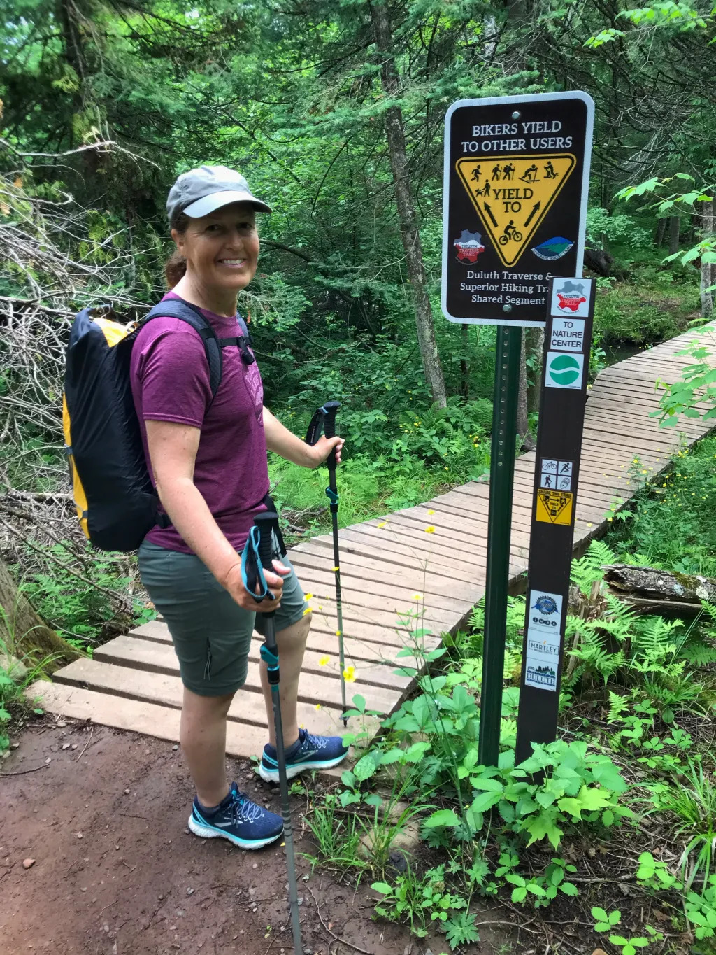
Proven shared-use practices allow hikers and mountain bikers to safely share many types of trails. As shown here, the Superior Hiking Trail and Duluth Traverse share the same trail tread along one section. The Duluth network is almost entirely shared.
Some might suggest that any criticism of NWTA is unfair, regardless of how gentle it may be, pointing to successes like Stub Stewart or Rocky Point. But those are beside the point. The real issue is urban access, where little has changed since 2015. Unfortunately, through their accepting the strictures the ORCMP imposed, the NWTA shares responsibility for its failures, and it’s fair to discuss that fact.
Some argue that comparisons to other communities are invalid because Portland is unique. However, others see differences as opportunities to adapt, not excuses to dismiss proven ideas. Advocates in Ridgeland, MS, for example, did not have a one-to-one comparable location. But they built a great trail system because they focused on the “how” and didn’t waste time comparing others to themselves.
An Extended Helping Hand
Ten years ago, I gave Portland’s first Knobbies in the Neighborhood presentation.
It addresses the key public concerns head-on:
Designing shared-use trails that are safe, enjoyable, and serene for hikers and mountain bikers.
Understanding environmental impacts and management practices that minimize or eliminate them.
Implementing club- and land manager-led models that reduce municipal costs, lower administrative burdens, and support park restoration.
If it is so valuable, why didn’t it have more impact ten years ago? Two reasons seem likely:
First, the ORCMP was about to begin. At the time, it seemed like the long-awaited cure for Portland’s anti-mountain bike bias. Few imagined it would instead become another opportunity for the City to pull the football away. Or that another decade would pass without a single iota of progress.
Second, the broader urban trail landscape looked very different. Expansive citywide trail systems in places like Knoxville, Bentonville, and Duluth were still under development, and most cities were only beginning to build their first networks. In that environment, it was easy to dismiss ideas from “outsiders.”
But times have changed. The decade hence has shown the ORCMP to be a failure. Meanwhile, a third wave of urban trail building is underway, with many cities now deep into developing expansive, high-quality systems.
Although the NWTA seeks true urban singletrack, that is arguably less possible than in 2015 because the ORCMP conflicts with national standards and best practices while limiting locations. But just reforming (or even abandoning) the ORCMP will not be enough. Portland must start building what other communities already have: mountain-biker-built singletrack designed for shared use.
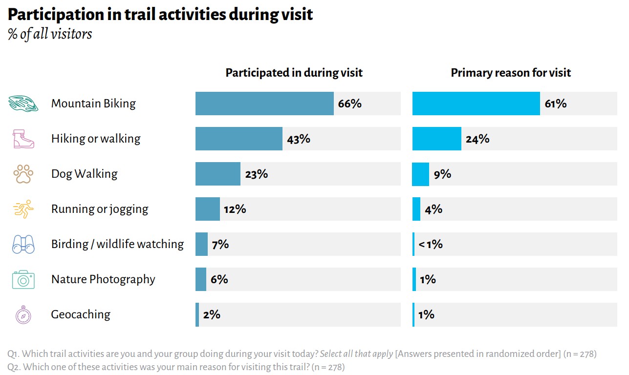
Graphic from the Greater Minnesota Regional Parks and Trails user survey of the Duluth trail system. The chart on the right shows why visitors came to the trails, while the chart on the left shows the activities they participated in. Beyond demonstrating that hiking and mountain biking can coexist successfully (even on trails built by mountain bikers) the results also contradict the belief that mountain biking displaces other users. Participation increased across every non-mountain biking activity, including wildlife watching and nature photography.
The problem is that proposals (before and after the ORCMP) and local trail construction have consistently overlooked the safety measures, environmental mitigations, management strategies, and best practices required for shared-use singletrack. That suggests Portland-area advocates still lack a clear understanding of what’s required.
Therefore, it seems obvious that what is needed is a discussion of the exact points covered in Knobbies in the Neighborhood. And this time, maybe there will be a more accepting attitude.
The next step is easy: host another Knobbies in the Neighborhood presentation in Portland. It would take only an invitation, a venue, with city officials, staff, advocates, and the public in the room. Ideally, NWTA would host it, but any Portland based group serious about urban singletrack could.
In Conclusion
The reality is straightforward: the ORCMP could have sparked real momentum for urban singletrack in Portland. Instead, consultant influence, citizen advisory decisions, and last-minute cloistering transformed it into a framework for segregation.
Yet the ORCMP did contain some foundational elements. Had its constraints been replaced with proven best practices, it might have advanced singletrack access in Portland. Instead, it limits meaningful access while omitting the management, safety, and conservation practices that have become standard across the country.
A decade later, the results are clear. Time has been lost, opportunities have passed, and Portland has fallen further behind.
For Portland-area mountain bikers tired of watching other communities build the trails they wish they had at home, there is a path forward. But it does not run through the ORCMP.
E-Bike Mechanic — Mokwheel Factory Store (Tualatin, OR) $25.00/hr · W-2 · 20–25 hrs/week to start, growing to 30+ by summer 2027
Who we are. We’re Oregon’s flagship Mokwheel dealer — “The Bike Shop That Has Your Back.” We sell fat-tire electric bikes and we take care of people from the first test ride through the follow-up call. Tualatin is our service hub: every build, every repair, every warranty claim in the state comes through this bench.
What you’ll do.
Diagnose and repair e-bikes — electrical and mechanical, not just wrenching
Own warranty diagnosis and documentation with the manufacturer
Build and quality-check new bikes before they go out the door
Talk to customers directly about what’s wrong and what it’ll cost — no service writer between you and them
Help train our build technician toward full mechanic sign-off
What we’re looking for.
Real e-bike or e-mobility experience, or strong bike mechanic experience plus genuine comfort with electrical diagnosis (motors, controllers, batteries, wiring harnesses, error codes)
Someone who can run a bench without supervision — that’s the actual job
Clear, honest customer communication
Comfortable being the only mechanic in the building
Why this job and not the one down the street. We’re a small shop opening a second Portland-area location in spring 2027. This role starts at 20–25 hours and grows to 30+ hours by summer 2027 as we open. You’d be the person who eventually holds a bench alone while the GM is at the other store — which is why we’re paying at the top of the Portland band instead of the middle. If you want to be a name on a schedule at a big shop, this isn’t it. If you want to be the mechanic, it is.
Pay & benefits. $25.00/hr, W-2. $200/month insurance stipend. Company phone. Shop tools and bench provided.
How to Apply
How to apply. No cover letter, no formal resume. Email tualatin@mokwheelstore.com with:
What you've been wrenching on and for how long
The hardest electrical diagnosis you've done — what it was and how you found it
What kind of schedule you're actually looking for, honestly
About This Position
bike works by p:ear is seeking a Safe Routes to School (SRTS) Coordinator to support youth, families, schools, and community partners in building safer, more connected opportunities for walking, biking, rolling, and using transit throughout East Portland and East Multnomah County.
The SRTS Coordinator will work closely with the SRTS Program Manager and existing SRTS Program Coordinator, school districts, SUN programs, jurisdictional partners, and community-based organizations to implement education, encouragement, engagement, and planning strategies that improve transportation safety and increase access to active transportation for students and families.
This position plays a key role in advancing bike works by p:ear’s mission to create equitable, community-centered transportation systems by delivering culturally responsive programming, supporting school-based events, strengthening community partnerships, and helping families feel confident choosing active transportation.
Position Details
Position: Safe Routes to School Program Coordinator
Schedule: Monday-Friday 9-5; occasional work before 9am, after 5pm, and weekends required.
Reports To: SRTS Program Manager
Compensation: $75,108 annually, (base pay + fringe benefits stipend)*
Location: East Portland/East Multnomah County, with regular regional travel
Position Summary
The ideal candidate is an organized, relationship-driven self-starter with strong facilitation, communication, and project management skills, along with a demonstrated commitment to transportation equity, youth engagement, and community-led systems change.
The SRTS Coordinator will support the planning, implementation, and evaluation of Safe Routes to School programming, including bicycle and pedestrian safety education, e-bike education, school events, encouragement campaigns, family engagement, and community outreach.
This role requires collaboration across multiple sectors, including schools, local government, transportation agencies, nonprofit partners, and neighborhood communities.
Essential Duties & Responsibilities
Program Implementation & Education
● Deliver bicycle (traditional and electric), pedestrian, and traffic safety education programming for K–12 students, families, and community members
● Coordinate and facilitate school- and community-based SRTS activities, including:
○ Walk + Roll events
○ Bike rodeos
○ Community rides
○ Safety trainings
○ E-bike education and hands-on riding instruction
● Support safe and accessible use of electric bicycles through education, demonstrations, and community engagement activities
● Support the development and implementation of culturally responsive active transportation curriculum and educational materials
● Promote safe walking, biking, rolling, transit use, and e-bike transportation through encouragement campaigns and community outreach
School & Community Engagement
● Build and maintain strong partnerships with school districts, administrators, SUN programs, teachers, families, and community organizations
● Serve as a liaison between bike works, schools, public agencies, and community stakeholders to align programming and identify community needs
● Support community engagement efforts related to transportation safety, school access, and neighborhood mobility barriers
● Cultivate youth and community leadership around active transportation and transportation justice
Planning, Coordination & Data
● Coordinate logistics, scheduling, supplies, and communications for programs and events
● Maintain accurate participation records, program data, and outcome tracking
● Support grant reporting, evaluation, and documentation requirements
● Assist with outreach materials including flyers, presentations, toolkits, newsletters, and digital communications
● Transport bicycles, equipment, trailers, and event supplies using organizational vehicles, including vans and larger fleet vehicles
Organizational Support
● Collaborate with bike works staff on related programming, advocacy efforts, and special initiatives
● Represent bike works by p:ear at community meetings, trainings, tabling events, and partner convenings
● Support additional duties as needed in alignment with organizational and program goals
Required Qualifications & Competencies
● Minimum one year of experience working with youth, families, schools, and/or diverse communities
● Experience facilitating educational programming, workshops, or community outreach preferred
● Strong commitment to equity, inclusion, and culturally responsive community engagement
● Excellent interpersonal, communication, and relationship-building skills
● Strong written, verbal, and public speaking abilities
● Excellent organizational, time management, and project coordination skills
● Ability to work independently while collaborating across teams and partner organizations
● Adaptability, problem-solving skills, and comfort working in a nonprofit/community-based environment
● Commitment to nonviolence, compassion, and trauma-informed engagement practices
● General knowledge of bicycles, pedestrian safety, and/or active transportation preferred
● Familiarity with electric bicycles and/or willingness to learn e-bike operation, safety practices, and maintenance basics preferred
● Experience riding bicycles in urban environments and confidence discussing active transportation safety with youth and community members preferred
● Valid driver’s license and clean driving record required
● Ability and willingness to drive organizational vehicles, including vans and larger vehicles used for program operations and event support
● Comfort transporting bicycles, equipment, and materials throughout the Portland/Gresham metro area
● Ability to stand for extended periods, work outdoors in varying weather conditions, and lift/move up to 40 pounds
● Reliable transportation or ability to travel regularly throughout the Portland/Gresham metro area
About bike works by p:ear
bike works by p:ear is East Portland’s nonprofit bike shop, advocacy hub, and youth workforce development program. Founded in 2017, bike works works to create safer, more equitable transportation systems by advocating for connected bicycle and pedestrian infrastructure, providing community education and programming, and ensuring historically underrepresented communities have a voice in transportation planning and policy.
Mission:
To advocate for a world-class network of active transportation infrastructure in East Multnomah County that provides equitable access for people of all ages and abilities.
Vision:
A safe, convenient, and seamless active transportation network that connects people to where they live, work, learn, and play.
Equal Opportunity Employer
bike works by p:ear is an equal opportunity employer and values diversity at all levels of the organization. We encourage applicants of all backgrounds, identities, and lived experiences to apply.
Reasonable accommodations will be provided for qualified individuals with disabilities.
Additional Information
*Grant-funded through 6/30/2029 with the possibility for extension.
This job description is intended to describe the general nature of the role and is not a comprehensive list of all duties or responsibilities. As a nonprofit organization, flexibility, collaboration, and a willingness to support evolving organizational needs are expected.
How to Apply
Please send a resume and cover letter to peyton@bikeworkspdx.org with “SRTS Coordinator” in the
subject line. Application closes on 9/4/2026 11:59pm. Email only; no phone calls please.
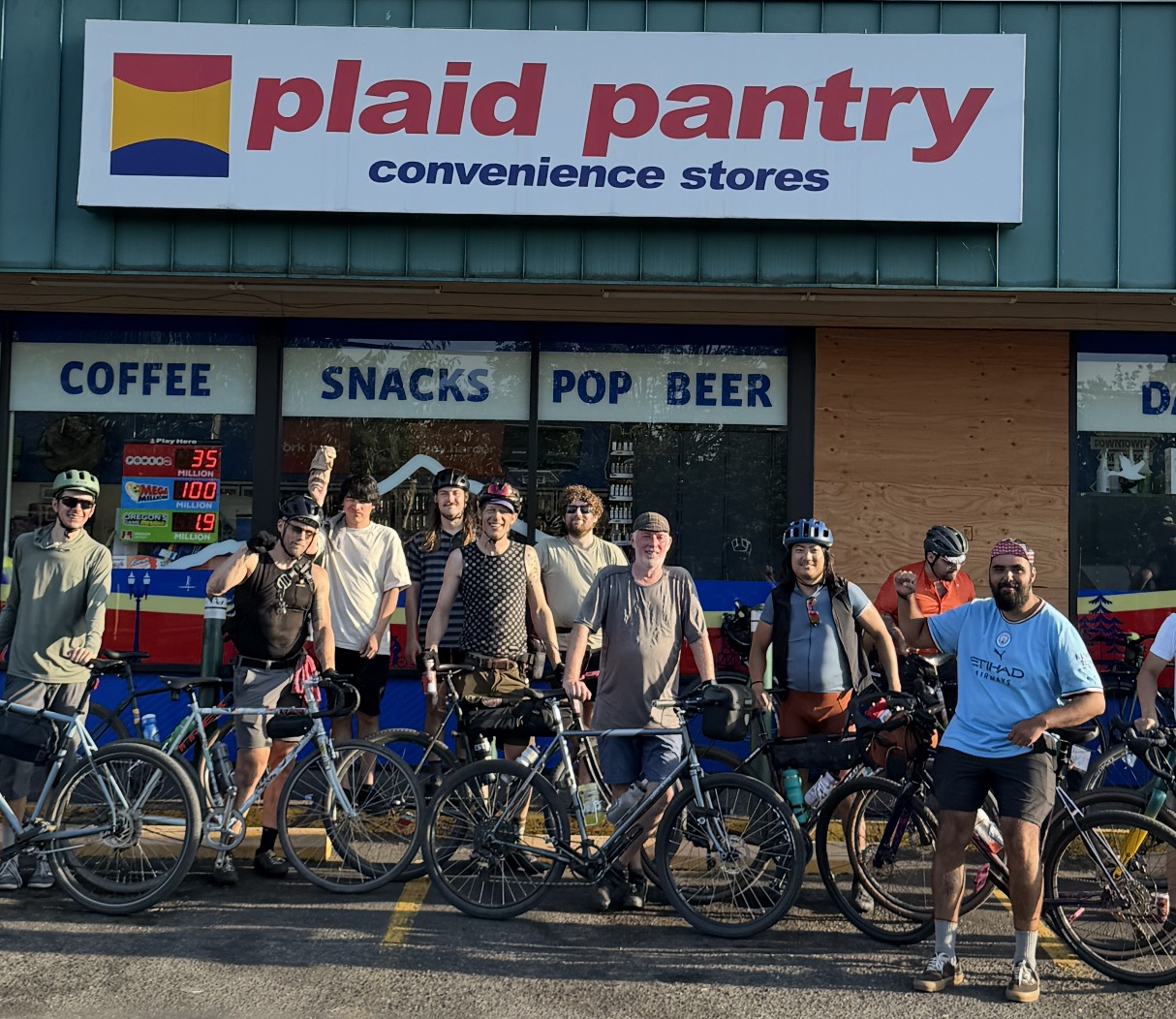
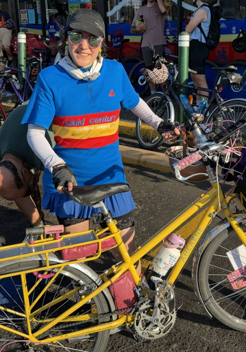
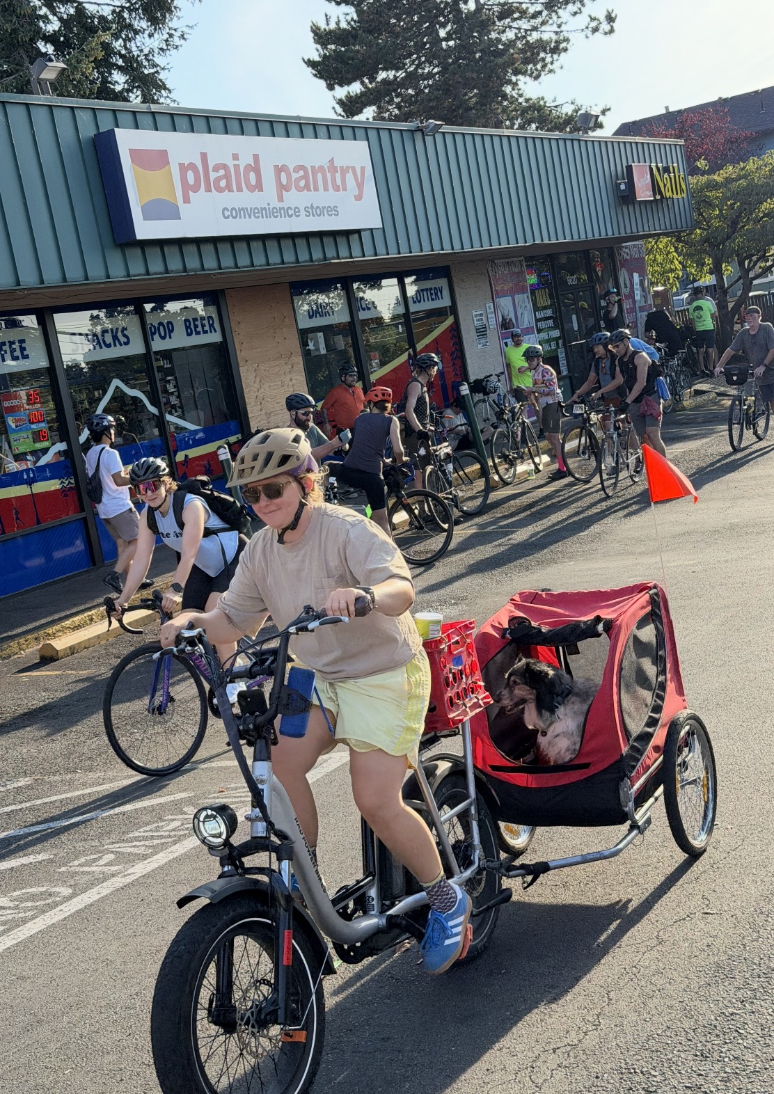
One of many crews who celebrated at the final Plaid location on the route at NE 67th and Glisan. (Photos: Jonathan Maus/BikePortland)
On Sunday, nearly 300 people pedaled across Portland for the first ever Plaid Pantry Century — a 102.7-mile route that took riders (and a few rollers) to 53 store locations. It was the type of ridiculous, free, fun event that Bike Summer is beloved for.
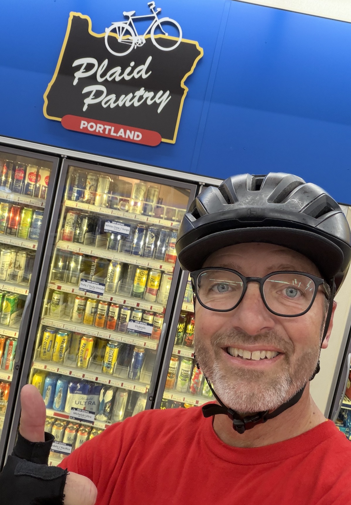
I was part of a relay team that split the route into five legs. My 22-mile leg began at the Plaid Pantry on SW 45th and Multnomah. Once I took a selfie with my teammate (a step organizers required as proof of hand-off), my mission was to follow the route eastward into Sellwood and ultimately to SE 104th and Holgate. That Plaid location was one of six control points on the route. In order to officially finish the ride, participants needed to make a purchase and keep the receipt.
Team Plaidemonium (minus one rider). Hand-off in southwest.A welcome sign.
I found the route to be unexpectedly fun. I’ve done a lot of centuries and typically the majority of the miles are on quiet backroads where I put my head down and contemplate life’s big questions as my brain ticks off the miles. There was hardly a dull moment on Sunday’s route. It forced me to experience new roads, destinations, and connections between neighborhoods. Along the way I reveled in quintessential Portland landscapes like bustling cafes, parks buzzing with activity, and city views that reminded me of why I love this city.
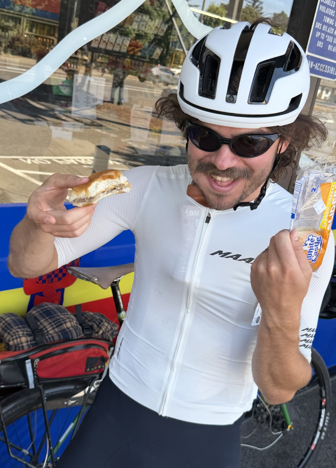
As much as I enjoyed riding, it was the few hours I spent loitering in front of the “last Plaid” on the route (at NE 67th and Glisan) that provided my sharpest memories. I met all types of tired and happy people as they rolled into the ceremonial final stop. Some rode fixed-gears, some rode city bikes or gravel bikes, and others were fully kitted-out on high-end road bikes. Their final purchases were just as diverse and included everything from ice cream sandwiches and microwave burritos, to candy and highly questionable adult beverages.
ScreenshotScreenshotScreenshotScreenshot
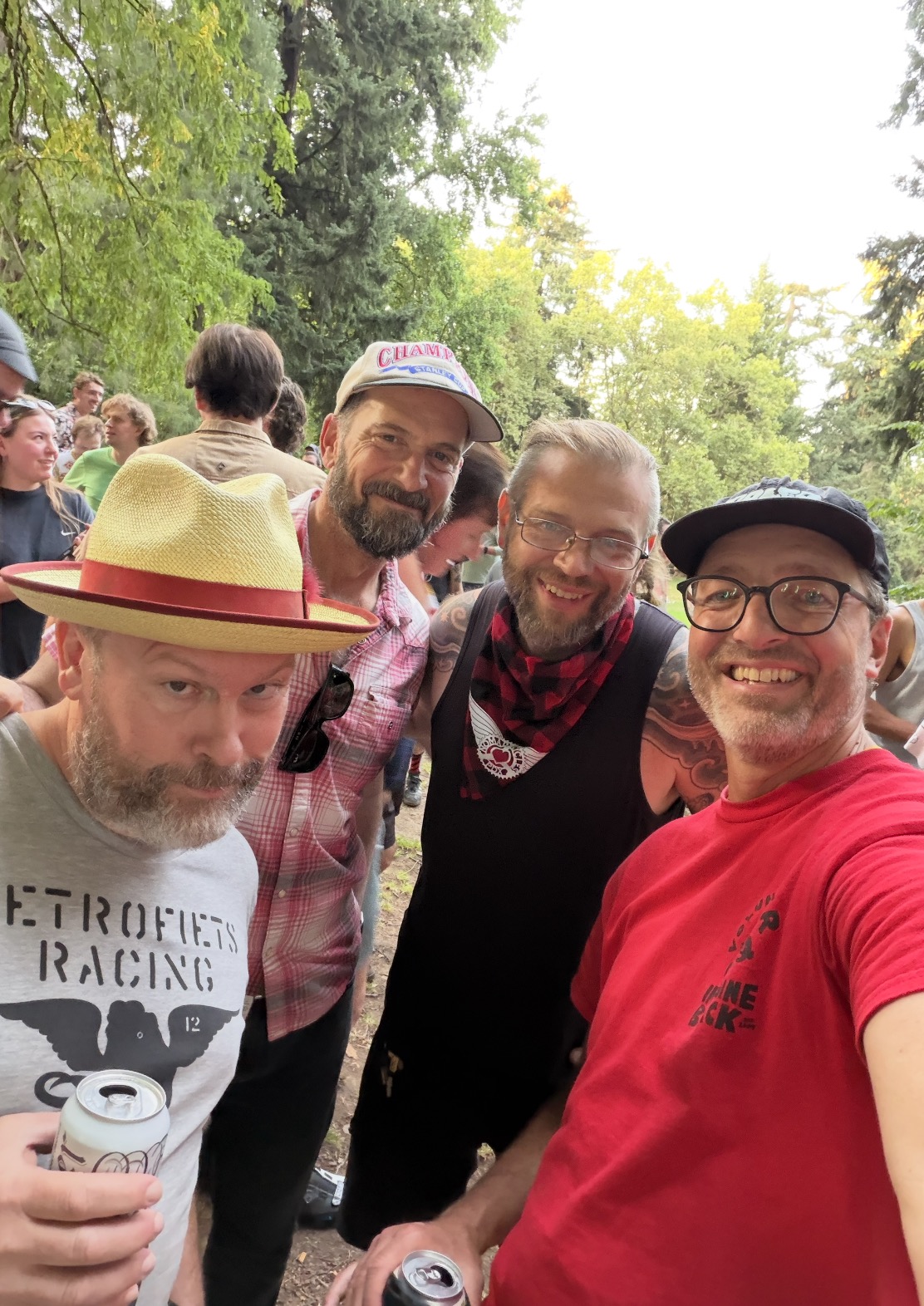
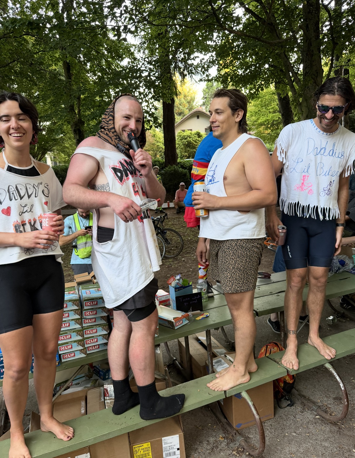
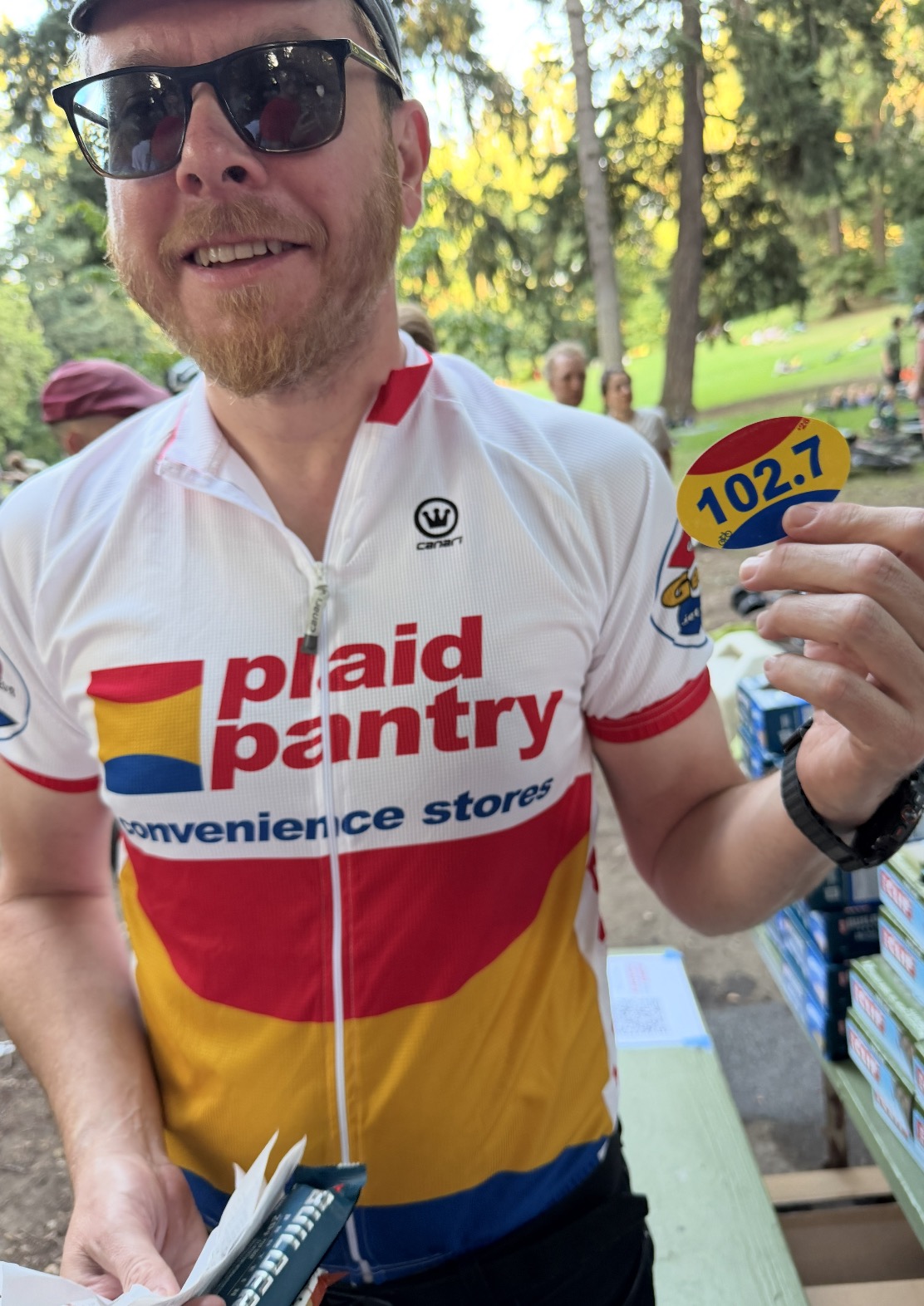
At the end of the day everyone gathered at Laurelhurst Park where receipts were tallied, prizes were distributed, and the silliness continued into the night. One of the special guests was Plaid Pantry CEO Jonathan Polonsky.
“You guys are crazy,” Polonsky said as he climbed onto a picnic bench and took a mic from ride organizer Lilian Karabaic. Once chants of “Plaid! Plaid! Plaid!,” died down, Polonsky, dressed in full Plaid Pantry lycra team kit, continued. “Thank you for doing this. I truly appreciate you all. We are local and we need support like this to stay in business. Without you folks, we don’t have reason to exist.”
Karabaic, who said she took inspiration for the “stupid” event from Portlander Simon Xu who visited 54 Plaid locations in eight hours back in January, only expected a few dozen people to take on the challenge. She and other organizers (her partner Aaron Parecki handled all the tech and Brad Reber and Nate Sjol did the painstaking work to build the route) were blown away at how many people wanted to spend their Sunday visiting convenience stores.
Similar to the Ladds 500, this absurd ride seems destined to become a classic and I won’t be surprised to see it come back next year.
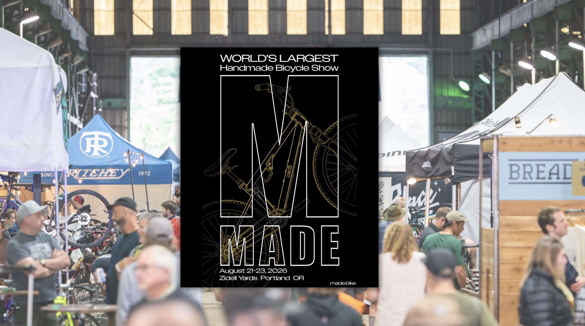
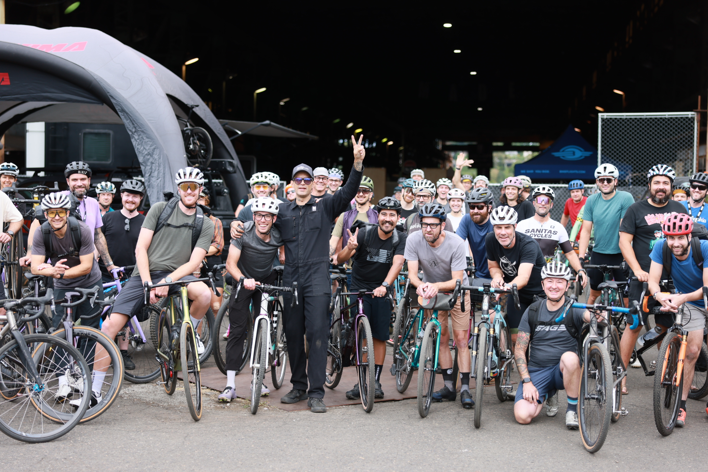
Portland has a stellar legacy of independent bicycle framebuilders and the industry that supports them. It’s a part of our community I’ve enjoyed documenting for many years. MADE, the world’s largest handmade bicycle show, continues that legacy by bringing the best bike makers from all over the country to Portland. And it happens next weekend!Below is a note from the show’s founder and director, Billy Sinkford. Hope to see you there. — Jonathan
(Photo: Rob Kerr)
Hello! Billy from MADE dropping you a quick note about next weekend, and getting you ready for a big weekend of bikes. It’s time for the world’s largest handmade bicycle show to return to Portland. This is our 4th year, and we are super excited to welcome you down at Zidell Yards. MADE is a labor of love, spotlighting framebuilding and the brands that support the builders.
The Portland cycling community has welcomed MADE and the handmade community with open arms. We appreciate you, and thank you for supporting the show. Our way of saying thanks, use code MADEBump (case sensitive) for 10% off tickets. You can get your tickets here.
Things kick off on Thursday evening with the Chris King 50th Anniversary Party at 5 PM. We open the doors at Zidell Yards on Friday at 9 AM. The show runs daily through Sunday at 4 PM. Hundreds of beautiful bikes (And the wonderful folks that made them) will be on display from local makers and builders from around the globe. There are tons of rides and events happening throughout the weekend. You can find a list here that will likely be updated throughout the week.
I hope you can come down and join us, or attend a ride or evening event. We have the cycling industry in town to support the show, come hang out! There will be big bikes (32 inch wheels are a thing!), product launches, scavenger hunts, giveaways, and more handmade metal bikes under one roof than you will see anywhere else. Keep up to date on the show on Instagram here, we will be posting show updates and some very special bikes throughout the next two weeks.
And finally, thank you Jonathan! We appreciate you and all you have done for Portland Cycling. The Bike Portland community is strong, and everyone owes you a tremendous debt of gratitude for years of service.