There were a lot of exciting Portland-area active transportation projects up for Metro funding through its 2025-2027 Regional Flexible Funds Allocation (RFFA) cycle, and not all of them were chosen. But Metro has other pots of money to dip into for regional projects, and they just announced how they’ll use $20 million from the 2019 parks and nature bond to fund 12 of them.
The $475 million measure sets $40 million for walking and bike trails. In addition to projects Metro says will center racial equity, the bond measure also prioritizes investments that will make the region more resilient to climate change.
The majority of the 12 projects Metro Council chose to fund this go ’round will fill gaps on existing routes. Three of them are in the City of Portland, and the rest are spread out throughout the metro area.
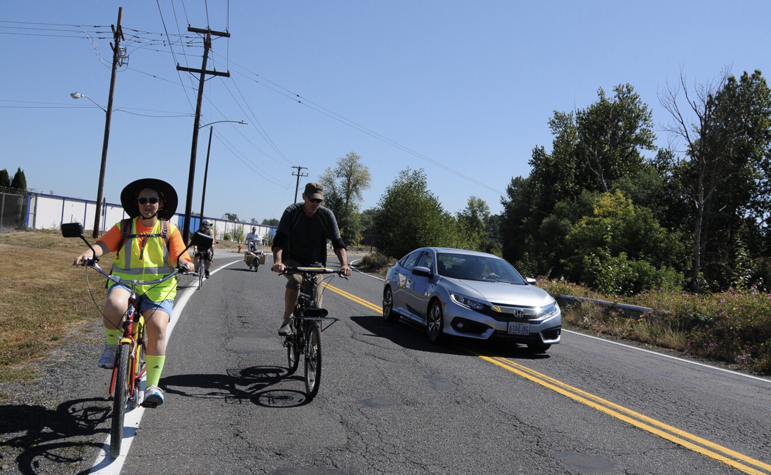
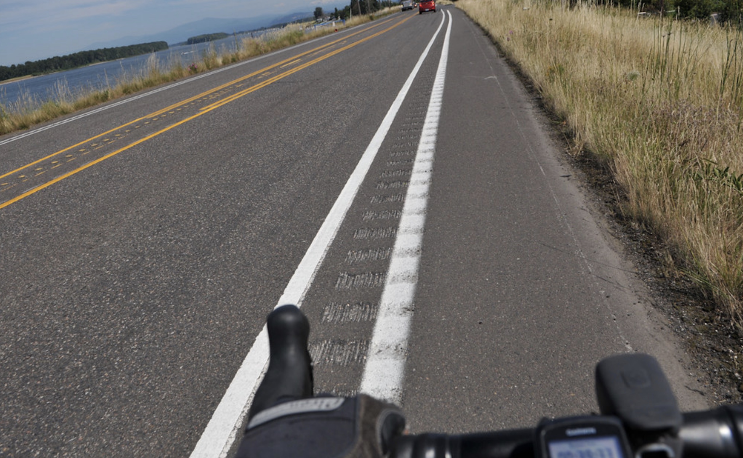
The three projects Metro chose to fund in Portland are key pieces of our regional, off-highway cycling network that have languished for many years. The NP Greenway Trail project, which recently received Metro funding for a separate gap near the St. Johns Bridge, has been a dream of local advocates since 2005. The Marine Drive path is very popular, but is also very dangerous because portions where gaps exist require riders to share the road on what PBOT considers a “high crash corridor.” As we shared in 2020, this vital path is 75% complete! And The Cornfoot road path will connect to PBOT’s new protected bike lanes on 47th and has been a glaring gap in the network for many years.
Below is a list of the 12 funded projects, with descriptions and dollar amounts taken directly from Metro…
Columbia Slough Trail: Cornfoot Road (Portland Bureau of Transportation)
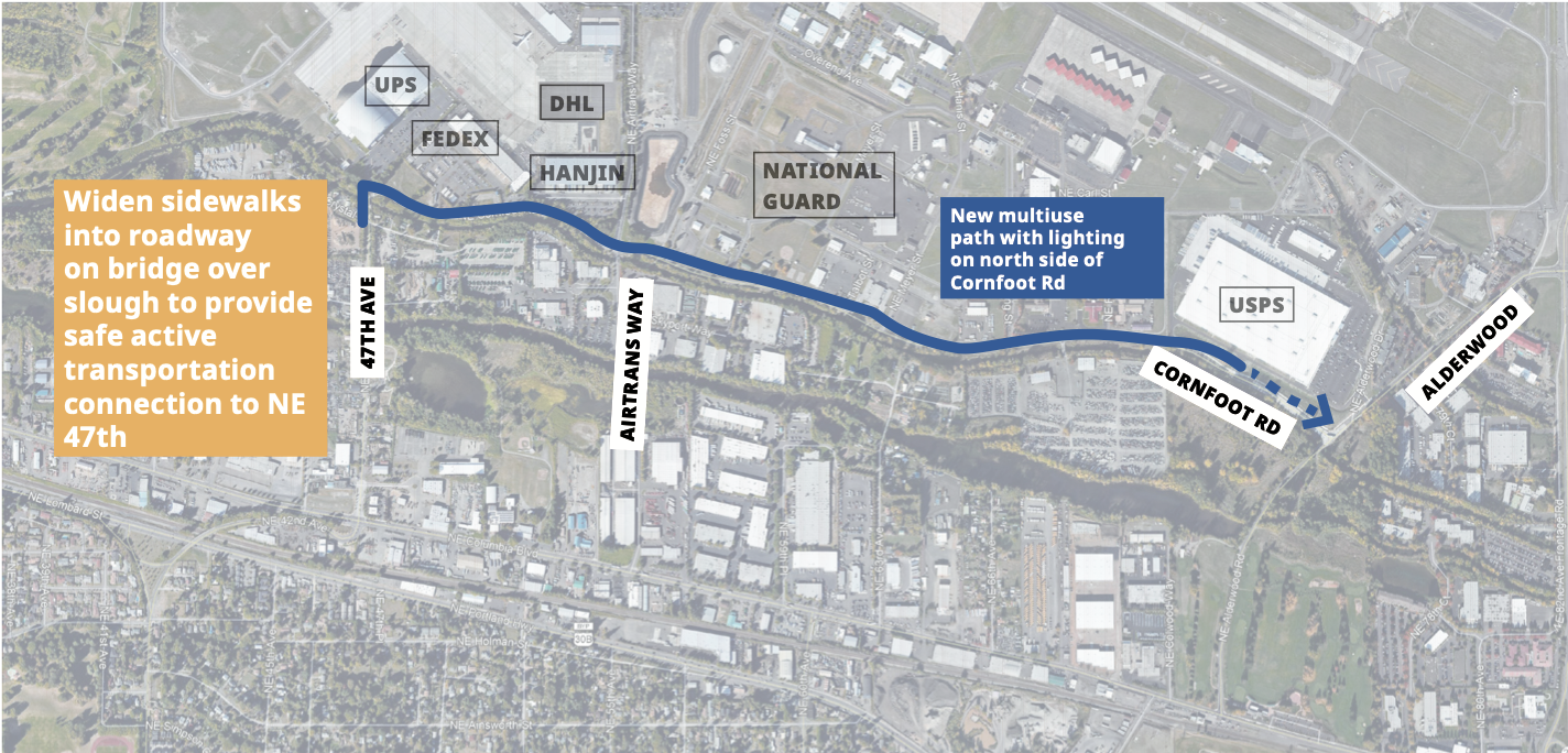
Grant: $4.6 million (Match: $2.2 million)
At 1.25 miles, this is the longest project to receive funding. This project will fill a major gap in the Columbia Slough Trail near the airport and industrial businesses. The project will move commuters and recreational trail users in this multimodal freight corridor off the busy road and onto a safer parallel trail. It builds on past Metro grant awards. Back in 2016, Verde received a levy-funded trails grant to engage Spanish-speakers in the Cully neighborhood to envision the future of this trail as a safe way to walk between Colwood Natural Area and Whitaker Ponds Nature Park.
Marine Drive Trail: I-205 to NE 122nd Ave (Portland Parks and Recreation)
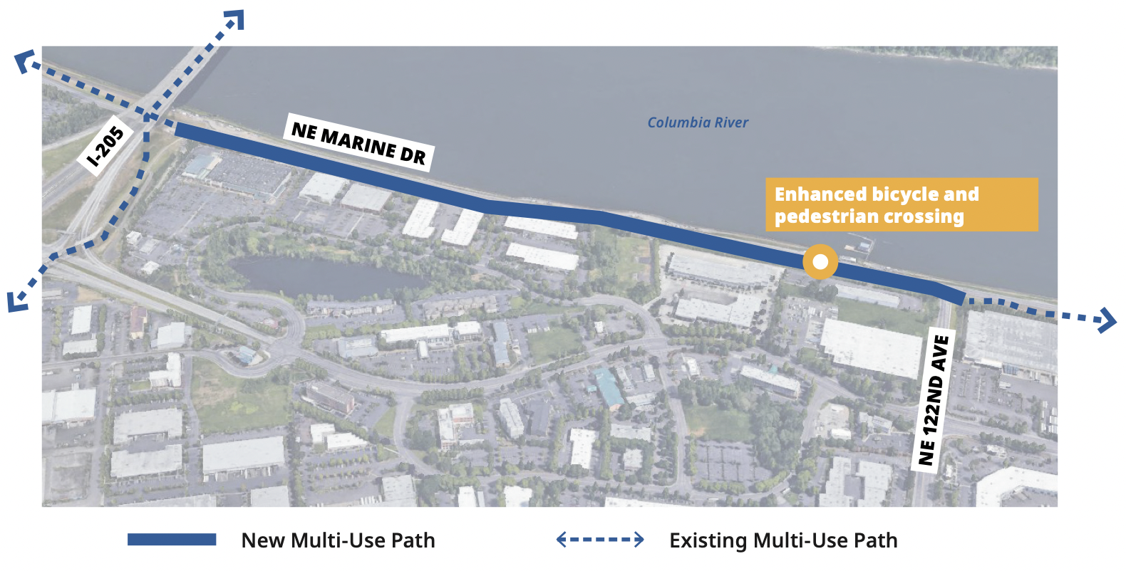
Grant: $2.3 million (Match: $1 million)
The City of Portland will build a major gap in the 40-Mile Loop, replacing dangerous on-street bike lanes with a separated path, while building on past bond investments. This 0.8 mile trail segment will provide trail users unparalleled views of the Columbia River and Mt. Hood. When completed, trail users will be able to enjoy nearly 14 miles of uninterrupted off-street trail along the Columbia River from NE 33rd Drive to the Sandy River in Troutdale.
North Portland Greenway: Kelley Point Park (Portland Parks and Recreation)
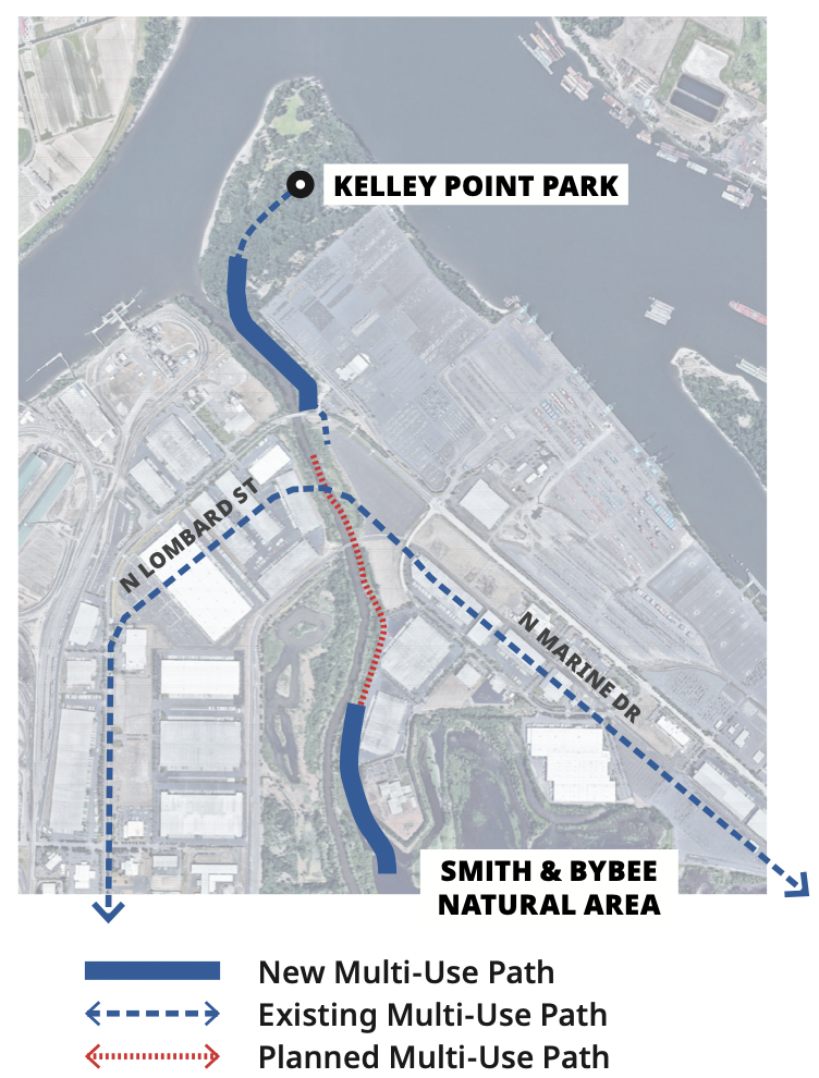
Grant: $1.9 million (Match $800,000)
Kelley Point Park is a historically and culturally significant place due to its location at the confluence of the Columbia and Willamette Rivers. It is also the future northern terminus of the planned North Portland Willamette Greenway Trail. While much of the trail is already built within the park, there is a 1,400 foot gap that currently forces trail users onto the road. This project will fix this by extending the trail to the 40-Mile Loop and Marine Drive Trails.
Clackamas River Trail (City of Happy Valley)
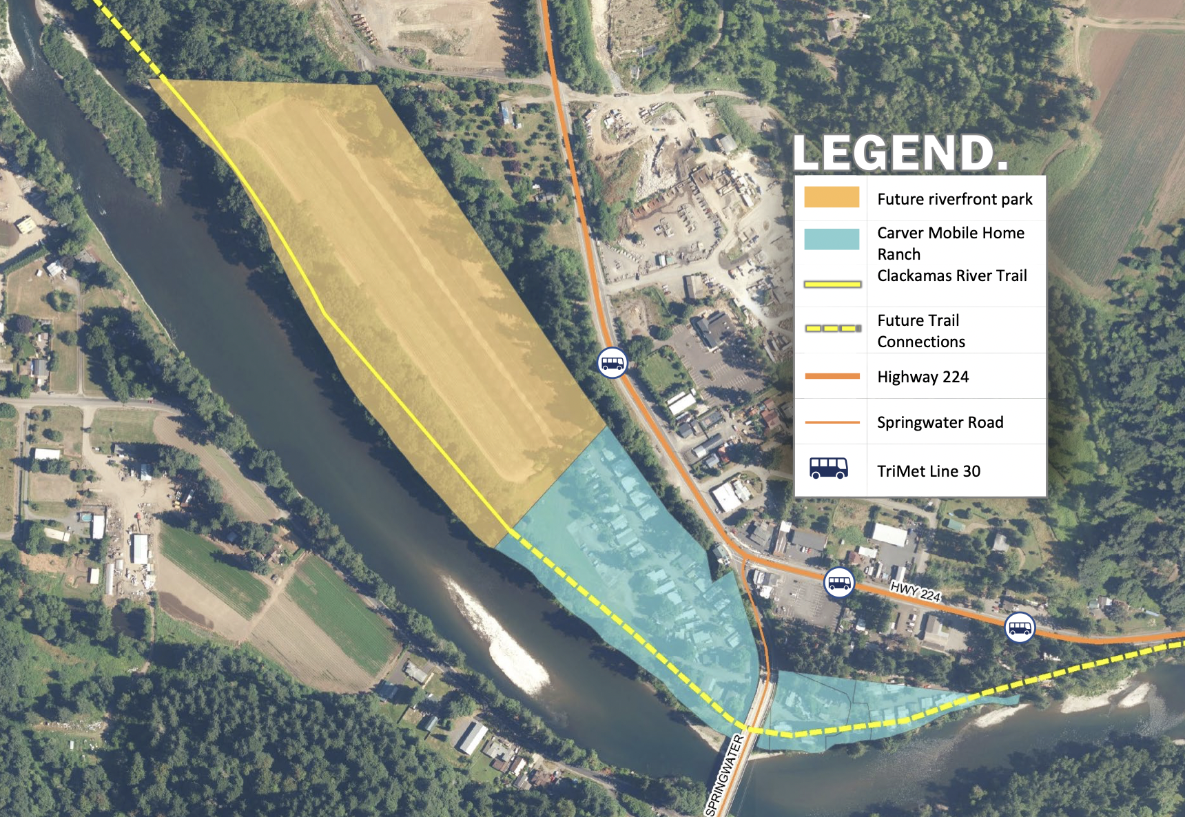
Grant: $670,000 (Match: $1.95 million)
This 1,450 foot long multi-use path in Carver will provide access to the Clackamas River in a rapidly growing corner of the region. The trail improves connections between a Trimet bus line, housing, and parks and naturals areas along the Clackamas River. It also leverages a nearly 75% local match.
Gresham-Fairview Trail Gap (City of Gresham)
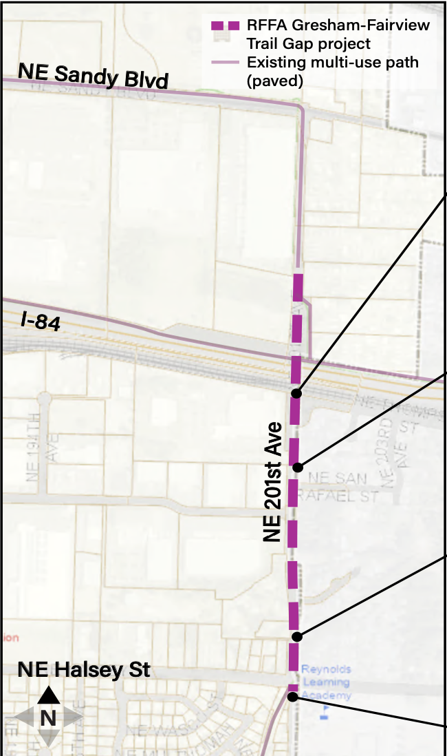
Grant amount: $4.2 million (Match: $750,000)
This project fills a gap in the Gresham-Fairview trail between Sandy Boulevard and Halsey Street, and includes a connection to I-84 Trail. The new stretch of trail expands on past bond investments and will improve safety along a high-crash street and providing commuters an unbroken path through Gresham from Powell to Sandy boulevards.
Sandy River Greenway (City of Troutdale)

Grant amount: $1.95 million (Match $1.6 million)
The City of Troutdale will build a riverfront path connecting downtown Troutdale to the 40-Mile Loop, Thousand Acres Natural Area and a major industrial employment area. This 1,400-foot-long linear park features access to the river and restored riparian habitat along the riverbank. The project is part of a larger urban redevelopment of a former industrial area. The redevelopment area is currently cut off from downtown Troutdale by the railroad, with the only existing non-motorized access following a dangerous roadway. This project offers a safe alternative for vulnerable road users and a more direct connection between major destinations.
Trolley Trail (North Clackamas Parks and Recreation District)
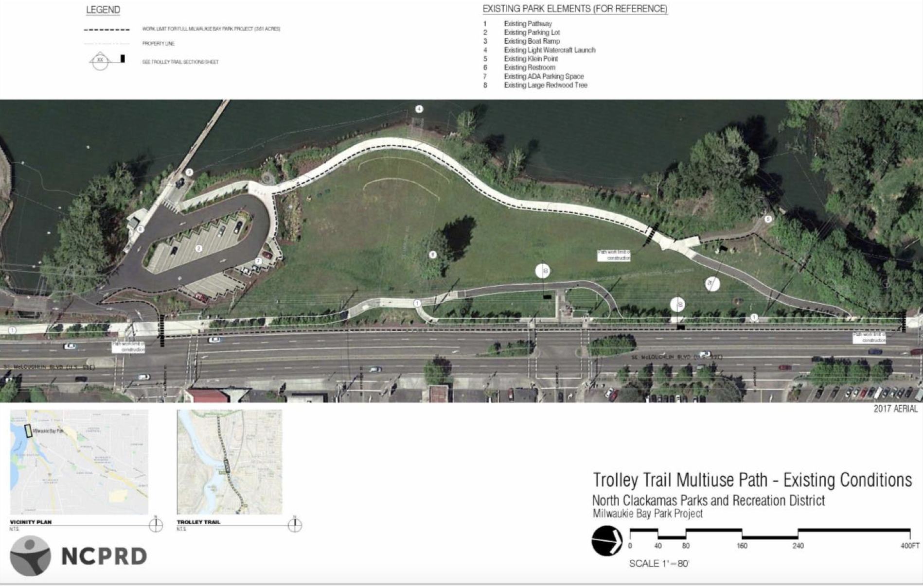
Grant: $658,027 (Match: $538,000)
The six-mile-long Trolley Trail is one of the most successful regional trails from Metro’s 1995 bond measure. As part of the Milwaukie Bay Park project, this grant project will realign and improve a 500 foot section of the trail along McLoughlin Blvd, improving safety and transit access while creating easier connections to the Willamette River.
Crescent Park Greenway Trail and Brookwood Ped Overpass (City of Hillsboro)
Grant: $1,000,000 Match: $176,471
The City of Hillsboro will develop a preliminary design for a pedestrian overpass of Brookwood Parkway and a new section of regional trail that serves one of the region’s major employment areas. This project will plan an off-street connection from Hillsboro’s recreation complex, along the south side of the Sunset Highway, to destinations in the rapidly growing industrial area west of Brookwood Parkway. The Crescent Park Greenway will serve bicycle commuters while offering area employees a creek-side respite for lunchtime strolls.
Emerald Necklace Trail (City of Forest Grove)

Grant: $200,000 (Match: $163,636)
The City of Forest Grove will conduct community engagement and alignment planning for the remaining unbuilt half of an 11-mile loop trail circling the city. The trail follows Gales Creek and connects many of Forest Grove’s neighborhoods, parks and natural areas.
Scott Creek Trail (City of Happy Valley)

Grant: $200,000 (Match: $163,636)
This project includes planning, preliminary engineering and right-of-way negotiation for a regional trail gap and safe crossing of a major arterial road. This 1,800 foot trail will fill a gap in the much longer Scott Creek Regional Trail, connecting Metro’s Mt. Talbert Nature Park to neighborhood parks to the north such as Southern Lites Park and Happy Valley Nature Park. The key feature of this project will be a safer, more direct crossing a Sunnyside Road, a seven-lane high-speed arterial roadway.
Westside Trail: US 26 Bike/Ped Bridge (Tualatin Hills Park and Recreation District)

Grant: $1.9 million (Match: $820,083)
Tualatin Hills Park and Recreation District will complete engineering for a bicycle and pedestrian bridge over Highway 26 to connect jobs, schools and parks. Once complete, this bridge will provide the only car-free crossing over a six-mile-long stretch of the freeway. The bridge is the linchpin in the Westside Trail, the 20-mile-plus north to south spine of Washington County’s active transportation network, which will one day connect the Tualatin River to Portland’s Forest Park.
Westside Trail: Segment 1 (City of King City)
Grant: $200,000 (Match: $163,636)
The city will design the entire segment of trail within King City, including an enhanced crossing at Beef Bend Road and access to the Tualatin River. King City is in the process of nearly doubling its housing inventory as it expands westward. The Westside Trail project sits at the gateway between the existing part of town and the new growth area. It will serve the recreation needs not only of this rapidly growing community, but also Bull Mountain to the north and Tualatin to the south.
Project construction timelines aren’t clear yet and will vary between agencies. Stay tuned!


Thanks for reading.
BikePortland has served this community with independent community journalism since 2005. We rely on subscriptions from readers like you to survive. Your financial support is vital in keeping this valuable resource alive and well.
Please subscribe today to strengthen and expand our work.
I think I’d rather see the money spent to clear camps and trash from existing trail segments and to build barriers to prevent vehicle access to those existing segments. Why build trails if you aren’t going to maintain them?
By the way, the peninsula crossing trail is much better now that the barriers are in place. Similar treatments should be installed on all mups as standard practice.
Places in WashCo are doing a much better job at maintaining their trails than the places in MultCo. So I for one am super happy to see this funding for the four projects there.
On a side note, the City of Portland gets a lot of flack for the state of the city, but it’s really MultCo’s responsibility and they’ve totally dropped the ball. So many people misdirect their ire towards the wrong people; Deborah Kafoury is the one who should shoulder the vast majority of the blame rather than anyone on the Portland City Council. Neither Wheeler, Hardesty, nor Ryan are perfect on this issue by any means, but they’re not the bogeymen that various people like to make them out to be.
And I’ll add that we see the same thing with roads: the MultCo-maintained roads are consistently the worst in the entire metro area. See, for example, Scholls Ferry between the WashCo line and Sylvan, a road that you’d have to have an absolute death wish to walk or bike on, and where someone died driving just a few days ago.
We do need these new trails, but I hope they are designed with more hardened features. A single removable bollard with padlock is not good enough.
I almost got hit the other day on the 205 path near Powell by a guy on a motorcycle blasting down the path at high speed making zero effort to not take up the entire path. I had to take evasive maneuvers to avoid.
Later, same day, by the 205 path and Stark I had a similar event with a go kart blasting down the path. At least this person made an effort to give me room to pass.
It is freaking romper room out there right now.
Of course, you can’t get to the Marine Drive path on the I-205 path because of the camps and debris.
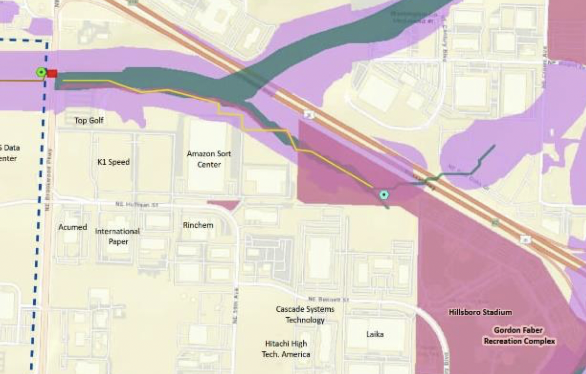
The Kelley Point Park map looks like it was made on a Friday around 4:45PM. Nothing lines up correctly. The planned path (red) already exists. Does the new path segment to the south mean they are going to repair the “Half-Life 2” trail?
That graphic perplexed me too Christopher of Portland. I stared at it for a while to try and figure out WTH got funded. Once the project moves forward we’ll post an update with the details.
The map is wrong, or more accurately out of date. It reflects the original application. The only part that actually got funded is the path under the bridge that connects Marine Drive to Kelley Point. This was explained to me by a Metro staffer.
thanks for clarifying! That will be a nice addition
came to comments to look for clarification- thanks! I guess we have to wait to learn more.
Always money for capital improvements and never funds for maintenance.
Capital improvements = photo op/ribbon cutting for politicians
Maintenance is no photo op/ribbon cutting
We moved into the Bridgeton neighborhood in 2007. At that time, we were told that the new (at the time) condo/apt projects west of here on the dike came with the requirement that the builders install and maintain a paved path from the end of Bridgeton Rd to meet up with the path that crosses to the island and over to Vancouver. 15 years later, no path. No plan for completion.
I was really hoping for some Marine Dr. improvement west of NE 33rd. The golf course, over COVID time, has completely given up maintaining the informal walkway between their wall and the metal barrier on the south side of Marine Dr. The encroachment of plants on the already narrow bike lane is at its worst ever… Big thorny trees, and thick moss mats way over the fog line.
I really thought the dike path was coming soon. Maybe after the multifamily projects on Anchor Way are finished being built.
I hope they do NOT remove the bike lanes on that portion of Marine Drive. If the new MUP they plan to put in is anything like the one that was so proudly unveiled a few years ago out near 185th, then it will become completely unsafe and unusable.
That very short section is full of mud and chopped cars and RVs. I always ride on Marine Drive along there once I cross over from the section of path along the river that starts near 138th. It does have a few camps and occasional cars but is not as bad.
As someone else mentioned, the unveiling seems to take precedence over maintaining.
Until the city quashes the street racing that’s rampant on these roads, I won’t consider cycling on them.
If Mult. County built bike paths on Sauvie there wouldn’t be drug camps clogging the pathways!! Safer than riding the roads out there, too!
Filling in that Fairview-Gresham gap will be huge. But improvements to the section of 181st connecting the I84 paths are really needed as well. It’s just slow and stressful trying to make that connection, so it ends being easier to go south and take San Rafael instead.
The headline – Columbia Slough and Marine Drive path gaps to be filled with Metro bond funds – makes it sound like Metro will be literally pouring paper cash into various potholes along the way, which given the amounts, is probably not that far from the truth. I do find the headline a bit amusing, particularly given how much more will be spent on the CRC2.
The image shown for the Trolley Trail project in Milwaukie is the existing condition, not the project work.