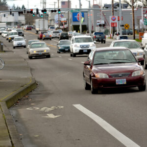
The Portland metro area’s western corridor is due for a revamped active transportation system. This part of the Portland region is a hub for growth and projections indicate it will continue to expand. Without some big changes, the current transportation problems the area faces – a lack of facilities for people biking and walking and related car traffic congestion – will continue to worsen.
The Oregon Department of Transportation’s Urban Mobility Office will aim to address these needs with their Westside Multimodal Improvements Study (the first non-freeway expansion project from the UMO office since it formed in 2020). It’s a collaborative effort with Metro to learn about “the current problems people have traveling by bus, on foot, or with wheels” along the corridor. In a draft report, ODOT and Metro describe the current conditions and say it “experiences significant traffic congestion for vehicles” and “lacks system completeness for bike facilities, sidewalks and trails.”
ODOT and Metro say their guiding values for this study are as follows:
• Develop a set of fair and equitable outcomes.
• Improve access to regionally significant employment, educational, and commercial
centers, including Regional Centers and Town Centers.
• Improve mobility throughout the Westside Corridor for people traveling to work and daily activities, as well as commercial traffic.
• Improve connections for freight, including generators and distribution.
• Support projected household and economic growth in the corridor.
• Support regional and statewide climate goals.
• Support adopted land use plans and goals for the region.
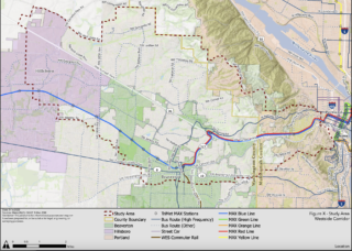
The study area is focused around Highway 26, which runs parallel to the MAX light rail. The majority of the focus area is in Washington County, but it will also look at parts of western Multnomah County including Portland’s Southwest Hills.
Advertisement
There are ways to get to and from central Portland to the west side without a car and many people do it. Combining a trip on the MAX red or blue line with a bike trip can be a good car alternative, popular especially among the Nike set (they built a whole path to accommodate this combo). Other large employers like Intel and Tektronix boast sizable bike commuter numbers.
There are a few nice sections of paths and bike lanes between downtown and Beaverton (and beyond), but not nearly enough to reduce reliance on cars.
“Current multimodal transportation conditions in the Westside Corridor result in an inequitable and environmentally unsustainable system that is overly dependent on personal motor vehicle travel, which results in vehicle congestion and unreliable travel times for people driving and moving freight,” the study’s draft issues and needs report says. “This adversely affects the safety, affordability, and livability of the area and can impede economic competitiveness.”
The steering committee for the Westside Multimodal Improvements Study began meeting last month, and will continue to meet throughout the next year and a half. This committee is made up of local policymakers and agency representatives including Metro President Lynn Peterson, Beaverton Mayor Lacey Beaty, Multnomah County Commissioner Jessica Vega Pederson, and others.
A public survey for this project is set to be released later this summer. If all goes well, we should see an implementation plan as soon as fall 2023.
On a related note, Metro has released a survey for people to identify the projects they want the agency to spend their 2025-2027 Regional Flexible Funds on, and some of the potential projects are located in the western corridor. The survey will be open until June 21 and can be found here.



Thanks for reading.
BikePortland has served this community with independent community journalism since 2005. We rely on subscriptions from readers like you to survive. Your financial support is vital in keeping this valuable resource alive and well.
Please subscribe today to strengthen and expand our work.
Thanks for the link for Metro comments – they’re exactly the agency that should be helping cities stitch their infrastructure together. Portland/Tigard connections are practically non-existent, and the Triangle of 217/I5/205 limits many potential crossing options for peds/bikes. Throw in Barbur Blvd, which at 5 lanes at 40mph and all the neighborhoods that you can’t bike through because of dead ends in creeks and gullies, and you have a big hot mess.
Thank you, as a Portlander who moved to Tigard for work I agree with what you said. There are so many 45 MPH arterials here that have 5-7 lane cross sections at intersections and you have a truly miserable to place to exist outside of a car.
Agreed! I work out in Hillsboro and can’t help but think that Cornell could easily accommodate protected bike lanes. It’d be great if we didn’t have to vote on which projects to prioritize though. I’d love to see them all built this year.
How about improving SW Scholls Ferry Road between SW Cascade by 217 and SW Raab Road by Highway 26? A lot of it functions as a rare north / south route. Multnomah County will be repaving their section of it by 2024 for the first time in many years.
“Car drivers have 100% safe and connected infrastructure to the west side.” Really?
That must mean there have been no fatalities and no crashes. I live on the east side, but I travel to the west side of Portland and the west part of the metro area often enough that I’ve actually witnessed car crashes. I’m sure that I’ve also encountered some dead end streets and turn prohibitions when driving.
I guess there’s a new definition for “100 percent” of which I’m not aware.
My point is that there are nice paved roads and a connected network for drivers that is essentially 100% complete.
Cars are inherently dangerous; you cannot and will not ever have no fatalities or crashes, at the very least not in our lifetimes. The only way to reduce automobile fatalities and crashes is to reduce driving. Washington Country is sorely lacking in those efforts.
The West Hills really are a barrier. Plus all of downtown PDX. I used to commute from NE 82nd to NW Industrial easily enough. Now I work in Beaverton and drive and occasionally MAX. I’d love to ride, but 82nd to the river is stressful enough. Then the river to the hills adds more stress, plus the overall climb & distance. Having a whole system is really important, vs. just one parts. The west side needs some extra help for sure, and then also a system that connects to it well.
I think the MAX tunnel(s) would really really improve movement over the West Hills and make working out in the westside industrial crescent more feasible for folks in the east. I think a lot about the 2009 Metro High Capacity Transit Study (https://www.oregonmetro.gov/sites/default/files/2016/02/18/HCT-system-plan-report-2009.pdf) and how much further along we should be with making it a reality.
For those who are able to ride them, we are lucky to have the Montgomery-Vista-Patton, Kingston, and Fairview “passes” over the West Hills. They are extremely low stress. There is also an amazing route that uses the Pittock Mansion road.
Terwilliger to BHH, not so much.
What strikes me is that on many of the roads near Tanasbourne (185th/Cornell) there is plenty of room to have sidewalks that are extra large to accommodate both pedestrians and bikes that have separation from 45mph traffic. Many of the major arterials could do this in that area of town. Look at Cornelius Pass between Cornell and hwy 26 – a completely separated pedestrian and bike path. This could be done in a loooot of places on the west side. Yes there are problematic roads where there are basically just water ditches but there is so much potential for building large multimodal sidewalks (but bigger and better).
Having lived in downtown Beaverton for two years, there are three very substantial big-picture problems to deal with that I can see:
1. There is a significant mismatch between the provision of transit (however sufficient it can be called) and the development of areas around it. The existence of multiple multi-level parking garages and surface lots, low-value non-mixed-use developments, and just plain-ol’ empty lots of land around both Beaverton Central and Beaverton TC is a major issue. The lack of residential/mixed use development is pushing population growth in the county away from Portland to further-afield suburbs like Hillsboro and Tigard; this is inconsistent with regional/city/state climate goals, and is also a major impediment to equitable housing goals, as well, and additionally, deprives the city of tax base growth by keeping the Beaverton’s population below what it would be with an adequate supply of housing (as evidenced by high housing costs). Beaverton grew at half the rate of Hillsboro from 2010-2020.
2. There are far too many unincorporated communities that rely on Beaverton and the connections it has to Portland while not aligning themselves with the climate and equity goals of Beaverton, itself. These areas abet NIMBYism by empowering local stakeholders (namely, homeowners) who benefit from proximity to Beaverton (for shopping and work) while impeding the sort of development that Beaverton ought to want (to be consistent with its climate and equity goals).
3. The two major east-west roads through Beaverton (routes 8 and 10) are incredibly detrimental to the character of the area. Pair their highway-like nature with the not-really-frequent-enough bus service they have (to say nothing of the sprawling suburbs they often service, with typically unsheltered bus stops), and it’s unsurprising that I routinely see people speeding down them at 50mph, treating them as local-service analogues to route 26. These are some of the worst stroads I’ve ever had the displeasure of walking along, and I can’t think of how terrifying they must be to bike on. The roads themselves should be reoriented to improve bus service and enhance ridership, and likewise, the areas around these roads should be substantially developed to reorient them to non-vehicular traffic.
As far as I’m concerned, this side of Portland is far further behind the rest of the city in terms of realigning to support non-automotive transport and meeting housing needs. Outside a very small area of downtown Beaverton, it feels very American here. I do not mean that as a compliment.
*Another issue that’s further outside the scope of this project should be the relocation of the freight line outside the city centers of Hillsboro, Beaverton, Tigard, and Tualatin. It’s completely inappropriate to have a heavily-used freight line going through the middle of a city at-grade in the 21st century.
Sorry; lots of thoughts about this whole situation.
Where would the Western rail line be relocated? WES uses part of it and I’d love to take a WES train to Salem and or Albany. Canyon Road is atrocious.
That’d be a whole different issue to fix, really. Ultimately, the freight line would need to be moved much further to the south and a bit to the west; it’d require working with the various farms out there to figure out an agreeable right-of-way, and ultimately I’d put it meeting its north-south leg between Hillsboro and Cornelius. Obviously, this’d be a major project, and ODOT would need to lead the way, to say nothing of getting the freight rail line owner to agree to actually build it. The PNWR that runs that line is owned by Genesee & Wyoming, which is by no means a small company, but we’d be talking about building almost 20 miles on a brand-new alignment where there’s currently no right-of-way of any kind. This would be a major project for the region–likely deep in the double-digit millions–but it’d completely change the development potential of all the downtowns the current freight line diminishes.
The other possibility this opens up is turning the current WES line into what it always ought to have been–a southward externsion of the MAX Red Line to Tualatin, and along with this hypothetical there should be much denser, less car-oriented development along the line. Of course, this would also mean the potential southwest extension of the Green Line would create a major transit center in central Tigard between the Green and Red–another bonus to the fantasy planning, here.
The diesel WES could still operate south from Tualatin to Salem or Albany if there was time in the schedule between freight operations and Amtrak’s Coast Starlight. However, as it stands now, the WES is an insult to modern regional rail practices, and Trimet would do much better to cease operating it and just resume the bus services it replaced, at a much lower per-rider cost.
Again, this is all just pie-in-the-sky at the moment, but it does hurt to see an area with decent urban bones like this place does be sabotaged by outmoded planning and development.
Thanks for taking the time to write out your thoughts on this. Having lived in central downtown Beaverton up until 2020, I agree with you. All the development in Cedar Hills is just a glorified strip mall and a miserable place to be as a pedestrian. They tore down the antique shop to build a parking lot for government vehicles. Two of the tallest structures in central Beaverton are parking garages. Like you said, there are so many empty lots and all they do is build car-centric strip malls and drive thrus.
There’s a bikeway along the Sunset freeway from West Slope to Washington Park. Bike access at either end is … not great, to put it charitably. Right now, it’s basically a road to nowhere. It could be a more useful path if there was a good, rideable connection to Sunset TC at the west end, and to downtown Portland to the east.
There is a connection, fortunately: just load your bike onto MAX and ride through the tunnel. But people should be able to bike that segment more easily than they can today.
1. Metro needs a better bike route from downtown to the western suburbs. Maybe a multi-use path along 26? Protected bike lanes on Burnside would be even better.
2. Protected bike lanes on Cedar Hills Blvd are badly needed. Same with 185th and Cornell.
3. TV Highway is a hot mess.
There is an off-road MUP along 26 from Knollcrest (Just east of 217) to Skyline = the only real pain is Porter & the overpass. What’s missing is a similar path from Jefferson to Skyline and better access to it (Wilshire is a PITA). The residential and back roads up to Wilshire are meh – a couple of 10%+ segments in there but low traffic in the main.
Going up the Madison Trail (before they wrecked it – do you still have to get off an carry your bike up the stairs?) around and then up Fairview was mostly low stress excepting the run around Lewis & Clark and over to Tichner. But climbing 1000′ for a 10.5 mile 1-way trip can be wearing on a person.
On the plus side, once you hit Skyline it’s all downhill into Beaverton. Likewise, going to PDX, once you’ve climbed out of the Zoo to Fairview the Zoo Bomb is great fun and will get you energized for the day 🙂
I can’t tell you how often I wished there was a bike route through the MAX tunnel – that would take several hundred feet off the climb.
Trike Guy, are you the tricyclist I frequently see on this MUP riding alongside a dog?
The MAX Tunnel from Goose Hollow to the outskirts of Beaverton has three different tunnels. One for eastbound MAX, one for westbound, and one for pedestrian traffic in an emergency.
Does anyone know if they are considering opening up the third tunnel to general bicycle and pedestrian traffic?
It would create a low-grade, weather protected bicycle route from Goose Hollow to the Camelot Ct Overpass on the west side of the hills.
https://opentopomap.org/#map=17/45.50574/-122.75452
https://www.google.com/maps/@45.5072153,-122.7470872,17.5z
Just curious,
Ted Buehler
One question with Camelot is that there is a creek on the east side of the cemetery and the on and off ramps to Canyon Road. I think a tunnel to connect to Barnes Road to the west of SW Leah Road where it meets Barnes would be nice. Slow brings things to a stop for some in the snow. It would help TriMet buses as Burnside and Barnes sometimes get closed. How about a tunnel to Sylvan? What if Scholls Ferry Road and Skyline were redone? A boardwalk on platform on the steep slope? I think the Oregon Zoo needs to remove the Zoo train and make trails with some mountain bike trails. The property to the south of the Audubon Society will become a park but it didn’t seem to indicate bike paths or trails from the very top of West Burnside by Skyline.
Still no word on expanding the MAX to Forest Grove and Cornelius. There are tons of people who rely on the bus, and getting to Hillsboro TC on the bus is atrocious.
The other part that irks me about this is just how easy this would be. There’s already a track going to Forest Grove, the route would only cross one property line, and the project would be at most $300M.
I don’t know why TriMet isn’t going for easy wins to get the public interested in what rail transit can do.