(All photos by Adam Herstein)
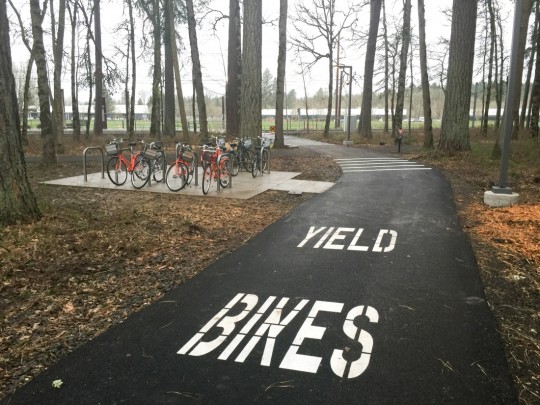
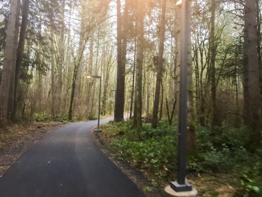
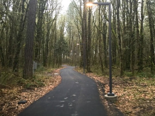
Nike has just opened a new bike path through a forested parcel adjacent to their world headquarters.
The path, which we first reported on back in November, is formally known as the Nike Woods Connector Trail. BikePortland reader Adam Herstein rode the path yesterday and provided us with his thoughts and photos:
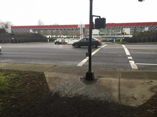
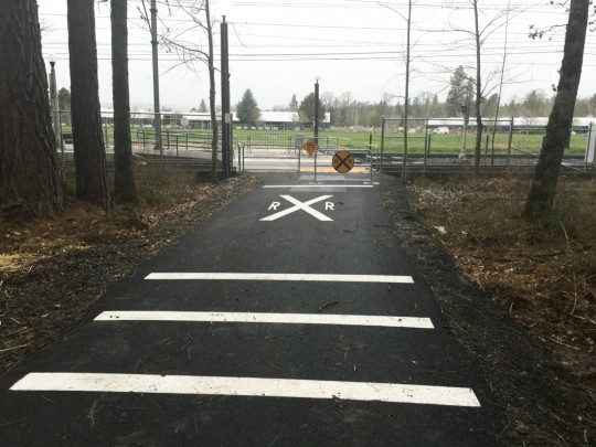
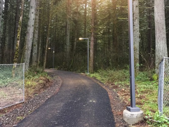
The path has lighting throughout to improve visibility and safety during the dark winter months. The path connects directly to the MAX platform on the south end and to Jenkins Road on the north. Unfortunately, there is no cycle-specific signaling to cross Jenkins into Nike; people cycling are expected to use the pedestrian signal.
Advertisement
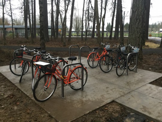
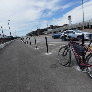
Overall, the ride is nice. The path is all paved asphalt. There’s a few feet of gravel at the north end before reaching the paved portion. There is also a grouping of bike parking staples adjacent to the MAX. Overall a vast improvement for people who take MAX to Nike and bike the last mile. The new multi-use path offers a much safer ride than on the substandard bike lanes along Washington County arterials surrounding the Nike campus
The path is about one-third of a mile long and it bisects a wooded parcel that’s ringed with a dirt running trail open only to Nike employees. While this parcel was previously closed to the general public, a source within TriMet has confirmed for us that the new path is open to everyone. At least for now. There’s a new path being built near the Beaverton Creek MAX light rail station on the south end of the parcel. Once Tualatin Hills Parks and Rec finish that path, it’s likely that Nike will close this new Woods Connector Trail to the public.
— Jonathan Maus, (503) 706-8804 – jonathan@bikeportland.org
BikePortland can’t survive without paid subscribers. Please sign up today.



Thanks for reading.
BikePortland has served this community with independent community journalism since 2005. We rely on subscriptions from readers like you to survive. Your financial support is vital in keeping this valuable resource alive and well.
Please subscribe today to strengthen and expand our work.
This is huge. The Hollister Trail has been runners-only, and there’s be no fantastic way to get directly from the MAX station to WHQ without taking the big detour around the woods.
Frankly, though, I hope this (along with the Portland Bike Share initiative) is a sign that Nike will get themselves back into cycling. It was so bizarre to me, when I worked for Nike, that I had no choice but to wear all my Pearl Izumi stuff to work as Nike currently sells precisely zero cycling gear anymore.
Good for Nike on this path! About their product lines, I worked at Bike Gallery through at least two of their attempts in the cycling market and they never seemed to have their heart in it. Maybe an office full of bike commuters in Pearl, Rapha, Showers Pass, and Novara gear will light the right fire under the right butt this time.
Looks good, and also like a lot of money spent. Which is the only reason why I wonder why the parking corral was not covered?
Let me be the first to comment that this is not a world class facility. It is too narrow, does not segregate bicyclists from other users, lacks a grade separated crossing of the running path, and it actually INTERSECTS with both roads and the MAX line. Gigantic fail.
Disclaimer: I have owned Nike shoes in the past.
So, J_R. What is your definition of a “world class facility?”
Disclaimer: I own lots of Nike common stock & numerous pairs of Nike sneakers.
A facility shall be considered a world class bicycle facility when:
The facility provides for exclusive use by bicyclists with separation of bicyclists by speed, skill level, and commonality of purpose for use.
The facility shall be designed and operated such that there will be no intrusion by non-bicycle traffic, including but not restricted to pedestrians, skateboarders, Segways, etc.
The facility protects the users from dangerous events such as meteor strikes, earthquakes, tsunamis, etc. and from undesirable elements such as headwinds, rain, and sun glare.
Finally, the jurisdiction responsible for the world class facility shall annually certify that “No motor vehicle was used during the conception, design, construction, or maintenance of the facility and no motor vehicle, including emergency response vehicles, traversed the facility during the past year.”
On what world are these world class facilities found?
Under norse bridges.
Uhh, you forgot “paved with a mixture of fairy dust and unicorn farts.”
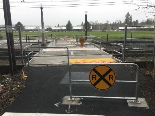
Those safety gates are sub-standard. Where are the fingerprint readers, retinal scanners, passcode keypads, and a note from Mommy to activate the gate? Where are the 150 db warning sirens and strobe lights? My goodness! Some poor unattentive rider might get hit by a MAX train without those safety protocols. Won’t anyone think of the children?!
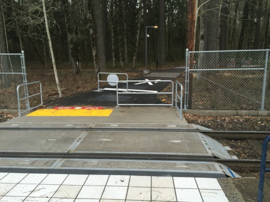
I think the infrastructure is more than adequate, I’m just not sure why there’s a barrier right at the same place as the “Rollthrough Rapidly” crossing. Seems contradictory.
Seems pretty obvious, frankly. Slow down, look both ways, then cross quickly. Forcing users to come to a stop (with the barrier) forces them to treat the crossing with at least a modicum of respect, even if they have headphones in and are completely distracted. It’s a simple, effective solution to prevent casualties.
Gee, thanks for the clarification John. Glad you took my concerns “seriously”.
https://en.m.wikipedia.org/wiki/Poe%27s_law
Here’s an idea: how about flashing lights and audible warnings at the track crossings, just like cars get? I bet that would eliminate most of the fatalities and close calls.
Thanks for the laugh!
I think the agitators (myself included) on here calling the facilities we want “world-class” is both inaccurate and bad branding. Some wise commenter (El Biciclero?) remarked that, if TriMet/City of Portland had just scoped the Tilikum bridge & approaches bike facility as if it were a car lane, then made it a little narrower, that would have been great infrastructure. We’re not asking for special treatment, kid gloves, or gold-plated bike lanes. We’re just asking for something that provides a similar level of comfort, routefinding ease, and avoidance of excess delay to the ubiquitous motor vehicle infrastructure around town. That’s not special treatment, and asking for it isn’t whining. It’s fair treatment, and asking for it is appropriate advocacy.
Compared to ZERO path it is world class. Given that overall this is a semi-private path I’m pretty confident it will be OK. I’ll buy you a beer when I’m proven wrong and some oblivious fred takes out an olympic runner training on the hollister trail.
Big improvement, and I think this is a great example of an effective bike/pedestrian railroad crossing. The barrier requires users to slow down as they approach the crossing, but does not require the burden of opening a gate. The only thing I would improve would be to paint the barrier with reflective high-viz paint.
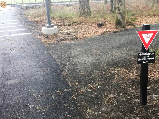
Love that “Cross Traffic is Faster Than They Appear!” No joke there, you will stumble across pro runners all the time on Hollister.
No kidding. I almost don’t want to go out for runs there, as I don’t find the talent differential between myself and the other runners there “inspiring”. After I got lapped by both Olympic-looking kids as well as a mid-60’s lady, I figured I should go take my chubby self elsewhere.
Well, if it was Joan Benoit, don’t feel bad! I’ve seen her running in PDX, including on the waterfront.
Thanks for posting this, Jonathan!
yay shared path, just hope its welcomed with all users. MUP struggles
Finally, I was wondering when they were going to build something in Uncle Phil’s haunted woods.
Now if they could the city/county to build protected bike lanes on the streets around the campus for the rest of us that would be go a long way in making it world class campus
Supposedly, design and construction efforts have begun for 2 miles of Walker Road (173rd to Park Way) between 2016 and 2019. The project will be broken up into phases, and will include 2 feet for buffers and/or protection in addition to the 5 foot bike lane.
http://www.co.washington.or.us/LUT/TransportationProjects/walker-road-phase-2.cfm?page=Activity
I’ve put in a request for Phase 1 design plans (173rd to Schendel) and an update on the schedule.
Can anyone provide a link to the new THPR trail that’s getting built? My Google-Fu is failing me at the moment.
The Westside Trail?
http://www.oregonmetro.gov/westside-trail-master-plan
This is a better quick summary of that plan (from their community presentations):
http://www.oregonmetro.gov/sites/default/files/may_2013_wst_presentation.pdf
As a runner that lives to the south of here I am looking forward to quicker access to the Hollister Trail via the Max Stop.
Oh the memories, in 1976 that property was a nature preserve. My Jr. High Biology class went there on a field trip.
This reminded me of the bike leadership HP brought to Vancouver in the 80s/ early 90s…when they built their office campus in what is now East Vancouver…they built the first modern bike lanes in the City.
“…There’s a new path being built near the Beaverton Creek MAX light rail station on the south end of the parcel. Once Tualatin Hills Parks and Rec finish that path, it’s likely that Nike will close this new Woods Connector Trail to the public. …” bikeportland
The new path described, sounds like the east-west running Creekside Development path that the city of Beaverton is working on. THPRD may be involved in its construction. The Westside Trail sections to the west of Nike’s campus, are nearly complete. Just a short distance through the nature park leads to a turn to the east onto the continuation of the Westside.
Nice gesture on the part of Nike, to have opened to the public, this short north-south connector trail through Nike’s woods, even if the public will have access to it only temporarily. The woods are a beautiful departure from the busy traffic outside of them.
No swing gates?
Shocked. Shocked!
But tgey DJ’d install railroad crossing signs, and yield signs at a place where they make sense. Directional signage would help. Maybe Nime should donate some money to Metro’s trail signage program. That would be a start!