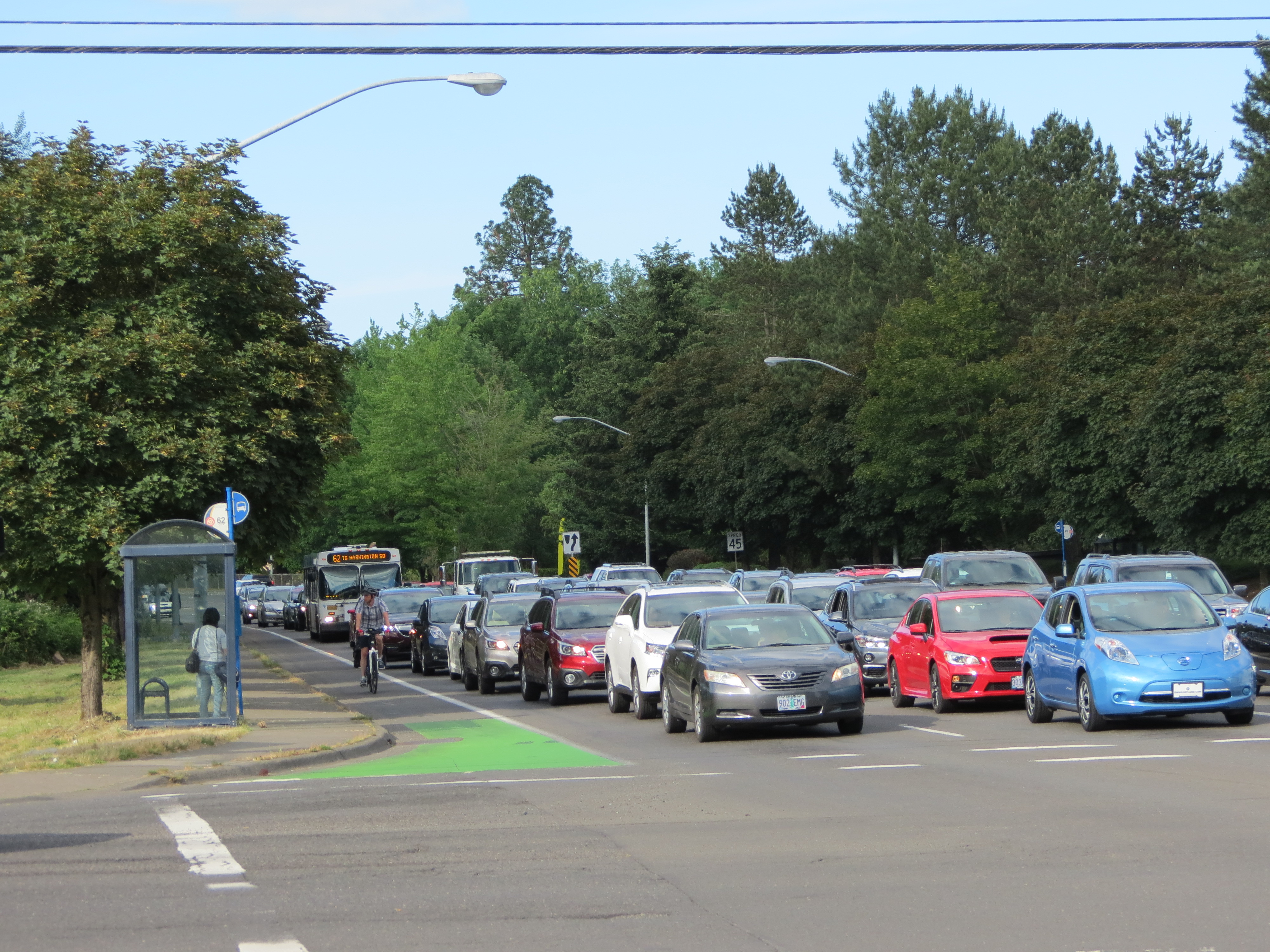
(Photos: Naomi Fast)
When I first began riding a bicycle for transportation I focused on things like getting used to car noise, figuring out how to keep the bottom of my pants from ripping on one side, and choosing the best bike bags for my shopping needs.
It wasn’t until moving to the suburbs of Washington County without a car that “open houses” snuck into my consciousness.
As I reported earlier this month, an open house for updates to Western Avenue is happening today. And tonight (5/30, 5:00 to 7:00 pm at Holy Trinity Parish, 13715 SW Walker Road in Beaverton) there’s another chance for public feedback on another important intersection on the westside, Walker Road and Murray — a.k.a. the Nike World HQ intersection.
In a way, this project fits hand in glove with ODOT’s planned freeway expansions. After all, westside employees don’t all live on the westside. Some commute from Vancouver, Washington, or other cities around the metro area. That’s neither here nor there, unless you’re concerned with air quality and traffic noise if a freeway widening is slated to take place near you.
If you bike to work at Nike, or past Nike, here’s how Washington County’s project page says the intersection will change:
*Dual left-turn car lanes will be at all four approaches to the intersection (currently just on eastbound Walker)
*Dedicated right-turn lanes at all four approaches
*A third southbound through-lane will be added to Murray Blvd, becoming a dedicated right-turn lane at Bowerman Drive (a Nike entrance)
*Two bridges and two culverts will be replaced
The county’s emphasis, it appears, is on carrying out plans to make driving easier.
What improvements will be made for biking, walking, and transit at the intersection?
None.
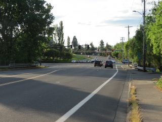
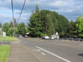
The official project page says, “Walker Road and Murray Boulevard are heavily used arterial roads.” It fails to mention which vehicles people use. In fact, the bike lane is consistently in use by people cycling, and sometimes on skateboards. There is also a bus line on Walker Road past Nike, Line 59, but it only runs once an hour six times per day, and not at all on weekends or holidays. Line 62 on Murray only runs once every half-hour. Plus, there’s no sidewalk between SW Meadow and SW Butner on the north side of Walker.
Walker Road, directly across the street from Nike, from Murray to Koll/SW 150th, happens to be densely populated. The census estimates that in 2017, Washington County had a population of 588,957 with 9% living in poverty (an estimated 13.4% lived in poverty in Beaverton). The area just north of Nike is a mix of Beaverton and Washington County zoning. The county’s zone descriptions (PDF) sheds some light on the number of people who are affected by increased driving along Walker. The area bordering Meadow Park Middle School is zoned “R24,” for residential use with a 19 unit per acre minimum and a maximum density of 24 units per acre.
Advertisement
It’s these people, whose property taxes are bundled into rents or paid directly, who are purchasing this $14 million intersection expansion through the county’s road funding program, the Major Streets Transportation Improvement Program (MSTIP). That price tag doesn’t include the $10.2 million for Walker Rd widening.
Residents who live in the area know best, when it comes to the need for complete streets in the area.
Here’s what some of them had to say in a previous public comment period, (as compiled from this Urban Road Maintenance District document — Note in particular the comments about Butner and SW Park Way, which are near the Walker & Murray intersection).
One commenter was concerned about Butner’s proximity to a school,
“Let’s make it safe for active kids; this is a lower-income area so you may get fewer votes online, so don’t let that represent a lesser need.”
Another commenter said,
“This needs to be a safe, 20 mph greenway, not a freeway! This project is greatly needed because it leads to the Sunset Transit Center.”
Another resident said,
“I live down SW Spring and walk regularly to Commonwealth Lake Park on this stretch of Butner where I’m often forced to walk in the road until I can make it to a driveway to shelter from oncoming traffic. I see families with children on bikes, and people walking dogs who are in danger because a significant amount of pedestrians, cyclists, and cars can be in this pinched stretch of road together. This would be a great first step to resolving the dangerous pedestrian situation on Butner.”
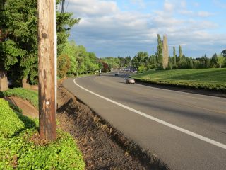
Walker Road east of Cedar Hills is also a potential bike route that only the bravest riders are willing to ride. The road has curves that many drivers take quite fast, and there are no bike lanes or sidewalks there. It isn’t terribly surprising that more people aren’t biking to work from these roads, with active transportation infrastructure having been neglected.
The county’s emphasis, it appears, is on carrying out plans to make driving easier.
As recently as this year, a less bike-friendly Walker road intersection was formed where the entrance to one of Nike’s new parking garages at Koll/SW 150th and Walker was closed to public use. When the building Yakima Racks once occupied was torn down, Koll was closed to the public. Prior to 2017, the public could reach the Merlo MAX stop by biking down low-car Koll to Jay street, to SW 158th. Now, people coming from, say, Meadow Ridge Apartments, must bike west on Walker, then make a left turn at the intersection of Walker & 158th. For some this left turn is easy; for others, it isn’t.
Further west on Walker toward SW 158th is the 92-acre THPRD Howard M. Terpenning Recreaction Complex, which is heavily used all year long for everything from baseball to swimming to soccer. Continue west on Walker, and there are more apartment complexes, restaurants, and a Fred Meyer store.
The Trimet MAX line is just a mile south of Walker. The Nike campus sits between Walker road residents and the nearest stations, making the MAX stop a good mile-and-a-half away. With a bus that only goes by 30 times per direction for the entire week, the primary connections to MAX for car-free residents are by walking or biking.
If only the County would cater to them a bit more they might not need to keep throwing millions at more lanes for driving.
— Naomi Fast, @_the_clearing on Twitter
Never miss a story. Sign-up for the daily BP Headlines email.
BikePortland needs your support.


Thanks for reading.
BikePortland has served this community with independent community journalism since 2005. We rely on subscriptions from readers like you to survive. Your financial support is vital in keeping this valuable resource alive and well.
Please subscribe today to strengthen and expand our work.
It is ironic that a company that makes products to put on human feet to be used for running and walking would be so backward when it comes to influencing the area surrounding their headquarters in to one where the modes of travel that involve shoes are all but impossible.
Maybe it’s not as ironic as it first appears. Most folks who wear their shoes for recreation, which was the initial market for them, drive to where they run, walk, hike, play basketball or whatever.
At this moment, Phil Knight is giving the University of Oregon a chunk of money to build a new wing of campus along the river. It will include, for the first time, parking garages right up to the, until recently, car-free riverfront. To me, that will be a sad legacy that will overshadow all the good that has been done by Mr. Knights abundant donations to his alma mater.
Agreed.
Nike is not what it once was and I’m done with their products which have become to be all about image and way overpriced for what they are — they aren’t even a good deal if you have access to the company store.
I find the general area rideable but no fun and I don’t many people would like riding there. The last time I was out there, I told my GF that if we wanted to be in an area like that, we should just move to the midwest where at least the cost of living is reasonable.
First of all, Mr. Knight is incredibly generous and he can do with his funds that which he wants to do and it is our place to utilize and be thankful. There is a critical need…no, it is beyond critical…for parking structures around the U of O campus. And especially in the area of the Knight Center…which hosts Concerts as well as basketball…all positive for the Eugene economy. It has become so spread out that one must walk great distances to an event…with the rain, with aging patrons, with children…it is not acceptable. At night events, there are adults and children jumping out from cars and sidewalks to cross the dark, rainy streets…in front of the long line of visitors searching for a spot in the residential neighborhoods. It is a safety issue first. No one looks forward to a large building at the ‘waterfront’….but what is your suggestion? We are so blessed in Oregon that we can enjoy its beauty from more than one spot.
“he can do with his funds that which he wants to do and it is our place to utilize and be thankful”?
Has the serf class returned?
It’s coming…Lords, serfs, and everyone believing in magic, which will take the form of “sufficiently advanced technology”. Welcome to 1340AD. Brush up on your Gregorian chants.
“Just do it, in a car”…
This article will only have comments about the Nike slogan and nothing to address the state of cycling on the west side. If it’s not on the east side of the Willamette, Portlanders don’t care.
It’s not Portland, it’s Washington county, so Portlanders have very little skin in the game, other than TriMet.
Yes, people from Washington County never drive into Portland…
Give potential cyclists better options westside and you may just take cars off downtown streets.
Lots of Portlanders cycle in Washington County, and vice-versa.
JD, that’s unfortunate if true. A few thoughts… After attending region-wide meetings last week, I’m convinced our entire region’s mode shift success is interconnected. After listening to Mike Mason of ODOT, my understanding is, for any metro-area car congestion relief plan to work, ODOT needs 5-15% more people to stop using cars.
So: they need us to keep biking, & they need more to start.
That’s assuming SW Corridor MAX is built. Currently, there are more big car parking facilities planned for the new MAX line, to support driving. But people who rely on transit need more first & last mile bus & bike connections to MAX. Cutting bus service illustrates induced demand in reverse. If a bus line = a car lane, & Trimet cuts it, history, it seems, shows it reduces users of the system. Some may just be stranded, without connection to MAX or economic opportunities, as has happened to some living by Nike. Add service to a bus line, & people can trust it again, & will use it. Even just a shuttle going back & forth on Walker between Murray & 158th would give transportation freedom for residents.
Another thought: maybe MSTIP funding should be drawn in part from employers, like the Trimet tax? Is it possible that Portland & Vancouver residents who daily drive across Portland or through PDX neighborhoods to work in WashCo are some of the very people who think this widening should happen? I wonder what percentage of commuters produce that intersection’s rush hour tie up, but won’t pay the widening costs. Their user fees would be paid by WashCo residents. People living near transit-weak employment campuses end up paying again in reduced neighborhood enjoyment brought by induced car traffic.
Finally, an anecdote: Saturday, I was telling a grocery employee I’d discovered a bike route to her Canyon Road store via 5th in Beaverton. She said, “Oh, I hate driving on Canyon! I always drive to work on 5th. I guess 5th must be nicer for you on bike, too.”
Does anyone really like wide roads?
I feel your pain – I live in a similar environment. Until recently, our local DOT would readily agree to whatever suggestions our state DOT would make for widening such roads, adding double-turns, etc, since the state was paying for such changes. However, after pedestrian crashes became 20% of all fatalities locally, the city started insisting on some changes you might try with your DOTs.
From your article, it sounds like you are resigned to the worst. However, if you are appealing for help, here’s my advice:
First, talk with as many local junior-level engineers, planners, and politicians as you can, both at the open house and afterwards. Be nice to them – they are very sensitive people. Praise them for having bike lanes where they are in the first place, and that you and many other appreciate having them. Then suggest how they might be improved, especially at intersections, how you and others need to go shopping, get to work, get your kids to school, etc. Again, be nice while saying this. They are just doing their job.
Second, suggest to your city engineers to talk with the state engineers to engineer traffic speeds to the posted limits (rather than 20 mph over), requiring the state DOT to reduce ALL traffic lanes to 10 feet center-to-center of the lane markings, including the turn lanes and the central median. This is a proven method for reducing car speeds. It also opens up more space for buffered bike lanes or any sort of bike lanes, which the city should insist be implemented, and since the state DOT obstensively has a bike and ped policy that supports such infrastructure, usually ignored, they should have no choice but to put them in. You may need to look up such policies beforehand and quote chapter and verse, like a bible-thumper.
Third, bug all the engineers to put in bike signals at intersections, leading timers for pedestrians (the ped green comes on 10 seconds before the car green), protected intersections, etc. Bring your NACTO guide if you have it, to show them what you are talking about.
Fourth, remember that even if the “final” design doesn’t have what you asked for, it can still be changed up until they actually build it, so keep up your campaign.
And don’t loose hope.
Why trust county commissioners Bob Terry and Roy Rogers ?
I admit it – I’ve lost hope.
Our commissioners are all about giving tax breaks to humongous corporations and making concessions to housing developers who want more lanes and higher speeds. They could care less about anyone outside of a car.
The sheriffs I’ve met are nice people, and have been responsive to our requests for enforcement in my neighborhood. But when I see them out on the road they are almost always going well above the speed limit. And they devote too much time to setting up speed traps on highway 26 and nowhere else.
Our DOT has plans for neighborhood greenways, but “no money” to implement them. I guess blacktop and bulldozers are cheap but paint for sharrows is expensive? There are bike paths built by the rec districts that meet roads without curb cuts because there’s “no money” to install them. There seems to be only ONE GUY at the county to talk to about traffic calming, and he doesn’t do anything but offer up a radar gun for your amusement, hand out ‘slow down’ signs, and quote from the standard engineering playbook about 85th percentile speeds, traffic volumes, and the need to build more road capacity.
The final Bethany plan promised 5-foot bike lanes (substandard, I know), and then they were built even smaller. It promised 5-foot sidewalks and a wide area to walk in with plants buffering against the sound barrier and the road, but the sidewalk is hemmed in by these plants, and street lamps, and benches, and cutouts. Even if we could get a plan we liked, I sure wouldn’t trust it to match the final product.
As a bold move, the county has installed a total of (1) roundabout, to meet the demands of neighbors who surely went to great trouble to pressure the county into doing something. Here it is, in all it’s glory:
https://goo.gl/maps/ZMgQaQZamLk
I think Washington County and I want different things, and maybe that’s okay. I definitely plan on getting out when I’m done working. Maybe sooner.
To be fair, there’s also one a block down at 203rd.
Oh, hey, look at that! I wonder how they scrounged up the funds to make this beautiful, traffic-calming feature!
https://goo.gl/maps/S2qsVYJw1PB2
I also forgot that they have roundabouts further out in the county, but those are made for the benefit of drivers so they spend more money on them:
https://goo.gl/maps/KhrZ7gDS6s52
The small ones are not roundabouts, but neighborhood traffic circles. Roundabouts would have yield signs but no signs in the circle.
Right, thank you.
Interesting to read this article and comments after the day I had yesterday. I live near Redding CA and ride in Redding a lot. Yesterday was our annual ride with transportation officials as part of bike month. members of the public got to ride with several state and city transportation officials and planers and even the mayor showed up on her e-bike for the ride.
The main subject for yesterday’s ride was talking about the new bike trail that will be built connecting our River Trail, a 17 mile class 1 trail from Redding up to the base of Shasta Dam, into the downtown area. Our city council just voted to close a short section of a small road, used mostly by cut through commuters for the construction of this new trail. After the trail passes the new closed road section it will have a two way protected cycle track into the downtown area. There will soon be protected cycle tracks in the downtown area as part of a second project. The bottom line is by the end of 2020 we will have a new way to bike into and around our downtown area that will be safe and comfortable for people of all ages and skills.
A bonus of yesterday’s ride was a chance to get a first sneak peak and initial designs for another project to upgrade cycling and pedestrian facilities on another street in town. While Redding may have gotten a late start in making things better for cyclists it is nice to have a supportive city council and public works department, and have a local state DOT office, that is supporting new trails and other improvements to make biking and walking safer.
Late start, indeed. The latest ACS data says Redding is one of those cycling deserts where there are fewer people riding than our pathetically low national average. But hey, they built a cool bridge, so that’s something.
Now if only the city, county and CalTrans would work together to allow people to ride from town to the many cool nearby sites (and beyond) without being on truly horrid roads, cycling in Redding could take off. It could even be a key stop-over place on gravel road bike tours where very hungry bike tourists take a day or two of rest before heading back into the mountains.
I did a Shasta ride with some Portland Velo folks a few years ago – one of the most scenic and enjoyable rides I’ve ever done (even with the I-5 section, beating hands-down any I-84 gorge connections I’ve had to endure). When I dated a girl in Redding many years ago we did a lot of cycling there, so it’s great to hear BAR’s positive news about the vision and momentum there. Good point on Caltrans, though – they don’t seem to understand how to create a holistic strategy for a region that’s ripe for cycling-based tourism.
Better yet, stop worrying about stuff like this. Kick back and watch it self destruct.
Yeah, better to just move to inner Portland to complain about suburban sprawl and a lack of high-density apartments with bike parking, all while cursing those who arrived after you driving up rents and on-street car storage.
This is really sad, considering they have a MAX stop just south of campus. Nike has shown that they don’t care about reducing SOV travel, and they do everything they can to dodge county taxes. Why would the county dump money into what is essentially infrastructure just for Nike? Especially when so many roads in the county are incredibly dangerous for all road users due to lack of shoulders, bike lanes, sidewalks, traffic signals, etc.
This intersection is a nightmare. Perhaps Nike should provide noded shuttles from various parts of Washington County and discourage SOV’s, rather than having all Washington County taxpayers pay for road widening.
Nike already has frequent, free shuttles from every MAX/bus station in a 5 mile radius and BikeTown bikes all over every campus and at nearby MAX stations (free and ONLY for Nike employees).
The problem at Nike is one of culture. A culture of selfishness and exclusion combined with ample, free car parking leads to car driving. Nike, for what it’s worth, has done everything to enable more of their employees to ditch their car but culture is much deeper than these superficial changes.
Having just ridden through this intersection EB on Walker a couple days ago headed to Portland I was yet again reminded that the worst part of this whole area is not at the intersection itself (which has typical WC serviceable but not great on-street bike lanes and token green paint at corners), Its actually the very dangerous maneuver required a few hundred feet east on Walker to make the left turn onto SW Park Way, which is the quietest, most direct route to connect to the Highway 26 trail.
There is not even a left turn lane on Walker to Park Way (even though there is one incongruously a block earlier to dead-end Far Vista Street), so you have to merge out of the bike lane into the single main lane of EB Walker that just reduced from 2 lanes to 1 concentrating and usually aggravating the motorists, then typically sit in the narrow median between two yellow lines to wait for a clearing to complete your left turn. Most of the time I just look for a small gap in traffic behind me, shoot out a pointing left arm and then basically pray I have attentive motorists behind.
Best idea would be a two way cycle track between Murray and Park Way so the left turn was eliminated, but otherwise either Far Vista could have a trail spur added from the dead end to Commonwealth Park to get to Park Way, or at the very least warning signage for motorists and new road striping indicating the merge and left turn as part of a bike route.
And don’t be too harsh on Nike, I don’t think they have direct input into the intersection configuration. And even though they have unfortunately recently added parking structures as part of their campus expansion, they have also incentivized transport usage through the new trail connecting the MAX station and campus through Hollister trail and a large pool of dockless Biketown bikes available to get back and forth and all around the campus. There is also a new separated cycleway on nearby 154th terrace past their satellite buildings making a connection to the Westside Trail. Riding in the area I see lots of cycling commuters coming and going from the campus, though I strongly agree MUCH better infrastructure could increase the active transpo share. Ironically a big part of the problem is the number of Portlanders who commute via SOV, rather than live nearer to the campus as a local and walk or cycle to work.
Yep, it is one of the worst parts of my NE PDX to 185th St. commute. At this point I pull over to the curb near the left turn, stop and wait for a good time to turn. Sucks but it is def the safest way to do it. Or, you could ride Walker all the way up to Cedar Hills Blvd and hang a left there. That may be a safer, way to turn left, but I much prefer the ride through the neighborhood than staying on Walker.
On your ride did you get the thrilling ride over the bridge with the disappearing “bike lane” just before 173rd? For that sketchy section I put it in the big gear, haul ass and take the whole lane.
Yeah, if there is absolutely no gap in traffic my “out” is to turn right at SW 139th, do a quick u-turn so I can wait there to cross Walker straight to Park Way. Wish they’d also put in a RRFD there, then I’d probably cross that way always.
I come from Amberglen in Hillsboro, so I get the double thrill of the lane take because of narrow bridges both at 190th and that one at 173rd. Both are downhill at least and yeah you can get up to 30mph + in the 45 zone to mitigate the speed difference with motorists. Still those obsolete bridges need replacing asap and get contiguous bike infrastructure.
“turn right at SW 139th, do a quick u-turn so I can wait there to cross Walker straight to Park Way”
That’s how I did it when I lived over there. Sitting in the median is far faster, but sketchy.
So sketchy, in fact, that if I have a clearing I will cross mid-block’ish and “salmon” the bikelane to the corner. Not ideal, but preferable to having 40mph Escalades heading towards me. Old school BMX skills still come in handy if I have to bunnyhop the curb in a moment’s notice.
Agreed. I wish the bridge(s) Could have been part of the deal when they redid the road RIGHT UP TO THE DAMN BRIDGE.
I have been taking these gaps with my sons bike trailer lately, though not during commute hours WB is a daunting climb with poor shoulders after, but going EB I agree you can at least just bomb through.
The biggest single thing they could have done as part of the expansion is NOT built new parking and created a pay-to-park pass system for employees. You can’t just give small carrots for active transportation when you are also spending millions to subsidize car parking (new parking garages usually pencil out around $20,000 per spot).
They did build those new buildings on top of their existing parking lots, so the parking structures are replacing spots that existed. They will also be pulling employee back onto campus from outlying leased properties down around Millikan. Overall they aren’t adding more people just changing where they are going. So fixing the traffic flow problems this causes, like the two lane to one lane pinch point on walker just west of the intersection isn’t altogether a bad thing. They are also fixing SW 158 south of Walker where south bound it squeezed from 2 down to one lane, which also was horrible for biking as there was only a shoulder and not a true bike lane.
A few years ago it was $14,000-$18,000 for surface parking, $34,000 for parking garages, and $50,000 for underground parking, per parking spot, including a portion of the driving surface.
And upon opening the first new parking garage on campus, an exec expressed his disappointment that it could not be LEED certified…
how about staying on Park Way and crossing Cedar Hills Blvd to get to and from there?
To and from where? I actually live in the neighborhood. Crossing Cedar Hills isn’t the direction I need to go.
The left turn from Walker to Park Way was one of my nightmares too, when my commute route went through that area. Often I found myself stopping in the bike lane a ways back from the intersection, and waiting – sometimes quite a while – for traffic from behind to clear … so that I can get across into the sketchy middle of the road, and wait for oncoming traffic to clear.
Often I wished I’d just crossed as a pedestrian and illegally salmoned up the westbound bike lane. That’s dicey too, because drivers turning right from Park onto Walker are looking to their left, and many eastbound cars are looking to make the same left turn from Walker to Park that I want to make from the bike lane.
I see nothing in this project that will make crossing Walker Rd at Parkway any easier, something I do on a daily basis. I am very disappointed in Wash Co. For ignoring the needs of the residents of the area. Butner Rd is also a disaster for anyone who needs to walk or bike to the business on Murray and Cedar Hills. The planners are intent on repeating the mistakes of the past with no thought of pedestrian or bike use.
Since apparently I can’t edit my own comment on this site, I need to override my smart phone and change the word “business” to bus lines as I had intended.
Butner should be converted to a 20mph greenway.
every day – I see thousands of cars to each and every bicycle…
give it up – most people, even liberals want to drive a car
No, thanks. I’ll keep riding. How many of those crazy libs in cars have you asked whether they would prefer to drive in continuing worse conditions, or ride if the options were safer and more efficient than they currently are?
I agree with both sides of these arguments. Yes more people will ride if conditions improve or if they just open their perspective just a bit… that said, as a progressive millennial with a young family living in the suburbs who has many friends who are progressive millennials with young families living in the suburbs I can say that cars are going nowhere and it is rage inducing how many don’t even consider cycling for exercise (see: driving to spin classes) let alone actual transportation (see: suvs to get baby and a couple bags of groceries home). It’s a never ending circle, people selfishly drive so roads get bigger and more people don’t want to drive as a result.
Keep seeking. You’re not there yet.
I suppose that if you parachuted onto a desert island and saw the few people living there eating bananas for every meal, you’d come to the conclusion that they LOVED bananas. Never mind that they were the only souce of food available to them.
What people do reflects the quality of the choices they have available, not necessarily their preferences. (And that holds true for people regardless of their political leanings, not that that had anything to do with this issue.)
I used to sit in traffic like the rest of the sheeple watching a few bicyclists pass me and beat me to work. Dug out the old Fuji from my high school daze and decided to give it a try, asked some of the ‘crazies’ for tips, and before long I was hooked. Maybe you haven’t opened your eyes wide enough to let in the light yet?
Build more capacity, more cars will come…build more capacity…more cars….. It goes on and and on until they want to put a freeway in.
Curious. When I lived in North Dakota, local politicians were continuously disappointed that in spite of the open freeways and total lack of traffic, no one would stay.
Rode this intersection this morning at 7am. Hardly any traffic… maybe I should have gone through at 9? idk but unless Nike is planning to hold daily sporting events I don’t see how traffic levels justify the extra lanes.
Peak Period Demand, or more likely Projected Peak Period Demand, AM & PM. (See mark smith’s comments above). Chances are one side of the street is busier in the morning, the other side in the evening, and as you expand the roadway, it will gradually get busier. Until the freeway bypass is built, then the roadway will empty out, and drivers and AVs will go 20-30mph over the speed limit.
Ah, the exception that proves the rule. Like when everyone points out that one cyclist in SF who killed a pedestrian.
The easier it is to drive on 26 (and they are currently adding lanes between 185th and Cornell), the further west people will live, because housing is cheaper out there. But eventually it will fill up again.
That should have nested under David’s North Dakota comment.
Location
US 26 | Cornelius Pass Road to 185th Avenue
Cost and Funding
$34.5 million
What Problem Will This Improve?
The stretch of U.S. 26 between Cornelius Pass Road and 185th Avenue has reached its vehicle capacity. The congestion is particularly evident on U.S. 26 westbound between 185th Avenue and Cornelius Pass Road. The population and employment in Washington County continues to grow, increasing the traffic demand on U.S. 26. Without improvements, congestion and related crashes are anticipated to increase in the area.
Price the congestion. Watch the traffic fall like a rock.
Like with all ODOT projects, they love to use safety as a selling point, which is funny because they never do anything just for safety’s sake, unless there is overwhelming outside pressure.
I worked at the swoosh for 15 years and while I loved working at the ol’ swoosh the company did a very poor job of getting people out of cars and into alternative transportation. The most stressful part of my bike commute was always within a mile of campus. It was not uncommon for fellow employees to almost kill you as you tried to cycle onto campus – texting, speeding and generally being aggressive. They are adding parking like it is going out of style and not investing in vanpools or doing a good job creating incentive to take MAX. (hint a free coffee and a breakfast burrito would be all I ever needed)