(Photos by Naomi Fast)
A former Portlander who now lives on the West Side, Naomi Fast is our Washington County correspondent.
In Beaverton, Millikan Way is a useful route to be acquainted with for visits to — or through — the city on a bike. If you’re new to this area of Washington County, or if you haven’t ventured out on a bike much yet, here are a few things to know.
The geographic and planning context
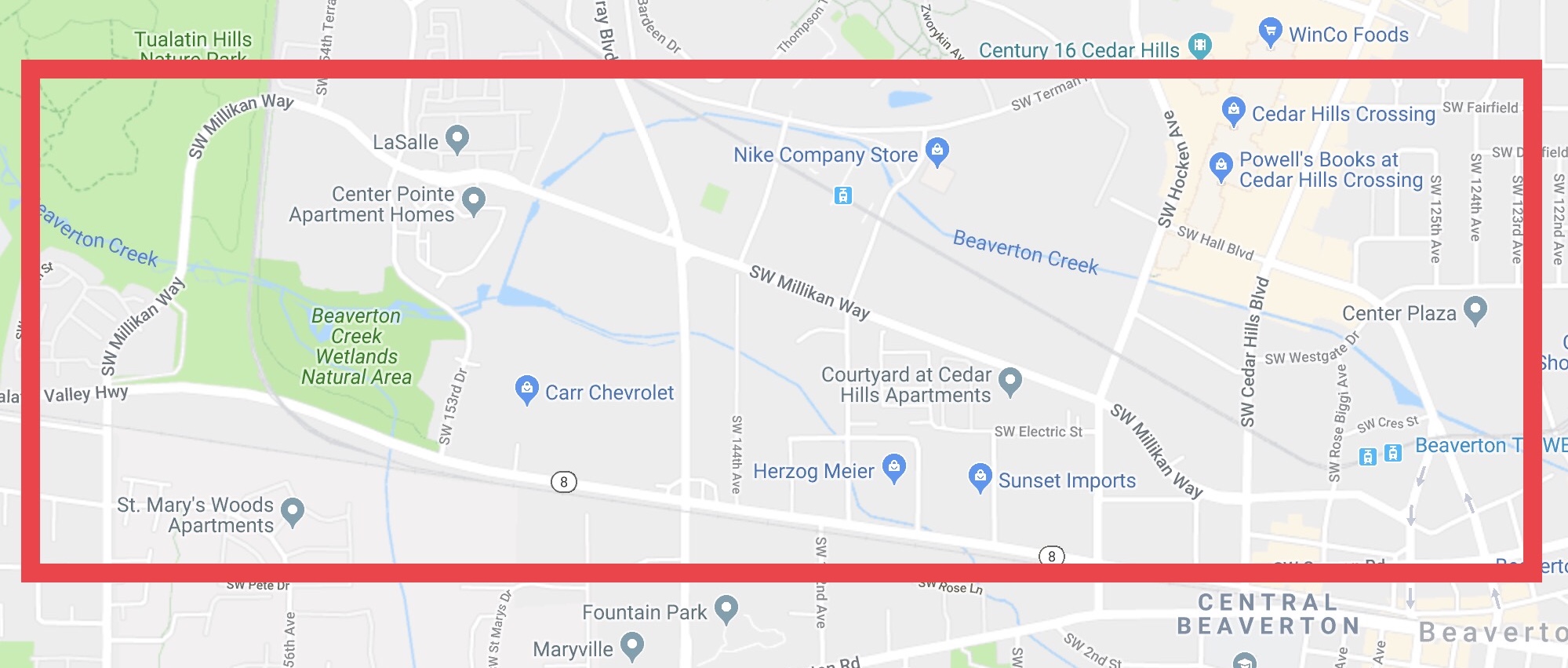
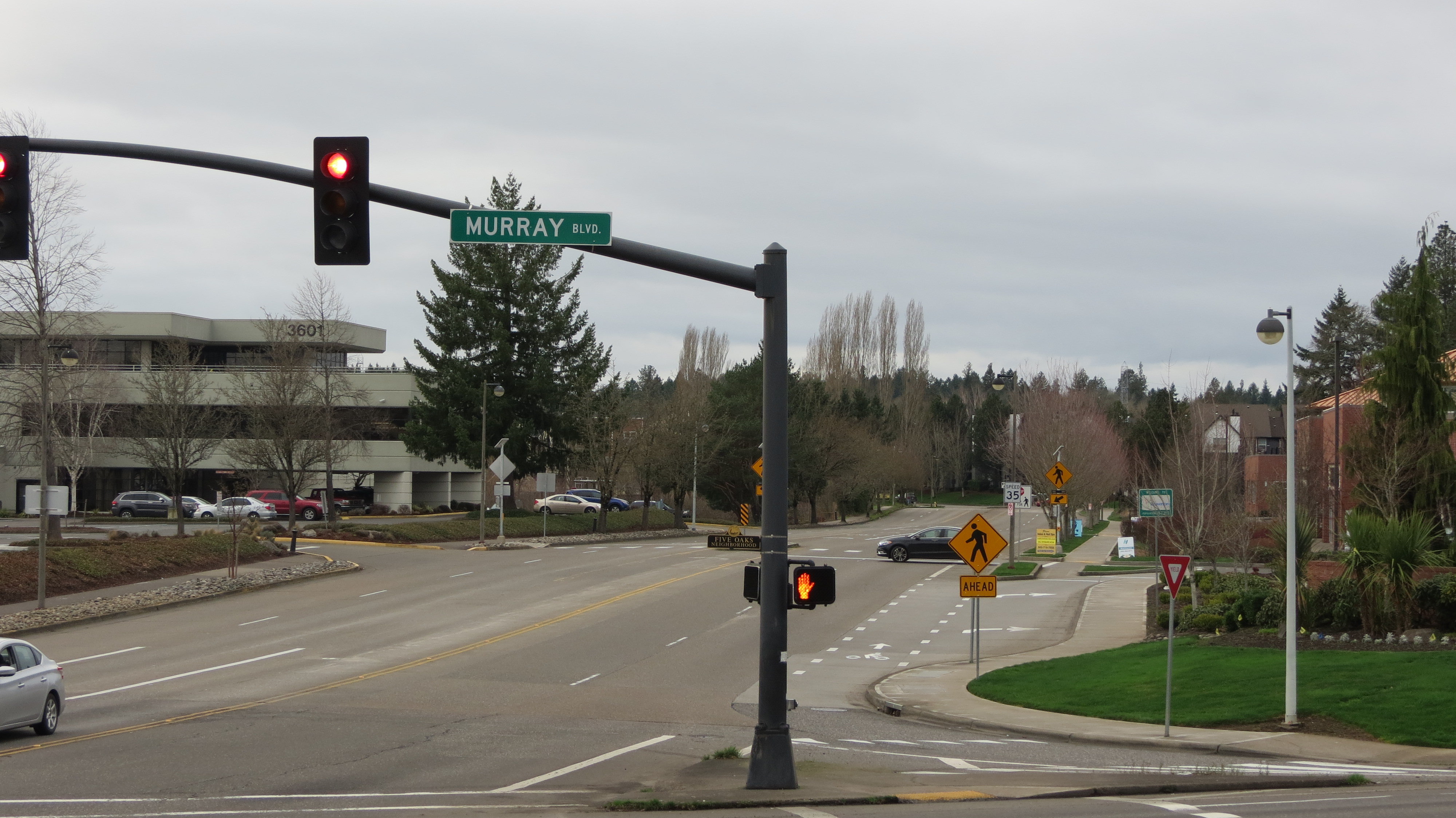
Millikan is mostly thought of as an east-west passage. However, at the western end, where SW 160th Ave becomes Millikan at Tualatin Valley (TV) Hwy, the route first heads north through the Tualatin Valley Nature park, then curves past a trail that leads to Merlo MAX before straightening eastbound to Murray.
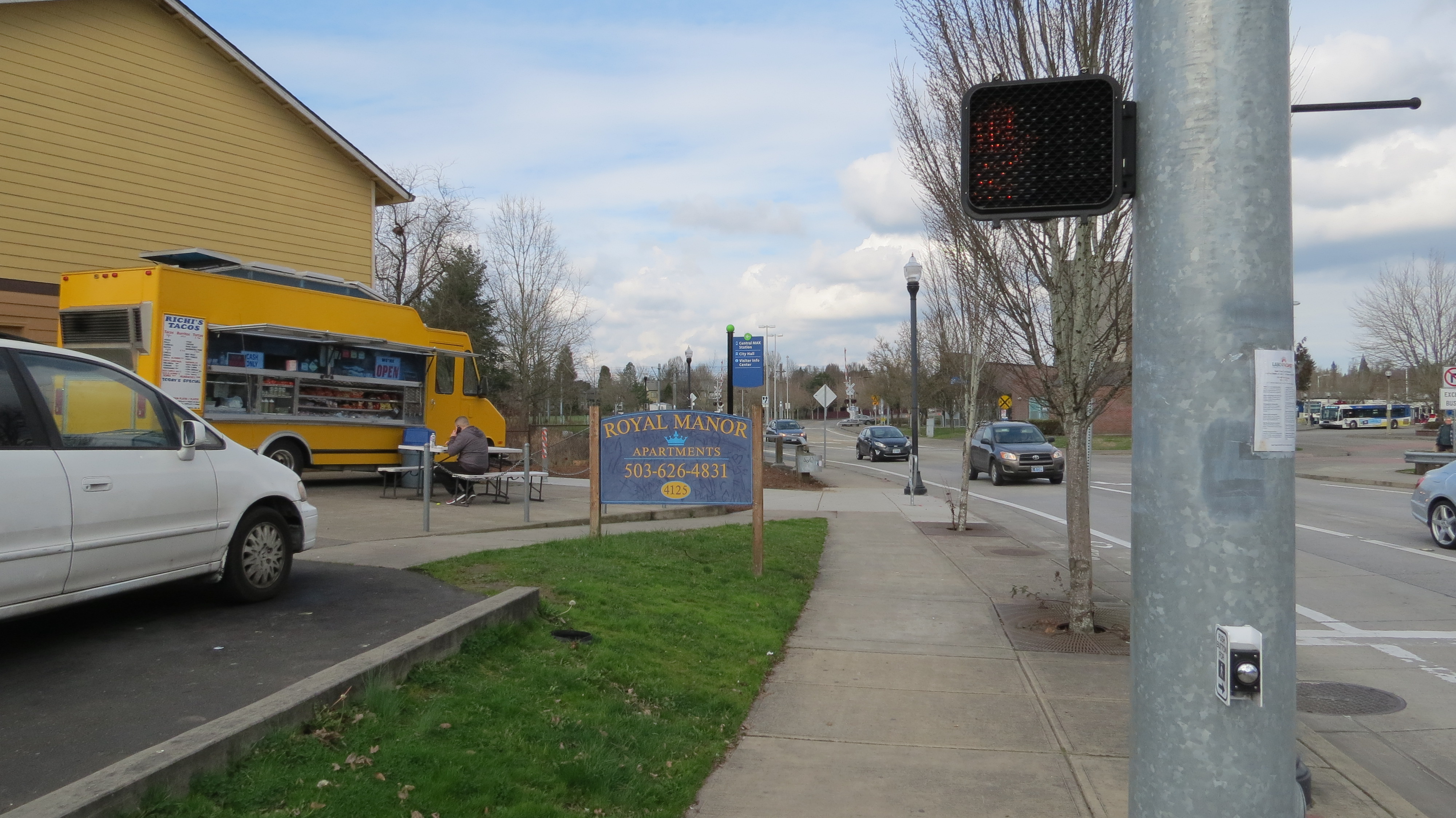
There’s a bike lane gap in this segment, between Murray and the Beaverton Creek bridge closest to TV Hwy. Motor vehicles users have two full lanes in each direction. Going east, after Millikan intersects Murray, the bike lanes resume and drivers have one lane each. The road veers east-southeast between the MAX tracks and Canyon Rd, passing Beaverton’s Round and two Hall Blvd bike shops before going through the Ford Truck Ranch. Millikan ends at SW Lombard Ave, next to Richi’s Taco truck and across the street from the Beaverton Transit Center.

Millikan is part of a Beaverton capital project known as the Canyon Road Alternate Bike Network. Technically, this project only goes as far west as Hocken. Of course, we may be on our way further west than that, or arrive to the bikeway from the west, via north-south arterials like Murray. This spotlight takes that into consideration.
The Good—no, the GREAT!
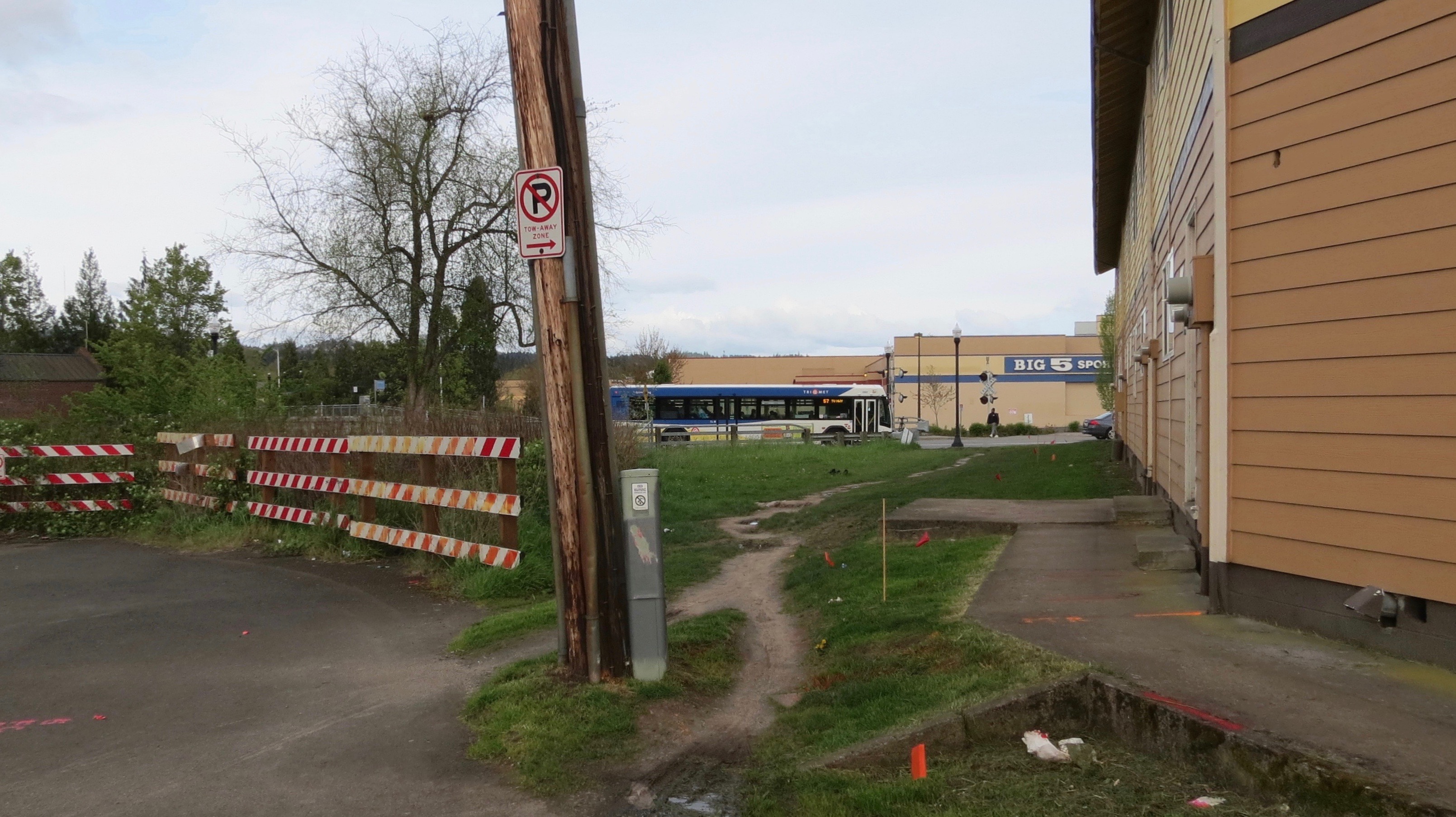

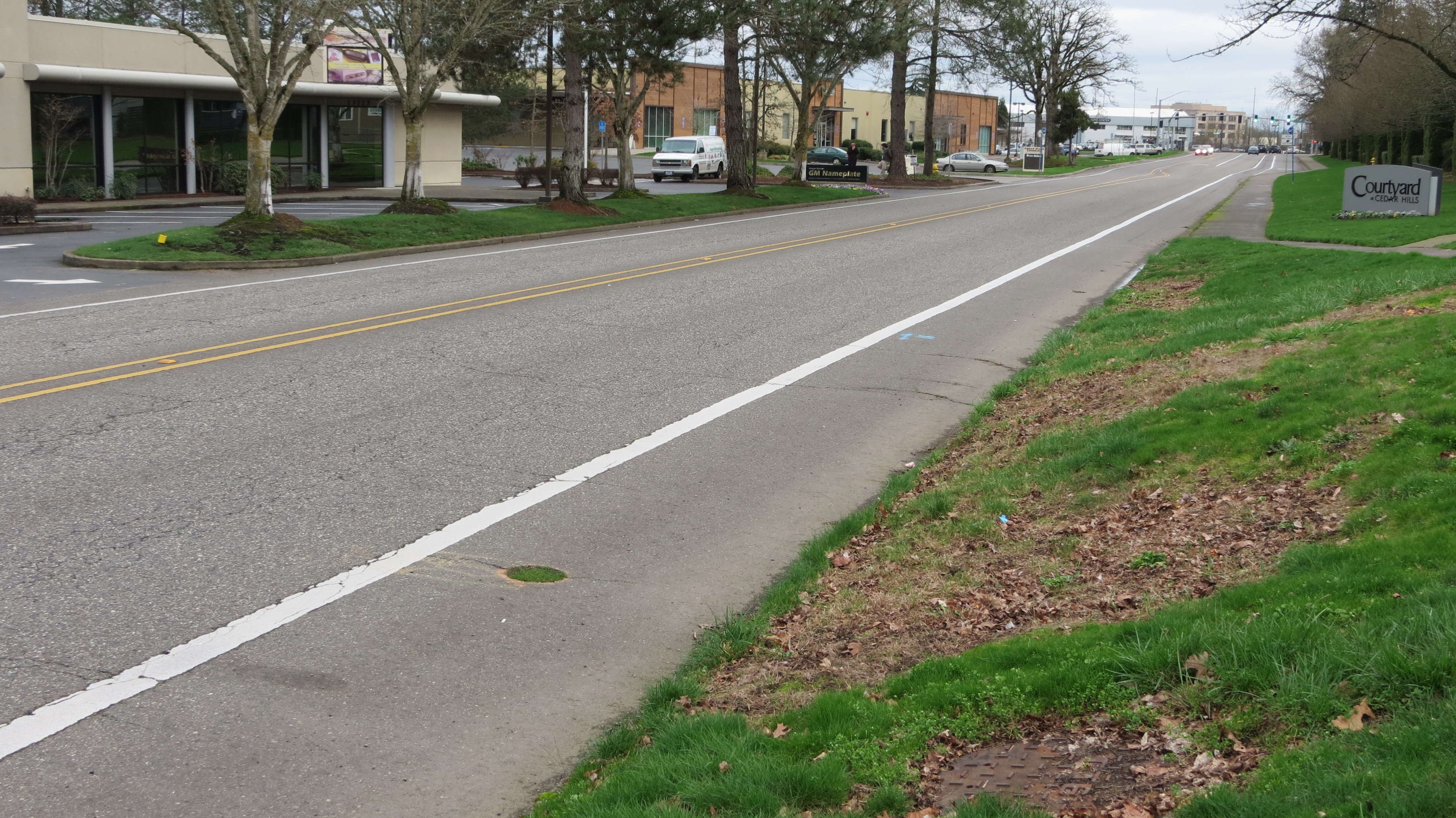
For a long time, Millikan’s pavement didn’t quite reach Lombard. But Millikan received a big dose of active transportation love from the city last year. This improvement is less than a year old, so anyone who’s still accustomed to avoiding this formerly muddy spot is in for a welcome treat. Check it out: there’s even a wayfinding sign!
The Bad

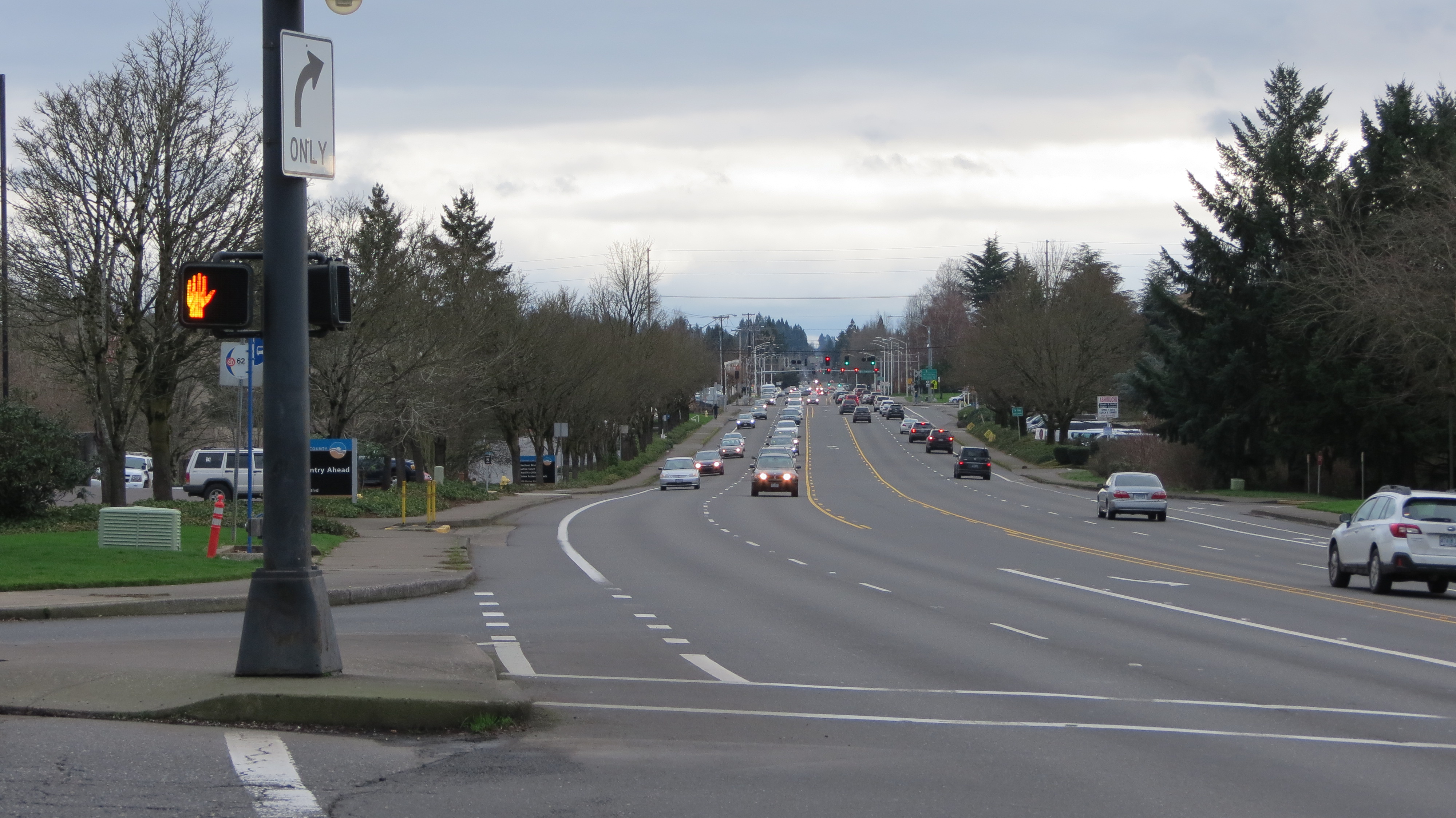
At City Hall, where the new BG’s Food Cartel is, Millikan intersects with Rose Biggi. Millikan narrows even more, and bike lanes are swapped for sharrows. To me, sharrows here aren’t the “bad” thing—not after riding the western segment that’s four lanes across, none of which are bike lanes. Notice the stop signs, though, alerting to the fact that this is a two-way stop. People riding on the bicycle route must stop, while people crossing the bikeway in cars do not stop.
I might not have instantly found this counterintuitive if I hadn’t ridden Portland’s neighborhood greenways, like NE Going St. That bikeway also has two-way stops. But on Going, I remember those stops being for people crossing the bikeway. It not only makes riding easier, but safer.
It doesn’t make sense for the best-known bike network in Beaverton to have an intersection where drivers are not required to stop before crossing the bikeway. I brought that up at a Bicycle Advisory Committee meeting. The hearsay is, various train tracks are the reason for this unfortunate tricky spot. But the food carts are receiving lots of visitors now, with many coming on foot. Maybe the solution is to close northbound Rose Biggi to cars at Millikan, such that Rose Biggi is open only to people using active modes between the MAX tracks and Millikan? I’m not a traffic safety engineer, so I really don’t know. I can, however, report how it feels to cross a street on my bicycle where motored cross-traffic doesn’t stop: bad.
Advertisement
The Bumpy
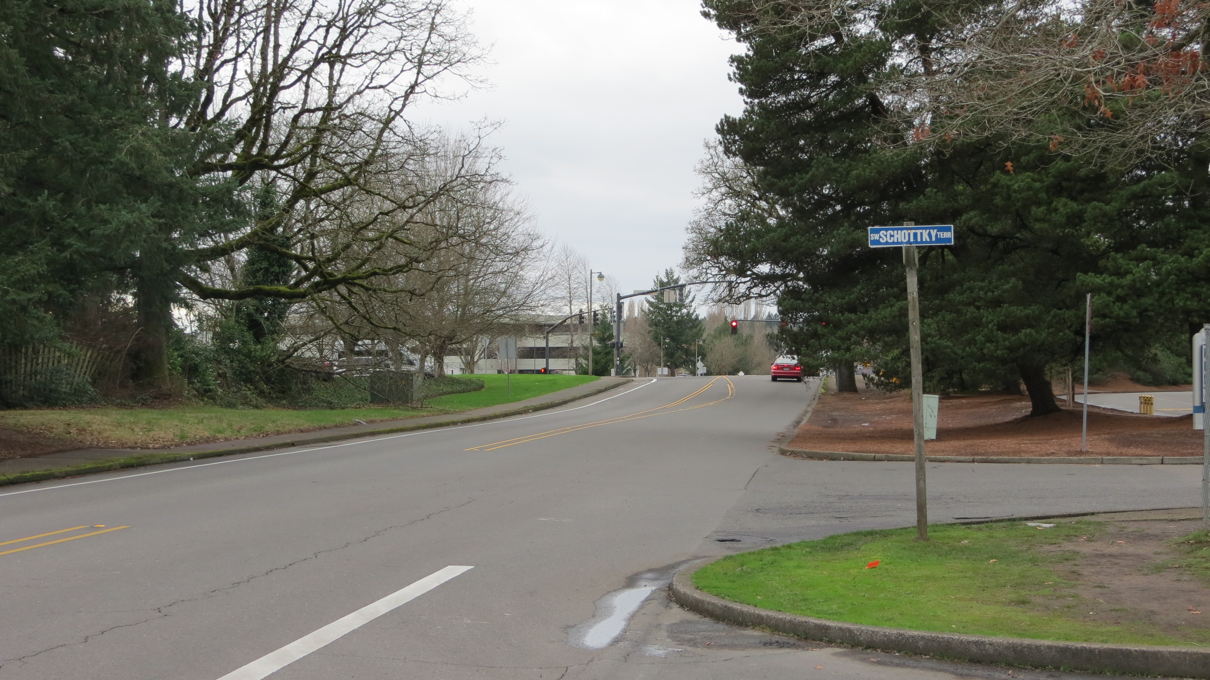
I love big trees like the ones along Millikan. My preference as a bike-commuter is that they be cared for, not cut down, not even for roads. It takes years for trees to grow large, and biking on streets shaded by rows of healthy trees is one of summer’s most pleasant travel options. Trees also make good snack or lunch meeting places, as well as landmarks, like this historic grove of oak trees preserved in Washington County. In fact, the neighborhood Millikan enters west of Murray, Five Oaks, is name for that grove.
So—instead of cutting down established trees living next to roads, I love when engineers seek alternate ways to tackle and work with roots that might bulge into the bike lane. But tackle the problem they should.
I recall one dark, rainy, winter rush hour when I turned to head east on Millikan from southbound Murray. After that ride, Millikan became stuck in my mind as a “bad” place to bike, associated with unexpected bumps, mud, debris and flooding, and darkness contrasted with hundreds of glaring car headlights. I didn’t want to end up always avoiding that stretch, so I went back for a closer look in daylight to see more of the logic behind my negative feelings.
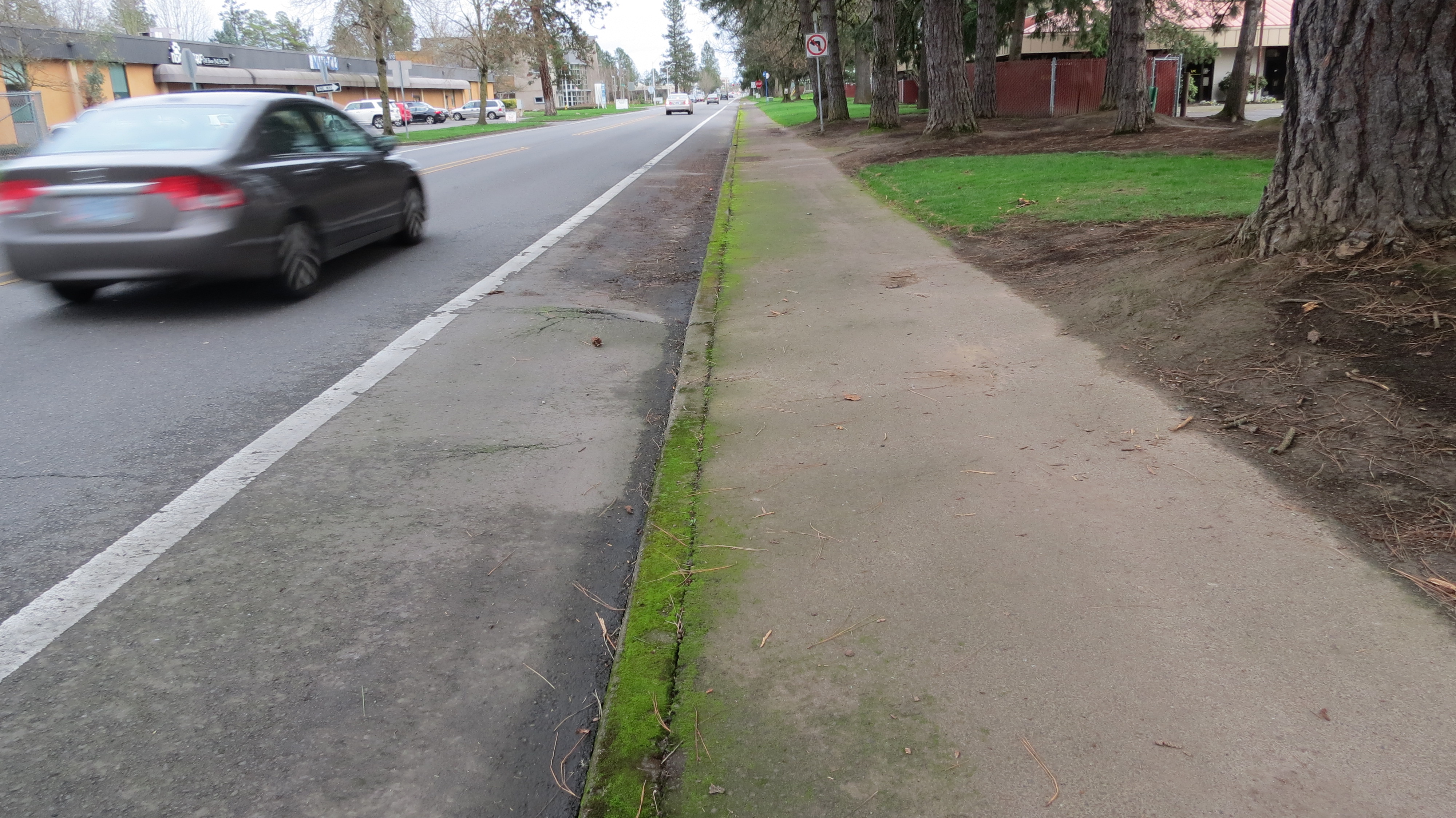
Here’s what I found on Millikan between Murray and Hocken: at least two significant root bulges, resulting in mud and debris pooling in the eastbound bike lane. A utility cut-out, growing grass in a perfect circle. Drivers racing the speed limit. The stretch is sandwiched between two very large intersections, where turning left can be a stressful or cumbersome event.
Westbound, the bike lane disappears just before the enormous intersection with Murray. Finally, there’s a sidewalk on only one side of the street, despite the every-30-minutes 62 bus line on this stretch. Sometimes it’s necessary to state the obvious: the solution to people being forced to walk in the bike lane to is to give them a sidewalk — not reduce or remove a much relied-upon bus line.
In Beaverton, the Traffic Commission is the committee that tends to handle these sorts of street concerns; they can be contacted via email jkhasho@beavertonoregon.gov. With the addition of more walk-to and bike-to destinations along Millikan, it makes sense for the city to prioritize making Millikan a bike route to feel good riding on year round, and as far west as possible.
Go West, young bikeway!
— Naomi Fast, @_the_clearing on Twitter
Read more of her dispatches here.
Never miss a story. Get this and other posts delivered to your inbox.
BikePortland needs your support.
")

")

Thanks for reading.
BikePortland has served this community with independent community journalism since 2005. We rely on subscriptions from readers like you to survive. Your financial support is vital in keeping this valuable resource alive and well.
Please subscribe today to strengthen and expand our work.
I work on Millikan Way (near the Millikan Way MAX station) and live on the west side of the Nature Park (near 170th and TV Hwy). Heading east from work, to the Bike Gallery, Beaverton TC, or (now) the food trucks, is pretty nice. But I have to say: heading west home from work on Millikan Way is miserable.
First the bike lane disappears, as you’ve shown in your last picture. Then, it disappears again, just past Edge Coffee (also as shown). At that point on Millikan, there are two lanes of auto traffic headed in each direction; drivers are happy to be off Murray or TV Hwy and they are moving fast. The curves create terrible blind spots for drivers. Riding on Millikan between Murray and TV Hwy is intimidating.
In fact, I avoid it. I take 141st south to TV Hwy and ride its bike lane west. I’d rather take a consistent bike lane – on stinky, busy, loud TV Hwy – than be constantly looking over my shoulder on Millikan Way! I really wish they’d eliminate one lane in each direction and create a center turn lane and bike lanes on each side.
” heading west home from work on Millikan Way is miserable.
First the bike lane disappears, as you’ve shown in your last picture.”
+1
When I last rode this, traffic was all backed up westbound and you can’t even hop up on a sidewalk or squeeze by the stopped traffic to queue up at the light.
Millikan is a daily ride for me and I love, love, love the new path connecting it to Lombard, I don’t mind the crossing at Rose Biggi because the cross cars are mostly going slow due to the max tracks, but I hate the intersection at Murray. It is huge and crowned and when I cross there I feel like I am in some sort of Mad Max Thunderdome. Luckily my daily commute does not take me across Murray so I mostly just have to brave it in weekends.
A dangerous concern on Millikan Way now is that Beaverton wants to remove the new trail they had just built back around 2017 in order to make a bypass for Canyon Road. Please push back against this wasteful project:
SW Millikan Way Extension Project | Beaverton, OR – Official Website (beavertonoregon.gov)
Naomi, Do you understand the new MUP that Beaverton is currently creating on the other side of the max tracks near the Millikan to Lombard bike path shown in your photo. They have finished clearing the turf and brush all the way from the transit center to Hall. I have looked at the cities’ plans and I can’t figure out the purpose since it parallels Milikan and is only a block or so over?
Hmm… This map lists projects by type; it looks like what you’re describing might be related to project CIP 3407, the Crescent Connection. Is that the correct area?
That’s the Beaverton Arts Center going in nearby, number 3521 on the map with the green rectangles. And this trail will eventually be happening, but it’s still kind of a long wait.
Yes, that is the correct area, and thanks for the links to the Beaverton Planning docs. I didn’t realize it would eventually connect up to Cedar Hills via Westgate drive.
The project providing for the further extension of the Beaverton Creek Trail from the work currently being done north of the creek between Hall Blvd and Lombard bordering the Beav Transit Center, could be really nice for biking and walking. That is the project I had in mind yesterday, but didn’t have an info link for. There were public meetings to encourage ideas from the public about what people were interested in having incorporated into the design of this trail. Hopefully it will be wide enough to accomodate walking and biking near each other, comfortably and safely.
If this is where I’m thinking of (could be wrong in my recollections), it basically short-cuts near the Performance Bicycle parking lot over to the TC. It was always a popular path, and back around the time I was working up the road on Millikan (~2004/5), Performance employees had mentioned people were asking the city to turn it into an official path. Maybe the area has changed around it, but I seem to recall it was the most direct and ‘safest’ route to the TC from the Round area, otherwise you had to ride across to Watson and then take the Canyon sidewalk in the opposite direction of traffic to cross Lombard and come back to the TC. I don’t think that little path at the end of Millikan over to Lombard was there at that time either.
What I remember most about that area was crossing two lanes of cars (coming around a curve) from the stop sign at Watson – it was always tricky either by car or bike, and google maps doesn’t show that they’ve added any “Keep Clear” signage to help rush hour problems there.
That picture of the stop at Rose Biggi brings back memories. There was a curve to that road that limited your visibility, if I remember right, and you’d also be riding and then the curb pinched you into the traffic lane right at the intersection without warning.
I can’t believe it’s been so long away from there now – time flies!
Before the recent paving project, there was the short dirt surface use path for years, between Lombard and the east end of Millikan Way. It wasn’t too bad when it was dry, slippery when wet. Worst thing about it probably was that it was so close to the back doors of the apartment residents, kind of infringing on their privacy. The project came with a privacy wall for the apartment residents.
The much, much longer Lombard to points west dirt use path(which seems to be named the Crescent Connection) now being developed on the north side of the same creek that the Lombard-Millikan Way connection borders on, was for me at least, a much hairier route, even when dry. Ground was uneven, in places boggy. Brushy, messy creekside, big old scary trees, no light. Something near the creek often smelled bad too. I walked it a number of times, but it had much to be desired.
I’m really looking forward to see what the city provides for a path and amenities along this creekside path, because compared to the Millikan Way route and then north on Hall, it could make for a much nicer walk from the transit center to all of the businesses, restaurants, misc shops and so on along Hall Blvd, north of The Round, where Performance bike is located.
Rambling on now, sorry, but since you mentioned a challenge, departing from the Performance bike shop parking lot(southern most exit), in crossing Watson’s sometimes heavy traffic coming around a blind curve, to get to Watson southbound: part of the reason this is a challenge, is that at the creek and south of it, the city has allowed property owners to let the landscaping grow very tall, which obstructs what could be a longer distance, safer view of fast, oncoming traffic around the blind curve. I was told that Damerow Ford is the property owner. I’d very much like to persuade Damerow to bring the height of its landscaping down. Just never thought I’d have much of a chance of persuading them, if it turned out I’m the only person concerned with this situation.
I think 5th Street is the best known bike route in Beaverton: the main high school, old town, farmers market, library, churches, offices, industrial, TriMet and it connects housing. It also connects to nearby empty lots available for job creation and it needs the most work.
rick, you’re right, 5th probably is still the best known! It’s a pretty solid route. The area around the Farmers’ Market & library & post office is great for bike wandering. Occurs to me it’s a decent area to practice riding in the street, too, for new bike commuters.
I think it was Watson and Hall and some other parts of the Beav where I really cut my teeth on taking the lane. I’m looking at it on google maps now and it looks like they’ve painted bike lanes in since my time there, though.
5th is great, but I think Park Way is the most known and most used Beaverton bike route….and if it had traffic calming and diverters it would be golden.
Park Way and nearby Cedar Hills shopping center need “road diets.”
A fair report on Millikan Way’s bike lane, it’s strengths and weaknesses. Thanks!
A few things: Millikan Way does not go through the 200 acre Tualatin Hills Nature Park, but does pass the entrance to that park. Just east of the park entrance, and I think, west of the RR tracks, the trail Millikan way crosses is part of the Westside Trail.
For myself, a kind of brisk rider, I think, I have little problem riding any section of Millikan Way, despite its quirks. Some people may though, of course. The section between Lombard and Murray, doesn’t have a high volume of motor vehicle traffic, except during the am/pm commute, and even then, the traffic is slower than on Canyon. Traffic on the section between Murray and TV Hwy is comparatively much faster than on the section I just described. It’s noisy, and feels dangerous to me. I don’t have need of riding this section, so I don’t. Not so good for people that do need to ride it.
Back to the section of Millikan Way between Lombard and Murray: East of Murray, it first travels past the lengthy Tek campus. As Naomi says, the bike lane there has bumpy spots, and in fall-winter, lots of pine needles. I’d encourage people not to ride over those hazards, but instead either ride the white line distinguishing bike lane from main lane, or ride the main lane trying the best they can not to stay as close to the line as is fair, all things considered, and not hold up faster traffic.
I’m sure there are going to be people that aren’t comfortable doing this…that very much feel the need for a full, smooth bike lane the full length of Millikan Way. I don’t see this quality of bike lane happening there anytime soon. Do the best you can. The city doesn’t do too bad a job of keeping the bike lane clean, but days definitely do go by during which there can be quite an accumulation of tree downfall and misc junk, before city maintenance can get back around to clean it up.
A consistently safe ped/bike route extending west to Forest Grove and the Banks-Vernonia Trail should be the ultimate goal. And of course, one running east back to Portland. For me, the Max station next to the north entrance of Tualatin Hills Park and the path from there into the park itself would be a good starting point for ped/bike connections to points west.
On the connection to FG and B-V trail. This was discussed and I attended a meeting on it:
https://bikeportland.org/2014/09/03/ma-closer-look-at-tv-highway-110269
Haven’t heard anything about it since I attended the meeting…
Man… Looks like I left Beaverton a tad early… That connection from Lombard to Milikan looks really Nice!
Now FYI… I told Beaverton Public Works about that root hazard years ago. Anybody crashes there, and remind your lawyers to look into that.
Blog post from 2016. You can now (with a cut through a shopping center east of the Beaverton Transit Center) ride east as far as SW 114th!
http://lynnerides.blogspot.com/2016/05/navigating-through-beaverton.html
What I’d like (and I’m sure many of you would like as well) is a way through from SW 160th to SW 170th and points west. While one CAN ride SW Johnson all the way in from the Freddie’s at the far west end (and the accompanying interesting detours due to there being a creek with no bridge on SW Johnson), we are then dumped on SW 170th, which is a scary place to ride. (Mind you, I have no issues riding on most of SW Millikan/SW 160th, except the part where it curves south to TV Hwy…). There used to be (technically) an entry into the Nature Park onto a chip trail, but navigation on the chip trails to the paved trail was opaque, to put it mildly.
I’m take it that if you’re north of TV Hwy on 160th, trying to connect west with 170th, you’d rather not ride the shoulder of TV, or cross TV to catch Blanton, go west to 170th, then cross TV, again. Understandable.
The land between 160th and 17th on the north side of the highway, belongs to who? Might we all guess? Most likely, St Mary’s of the Valley school for boys, but of course, there’s the question of the width of the county’s right of way for the highway, and whether that might somehow allow for a bike lane connection separated some distance (by how much? At least 10′ would be nice.) from the highway.
Personally, I rather dread what I expect to likely be the majority of the ‘improvements’ to 170th north of the highway, but there may already be projects in the works, pending by which to widen this road. That likely will mean at least some installation of bike lanes, but a downside, to my mind, is that the road improvement will also likely be in the form of and additional two or three main lanes to the current two.
For once, I wish the majority of people in the area would buck the trend, and not support increasing the capacity of a road like 170th for higher numbers of motor vehicles. Instead, making the initial redesign of the road provide for only the addition of sidewalks and bike lanes that provide for the travel needs of those members of a growing population that are interested and enthusiastic about those modes of travel.
Although both can be sketchy, I prefer the Baseline-Jenkins connection if I’m going east-west.
I’m just seeing this article years after the fact and wanted to add something in case someone else ever stumbles on it. In 2008 I was hit by a car on Milikan heading eastbound towards Murray. A car coming the other direction on Milikan turned left into me while racing to get to work at what was formerly Stream. Milikan at that point should actually have a protected lane.