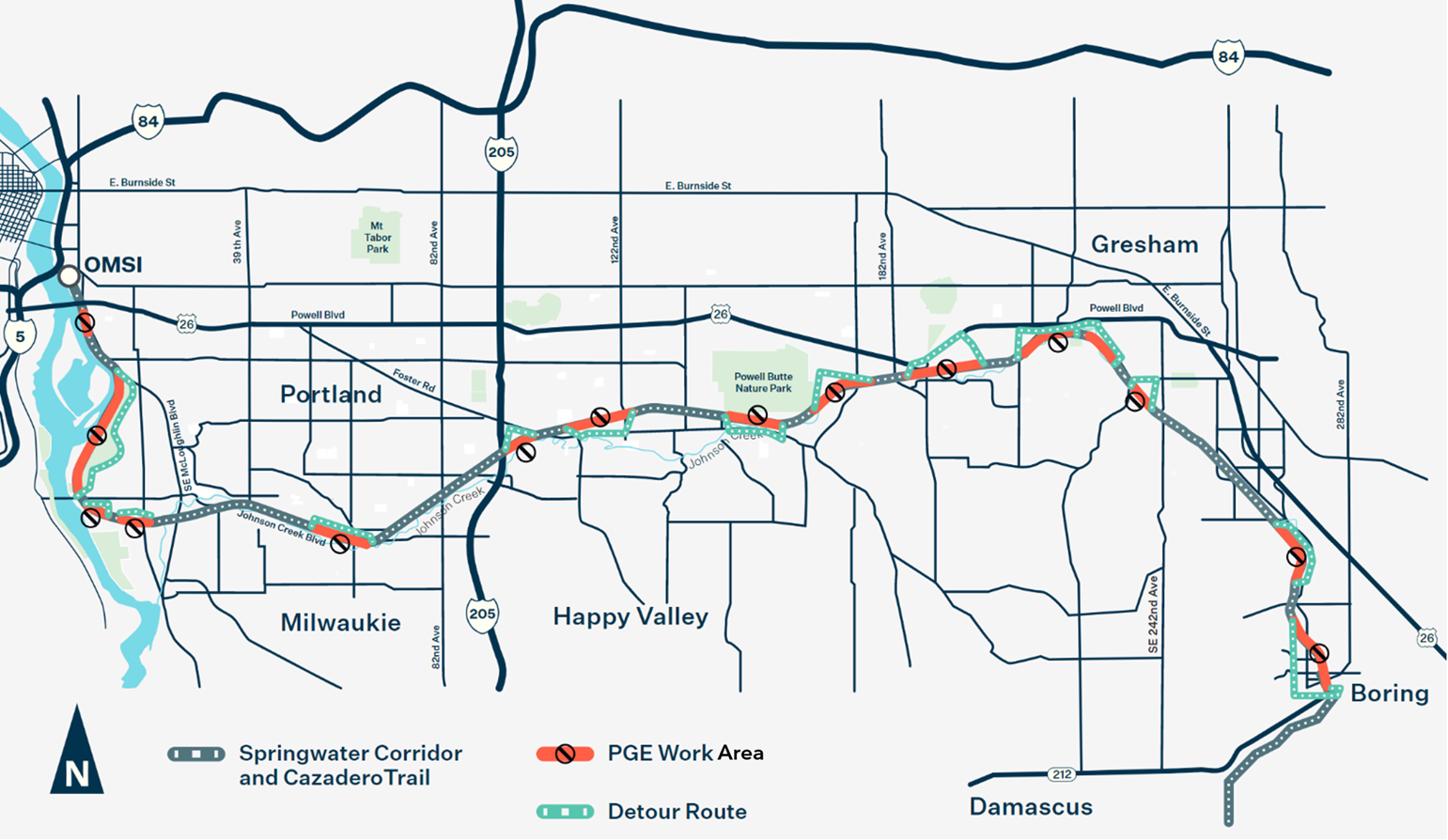
The story behind that surprise blockage of the Springwater Corridor path
An explainer about a surprise work zone on a busy section of the path.

6/25: Hello readers and friends. I recently had my second (of two) total knee replacement surgeries so I'll be out of commission for a bit while I recover. Please be patient while I get back to full health. I hope to be back to posting as soon as I can. I look forward to getting back out there. 🙏. - Jonathan Maus, BikePortland Publisher and Editor
Make sure to follow @BikePortland on Twitter for updates.
An explainer about a surprise work zone on a busy section of the path.

TriMet has begun their biennial (every other year) inspection of the Tilikum Crossing and the work comes with detours for bicycle riders. The path needs to be closed so a contractor hired by TriMet can inspect the bridge cables. The Oregon Department of Transportation will take the opportunity to do its own inspections at the … Read more
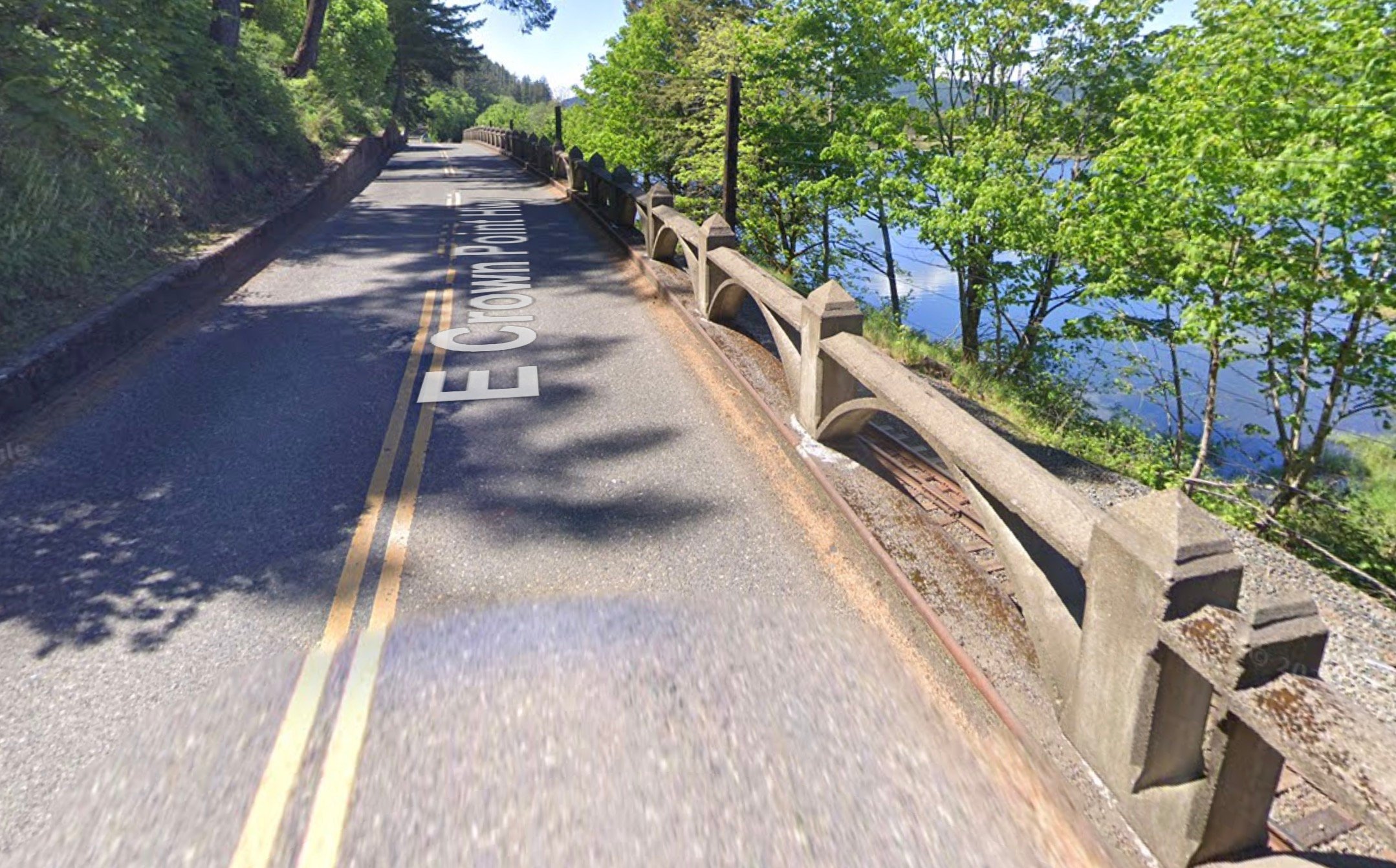
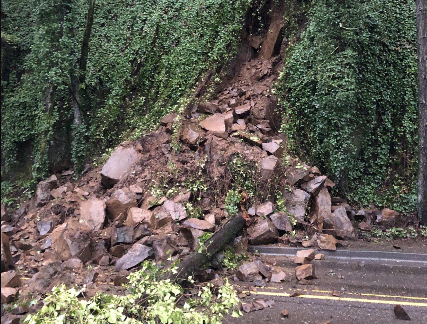
Work near Multnomah Falls essentially closes the Gorge… unless you want to bike on I-84.
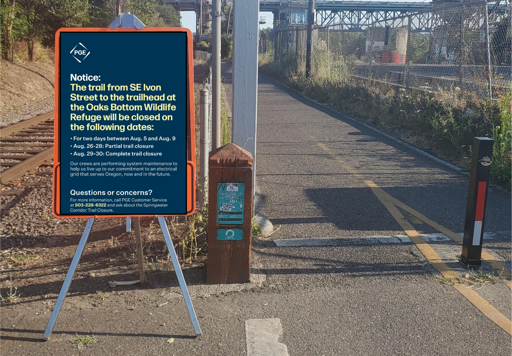
New dates and closure details confirmed.

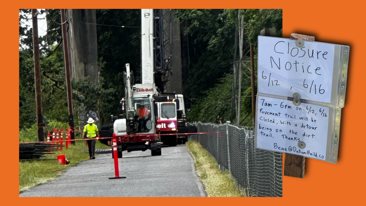
No official word or confirmation from PGE, but the sign looks legit.

It’ll be closed until a city contractor can fix the cameras.

The path adjacent to the bike lane is popular with walkers and joggers who don’t expect fast-moving riders.

Portland Parks & Recreation has closed one of the two sets of ramps on the Eastbank Esplanade until further notice. People using the path today were given no prior warning before coming to chain-link fence and sign announcing the closure. A QR code on the sign links to a page on Parks’ website that says, … Read more

Contractors working on a City of Portland Bureau of Environmental Services project in the central eastside want to spread the word about near collisions between bicycle riders and heavy equipment. BES recently broke ground on their SE Stark Trunk Sewer Project, which will install a stormwater diversion structure to redirect combined sewer from a pipeline … Read more