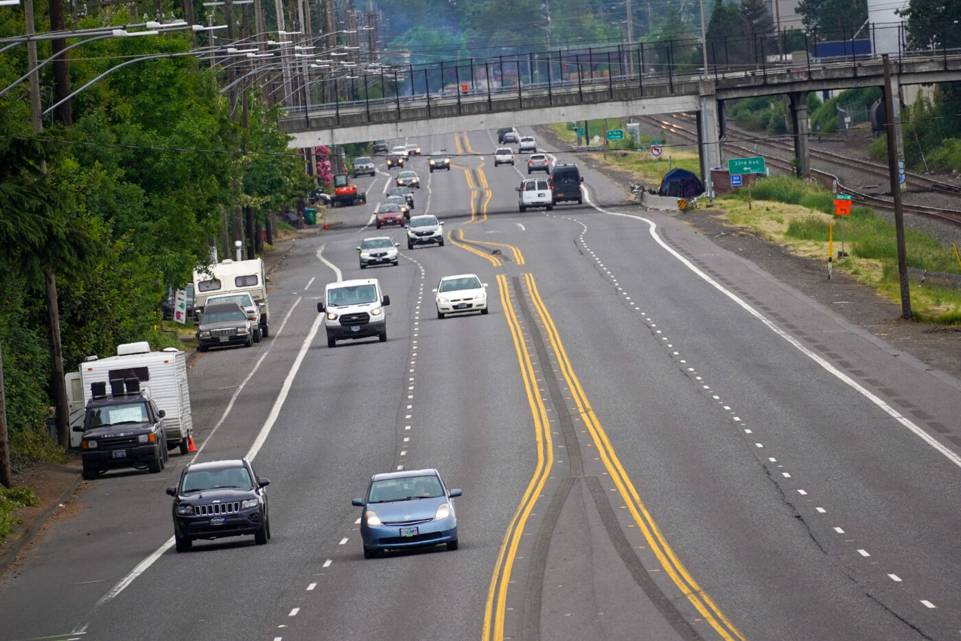
If Portland ever wants to move the needle toward bicycle use, we must build more high-quality bikeways on major streets. There’s been one segment of one of these streets that I’ve had my eyes on for many years and I finally spent a bit of time taking a closer look.
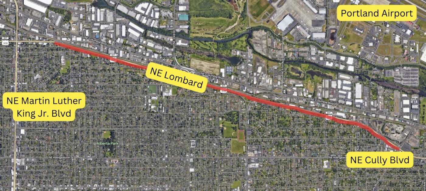
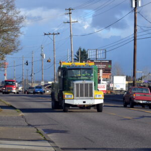
I’m talking about Northeast Lombard east of Martin Luther King Jr. Blvd. It’s a 62-foot (plus or minus) expanse of pavement at the very northern edge of Portland’s residential grid that separates thousands of homes from industrial jobs and natural areas along the Columbia River and slough. With its 45 mph speed limit (and a typical speed well over 50) and average daily traffic count of 29,000 cars — the section of Lombard between NE 11th and Cully Blvd/72nd Ave (and beyond) is a classic “stroad.” In many ways it looks and feels like a freeway, but with its cross traffic, driveways, bike lanes, and proximity to the neighborhood, it also functions like a street.
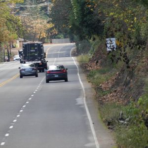
Despite all this space, the street currently has just very narrow (five feet or so), unpainted and unprotected bike lanes. The cross-section includes four general purpose lanes (two in each direction), bike lanes on both sides, and a lane used for parking cars on the south side. That’s about 52 feet for driving cars and just 10 feet for riding bikes — and most of the time that biking space is filled with gravel, partially blocked by parked cars and RVs, or littered with driving detritus.
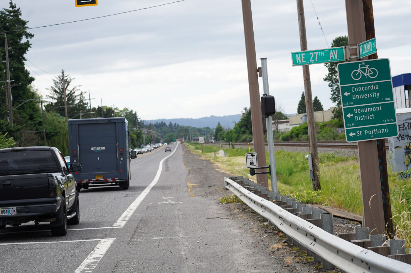
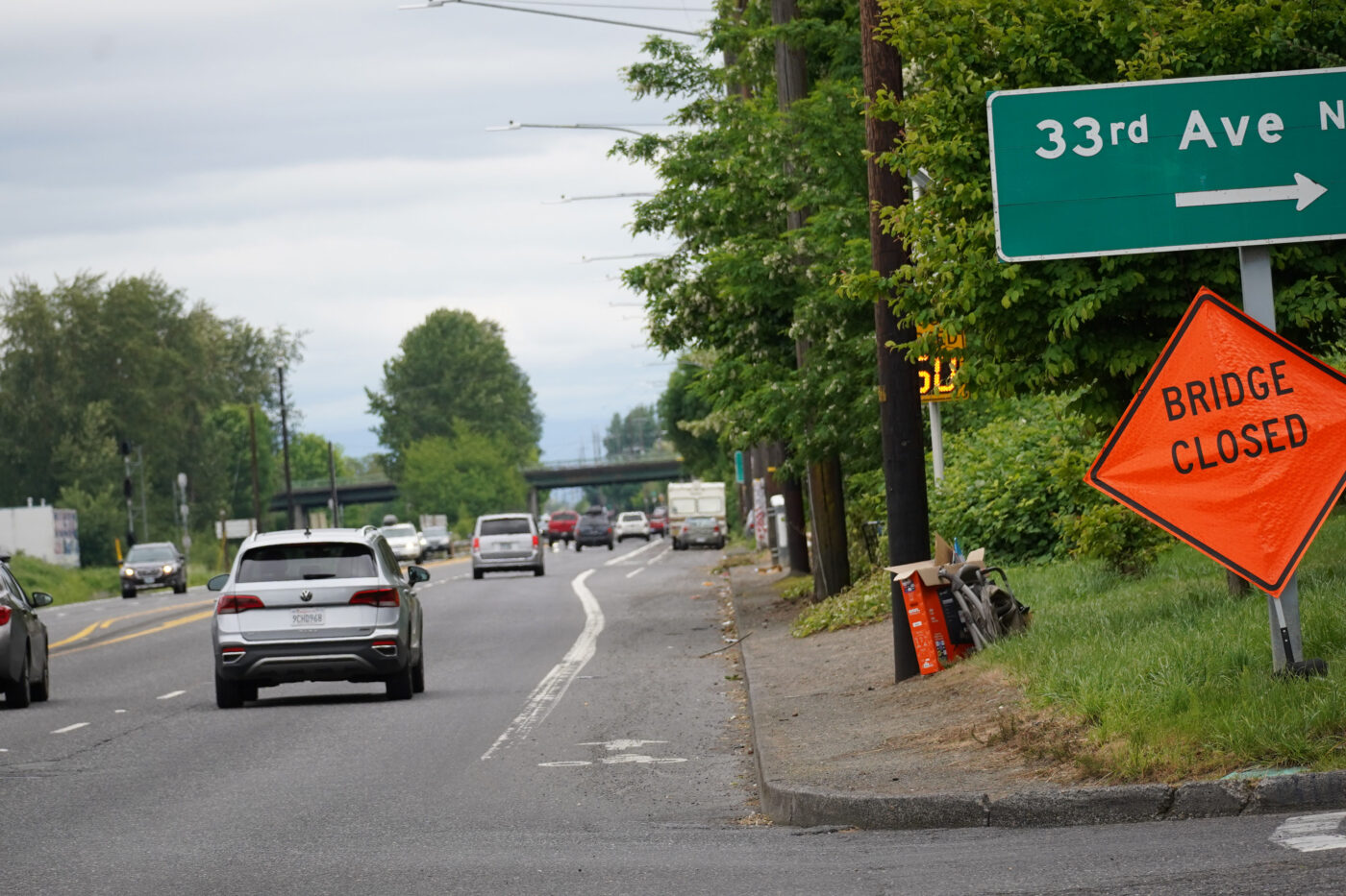
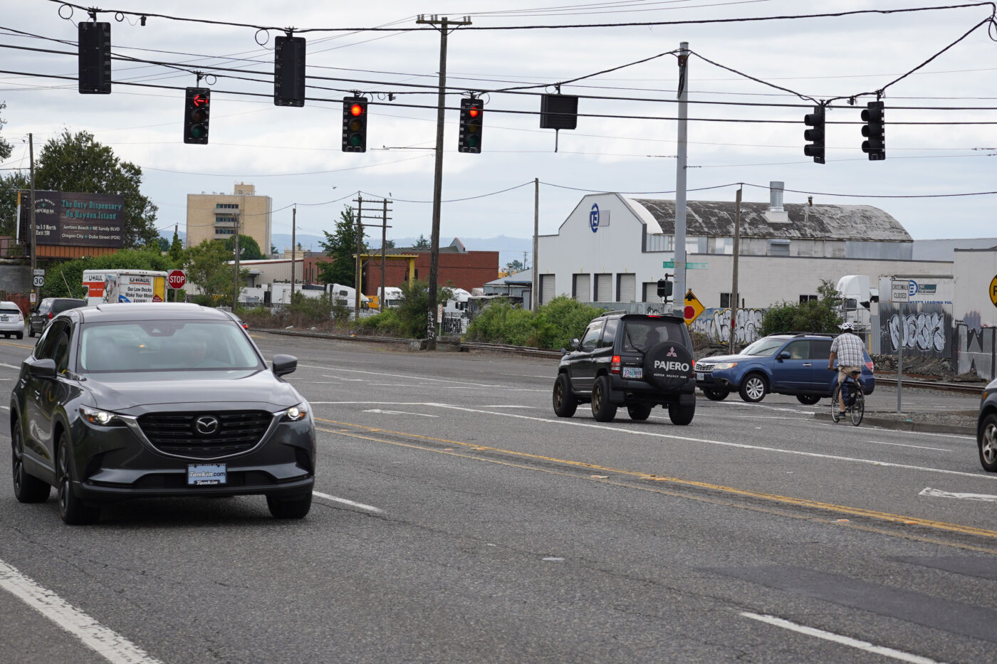
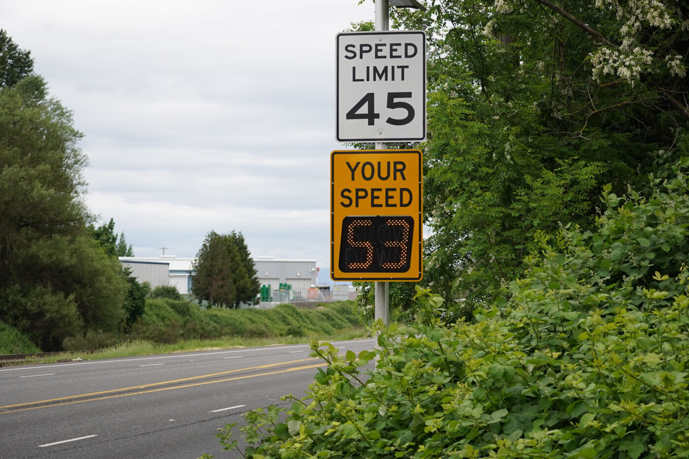
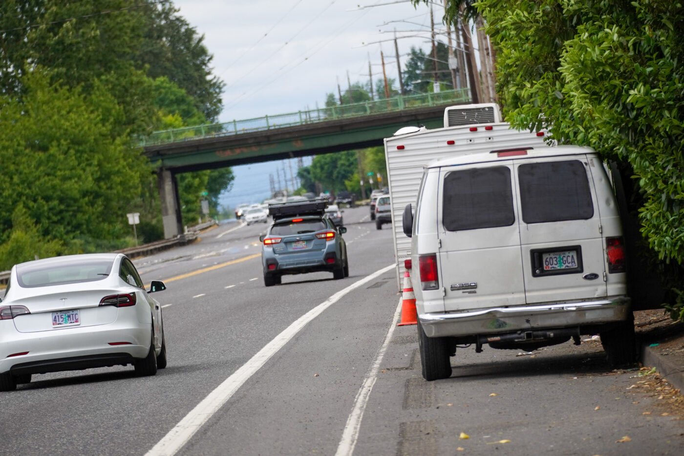

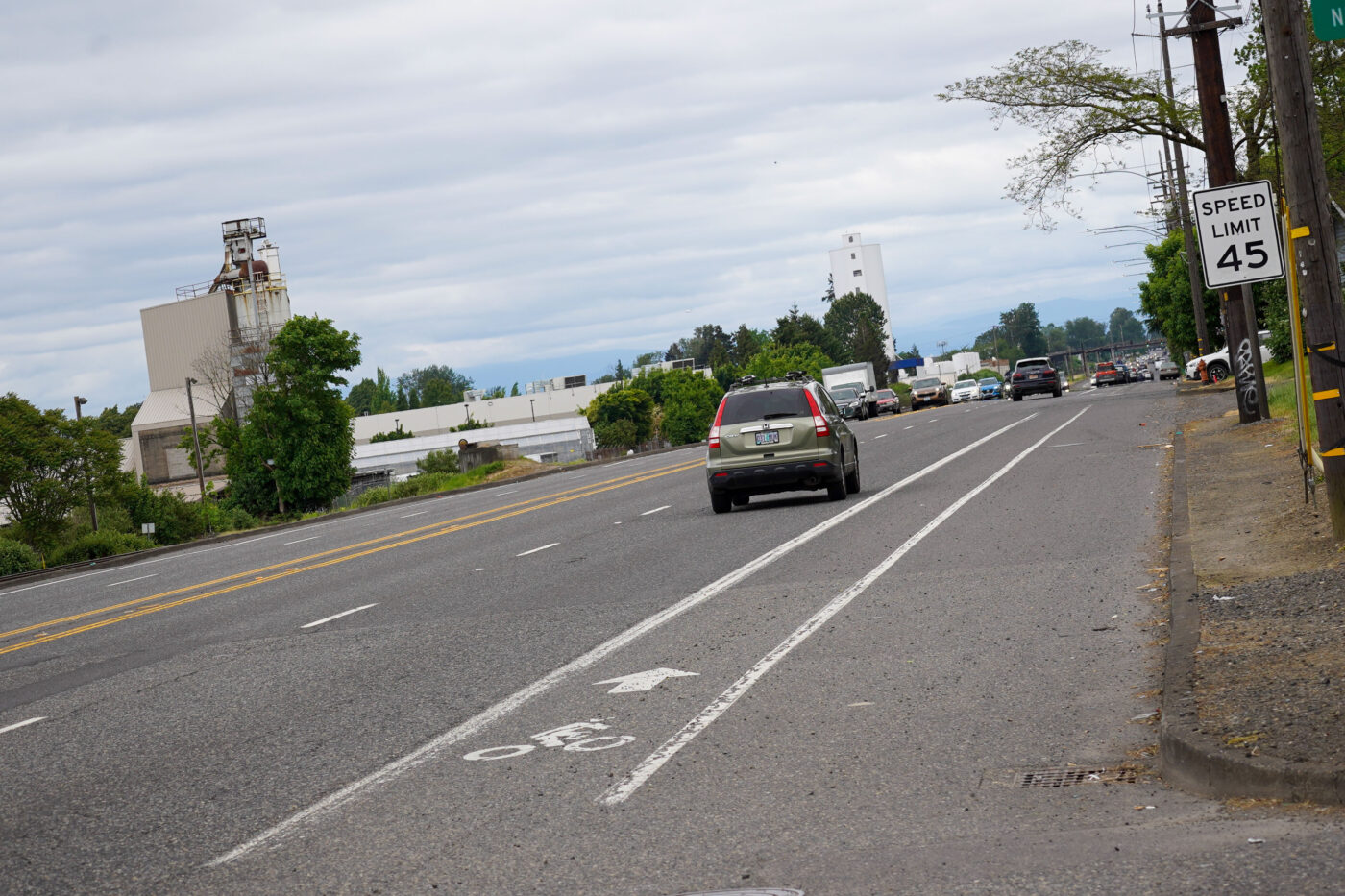
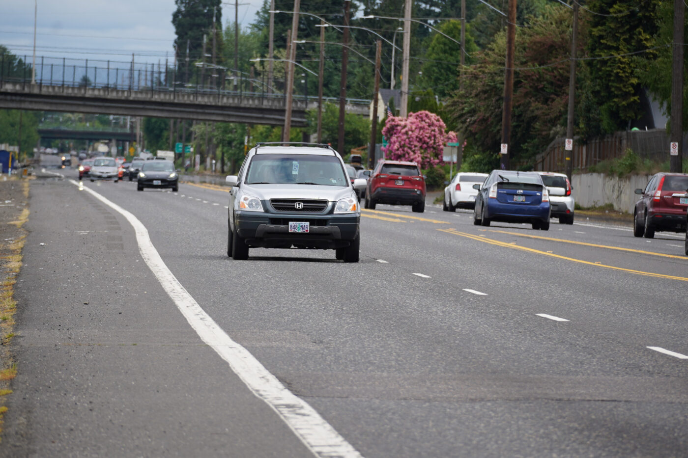
There’s no reason it has to be this way. We are just choosing to live with an outdated design that fails on almost every measure we say we care about: It’s a car sewer that’s unsafe for all users, it doesn’t have adequate biking or walking infrastructure, and there is no bus rapid transit or light rail. And it should be noted that there’s another stroad — NE Columbia Blvd — just a few hundred feet away. Drivers get redundancy, bike riders get scarcity. Is it any wonder more people don’t ride in this city?
Can you imagine an excellent bike lane on this street? You’d have a fast and direct connection between the Woodlawn and Cully neighborhoods. You could also connect to existing bike routes and bridges on NE 33rd and 42nd. Industrial workers at the Portland Airport and the hundreds of other business in the Columbia Corridor would have a more viable alternative to driving. Getting to Cully Park at 72nd would suddenly be feasible for many more people. It would help spur vibrancy at the new Las Adelitas residential development. If we were able to update the design all the way to 82nd, you could hop on an e-bike and go from north to east Portland in less than 15 minutes. It could be Portland’s first bike highway.
Heck, the north side of the street doesn’t even have any homes, cross-traffic or driveways! We could plop down a few hundred jersey barriers tomorrow and protect the bike lane!
Yes I realize there’s the neighborhood greenway on NE Holman and Simpson, but that’s not good enough. The Holman route gets broken up by Fernhill Park (at NE 37th) and you have to navigate your way to NE Simpson to stay on the greenway. It also has speed bumps and very poor pavement quality in many spots. The biggest reason I’m not a fan of Holman is because it’s hidden. As even the City of Portland’s own bicycle coordinator for the past 30 or so years has stated, these hidden bikeways are likely a major reason why more people are not riding bikes in Portland.
The simple fact is that we must make bikeways more visible if we want more people to pay attention to it. And there’s not better way to make biking visible than to put bike-specific infrastructure on streets where a lot of people drive.
And let’s not forget Martin Greenough. Martin was 38 years old, lived near Lombard and Cully Blvd and had just gotten a new job north of Columbia near MLK Jr. Blvd. He had only lived in Portland for two weeks and wanted to bike to work and realized Lombard was the quickest way to do it. He opened a city bike map and saw that Lombard had bike lanes, and he went for it. Then on the night of December 12th, he was riding on Lombard near 42nd and was struck by a drunk driver and killed. If we had physically separated bike lanes (instead of a gap like where he got killed!), Martin might still be alive today.
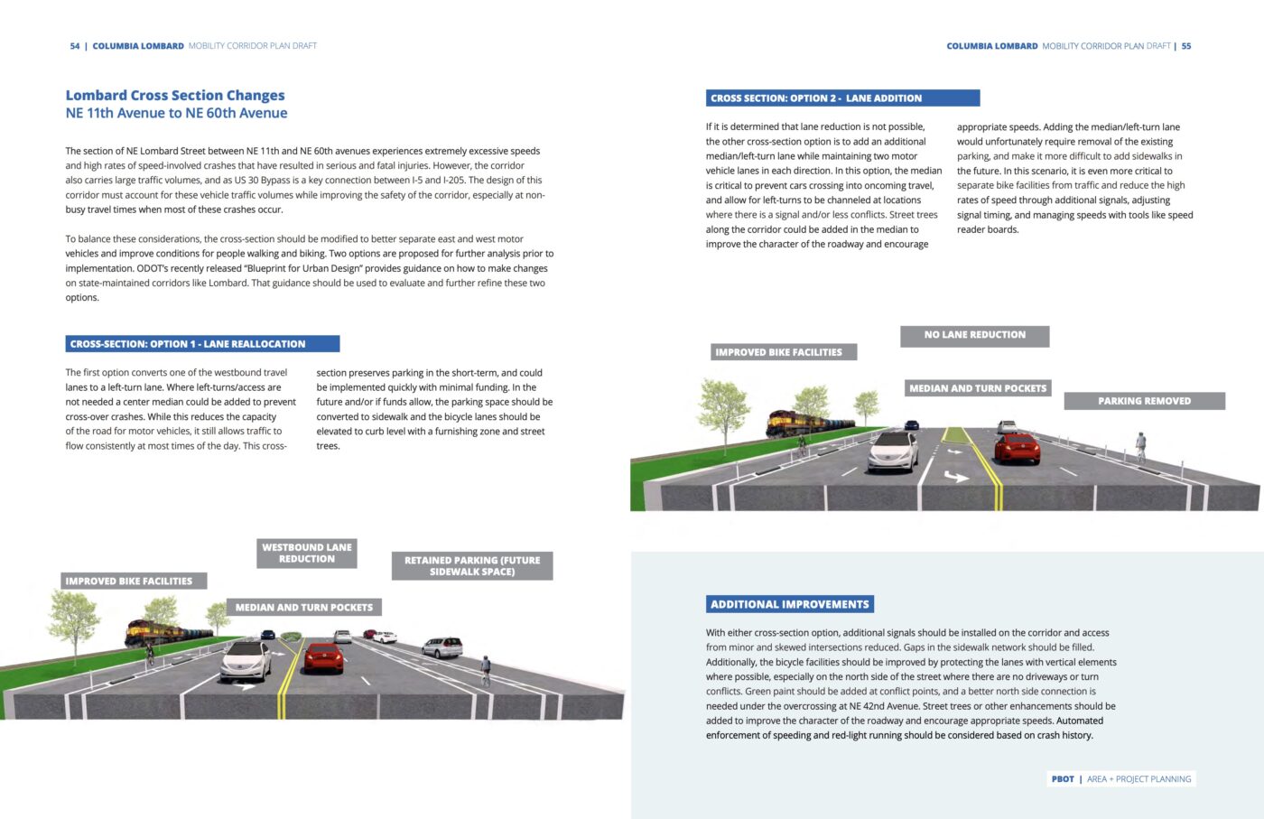
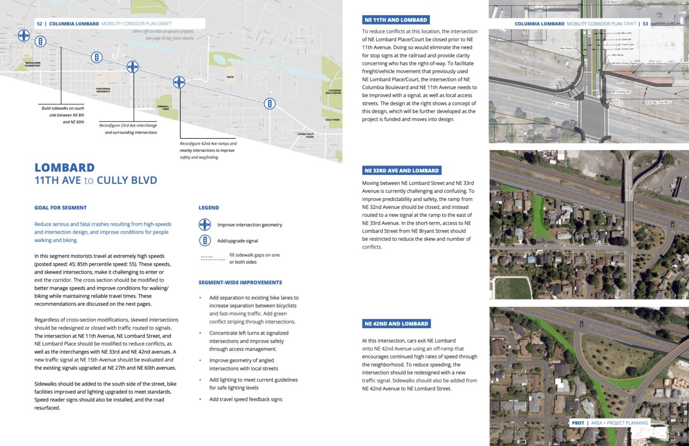
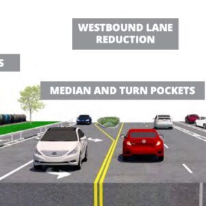
Lest you think I’m some radical for this idea, consider that the Portland Bureau of Transportation has already put some serious thought into it. Their Columbia Lombard Mobility Corridor Plan that was passed in 2021 had some specific ideas for how to improve this stretch of Lombard (see pages from the plan above). On this segment they recommended we, “add separation to existing bike lanes to increase separation between bicyclists and fast-moving traffic.” The plan also called for closing a ramp at NE 32nd and reconfiguring the dangerous intersections at 33rd and 42nd. While PBOT’s plan was disappointingly timid (they were too afraid to suggest anything that might decrease car capacity) at least they recommended removing the parking lane to make room for wider bike lanes and a future sidewalk and/or raised bike lane. In one of their recommended options that keeps the parking lane, they were suggested removal of one driving lane westbound to make more cycling space.
So we’ve got the space, the rationale, and the plan. Now let’s find some political will and make something happen. There’s so much we should do on this stretch of Lombard! What we shouldn’t do is settle for what we have.


Thanks for reading.
BikePortland has served this community with independent community journalism since 2005. We rely on subscriptions from readers like you to survive. Your financial support is vital in keeping this valuable resource alive and well.
Please subscribe today to strengthen and expand our work.
A whole article about Lombard with no mention that this is an ODOT owned and controlled state highway?! That is easily the most important reason why it is so auto-centric. PBOT can plan all they want, but they don’t make the decisions about this roadway.
Surely ODOT has begun also to be infiltrated.
Has it yet referred, e.g., to climate or Equity?
I do believe that Lombard is ODOT.
I agree, JM, but you have to remember ODOT’s unspoken motto:
“Let no automobile or truck driver ever be inconvenienced – not even for five extra seconds.”
That’s due to law passed by the Legislative Assembly and policy set by the OTC, who in turn are appointed by the Governor. Climate change should be among our highest priorities as voters, and these are low-hanging fruit we can demand from our elected officials every time they campaign, hold hearings, and vote on bills and motions.
Viewed in baggage-free manner: If a bike path is desired there, learn where state property ends and the railroad property begins, and if something lies between. (Is the overpass in one photograph a clue?) That’s if both sides are considered, which is likely wasteful in this case. Only one path may be needed, and justified, two-way, on the development side, leaving the railroad side alone. When not on the path, where would cyclists usually be, and where would the come from or go?
Some might still use the shoulders or outermost parts of the existing lanes as real cyclists always have properly done, but given in Portland, as elsewhere, growing numbers of lesser-quality motorists (too), the path would be desirable if done well*.
Speaking of well, or rather, proper: With the photographs we see here and Mr. Maus’s artful description for activist enhanced appeal to emotion, the typical toy stuff we see in the cross-section depictions is no substitute for what’s needed: Jersey barriers, even with healthy separation of the path from the roadway.
(Of the cross section descriptions, Option 2 obviously is the one to select, even without considering that what’s needed are Jersey barriers now, not toy posts. What traffic speeds, levels, and composition are found on this roadway, again?)
* It’s not just an evolution of “old, bold cyclists” even among the experienced, but rather, real cyclists always will reject and avoid poor-quality, inferior, as well as any unsafe cycling facilities, something so lost on today’s “advocates” and planners. Will any bike lanes or “physically separated bike paths” be kept clean, incidentally?
What the heck is a real cyclist? Do I need to sign up for a membership card or something? Asking for a friend…
There’s a test, you have to be checked for endurance, you need the proper uniform, and you need to swear on a bible that you think e-bikes are for lesser humans. Anyone with a family or bad knees need not apply.
Not by real grown-ups, and the kids these days that are political are usually directing their ageism toward single-family home owners out of envy and resentment like their predecessors. A few materialistic types have been that way for racer cosplay and “polo-club snobbery” since shortly after the Bike Boom started, with fashion later accompanied sadly by gadgetry, but many don’t care. Just ride your bike as you should. No fashion statement, no depraved activism required. It’s not wanted, in fact; a good deal of both things are why I hear and read of so much RESPECT LOST for cycling and cyclists by former veterans.
Note if you want a bike highway in the real meaning of that term, it means running on the outside or railroad side of the state highway, not the inside or development side where it would be much more accessible. However, where is so much access to be found? Yes, at intersections. Would you accept many intersections and thus interruptions and likely forced stops?
Also, not done in this country and likely to “trigger” the more childish too quickly, but what about a possible different approach sometimes incorporating an oft-raised cycle track with a sidewalk? Note and file
Burnside from west 18th to east 162nd would make for a much better (and more politically feasible) cross-town barrier-protected bikeway, IMO. Little or no ODOT to deal with, just a bit of TriMet (east of I-205) and Multnomah County (at the bridge).
I don’t know about that David. This isn’t a competition, but one reason this Lombard segment is appealing to me is because it’s located in a place without any businesses or complicated jurisdictional stuff. Yes ODOT would be a part of it but they aren’t always that bad on projects like this and I could see them working closely with PBOT. Burnside would be much different ballgame! And Burnside is much much narrower and IMO that’s what makes Lombard such an opportunity – it has tons of open space that isn’t needed and can be flexible to new uses.
How about a bike / walk bridge over the railroad tracks by Lombard at 27th Ave? There are some businesses on Lombard by 55th Ave. More trees on Lombard?
I think if the “average Joe and Josephina” of Portland felt the city was well run, clean, safe and cared for its infrastructure they would be much more willing to support cool projects such as this one. The city’s choice to focus on ideology (and the resulting precipitous decline in quality of life ) instead of providing essential municipal services has severely hamstrung its ability to rally the populace to implement meaningful projects such as this one.
Well stated!
If PBOT is banging on the doors of a freight railroad to build a bike path, I would hope they would focus on the Sullivan’s Gulch MUP. It’s the bike highway that would really turn the needle on bike mode share being so central in dense and growing areas (already upzoned due to presence of MAX stations) and easily connected to many north/south bike boulevards.
While I would love as many bike highways throughout the region, this one seems very low on the list given that it’s on the edge of lower density residential and has little to no street connectivity.
Right. Lombard might be somewhat important. But if we want to move the needle on mode share, we need to focus first on building a separated network where a high volume already exists and/or where evidence for demand exists. That means Vancouver/Williams, Broadway/Weidler, an East/West separated lane such as on Hawthorne, etc. PBOT still hasn’t separated traffic on W Broadway near the bridge. That’s how high a priority they see a separated network to be.
The Hawthorne safety project has decimated transit throughput during peak hours due to massive traffic jams. Do you not remember how “Healthier Hawthorne” supporters wrongly claimed that there would be large increases in speeding and vehicle throughput? This lane reduction has been a huge setback for transit and bike lane installation would have had the same result.
To be blunt, anyone who has a smidgen of interest in alternatives to the bloody and ecocidal automobile should be focused on improving transit on Hawthorne, not some hypothetical narrow and meandering bike lane (that would make SW 2nd look like world-class infrastructure).
I’m not exactly sure what you’re saying. The argument that putting a protected bike lane on hawthorne is antithetical to transit is making a large assumption. Both transit and bikes should and can be a priority on one street. Limiting SOV traffic (particularly commuters) on Hawthorne would be a very easy fix.
My point is that general lane removal has very negatively impacted transit and that the addition of bike lanes would also have required removal of two general lanes.
I think the addition of rose lanes is the only option that would not require removing SOV from Hawthorne (which is not tenable in the current political environment).
There are also two parking lanes and a center median. As much as I like curb extensions, they really do limit the possibility of removing parking for a bike or bus lane.
Curb extensions greatly improve safety for pedestrians. We all like improved safety, right?
That is what I am proposing. With limited very short “rose lanes” (e.g., bus/delivery vehicles/emergency vehicles only) at intersections to limit cut-through SOV use, Hawthorne could easily have very limited, local-only SOV traffic. This would allow for fast/predictable transit service as well as protected bike lanes. Very few people question whether we should limit cut through commuter traffic on a particular street, but it is indeed quite normal in many countries, even in the US in some cities.
There is plenty of room on Hawthorne for buses, bikes, and wider sidewalks to boot. But PBOT insisted on parking for private cars, a center turn lane for cars, and truly gargantuanly wide lanes instead.
This stretch of road would be great to have as both a safe bike route and express bus route. I used to commute between Kenton and Parkrose and the idea of a 1.5 hour bus ride where you have to go south, go east, then go north again made the 20-30 minute drive the default option every time. I rode my bike up to Marine Dr once but, while it was a nice ride, it took over an hour to get to work. I probably could have got it down to 45 minutes if Lombard was any good to ride on, especially that nightmare section near I-205.
I can’t remember the exact location but I’m pretty sure that camper trailer that’s always parked in front of one of the houses along Lombard has been destroyed twice that I’m aware of by someone driving into it. I’ve seen the aftermath of other crashes several times and all manner of bonkers driving along this part of Lombard. 53 mph will have you getting tailgated and passed the whole way. Strong protection of any bike lanes should be the minimum.
It could be cool to have a bike highway along Lombard, but I think my wishlist for Lombard would be the Interstate Ave treatment. A light rail line connecting from the airport/parkrose TC (and ultimately extending through St Johns), would also improve meaningful transit routes for people living or working in the area. Add in a road diet and (hopefully protected) bike lanes, and now we’re getting somewhere.
Keep in mind that Lombard in its current state is par for the course for much of America. For a few years I rode and commuted around Northern Virginia, and many of the established cycling routes are painted bike lanes along busy highways and stroads with 45-55mph posted speed limits. Having moved back here more recently, I’m thankful that places like Lombard feel more like the exception than the rule.
I know that this cover photo is real but it looks like an AI illustration for the prompt “mashup of the worst parts of 33rd, Marine Drive, and Highway 30.”
Bike paths along Lombard will suffer the same fate as the paths along I-205.
People living along urban highways throughout Portland will suffer the same fate as people living along urban highways throughout the US.
Aren’t the neighborhood streets located where people actually live and have low speed traffic already “enjoyable” enough?
They are not always known by people. Even Beaverton is almost done with the road diet on busy SW Western Avenue in an industrial / retail / office / housing district that meets a railroad crossing.
For motorists? Yes.
Cover photo aside: Why does Portland mount its street lights so darn high? LED streetlights don’t need to be mounted that high up, & in fact should not be. I know this is ODOT, but it is widespread across the city – – this pic just illustrates it very well.
Locating the lights high up makes them harder to vandalize or shoot at.
“Drivers get redundancy, bike riders get scarcity.” is the perfect description of our bike network
Absolutely! Another egregious example of this is SW Barbur. It’s as wide as 6 lanes in areas, with i-5 being the literal next road over. What do bikers get? Sad gutter bike lanes next to +50mph traffic.
I really like the headline picture, it does a great job conveying just how much wasted space there is. The giant centerline buffer, wide driving lanes, barely utilized parking. A little bit of paint could go a long ways.
I am a die hard rider. Have been for 30+ years.
But let’s be real. And I mean brutally honest. Even if Portland had a bottomless budget (which it does not) dedicated to giving every cyclist their dream commuter friendly city, I seriously doubt if we would see even a slight increase, never mind anything near enough to equate to a meaningful increase in bike/walking commuter ship to decrease traffic or congestion on the roads.
As it stands, we are at 2.8% (according to the https://bikeportland.org/2023/03/15/city-counts-reveal-data-behind-portlands-precipitous-drop-in-cycling-371407 bikeportland article from March 15, 2023. It says we were at 7.2% in 2014, roughly 3X what it is now. I don’t know about you, but 2014 seemed pretty similar to what it is now as far as day to day life was like. And I ask myself why was there 3X as many riders in 2014? Were the roads better then? Was it safer in 2014? More bike lanes in 2014? Was the weather better in 2014?
Where did those other commuters 4.4% of commuters go? That number of people counted on bikes is actually smaller now than in 2014, not relative to population because ‘Californians moved here with a car centric lifestyle they brought with them.‘ as I’ve seen posited on forums.
Bike advocates can kick and scream all they want. But I think you have your head in the sand if you think that more bike lanes, bike boulevards, whatever… are the answer to get more people out on their bikes. We are not Denmark, Netherlands, Belgium, etc….They have different cultures.
I used to work at a company that had sustainability written into it’s mission statement. We attracted all sorts of environmentally conscious people to work there. But when we launched our smart commuter program – paying people money to commute by any means but a single occupant car (bike, bus, carpool, walk, etc…), it rarely resulted in more than a handful of increases above and beyond the people who already did it.
Cars here in the US are not going away. Not in our lifetime anyways.
Portland is supposedly one of the most bike friendly cities in the US. And it is. TO THOSE OF US WHO LIKE BIKES. But to everyone else, they can’t and likely won’t be bothered to ride no matter how many bike lanes there are, how safe cycling becomes, how many employers have showers, etc. There will be a few new converts here and there, but again…not a meaningful increase. I just don’t see it. That’s my humble opinion.
But I’m not going to stop riding.
I try to avoid driving on this road because it feels so unsafe. I can’t imagine biking on it. Any bike path would need to be fully separated and protected.