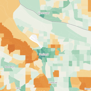
After months of planning, residents of southwest Portland, led by super-citizen trail advocate and Alice Award nominee Don Baack, have come up with a map of a new southwest bike network.
Baack, who leads the group Southwest Trails, has been working hard to garner neighborhood feedback and collaborate with PDOT to include these recommendations in the upcoming Bicycle Master Plan update.
Click the map for a larger view.


Thanks for reading.
BikePortland has served this community with independent community journalism since 2005. We rely on subscriptions from readers like you to survive. Your financial support is vital in keeping this valuable resource alive and well.
Please subscribe today to strengthen and expand our work.
Hopefully the city will give some thought to improving the Willamette trail as well – the trail surface in many spots has issues (especially due to tree roots) and that whole area is decidedly bike-unfriendly. There is also a lack of connection and direction (i.e. signs) linking the trail to destinations like Johns Landing.
I notice that the group has designated Vermont as a east-west link. I would like to see the City add bike lines to Vermont west of 45th to link it to the bike lanes under construction on Oleson.
I ride a portion of Vermont west of 45th everyday and it can be nerve racking having cars pass you with no room.
sweet, maybe SW isn’t actually the no-man’s-land i tend to think of it as.
Thanks for highlighting this important effort, Jonathan.
SW is definitely not a “no-man’s-land” for bikes. It’s been amazing for me as I work there that every time I go, literally, I see more bikes than I’d seen the previous visit.
I’d encourage anyone interested in cycling in Southwest to attend SW Trails meetings. They are always on the 4th Thursday of the month at St. Luke’s Church. Here’s the info for this month’s meeting:
SW Trails MEETING: Thursday, March 22, 6:30 PM St. Luke Lutheran Church, in the Conference Room on upper level 46th & SW California (1 block west and 1 block south of 45th & Vermont)
I’ve been working with SW Trails for about 9 months now as they prepare for participating in the Bike Master Plan update. The work Don Baack and the rest of the group is doing is really productive. I think SW Trails work will result in neighbors from every neighborhood in Southwest participating in the Bike Master Plan update to advocate for a bike network in their neighborhood.
An FYI – the map on this post is not complete. The person who is drawing the map is still working to get all the SW Trails ideas included on the map. SW Trails has, indeed, indentified ideas for the southern part of the district that have not been put on the map yet.
Hope to see some of you Thursday night at the next SW Trails meeting.
Thanks.
Greg Raisman
Community and School Traffic Safety Partership
Portland Office of Transportation
(503) 823-1052
I ride Vermont quite often and cannot recommend it to the average rider – not only because of the traffic level but also the hills [especially as you proceed east past 45th and beyond Bertha].
Widening or improving will not assist this in any way in my opinion because similar to Oleson all that will happen is increased Beaverton traffic cutting through the neighborhoods to get to downtown.
It would seem more reasonable to list SW Multnomah without Vermont. Multnomah connects to or accesses Barbur, Terwilliger, Oleson, Taylors Ferry and Vermont. It also has the benefit of already being ‘improved’ with bike lanes and a very flat route.
Anyone who sees this area as a no mans land doesn’t ride it every day. I ride many of these routes on my way to work in Macadam from Cedar Hills (Beaverton).
I think we need a main route continuation of the Sunset bike path AND these routes. These routes are some of the MOST BEAUTIFUL RIDES in the city. However, a practical route to downtown is needed greatly.
~n