🚨

6/20: Hello readers and friends. I am having my second (of two) total knee replacement surgeries today so I'll be out of commission for a bit while I recover. Please be patient while I get back to full health. I hope to be back to posting as soon as I can. I look forward to getting back out there. 🙏. - Jonathan Maus, BikePortland Publisher and Editor

Congressman Earl Blumenauer and Commissioner Mingus Mapps talk 122nd Ave plan

Commissioner Mingus Mapps and Congressman Earl Blumenauer at a press conference on 122nd Ave this morning. (Photo: Taylor Griggs/BikePortland)

“122nd Avenue runs through some of our most diverse and dynamic neighborhoods, but it’s one of the most dangerous roads in the metro area. With this grant, that’s about to change.”

-Commissioner Mingus Mapps

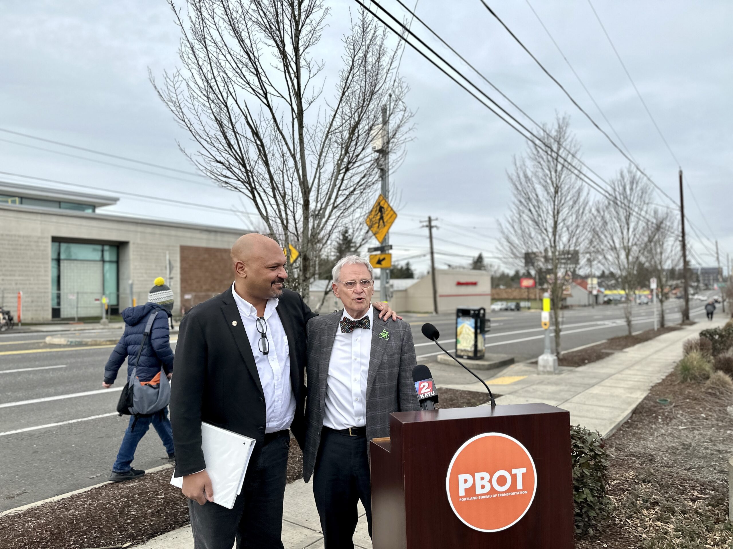
The sidewalk on 122nd Avenue is not necessarily the ideal place to hold a press conference, what with the high volume of loud car traffic zooming down the street a few feet away. But that’s exactly what made it important for U.S. Representative Earl Blumenauer, Commissioner Mingus Mapps and Portland Bureau of Transportation staff to meet there this morning.

Straining to hear each other talk over the noise on the street, it was clear to everyone in attendance how much this corridor needs a transformation — and they hope that change is coming thanks to $20 million in federal funding the city received at the beginning of February.

“This is a signal of everything we’ve done wrong. It’s a signal to people to speed,” Blumenauer, the longtime transportation and safe streets advocate who represents most of Portland east of the Willamette River in the U.S. House, said as he gestured to 122nd Ave behind him. “Until recently, we’ve been going the wrong way.”

Blumenauer commended the PBOT team for their work in the face of their budget woes.

“I’m really pleased about what PBOT is doing in terms of being on the cutting edge by doing a lot with few resources,” he said. “And [Commissioner Mapps], I appreciate what you and your team are doing and welcome you here.”

After Blumenauer spoke, Mapps took the podium to give his thoughts. This was one of the first opportunities to hear the commissioner speak about transportation issues publicly since he took over PBOT about six weeks ago. He seemed pleased to be in Blumenauer’s company in the same position the congressman occupied when he was a member of Portland City Council in the late 1980s and 90s.

“This [grant] is a game changer for Portland,” Mapps said. “122nd Avenue runs through some of our most diverse and dynamic neighborhoods, but it’s one of the most dangerous roads in the metro area. With this grant, that’s about to change. I want to thank Congressman Blumenauer for everything he’s done…for being an incredible champion for safe transportation.”

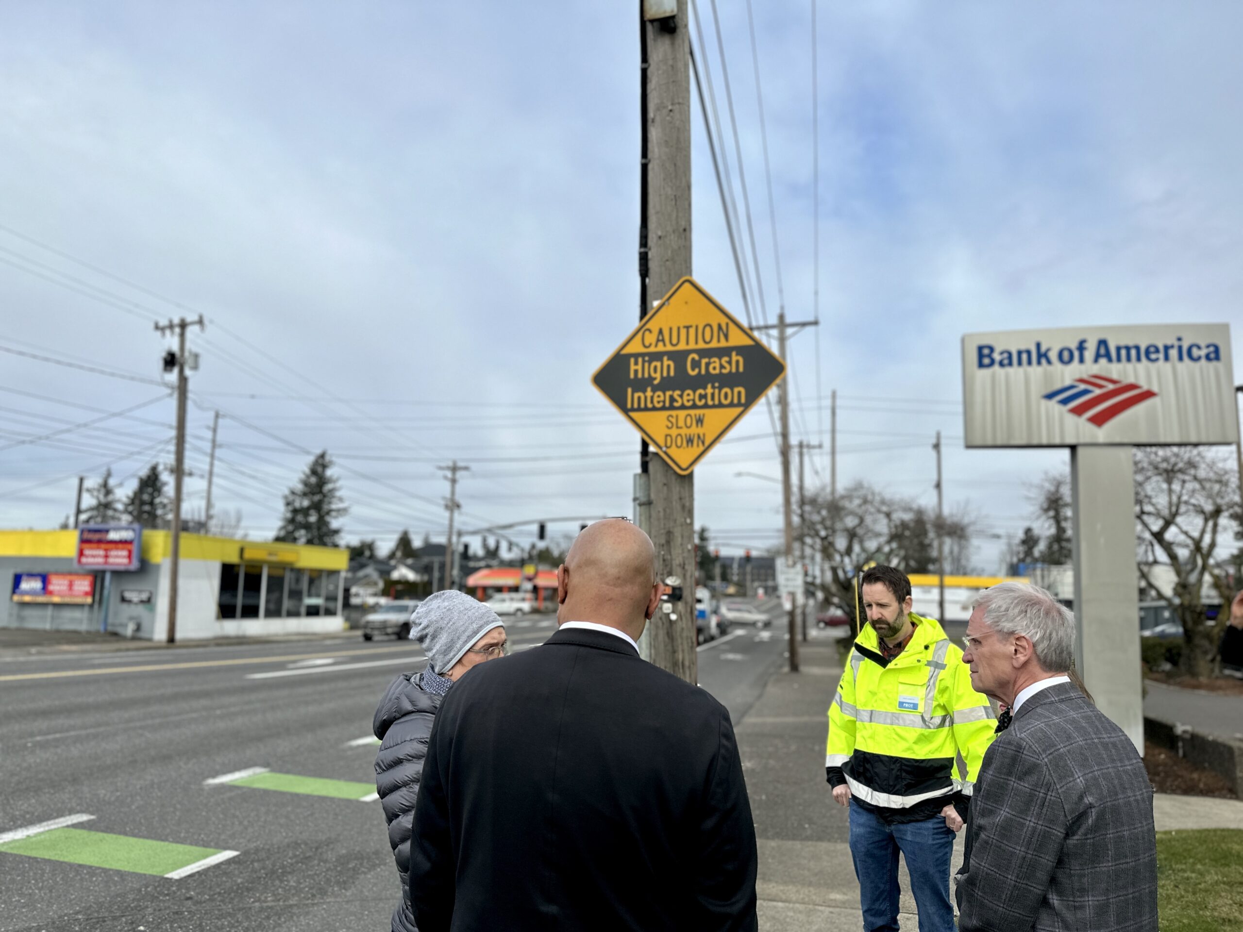
The grant will partially fund PBOT’s 122nd Ave plan to turn the street into a safe “civic corridor” with protected bike lanes, more tree canopy coverage, medians, lighting and more. PBOT Capital Delivery Division Manager Steve Szigethy elaborated to Blumenauer and Mapps about the project plans on a short walk on 122nd from Morrison to Stark streets. He highlighted PBOT’s desire to reduce car speeds with additional signalized crossings, speed reader boards and by redesigning the street to have fewer driving lanes and more room for people biking.

The high crash intersection sign at 122nd and Stark.

“Something I’ve learned as the commissioner in charge of PBOT is that one key things driving traffic fatalities here in Portland is the intersection of speed and people,” Mapps said.

Speaking of intersections, one of the most dangerous ones is at 122nd and Stark. This is one of Portland’s high-crash intersections and is among the most treacherous spots in Portland for people walking and biking. PBOT installed the city’s first intersection safety camera at 122nd and Stark last year, and planners think other upcoming changes to 122nd Ave will contribute to making the intersection safer.

A plan this robust will take quite some time to get underway — PBOT staff hope that after about a two-year design and engineering process, construction can begin in 2026. In the meantime, PBOT plans to construct several new signalized crossings on 122nd using money from Fixing our Streets and Metro.

“We’re going to be able to make this road safer for people who are walking, biking and taking public transit,” Mapps said. “We’re going to make this a model project for the City of Portland.”

Washington County budget woes threaten transportation funding

Washington County transportation funding. (Source: Washington County Land Use & Transportation)

The Washington County Coordinating Committee (WCCC) heard this week that looming budget shortfalls might impact a decades-old county transportation funding mechanism.

At Tuesday’s WCCC session, Stephen Roberts, Washington County Director of Land Use & Transportation, reported that county “transportation and other community needs continue to exceed available funding.”

The WCCC advises the county Board of Commissioners on regional transportation and land use planning, and is composed of elected representatives from cities in the county and the county itself. One of its roles is to recommend MSTIP (Major Streets Transportation Improvement Program) projects to the Board of Commissioners.

MSTIP is a funding mechanism unique to Washington County and has a five-year funding cycle. Area transportation departments have submitted 25 projects for consideration for the current 2023-28 round. Understanding MSTIP’s history helps to explain the present funding conundrum. It began as a voter-approved capital levy, but in response to the 1997 tax revolt Measure 50 Washington County rolled the levy into their permanent property tax, with the consequence that money targeted for transportation is placed in the general fund.

There has been a good faith agreement between the cities and county that this money would be transferred yearly from the general fund to MSTIP. With this year’s budget gap, however, the Commissioners have been advised to develop “strategies for mitigating a potential FY 2023-24 General Fund transfer reduction and project cost escalation.” In other words, Washington County needs some of that money, which in past years would have gone to MSTIP, to close other budget gaps.

MSTIP has funded 150 miles of bike lanes and sidewalks, and more than 150 projects totaling $900 million since 1986. This year, Tigard, Beaverton, Hillsboro have projects under consideration for for 2023-2028 MSTIP funding. For example, Tigard’s Greenburg Rd complete street rebuild, which BikePortland reported about last fall.

But projects approved in the two previous MSTIP funding cycles, 2012 (3d) and 2016 (3e), are also putting pressure on transportation funding. Because of cost-escalation, it is anticipated that the county will be obliged to cover an additional $70M to complete the remaining projects.

One of those projects, the SW Multnomah Blvd / Garden Home Road Intersection Safety Project has $1 million in MSTIP funding and $1.2 million from Portland System Development charges allocated to it. But the project, which is managed by the Portland Bureau of Transportation, has languished in the design phase for years, and was “put on hold until more funding can be secured.” Now that MSTIP funding is also up in the air, the project shortfall on the Portland end might offer a convenient way of postponing the project indefinitely.

Washington County Board of Commissioners.

This year, MSTIP was forecast to provide $140 million, to be divided evenly among the four Washington County districts, making $35 million per district. There is still much uncertainty and, depending on how much money Washington County Board of Commissioners decides not to transfer out of its general fund to MSTIP, capital transportation funding could be facing very lean times.

Roberts recommended that “it is timely now to invest a relatively small amount of funding to begin project development for several new projects while continuing to deliver previously committed 3d, 3e and Bonding Cost-sharing projects.” And he emphasized that the funding issues were of both short- and long-term concern.

In March, the county will have work session briefings on MSTIP and the Capital Improvement Plan. Roberts said that policy decisions will need to be made and that “equity focus and community engagement are key for prioritizing the allocation of limited funding.”

New east Portland bike connection in the works with wetlands restoration project

An overview of the project. The purple dotted line shows where the new trail would be. (Source: BES)

“Without this trail connection, the network is broken, access is diminished and active transportation becomes less attractive than with the connection.”

-Roger Geller, PBOT

The Portland Bureau of Environmental Services’ (BES) Springwater Wetlands and Floodplain Restoration Project is meant to reduce the risk of flooding in the Foster-Powell and Lents neighborhoods near the wetlands along the Springwater Corridor Trail and restore habitats for wildlife like birds, pollinators and amphibians.

But Oregon’s protected red-legged frogs aren’t going to be the only ones with spruced up stomping grounds. Planners also want the project to include a new bike and walking trail connection from the Springwater Corridor Trail to east Portland neighborhoods and a future major bikeway corridor.

Portland Bicycle Coordinator Roger Geller and members of the Portland Bicycle Advisory Committee (BAC) weighed in on the project at a Tuesday BAC meeting after a presentation from BES senior engineer Tressie Word. The project team is currently in the midst of the land review process for the floodplain restoration and need to show that the trail is a clear public benefit in order for approval.

“We’re trying to increase habitat health, hold more stormwater on city property and improve community access to nature and [neighborhood] centers,” Word said. “The planned trail connection that we’re talking about is something that’s been in the works for a long time.”

The new trail would add a connection between the Springwater Corridor Trail and SE 115th and 117th Avenues. 115th Ave is in the Portland Bureau of Transportation’s Bicycle Plan for 2030 as a future bikeway corridor. Geller said PBOT is seeking funding for the 115th Ave bikeway project and having this short trail connection over the floodplain will help move it along.

The future 115th Avenue bikeway corridor. (Source: PBOT)

“This is an important corridor we’re seeking funding for, and this little trail connection is a relatively complicated element because it’s in a wetland,” Geller said. “We’re very happy that BES is being such a good partner and incorporating it into their project.”

It may be a short trail connection, but without it, it would be more difficult to access the future 115th bikeway from the Springwater Corridor Trail (and vice versa).

“Without this trail connection, the network is broken, access is diminished and active transportation becomes less attractive than with the connection,” Geller wrote to BES in a letter of support for the project.

The project team is facing opposition from neighbors who are concerned about a new trail connection in their neighborhood for fear of a potential increase in crime, vandalism and drug use. Geller said he believes the benefits of this project would vastly outweigh any potential detrimental impacts.

“These are concerns that have been expressed with pretty much every single trail project that has been developed across North America for decades,” Geller said. “And that’s always the concern before the project is implemented, and then once the project is implemented, it turns out that people really do appreciate the trail. They do appreciate the access to nature. The types of concerns that they express really don’t come to fruition.”

The BAC voted to approve a letter supporting the project, which includes the following points for why the trail provides significant public benefits:

  • Contributes an important transportation connection between the Springwater Trail running east-west (that connects communities from Sellwood to Boring) and the north-south bikeway to be developed on 115th Avenue.
  • Serves an important part of the city’s planned bicycle transportation network – filling a gap to strengthen overall circulation within the network.
  • Provides access from many neighborhoods to the north to the Springwater Trail, which serves as both a transportation corridor linking to commercial centers like Division-Midway and Gateway (as a Major City Bikeway providing a safe alternative to Foster Road) and as a recreational destination (connecting to other major recreational destinations like Powell Butte Nature Park).
  • Provides a safe, active transportation connection that encourages bicycling or walking rather than driving – improving opportunities for Portlanders to lead healthy lives.
  • Supports lowering carbon emissions, reducing household costs and providing access to open spaces, especially for Portlanders of color, with low incomes and limited English proficiency that are more likely to experience environmental impacts and housing and transportation cost burden.

If all goes according to plan, construction on the wetlands restoration project and the trail will begin in spring 2024. It’s not yet clear when the 115th Ave bikeway will be constructed.

Two ways to weigh in on Portland parking

The neighborhoods looking for parking plan help. (Sources: PBOT and CEIC)

Attention, car parking policy aficionados. There are two opportunities for you to speak out about parking plans in Portland’s Boise and Central Eastside neighborhoods right now.

First, if you’re looking for something that involves some time commitment (and you live, work or frequently visit the Boise neighborhood): the Portland Bureau of Transportation is working on a “comprehensive parking management plan” for the Boise neighborhood and is seeking 11-15 volunteers for an advisory committee to oversee the plan. PBOT states this plan could “include a new kind of parking permit program, with new tools and techniques to try out and potentially parking meters.”

“Members will help advise on every aspect of the plan, including the process for outreach, planning, and decision-making; the boundaries of the study area; the boundaries, hours, and rules of a possible permit program; as well as ways to make any changes to parking more equitable and sustainable,” PBOT states in the application. “Members do not need parking expertise but should be familiar with their local area parking patterns and issues.”

PBOT is looking for a diversity of perspectives and interests on the committee, including from people who live and work in the Boise area and Black residents who were displaced from north and northeast Portland who frequently visit the Boise and Albina neighborhoods. Members will be expected to attend 10-15 two-hour meetings between April 2023 and June 2024. The meetings will be held virtually or in a hybrid in-person/virtual format. Applications are due February 28th, and you can apply here.

For something involving much less time commitment: the Central Eastside Industrial Council (CEIC) is asking people to fill out an online survey about their thoughts on transportation and parking options in and around the Central Eastside. This is part of the CEIC’s ongoing Parking Master Plan efforts.

“Do you regularly walk, bike, drive, ride, or roll into the Central Eastside? Do you have thoughts about how the CEIC, the City of Portland, and other organizations can shape the future of our District?” the survey asks. “As part of our ongoing effort to leverage the transportation and parking systems within the Central Eastside that supports employment, tourism, and business growth, we seek your input on how employees, residents, and visitors access the district.”

The CEIC survey includes several questions about where respondents live and work and their experience with parking and transportation in the Central Eastside. If you take the survey, you’ll have a chance to win a gift bag with products from Central Eastside businesses. You can find the survey here.

Sunday Parkways 2023 dates and routes released

A Sunday Parkways event in 2019. (Photo: Jonathan Maus/BikePortland)

Sunday Parkways fans, get excited: the Portland Bureau of Transportation just released some details about this summer’s open streets events. Where will the city close streets to car traffic so people have more space to walk, bike, roll and play? Drumroll, please…

The first two Sunday Parkways this year will repeat routes from last summer, taking place on May 7th in east Portland (Gateway, Hazelwood and Mill Park neighborhoods) and June 25 in northeast (Cully and Concordia neighborhoods). Then, on September 10, Sunday Parkways will head to southwest Portland for the first time in eight years, temporarily transforming streets in the Multnomah neighborhood between Spring Garden and Gabriel parks.

We reported at the end of last summer that PBOT planned to permanently cut back their Sunday Parkways programming from five events a year, as was the tradition pre-pandemic, to just three. Additionally, PBOT announced the open streets events would be held in the same locations three years in a row to help the neighborhoods gain familiarity with them. (In the past, they’ve rotated around the city each year.)

The decision to cut back on Sunday Parkways days has been criticized by advocates and fans of the city’s marquee open streets days. Sunday Parkways are an annual tradition all about embracing active transportation in Portland, and they’re one of the only times the city supports shutting down streets to cars on a large scale, so it was disappointing to some supporters to see PBOT eliminate two of them. PBOT attributes the change to their oft-discussed budget woes and says they’re focusing on highlighting parts of the city that haven’t historically been sites for these types of open streets events and generally lack active transportation infrastructure, like east Portland.

One person excited about this year’s event schedule is David Stein, a member of the Bicycle Advisory Committee and southwest Portland resident. In an email to BikePortland, Stein said he was pleased to see the event scheduled for SW.

“Sunday Parkways is the biggest encouragement program that the city has for walking, biking, and other low carbon modes of transportation. The void of this program in SW was a signal of just how treacherous this part of the city is for people who aren’t using a car or truck to get around,” Stein said. “Bringing it back will highlight some of the investments made is this part of the city and show people that it is possible to get around Multnomah Village [using active transportation].”

In a press release about this summer’s events, PBOT stated the SW Sunday Parkways is intended to feature new sidewalks and bike lane infrastructure along SW Capitol Highway.

PBOT also stated in the press release that they will work to increase public safety at Sunday Parkways this year. This could be in reference to the incident that occurred at the east Portland Sunday Parkways event last August, when an angry driver brandished a gun at volunteers and attendees, yelling that people on bikes were “taking over everything” so he couldn’t get home.

“It’s important that everyone feel safe as they explore new ways of getting around, especially on streets that prioritize people walking and biking. Based on learnings from last year we will incorporate more public safety tools including updated volunteer/staff training, road closure notifications and suggested alternatives for motorists living along the route.”

There’s time to get involved in this summer’s Sunday Parkways if you want to support these open streets days. You can take the pre-season survey to provide your thoughts about the events (and potentially win some free merch) or sign up to volunteer.

Beaumont-Wilshire residents profess love for car parking near Wilshire Park

Screenshot from virtual BWNA meeting Monday night.
(Source: PBOT)

Since it was just Valentine’s Day, we need to have at least one love story on the front page. So here goes…

At a meeting of the Beaumont-Wilshire Neighborhood Association (yes, that one) Monday night, the Portland Bureau of Transportation presented their latest plans for a new bike path along the south side of NE Skidmore Street adjacent to Wilshire Park. The project is part of their effort to establish a safe and convenient east-west neighborhood greenway on Mason-Skidmore and connect to a new crossing of NE 33rd Avenue.

The idea is to make a two-way bike lane next to the park that is protected from the rest of traffic by parked cars. The bike lanes would be five-feet wide and there would be an additional two-foot buffer to the parking spaces. To make room for this, PBOT would narrow the driving space to a 14-foot lane for both directions of car travel.

Monday night’s meeting was the first public showing of PBOT’s plans. I mention that because PBOT already reached out to neighborhood association leaders to ask what they felt about a traffic diverter at NE 36th or 37th to help make the street safer and reduce driving volumes. They rejected the idea and PBOT shelved that element of the plan before it was ever made public (really bugs me when the do that, but I understand they want to get a project done and not have it devolve into another controversy).

So last night, PBOT Project Manager Scott Cohen gave folks the rundown of the current design proposal. After reminding them that PBOT already pulled the diverter off the table,  Cohen also sought to reassure them about parking: “What we’ve done is tried to preserve all of the parking possible.”

To build the bike lane and improve visibility at crossings into the park, PBOT says they’ll eliminate about 20-25 parking spaces. That would still leave 40 spaces on this one side of Skidmore. The north side of the street would not have any parking removal at all (not to mention that people can park on every other street in the neighborhood).

Despite what to me seems like a reasonable compromise from PBOT (trust me, I’d personally prefer no parking on the south side and a very wide, protected space for bikers and walkers), I was surprised to hear people still complaining about a loss of parking and casting other aspersions on the city’s attempt to make the street safer.

Here’s a sampling of what Cohen heard from members of the neighborhood association:

First, the naysayers…

“So this is supposed to be a neighborhood park yet you’re talking about reducing parking spaces? That doesn’t sound very neighborhood friendly. And my other question is, when the kids are getting out of the car, they’re going to be opening the car door into the bike path. Now you really expect the kids to look behind them when there’s no rear-view mirror on that side of most cars. This seems dangerous to me.”

“We’ve narrowed it so basically one car can fit through… I don’t know why don’t we take advantage of the path that’s in the park? And do a bike-slash-walking path where there’s already a walking path just to make that [driving lane have] a little bit more space for everybody to be able to squeeze by each other because it feels really tight given the car volume.”

“I’m also concerned about the narrowing of lanes room for cars. Scott was saying they’ll have to negotiate to get by each other. And you know that that will slow them down, but it also increases the danger to people parking and opening doors… You know you open a door one way and you might hit a car, then open the door the other way, you might hit a bicycle.”

“If you looked at the comments on BikePortland, Jonathan’s website, there were a lot of people there that had problems with design.”

[In response to someone asking about better ADA access across Skidmore]: “Can we close off the crossings on [35th and 36th]? Right now there I know it’s a legal crossing, but there is no landing on the other side. And so I’m wondering if you could put up those little bars to keep people from crossing and direct them down to the one crossing and maybe put the money into more parking [and] we can have an improved pedestrian crossing, ADA access and have a better entry to the park.”

Thankfully, Cohen firmly rejected this suggestion of closing crosswalks into the park. He said from PBOT’s view parking is the “lowest [priority] use [of space] in this area.”

“On Saturdays and Sundays, they [Little League] have hundreds of people that come from all over for games and so, I know that [parking] may not be a priority for the program, but I think it is something from a neighborhood perspective that is important that we accommodate parking for park users.”

Don’t despair, there was actually solid support for the project from the neighborhood. Here’s what some folks said:

“I’m a little concerned about the priority for parking. And trust me I like parking when I have my car, but I don’t not care about Little League folks coming and needing parking during the summer, but the worst case scenario is they can park on side streets. So I just don’t know that we have to be concerned that everybody gets a parking spot right across the street from the park. And because those people aren’t necessarily in our neighborhood, it seems like as a neighborhood association, our priority is with those of us who live right around the park.”

“This could be a project that increase walkability and increase more sense of community. And from all the study and research that I’ve seen, we don’t do that by prioritizing people driving. And I feel like we’re missing an opportunity to create more space for people to move by creating a wider multi-use path. So instead of, you know, pedestrians having to navigate the same space, as people cycling on Skidmore, why not make a wider? I’d also like to see the diverter option back on the table. But otherwise, this is a nice compromise and I look forward to the improvement.”

“I believe street narrowing is going to help. I’m not really worried about someone having to park a block away to go to the park.”

[From a very young boy, maybe 7 years old!] “I would like to have this because I usually bike to school. When I bike to school I usually bike on like, where the bike lane is. So I am in favor because I like having a clear bike lane. I don’t want to be rushed when I’m biking.”

“I’m in favor of the proposal… When are we going to stop making cars a priority and make bikes the priority?”

Overall I didn’t hear anything at the meeting that would stop or delay the project. Kudos to PBOT’s Cohen for his deft handling of everyone’s comments. PBOT’s goal is to finish up the design and build the new bikeway this summer. Learn more at the project page.

City’s bike committee explores south Portland’s riverfront bikeways

The route for this BAC ride. (Source: PBOT)

The Bicycle Advisory Committee’s monthly rides are great opportunities to learn about current and planned bike infrastructure. The rides are led by Portland’s Bicycle Coordinator, Roger Geller, who gives an inside look at Portland’s bikeways that few others can offer. They’re open to everyone, and are a great way to discover uncharted routes. On the last ride I accompanied in December, we traversed the new protected bike lanes on SE Division Street and checked out the advisory bike lane in outer NE.

This month, it was time to go south.

Saturday’s ride consisted of about a dozen participants in addition to Geller. There were some members of the BAC in attendance, including Chair Ally Holmqvist and Vice Chair Joseph Perez, as well as several local advocates unaffiliated with the committee. We started the ride at the Salmon Street Fountain downtown and headed south on Better Naito into the South Waterfront area. There’s a lot of new development happening in this part of Portland, which is the most transit-dense area of the city (when you include the aerial tram) and has some of the most sophisticated bike facilities in town. 

But the network here is disjointed. The green, sidewalk-level bike lanes near the Tilikum Crossing and Oregon Health and Sciences University lower tram terminal end abruptly for people headed west. If you’re heading south, you can pick up the South Waterfront Greenway trail for a bit. That path doesn’t connect to anything, though, making it hard to fully appreciate how nice the trail is

The abrupt end to the South Waterfront Greenway. 

When construction is completed for an apartment complex on the lot between the end of the South Waterfront Greenway and the start of the Willamette Greenway Trail just south of the Old Spaghetti Factory, these two trails will be merged over the current gap. This will be very helpful for people traveling to and from south Portland by bike. 

Geller then led us onto the Willamette Greenway Trail, a path with great views of people sailing the river that’s unfortunately hindered by treacherous bumps. We managed to navigate the bumps to the Sellwood Bridge, which is as far as the trail will take you. 

I’ve never used the Willamette Greenway before — if I want to go to Sellwood or Milwaukie, I’ll take the better-paved Springwater Corridor Trail on the east side of the river — and I was most intrigued by the train tracks that accompany the path. These tracks are used by the Willamette Shore Trolley, a heritage rail line that travels between Portland and Lake Oswego as a summer attraction. 

Last year, I talked to the folks behind a push to bring new life into this trolley line and potentially forge a new, more utilitarian connection between Portland and Lake Oswego. After seeing the largely-unused tracks with my own eyes, I believe something needs to be done here. Let’s bring back the conversation about building a trolley trail along the west bank of the Willamette through Riverdale and Dunthorpe to Lake Oswego. 

Kids biking on SE 21st Ave.

Geller led us across the Sellwood Bridge to the east side of the river to head back north via the SE 19th Ave neighborhood greenway in Sellwood. The surrounding neighborhood has some great spots — my personal favorite is Piece of Cake, the incredible dessert shop on SE 17th — and is easily accessible by bike by taking the Springwater or via the MAX Orange line. Heading north through the area, it was great to see kids riding their bikes in the neighborhood.

As we made out way through the neighborhood, Geller pointed out another example of Portland’s smorgasbord of street designs: the pervious pavement on a few blocks of street in Sellwood near Westmoreland Park. This permeable pavement captures stormwater through the street surface and into the ground as opposed to in a drain pipe.

These streets in Sellwood received the treatment in 2004 and are the only public streets in the city with this kind of pavement, so clearly the city didn’t think it worked well enough to replicate everywhere.

The ride ended back at the Salmon Street Springs, though I split off early to stay on the east side of the Willamette. Overall, it was an interesting look at some infrastructure I hadn’t seen before. I’m very glad Geller is leading these rides on a monthly basis again. I highly recommend them to anyone who wants an insider look into Portland’s bike infrastructure. Check out the BAC’s webpage for more information. And hope to see you next month!

Podcast: Former Metro President and TransitCenter ED David Bragdon

As a veteran of Metro Council (Portland’s regional planning authority) — including a seven-year stint as president from 2003 to 2010 — David Bragdon has been around the block when it comes to Oregon transportation politics. And for the past decade he’s been executive director of TransitCenter, a nonprofit foundation that funds and conducts research and advocacy to improve public transit across the U.S. Before that he led a planning office for former New York City Mayor Michael Bloomberg.

Suffice it to say, Bragdon has a mix of experiences in advocacy and government that I feel BikePortland readers could learn  a lot from. So when I heard he was leaving his post at TransitCenter and was making a stop in Portland to visit family, I figured it was a perfect time to invite him into the Shed for an interview.

David and me in the Shed.

I hadn’t talked with Bragdon since I stayed at his apartment in Brooklyn after Hurricane Sandy in 2012, so I wasn’t sure what direction our conversation might go. Many of you are likely aware of Bragdon’s sharp criticisms of the Oregon Department of Transportation (which he insists on calling the Oregon State Highway Department). I opted to not rehash all of that (although we do touch on ODOT’s Portland megaprojects). Instead, we talked about a range of issues including: how advocates can influence government, what PBOT should look for in their hiring of a new director, PBOT’s budget woes, why he doesn’t trust ODOT, TriMet and transit governance, and more.

A few highlights:

  • Bragdon said his biggest regret from his 12 years at Metro is allowing himself to be “duped” by ODOT’s dishonesty.
  • He makes the case for why Metro should take over a leadership role of TriMet.
  • His opinion on transit enforcement and why he thinks there’s a roll for armed police response.
  • Why he thinks the plea of “We are out of money,” from PBOT is not a good strategy.
  • Why he thinks PBOT staff and the quality of TriMet’s bus service deserves more credit than it gets.

Listen to the episode in the player above or wherever you get your podcasts. And make sure to subscribe so you get the latest episodes first. Note that I’m leaving for vacation tonight, so the podcast will take a break for a few weeks. Expect fresh episodes the first week of March. Thanks for listening.

‘Bike Bus Bill’ would give school districts more flexibility with transportation funding

There are more ways to get to school than taking the school bus. (Photo: Jonathan Maus/BikePortland)

On February 20th at 3 pm, the Oregon House Committee on Education will hold a public hearing on HB 3014, a bill that could give schools more flexibility in how they spend transportation dollars. Currently, Oregon law says monies set aside for school transportation can only be spent on buses or vans.

Supporters of this bill, including Portland-based nonprofit Oregon Walks and Alameda Elementary School teacher and bike bus leader Sam Balto, feel like it’s time to expand the possibilities of these funds so they can support things like public transit passes and payments to crossing guards, as well as leaders of bike buses and walking school buses.

The introduction of this bill (which is included in our guide to the 2023 Oregon legislative session) was prompted by a school bus driver shortage that has created a school transportation crisis in Oregon for several years now. This problem resulted in Portland Public Schools cutting bus service for routes to Lincoln and Benson High Schools from areas outside of TriMet’s service area, a move that put some families in a transportation lurch.

Programs like Balto’s bike bus have demonstrated there are practical alternatives to school buses for a lot of students. But one of the things holding back the development of more bike buses across the state is the fact that most districts cannot currently can’t use their transportation funds to pay people to lead groups of kids walking and biking to school. They have to rely on volunteers instead, which isn’t sustainable for mass implementation of these transportation modes.

Here’s an excerpt from the bill text:

The rules adopted under this subsection must allow for the reimbursement of costs incurred by a school district in lieu of providing transportation, including public transit passes, payment for crossing guards or pedestrian or bicycle group leaders and payment for the promotion and coordination of alternative transportation options. In no event may a school district receive an amount under this paragraph that is greater than the amount the school district would have received under paragraph (a) of this subsection for providing transportation…

In a one-pager from bill supporters East Multnomah County Schools and Oregon Walks, they point out the bill doesn’t give districts any additional funding for new programming.

“Currently, school districts can only use State School Fund Transportation Grant dollars to cover certain types of transportation,” the brief states. “[This bill] simply gives them greater flexibility in how they use their existing dollars so they can do what it takes to get all students to school.”

Balto has long been advocating for paying bike bus and walking school bus leaders, saying it will be what truly tips the scale for these alternative transportation modes to be seen as legitimate just like the yellow school bus or the car drop-off line. HB 3014 is what could make this happen for Oregonians.

The bill currently has 11 sponsors — seven in the House and four in the Senate. All of them are Democrats. The bill will be heard in the Committee on Education. Two of the bills sponsors, Rep. Courtney Neron (D-26) and Rep. Hoa Nguyen (D-48) are members of that committee (Neron is chair).

So, if you want your kids to be able to ride a bike bus or you just want to see more TikTok videos of cute children riding bikes en masse (and who doesn’t?), pay attention to this bill. The hearing is not on the committee agenda yet, but should be posted here soon.


UPDATE, 12:50 pm: Bill sponsor Rep. Khanh Pham is hosting a bike bus day in Salem to show support for the bill at the hearing. See the flyer below for details.

Learn about all the bills on our watch list with our 2023 legislative guide.

Portland’s Office of Civic Life previews new district map

It has been wonderful to see BikePortland commenters refer to the Office of Community & Civic Life’s new neighborhood profiles. We reported on them a couple of weeks ago in our Portland Engagement Project post, and I’ve noticed some of you referring to stats from the profiles in your comments. That’s great!

Shortly after we wrote that article, the Office of Community and Civic Life issued a press release with much of the same information.

With one exception. The press release offered a preview of their new Neighborhood Association and District map (at top).

A comparison with the old map shows a small boundary change—the northern-most SW neighborhood association, SWHRL, joined the Northwest coalition. And the new map has substituted icons for coalition names.

Editor: The last several paragraphs of this story have been edited out per the comment below from the Office of Community and Civic Life. (10:23 AM 2/14/2023)

PBOT Begins Work on 82nd Avenue Critical Fixes

From Portland Bureau of Transportation:

Critical Fixes projects brings urgent safety improvements and maintenance repairs to 82nd Avenue.

(Jan. 30, 2023) – The Portland Bureau of Transportation (PBOT) began its multi-year effort to bring urgent safety and maintenance repairs to 82nd Avenue with the installation of new speed reader boards and traffic signal controllers on the 7-mile corridor. These initial investments come just six months after the ownership of the corridor transferred from the Oregon Department of Transportation (ODOT) to PBOT and are informed by a decade of community planning and advocacy. 

The speed reader boards alert drivers to “Slow Down” while providing real-time feedback on how fast they’re driving. PBOT deployed one speed reader sign north and south of McDaniel High School, just as people are approaching the school. 

More safety improvements are expected as PBOT begins its work on the Critical Fixes: Signal Timing Improvements Project. The installation of new traffic signal controllers replaces the 20-year-old “brains of the intersections.” The newly-installed signals provide a major upgrade and bring PBOT’s signal technology up to modern standards. The new Advanced Transportation Controllers allow PBOT to interconnect its signal timing adjustments and high-speed fiber optic communications. With this technology in place, PBOT will make efforts to reduce opportunities for drivers to speed through multiple signals. Additionally, PBOT will remotely monitor performance in real-time and shorten overall wait time for all people traveling Tat traffic signals. B-roll video of PBOT crews installing the Advanced Transportation Controllers is available to news media upon request. 

In total, PBOT expects this technology to be installed at 18 intersections on 82nd Avenue, with the majority of the installations occurring later this week. 

This new equipment will enable PBOT to implement pedestrian head start signals at several locations throughout the corridor. A pedestrian head start is a signal timing strategy that improves the safety and visibility of pedestrians by giving pedestrians a walk signal several seconds before vehicles are given a green light. 

As part of 82nd Avenue Critical Fixes, PBOT will improve safety for those moving along and across the corridor. Over the next several years, PBOT and ODOT will add a total of 17 new or upgraded crossings of 82nd Avenue to improve safety and fill many of the existing crossing gaps. As these 17 new crossings are installed, PBOT will update its traffic signal system to prioritize safety for all road users. Visit the Critical Fixes website for a full list of planned crossing and traffic signal locations. 

PBOT’s safety improvements to 82nd Avenue come after years of community engagement. Watch the video below, and hear from McDaniel High students on how necessary critical safety improvements are to the corridor. 

Read more here.