


The Bicycle Advisory Committee’s monthly rides are great opportunities to learn about current and planned bike infrastructure. The rides are led by Portland’s Bicycle Coordinator, Roger Geller, who gives an inside look at Portland’s bikeways that few others can offer. They’re open to everyone, and are a great way to discover uncharted routes. On the last ride I accompanied in December, we traversed the new protected bike lanes on SE Division Street and checked out the advisory bike lane in outer NE.
This month, it was time to go south.
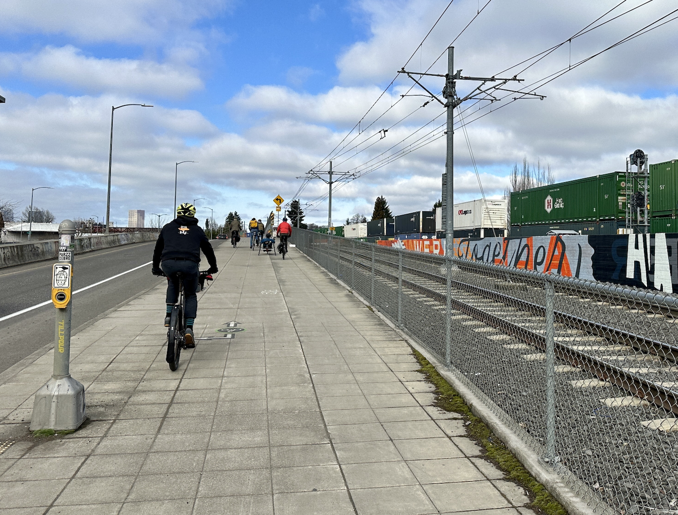
Saturday’s ride consisted of about a dozen participants in addition to Geller. There were some members of the BAC in attendance, including Chair Ally Holmqvist and Vice Chair Joseph Perez, as well as several local advocates unaffiliated with the committee. We started the ride at the Salmon Street Fountain downtown and headed south on Better Naito into the South Waterfront area. There’s a lot of new development happening in this part of Portland, which is the most transit-dense area of the city (when you include the aerial tram) and has some of the most sophisticated bike facilities in town.
But the network here is disjointed. The green, sidewalk-level bike lanes near the Tilikum Crossing and Oregon Health and Sciences University lower tram terminal end abruptly for people headed west. If you’re heading south, you can pick up the South Waterfront Greenway trail for a bit. That path doesn’t connect to anything, though, making it hard to fully appreciate how nice the trail is.
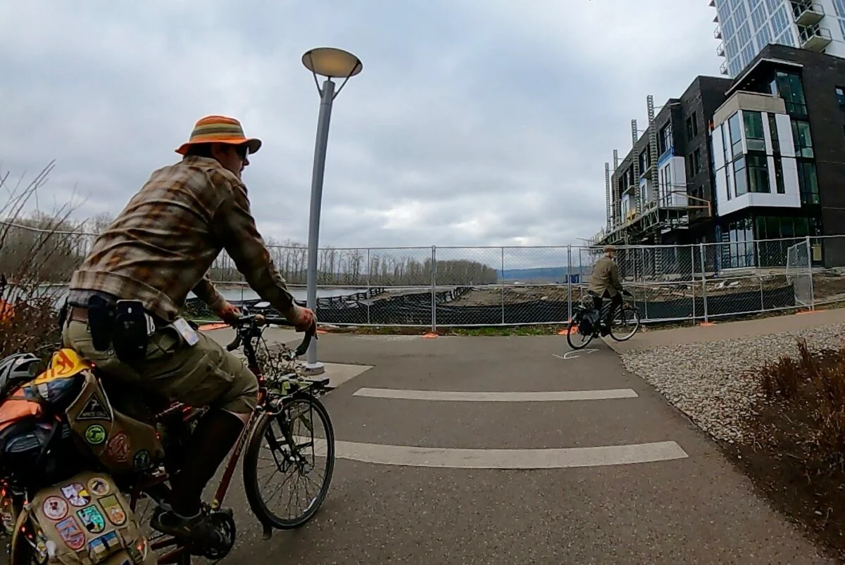
When construction is completed for an apartment complex on the lot between the end of the South Waterfront Greenway and the start of the Willamette Greenway Trail just south of the Old Spaghetti Factory, these two trails will be merged over the current gap. This will be very helpful for people traveling to and from south Portland by bike.
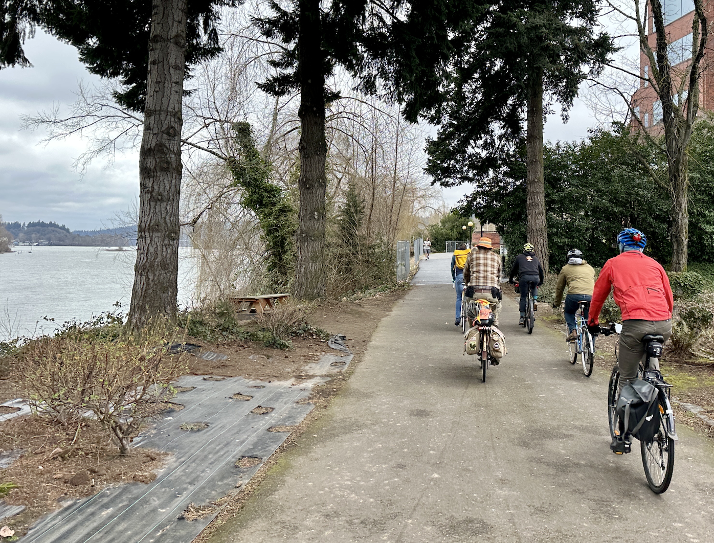
Geller then led us onto the Willamette Greenway Trail, a path with great views of people sailing the river that’s unfortunately hindered by treacherous bumps. We managed to navigate the bumps to the Sellwood Bridge, which is as far as the trail will take you.
I’ve never used the Willamette Greenway before — if I want to go to Sellwood or Milwaukie, I’ll take the better-paved Springwater Corridor Trail on the east side of the river — and I was most intrigued by the train tracks that accompany the path. These tracks are used by the Willamette Shore Trolley, a heritage rail line that travels between Portland and Lake Oswego as a summer attraction.
Last year, I talked to the folks behind a push to bring new life into this trolley line and potentially forge a new, more utilitarian connection between Portland and Lake Oswego. After seeing the largely-unused tracks with my own eyes, I believe something needs to be done here. Let’s bring back the conversation about building a trolley trail along the west bank of the Willamette through Riverdale and Dunthorpe to Lake Oswego.
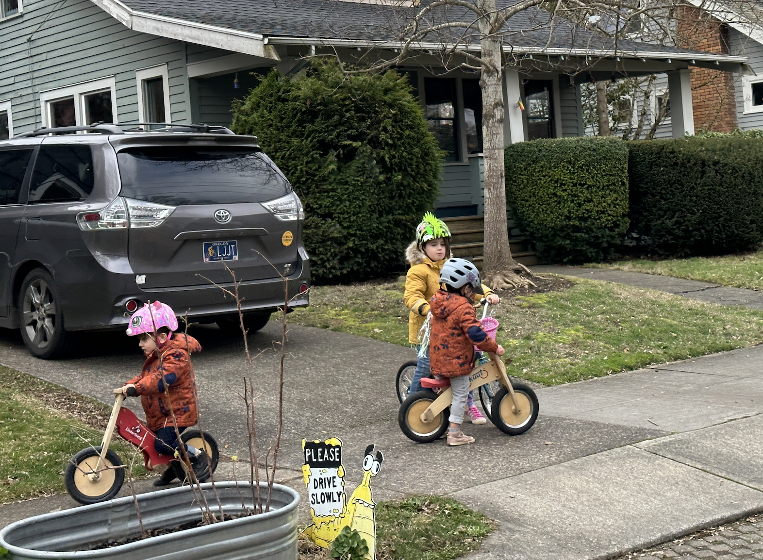
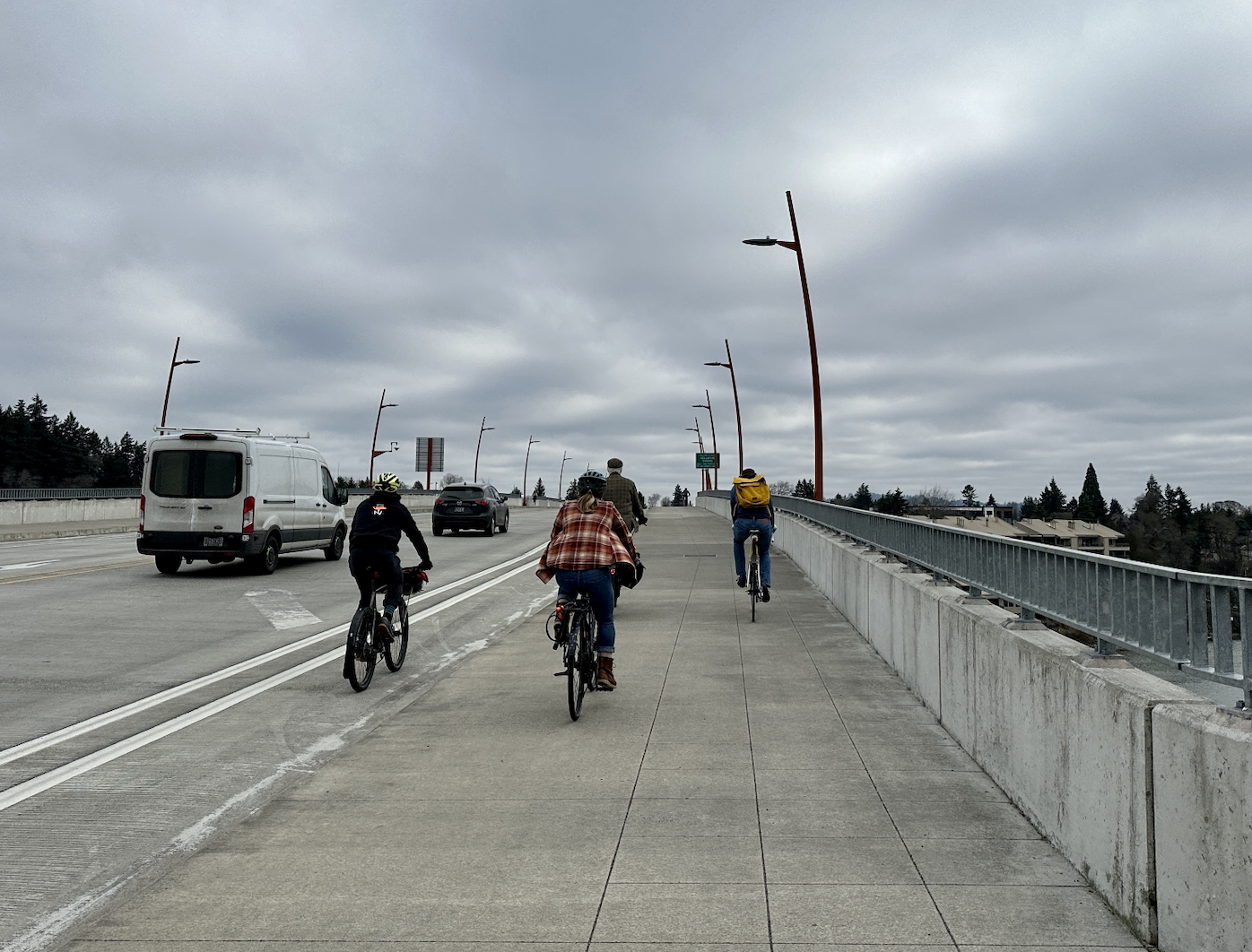
Geller led us across the Sellwood Bridge to the east side of the river to head back north via the SE 19th Ave neighborhood greenway in Sellwood. The surrounding neighborhood has some great spots — my personal favorite is Piece of Cake, the incredible dessert shop on SE 17th — and is easily accessible by bike by taking the Springwater or via the MAX Orange line. Heading north through the area, it was great to see kids riding their bikes in the neighborhood.
As we made out way through the neighborhood, Geller pointed out another example of Portland’s smorgasbord of street designs: the pervious pavement on a few blocks of street in Sellwood near Westmoreland Park. This permeable pavement captures stormwater through the street surface and into the ground as opposed to in a drain pipe.
These streets in Sellwood received the treatment in 2004 and are the only public streets in the city with this kind of pavement, so clearly the city didn’t think it worked well enough to replicate everywhere.
The ride ended back at the Salmon Street Springs, though I split off early to stay on the east side of the Willamette. Overall, it was an interesting look at some infrastructure I hadn’t seen before. I’m very glad Geller is leading these rides on a monthly basis again. I highly recommend them to anyone who wants an insider look into Portland’s bike infrastructure. Check out the BAC’s webpage for more information. And hope to see you next month!


Thanks for reading.
BikePortland has served this community with independent community journalism since 2005. We rely on subscriptions from readers like you to survive. Your financial support is vital in keeping this valuable resource alive and well.
Please subscribe today to strengthen and expand our work.
Pervious pavement needs routine maintenance – vacuuming – in order to function as designed, otherwise it clogs up with soil particles, moss and algae, etc. and essentially becomes impervious.
Given all the other problems PBOT has with maintenance, how often do you think they come out to maintain these few blocks of pervious pavement? My guess is never.
Thanks for that insight!
For more COP porous concrete experiments, check out N. Gay between Wygant/Humboldt, The south curb apron on SE Madison between 12th/11th, the entire Willamette River Greenway Trail section on Swan Island from the south terminus to the north end of the Daimler HQ building. I think the Powell Butte Parking lot used porous asphalt for the parking spaces, too.
Wait. There’s a Willamette River Greenway Trail section on Swan Island?
it s a great trail along the river. There a few nice beaches, too, although they have allowed some large camps/trash piles/abandoned boats to accumulate. There is a newish section between Daimler HQ and the river, a section built in the 2010’s upstream of that, and nice older section from probably the late 70’s with some nice places to sit (benches, picnic tables. It is some of the nicest infrastructure along the river but it is very hard to get to by car, bike or on foot.
Everyone knows team but doesn’t like to do routine maintenance.
Willamette greenway trail is not suitable as a bike path. It is way to curvy with sharp turns, narrow in many areas, during the summer time is full of pedestrians, and has really poor connections to the rest of Macadam area and involves riding on the sidewalk to access any business on 43. Not to mention the poor condition it is in.
It’s great for what it is, a recreation path and it should probably stay like that. But there really isn’t much of an alternative. S Landing Dr to S Moody Ave in front of the tesla building is what I end up taking but it still has some pretty major problems. What really needs to happen is bike infra on Macadam ave.
Yes to all that. The connections to Macadam, along with the various driveway crossings, are a collection worthy of their own “How NOT to Design” article. Some of the newer ones are especially bad. PBOT/Parks/Water Bureau combined to build a contorted (but soon to be improved) one at the Nevada entrance to Willamette Park that’s been the subject (pre-new design) of a couple articles here (the “mysterious black fence” location).
I’ve read about people who have walked the Willamette Shore Trolley route, and I’m not sure it could be made into a trail very easily. For one, there are a few trestles that are pretty long (and not fun to walk over). I suppose they must inspect them reasonably often for the trolley service. But also the houses (mansions?) that line the route would probably throw a huge fit over a “crime path” running, quite literally, through their backyards. I mean they’re the ones who bought property abutting a rail line, so not looking to feel bad for them. Just that it might be a big lift politically speaking.
I’d ride it all the time though, it would allow me to commute to/from work on my bike (when I don’t use the bus to avoid the west hills) much more conveniently. Maybe the Lake O to Downtown piece of it wouldn’t convince many people it’s “needed”, but it would be a genuinely useful connection for people heading SW to Tigard/Tualatin/Durham/Sherwood.
Yeah, that’s why the proposed streetcar line to Lake Oswego was so contentious, as I’m sure you know! There is definitely a political struggle to getting something like this done. I’m going to try to do an updated story about the Willamette Shore Trolley soon, so stay tuned!
I’d love a trail. But one issue was that through the Dunthorpe area, segments of the rail r.o.w. are easements, not ownerships. The easements are for rail use. So the residents along there argue (and could be right) that if rail use is stopped, the easements don’t allow conversion to anything else.
Also, the reason for the trolley running is that it preserves the rail use, thereby preserving the easements.
Does the easement specify the track gauge needed? Could they convert it into a 2ft gauge railway (they exist) and have a ‘service path’ that runs along side the track and happens to be open to the public?
Typically, rail trails use a process called “rail banking” which was specifically designed to deal with the easement issue. When a rail line is rail banked, the easement is preserved to ensure both complete trails are able to be made and that future rail service can be started up with minimal headache.
Was an update published? I am curious about any developments on this project. I stubbornly rode the proposed route today. It was cool, but really tough going including walking my bike over the trestles, but it could be amazing! I was struck by how unfortunate this right of way isn’t what it could be.
The trolly tracks are very rideable, though there are the aforementioned bridges with nice sized gaps between the beams that when wet and in road shoes make for a spicy crossing, but it is otherwise super fun to do.
As for the desire for a path there, it is a shame that we have allowed our paths to devolve to such an extent nobody would want something similar. I rode from downtown Washington DC to Bethesda on their canal and rail trail paths and was blown away by the infrastructure and types of homes that were abutting the path.
I might be dense, but when I followed the link, I could not find any information about these monthly rides- can anyone provide some clarity?
I just linked to the BAC site. They announce details of the monthly rides about a week beforehand, so check back at the website in March!
thanks
Ah, ignore my previous comment regarding the ride schedule. Sadly that would almost always be too short of notice for me to join, providing they take place during the work week.
They’re usually (maybe always) on Saturday mornings! Typically the second Saturday of the month.
Excellent! I’ll definitely have to join for one.
Don’t forget the eternally out of service and urine soaked SW waterfront elevator over I-5
You mean the elevator to the Hooley I-5 crossing? It’s OOO about half the time I want to use it, meaning I get a workout on the stairs.
Yes, it smells like urine – like much of the rest of Portland.
Instead of a tram to Lake Oswego, Portland should build a tram line connecting South Portland, Sellwood, and the Tacoma MAX Station. The Sellwood Bridge was built to support a potential future rail line and such a line would be a convenient feeder and connection to the MAX. Also has the added benefit of being entirely within the city limits – Portland wouldn’t have to deal with jurisdictions less friendly towards public transportation.
Why isn’t this ride mandatory for Portland City Council and other decision-makers?
I remain convinced that until powerful people ride bikes and see how bad the cycling infra really is, we’ll never get better cycling infra.
It will be interesting to see if bike rider Mingus Mapps will lead PBOT into initiating an era of more dynamic and thorough cycling infrastructure.
And why I was thinking a virtual tour might be helpful! (I said for those who can’t, but meant for those who won’t;))
“The green, sidewalk-level bike lanes near the Tilikum Crossing and Oregon Health and Sciences University lower tram terminal end abruptly for people headed west.” Yes, anyone heading west of the South Waterfront area is basically screwed in terms of bicycle infrastructure.
I would love to join on one of these, I see the meetings are the second Tuesday of each month, are they also the rides?
I commute north to south through the OHSU campus to just south of willamette park daily. By far, the biggest hazard is the tiny bike lane snug between a tram line and parking lane on S Moody Ave. Cars/trucks are frequently parked in the lane and opening car doors require quick maneuvers over train tracks. There are several blind turns and a couple opportunities for right turn hooks. I see something scary or avoid some hazard myself almost every day.
I like the idea of a monthly ride to share new spots and maybe some tricks of the trade. It would be especially nice to traverse the riverfront paths. I wonder if it might be possible for Mr. Geller to do a go-pro while he’s riding….give a virtual tour for those who can’t make the ride! Great article!