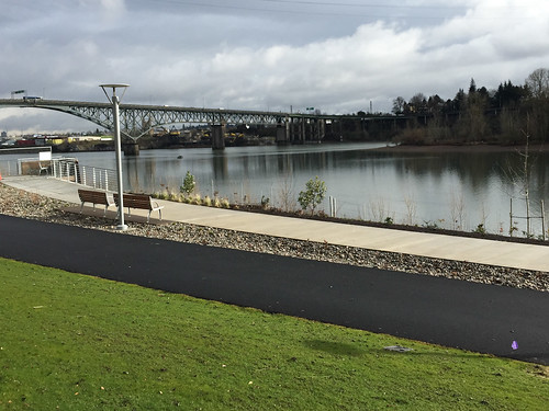
(Photos by J. Maus/BikePortland)
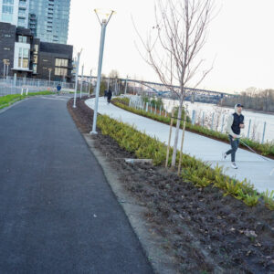
I finally got a chance to check out the new section of Portland Parks’ South Waterfront Greenway and I have to say: It just might be the best integration of public space and bike path Portland has ever built.
Now, if we can just make it actually connect to something we’d be in business.
The path itself has been over a decade in the making (it first shows up in city plans in 2004) and construction started in earnest about five years ago when the City of Portland purchased a quarter-mile of land along the Willamette River in South Waterfront. The project stalled three years ago due to a lack of funding but City Council finally authorized the final $4.7 million to complete it in February 2014. (The funding source was primarily System Development Charges, or SDCs, which are fees paid to the city by developers to mitigate the impacts of their developments.)
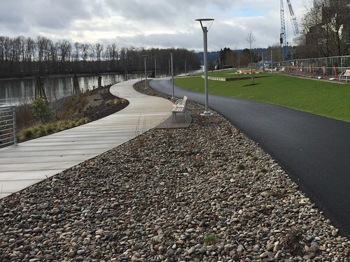
Beyond the world-class design and general excitement about a new section of riverfront bike path in Portland, what makes this project special is that walkers and bike riders will have their own, separate paths. As we’ve seen on the waterfront path just north of this location, overcrowding on Portland’s multi-use paths is a major problem. The separation of uses inherent in this design will (hopefully) alleviate some of the stress and tension of a crowded path where bikers and walkers mix.
Take a little tour and see what you think…
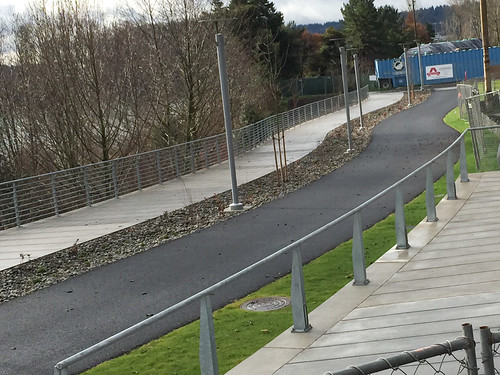
I rolled in at the path’s north entrance on SW Curry Street, or what the Parks bureau calls the “Curry Overlook.” Here’s the view of the path looking north…
And looking south…
Advertisement
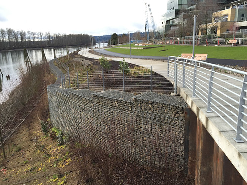
Another view south showing the entire elevation, including the expansive (and very expensive) shoreline restoration work they had to do…
Note that only a small section of the walking path north of Curry St is currently open. Parks has fencing up around most of the path (which I went around to get some of my photos) to make sure the new lawn and other plantings can get established before the official opening later this spring.
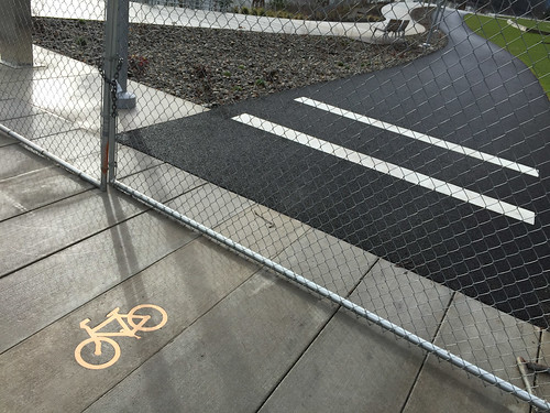
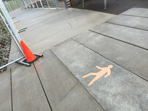
One thing I like about the design are the subtle markings. Note the classy, inlaid “bike” and “walk” symbols to direct folks to the appropriate path (these are so much better than paint or thermoplastic)…
Just north of Curry the walking path dives down a gradual ramp into the Willamette. This area will likely be busy as a kayak and canoe launch; and I have a feeling that some folks might tempted to launch off it a la the Cupcake Challenge…
Like I alluded to above, unfortunately this path comes to an abrupt end north of Curry St at the start of the Zidell Yards (a marine services company) under the Ross Island Bridge, tantalizingly close to another section of existing path…
And here’s a look at the southern terminus of the path, south of SW Gaines…
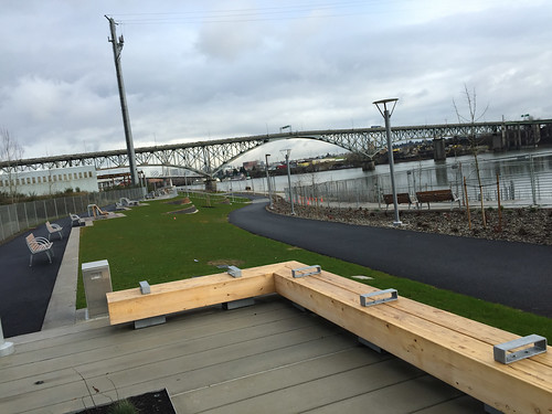
Overall, I was very impressed by the public art, the benches, and other furnishings. All are very high-end, built to last, and they make it clear to users that the City of Portland respects this space…
Now our challenge is to connect this path to other sections of the existing Willamette River Greenway path to the south and the north. Hopefully that won’t take another 10 years.
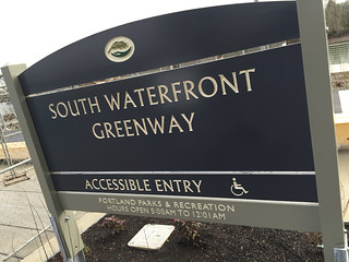
— Learn more about this project at the Portland Parks & Recreation website.






Thanks for reading.
BikePortland has served this community with independent community journalism since 2005. We rely on subscriptions from readers like you to survive. Your financial support is vital in keeping this valuable resource alive and well.
Please subscribe today to strengthen and expand our work.
Nice! Joggers are gonna love that blacktop!
This was my first thought as well. Asphalt is better for your joints, so I guarantee that runners will be using the “bike” path.
Got a citation on the “asphalt is better for your joints” statement? I would have guessed the squish in the shoes made a much bigger difference than any hardness differences between asphalt and cement.
Doesn’t need a citation. It’s just the general consensus amongst joggers – whether it’s truth or not. I suspect it’s complete hogwash as you state the shoes would make a bigger, more measurable difference.
Documented proof that asphalt is easier on the joints than concrete is irrelevant, because that notion is commonly held among runners.
maybe that is why I keep encountering joggers in the bike on the hill of Interstate Ave! I find it irrationally irritating to be pushed out of my skimpy 5-foot lane into the path of speeding motorists because some dude is compelled to jog down the road at rush hour!
http://www.slowtwitch.com/Training/Running/Concrete_or_Asphalt__4793.html
But you are correct in your assessment that the shoes account for the vast majority of the cushion.
Thanks Chris, this is an interesting digression. I ran cross country and track through high school and college, and this was new to me.
The conclusion of the study is pretty much that the difference between concrete and asphalt is negligible compared to the difference between running technique, speed and shoe materials.
Both should have been KloroTech stuff from Spokane.
that was my first thought…
and the anti-skateboarding rails on the long benches…
but it’s the thought that counts…
it will be a decade before the two paths meet…Zidell’s going nowhere fast..
True, but its fun to watch them work. Kind of like sitting in a brew pub watching beer ferment in a tank–but Zidell has cranes and sparks and loud noises–it a lot more fun and interesting. I don’t mind biking or walking around it at all.
About Zidell, let’s be careful what we wish for. Industry/commercial zones next door are important as far as I’m concerned. I can’t stand the fact that in the Central Eastside Industrial District businesses are pulling up stakes faster than you can say gentrification.
The paths look very impressive. Not sure I quite understand the $4.7million figure, though. Wow.
It was stated in the article that the river bank restoration was “expansive and very expensive”. I’m guessing that was a major contributor to the high price.
Right. I guess to the extent that most of the money went to restoration (rather than the fancy benches) it would be good to hold onto that. Otherwise in these times of no money for anything other than asphalt and war we run the risk of mistaking this for pork.
Does the north end really end at a sidewalk with stairs?
Do you get the impression that this is pretty much exclusively a recreation path right now?
yep. it sure does. Sorry to say.
And one person’s recreation is another person’s transportation.
Seriously though… by nature of the fact that it doesn’t connect to anything, it won’t see any serious commuter or utilitarian bike traffic at all. Most likely it will be for families and retirees and picnic-takers on the weekends. There’s a bike lane on SW Bond just a block over that the more serious-minded riders will stick to.
I see a dirt path flanking the stairs in the future…
although those stairs look easy enough to ride on a mountain bike…
I look for excuses to travel that route and once there, I recreate… like two weeks ago on my biannual visit to the accountant and the Buffalo Gap. I took my time exploring. Continuation on the path would/will be awesome!
This beautiful separated path begins after the convoluted and confusing “separated” bike ped path along SW Moody. Fortunately, that stretch is wide enough that there’s plenty of room when peds or cyclists don’t use their designated path.
Why is “separated” in quotes. Are you questioning whether that section of Moody (with it’s curb, raise, and 10 feet of sidewalk) is actually separated from the road?
I think he’s questioning the effectiveness of “separation” between pedestrians and bicyclists on the Moody path. Having observed 4-across and even 6-across pedestrian formations in the Moody bike lane in the past month, I question it as well.
It’s not the separation from the road, but rather the intended separation of bicyclists and pedestrians.
I was over in this area a few weeks ago and was very impressed by the separate walking/bike riding spaces. Hopefully this will connect with the rest of the network soon!
and eventually with Lake Oswego soon
Great sense of humor!
The raised part you refer to is only a block or two. Here’s an example what I was referring to:
http://goo.gl/maps/89R02
My feeling about bike path delineation is that the City of Portland, with the best of intentions, is WAY overthinking what’s needed to guide cyclists, motorists and peds.
The area is a park, not simply a transportation corridor. It should be a point of pride that this section of Greenway does not settle for the least possible.
For people living in South Waterfront and commuting to downtown (or anywhere north) it will be useful. (There must be some people who do that, right?)
Also, I’d really love to see a paved path added to Waterfront Park, like this one, so that people on bikes didn’t have to “interact” so much with people on foot. Yeah, it would be taken over by every festival all summer long, but it would be there most of the time.
Ride the new greenway to the tram, ride the tram up the hill to OHSU, coast into downtown via Terwilliger & SW Park! It’s the lazy man’s commute! 🙂
I’d rather see protected bike lanes on Naito than a bike path though Waterfront Park.
This looks really beautiful. I’d love to see more shared spaces, like Waterfront Park, redesigned with separated paths like these.
Regarding Waterfront Park, I’d be happier with protected bike lanes on Naito. This would also be better during the numerous summer festivals.
Sometimes you include a map when you feature infrastructure changes additions as this. Great if you can as for some of us it clarifies and defines better than pix do; thanks.
Not connected to the Moody path is killing me. Ending in stairs is killing me all over again. Nice path but no good way to get onto or off of it! 🙁
Very nice!
I think that explicit “bikes only” and “no bikes” graphics will be needed, periodically along the path, not just at its start.
There isn’t much distance between this path and the Willamette Greenway path to the south. Any idea when these two trails would be connected?
Regardless of the path’s potential as a connector to a larger transportation network, I’d recommend people check it out and, if they like the design, consider it a prototype for other facilities around Portland. Future experiments will only get political backing with vocal support.
Great looking park on the river, but doesn’t do much as a bike path.