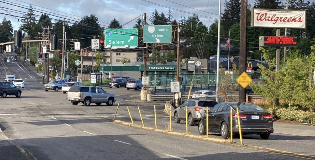
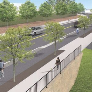
(View looking southeast on SW Capitol Highway at SW Barbur Blvd).
(Photos: Lisa Caballero/BikePortland)
The Oregon Department of Transportation will begin work this summer on its Barbur Crossroads Safety Project at the intersection of SW Barbur Blvd and Capitol Highway. Project elements include new lighting, ADA ramps, a new sidewalk, pedestrian countdown signals, wayfinding signs, and an operational re-routing of I-5-bound drivers into a “jughandle” configuration.
One thing the $2.97 million project doesn’t include: bike lanes.
This omission would leave a critical gap in the region’s north-south bike network and does not mesh with the Portland Bureau of Transportation’s commitment to a safe, low-stress active transportation corridor between Hillsdale and the Portland Community College Sylvania campus.
Advertisement
This summer, PBOT will roll out its $26 million SW Capitol Highway Project, which includes protected bike lanes and sidewalks from Multnomah Village to the Barbur Crossroads where, apparently, the infrastructure will come to an abrupt halt. South of the Crossroads, the PBOT infrastructure picks up again with the Bureau’s recently implemented SW Capitol Highway road diet which includes bike lanes protected with plastic delineator wands and extends to PCC Sylvania.
With the completion of the Capitol Highway Project, PBOT will have done right by one of few continuous north-south bike routes through SW Portland, and their improvements will set the stage for ODOT to close the Crossroads gap and complete this spine.
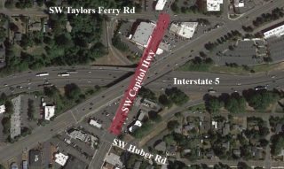
Unfortunately, the ODOT plan does not do that and the 850-foot unmarked span from SW Taylors Ferry to SW Huber St (in graphic above right) will continue to be a dangerous gap in this 3.5 mile corridor.
What about people on bikes?
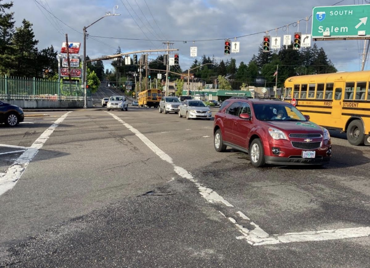
ODOT is not attempting a bold vision in its Barbur Crossroads Safety Project. Rather, it is looking for a high “benefit-cost rate of return” given the “financial constraints of available project funding.” As such, they have chosen the easiest design which involves the least change.
BikePortland asked ODOT Region 1 Public Information Officer Don Hamilton to help us understand why bicycle infrastructure was not included in the safety upgrades. Hamilton responded that, “We are continuing to discuss ways of improving that stretch of the road with the city. We have nothing definitive to report, but discussions are ongoing.”
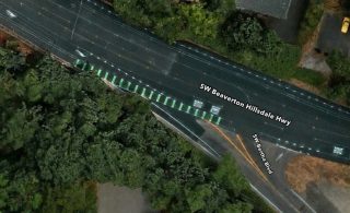
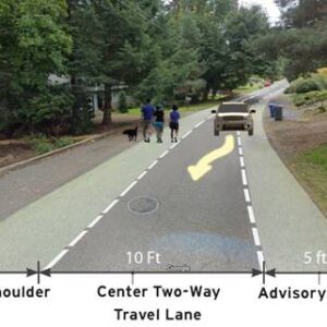
Capitol Highway at Barbur is about 50 ft-wide with four lanes. PBOT’s treatments to Capitol Highway north and south of the intersection will reduce the street to one lane in each direction (a second lane is added on the approaches to Barbur). At a project on nearby Beaverton-Hillsdale Hwy, PBOT was able to add a curb-protected multi-use path by reducing travel lane width down to about 10 ft; ODOT is not reducing lane widths at the Crossroads. Nor does the ODOT design include any zebra-striped green paint to guide people on bicycles through this dangerous, 143 ft-long skewed intersection. (UPDATE/CLARIFICATION: Before writing this article I contacted two ODOT employees with a question about lack of bicycle infrastructure on Capitol Hwy between Taylors Ferry and Huber–neither of them contradicted me or offered that any infrastructure was going in. This morning I noticed that one ODOT presentation slide mentioned green conflict markings at three Barbur intersections, including with Capitol Highway. This is a good thing. ODOT hasn’t released a design or schematic, but it looks like those green markings will run through intersections along existing Barbur bike lanes.)
I don’t know what the character of the interactions between ODOT and PBOT have been on this project, but any Portlander with a satellite map can find examples of innovative ways throughout the city that PBOT is trying to protect bicycle users. With some green paint, and advice from PBOT, ODOT could have taken a step toward protecting people on bikes. Perhaps they still will.
Regardless of bike facilities, the area is likely to remain a high-stress, car-centric environment.
The jughandle controversy
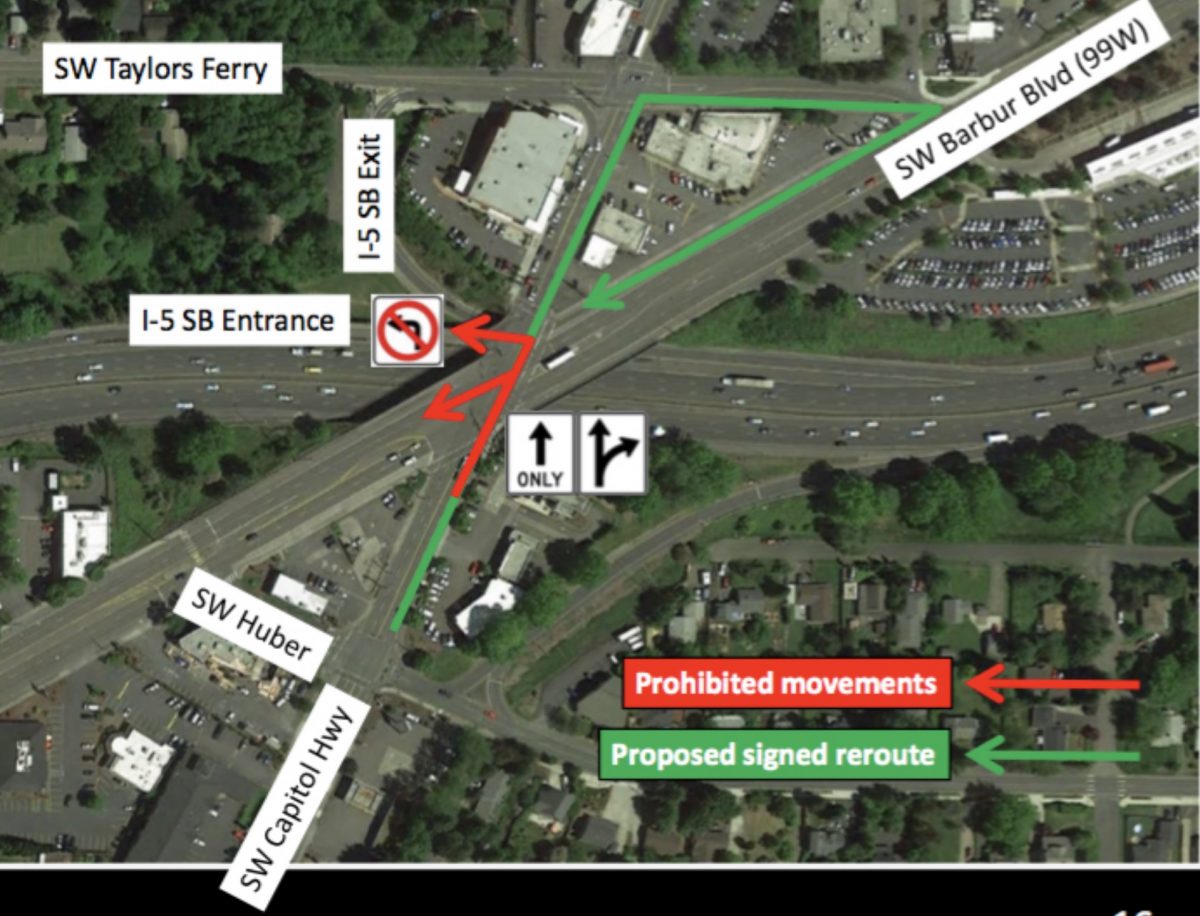
(Source: ODOT slide presented to Crestwood neighborhood association in 2019.)
ODOT is also moving forward with a “jughandle” design which has raised concerns from neighborhood advocates. At an April 19th Southwest Neighborhoods Inc Transportation Committee meeting with ODOT representatives, committee member and SW Trails founder Don Baack stated that, “I join a lot of others in being very skeptical about the operation of this proposal.”
“I join a lot of others in being very skeptical about the operation of this proposal.”
— Don Baack, SW Trails
A “jughandle” is a poor man’s cloverleaf. It creates a looped ramp by co-opting local city streets into freeway-supporting infrastructure (see graphic above). As such, it encroaches on local streets and effectively increases the freeway’s footprint. ODOT plans to direct I-5 southbound drivers into a jughandle along Taylors Ferry Rd, which will create a loop around a popular area grocery store, Barbur World Foods, and will intersect with two Safe Routes to School-designated crossings at Barbur. The risk is in the proximity of two groups of road users with very different frames of mind: a queue of drivers impatiently waiting to enter I-5, and children walking to school.
This tension was brought up by Baack at the April meeting: “I suggest you do not permit right on red because it is really difficult with kids, they don’t watch, they don’t look, and the drivers are in a big hurry to get someplace.”
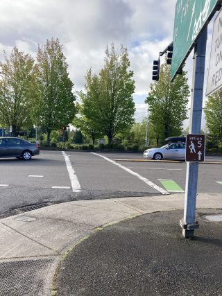
Other committee members noted this is the only crossing to the Barbur Transit Center from the north, and to the pedestrian bridge over I-5. Cycling advocate Eric Wilhelm asked whether ODOT’s traffic modeling had depended on a permitted right-on-red, and whether without it “this is even going to work,” particularly given transit ridership goals which should fill the crosswalk with people. ODOT’s Information Officer Hamilton told BikePortland yesterday that the agency was “in the process now of evaluating those concerns.”
After over two years of expressing reservations about the jughandle design, committee members found themselves in the rearguard position of requesting an assurance that ODOT, within a year, will perform a before and after safety and performance assessment—and to report the results back to the committee. It is unclear if ODOT has agreed to do that.
Circulation problems
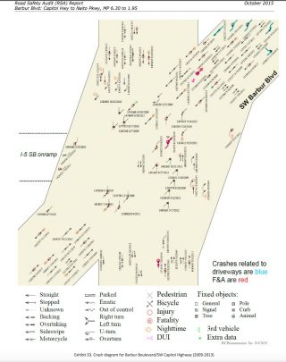
ODOT says the intersection of SW Barbur Blvd and Capitol Highway is in the top 10% of the Safety Priority Index System (SPIS), which means it’s one of the most dangerous intersections in the state. There were 161 crashes between 2007 and 2016, 16% of which were directly related to northbound traffic on SW Capitol Hwy turning left onto SW Barbur Blvd, or onto the I-5 southbound freeway on-ramp. To address this, ODOT will be prohibiting these left turns at the intersection and instead routing that traffic into the jughandle pattern.
One thing everyone agrees on is that this is a complicated, high stakes intersection. It abuts both the planned West Portland Town Center (WPTC) and the stalled Southwest Corridor Light Rail Project. At the heart of the controversy is the ramp onto I-5 south, the first southbound entrance onto the freeway after the South Waterfront entrance, over four miles to the north. This scarcity of ramps puts additional traffic pressure on an intersection already operating over capacity.
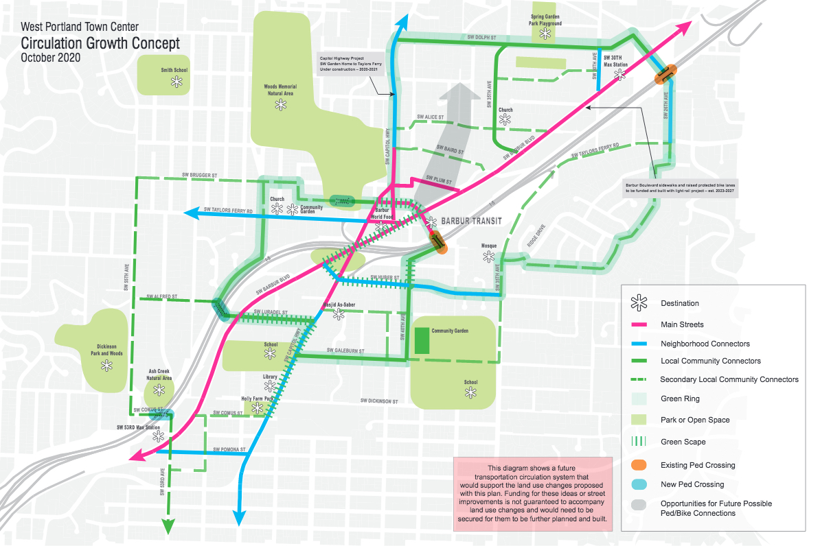
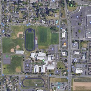
At first glance, fixing this intersection would seem to require a paralyzing amount of coordination between agencies, but in truth the ball is in ODOT’s court. ODOT has jurisdiction over the freeway and Barbur Blvd. And although the WPTC will depend on safe infrastructure for success, its Green Ring and Circulation Growth Concept are aspirational and unfunded (see graphic below). Similarly, TriMet’s light rail, if realized, will come with restricted funds and will also depend on improved infrastructure for success—but it will most likely be limited in how it can contribute. TriMet’s current plan shows the train running elevated over the Crossroads.
Rather than a jughandle, neighborhood advocates would have preferred upgrading the northbound Capitol Highway signal to include a protected left-turn phase and a dedicated left-turn lane on Capitol Highway where ODOT is prohibiting left turns. ODOT studied and rejected that option saying that it would result in increased traffic delays and congestion, which would in turn increase queueing at the Capitol Highway-Taylors Ferry intersection and on the I-5 southbound exit ramp, “potentially creating new safety concerns.” According to ODOT, a dedicated left-turn lane would also create delay south of the Crossroads due to the loss of a northbound lane.
The Crestwood neighborhood association also requested a “red light/speed camera at the intersection of SW Captiol Hwy and Barbur to deal with the root cause of the crashes,” which they suggest is southbound Barbur drivers running the red light to access the freeway ramp. That idea does not seem to have been taken up by ODOT, whose decisions continue to favor car users at the expense of other modes.
The Portland Bureau of Planning and Sustainablilty’s 2013 Barbur Concept Plan summarized how car-centric street design has prevented the area from reaching its potential:
There is no way to solve the transportation circulation in the Crossroads one intersection at a time… potential growth at the Crossroads has been arrested in large part by the traffic congestion. The community, while generally supportive of more intense land use in this designated town center, has been reticent to support much development in an area where the street network is at or near capacity and the bike and pedestrian connections are lacking from the surrounding neighborhoods . . . the real catalyst here will be resolving the congestion issues and improving the street design to better accommodate all users.
With three projects lining up and a significant investment being made, now is a perfect opportunity to make those accommodations.

— Lisa Caballero, lisacaballero853@gmail.com
— Get our headlines delivered to your inbox.
— Support this independent community media outlet with a one-time contribution or monthly subscription.


Thanks for reading.
BikePortland has served this community with independent community journalism since 2005. We rely on subscriptions from readers like you to survive. Your financial support is vital in keeping this valuable resource alive and well.
Please subscribe today to strengthen and expand our work.
Thanks for another great article, Lisa, about the bike-infrastructure-starved SW quadrant of Our Fair City.
I’m uniquely qualified to comment about this intersection since I ride through it on my bike EVERY SINGLE DAY. Though you are correct in thinking that this intersection needs to do more for non-car users, bike lanes would never work here – there’s just no room. The only way for a person on a bike to use this intersection safely is to become a car and wait your turn and get in the flow of the lane. In my experience, 98% of drivers see you and give you room to ride. As the great Marianne Fitzgerald put it so well, “This intersection is so dangerous that it’s safe.”
The jug-handle idea is crazy! It’s never going to work. The intersection has actually been okay during the pandemic, but it’s clear that post-pandemic the intersection will go back to its regular chokepoint status, trying to get people onto I-5 N and S from both directions, moving the thousands of people to and from PCC every day, and tens of thousands of cars and trucks on Barbur. ODOT needs to spend a few mil to buy up some property and create other on- and off-ramps to I-5, unless traffic can magically decrease again to a level this intersection can handle.
Hello Fred,
You are uniquely qualified to comment on this intersection, I don’t know anyone else who rides through it everyday.
Regarding bike lanes not working, I’m not going to argue with you. Green paint is not car-kryptonite and the span that the s-bound traveller needs to cross is really long and exposed, about 200 ft from the I-5 onramp to the southside of Barbur. ODOT will be putting green conflict marking at some crossings, although they haven’t reported a design. The n-bound, eastside of cap hwy is more manageable. These huge crossing distances exist because the two roads sit at a 40 degree angle.
Don Baack told me that he has been requesting a s-bound I-5 entrance ramp at 25-26th since 1999! He thinks it would take about 50% of the cars off Barbur and lighten the load at the Crossroads.
A transportation committee member brought up the idea of adding another s-bound entrance north of the Crossings at the April 19th meeting. ODOT will be doing bridge work in this area, and he asked that the design they choose not preclude the possibility of adding a s-bound ramp. This was a high point of the meeting and the ODOT reps seemed open to the idea.
I would like to talk to you before I write these articles, not after. Would you email me at the address at the bottom of the article, I’d like to be in touch with you.
Couldn’t the problem be solved by closing the freeway ramps? There are others nearby.
The problem is that there are not any I-5 south on-ramps between downtown Portland and Capitol Hwy. This builds up a lot of traffic pressure.
One of the things that took me a while to get used to with freeway driving in Portland is that the ramps are not symmetrical. Some spots have on-ramps, others have off-ramps, or they have them for one direction and not the other.
Lisa, I agree with you. Portland has terribly designed on and off ramps, and this is the worst coming off at a diagonal of two busy street. It would be a much better, though more expensive, solution to add a new SB onramp a bit north of there and then people could either use that or the one at pacific hwy a few miles south
Growing up in SW, I’ve always wondered why ODOT hasn’t built a SB on ramp at Barbur and SW 24th. There is a SB off ramp here, and plenty of space for a slip lane. This would take a lot of pressure off of the on ramp at Capitol.
I’m no traffic expert, but would expect that most folks getting on I-5 south here travel via Barbur or Capitol Hwy from the north…SW Portland, Multnomah, etc. How many come from the south and need to make a left at this terrible intersection? They have other options for going south on I-5.
Slower speeds and a bit more congestion should make the area safer, but ODOT has always had “congestionphobia!” Lower speed limits, narrower lanes, red light/speed cameras are all proven ways to make an intersection safer…an make some room for bike lanes.
Lenny, I agree. It seems like PCC folk and other folks in cars needing to head to I5 SB could use the onramp at SW 64th Ave, by taking G/Lesser out the west side of campus. Although I know data matters, and I’m not a SW saavy Portlander…
It just seems everytime I drive Portland, I’m always amazed by the redundancy of the street network that only folks using cars have the privilege to experience…
Hi Lenny, regarding PCC drivers having “other options,” you’re right, they do. But apparently enough of them use this on-ramp that ODOT thinks the left turns are a major source of crashes.
One frustration that neighborhood activists have expressed is ODOT not sharing the traffic and circulation studies they report having performed.
I agree with your last sentence.
I remember when I-5 through SW opened. I biked most everywhere from our home in Multnomah…especially Hillsdale, Gabriel Park, L&C College where my father taught and so on. I had a friend who lived down in the Corbett area, and when the freeway paving was done but it was not yet open to traffic, I rode all the way down to the Corbett exit. Great ride! Don’t recall the ride back home.
I was hit once by a pickup turning left in the Village…one of the few bits of sidewalk around up 35th. I was riding on it. Big mistake…had I been in the street I would have been in plain sight.
This jughandle-access to I-5 looks like it will be about as safe and popular as the I-5NB/Ross Island Bridge route through Lair Hill.
Incredible that ODOT is worried about the possibility of congestion, but not worried about the possibility of children getting mowed down by drivers, to the point that even the small concession of prohibiting right-on-red turns hadn’t occurred to them.
The fact that they are still “evaluating” the “concerns” just goes to show how much they (don’t) think about the safety of other road users.
Yeah, it took me a long time to figure out how to traverse from Barbur to SW CapHi southbound. I avoided the actual intersection for a long time because There’s not a great patter from northbound Barbur to southbound SW CapHi. I was using the ped bridge over I-5 at first.
Overall, it is a pretty challenging intersection in all but the lightest of traffic.
Every city in the USA that I’ve ever visited or lived in has had at least one intersection area that is beyond terrible, too difficult for local planners and engineers to fix without a complete rebuild and land use makeover. Some cities have more than one. If there was an easy fix for it, it would have been done long ago.
Hi David, Thank you for that observation about “beyond terrible.” It’s true.
If you look on page 45 of the 2013 Barbur Concept Plan you’ll see that BPS did just what you mention–it hired a nationally recognized outside expert, Ian Lockwood,
His concepts are good and end up being your “land use makeover.” But it seems that a new freeway ramp is critical to implementing them, and the land use makeover isn’t cheap. But at least a good designer has looked at it and provided a path forward. His “concepts” are neat and would do a lot for placemaking.
Yeah, it’s kind if insane to have two major streets /highways intersect ON TOP OF having a freeway on ramp at the same location. Dumb dumb dumb. Guess nobody in IDOT is smart enough to actually design smart roads.