ODOT’s three million dollar Barbur Crossroads Safety Project is nearing completion. The project, also known as “the jughandle” by area activists, is being built with All Roads Safety (ARTS) funds.
Additionally, Portland has contributed its own pot of money for transitioning pedestrians and cyclists to Barbur Boulevard from the south end of their ongoing $27 million Capitol Highway project. The area is a complicated jumble of traffic and funding, with the three projects happening somewhat simultaneously. This week I visited the site to see how things are coming along.
The Barbur Crossroads Safety Project
As we have previously reported, the jughandle project has been controversial, with transportation activists objecting to the design and also concerned that automobile and truck traffic is being routed across a Safe Routes to School crossing.
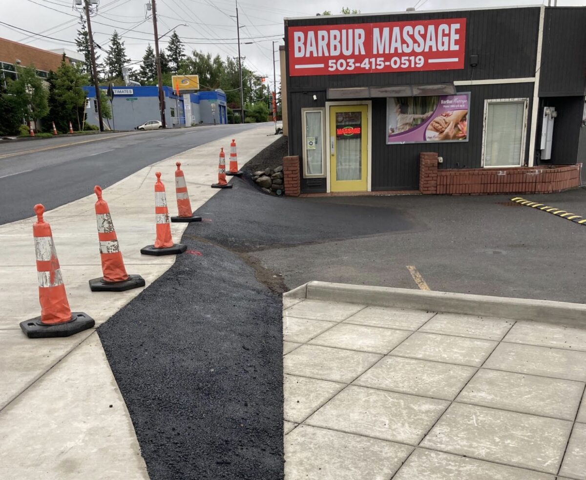
The first thing I noticed was the new, widened sidewalk along the east side of SW Capitol Highway. This will be a multi-use path for people biking and walking. The before and after photos below show what a big change this is visually.
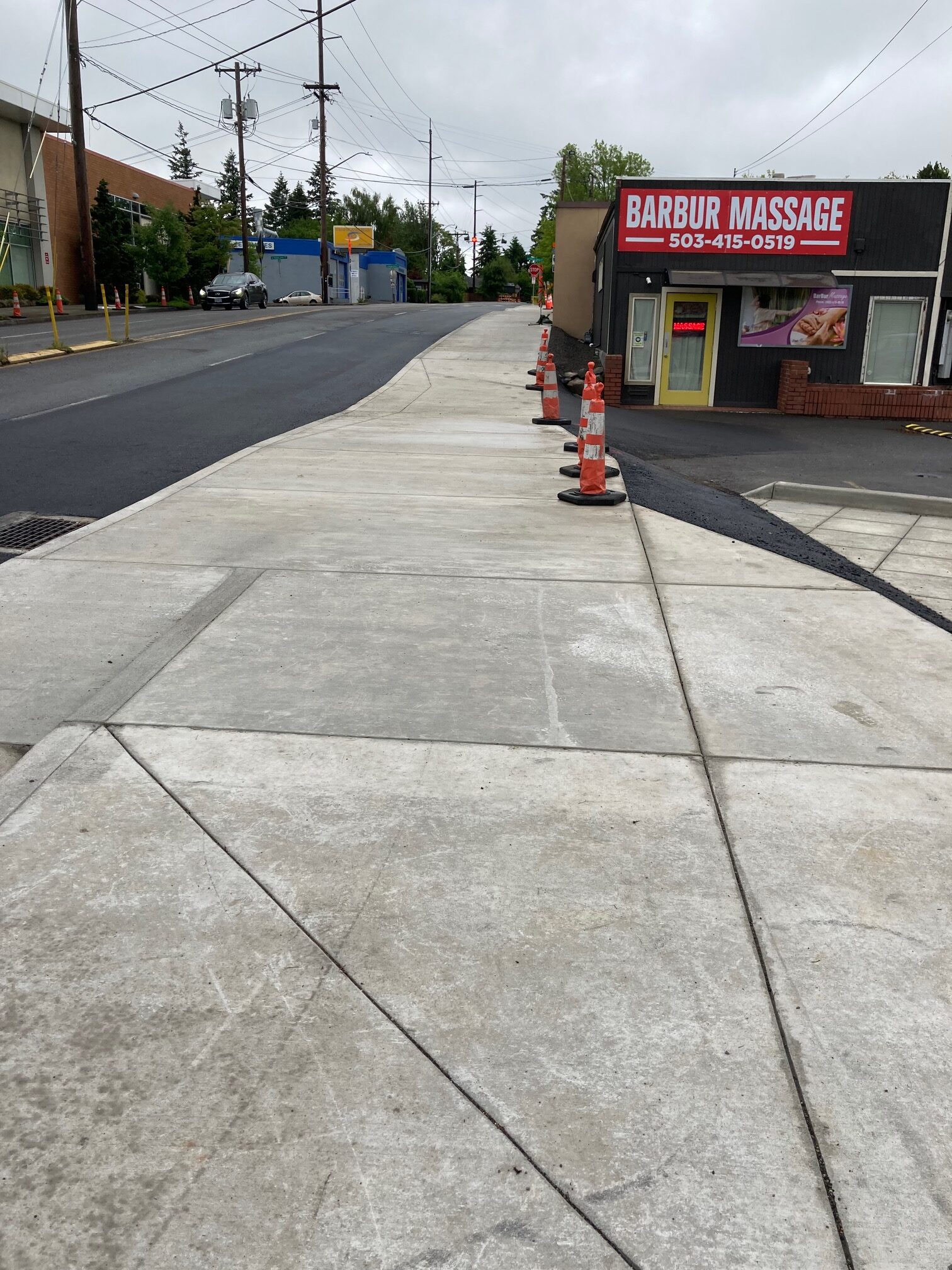
This seems to have been a fiddly project, and the widening and grading appear to have affected both the east and west sides of the old walkway. To the east, space previously used for driveway ramps to the below-grade businesses has been narrowed. The result has been to make the ramps along Capitol Hwy steeper, as seen in the photo below. (The triangle of businesses are also accessible from Barbur Blvd and Taylors Ferry Rd.)
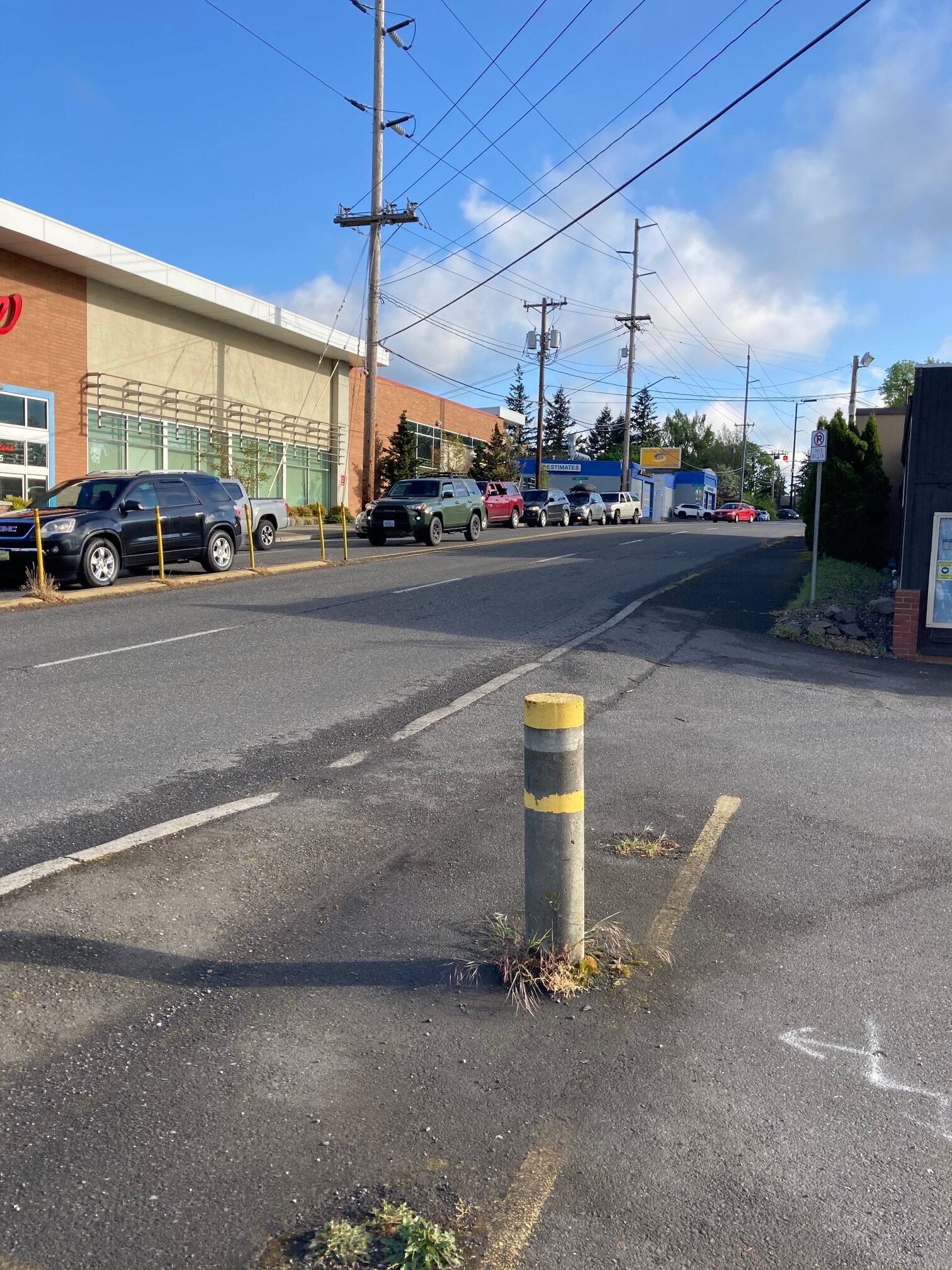
Before and after photos approaching Taylors Ferry Rd (below) show that a telephone pole appears to have been relocated, and the sidewalk width extended into street space.
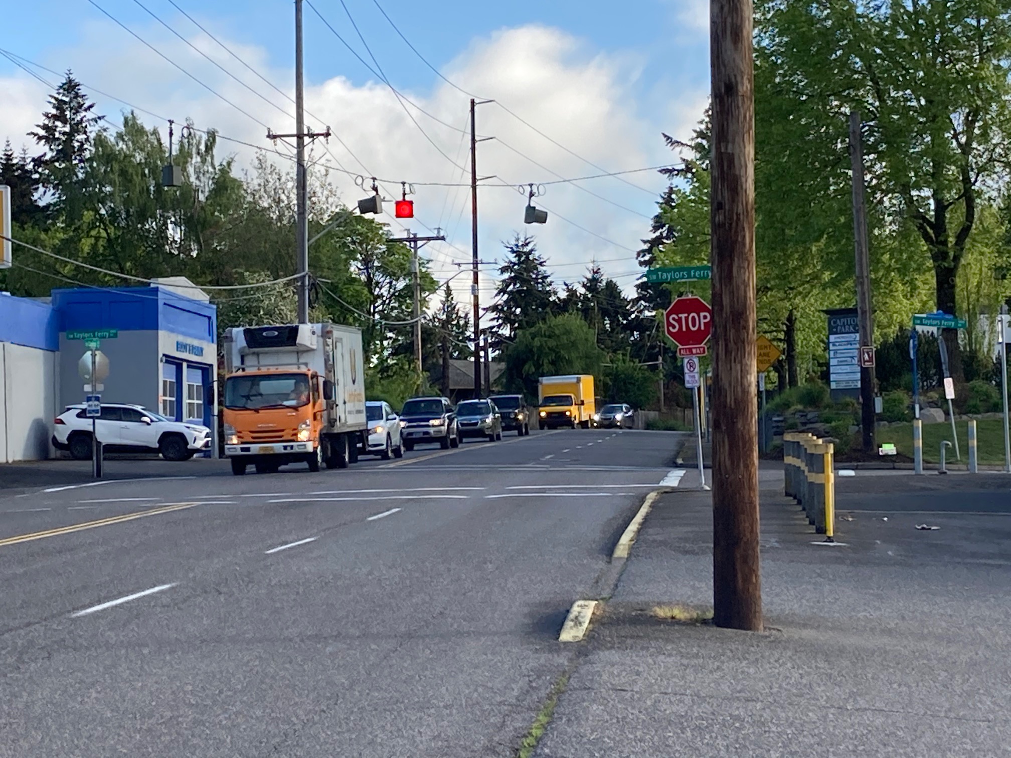
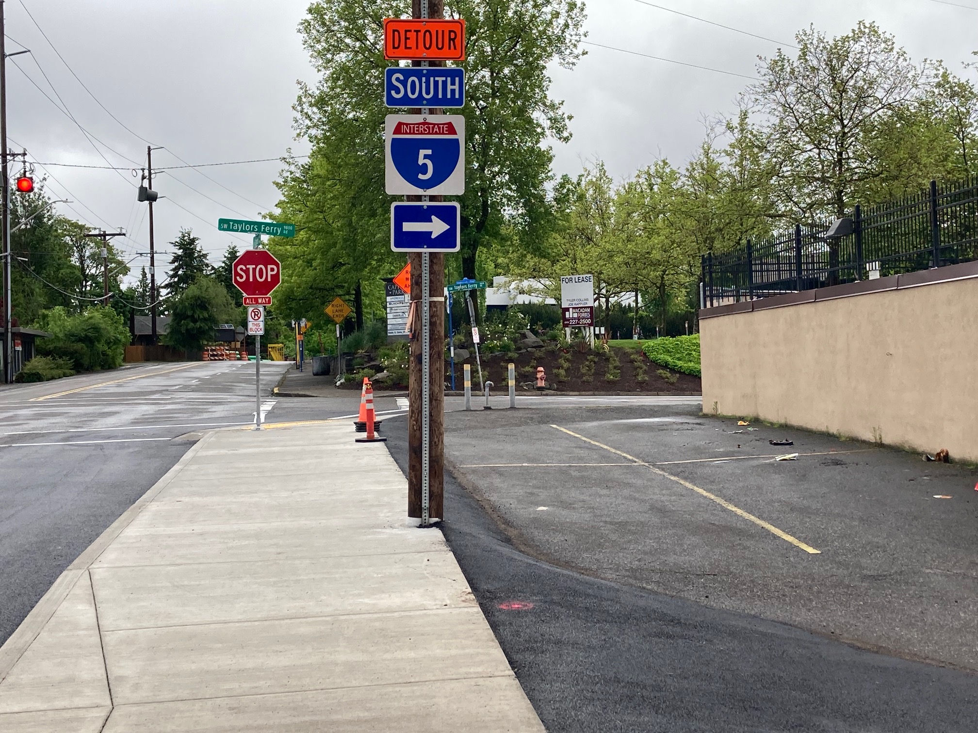
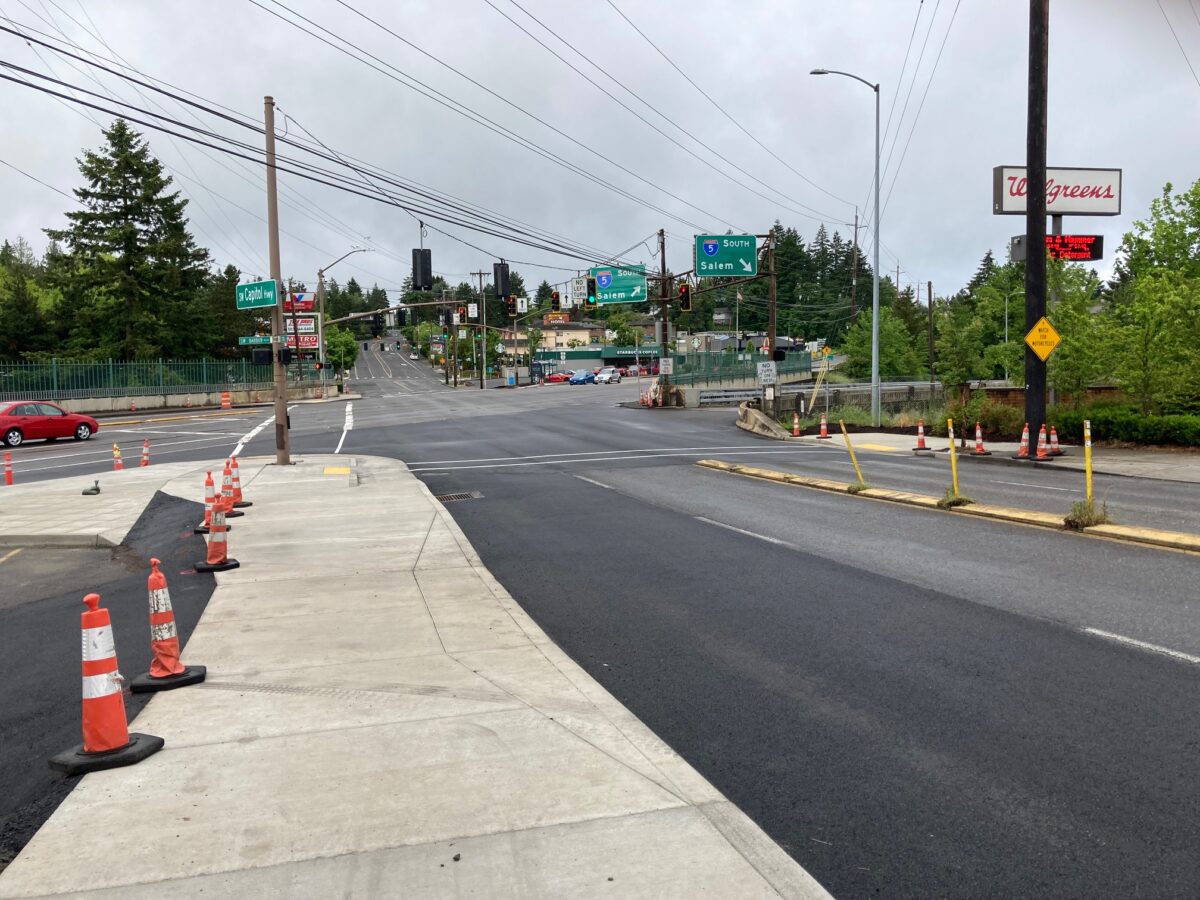
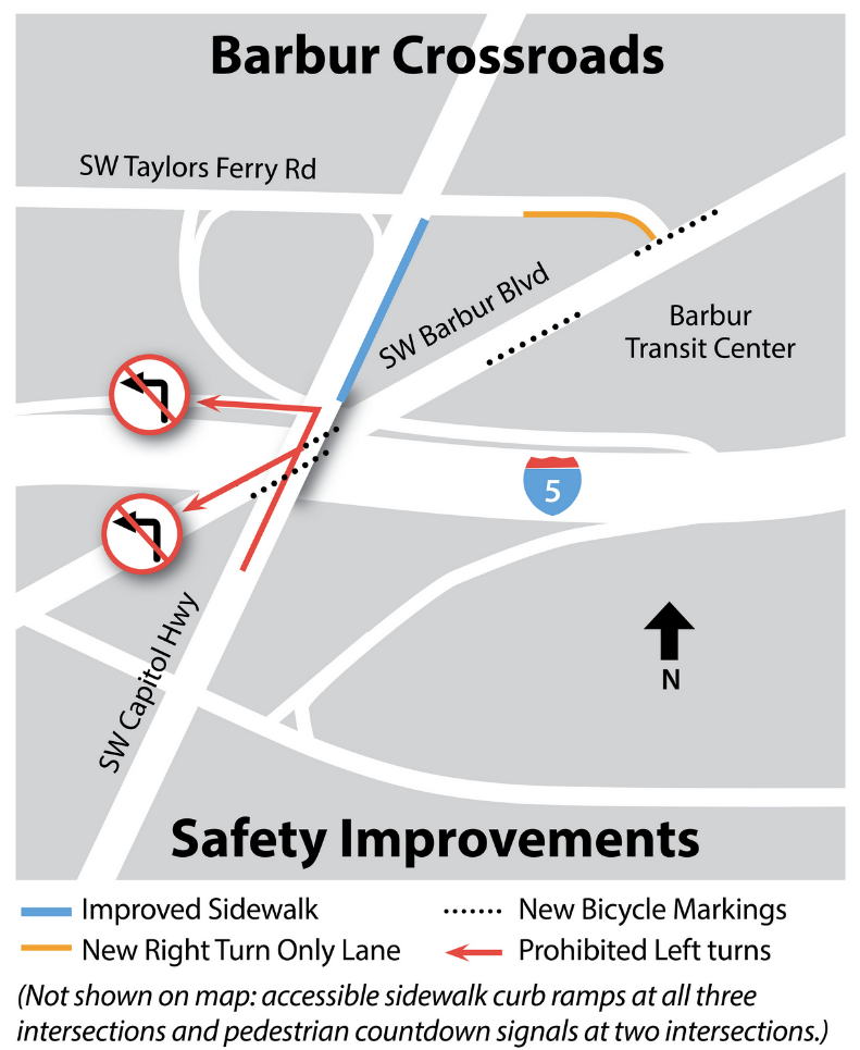
The Crossroads project also involved a change in traffic operations—the prohibition of left turns from northbound Capitol Highway onto both I-5 and Barbur Blvd, and the redirection of that flow into two right turns onto Taylors Ferry and Barbur Blvd (the “jughandle”).
The Barbur Crossroads is in the top 10% of dangerous roadways listed in the statewide Safety Priority Index System (SPIS). ODOT identified the left-turn conflicts as one of the main contributors to the 161 reported crashes in the intersection since 2008.
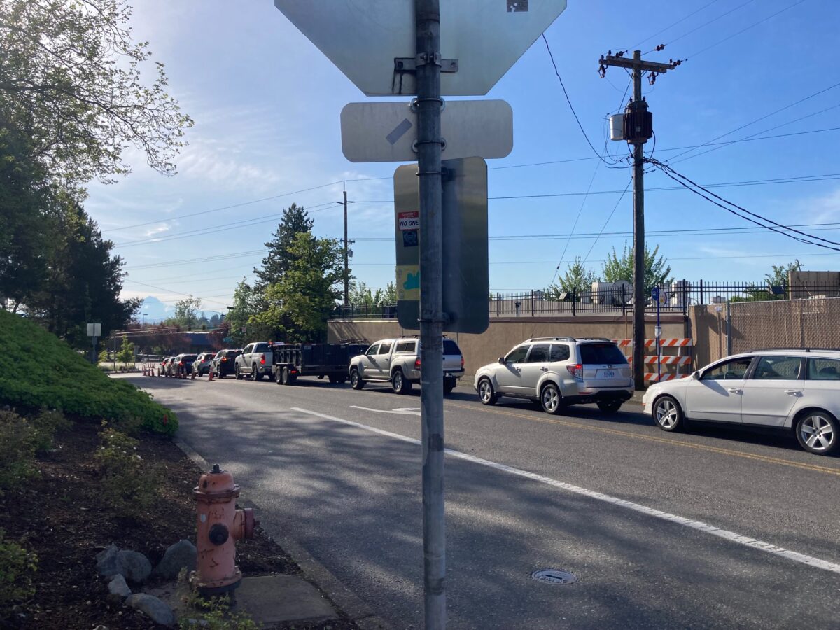
I visited the area a second time during weekday morning peak traffic to get a sense of how the left-turn prohibitions had changed the traffic flow. Car traffic was backed up on Taylors Ferry for the entire block between Barbur and Capitol Hwy, and also further to the west. Contributing to that congestion might be the Capitol Hwy detour which puts drivers on Taylors Ferry. Interestingly, with the slug of cars I watched, every driver turned left (NE) onto Barbur, nobody used the re-route as a jughandle for entrance onto southbound I-5. I concluded that, with Capitol Hwy to the north still closed, it was not yet possible for me to understand how the Crossroads projects would affect traffic flow.
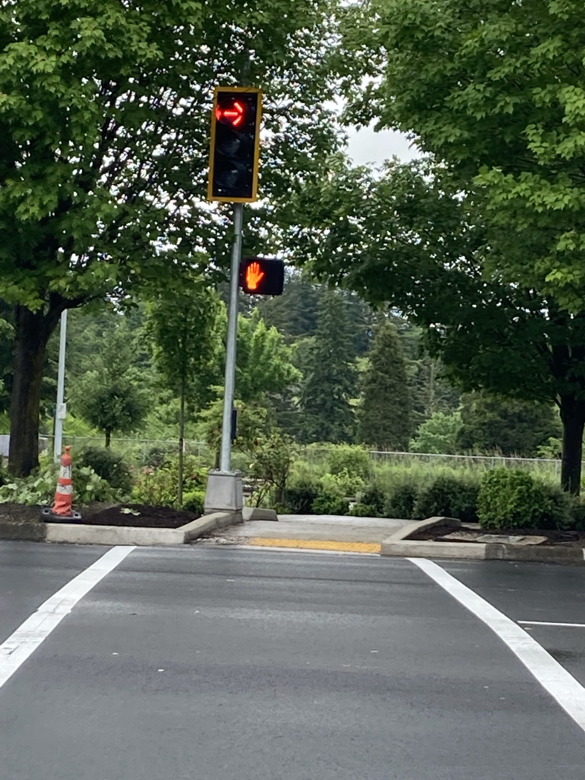
At the bottom of SW Taylors Ferry, at the intersection with Barbur Blvd, the traffic flow is split into a right and left turn lane. Drivers turning right onto the third leg of the jughandle can continue south on Barbur Blvd or enter I-5 south. It is this right turn that crosses the Safe Routes to School route across Barbur to Jackson Middle School. Transportation activists requested that ODOT install a light with a red on right turn phase, seen in photo below.
ODOT’s Barbur Crossroads project is expected to finish up this summer, and PBOT’s Capitol Highway project is projected to be completed at the end of the year.
The big stormwater basin on Multnomah Blvd
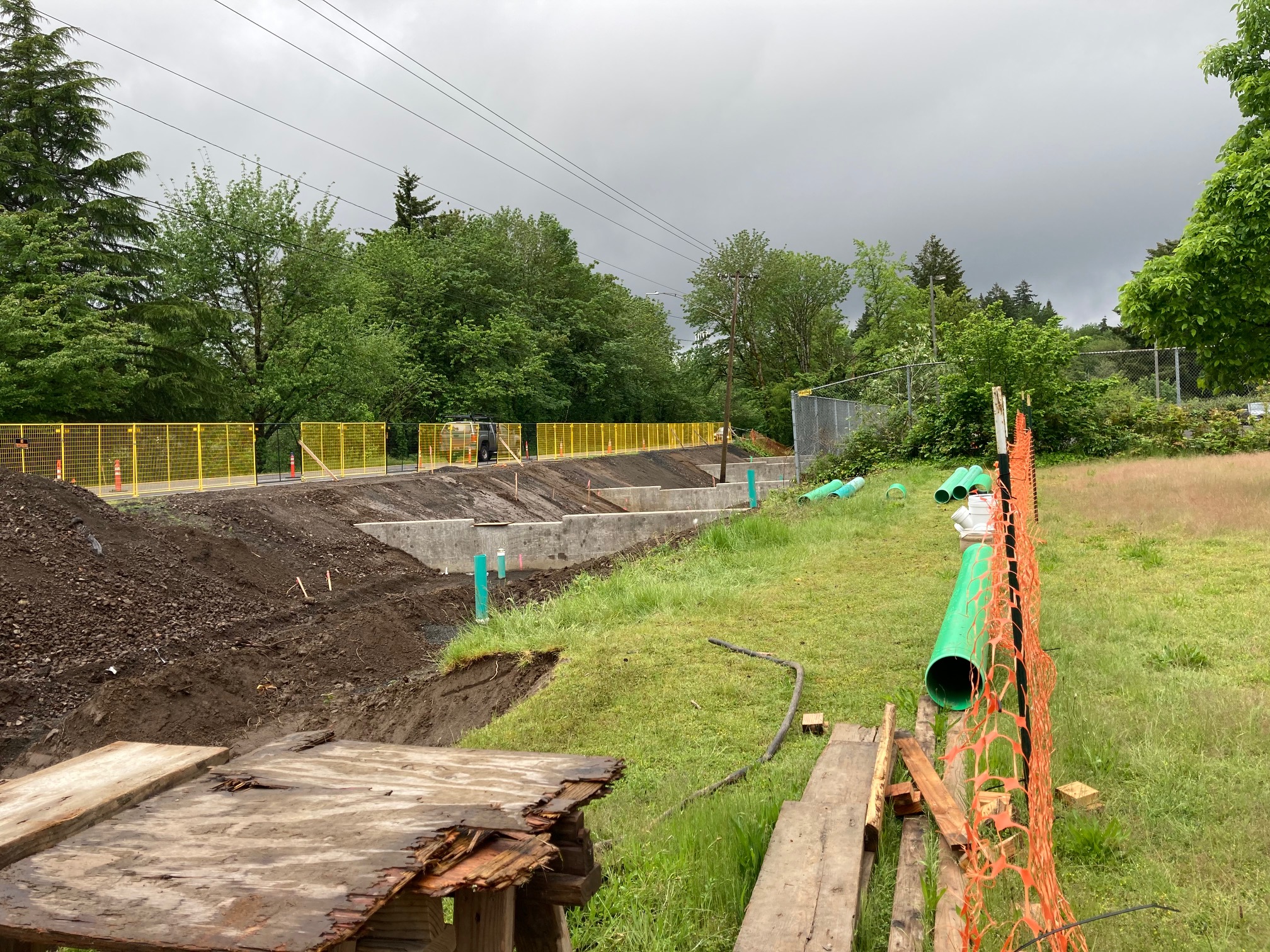
This is one of four stormwater treatment and containment basins associated with the Capitol Highway Project. We previously reported on the step by step construction of one of the smaller basins built at Woods Creek. The Multnomah basin is the largest facility, and it is huge. It sits just south of the US Post Office on 40th Avenue. The westbound Multnomah Blvd bike lane is closed along the length of the basin during construction.


Thanks for reading.
BikePortland has served this community with independent community journalism since 2005. We rely on subscriptions from readers like you to survive. Your financial support is vital in keeping this valuable resource alive and well.
Please subscribe today to strengthen and expand our work.
Thanks for the great up, Lisa. May I offer some (hopefully) constructive criticism? I appreciate your use of photos and graphics, but I could not understand the before/after photographs. I am not too familiar with this area, and the photos do not seem to relate to each other. It might be more instructive if the photos were taken from roughly the same vantage point, or are paired with a map showing the photogrpaher’s position.
Thanks maxD. That was my doing. Was just trying a new tool we have. Lisa already told me she doesn’t love it so I’m in the process of switching it to a side-by-side view.
The revisions are really helpful, thanks!
I remember walking the area with a group that included Marianne Fitzgerald about 10 years ago. Those new curbs aren’t tall enough, IMO – a local NC engineer once explained to me that if you are trying to prevent trucks from mounting the curbs, they need to be 18″ high at a minimum. Lane width determines traffic speed – 10 feet for 35 mph, 9 feet for 25-30 mph, so they ought to reduce the number of lanes for a few blocks in each direction and add edge lines on each side (sort of like unmarked bike lanes). Yeah, sure, there will be congestion for a few blocks, but traffic speeds need to be reduced anyway.
What a nasty set of streets, it reminds me of most of the highway intersections out here in NC…
Thank you for the project update. I love the before/after images.
The year might have been 2012, and perhaps you and Marianne were walking around with urban designer Ian Lockwood?
Marianne Fitzgerald is very unhappy with the jughandle design, as are Don Baack and Eric Wilhelm. It’s not just that they think it isn’t good, they think it makes the area even more dangerous. I cover their criticisms at the bottom of this article:
https://bikeportland.org/2021/05/07/car-centric-jughandle-but-no-bike-lanes-through-barbur-crossroads-330781
Ian Lockwood drew up some concepts for a true reorganization of this area for BPS. They were published in the 2013 Barbur Concept Plan, p. 45. You can see them here:
I don’t remember an Ian Lockwood, so I’m guessing it was 2010 or 2011, related to our common membership in the PBOT Bureau Advisory Committee. There were also several local neighborhood association members and others from the various districts from around town. It might have been a Pedestrian Advisory Committee walk, I can’t remember.
How sad that so much labor – from so many professionals as well as volunteers – led to such a crappy design and what I’m sure will be even crappier outcomes for everyone.
I ride through this intersection EVERY DAY and I always TAKE THE LANE. The design that has me riding on the sidewalk next to that awful liquor store and the wonderful Barbur World Foods? – not gonna happen. Cars blasting out of that parking lot don’t stop at the sidewalk – just at the road. Some cyclist is going to get badly injured or killed there.
Every project has an unstated goal, and I believe the unstated goal of this one is to get every person who drives a car in Far Southwest to avoid this intersection entirely. Any driver who gets stuck in the jughandle once will resolve never to do so again and thence get on I-5 south via the spaghetti intersection down the hill toward Tigard.
Hey, Lisa, thanks for the coverage about West Portland Crossroads getting worse, not better, for all modes. Two issues are a) the new traffic pattern which encircles the businesses within West Portland Town Center, and b) the new “multi use path” (MUP) that is supposed to take the place of real sidewalks and bike paths within the West Portland Town Center because it was cheaper and easier to build. It’s only been a few days so as Lisa said, most drivers are still using the familiar traffic patterns and ignoring the new signs. The second and more serious issue is the MUP on the east side of SW Capitol between SW Barbur and SW Taylors Ferry that greatly increased the slope between the concrete MUP and asphalt connection to the below-grade parking lots. This creates problems for everyone all around. First, cars have to hit the gas to get out of the lot and hope they don’t bottom out, therefore they might not see people walking or biking in the MUP. Second, the asphalt slope is particularly dangerous for anyone with a mobility device (wheelchair, walker, white cane) who could easily trip and fall while walking to stores or the “pedestrian plaza” in Lisa’s photo. Since this parking lot is for the only grocery store in the West Portland Town Center, if someone gets hurt while trying to access the grocery store, they are more likely to sue the local businesses rather than ODOT who designed this monstrosity. Third, ODOT put a new motor vehicle I-5 sign in the former loading zone for Barbur World Foods, thereby limiting their vendors’ ability to serve the store. I am very concerned about the negative effect these auto-centric improvements will have on the grocery store and other town center businesses we need in our neighborhoods.
This “barbur safety project” is targeted toward avoiding motor vehicle fender benders and the design is not at all concerned about people walking or biking or trying to access the businesses that we need to sustain a “town center”. Please contact ODOT’s PR person, hope.estes@odot.oregon.gov, with your feedback.
The “walk” that David mentioned was not the Ian Lockwood walk, but I’ve been walking anyone who is willing through this area, anytime. The Portland Planning and Sustainability Commission is making its final recommendations about the draft West Portland Town Center Plan on Tuesday June 14. Town Centers need to be designed for people. Not for cars. Except, it seems, if ODOT freeway ramps trump other modes, here and elsewhere.
Thanks, Marianne. One other thing to consider about blocking the BWF loading zone is that when it was unoccupied by trucks, cars would drive on the sidewalk between the BWF parking lots. Yes, ON THE SIDEWALK. I was almost hit there once by a car. So clearly that problem had to be fixed and if the new design fixes it, that’s a good thing, though I agree with you about the generally crappy and unsafe nature of the other “improvements.”
Yes, before the last ODOT “improvement” (ODOT added more motor vehicle lanes on S/WB SW Barbur about 15 years ago) this cut-through was a full fledged loading zone and motor vehicle travel lane. Some who were used to the former full fledged loading zone and motor vehicle lane have not changed old habits, especially when S/WB SW Barbur is backed up. I agree it’s dangerous. We have suggested removing motor vehicle travel lanes within Crossroads to make more room for people on bikes but that conversation has not gotten very far because of the freeway ramps.
Thanks for the updates!! (You might add text to the caption explaining the sliders on the before/after photos. I didn’t know they were there for the longest time, and just saw two poorly cropped photos 🙂
Awe thanks for this comment. Granted, I didn’t read the article closely, but it wasn’t apparent to me that I could slide the photos to transition between them, which made it all make a lot more sense.
It might work differently on different devices. I first read the article on an iPad and was also confused about the slider. It was more obvious on the desktop computer.
But I prefer a side-by-side comparison because it shows how subtle the changes to the walkway are.
Also, there is a photo of the driveways which Jonathan accidentally dropped. Just like the front end of the site has changed, so has the back end!
I’m excited for Capitol Hwy to open up, will finally be able to go down to World Foods on bike. But wow, what a sad intersection that is being updated to be just as disappointingly car dependent. ODOT should just pay PBOT to do anything within Portland as its clear ODOT can’t be trusted to make safe, complete streets.
Thanks for the update! I saw the no-left-turn last night on the way to Tigard Fred Meyer and had to use the jug handle. I think this definitely makes it safer for cars as there were many questionable left turns and questionable lane changes behind the people waiting to turn left. I don’t think this makes it safer for bikes.
Going Southbound on Capitol, biking on the curb across those driveway ramps will be super sketchy. Bikes would have been safer with a lane in the street to give cars a better angle to see them.
I have a similar issue with the bike lanes going Northbound from PCC to that intersection on Capitol Hwy. On the steep, downhills descent it’s easy to go 20-25 mph on a bike, but cars turning left or right onto Capitol Hwy from the neighborhood streets have no horrible sightlines to the bike lane and will frequently plan on not stopping until their bumper is physically in the bike lane. I had a few close calls and eventually just stopped using the bike lane on the descent. If people think the answer is for bikes to squeeze the brakes and go 10mph down a hill when they have right of way, then something is wrong, IMHO.
Do you mean northbound from PCC?
Your observation about being safer for cars but not safer for bikes gets to the heart of the criticism of the active transportation advocates. They would add not safer for people on foot either. I don’t use the intersection enough to have a granular opinion about some things, but when I look at the big picture, including the city wanting the area to be a town center, it seems like a more ambitious, and costly, design is needed to make the area truly vibrant.
Yes, northbound – thank you! I agree with you completely about any real change coming with a very big price tag. Thanks again for the continued SW coverage – it’s much appreciated!
You nailed it, fishy! I’ve complained to the city about the sightlines at the intersections on SW Capitol, but no one has done anything. Someone will need to be killed before the city will take any action, unfortunately.
I commute through the construction on Multnomah Blvd daily, and in my (morning/evening) experience the flaggers have been wonderful when it was closed to single lane, either giving me and other cyclists priority through the lane, or waving us through the coned off lane. I appreciate that they have prioritized our safety.
On the subject of safety I would like to see significant changes to the Garden Home/ Multnomah/ SW 69th mess of an intersection at the Old Market Pub.
Yes, that’s a bad one where the cars turn and move out of their lane and the bike lane narrows. I think all these 35 mph streets near these neighborhoods need to be dropped down to 30 mph with a bit of street furniture to encourage the change.
The intersection at Old Market Pub will be re-done soon – the design is done. It’ll be a regular T-intersection and each street will get its turn – blah. I wanted a roundabout.
Ooh, that would have been nice! When I lived near Ladds Addition I loved the roundabouts.
I voted for the roundabout, too. 🙁
The right arrow needs to have a “no right on red” sign. Last time I looked up the relevant Oregon laws it said right on red was permitted even when there is a red arrow.
I looked it up because there is a right arrow at 99W & Hall (right from southbound hall onto southbound 99W) and was curious if I could go through or not after watching folks take the free right without triggering the red-light cameras.
Thanks Andrew, I’ll give rewording the caption a shot.