
(Photos: Jonathan Maus/BikePortland)
The Portland Bureau of Transportation recently put the finishing touches on two new neighborhood greenways in east Portland. Known as the “130s” and the “HOP,” the projects add nearly seven miles of “low-stress, family-friendly” bike routes to a part of town that desperately needs them.
I rode both of them last week to get a closer look.
The 130s

The 130s is so named because it follows a north-south route that generally stays within a few blocks of 130th (if you’re new here, this naming convention applies to lots of greenways). It starts at SE Foster Road and goes about five miles north to I-84. PBOT began construction in summer 2019 and just finished up this year. The route alternates between 128th, 129th, 130th, and 132nd — all of which have been updated with speed bumps, 20 mph signs, sharrows, crossing upgrades at major streets, and so on.
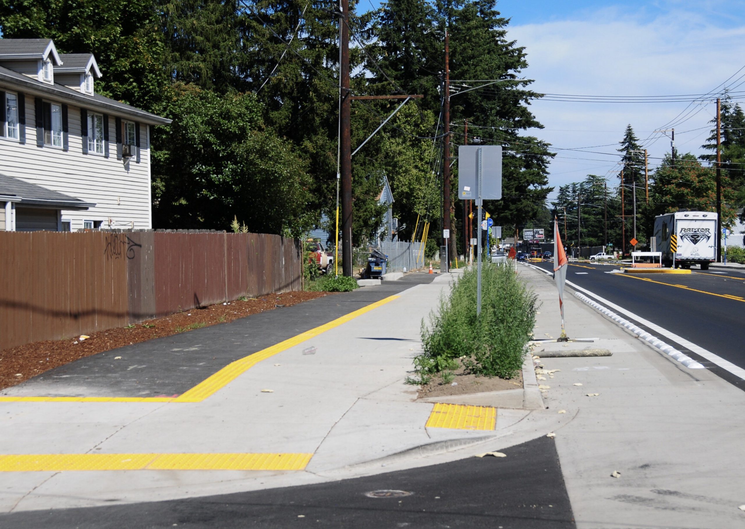
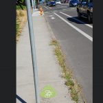
I started on the 130s at 128th where it meets the Springwater Corridor path where the land-use is classic Portland suburban/rural with no sidewalks and low traffic volumes. Things were calm until I got to SE Holgate where there’s a jog over to 130th. To make the crossing a bit safer, PBOT added a buffer to the bike lane and installed crosswalks (see below). Even though Holgate is narrow and has just one lane for drivers in each direction, people still drive too fast. It would be great if greenway crossings always came with some sort of traffic calming on the larger streets.


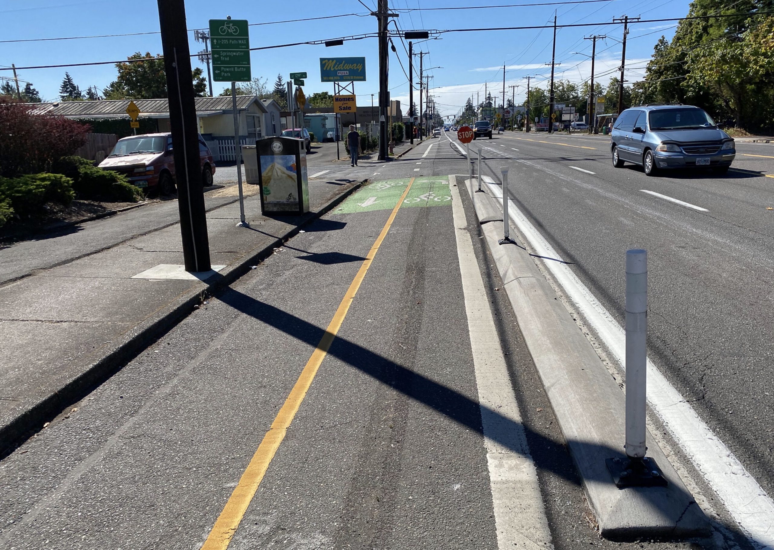
The next big crossing was SE Powell (Hwy 26) where the route jogs a block west to 129th. Riding northbound there’s a new signalized (flashing beacon) crosswalk and median that leads to a protected bike lane on the north side of Powell. If you were riding southbound, I think the idea is to go east on a new path paved next to the sidewalk on the north side, then use the new signal. ODOT is working on their Outer Powell Safety Project in this same area so we’ll soon have protected bike lanes which should make this crossing even better.
Advertisement


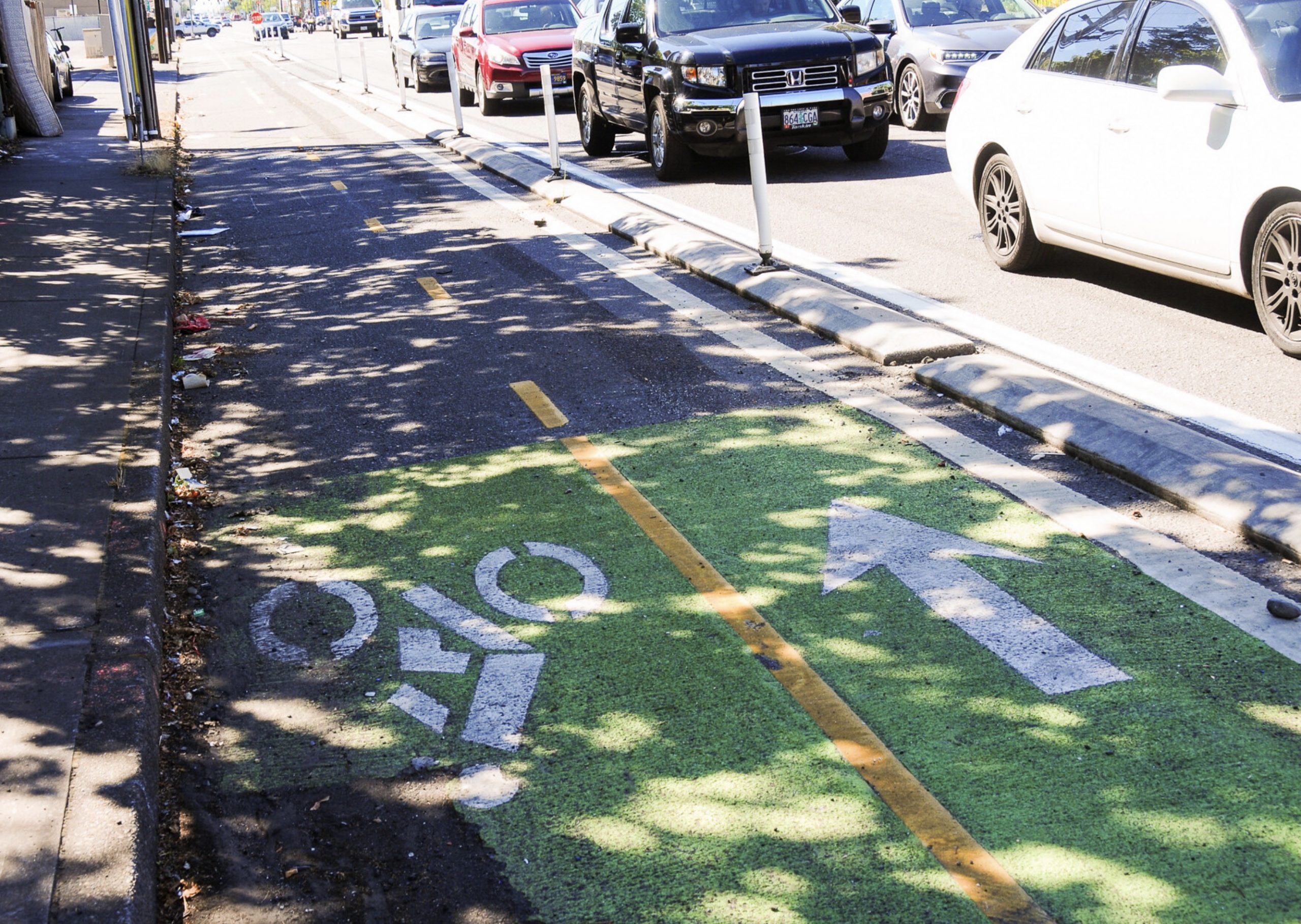
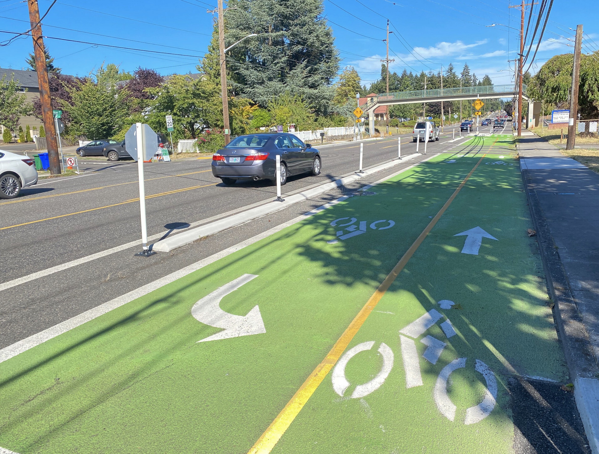
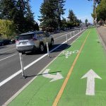
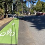
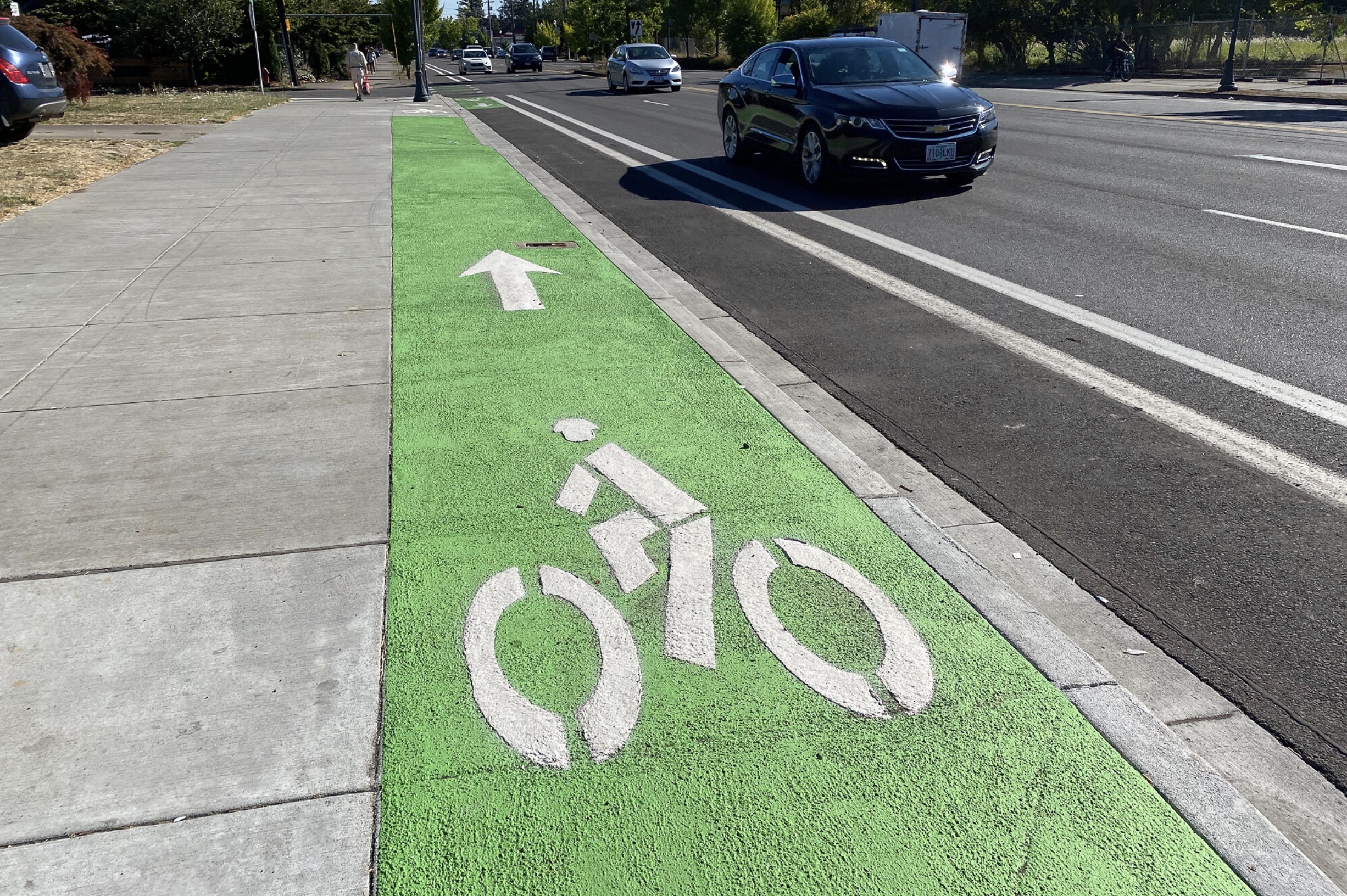
At Division the route jogs east back to 130th. Division is wide and sketchy arterial with multiple traffic lanes. To facilitate the bike crossing PBOT has built a two-way protected bike lane on the south side. The lanes are protected by a concrete curb, buffer striping, green coloring, plastic wands, and reflectors. Even so, being surrounded by so many loud and fast drivers raises my stress level quite a bit.


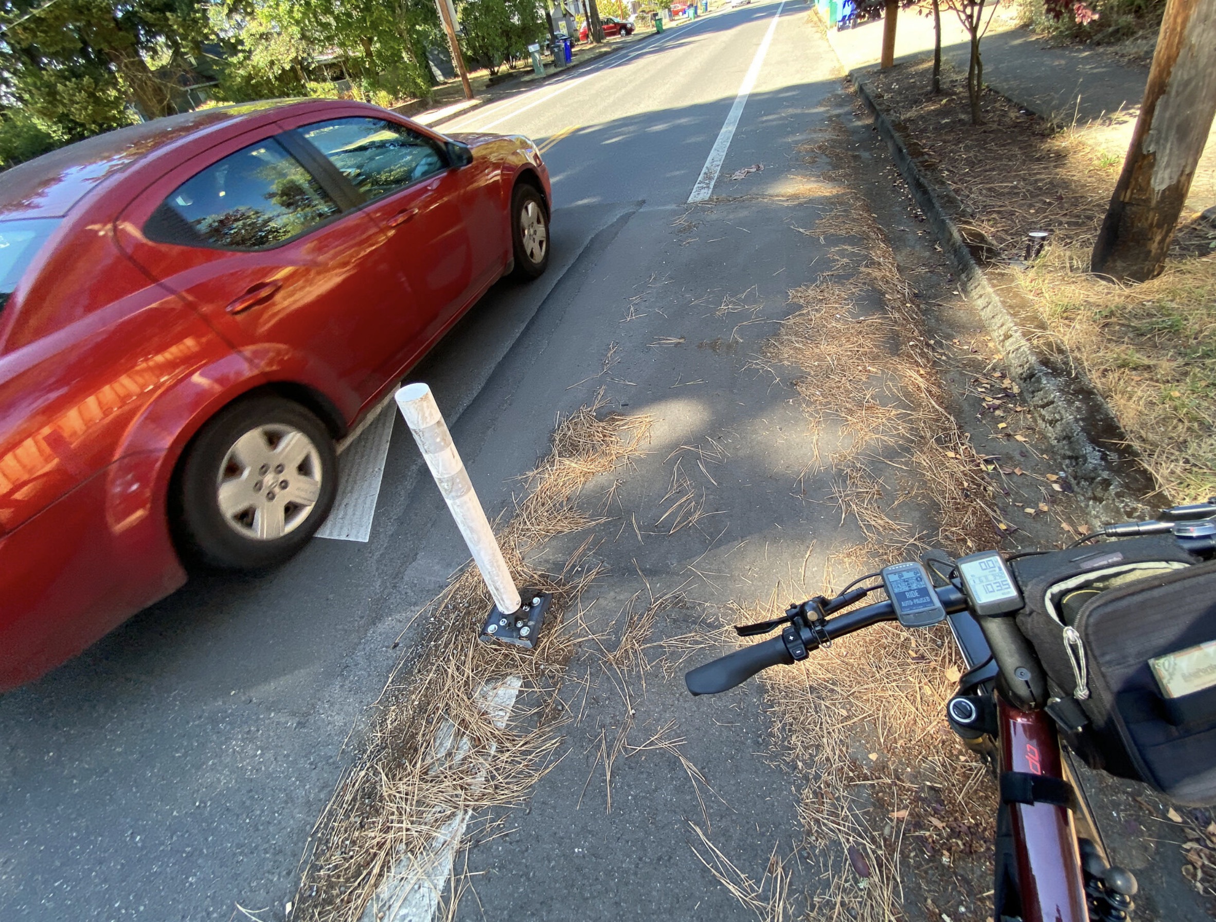
Between Stark and Division PBOT has installed “fire-friendly” speed bumps, owing to its designation as a first-responder route. These bumps have four large grooves intended for tires of fire trucks and ambulances. As I’ve documented previously, I don’t like these. The majority of drivers illegally swerve into the grooves, which means they can avoid slowing down and they put themselves (and others) at risk for collisions. The bumps also go well into the bike lane which creates a bump for riders (who don’t need it) next to a gutter which collects debris.
Advertisement


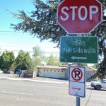
At Stark the route once again makes a jog west to 129th and PBOT has created a two-way facility to help make it happen more safely. This time they’ve decided to route southbound bicycle riders onto a sidewalk between 129th and 130th where there’s a new crosswalk and signal. Northbound this isn’t too big of a deal since Stark has a buffered bike lane (why all these buffered lanes don’t have physical protection is a mystery to me!). But southbound, getting onto the sidewalk requires riders to cross in front of drivers turning off Stark northbound on 129th. This could lead to a collision. The sidewalk route itself is not ideal. PBOT has placed little green pavement markers to help guide the way, but the sidewalk is narrow and you’ll be sharing the space with others.


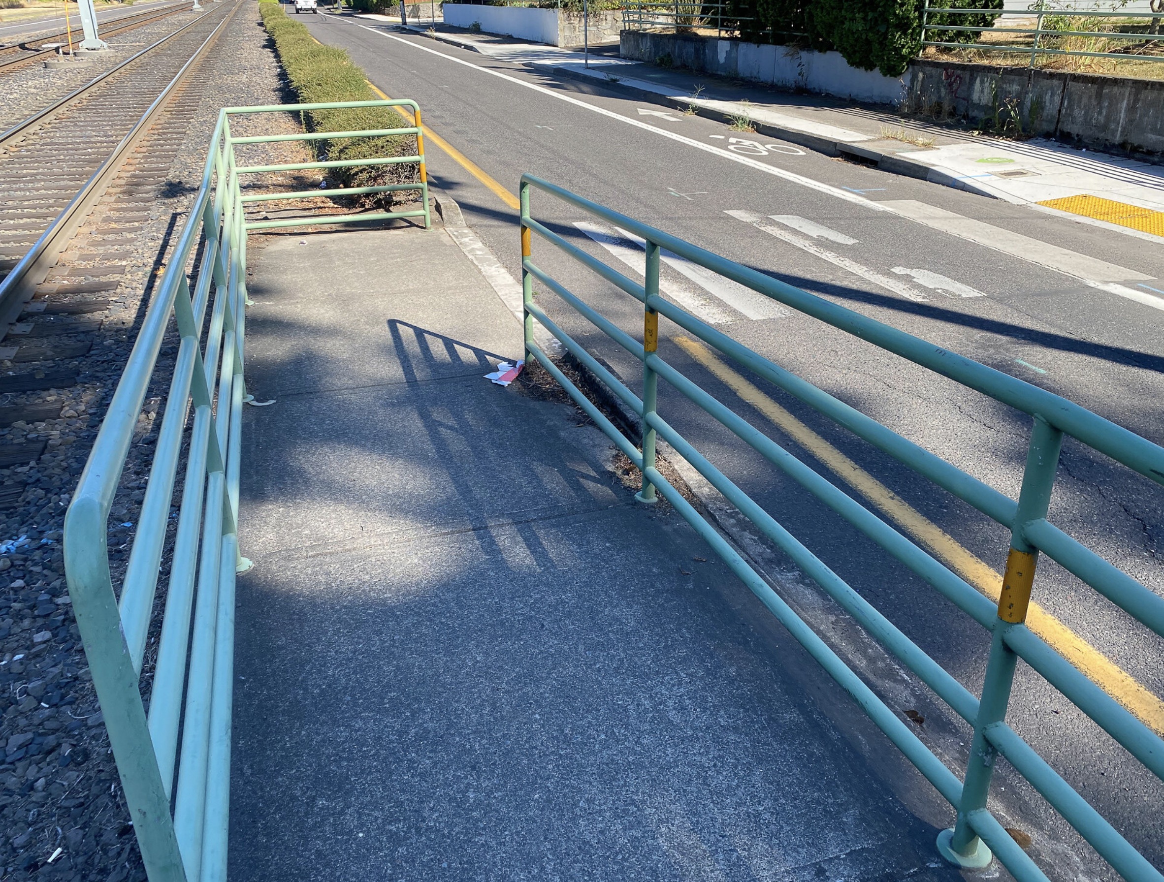
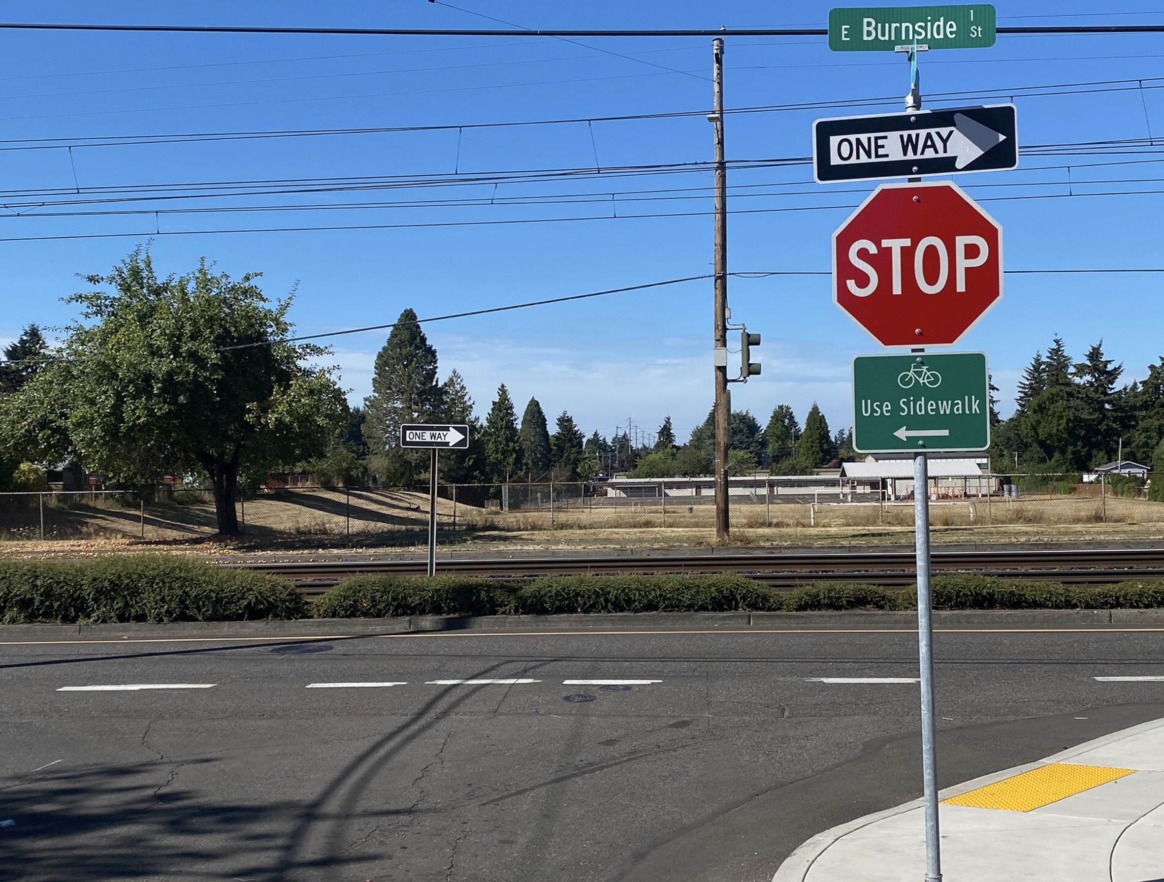
Continuing northbound I came to Burnside, which requires another one-block jog east to get to 128th. Since Burnside also has a MAX light rail in the middle of it, this crossing very constrained. The route took me onto the sidewalk following those green dots again and then directed me over the rail tracks via a narrow sidewalk hemmed in by railings. These tight corners will be difficult and/or impossible for people riding large cargo bikes or pulling trailers.


The next crossing I came to was at Glisan near Menlo Park Elementary. I shared a preview of this project when it was built last year. With two-way protected bike lanes on both sides of the street, and a flashing beacon crossing built right in front of the school, this is one the most thoroughly designed and capital-intensive bike crossings in Portland. It works well and feels safe, but it feels a bit ahead of its time — given the low cycling rates in this neighborhood and with the school being so quiet these days.
Advertisement


Let’s go to the HOP
North of Glisan I connected to the new HOP neighborhood greenway and headed west. The HOP stands for Hassalo/Holladay-Oregon-Pacific, the three streets that a new, $1.5 million greenway relies on to get from Glendoveer Golf Course in the Hazelwood neighborhood to the Gateway Transit Center at I-205.
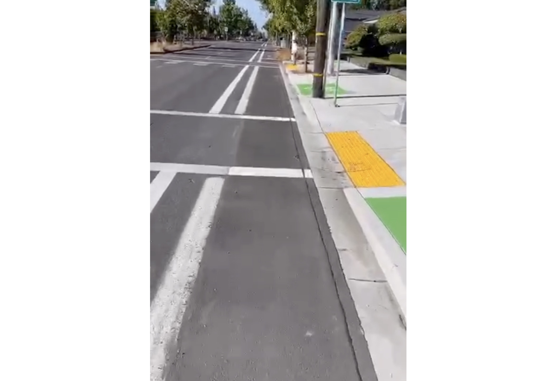
The residential street portions of this new route are chill and calm and aren’t worth discussing here — except for two newly paved sections. As part of this project PBOT laid down fresh pavement where there used to be gravel and potholes on NE Oregon between 110th and 111th and NE Holladay between 118th and 119th. I’ll focus my report on the two major arterial crossings and the connection to the transit center.


At NE 122nd PBOT needed to create a safer crossing to keep people on the route because NE Holladay is off-set by about 250 feet. Their solution is another two-way protected bike lane and a new crossing with a flashing beacon. Riding westbound it was easy to roll into the new protected space. At the crosswalk there’s a button-activated flashing beacon and a cross-bike that worked like it was supposed to (the people stopped for me immediately). Coming from the east to cross 122nd, I had to cross oncoming traffic to get up onto a new bike-only sidewalk that positioned me at the new crossing.


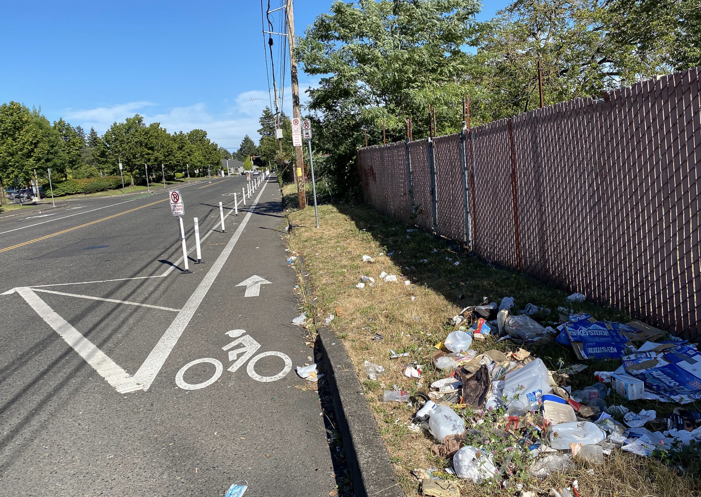
The next big arterial I had to deal with on the HOP was 102nd Avenue. The route at this point had me on NE Pacific and I faced another off-set crossing situation. PBOT handled this one a bit differently (the lack of consistency is problematic). Heading west from Pacific, I took an unprotected bike lane with a buffer northbound and then was routed up onto the sidewalk to get into position for the signalized crossing. For people going eastbound on the HOP at Pacific and 102nd, PBOT routes the greenway to a new bikeway built on the eastern sidewalk.

The last section of the HOP took me directly to the Gateway Transit center where I could connect to bus/MAX or get onto the I-205 path. To help make this connection, PBOT has added an unprotected bike lane for westbound traffic (adjacent to the shopping center) and a parking protected, curbside bike lane eastbound.
Advertisement

I found the eastern end of the HOP disappointing. I didn’t find any clear connection to the transit center itself. I mean, this is a major transit center and the bikeway just seemed to fizzle out. I didn’t see any clear signage and there certainly wasn’t a protected space that got me all the way to a place to park my bike and get onto transit. Also, the eastbound bikeway to 102nd was littered with debris and overgrown vegetation. It makes no sense to invest in a new bikeway if we don’t make it great at the connections!
Takeaways
Overall, it’s fantastic to have these greenways completed. East Portlanders have been waiting a very long time. The lack of street grid and high speed of drivers makes every bike network investment important out there. While I focused on the crossings, what’s really great about these new greenways is how they will help people find their way between neighborhoods. I love knowing that no matter where I’m at in the city, if I’m on a road with sharrows and speed bumps, I know it’s the safest route to be on — and that it will connect me to another route. I can get across the entire city simply by following the sharrow breadcrumbs.
The lack of consistency in the treatments and all the sidewalk routing is troubling (and it’s not limited to these two projects). There’s a lot of non-intuitive bike traffic movements that people in cars and on bikes will have to get used to. That learning curve makes me nervous because it could result in a lack of enthusiasm for riding or more risk for those who do it.
And finally, we must do more to tame high-speed traffic on arterials. PBOT is making strides here (they just got approval to lower the speed limit on 102nd), but they’re not moving fast enough. It doesn’t matter how good our low-stress greenways are if the crossings are high-stress. A chain is only as strong as its weakest link, remember?
Get out there and try these new greenways. I’d love to know what you think.
(P.S. If you follow BikePortland on Instagram you got the first-person video version of this report already! I plan to do more of those, so stay tuned.)
— Jonathan Maus: (503) 706-8804, @jonathan_maus on Twitter and jonathan@bikeportland.org
— Get our headlines delivered to your inbox.
— Support this independent community media outlet with a one-time contribution or monthly subscription.


Thanks for reading.
BikePortland has served this community with independent community journalism since 2005. We rely on subscriptions from readers like you to survive. Your financial support is vital in keeping this valuable resource alive and well.
Please subscribe today to strengthen and expand our work.
Great review of an important new set of projects in much neglected East Portland. I’m really glad you pointed out the inconsistency in crossing treatments along this route. The inconsistency in bikeway designs has been a concern of mine ever since the left handed bikeway on N. Williams. I assume that PBOT designs bikeways based on the specific conditions at each project area and while that makes some sense, I think prioritizing designing around current conditions tends to favor drivers of automobiles at the expense of those riding bikes or pedestrians. I also think the inconsistency ultimately makes navigating the roads more difficult for automobile drivers as well.
Thanks for doing this report Jonathan (and the Insta videos last week)! It’s true that the “imperfect grid” of East Portland led to some creative solutions for crossing the arterials.
Because of that, we created a couple of videos about the new Neighborhood Greenways to help folks get a preview and feel more comfortable when they actually ride the routes. The First Look at the 130s and the First Look at the HOP are linked from the GoByGreenways.org page, but I thought a direct link here might be of interest.
And lastly thanks to Jim Chasse, David Hampsten and all the members of the East Portland Action Plan Bike Subcommittee who were so generous with their time and wisdom about traveling East Portland by bike!
Jim Chasse should be given credit for figuring out the 130s route in 2009-10 and Richard Bixby, who ran the EPCO/EPNO office for 20 years at 115th & Holladay, was the person who told us about the HOP connection. We met PBOT staff in a series of meetings at Muchas Gracias at Wasco and 102nd, in 2009-13 to develop these two routes, plus the 150s and the 4M. (Roger Geller designed the 100s route.) Much thanks to PBOT’s Timo Forsburg for encouraging us to meet and articulate our designs to city officials and Dan Bower for getting the funding. The 130s was a Tier 1 project that was supposed to be implemented 2012-13 right after its funding but kept getting endlessly delayed and redesigned, along with the 4M and outer Powell. The HOP was Tier 2 with the 100s and 150s routes, which are also funded, plus Division and NE Sacramento.
I’m glad the 130s and HOP are completed at long last. I agree they aren’t perfect, but now we have something to improve rather than wait to get started. The speed pillows on 130th are for the David Douglas School District yellow school buses; the fire engines already use alternative routes.
When comparing stress levels of infrastructure, try riding on 122nd or Division first, then these routes. Comparing outer Portland bikes routes with inner ones is pointless, IMO.
What is the current status of East Portland’s premier east-west route, the 4M, on SE Market, SE Mill, SE Millmain, and SE Main?
David, I’d like to thank you, Jim Chasse, as well as the many other volunteers involved with the EPIM process.
If PBOT builds out the 100s*, 150s, and 4M in the next two years (like they say they will), I might even be willing to take their claims that they are newly focused on “equity” more seriously.
*still incomplete
Of the 3 main N-S routes (100s, 130s, 150s), the 130s was the least technically difficult, as it had no gravel streets to pave. All the routes involve jogs or crossings of exceptionally dangerous high-crash multi-lane arterial streets. The 130s has always had strong support from EP neighborhoods, business associations, Metro, the county, ODOT, and even TriMet. The main opposition came from the school districts and internal staff from PBOT, who would give us very uninspiring words of wisdom:
“No one will use it.”
“It will be transformative for East Portland cycling, of course, but we are prioritizing other parts of town.”
“We had a recent conversation with a neighborhood along the route and they oppose it.” When pressed about when that recent conversation took place, it was 19 years previously, a definition of “recent” that I hadn’t heard before.
“The Fire Department opposes it.” (They didn’t care one way or another when we asked them directly.)
The 150s is the next easiest, it has paths through Parklane and Glenfair parks and a very steep grade at Halsey. It goes through what is probably the lowest income part of the city.
The 100s has lots of technical difficulties, including gravel streets, oil-paved asphalt streets that need rebuilding, parks to pass through, plus it goes by a private hospital, a community center, and the East Precinct police station (site of recent riots within the last 19 years.) It also has more choices of which streets to use – it could be 100s or 110s. It’s really two parallel routes.
This kind of gas-lighting by city employees is all too common.
Like the 130s, the 100s was repeatedly scheduled for build-out and repeatedly delayed. The most recent cancelled build-date was in the summer of 2019:
https://www.portlandoregon.gov/transportation/article/651634
The HOP route also had terrible gravel sections and it’s unfortunate that it was completed without also building the critical 100s link to the Weidler-Halsey couplet (the only proposed low-stress connection, IMO).
The 150s will be one of my favorite neighborhood greenways when it’s completed but I’m pissed that the path through parklane park was dropped. It was also scheduled for build out in 2019 but was again delayed without explanation:
https://www.portlandoregon.gov/transportation/article/651636
Last I heard the 100’s and 150’s build out will occur in 2021 except for the crossings on Powell Blvd. They will be built by ODOT by 2023 during the remainder of the construction of Outer Powell.
I’m thrilled the HOP and 130’s projects are almost complete (the signal on Powell is still not activated).
These Bike facilities provide not only great low stress movement throughout east Portland by bike, but also crossings at main arterial streets for both bikes and pedestrians (something that wasn’t even on PBOT’s radar).
It’s sad the city didn’t prioritize these projects for funding and construction by 2017 which was the original completion date for the East Portland In Motion plan. A 5 year implementation plan passed by city council in 2012. PBOT continues to under fund the remainder of the projects, or delay their build out. To be fair, the EPIM plan has provided miles of sidewalks and multiple, safe crossings for east Portland residents. Still a lot of work to do.
Jim, you, Katie, Brian, Walt, Timo, and I rode the 130s and HOP route together only a few dozen times. Is what has been constructed so far what we envisioned? Does it satisfy? (I’m in NC and likely won’t be back in Portland for a year or two, so you and the others still living there are my guide, and Google Street View is a lousy substitute.)
David, It’s what we envisioned though the crossings and wayfinding signage could be better.
What many people don’t realize is the effort it took to produce the EPIM plan considering the difficulties posed by the Blue line and utilizing existing crossings for the North/South bikeways.
I’m afraid the 150’s will be a more challenging route to follow as PBOT was unable to convince the Reynolds School district to commit to a MUP through their property north of Parklane park.
The 4M will also not be a direct route from 162nd to the city limits. PBOT would not consider the $11 million in street improvements to safely provide bike access.
Also note that these bikeways will not be considered Neighborhood Greenways in certain segments because PBOT changed the rules for Greenway auto volume since the EPIM was done. Hope you are well.
Regarding the “4M” — if you mean the extension of the Lincoln-Harrison greenway past Mt Tabor into East Portland — it’s good. I ride it fairly often. You can get all the way to Gresham via those roads plus the bike path next to the Max lines going east from Burnside at SE 202nd.
Would you ride with an 8 year-old on it? Or your mom? Is it safe for them, in your opinion?
I rode them both last week after I received a mailer from PBOT abut them(I live east of 82nd in the Montavilla neighborhood). I rode mid-day on a weekday and for the most part found the routes refreshing calm. Some areas were familiar to me, but parts of the 130s route south of Stark were completely new to me and it was good to get a ride through that neighborhood.
As you mention, some of the main crossings are problematic and/or confusing. The lack of consistency (and signage in places) was frustrating, and I had to backtrack a couple times to figure out what the intended route was. I’m still not sure what’s up with Division (I was southbound) and I don’t think I crossed as intended by designers. South, then west, cross, then east? I dunno. The work on Powell is impressive, but not yet complete, and the day I rode, the crosswalk for the route was roped off with tape and cones and still under construction. That said, these two routes definitely fill a void in outer east Portland.
Some Neighborhood greenways connect community resources, thinking about N Central in StJohns which connects the central business district,3 schools, the library and 2 parks. Not so much connection out here, Gilbert Heights, David Douglas and Menlo Park schools and not much else. I guess because at this point, there IS no there, there.East Portland is a works in progress, but I hope safe(r) connection encourages some of those community pieces.
The 130s connects the Springwater MUP near Gilbert Middle School with the vastly underused I-84 MUP near the campus of the (private) University of Western States. In between are several parks, an existing local neighborhood greenway on SE Bush, numerous churches, a couple of public elementary schools, and the largest public high school in the state of Oregon, David Douglas. Unlike inner portland, the 130s connects to an existing network of on-street bike lanes on the major arterial roads (which badly need upgrading) on NE Halsey, NE Glisan, E Burnside, (soon to be on SE Stark), SE Division, SE Powell, SE Holgate, and SE Foster. It intersects the 4M at SE Market and SE Mill near the David Douglas High School campus and Lincoln Elementary. Nearby are several large public housing projects and numerous dilapidated affordable-by-accident housing developments with the largest concentration of BIPOC residents that the city currently has.
Many of the early inner portland neighborhood greenways didn’t connect anything to anything else either, such as Lincoln-Harrison or the Clinton greenways. They were created as non-controversial central spines that other routes were later added upon that did connect to useful places. It’s the same with the 130s and 4M – they create a central spine that additional local greenways can easily connect in, to eventually create a complete network. Unlike most of inner portland, East Portland already has an extensive network of on-street painted bike lanes on most of its arterial roads (put in by Multnomah County before annexation) – they need upgrading to protected – but again it’s politically easier to upgrade an inadequate existing facility than to create a brand new one, as folks in inner portland are discovering the hard way.
The HOP is a local connector, one of I hope many others, that connects the 130s to something useful, in this case to two shopping districts, the “main street” of East Portland (122nd), the East Portland Neighborhood Office, two local parks, and the busiest MAX station in the system.
I mean, aside from Mt. Tabor and Ladds Addition, what does Lincoln-Harrison connect? Or even more utterly useless, the Ankeny/Everett/Burnside Greenway?
The three greenways I use the most are Lincoln/Harrison, Ankeny, and Going. They are all used to get between work in the CEID to home in NOPO while avoiding super sketchy bike infrastructure with many large an dangerous gaps. I I don’t why you would characterize them as useless since I see lots of people of all ages and riding styles (and running, walking, etc) using them throughout the year.
I think you missed the sarcasm in DH’s statement. TLDR: You need to build the central spine of a network somewhere, and often the route of just the spine itself doesn’t seem to be that important. It’s once all the other routes connect to that central spine that you see it’s importance in the whole network.
Exactly. I myself have used the Ankeny and Lincoln greenways numerous times, love them all, and they are all busy, but none of them directly connect to anything – they are a bit like freeways in that respect.
signage and wayfinding need some work. Esp the crossings of Division and Powell, already intimidating streets.Coming from the North, Division sends you down a contra path for a block and if you don’t catch the sign on the N side of the street it leads to major confusion. Powell lacks a crosswalk and has you ride the sidewalk once you get across, but not marked visibly. That said, anything is an improvement.
PBOT is presently running a “Zebra” scavenger hunt that covers the 130s and HOP. Find the green zebra signs along the routes to be entered into weekly prize drawings plus two $500 prizes at the end of the contest. More info can be found at http://GoByGreenways.org
Jonathan said ” I love knowing that no matter where I’m at in the city, if I’m on a road with sharrows and speed bumps, I know it’s the safest route to be on — and that it will connect me to another route. I can get across the entire city simply by following the sharrow breadcrumbs.”
I wish that were true. I find that I can’t count on the sharrows and direction-finding signs. They frequently are missing at key turns, leaving me to depend upon Google Maps to find my way around the bike routes. That was certainly true of the 130s and HOP bikeways, a week ago, when I rode the same route as Jonathan described in this article.
Hi Mark,
Good point. I agree that the “just follow the sharrows” method isn’t perfect 100% of the time. Another caution about relying on sharrows for wayfinding is that the markings are very often paved over or destroyed whenever there’s a pothole filled or pipe/utility work is done, etc…
Mark, Great point, and I second the sentiment. Greenways SHOULD be safe, direct, and well-connected, but that is seldom the case.
This whole new network connects at the Gateway Transit Center & 205 bike path, which should be an awesome network connection spine…but isn’t. It’s hard to get to the transit center from the western part of the bigger bike network. I live just west of 82nd, and south of I-84. Getting across the maze of MAX/84/205 is such a hassle. The I-205 bridge crossing at Glisan isn’t really any better after all the “improvements”, and then it’s north on the path (with all it’s usual problems) to the access to Pacific.
We rode out that way to Gateway Discovery Park for the parkways last year, and I was surprised at how close it was, but didn’t like making those on-ramp crossings on Glisan with a kiddo. Hoping for better connectivity once the Halsey bike path goes in, the 205 undercrossing happens, and the new red line access comes to the top of Gateway Green. That’s all a long way off, though…
Hopefully once we have a Sullivans Gulch multi-use path that connects downtown to Gateway, and better infrastructure connecting the Gateway hub to Gateway Green, the connection of all these routes in East Portland will make more sense.
The primary point of neighborhood greenways is for bicycling as transportation, rather than casual recreation – getting workers to their jobs and expanding opportunities, getting students and teachers to schools, connecting to transit, taking care of errands.
The inner Portland network is designed to get people from the relatively low-density single-family neighborhoods to downtown, PSU and Pill Hill. The East Portland network is designed to get East Portland residents to their jobs, very few of which are downtown (less than 10% according to the B of Planning & S), but are predominantly in the Columbia Corridor, Gresham/Troutdale, Clark County, and Clackamas County, or within East Portland itself. Connecting to inner Portland isn’t a very high priority for East Portland (nor does connecting to East Portland has ever seemed to be much of a priority for Portland either.)
The SG trail requires both lots of cash and the full cooperation of Union Pacific Railroad, both of which are less likely than America ending racism. If fact, you would save a lot of money and angst by making the entire length of Halsey bus&bike only, and it would be politically easier, IMO.
RE: Speed Cushions,
“As I’ve documented previously, I don’t like these. The majority of drivers illegally swerve into the grooves, which means they can avoid slowing down and they put themselves (and others) at risk for collisions. The bumps also go well into the bike lane which creates a bump for riders (who don’t need it) next to a gutter which collects debris.”
You did a study to determine ‘majority”? On SE Harrison about 87% of drivers are on the correct side of the center of the street, and there is much more opportunity for violations on such a low volume roadway with no centerline marked.
The use of the channel is a known issue, that’s why the shorter bump design was used (14 foot instead of 22 foot tables). This also minimizes the reduction in slowing.
“Illegally”, is false, unless they are driving on the centerline. Unsafe and illegal are also not identical.
Then, having complained about the channel and swerving, you complain about having a bump in a bike lane, apparently disconnecting how less safe no bump in the bike lane would be for cyclists due to swerving. We define need differently.
It was all my opinion paikiala. Sorry I didn’t make that more clear.
Fact is, many people who see these type of bumps swerve into the grooves. That is unsafe. They also don’t slow down. That is unsafe too.
You wrote, ““Illegally”, is false, unless they are driving on the centerline.”
But the photos show that one of the channels is on the centerline, so cars that use the channel to avoid the bump ARE driving on the centerline. So describing it as “illegal” is accurate. In other words, “”Illegally is true, because they ARE driving on the centerline”.
As I clearly wrote. It is possible to put the right wheels in the right channel and not touch the centerline.
Cyclists still have to make 14 turns to go the same distance that drivers go without making any turns. Drivers also get stop lights at major crossings and dedicated lanes the entire route.
When the city starts caring about transportation safety then it will be obvious because of the huge uprising from drivers.