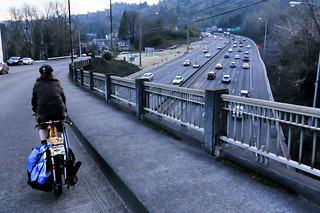
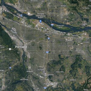
As promised last month, all this week, Michael Andersen and I will be working and riding in Southwest Portland. The goal is to gain a better understanding of that part of our city (its people and places), and share what we learn and see with all of you.
The weather, topography, and distance from both of our houses (I live in north Portland, Michael lives in northeast) will make things a bit more challenging, but that’s all part of the experience.
Advertisement
Before we get things started, here’s how our story list is shaping up:
- A jaunt up to Council Crest, one of Portland’s most iconic rides.
- A close-up look at the SW Corridor Plan.
- The latest on SW Barbur and what next steps will activists have to take to make changes happen.
- Bike shop visits and news updates (there’s some big news to share!).
- Places to ride: A look at the best pubs, cafes, parks and other destinations.
- People on Bikes, SW Portland edition.
- A special edition of our Friday Profile with a southwest theme.
- The good, the bad, and the ugly of southwest Portland bikeways.
We’re excited to learn more about this great part of our city. We’ll also be posting to Twitter (using #swpdxbikes) so make sure you follow along there too.
We’ll be here in Southwest all week! And join us Friday afternoon for a BikePortland Get Together and social hour at the Lucky Labrador Public House in Multnomah Village (7675 SW Capitol Hwy) from 4:00 – 6:30pm.


Thanks for reading.
BikePortland has served this community with independent community journalism since 2005. We rely on subscriptions from readers like you to survive. Your financial support is vital in keeping this valuable resource alive and well.
Please subscribe today to strengthen and expand our work.
Please remember the updates for the future Red Electric Trail, new bridges over Fanno Creek, boardwalks in April Hill Park and SW Johnson Street, and lower speed limits on both Multnomah Blvd and SW Vermont Street.
I enjoy seeing the new Riversgate Church in Multnomah Village.
If you have time, I’d love to hear your take on the close-in SW–our lack of connections in many spots, the poor condition of so many of those connections (WA Park connections to NW24th for instance, the potholes on Kingston, etc.), and of course the choices we make because of topography, Burnside, Skyline, etc. Personally, I feel our little section of the city is ignored. But there are a ton of us around here who ride–and we do have SW Fairview, Council Crest (which you’ll get to) and Hewett. Enjoy!
West Burnside needs an overhaul. Even SW Barnes Road has a sidewalk from St Vincent hospital and past the QFC grocery store.
I hope you ride on Boones Ferry so you can experience a real adventure.
It needs a new bridge over Tryon Creek
http://swtrails.org/2015/01/28/boone-ferry-trail-bridge-report/
When you’re looking at the SW Corridor Plan, be sure to review the Barbur Concept Plan, which is the City’s take on the land use opportunities along the corridor – where the ‘great places’ should be.
yes Boones Ferry all the way from north to south ;-P BTW I have been riding Fanno Creek for like 4 years.. very interesting! live in Wilsonville and ride to Beaverton/Portland alot
THPRD has removed many weeds along the Fanno Creek Trail lately.
Good luck and safe riding out there in the bike “wilderness”.
Does BikePortland have an administrative policy that all of its staff cannot travel on the same plane, bus, MAX …or bike lane in [SW Portland+}. What is BP’s “line of succession” contingency plan?
Fanno floods after heavy rain it can be a huge pita trying to stay connected to the path when it happens, oh they put a cross signal wanna say at hall, almost been hit 3 times by ppl that blow the red during blinking light :/ becareful if u use it.
The Fanno Creek Trail underneath Scholls needs a cleanup.
That is only a trail in the summer. In the winter it is part of Fanno Creek.
Welcome to SW. It would be interesting to look into the impact of the number of government agencies on the various routes and infrastructure. For example, I live in unincorporated Washington Co. Depending on my route, a ride to the store can go through Portland, Beaverton, Tigard, or a combination of all. And then there are the parts of the route that fall under the jurisdiction of THPRD. Even with a map, it can be hard to tell who is responsible for any given stretch of road.
ODOT controls SW Beaverton Hillsdale Highway from Highway 217 until SW 65th Ave which is the county line. The bike lane on that highway starts / ends in the 67th block.
A couple of history notes…
In 2002 when OHSU sought city permission to expand (and thus generate more traffic), it promised to mitigate traffic on key SW streets, including Patton, Humphrey and Dosch. The promises were not enforced. See http://www.portlandoregon.gov/bps/article/58712
In 2005, Portland & Multnomah county adopted a joint Transportation System Plan for the Urban Pockets of Unincorporated
Multnomah County that included a call for a new bike/ped connection between SW Humphrey & Hewett so that people in the Humphrey Park neighborhood would have an alternate way out. But city staff have repeatedly disregarded this plan. Indeed, when a subdivision of 4700 SW Humphrey Blvd. was planned, staffers reviewing the application excused the developer from having to conform to city policies for this area that would have required new bike/ped connections. The excuse was that it would be unsafe to encourage people to walk or bike on Humphrey… which ignores the fact that people are already walking and biking the road and contradicts the designation of Humphrey as a City Bikeway and City Walkway.
Twenty years ago, there was a wonderful collaboration between the city and the neighborhood that resulted in filling the gaps between sidewalk sections on SW Patton between Humphrey and Strohecker’s grocery store. but inside of heralding an era of innovation, the city then retreated… just making excuses when pressed for improvements.
Making new connection in the SW hills is tougher than on the east side, but too often the city has failed to really try.
oh fanno is really ” MUP ” path but its tricky riding it because lotta diffrent types of users on it, one time this lady’s dog attacked my ankle :/ as I passed slowly and her leash was sprawled across trail.