Third in a week-long series about the BTA’s five new advocacy campaigns.
With almost every street project that isn’t happening in Portland, the city’s stated reason is that it doesn’t have the money. A long-discussed couplet of north/south protected bike lanes through downtown is the exception.
As we’ve been reporting, the city has enough money lined up, thanks to a $6.6 million Metro grant for downtown active transportation improvements that took years to secure. What’s still missing is political support.
The Bicycle Transportation Alliance launched a campaign this month aimed at lining up that support among “civic, business and elected leaders.”
BTA Advocacy Director Gerik Kransky said that even though downtown is far and away the most popular destination for bike-commuting, it’s a yawning gap in the city’s network of low-stress bike routes.
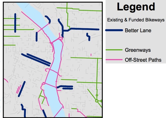
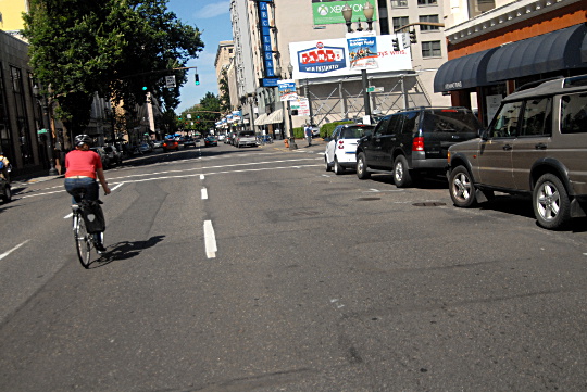
“You get into downtown and it’s gone — there’s nothing left,” Kransky said in an interview. “Though we’ve got the wide painted bike lanes on southwest Stark and Oak running east-west, we don’t have a corollary facility running north and south through the central city.”
“I think it’s an opportunity for us to make a big bold political statement about committing space on a major thoroughfare to bikes,” Kransky said.
Which major thoroughfares, exactly? That’s still an open question.
Routes still being decided
(Photos: M.Andersen/BikePortland)
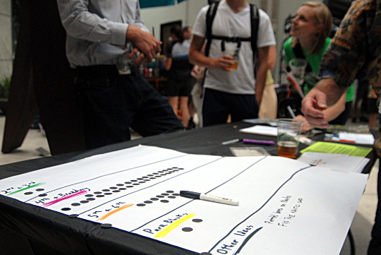
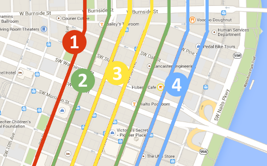
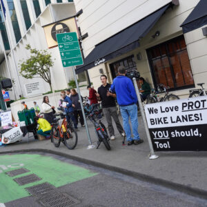
At the BTA’s members meeting this month, people who stopped by Kransky’s table had a chance to vote on their favorite route for a north/south couplet: 2nd/3rd, 4th/Broadway, 5th/6th or the park blocks (presumably 8th, 9th and/or Park).
Another possibility might be a bidirectional bike lane on only one of those streets, similar to the design Seattle is about to open on its 2nd Avenue downtown. About a third of the country’s 164 protected bike lanes are bidirectional, almost all of them on one-way streets.
Advertisement
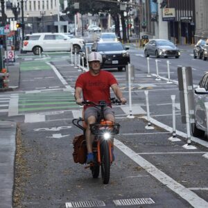
At the BTA meeting, a 4th/Broadway couplet was far and away the popular favorite, in part because Kransky was (as he put it) shamelessly arguing that it’s the ideal route, thanks to its connection to the existing protected lane on Broadway near Portland State University, the existing buffered lane on the west landing of the Broadway Bridge and potentially the N/NE Broadway protected lane that the BTA is also gathering support to build.
Meanwhile, a group of Old Town businesses has been urging the city to consider protected lanes on 2nd and 3rd Avenues to reduce speeding and car/pedestrian conflicts on those streets.
Kransky said one of his main concerns is that the city will use a paint-only design that doesn’t actually prevent motor vehicles from encroaching or parking on the bike lanes.
“You could imagine a world where you could create a paint buffer, a la Broadway at Portland State University, for pennies and then there’d be a lot of money for other stuff,” Kransky said. “There’s a lot of money there, and what we would like to make sure is that we get a truly world-class facility built. I would imagine we’re going to need most of that money if not more.”
On the other hand, Kransky said it’s reasonable for the city to dedicate some of its $6.6 million budget to planning and community outreach.
“One of the lessons that I learned from the failure of the 20s Bikeway conversation … was that the city didn’t necessarily have the right approach when it comes to community engagement,” Kransky said.
Quick take: BikePortland’s summary of the project
Where the idea came from: Dan Bower, the former manager for the city’s active transportation division, was the longtime point person on this project, which has been seen as a complement to another project he spearheaded: a public bike sharing system. Bower left the city last spring, after securing funding for both projects. They’ve been on the city’s back burner since.
What it might cost: A bike lane that’s elevated from the roadway, as in Copenhagen or Indianapolis, might cost $16 million to $50 million for two miles (one mile north, one mile south). Planters or concrete curbs, as in Seattle or Vancouver BC, would cost less than a million, but more if dedicated bike signals were added.
Obstacles: If either Broadway or 6th is involved, downtown hotels are certain to be concerned about front-door access for taxis and customers. Last year, the Portland Business Alliance successfully opposed converting a general traffic lane to a bike lane on Southwest 12th Avenue, a street that rarely sees any congestion. For this project to work, the plan will need to address block-by-block design complications and also contain some antidote to the notion that the most valuable street is one that can carry and park as many cars as possible.
Finally, the Portland city council seems deeply reluctant to do anything that might improve biking — and thereby attract the ire of people who oppose biking improvements — until a new citywide transportation fee or tax is approved. “My read on the politics is the street fee has to come first,” Kransky said.
Likely tradeoffs: Either a parking lane or a general travel lane, maybe more, on any affected street. At least a few parking spaces would probably have to go away for the sake of improving visibility. If the lanes were to go on 5th/6th, the change would be simple — no car turns onto the transit mall — but might draw more opposition.
How you could help: The BTA isn’t really asking for much help on this campaign at this point. It’s circulated a petition in print but hasn’t yet posted an online version. “The most important thing would be standing up in support of cycle tracks, period,” Kransky said.
Check back each day this week for another post in our series about new advocacy campaigns.


Thanks for reading.
BikePortland has served this community with independent community journalism since 2005. We rely on subscriptions from readers like you to survive. Your financial support is vital in keeping this valuable resource alive and well.
Please subscribe today to strengthen and expand our work.
I can’t decide which streets, either. Let’s do all of them!
5th/6th? what about the midblock parking garage driveways at several locations?
Alternatively, let’s do none of them.
If every lane is a bike lane, why not place sharrows on all the downtown lanes at the beginning of every block?
2nd and 3rd or 3rd and 4th would be really ideal. They all have 3 lanes and are very rarely, if ever, even close to capacity.
‘very rarely’? Maybe, but the few hours they are, the congestion is intense and localized, usually near the bridge roads over the Willamette.
A “few hours” of intense congestion is an overstatement (there are generally only cycle failures for 30 minutes or so unless an incident on a bridge or highway is mucking things up downtown), but that’s beside the point.
We now know from 50 years of experience widening intersections and adding capacity to mitigate peak hour congestion will only lead to higher volumes and more congestion. So the fact that our streets operate at capacity at the peak is the best argument you can wake for _removing_ motor vehicle capacity and repurposing this space as something that has vastly greater person-capacity. Like a bike lane.
what we would like to make sure is that we get a truly world-class facility built…thanks to its connection to the existing protected lane on Broadway near Portland State University
Chris Monsere’ report on the SW Broadway protected bike lane:
Over 40% of cyclists stated they had been involved in a near-collision with a pedestrian…One cyclist and two pedestrians surveyed stated
that they have been involved in bicycle-pedestrian collisions on the cycle track.
Cycle-track cyclist counts show a decrease in numbers
Many survey respondents who currently cycle along the cycle track
indicated that they previously cycled on SW Broadway less frequently
(38%) and/or chose alternate routes (30%).
http://bikeportland.org/wp-content/uploads/2011/02/PSUCycleTrackBBLReportFINAL.pdf
Two can play that game!
“Over 70% of survey respondents indicated that the cycle track made cycling on SW Broadway safer and easier, and that the cycle track made for a better cycling environment in Portland. Concern about the threat of being “doored” (e.g., having a car door open into the pathway of the bicycle) by a motor vehicle was substantially lower in the cycle track when compared to a standard bike lane (36% vs 95%).”
“Surveys indicated that 97% of cyclists always or usually ride in the cycle track when riding on this section of SW Broadway…. When comparing the prior bike lane configuration to the cycle track design, the percentage of cyclists riding in the motor vehicle lane decreased from 12% to 2% of riders”
“Cycle-track cyclist counts show a decrease in numbers, though our one-day comparisons are not of the same time period. The “before” video was taken during PSU’s spring term, while the “after” video was taken over the summer break. Many survey respondents who currently cycle along the cycle track indicated that they previously cycled on SW Broadway less frequently (38%) and/or chose alternate routes (30%).”
This is not a “game” for me. This was my commute route. And it’s not just me since my concerns about pedestrian conflict are echoed by survey participants. Moreover, the fact that 40% of people surveyed on or near the facility state that they either avoid or have stopped using the facility suggests it’s not perfect. (The many people who switched to SW 5th were not captured by Monsere’s survey.)
I’ve also stated multiple times that I would like to see this facility improved and have offered specific suggestions (curbs or low barriers instead of parked cars). Signs would also cut down on ped vs bike conflict.
Do you work for Alta or another transportation planning firm, maccoinnich? I’m just asking because I’m pretty sure your staunch defense of a facility designed by Alta might then represent a conflict of interest.
You keep saying that nearly 40% of people are avoiding the facility, but as I pointed out to you in the NW Everett thread, it doesn’t say that. It says the opposite: 38% *previously* cycled on SW Broadway less frequently.
No, I don’t work for Alta, or any similar organization. That accusation is a really weak argument against me. My interest comes from the fact that I live in NW, on the edge of downtown, and want to see better cycling facilities in Portland’s central city. I don’t think SW broadway is perfect, or is the right model for every street. I do think that right now, however, it’s the best street to cycle on Downtown.
I apologize — I did misinterpret that statement.
I do think that right now, however, it’s the best street to cycle on Downtown.
That is not saying much given the complete absence of bike infrastructure downtown.
Some of the bike-ped conflicts on the SW Broadway cycle track are no doubt due to its unique location alongside PSU’s campus where there are a ton of pedestrian volumes. I think the, um, interesting signal timing decisions contribute to bad ped behavior as well, since the ‘Walk’ display shows for a ridiculously short period (about 3 seconds out of every 45 or so).
That study was also completed pretty immediately after the cycle track opened, and of course it was a new and unique thing back then. My own (admittedly anecdotal) observations from living four blocks away from it for a few years is that all users needed some time to “figure out” the design. It works much better then than it did in 2011.
I’d also note that Monsere’s later work found that usage skyrocketed on facilities where protection was added. That this appears to conflict with the result obtained in this study is worth looking into.
It’s easy to cherry pick pieces of research to support this claim or that one. But when approached with an open mind, what this and all research offers is an insight into what might be working well and what might not so that we can design future facilities accordingly, considering the findings in tandem with observations, context, and common sense.
That the “future facilities” have yet to manifest is the problem here.
http://greenbikeloop.weebly.com/#/
People need an alternative to Broadway, one that is practical for commuting, and can serve all of downtown from top to bottom. When we talk about 4th or 2nd, the conversation necessarily leaves out connections. How do we get to these bike lanes? We need a safe route for the entirety of downtown, and for ALL types of riders. The Park Blocks can be this.
I think we need a N-S connector close to the river and one further from the river. Along with Naito and the Park Blocks, this would give great comprehensive coverage for N-S biking throughout downtown. Perhaps 4th or 5h, and again on 12th would give us, in order from East to West:
Naito (2-way bike lanes)
4th or 5th (Northbound)
Park Blocks (8th and 9th, N & S)
12th (2-way bike lanes – contraflow?)
Thats my $.02 after biking through downtown for the past 11 years.
I wonder if, instead of one “fancy” set of north/south bike lanes/cycle paths for $6MM, it might not be better to have two “not-so-fancy” sets. For example, one set on 2nd/3rd and one set at the Park blocks or on Broadway.
This is because, I suspect, most people aren’t willing to ride very far out of their way just to get to a street with a bike lane. A couple blocks, maybe.
Agreed. Convenience is likely the most common factor among riders once they get near their destination. Every lane is a bike lane.
Here’s to setting up a “cycle track” jar where people have to give a dollar every time they use the term (which is completely confusing to the public).
While I say go with the polling and use separated bike lane, at least go with protected bike lane.
Related: can we get a decent lane on SW Main right after the Hawthorne Bridge? It kills me that the great infrastructure of one of our best “bike bridges” just straight up ends as soon as you hit downtown. (And after that maybe we could do something about the Burnside entrance into downtown too.)
THIS.
Based on my experience I’d say Burnside needs it more. Traffic is coming 35-45mph off the bridge and there are a lot of right hook opportunities… plus bikes really have nowhere to go. And Couch is not a viable alternate street for biking with a string of terrible intersections (including Broadway with the mass non-compliance at the stop signs and crosswalks by drivers).
Agreed. I wish I could remember where I saw it, but someone has done concept drawings for extending the Burnside bridge bike lanes as far as the Park Blocks (after which the right-of-way narrows). It wasn’t part of the Burnside-Couch couplet, because it showed Burnside remaining a two-way street. I thought it was PBOT, but I can’t find it anywhere. It could have been an advocacy group. I would love to see that happen.
Couch isn’t viable for now, but I recall that a signal IS one of those rainy day projects the city has in mind.
FWIW I prefer Davis. From the waterfront, it’s your first/last chance to cross Naito. From the Burnside, an extra block buys more time to move safely into a left turn position. It works for everyone.
Riding east on Burnside toward the Burnside Bridge is not too bad. Cars going straight almost always avoid the right-most lane, because drivers know it is clogged with buses and right-turning cars. So bicyclists and buses pretty much have that lane to themselves, from about Park St. It is quite rideable, although you need some patience if you get stuck behind a bus. Conceivably that right-most lane could be designated/marked as only for bikes, buses, and cars turning right. This marking might encourage more cyclists to use it, and for drivers it wouldn’t change the status quo.
Riding west on Burnside leaving the bridge is a problem. I think curbside parking should be removed and a bike lane installed for the first couple of blocks, long enough to let bicyclists connect to the nearest north-south bike lanes – e.g. to the 2nd/3rd couplet if that is the chosen option. There are essentially no retail businesses there – just the missions and social services offices, whose “customers” don’t arrive by car (although they seem to often leave via ambulance, so emergency vehicle access is required). There is just a single restaurant (Alexis Greek Restaurant). I’m not sure how bikes would turn from west-bound Burnside to south-bound 3rd, but simply crossing 3rd and lining up at the traffic light is an option (similar to the turn from Weidler to Williams).
I didn’t get into it in this post, but bridge connection improvements like this are also often mentioned as an (additional? alternative?) way to spend the $6.6 million. If you think this is a higher priority than north/south lanes, I’m sure both the BTA and city would like to hear from you directly on this point.
I’d be happy if they simply repaved the first two blocks of SW Main west of the Hawthorne bridge.
Prioritize investment in the uphill (southbound) direction. You can practically coast down 2nd or 4th and match prevailing speeds and signal timing. Broadway or 3rd is where you need separation.
That is true for the fast and bold cyclists. But if one thinks that bike infrastructure should accomodate slow and timid riders (the “8 to 80” mantra), then one would want bike lanes going downhill as well.
Hear, hear! Now invoking the ALL AGES theme. As often as we can, let’s remind these discussions that people of all ages are riding bikes, not only the commuting set.
That’s why I said “prioritize” — I doubt we can afford world class facilities everywhere, so let’s spend more money on separation on the streets that have a lot of speed differential, and provide something more bare-bones on the streets that have fewer inherent conflicts.
Go ahead and put in all the protected bike lanes you want, but do so only with the explicit understanding that they will not eliminate safety issues at the frequent and numerous driveways and intersections at which turning maneuvers occur on the downtown street grid, and then ONLY if the state legislature repeals the mandatory bike lane use statutes (ORS 814.420), allowing cyclists to choose not to use these potential death traps without fear of police enforcement.
Luckily, downown doesn’t really have that many driveways, at least on N-S streets. At least not compared to many of the streets in more residential neighborhoods or commercial corridors outside of downtown.
As a young male rider, our biking infrastructure needs to be able to safely accommodate children.
If it doesn’t, its a failure! Cities should be an environment designed for people, not be a “survival of the fittest/luckiest.” Its not like we are unable to afford it.
Children are not motoring and polluting our shared environment. I strongly believe we should emphasize facilities that get more adults to cycle.
I lived in Indy prior to Portland and experienced the cultural trail. Bring the physically separated lanes to Portland!
The city already has some potentially world class bikeways downtown, all they need are some sharrows and diverters to make it happen. 5th/6th and Morrision/Yamhill are pleasant to bike on whenever they aren’t backed up with traffic. Just allow cars to turn onto them on blocks where parking garage or hotel access is needed but not allow cars to continue on. I’d imagine this would be a lot cheaper than adding completely new protected bike lanes, and parking is already removed on these streets so that battle wouldn’t have to be fought.
Of course something has to be done with Broadway. It’s a huge mess going South past Burnside. It’s like a gauntlet of every type of dangerous bike/vehicle interaction. Deliver trucks, door zone, taxis, tour buses, hotel patrons unloading, right hooks. It’s ridiculous the main route into downtown is so fraught with obstacles, and a small miracle people aren’t injured on it more often.
I recall that, in a car, you can’t turn right off of 6th, so anyone driving onto 5th to get to a midblock parking driveway would have to go two blocks to make another left off in the one-way grid. Is there a place on 6th you can turn right across the LRT tracks and bus lane?
Yes, one: at 6th and Harrison in front of the PSU rec center. I believe that is the only place, however.
I recall a garage on 6th between Main and Salmon.
All of this stuff drives commerce, it is already cost prohibitive to run a business in downtown, impeding access to a business logistics and customer base is just pounding nails in a coffin. Having free reign on every street only buggers up the whole system, if bikes would migrate to the non bridge streets after crossing there may not be as much opposition to consuming the already limited road space.
I just bumped into this video about how to design cycleways in the Netherlands from one of my youtube subscriptions. I think that PBOT should be watching these vids!
https://www.youtube.com/watch?v=TemAwgUrWJc
Intersection in question: https://www.google.com/maps/search/Marnixlaan+and+Amsterdamsestraatweg+in+Utrecht/@52.105154,5.092203,3a,75y,313.55h,72.61t/data=!3m4!1e1!3m2!1sNUSZIYZb32iMA97STcv7KA!2e0
FYI, that intersection is only 85′ x 80′ (not including sidewalks, includes cycleways) prior to the cycleway reconfiguration. Sadly, most of Portland’s intersections downtown are only ~40′ – 50′ across.
Apart from the right of way needs, the video often shows congested before conditions and uncongested after. This helps illustrate the ideal operation, but I foresee such investment on a busy bikeway, so congestion, bike congestion, like Madison at Grand AM peak, would tend to cause less efficient operation. Not that that would be a bad problem to have – bike congestion. 102nd, 122nd, Halsey, Glisan, Division, Powell, all good candidates for such a grid.