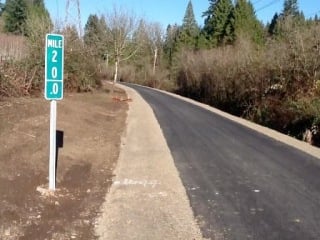
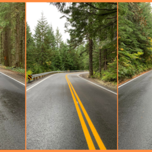
(Photo: Clackamas County)
As promised last month, Clackamas County has just announced that paving is complete on the final segment of the Springwater Corridor Trail from Rugg Road to Boring Station Trailhead Park. This 2.25 mile section now means the popular paved path extends 21 miles from downtown Portland to Boring.
The new section is 10-feet wide with 2-4 feet of compacted gravel shoulders (for people on horses). The County has also added a new bridge deck and railings and improved intersection treatments and signage at street crossings. Funding for the $1.9 million project came from a $1.2 million federal Transportation Enhancement grant and addition funds from Metro’s 2006 Natural Areas Bond Measure and Clackamas County Parks.
I had the pleasure of riding the newly paved section a few weeks ago and it’s fantastic. If you’re looking for a fun weekend excursion from Portland, take the Blue Line MAX to the end of the line in Gresham and head south to connect to the Springwater Corridor. Once on it, you’ll ride east for a few miles before turning south where you’ll hit the new section and you can take it to Boring, or continue a few miles south to Barton Park for a view of the Clackamas River.
Clackamas County is hosting a community ribbon-cutting event on February 1st at Boring Trailhead Park.


Thanks for reading.
BikePortland has served this community with independent community journalism since 2005. We rely on subscriptions from readers like you to survive. Your financial support is vital in keeping this valuable resource alive and well.
Please subscribe today to strengthen and expand our work.
Great news! I look forward to riding it.
When I took my kid bike-camping at Barton Park a couple summers ago, I enjoyed the fact that the last couple miles of the ST were unpaved. Ah well, that’s progress I guess.
More important to me would be to finally replace the washed-out trestle on the stretch between Boring and Barton Park (officially it becomes the Cazadero Trail beyond Boring, I think), so you can get to Barton without riding those last 3 miles on what’s a pretty awful road for cycling with kids. IIRC that’s planned sometime in the next few years.
I’ve been wondering what’s up with the Cazadero Trail – looks like State Parks has applications in for funding (2 bridge replacements are needed).
Does anyone know if the plan is to eventually pave it or leave it soft-surface? Can’t find any sort of Cazadero Trail Plan on the interwebs…
Where did you find this info? If you look at the adjacent properties, it doesn’t seem like the old train trestles are necessary, if the county purchases ROW along the North fork of Deep creek.
here’s the State Parks TE grant application from about a year ago. Not positive it was funded, but i think so –
http://www.oregon.gov/ODOT/TD/AT/TEOBPAC%20Applications/103_OPRD_Cazadero.pdf
If you can handle a longer ride, just start the Springwater at OMSI and ride all the way to Boring. It’s a great ride, and the steam train is running through Oaks Bottom now.
Chris I,
can this be intuitively navigated by heading south on the esplanade, or are there the typical convoluted, counter-intuitive stretches? I would love to try this, but I am not very familiar with with outer SE and I am not eager to get turned around when the daylight is so scarce. Thanks!
If you have a smart phone…download the Maplets App…and then download the free METRO and other bike maps…some even have GPS logging to make where you are on the map. Super sweet!
That is, if you have an iPhone. Sadly, Maplets hasn’t released an Android version yet (grumble grumble).
Not so – https://play.google.com/store/apps/details?id=com.zaiadesign.maplets
MaxD, the connection from the Esplanade to the Springwater is easy (from the south end of the Esplanade go one block east to the first right (4th) and it puts you on the Springwater). The part I’d get cues for is the Sellwood Gap.
The Sellwood Gap isn’t even that big of a deal. The Springwater kind of ends just after the Sellwood Bridge. Just after the Sellwood bridge take a left (SE Umatilla ST) continue on to 19th Ave take a right and you will run into the trail again.
Actually, you have to take a sharp right from 19th to get back onto the trail. I missed it once, though it seems obvious now.
The connection is signed with symbols painted on the pavement. Just look for the symbols and you can’t go wrong.
It is to hard to find and to navigate. All hope is lost and it may rain. If you insist on pressing through, the best way to discover this trail is to put bicycleson a car and drive them all to Boring, using intuition, and then inquiring at the Shell station how to find the bike path. It’s a control after all.
Once you get through Sellwood, it’s all trail. Very easy.
Was this formerly a gravel trail that dead ends in some pretty woods?
Nice ride. Wouldn’t miss the gravel, tho.
I liked the gravel..a little mud and rocks along the way was fun. and anything with few people is nice sometimes too…
I am sure there will still be some water bleeding over in some sections though.
I agree. I am afraid we are too quick to pave over every mildly used dirt or gravel trail these days in the US (the fact that in many areas parallel (like only a foot or two off the main path) dirt trails pop up next to paved ones makes it obvious that there is a desire for softer surface trails). But in this instance I can see where completion of the path makes sense.
As the user of a recumbent bike, for medical reasons, I have to disagree: gravel paths are useless for recumbent cyclists. For that matter, loosely-packed gravel paths are essentially useless for any cyclist.
For the record, those last 3 miles of the Springwater were hardpacked, not loose at all. I rode it easily on my Madsen cargo bike – not the most nimble of vehicles – loaded up with a kid and camping gear. And some recumbents handle gravel just fine – when I test rode a Bacchetta Giro I rode it up and down the steep dirt paths on Mt. Tabor with slick Kenda Quests and not much difficulty. With semislicks or BMX dirt-oriented tires it could handle quite a bit of rugged terrain.
But in any event, you got your pavement. I don’t think any of us are too upset about it, just quietly honoring an inevitable but ultimately minor loss. As we did the paving of the Trolley Trail, and the Banks-Vernonia before that. We do still have, and hopefully always will have, the Crown-Zellerbach, the Lower Deschutes and most of the Klickitat.
Do all paths need to be accessible for all bikes?
I’m not really commenting about this project specifically, just the paving over of paths in general we’re seeing in America.
Great News! Now I can stay off the road, and not have the fears for my bike’s tires suffering from abuse on the gravel.
WOOT! My wife and I just purchased a home near the springwater mid-way between downtown Portland and Gresham. So happy to see this path actively maintained!
Welcome to the neighborhood! You’ll love the trail access.