(Photos: M.Andersen/BikePortland)
Though it’s possible to get between central Gresham and the Springwater Corridor by bike lane, there’s never been a truly comfortable link between the two, or first-rate bike connection between Gresham’s central business district and the dense Rockwood area. That’s about to change.
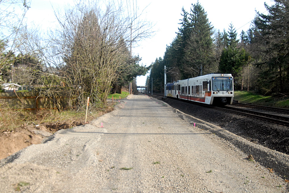
Gresham is building a wide new paved path alongside the MAX tracks between the Cleveland Avenue station, at the eastern end of the Blue Line, and the Ruby Junction station where many TriMet trains stop their runs to go out of service.
When it opens sometime this year, it’ll be a million-dollar upgrade to the made path that’s run in the grass alongside the tracks for years.

Here’s a Metro map of the route, with the Springwater Corridor and Gresham-Fairview Trail marked in green:

David Daly, Gresham’s engineer on the project, said Tuesday that the route will be fully ready to ride by Oct. 17 at the latest. That’s the contracting firm’s deadline to finish everything, including new plantings.
Daly said the path might open sooner than that.
“The track belongs to our contractor until they’ve reached substantial completion,” he said. “We’ve had good weather this spring, so we’ve been able to keep out ahead of schedule so far.”
On Sunday, with construction halted for the moment, a friend and I headed west on the future path out of downtown Gresham. Though I wouldn’t recommend it as a transportation route with or without anyone at work, it was easy to see what a nice amenity this will be once it’s complete.
It runs adjacent to TriMet land, interacting gracefully with stops along the way like the Civic Drive station here:

As it approaches Ruby Junction, the route cuts beneath the rail line:

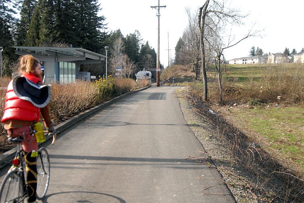
And almost to the Ruby Junction station, it meets the existing Gresham-Fairview Trail, which runs south to the Springwater.

Advertisement
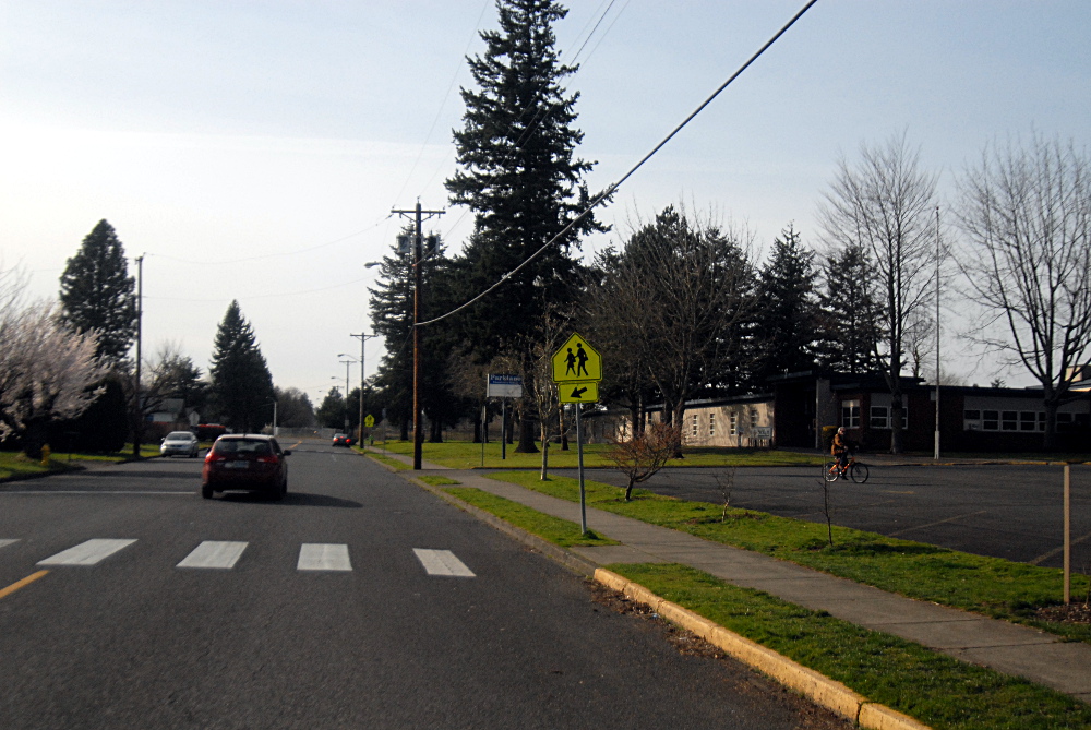
Another option for folks headed toward Portland is to follow this sidewalk just south of the Ruby Junction station…

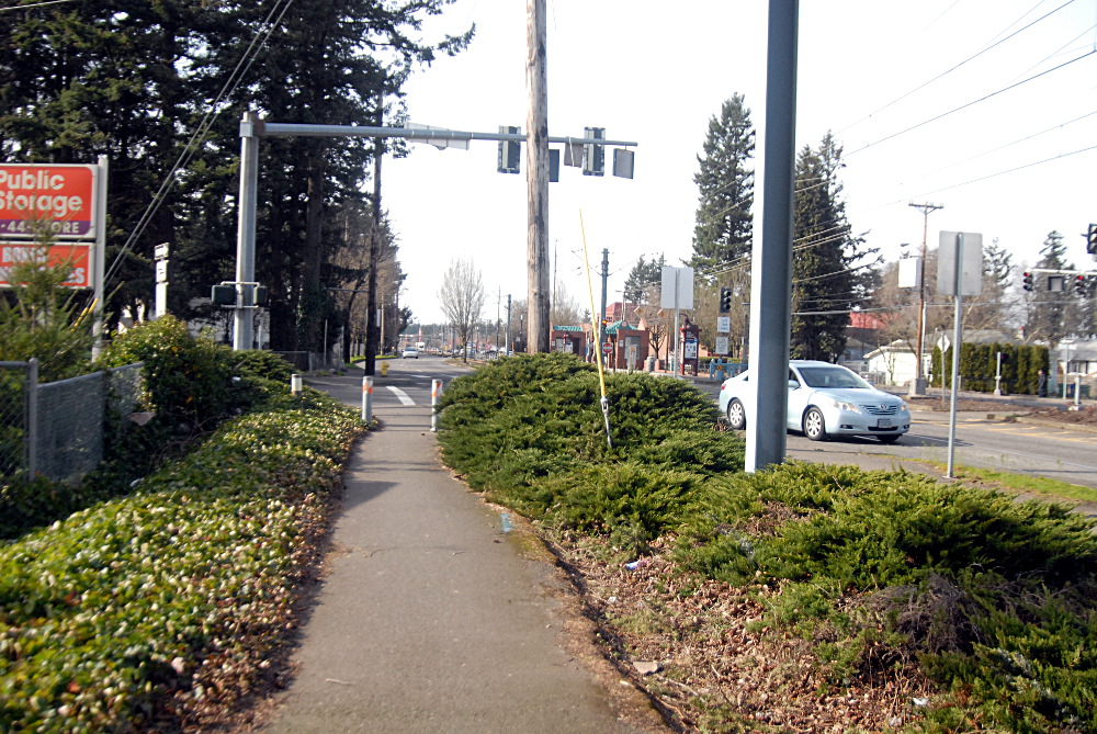
…and onto Yamhill Street, which is moderately comfortable at best due to wide lanes and regular traffic. Fortunately, this section is due for some modest improvement — sharrow markings in the lane — thanks to a Regional Travel Options grant from Metro announced last week.

…until you reach a calmer part of the street.
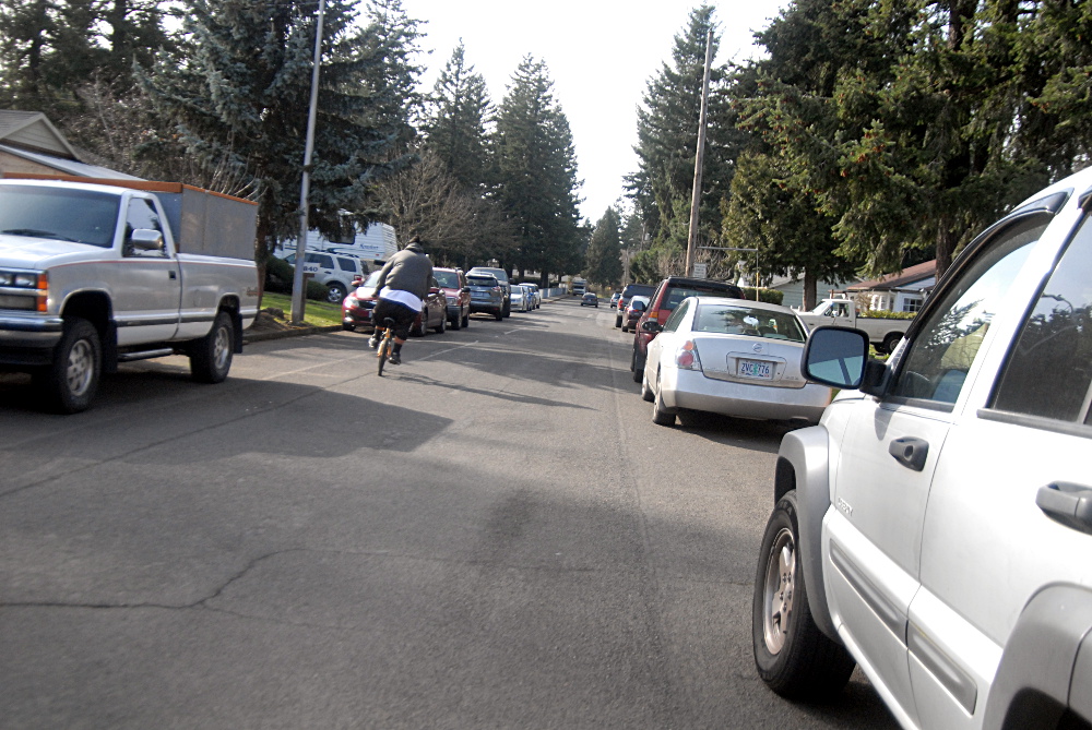
Yamhill, in turn, connects to Main Street and the planned 4M Neighborhood Greenway, which snakes all the way west through the neighborhoods to Interstate 205.
After navigating our way east using the narrow, busy Springwater on a sunny weekend morning, seeing the wide right-of-way set aside for this path was its own sort of fresh air.
You can read Gresham’s account of the trail plans here.
If I have any major concerns about the route, it’d be nighttime safety in a setting that’s quite separate from the street grid — “ultimately, the best way to deter crime and vandalism on the trail is to have a large volume of users,” the city writes — and that other bane of the outer Springwater: the street crossings. It won’t be until we see the design elements there that it’ll be clear whether this nice new facility is going to make itself truly obvious to people whenever they drive across it.


Thanks for reading.
BikePortland has served this community with independent community journalism since 2005. We rely on subscriptions from readers like you to survive. Your financial support is vital in keeping this valuable resource alive and well.
Please subscribe today to strengthen and expand our work.
Awesome! Is wayfinding signage included in this project?
yee haw I love connecting trails…
It needs to be very wide and separate pedestrian and bike traffic.
Nice to see Gresham gracing these pages given we don’t hear too much about our neighbor to the East. Incidentally, I see they’ve been granted Silver status since the donning of Bronze in 2010:
http://www.bikeleague.org/sites/default/files/bfareportcards/BFC_Fall_2014_ReportCard_Gresham_OR.pdf
BTW Michael, your link to Gresham’s trail plans pdf is broken.
You can read Gresham’s account of the trail plans here (PDF). This link does not work. Can you fix it?
Rookie mistake on my part – fixed, thanks. Also see Stevie Mare’s links below.
this is the first time I’ve heard the term “Springwater system”… what is that?
This is great. The next priority should be getting the Gresham/Fairview trail extended to Sandy Blvd. It will enable access to several large employers and many low-income residents to this great off-street bike network!
Every light rail project should include a multi-use path paralleling it when possible. I tried repeatedly to talk with folks during the Milwaukie light rail planning process about building a path like this between downtown Milwaukie and the Tacoma station area, and couldn’t get any traction with the planners. Good to see Gresham making it happen!
May have been an issue getting the adequate ROW from the railroads? Union Pacific notoriously difficult to negotiate with on this subject because they usually demand an excessively wide buffer between their trains and other transportation facilities. Portland and Western isn’t probably much better in this regard.
Reza, no doubt there could have been ROW issues in Milwaukie. However, before the light rail came along, Milwaukie had in one of our downtown plans, a MUP in the same ROW that the light rail is being constructed in. Even with possible ROW issues in Milwaukie that could have prevented a parallel MUP, I think we can probably all agree that there are large swaths of land that parallel light rail tracks in other parts of the Metro Region which could easily accept MUP’s. One fine example of this can be seen between Tacoma and 17th Ave on the new orange line. There seems to be plenty of space there, even after the tracks are in place, and it would make a great direct route into inner SE Portland for people using the Springwater..
I think the bigger conversation here is who owns ROW, and why are we not putting ROW to better, more intelligent and diverse use? We have ODOT, Tri-Met, PDOT and other agencies, that all own/maintain ROW that WE OWN. They should stop protecting their own turf (ROW), and start working more collaboratively with each other to come up with the best possible network for all users that we can possible create, even if that means giving up some of their ROW for nothing. Even the difficult freight rail lines should be forced to play along for the betterment of our system, seeing as how most of them got their ROW through shady bribes and backroom deals.
Agreed. Trimet missed a major opportunity with the Green Line to complete the missing link in the I-205 bike path – or more to the point, the public missed a major opportunity by not forcing ODOT and Trimet to accommodate it. (Flavel)
ugh. FLAVEL.
I’ve looked at this route and am somewhat surprised to see the emphasis on connecting the Springwater with downtown Gresham. Personally I’ve found it fairly easy to get to downtown through Main City Park. I see this path as more valuable for connecting the Gresham-Fairview trial with *anything*. That route, while nice, ends in the middle of arterial wasteland. Residents of west Gresham would potentially have a better connection to downtown.
I second your comment Matt, and sorely wish there was something like this in Beaverton-Hillsboro. On the west side there is REALLY poor connections between the Zoo and Hillsboro
Get in touch with the BTA. Not the MAX ROW, but one of their current campaigns is about building a safe connection for bicycles parallel to TV Highway and the Tillamook Branch operated by Portland and Western RR.
Correct link (download):
https://greshamoregon.gov/WorkArea/linkit.aspx?LinkIdentifier=id&ItemID=281356&libID=281356
Project page:
https://greshamoregon.gov/city/city-departments/environmental-services/transportation-streets/Projects/Template.aspx?id=281359
Now if they can clean the street bike lanes!
How long will it take for a homeless camp / bike chop shop to appear?
lets help keep it ” tweeker free “
How?
Services > Enforcement …
but we’ll still need some enforcement.
Unfortunately the politics that far east trend away from services and more towards “more bars, more walls, more guards”.
And a antiquated city government that has no interest in changing the plight of east Portlanders.
>>Yamhill, in turn, connects to Main Street and the planned 4M Neighborhood Greenway, which snakes all the way west through the neighborhoods to Interstate 205.
It’s rather a mess for those unfamiliar.
Main runs 182 to 138 , kinda, but turns into MillMain South of Parklane Park and then into Mill or Main, Mill gets to 122 and then you’ve got to jog over to Main (?) again to get to 205.
Yamhill doesn’t really “connect” to Main. But you can jog over to get there.