Someday, you’ll be able to type two addresses into your computer and get customized directions for traveling between them — by bike. The addresses could be in the same city, or across the country. You could choose between different kinds of routes, or find out how to transfer to the bus or train for a leg of the trip.
That’s the dream, anyway. And it’s a dream being chased by a small, but determined band of bike-loving programmers and mapping experts across the country.
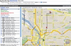
The idea of online bicycle route planning is at least as old as the advent of online driving direction programs such as MapQuest, and Portland became the epicenter of its realization in 2005 with the debut of byCycle.org.

and Donohue in 2006
(Photo © J. Maus)
ByCycle.org is the brainchild of Wyatt Baldwin and Lauren Donohue. The award winning site provides trip directions by bike between any two addresses in Portland, (as well as in Milwaukee, Wisconsin). Users can choose “normal” or “safer” routes.
The byCycle.org project is on hold while its founders earn a living doing other things (Baldwin now works for TriMet). But they have made its code open source and posted a guide for anyone with the zeal and resources to create a similar service in other cities.
The question that first comes to mind when the idea of online bicycle route planning comes up is: What about Google? One man, Peter Smith, has made it his mission to lobby Google to do just this. His blog, Google Maps Bike There, gathers signatures on a petition and tracks news and rumors in the world of online trip planning.
In 2008 Smith reported a rumor that the city of Austin, Texas was working with Google to implement an online bicycle route planner, but there have been no updates since then, and Google keeps extremely close-lipped about any plans it may have.
The challenges to implementing an interactive bike route planning system in one city, much less nationally are huge, according to Aaron Antrim, owner of Trillium Transit Internet Solutions, a company that helps municipalities put their transit data into the format accepted by Google Transit.

in Southeast Portland that he
co-founded in February.
(Photo © Elly Blue)
Antrim, whose passion for all things involving online trip planning data is manifest, sat down with me over a beer one afternoon to explain all the issues. It’s far more complicated than you’d think, he says — even if Google were to decide to take the reins. The software is already out there, but “the real challenge for a bike trip planner is the lack of data.”
For comparison, Antrim says, look at how Google Transit works. Google provides the user interface, but requires participating municipalities to standardize and publish their data, called Google Transit Feed Specification (GTFS).
Transit agency data usually exists in some form that can be formatted to fit with GTFS. What doesn’t yet exist is the equivalent sort of data for bikes — A “GBFS.” This is in part because U.S. cities do not have agencies that deal with bikes in the same way that, for instance, TriMet runs Portland’s transit system.
“The real challenge for a bike trip planner is the lack of data.”
— Aaron Antrim, Trillium Transit Internet Solutions
So bicycle data is managed by individuals, startups, and innovative city agencies, if at all. Just getting the raw material is the first challenge. Only three companies provide street mapping data in the United States — two of them, Tele Atlas and NAVTEQ, have pretty much cornered the market, and are used in driving directions provided by MapQuest and Google, and for the wayfinding devices in newer cars.
The third source, Tiger, is derived from the census and is lower quality, but available for free. This is what Metro uses for their maps, including their bike map — from which byCycle.org’s data is derived.
Tiger’s data is usable, byCycle.org’s Baldwin told me in an interview, but requires a lot of massaging for functionality, as it doesn’t take into account any bike-related infrastructure, or other basic factors such as one-way streets.
“Routing is really complex,” says Baldwin. There are a million little things to think about with the data, and the process of working out the kinks is still ongoing. Today, much of byCycle’s data is edited based on user feedback and the legwork of a friend of Baldwin’s who rides all over Portland with a GPS unit mounted to his bike, mapping new routes and manually entering data in places where the bike-specific infrastructure deviates from auto routes.
One potential source for bike route data is Open Street Map (OSM), a repository for mapping data that works like a wiki — anyone, from a national transportation agency to individuals with GPS units on the back of their bikes, can add or edit map data for anywhere in the world. OSM also has a special overlay for bike infrastructure and is, Antrim says, where Google engineers generally refer anyone who asks about bike and walk trip planning.
But the data available is only as good as what has been uploaded — and in many places in this country, bike route data simply doesn’t exist. Antrim says he would love to see the League of American Bicyclists make map data a consideration in their Bicycle Friendly Community awards program. In the meantime, OSM is often updated through company-hosted mapping parties (Chris Smith recently wrote in PortlandTransport about attending one of these). OSM also makes software available that shows undocumented streets so that intrepid users can fill in the blanks.
Another problem with bike map data, according to Antrim, is that there is no universal classification for bike routes. The European Union has a standard classification, but in the United States it’s still a free for all. A “bike boulevard” in one city might be called a “bikeway” or a “low traffic street” in another. There are standard classifications, but as Antrim says “there are many variables in what goes into making a facility, so classifying that is a challenge.”
There are a handful of other online bike mapping systems out there. About a year ago Ride the City launched in New York City. Based on Open Street Maps, the program is similar to byCycle.org, with some different features, such as specially marking streets with and without bike lanes, and displaying bike shops along your route.
Most are like the international Bikely.com or Minneapolis’ new Cyclopath.org, invite users to enter their favorite bike routes for others to try. While useful resources, these are not interactive trip planners which will give you customized, door-to-door directions.
One of the most promising avenues for advancement is multi-modal trip planning, producing seamless directions involving transfers between multiple modes. Multi-modal planning had, like byCycle, its watershed moment here in Portland in 2005, when Google Transit, in conjunction with Trimet, introduced the possibility of multi-modal trip planning. And last summer, TriMet unveiled its own feature that incorporates door-to-door directions for trips that involve both walking and transit.
The only interactive, multi-modal online trip planner out there that includes bicycle routing is in Atlanta, Georgia, and called A-Train. It was developed by David Emory, a city planner for Atlanta, who volunteered hundreds of hours of his time developing software that plans trips using combinations of transit, walking, and biking. For bicycling directions, the user decides how much weight he or she wants the program to give the three criteria of safety, elevation, and distance.
A-Train’s software, a package called 5 Points, will eventually be made freely available to other transit agencies and advocates. Last year a TriMet representative told BikePortland that the agency is very interested in Emory’s software and are waiting for it to become open source so that they can take a serious look at integrating it into their own mapping (currently they use an ill-matched variety of different tools).
What may be needed for national mapping, says Baldwin, is for someone to take the lead the way TriMet did in 2005, when data managers spent six months working with Google to create Google Transit. Together they worked out a strong local model that has since been applied to other cities as the gold standard (more on that in a recent Portland Mercury story).
A strong bicycle trip planner that could be applied in municipalities nationwide would likewise need to be fleshed out and troubleshot in one location with a committed local partner. So far, all efforts towards this end have been ahead of their time. But the moment may be arriving.
Bicycles are taking off as a mainstream mode of transportation, and agencies are starting to take notice and begin to tackle infrastructure needs in a structured way.
Google has also begun to take a conspicuous interest in bike infrastructure, using tricycle-mounted cameras to capture bike trails for their Street View feature.
And rumors, which ebb and flow constantly on this topic, are starting to turn up again that Google is testing a bike route planning service, due for release “real soon now.”
Like Open Street Map, Google gathers data from the public — but unlike OSM, the data becomes proprietary once in Google’s hands. All the other possible national templates are open source, but small-scale developers are not able to pay for licenses to use the higher-quality data from the two big mapping companies. Either way, the work that needs to be done to make map data bicycle-specific and to standardize infrastructure typology is legion. It’s anyone’s guess right now what the future will hold.


Thanks for reading.
BikePortland has served this community with independent community journalism since 2005. We rely on subscriptions from readers like you to survive. Your financial support is vital in keeping this valuable resource alive and well.
Please subscribe today to strengthen and expand our work.
Hm, this article has a pretty US-centric perspective. In Europe, there are quite a bunch of functional bike routing services, mostly based on Openstreetmap data. This data is far from perfect, but for large areas in Germany or the UK it’s definitely much better than Google’s data — and it’s free (as in speech, not beer). You should’ve at least mentioned http://www.opencyclemap.org/ where you can see what kind of bike-specific data is available. One pretty good routing service based on OSM data is http://data.giub.uni-bonn.de/openrouteservice/
Unfortunately, Openstreetmap is not really popular in the US, probably due to the better availability of free geodata (like TIGER).
Bottom line: don’t complain to google, but become a mapper yourself! Let the (geo)data be free!
Thanks for pointing out the opencyclemap site — I’ve added a link in the article. Can’t believe I overlooked that in the finished article!
It would be better if TIGER were updated more frequently – TIGER has a lot of errors. Part of that is due to the slow update process (which happens with all federal agencies), and part of it is because much of the data is gathered through aerial photography, which is inferior to actual people on the ground. (but a heckuva lot cheaper)
bycycle.org is awesome. the effort is much appreciated.
As a software engineer and bike fanatic I found this article fascinating. I think it really helps to put into perspective how difficult it is to create tools like Trimet’s transit tracker and byCycle.org.
It looks like until we get some standards for classifying bikeways and open map data to use with software routing systems, we aren’t going to get very far.
Fantastic write-up, Elly. Thanks for all the specifics and sources.
In the end, I’d LOVE to see something come together that would allow Google (or any other map provider online) to have better, unified data to pull from (such as standardized road classifications centering around bike needs). I love ByCycle.org, but it isn’t as usable when I’m out and about on my bike trying to access a route on my phone (whereas Google maps, Mapquest and others have the dev resources to make much better map interfaces for mobile use).
As far as standardizing a road-classification system for bike-able roads nationally, could we sick Earl Bleumenauer on this? 🙂
Thanks for such a great article, Elly.
One key thing that keeps bike data that could be used for routing from getting out there is that many of the existing data systems (e.g. Portland’s) for the street network were built and are still maintained with only cars in mind. I know this because here at PBOT I maintain the street centerline file for the City, and it classifies streets as local, arterial, freeway, etc. with only cars in mind. Portland’s bike network is also maintained in GIS data, by the bike planners here (Roger Geller et. al.), but with a different purpose and structure, and it doesn’t include all the roads. Being an avid bike commuter for many years, I see the need for change, but there are so many stakeholders with the centerline data implementation — everybody from the 911 call center to the people who put down the bike lanes — that it will take continued awareness and work to change things to include other forms of transportation (bikes as well as peds) in these systems.
In other words, as the physical infrastructure changes, the electronic one needs to keep pace with it.
Paul Cone
Mapping and GIS
City of Portland, Bureau of Transportation
The University of British Columbia in conjunction with Translink (the regional body responsible for transportation in Metro Vancouver) has put together an excellent cycling route planning tool based on Google Maps. http://www.cyclevancouver.ubc.ca/
One interesting feature of the tool is that it takes into account air pollution and vegetation along the proposed route.
Just to play the devil’s advocate, so to speak, for a moment: most major cities already have excellent bike maps available, like the Metro Portland bike map. It’s cheap, portable, waterproof, very easy to use, and meets the needs of most cyclists.
The vast majority of bicycle trips are relatively close to home where people are already familiar with routes and transit options. Most major cities have online transit planners like the one on the Tri-Met website, and it is already an excellent, easy-to-use tool for navigating within a few blocks of any transit stop.
If you’re biking in an unfamiliar city, wouldn’t you prefer a portable paper (or vinyl) map showing ALL bike routes, so you can make spontaneous trips wherever you want without referencing the internet? You don’t necessarily need to know bike-specific routes anyway, it’s easy enough to avoid busy arterial streets by taking a parallel side street, and you can still find your destination easily enough.
It’s great that the software engineers enjoy taking on a big challenge like this, but in some respects it just doesn’t seem necessary. How much benefit will you get from a bicycle-specific online trip planner that you can’t already get from available resources and high-quality detailed traditional maps like the Metro bike map?
I’m just sayin’, that’s all. No hard feelings.
@Quentin
People have been asking questions like that for years (thinking they’re adding something constructive to the discussion), and the answer is always the same: there’s a need for *both* paper maps and online maps/tools. There are many technical, personal, and even political reasons for this.
Is “Devil’s Advocate” synonymous with “false dichotomy”?
I’m currently working on this problem for my doctorate at Wayne State in Detroit. Detroit is mostly without defined bike routes but there is little traffic and loads of pavement. Deciding what roads to take can be a challenge though as the city is fragmented by highways, railroads, massive industrial complexes and insular redevelopment projects. Unlit bridge underpasses, poor pavement and unsafe neighborhoods add further complexity.
The two main goals for the project are to base the routing on the current state of the art research on cyclists preferences and to devise some sort of single number rating (like walkscore) that could be a selling point for neighborhoods with good connectivity and allow stakeholders to identify which changes to the built infrastructure would be most beneficial.
We are planning to use the open source concept to create a “Ride the City” for New Haven. Apparently Ride the City has had many requests from other cities as well.
@Quentin
PS And don’t get me started on the software engineering and GIS effort that went into producing those “easy-to-use” paper maps…
But, yeah, no hard feelings. It’s just that the technology’s not going away (for various reasons) and lots (*lots*) of people actually find it useful (can you believe it?!), sometimes even more useful than some crufty old piece of folded up paper.
I’ve been using http://mapmyride.com for planning bike trips. It gives you elevations and slope percentage. It was fairly accurate in mapping my route from Santa Barbara to San Luis Obispo tha I made a few weeks ago.
“Most are like the international Bikely.com or Minneapolis’ new Cyclopath.org (which uses OSM),”
Cyclopath does not use OSM, but assembled its map data from various local government sources.
Thanks for the correction, Hokan. You’re right, and I’ve edited the story. Sorry about that.
great write-up, Elly — very comprehensive.
i like Aaron’s idea of adding a ‘bike data’ requirement to the LAB’s certification program.
ibike.org lists the bicycle facility classifications like this – best/safest to least:
* Separate Facility (a.k.a. Class I)
* Bike Lane (a.k.a. Class II)
* Bike Route (a.k.a. Class III)
* Bike Friendly (a.k.a. Class IV).
seems like a good place to start for a Google Bike Feed Specification (‘GBFS’).
Austin has a copy of their bike route data online (shapefiles/lines) — from 1997. it seems to classify the different routes appropriately. linked from sidebar of site. i figure every city should do the same.
the sf bike trip planner just added geolocation, which i thought was cool. just google it. added feature is only useful for sf.
and now that i think about it, how did google do the walking directions? i know they worked with walkscore, but how are sidewalks and various paths classified? is it just a ‘yes/no’, or are some sidewalks better than others? and is it the TIGER data that includes this info? it seems this walk data is much more readily available than bike data.
i heard the alleged google bike map tool would _not_ be based on the type/class of bike facilities, but based on how many people rode particular routes — an approach which Boston used to come up with its first bike map.
now back to listening to Dog Days Are Over. 🙂
I wonder if Google could (automatically) analyze their nation-wide set of street photos and categorize streets for use in a bike trip planner?
The seem like smart people. I bet they could do it. 😉
There is already a very useful tool that does this to a degree – and it is largely driven by cyclists. Check out http://www.bikely.com – plenty of routes already mapped out, and because they’re put there by cyclists, rather than car engineers pretending to think about cyclists, much of the guesswork about what’s safe and what’s not may have already been taken out of the equation.
Happy cycling:)
There are two bike route planning websites for Chicago bicyclists. There will soon be three.
The two (and upcoming third) are listed on the Chicago Bicycle Program’s website:
http://chicagobikes.org/public/bikeroutes.php
I’d also like to note that enterprising and interested individuals or groups can take a crack at their own bike route planning tool using our high quality GIS bikeways data. It’s not available for download, but those who would like a peek can email me for a copy.
This is in addition to our extensive website for Bike Parking, showing installed and requested bike racks across the city, mapping them across a number of geographic or political boundaries.
http://www.chicagobikes.org/bikeparking
The Bike Parking data is also published on EveryBlock.com, a website offering citizens a day-by-day breakdown of activity in their neighborhood (be it crime, restaurant inspections, or new photos posted).
I’d be happy to answer other questions, or take feedback from people regarding the data and services the Chicago Bicycle Program provides.
Steven Vance
Bike Parking Assistant
City of Chicago, IL
Thanks for the great write-up!
I just wanted to point out that cyclopath.org DOES do door-to-door directions. It is not just a list of riders’ favorite routes. You can type in a starting and ending location and cyclopath gives you a recommended route based on a variety of criteria.
The Broward Co., Florida MPO (covering Ft. Lauderdale and the surrounding area) has developed a bike route planning map in cooperation with Florida International University & the University of Florida.
Their map allows users to choose which of the five following aspects they want to prioritize:
– Short
– Fast
– Least Interaction with Traffic
– Simple
– Scenic
For any other part of the country I’d also want to include “Flat” and ideally have slider bars so these could be ranked in order.
At times the byCycle.org site has given me directions that aren’t as direct or fast as I’d like, prioritizing off-road routes instead.
Great piece. It captures the problems well and shines light on many of the projects underway.
One thing I’d like to discuss clarify — “Google gathers data from the public — but unlike OSM, the data becomes proprietary once in Google’s hands.”
I believe Google does collect road data, address, and location from TeleAtlas, and public sources (both institutional and end-users), and I am still trying to understand all the channels they use and how it’s folded together. Their road data is not released in a machine-readable format.
However, Google Transit has had the effect of making much more transit data available to the public in machine-readable formats. The Google Transit Feed Specification is the most widely used format for transit schedule and geographic data.
Here is a list of some of the publicly available data in the Google Transit Feed Specification:
http://code.google.com/p/googletransitdatafeed/wiki/PublicFeeds
Details on how Google has helped to facilitate this are in the recent Mercury article on TriMet’s open data practices and collaboration with Google:
http://tinyurl.com/mkx3j9
So, what I am getting at is that if Google were to accept bicycle data for trip planning in some sort of standardized format that other software is allowed to also use (like has happened for transit) then this would be a boon for the overall availability of bicycle facility data.
Oh, and one trip planner note I wanted to point out: I plan most of my transit trips on my iPhone. I look forward to the day when I can do the same thing for bicycle trips.
Elly, thanks for the great write up.
Two weeks ago, I had the pleasure of attending a workshop on multi-modal trip planning held by TriMet. Many of the people mentioned in this article were present, as well as reps from a number of other transit agencies. The Open Planning Project (where I work) is currently working with TriMet to create a complete open source multi-modal trip planner, building on several great open source apps that are already out there (including byCycle). We are looking to connect with more developers who are working in this space, so please check out the wiki and join the dev list if you’re interested.
TriMet deserves a lot of credit for pursuing the goal of a high quality trip planner, and also for being so open and inclusive in their planning process. All you folks in Portland are fortunate to have such a progressive transit agency in town.
Someone may have already informed you that a team at the University of BC put together a bicycle route planner for the Vancouver area.
http://www.cyclevancouver.ubc.ca/
Several of the areas identified as problems in this text have been addressed some time ago in The Netherlands. A system called BicycleNetter was created by Demis and the Dutch Bicycle Union some years ago, and the unique feature is that is is mounted on a Mapserver which allows vector editing of the network by end users. The Dutch Bicycle Union has been managing this on the Demis mapserver and there are now (as of end 2008) over 3 million such edits. The routing systems, even in Openstreetmap, just are not good enough for cyclists to use reliably. This system has been so well supported by the bicycle users that there are now 6 Dutch provinces providing fiscal, support. It is an interesting model where crowd sourcing, with some QA, has produced a well used and well regarded wide area system (unsurprisingly other Dutch leisure modes have also moved to take advantage of this approach).
More recent work at Demis has added to this real Time weather data feeds with the cooperation of the Dutch weather service, a further enhancement using very recent Location BAsed Services APIs are now also up for exploration.
These enhancements are on the http://www.roadidea.eu Framework 7 EU project website for anyone to try.
Check http://www.roadidea.eu/pilots/pages/pilot5.aspx to try out the weather-integrated routing system
A draft paper has been written to explain how this was done and the characteristics of the process for creating a full bicycle routing system (the weather is a recent exploratory addition), but has not yet been put into a refereed journal as it is not clear if the technical details of APIs etc etc are of greatest interest or if the characteristics of successful quality managed crowd sourcing etc are where more detail is needed. There are as yet only a couple of other systems discussed,as the draft was aimed simply at making the experience of several years successful operation better known, and to encourage others to keep improving systems elsewhere. Discussion of other approaches are being added all the time. However copies of the current draft are available to anyone who might be interested..