A video shown at an open house earlier this month for the North Park Blocks Extension project created a stir among those who viewed it. The video shows the most detailed conceptual rendering of a project that I’ve ever seen. Someone told me about it excitedly a day or so ago and project staff with the Portland Parks Bureau (the agency leading the project) have finally made the video public.
To back up a bit, the North Park Blocks Extension Project will expand the Park Blocks north of NW Glisan and eventually connect them to the Broadway Corridor redevelopment. In addition to an exciting new public space, I’ve covered this project because of how it includes a major piece of the Green Loop. In June 2024 I shared a few of the design concepts the Parks Bureau was considering. Now they’ve narrowed it down to one choice and have opened a new public feedback phase to help them flesh out the design.
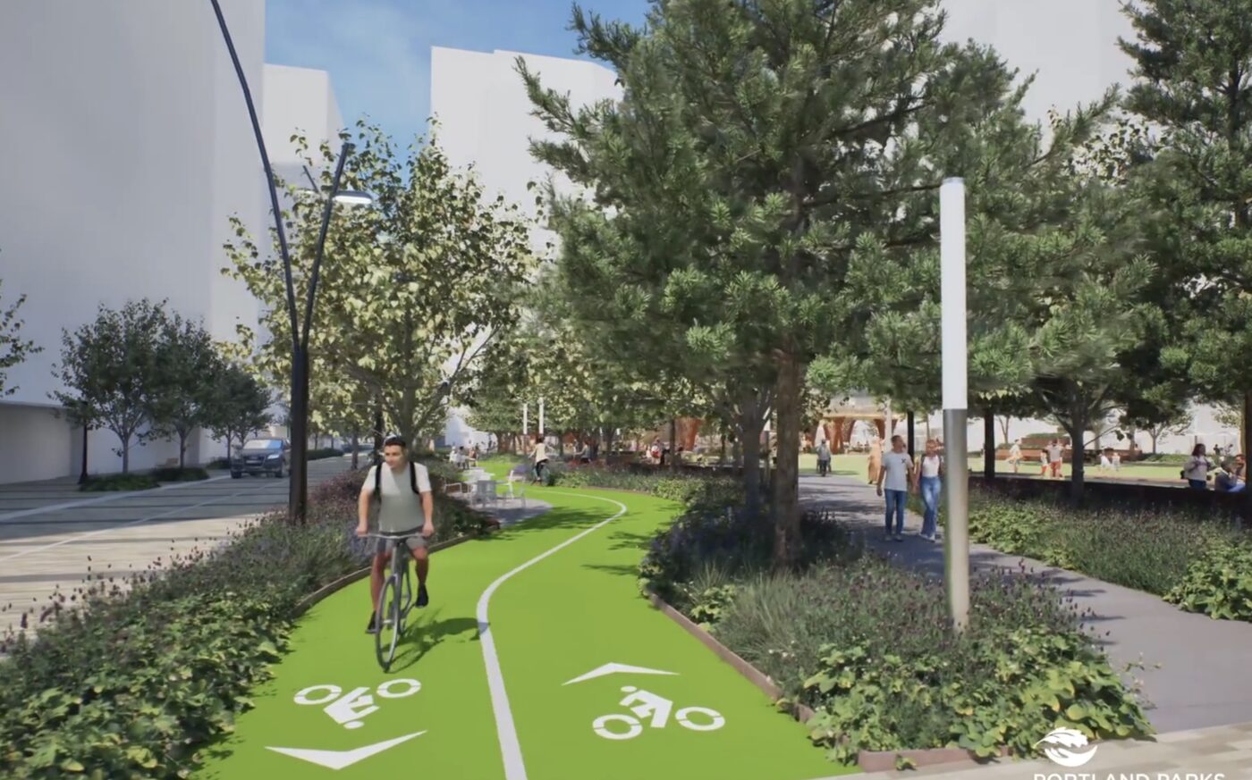
This new video released today is part of an open house and online survey that is open through March 31st at 5:00 pm. Watch the video and see more stills of the bikeway below the jump.
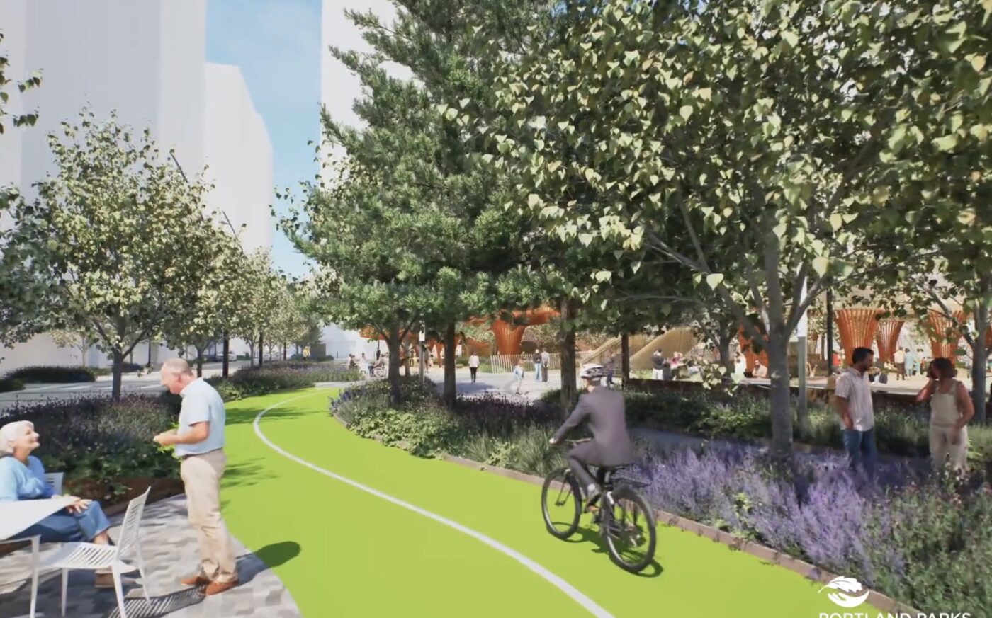
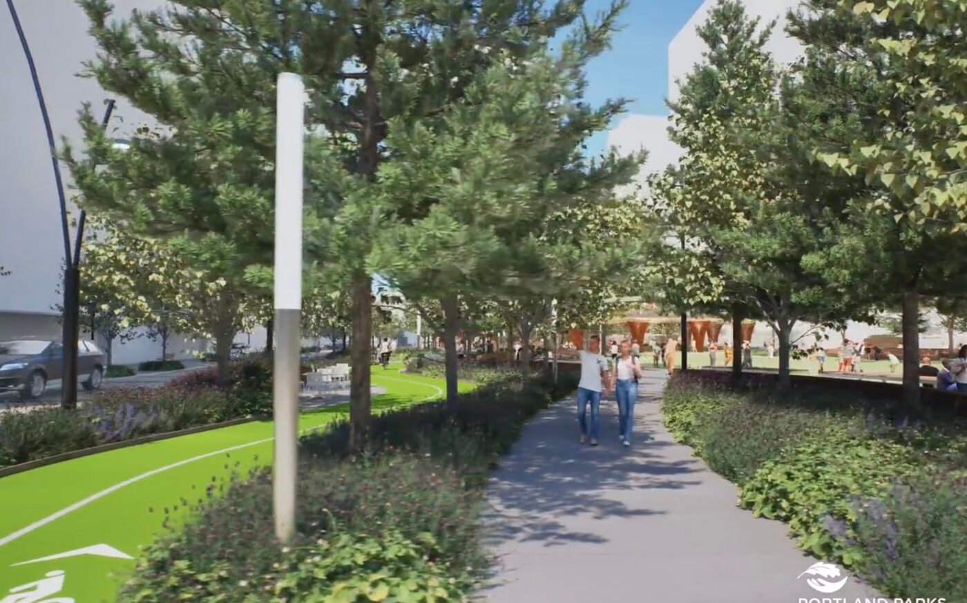
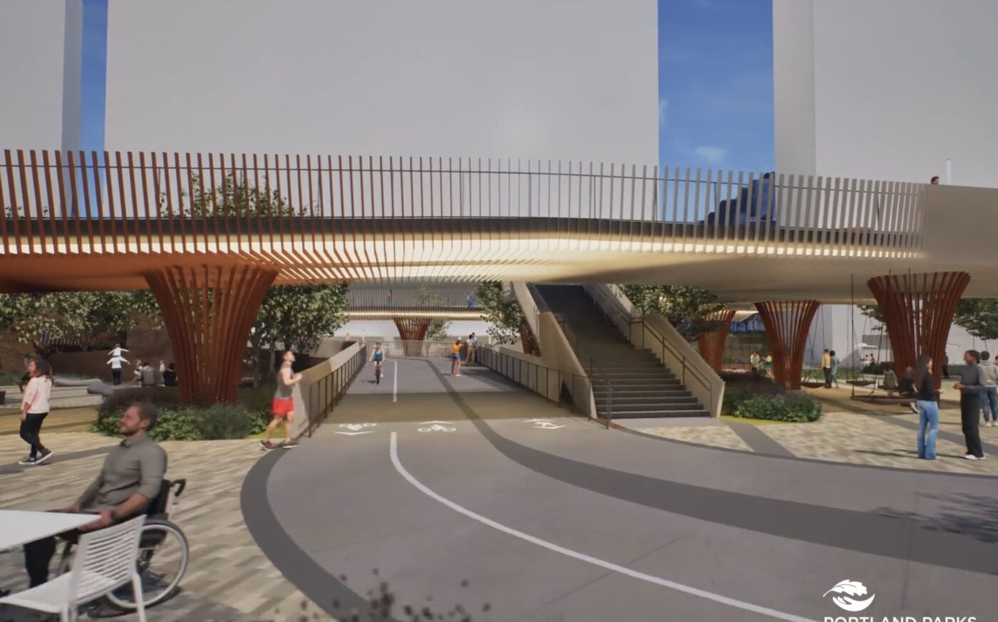
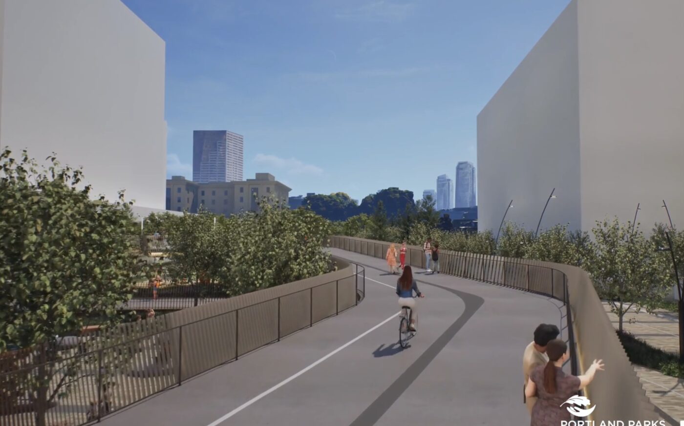
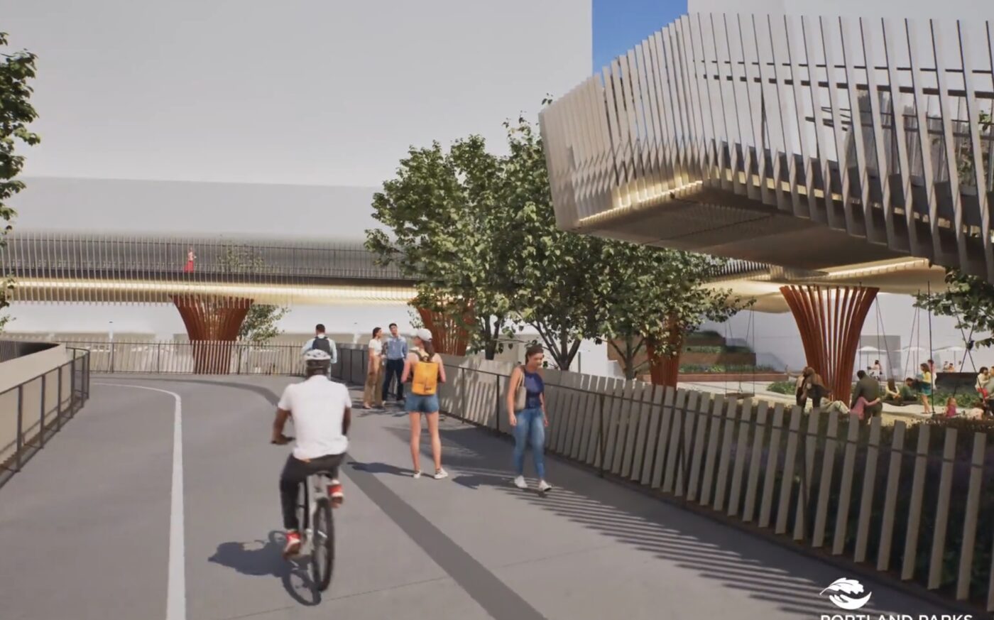
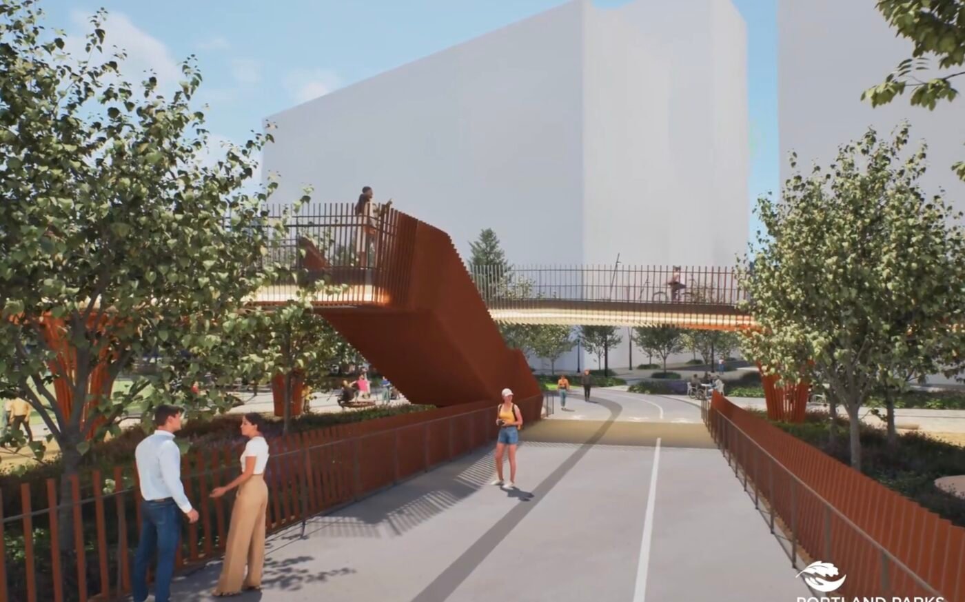
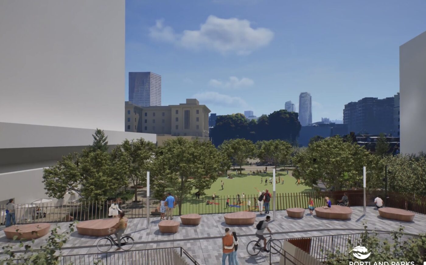
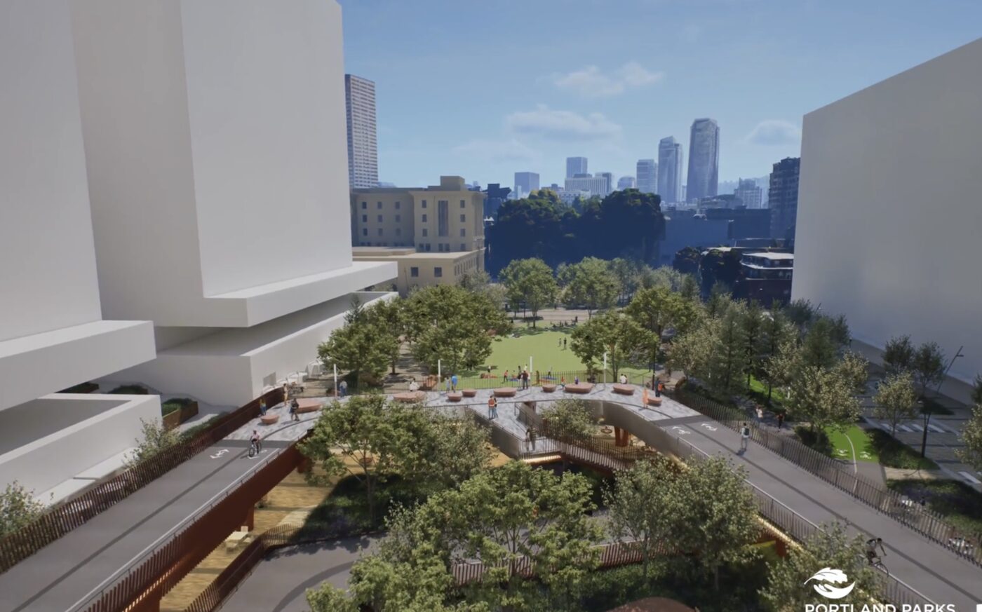
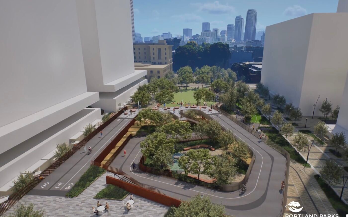
The video was created by PLACE, an architecture firm hired by Portland Parks. It offers an awesome view of what’s in store for the North Park Blocks and gives us our best perspective yet on how cycling will work on this section of the Green Loop. This is just one piece of the larger loop that is enshrined in Portland’s all-powerful Comprehensive Plan as a route through the central city that utilizes the Tillikum and Broadway bridges. Progress on the Green Loop is strong right now, according to Friends of Green Loop Executive Director Keith Jones. In addition to the North Park Blocks Extension, a segment of the route adjacent to the new Darcelle Plaza is also in the works. Jones told me today that both PBOT and Prosper Portland have made Green Loop-related hires recently and he expects a Green Loop Concept Plan effort to being next year.
Getting back to the video, note that the ramp you see at the end will take riders through the future Broadway Corridor development and deliver them to the western landing of the Broadway Bridge (hence the elevation gain).
— North Park Blocks Extension Project
— The Green Loop
— Broadway Corridor Redevelopment


Thanks for reading.
BikePortland has served this community with independent community journalism since 2005. We rely on subscriptions from readers like you to survive. Your financial support is vital in keeping this valuable resource alive and well.
Please subscribe today to strengthen and expand our work.
Why make the cycle route meander? The meandering section is buffered from the pedestrian walkway and the road. And what is with the tables attached to the cycle track and not the sidewalk?? It always feels like Portland Parks never understands biking from a transportation perspective.
They’d probably love to hear that feedback. Also, keep in mind that there are likely to be (and should be IMO) sections of the Green Loop that work better as slow areas for bike riders. Maybe PLACE and others have added meanders to reinforce that and encourage slower cycling. I’m not sure. Also, maybe the tables are for bike riders so it makes sense they’re on the bikeway
I’m in favor of more places with bike access. However if the Green Loop bike path, designed to mix bike riders with others, is seen as a sufficient facility for bikes we’re less likely to get uncompromised travel routes.
One group of tables did seem oddly placed. There was no pedwalk entering the table area, and the adjacent riders had just come down a ramp. No bikes or bike racks were present. The NPCs were careless of the presence of bikes–if there were small children in a group at a table you’d want a little more clearance.
After a few repeats of the video the hold music is less pleasing.
The pathway reminds me of Railroad Park in Birmingham Alabama. https://www.google.com/maps/@33.5111658,-86.80761,3a,75y,101.7h,79.16t/data=!3m8!1e1!3m6!1sAF1QipOJ8fezakg0fcNPwcoHzUZ764ka4gUx7pnZaGxJ!2e10!3e11!6shttps:%2F%2Flh3.googleusercontent.com%2Fp%2FAF1QipOJ8fezakg0fcNPwcoHzUZ764ka4gUx7pnZaGxJ%3Dw900-h600-k-no-pi10.837774930498611-ya14.700733991027832-ro0-fo100!7i4278!8i1724!5m1!1e3?entry=ttu&g_ep=EgoyMDI1MDMyNC4wIKXMDSoASAFQAw%3D%3D
Agreed. I also think it’s a mistake to keep the car access on the western side. Those blocks could be much more vibrant if the entire area was pedestrianized.
Are the blank buildings data centers or detention facilities?
seriously david? They’re just left nondescript probably because from a design perspective, it enhances the main subject of the video by just having blank white buildings in the background.
i gotta admit, that made me laugh out loud
Neither; it’s housing for the AIs.
Sooooo…a data center? 🙂
Those are Apple’s buildings. No windows.
Funny you say that as we refer to the building with Apple offices in Produce Row as “the Fishbowl” (i.e., it’s relatively untinted glass)
IMO, the park concept is well designed. I just hope they get some good water features and artwork that can help establish this park as a destination. I’m really excited about the ramp structure because it provides opportunities for public views of the North Park blocks corridor. The cycletrack and ramp structure remind me of biking in Copenhagen and Amsterdam. I hope they turn out well.
What’s the plan for the Green Loop on the Broadway Bridge? Those sidewalks are not ideal from a biking perspective.
yes to art and water features!!
The Green Loop through the Park Blocks will fell many dozen trees its entire length. Parking spaces will remain (no chainsaw taken to parking revenue) as the bike paths will be on both sides of each park block. Dammit! Dam Portland Parks Bureau! My thinking for the south park blocks removed the rows of parking next to the park and devise a 2-direction bikeway on 8th from PSU to Burnside. For the North Park blocks, this same removal of parking next to the park and a similar 2-direction bikeway extend straight across Burnside on 8th, or is it Park Ave?
The life-threatening ‘circular’ loop ramp at the northernmost block should be STRICKEN from the plan because it forces users to risk their lives at the hazardous 3-way stoplight where the Broadway & Lovejoy ramps meet. The safest ramp eastbound would be on the east side of the Broadway ramp from Johnson Street to Irving. The safest ramp westbound would be down the Lovejoy ramp then along the cul de sac just north and under the Broadway ramp. Also, an elevator could be installed at the Broadway/Lovejoy stoplight could for westbound ped/bicyclists.
I’m glad to see that a ped/bikeway bridge along the Clackamas Street alignment is still in the works. However, it’s likely this ped/bike bridge must wait for the Rose Quarter of I-5. BTW, that stretch of I-5 from the Fremont Bridge to I-84 is not a bottleneck and I-5 there should NOT be widened.
This is not true.
In the near future biking will be Easy. Fortunately everyone will have learned to keep the cranks level.
And ride oh-so-slow.
Not that this is a prime issue, but what jumped out at me were the horrible lighting fixtures. Those fully-exposed vertical light tube fixtures were used all over Caruthers Park in the South Waterfront. They’re blinding to anyone walking or biking past them.. They’re also particularly bad for birds and other wildlife, which is bad and ironic for a public project with “green” in its name. Fully-exposed-fixture outdoor lights should have disappeared from designers’ toolkits decades ago.
They’ll be in my survey response. On the positive side, I appreciate the presentation renderings that make it easy for people to see what they like or don’t like about the project.
Wow I am so happy I live in Portland. This is amazing! now we just need to add some woonerf, shared street touches like cobble stones so people driving can’t speed through.
the pavers look great, and hopefully they will be uneven.
https://www.nycstreetdesign.info/material/granite-block-0
https://www.nycstreetdesign.info/material/granite-block
HA! Joe love your thoughts. I always find myself in the outlier as well for wanting cobbles that are nearly unridable for roadie tires. Also more jumps. 🙂
Some of those streets you linked to downtown are rough enough to slow most drivers, but the newer pavers are quite ridable on pretty much anything.
Should we use the people’s money to build dense social housing OR develop projects designed to juice real-estate gazillionaire profits?
I am assuming that the money being spent here is largely from PPR’s SDC funds, which have to be spent on capital improvements to parks. So that’s not really the choice being made – it’s between this and other capital projects PPR may have. Are there better park projects that benefit the people more? Maybe, but I think extending the north Park Blocks has lots of benefits for folks who live in Old Town and the Pearl. Future parts of the project that are not related to the park specifically might engage more in the dialogue of “what housing and for whom”, but also the first project being built is a $147M joint venture for a 230 unit building with 100% of units affordable at 60% AMI or lower, with 40-something at 30% AMI.
If you want to critique the US model of affordable housing, that’s fine, it’s got a lot to be desired, but projects like the one linked above would not be possible for the city to independently finance as European-style socialized housing (even if a regulatory environment for doing so existed). Given that the price for a 60% AMI 2 bedroom (three person household) is like $1600/month, “affordable housing” can be in name only, and that’s a huge issue, but probably not what you meant at this point when you said “juice real-estate gazillionaire profits”
As an aside, navigating the Propser-hosted website for the overall project really sucks if you want to get specific funding information on this thing, so anyone and everyone can be forgiven for not really knowing what’s going on.
My question was not about some tiny bit of park-space but about the bigger issue of whether spending many tens of millions on a real-estate-market-oriented “green” loop makes sense when we 1) have an ubiquitous lack of protected in-street cycling infrastructure and 2) have a chronic shortage of affordable housing? Do you (e.g. market urbanists) genuinely believe that a meandering and intentionally slow leisure-loop designed to boost real-estate profits is worth sacrificing dozens of miles of protected bike lane that could be creatively funded with the enormous amount of money we shovel into market-oriented urban renewal (e.g. TIFs/URAs/SDCs/tax-abatements/additional assets we funnel to prosper/developers)? Do you also believe that a speculative real-estate market that valorizes greed is what we should rely on to address a chronic and worsening low-income housing crisis?
If you find yourself arguing that the government shouldn’t spend money on building parks, you might want to do a little bit of self reflection regarding why you’re on the same side of an issue as the right.
I wrote:
You wrote:
As I explicitly made clear above, my question was not about parkspace equity but rather about whether spending many tens of millions of the people’s money on a glamorous real-estate-gazillionaire subsidy is the best way to promote the greater good when it comes to park space equity, transportation alternatives, or the chronic and profoundly-dehumanizing lack of low-income housing.
My proposal: we extend the park blocks without a bougie green loop, use some of space in the post-office blocks for parkspace, and build a forest of tall non-market social housing towers by defunding Prosper and creating a social housing TIF+URA+additional local/state funding with permanent tax abatements. I’d also prefer the 20+ floor social housing towers to be brutalist as f*** too.
So you’d defund Prosper Portland, then create a different agency tasked with creating social housing via the same funding mechanisms that Prosper Portland uses. Wouldn’t it be easier and cheaper to just have Prosper build non-market social housing? I can say with some confidence that the staff at Prosper are not the reason this doesn’t already happen – it’s because of the legal and financial machinations that relate to affordable housing finance and construction in the United States.
Your proposal is functionally identical to the current proposal, just with a different approach to affordable housing. Cut out the middle man and just advocate for affordable housing reform.
I agree with Councilor Green that we should cut the middlepeople out (nonprofit corporations and private developers) by having the city fund a social housing department that builds and acquires housing.
I generally agree with you, at least until I see how much the city actually pays to buy and/or build anything. We might as well build with bricks of gold.
It’s funny to me that you are trying to define me as this
The money that is spent on economic development via market-oriented urban renewal schemes is not money that would have been spent on protected bike lanes. I don’t personally think every urban renewal scheme is good, or well articulated, but saying that doing a project like the Broadway Corridor or the Green Loop is “sacrificing dozens of miles of protected bike lane that could be creatively funded” is a bit much. Yes, if we were to abolish Prosper Portland, we could theoretically use that money in the budget to build the platonic ideal of a bike network, but I think you would need to justify doing something like that in a more concrete way than the relative benefits that bike network provide. And for what it’s worth, if I were the Lucius Quinctius Cincinnatus of Portland, cutting Propser’s budget to fund bike lanes would rank lower than cutting some other department budgets.
No. Is that something you inferred from my comment about the sorry state of affordable housing in the US? Or from my comment about the legal reasons as to why the money spent on the project this article is about can’t reasonably be redirected to “dense social housing”? I think that is a pretty clear example of a strawman though, so kudos on that.
There are other budgets that I would also rank higher but my post was focused on the city’s urban development nonprofit.
My comment was a continuation of the topic in my own OP so not a strawman. I intentionally specified “market urbanists” to distinguish that part of my comment from your response. I don’t see you as a “market” urbanist, blumdrew, but correct if me if I’m wrong.
I don’t understand modern design’s obsession with close, vertical, parallel elements.
As a destination, this looks gorgeous, with a few minor adjustments. The tables alongside the green bike lane are pretty ridiculous, but just replace with bike racks and add a little zebra striping and voila! Hope to see more bike parking scattered throughout in real life. It’s clearly not going to be a zoom zoom through-travel route, but was the green loop ever intended to be one?
The NPCs were kind of hilarious. Why was it only women doing their little warm ups in the park (in a circle), and not the men? Why did the bikes look like they were being pulled along a little track? I know that’s not the point, but it was funny to watch.
It looks like motion capture, since the movements are humanlike, but really really AI, uncanny valley in context. I love it! Pepperoni Hug Spot eat your heart out.
I like the rendering a lot, only feedback is that I think the cycle path should be twice as wide at least in both directions. But! Truly, when is this thing going to get built? I feel like it’s already been bandied about for like five years and still no mention of any sort of timeline. I feel like I’m going to die waiting for this.
At the rate it’s going, it’s starting to feel like it’s not about making something useful happen for people, but rather, as Soren suggested, a fancy pet project for polishing the jewel in a bunch of planners’ crowns—and enticing real estate overlords.
The design flaw that jumps out to me is the continuing inability of SW cyclists being able to reach downtown and the green loop safely and comfortably. With the exception of Moody, all routes into downtown are terrible. Many as bad as they were 30 years ago.
It’s quite interesting that designers feel the need to control people in the future with the whole “meandering is meant for slow bike travel and not fast bike travels” I mean come on. Here you have a blank slate. Why not plan for everyone vs controlling everyone?
This park makes no sense. It’s just a giant bike path. Why not build a park instead of a road in a circle
I am glad to see that they moved the bike lanes to the west edge of the park. Portland is famous for its small, 200’x200′ blocks, and the park blocks are half blocks- 100’x200′. I really wish that bi-directional bike lane could get pushed out on to 9th where transportation belongs! You would replace one lane of parking with bike traffic, and bikes would at least be crossing the cross streets in a sort expected location. This frustrating compromise will work OKO for this block and maybe the next block south, but what then? The Green Loop promises to be a frustrating mess of lane types and positions. I really like the concept of a string of parks, but this is supposed to be a loop for recreation and transportation. It was never well-planned, and now it has fallen toa design firm to design this AND plan or establish the plan for the next phases. The design is OK, they improved the circulation some, but there are still too many bike/ped conflicts baked in. But where this really fails is in its shortsightedness (that is City planning failure more than a design team failure). Get the bike lanes into the right-of-way and establish a solid place for this to set the Green Loop up for success.
The last thing we need is another Waterfront Park situation; what we need instead is a Better Naito type solution.
That is, give folks some room to ride without creating conflict with everyone else in the space.
agreed, this is poor design stemming from very poor planning.
Reading between the lines a bit and I would think that funding constraints are a partial reason for the design choices. Parks funding the park extension (via SDC $$) means that they are limited in how much they can do in the ROW*, so the choice for a shared use path through a park reflects this. How much of this is “bad planning” is debatable, I think it’s more the legacy of outlandishly siloed city bureaus (which is of course a form of bad planning)
*evidently, it’s easy to imagine a situation where PBOT vacates some right of way to give to PPR, and then PPR builds a nice calm bikeway in the area where 9th was, but this would require too much intrabureau co-operation
If the Green Loop was planned better, the alignment would have negotiated and vetted with PBOT and PP&R. If the bike lanes would have been allocated to replace the eastern parking parking spaces on 9th, then PP&R could have just routed the lanes there at the the bottom of the bridge, then paid PBOT or the project contractor to stripe the lanes and add some plastic bollards. It is true that getting a RW permit for curb cuts, crossings, signs, etc is an additional hurdle that PP&R is likely eager to avoid, but those things will all be required for the green loop to function anyway, so may as well bite the bullet now. I agree that the siloing is problematic, but City plans can (and used to) to get into that level of detail and get written buy-off on things like routing from the relevant bureaus. The Green Loop never made it past the amorphous concept stage. It was conceived of and run by planners who lacked the skillset to grapple with the myriad site-specific complexities along the route. Because of this, the project is doomed to get built piecemeal with a different configuration for each segment. Hopefully we will get some useable greenspaces out of it, extending the North Park Blocks is an obvious thing to celebrate, but I am afraid the “loop” function will never work. Without some real commitment, it will just be a marketing gimmick I’m afraid.