There was an important nugget of good news buried in Thursday’s excitement around a major milestone for the Burnside Bridge project: a bicycling and walking connection to the Eastbank Esplanade has been resurrected thanks to tenacious advocates and agency staff willing to listen.
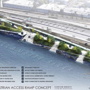
Last month we reported that Multnomah County and City of Portland officials decided against making a direct connection from the new, $900 million bridge, to the Esplanade. The Esplanade is a crucial part of our bike network and is currently only accessible from the Burnside Bridge via steep flights of stairs. After studying the idea and hearing pleas from river and cycling advocates that an elevator and/or stairs weren’t acceptable options due to ADA and other accessibility concerns, county and city leaders said a ramp would be too complicated and expensive.
But for some reason in the past two weeks, that position has changed.
“The connection is alive!” read the excited text to BikePortland from Human Access Project Ringleader Willie Levenson from yesterday’s Multnomah County Board of Commissioners meeting where the vote to adopt a bridge design was finalized.
“It is incomprehensible that Multnomah County may choose to build a bridge that costs an extra $45 million [the cost of the ultimately approved design] while also claiming they do not have adequate resources for important multimodal connections.”
– text from letter signed by leaders of City’s Bicycle Advisory Committee
At the outset of the discussion about the design, County Chair Jessica Vega Pederson shared the good news, “I want to be clear that today’s vote will not preclude a connection [to the Esplanade], and city and county staff have begun a process to re-examine this issue, to work towards a resolution, and that will be a focus in the coming months.”
It’s unclear what exactly moved the needle on this issue. But it’s likely that testimony and advocacy from Levenson, Portland cycling advocate Joseph Perez of Bike Loud PDX, and several others, played a role. Major credit is also due to members of the City of Portland’s Bicycle Advisory Committee (BAC), who finalized a letter on Tuesday that was sent to city council members, city administrators, and Portland Parks & Recreation (PP&R) Director Adena Long. The letter, signed by newly elected committee Chair Jim Middaugh and Vice-Chair Perez made it clear the BAC would not support the Burnside Bridge project unless a ramp connection to the Esplanade was still on the table.
The letter reminded city officials that a ramp and, “easily accessible connections to the pedestrian and bicycle network at each end of the bridge” were part of their original conditions of approval in 2021 and that, “investing in longstanding landmark infrastructure that fails to connect to our premier inner east car-free connector is unacceptable.”
“It is incomprehensible that Multnomah County may choose to build a bridge that costs an extra $45 million [the cost of the ultimately approved “inverted Y” option] while also claiming they do not have adequate resources for important multimodal connections,” reads the letter.
In a comment to BikePortland after yesterday’s meeting, Levenson said Perez, the BAC and staff at PP&R were key to keeping the ramp connection alive. “It’s nice to know city leadership at PP&R does care about the work of the dedicated volunteers of the BAC. Big props to PPR and Multnomah County for… leveraging this investment to get as much incremental benefit as we can get as a city.”
According to comments from Multnomah County Transportation Director Jon Henrichsen at the board meeting yesterday, a workgroup to explore Esplanade connections that includes Portland Bureau of Transportation, PP&R, and County staff has already been formed and they had their first meeting earlier this week.
Now advocates’ attention will shift to the outcome of these meetings and two other vital questions surrounding this project: How long will the Esplanade path be closed during construction of the new bridge and what will the detour route be?
Stay tuned for answers and opportunities to weigh in.
Correction, 4:15 pm: This story originally said Multnomah County officials made the decision to advance the bridge without a ramp connection to the Esplanade. That was wrong. The decision was made by Multnomah County and City of Portland. I regret the error.


Thanks for reading.
BikePortland has served this community with independent community journalism since 2005. We rely on subscriptions from readers like you to survive. Your financial support is vital in keeping this valuable resource alive and well.
Please subscribe today to strengthen and expand our work.
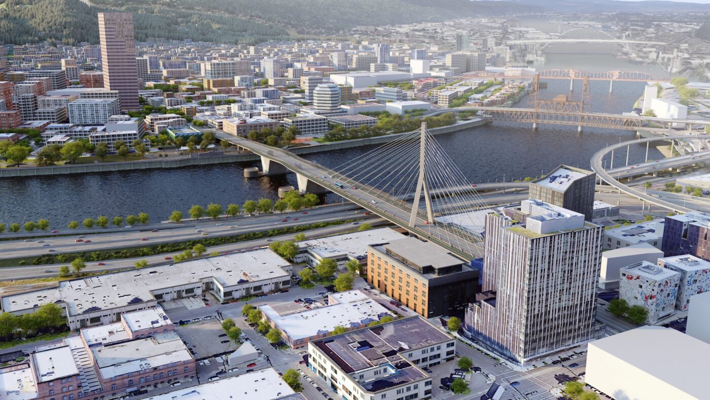
The picture at the top of this article is NOT the “… design approved yesterday”. The “inverted Y” design was approved, as noted in the article. The one shown is another.
The ramp designs that were considered earlier this year were really complex and expensive. The Human Access Project originally proposed a long straight ramp on the south side of the bridge. That should be cheaper. It does have the downside of connecting to only one side of the bridge, but that could be addressed in a couple of ways.
The City deserves an explanation if that style of ramp is rejected.
I wouldn’t be quite so sure that what HAP was showing would be any cheaper. Their relatively simple looking ramp cantilevers off of a very tall, very long concrete wall that would need to be built in a very inaccessible site. The foundation elements for such a structure would be immense, to say nothing of the wall itself which would be many feet thick.
I suspect the only way to do it that might save some money would be to loose the wall and do something way more conventional with the ramp supported by singular or pairs of steel columns every 50ish feet along the ramp. Of course this assumes you could get a crane and large trucks up and down the current esplanade, which I have some doubts about. It would definitely be a less pleasant place for users right next to the freeway without that big old wall in between.
How did they build the current ramp and stairs to the bridge? From barges?
The ramps to and from the floating portion? I’d be pretty shocked if those weren’t fabricated off site and barged in.
Jonathan, the header image is of the wrong design, it should show the inverted Y bridge as mentioned further in the article.
It’s great news that the ramps are back on the table! I’m glad they reconsidered.
Isn’t this the same Multnomah County that seriously proposed a combined walking/cycling lane on only ONE side of the Sellwood Bridge, to save money?
And walking/cycling advocates had to talk them out of THAT idea also??
I propose we get rid of MultCo gov’t – let City of Portland take it over, as other cities have done to their counties. We don’t need this extra layer of bad governance.
Where was The Street Trust?
They were busy seeking gov’t grants?
Advocating for more tents on sidewalks.
This is great news. Thanks to the folks who are advocating for it!
This is great to hear. Thanks for covering this. I read multiple news articles on mainstream websites yesterday that mentioned approval of the inverted y design with no mention of the esplanade connection. I was furious until reading this story. Kudos to the BAC, Willie, and others who stepped up to make this (possibly) happen.
I want to ride the big spiral ramp so badly
I don’t imagine it’ll be a spiral if it actually happens. More likely a long, straight ramp, with maybe one switchback. Something like the ramp on the east side of the steel bridge
Joe and Willie and others behind the scenes:
Great advocacy work! Keep it up.
A fantastic news! Thank you for reporting on this, Jonathan.
This is good news indeed! Thanks to everyone who’s put in advocacy work on this so far. There’s a fantastic opportunity here to build something that helps the heart of our city be a vibrant & healthy place where people want to spend time, and not just a place optimized for cars to speed through as quickly as possible on their way to somewhere else. It’s nice to still have hope that we can make that happen.
Such wonderful news – thanks to this group of tireless advocates, and for the officials who listened and were willing to step back from what would have been a terrible omission.
This is good news for sure! I was so taken aback that the county would poll residents regarding design choice, then choose an expensive design that polled poorly, and then claim there wasn’t money for ramps. I think access is far more important than a trophy bridge (and I think the “inverted Y” design is wicked ugly, but that’s just me). Anyway, 4 years in Portland and I continue to wonder at the arrogant governance here.
Hopefully, all funds from the arts tax will help to fund it. I think the new Burnside bridge actually looks nice in renderings and I think it might slightly lead to people driving less fast on the new bridge.
Two things I wish the Esplanade had: a sound wall and strong anti-car protection at every entrance. It will never be perfect with it right next to the freeway but I think a wall would go a long way toward making it quieter. I was walking along the Esplanade with a friend a little while ago and we had to yell to hear each other, it was so loud. The 205 path is ok with a decent sound wall blocking the freeway noise.
Yes! It got worse when Parks went through and thinned out the trees and vegetation. This seems like one of those jurisdictional voids where a huge improvement could be made but no one wants to spend their budget on it. It is likely to get much worse if the RQ widening goes through and takes away more of the space as planned.
As planned, relocating the southbound exit ramp from Broadway to Wheeler Way is clearly a “hair pin” death trap. Planners at ODOT, PBOT and Metro know it only too well. They promised developers lucrative contracts. The new apartment blocks that face the southbound off-ramp breaks their promise to “reconnect” Albina neighborhood. Originally, Hancock Street was to extend to Dixon but now it can’t because these apartment blocks are in the way. The Rose Quarter I-5 project as proposed will be cancelled once again but not before hundreds of million dollar promises are deposited in developer bank accounts.
I’ve long been working on a design that “realigns” I-5 between the Morrison and Burnside Bridges that completely removes the exit ramp closest to the floating walkway and where it intrudes overhead into the esplanade. It’s realigned about 30′ east and the exit ramp merge segment made simpler, probably safer for motorists.
The space created can be raised with an earthen berm and landscaped to deaden traffic noise especially beneath the Morrison Bridge. Enough space is created for a “helical” ramp for the north side of the Belmont Bridge (matching the south side “helical” ramp) creating access to downtown, but not to the eastside. People could FINALLY walk to north side of the Morrison Bridge!!!
Not an inexpensive proposal because northbound I-5 lanes are also realigned to create access to both I-5 and I-84 from the Morrison Bridge. Current access to I-84 is directly from Grand Ave. Truck traffic headed to I-84 could remain on left lanes of Grand Ave and take this new safer on-ramp.
From downtown, traffic headed to I-5 and I-84 is directed to a pair of stoplights on the Morrison bridgehead. The high speed “flyover ramp” is removed. Sounds complicated but seems safely possible. Cyclists would get a new ramp (that flies over the traffic exit ramp to Water Ave) to this stoplight. A wide bikeway is created eastbound/westbound on the inner lanes of the Morrison/Belmont viaduct.
I’ve made accurate renderings of this design and would like Bike Portland to give it a review.
Art, please also forward the renderings of your design to bikeloudpdx.org
I’m not very proficient with computer lap top. I’d either scan them or take a photo that can be copied and sent. My laptop photo program is lost or buried. I’ll keep bikeloud in mind to bring paper copies at some meeting. Thanks for your request. Art
My realignment of I-5 proposal could be put on the proverbial back burner.
The Columbia River I-5 Bridge replacement proposal appears to have arrived at a supportable design. Access to Hayden Island was the final shortfall needing a good fix. Access now is similar to the 2010 “Concept #1” access from Marine Drive. No entrance nor exit ramps directly to/from I-5 onto Hayden Island. I supported Concept #1 then. Its access however was west of I-5. The current design access is east of I-5 has less impact. The only obstacle is the choice of “double-deck” vs “single-deck. SINGLE-DECK is the ONLY sensible option.
The Rose Quarter I-5 so-called “improvement” is a horrific proposal. Funds can be redirected to the Columbia River I-5 Bridge replacement instead. Elements of the Rose Quarter I-5 project can be salvaged at a minimal expense. First on the list of priorities is removing ODOT director Kris Strickler from office. He cannot be trusted.
Johnathan, a bit of a tangent, but do you know if they’ve announced what will be continuously closed and will only be intermittently closed during construction? I could see them wanting to have the esplanade continuously closed for the couple of years it will take to build this thing.
The Esplanade is a long, contiguous bikeable route without motor vehicle conflicts that is unique on the East side. Even with freeway noise it’s a good place to be. It’s incredibly shortsighted to just shut it down for years. We don’t shut down car thoroughfares in that fashion with no better accomodation than a sign indicating an inferior facility half a mile away.
In Portland construction of any sort merits a complete taking of adjacent bikeways. Yes it takes some planning and design work to keep a route intact. Send a message that bike travel is understood to be a real and important thing.
Maybe the county should change its design choice to the cheaper one that people said they want, and use the savings to build a better connection.
They should just build a stair and an elevator, but make sure it’s high enough quality to be reliable.
I can’t wrap my brain around stairs or an elevator even being an option when one of the whole points of this bridge is post-earthquake transportation. In other words, why even build a car-centric bridge for a time when cars won’t likely be an option?