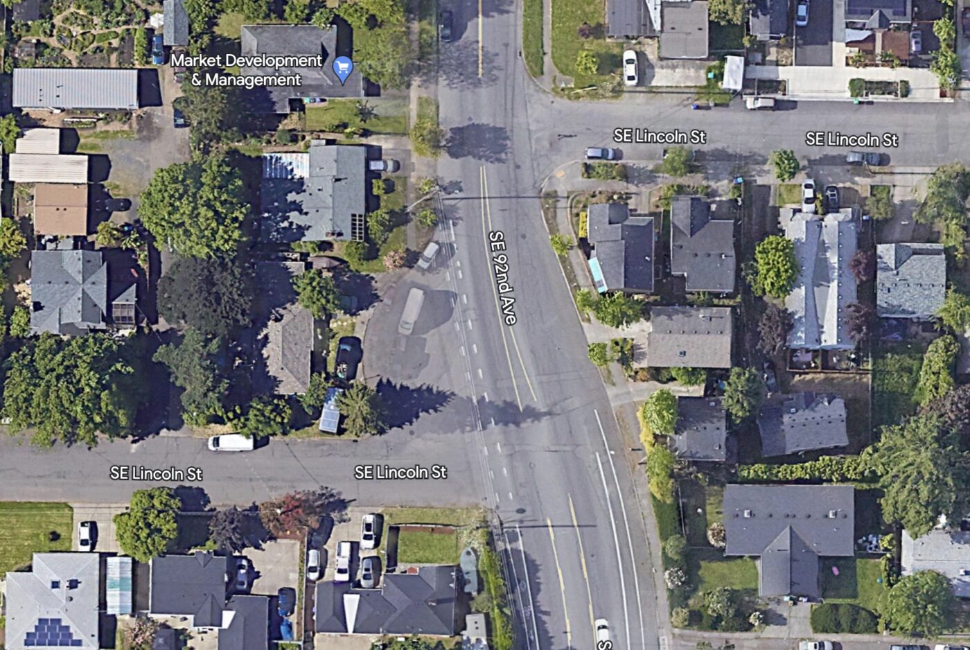
The Portland Bureau of Transportation has partially completed a project they hope will improve the crossing of Southeast 92nd Avenue at Lincoln. Just north of SE Division, this “T” intersection is very wide due to a cut-out of one of the corners (was it a streetcar turnaround perhaps?). At its widest location there is 115-feet of pavement on this relatively residential, neighborhood street.
Thanks to the local gas tax increase and PBOT’s Fixing our Streets program, the agency is adding new pieces of sidewalk, medians, crosswalks, bike lanes, and more. One big impetus for the project was the role the intersection plays in connecting people to Harrison Park School. SE 92nd and Lincoln was flagged in a 2017 effort to identify safe routes to school projects.
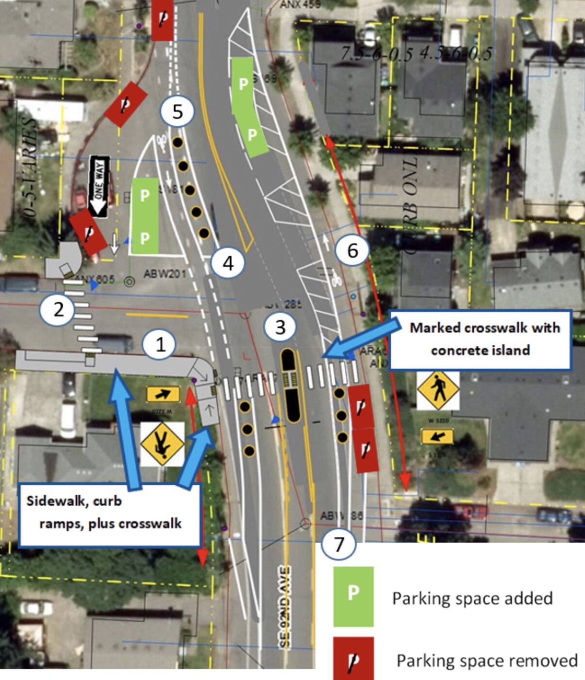
Here’s the complete list of what we can expect (via PBOT):
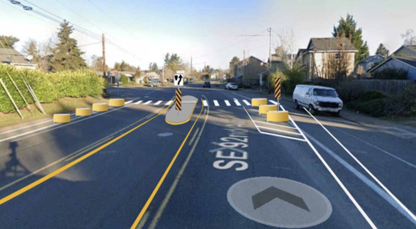
- Build a segment of sidewalk and three new curb ramps on the NW and SW corners of the intersection
- Mark crosswalks across SE Lincoln and SE 92nd Ave
- Build a concrete island in the SE 92nd Ave crosswalk to provide a waiting space for people walking
- Tighten turning radius to slow southbound vehicles turning right from SE 92nd onto SE Lincoln
- Separate automobile and bicycle travel lanes with concrete barriers
- Extend the east side bike lane through the intersection
- Adjust parking spaces by: removing six (6) legal parking spaces, but adding four (4) new legal parking spaces. This will be a total change of removing two (2).
New lane striping and pavement markings have been added, as have changes to parking spaces. PBOT plans to return in fall 2024 to complete other elements of the project.
Learn more about this project on PBOT’s website.




Thanks for reading.
BikePortland has served this community with independent community journalism since 2005. We rely on subscriptions from readers like you to survive. Your financial support is vital in keeping this valuable resource alive and well.
Please subscribe today to strengthen and expand our work.
I have questions about this one. I can see how that works if they proceed the main road and turn when they reach the (4) marker, but what’s stopping them from using the new one-way street as a slip lane and crossing the bike line at a higher speed?
Really good point Max. That slip lane needs to be a park. There is one driveway in that space.
Yeah, they should make a small access road connecting the driveway to Lincoln St and completely fill in the rest of the area with green space.
FWIW, I did email Safe Routes about this a couple weeks back. No response yet.
I got a response:
We were presented this self same project 10 years ago. You mean they still haven’t built it yet?
Doesn’t look like it based on the aerials. In 1955 when it was still a dirt road it looks like it was just a spot to turn around. Then in 60 it had a building in the center. By 70 that was gone and when they finished paving the road by 81 they just left it that way.
Minor quibble: I think the headline is pretty overblown! Paint and moveable concrete barriers don’t count as a “Major Overhaul” in my book.
Huh, I wouldn’t think this is needle mover when we have much bigger issues. Especially when PBOT is theoretically going broke. I’d spend all the money at 92nd and Holgate as it’s a major issue that can’t seemed to get “fixed.” I’m sure the guy in the corner will find a way to illegally park like many do on Division and 136th. This seems more like a “hi, we’re here to remind you we exist,” job. Feels like phase 2 as they have already added features here in the last 2 years.
This has been my neighborhood for the last decade, so perhaps I can offer some info.
As for streetcars, the closest the Mount Tabor Villa line got was a few blocks NE of here on Yamhill.
However from what I’ve heard from several older neighbors, the wide area / roundabout at Lincoln was where a bus line terminated in the 50s / 60s, and possibly later.
If you look at the historic Portland annexation map, you’ll note that this was the end of city limits for quite some time. NW of the intersection became Portland between 1901-1901; immediately across 92nd to the east wasn’t added until 1951-60 and both sides south of Lincoln weren’t added until 1981-90!
These boundaries had huge implications for the area. Lots that remained unincorporated Multnomah County are huge: double or even triple the square footage of many other areas of inner Portland.
Zoning on these has also long been higher, R10 if I recall correctly, so this has lead to many being divided into flag lots or turned into apartment buildings. Sidewalks are missing throughout most of this area and local streets are still gravel in a few spots. As such, both quality of life and home values suffer in this area and IMO it holds back our corner of the city from improving to the level that it has elsewhere. Most people wouldn’t even consider this part of Montavilla and people have straight-up dismissed this assertion until I broke out the Portland neighborhood maps and showed them.
While a city bus turnaround would make sense since this was prior to Trimet’s amalgamation of regional bus operators in 1970, I’ve also heard the intersection described as a “school bus turnaround” which is also plausible, since this would be the outer limit of PPS’ range.
To offer my perspective as a neighbor with nearly a front row seat to this: I’m wholly appreciative and supportive of the project. It’s something I’ve begging PBOT for since I moved here a decade ago. All along it’s been a huge barrier to us using the mass transit options just 1/3rd of a mile away.
The pedestrian experience here was awful before the improvements were begun. To walk on the west side felt very exposed, especially since automobile traffic was routinely going 40+ mph through that corner. When the concrete columns and bollards went in I went out in my yard and watched with joy as I saw brake lights on vehicles entering that curve! It’s doing a great job calming speeds slightly.
FYI we’re still missing the crosswalk and pedestrian island. Those should help as well.
Unfortunately the SE corner of Lincoln still has terrible sightlines for westbound vehicles turning onto 92nd. My neighbor’s parked car has also been hit twice by vehicles who didn’t make the the turn.
As of this morning there’s now a derelict RV that’s parked in the bike lane betwen the concrete barriers and the sidewalk and all day I’ve been watching bicycles and pedestrians (STILL no sidewalk here!) use the automobile lane to bypass it. My neighbor and I are taking bets on how many weeks it takes the city to remove this hazard from our lives.