Advertisement
The City of Portland is all set to update the intersection of Southeast Lincoln and 92nd in the Montavilla Neighborhood. It’s part of a $112,000 effort aimed at improving safety for everyone, especially people trying to access nearby Harris Park school. Below is a report on the project by Jacob Loeb initially posted on Montavilla News.
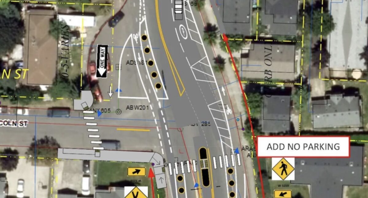
SE 92nd Avenue at SE Lincoln Street features an unusual and confusing intersection thanks to a southbound turnout lane. This poorly marked configuration creates ambiguous crossing points for cars, bikes, and pedestrians. This summer, the Portland Bureau of Transportation (PBOT) will implement several safety improvements and restructure this complicated “T” intersection.
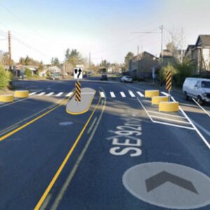
Funded through the Fixing Our Streets program, PBOT crews will add a marked crosswalk and a median refuge island on SE 92nd Avenue aligned with the southwest corner of SE Lincoln Street. Workers will repaint 250 feet of the bike lanes on both sides of SE 92nd Avenue to place riders against the curb. Eleven round cement lane separators will provide a protected buffer zone between the bike lane and automotive traffic near the intersection.
Advertisement
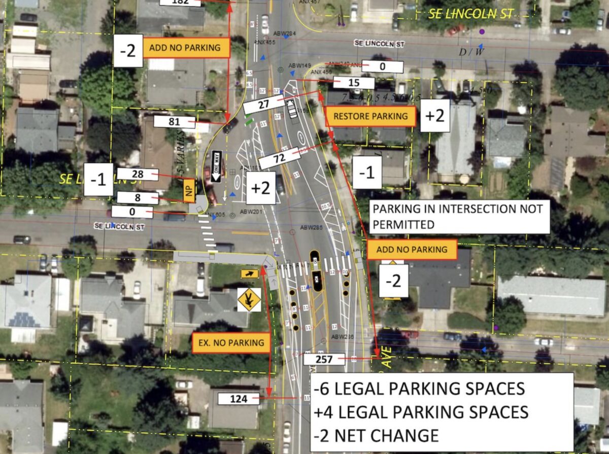
As a result of the expanded bike lanes and pedestrian safety improvements, PBOT will create two new “No Parking” zones and extend one zone further south. This parking change will remove six curbside parking spaces. However, the lane reconfiguration will add back four new parking spaces. Newly painted buffer zones on the east side of SE 92nd Avenue will support two parking spaces located between the bike and northbound traffic lanes. The southbound turnout will provide space for two additional parking spaces on its eastern edge. When complete, PBOT expects the project to eliminate two on-street auto parking spaces.
PBOT crews will add another new marked crosswalk to aid pedestrians crossing SE Lincoln Street when traveling on the west side of SE 92nd Avenue. This portion of the project will require a street corner reconstruction and the installation of 90-feet of new sidewalk. Much of SE Lincoln Street lacks consistent sidewalk infrastructure. Creating new Americans with Disabilities Act (ADA) compliant ramps and a short sidewalk connector will facilitate a clear, protected path to the enhanced SE 92nd Avenue crossing point.
As a well-traveled route to Berrydale Park and nearby schools, this confusing intersection needs these safety updates. PBOT’s changes should provide clearer cues for all road users by using physical lane delineators in conjunction with road markings. Additionally, the median island will incentivize fast-moving drivers to slow down as the roadway narrows, giving them time to avoid potential collisions. Look for construction to begin in summer, and use caution while crews are working in the street.



Thanks for reading.
BikePortland has served this community with independent community journalism since 2005. We rely on subscriptions from readers like you to survive. Your financial support is vital in keeping this valuable resource alive and well.
Please subscribe today to strengthen and expand our work.
I don’t live in Montavilla so I fully admit to not understanding the daily lived experience here, but why does tiny Lincoln need this turnout lane from 92nd? Lincoln dead-ends 3 blocks west of here.
The upgrade is a lot better than it was, but it’d be better still if that turnout got depaved and became a parklet. Or hell, cordon it off on one side and make it parking; even that would be better.
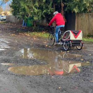
Lincoln is a low volume street that connects Harris Park school to the I-205 path. It has a huge pothole just before the school. This article would have benefited from having a map showing a much larger area.
That whole little divot there is weird. I used to ride through there regularly and there was usually a subaru of some sort being worked on in there. I wonder what the purpose of the cutout was?
I’m dying to know the history behind this incredibly strange intersection. Does anyone out there know?!
https://www.historicaerials.com/viewer
If you go back to the 1950s, you can see that the existing road here always jogged a bit at this location. In the 1955 aerial, you can see they develop a cul-de-sac, even though the road also appears to continue south as well. Looks like this was never developed, and the street has always been strange and wide here. At some point between the 1970 and 1981 aerial, the cul-de-sac circle is gone.
Looking at the aerials it looks like it was just a natural progression of the development of the area. Started out as some haphazard dirt roads in the early 50s. Then by 55 it had been carved out as what looks like a place to turn around. By 60 there appears to be a building on the space and 70 it was just cleared out empty field space. Then in 81 they just paved it all as is. I wonder if they offered to adjust the property line but the owner of the adjacent property didn’t want it for maintenance or tax reasons.
https://www.historicaerials.com/viewer
I thought something was going on when I saw a bunch of spray paint marks all over the road there. It would sure be nice if the bike lane went at least as far as Mill St to connect with the greenway. The road is wide enough and the parking rarely full enough that I sometimes ride where a bike lane would be. I’m not looking forward to another mess of confusing white lines and the inevitable cars parked in the bike lane but I am glad about the other improvements.