— By Taylor Griggs and Jonathan Maus
The plan to expand the I-5 freeway between Portland and Vancouver, known as the Interstate Bridge Replacement Program (IBRP), has had some success over the last year or so. It has broad local political support and even got name-dropped by President Joe Biden. But that doesn’t mean it’s been all smooth sailing.
Speaking of boats…
Whether or not they can fit under the currently proposed design has suddenly become a much bigger deal. As reported by The Oregonian Tuesday, the U.S. Coast Guard is putting their foot down when it comes to their demands that the project do a more thorough review of a movable lift-span (drawbridge) option.
IBRP Administrator Greg Johnson told BikePortland via email this morning that the Coast Guard delivered a letter to the Federal Highway Administration and the Federal Transit Administration in February requesting a study of a design option that provides 178 feet of river clearance. “Including only one alternative in the Supplemental Environmental Impact Statement (SEIS) introduces risk that no permittable alternative will be evaluated in the SEIS,” reads the Coast Guard letter.
In response, Johnson told us, “To do this, the program is moving forward with studying a movable span as part of the National Environmental Protection Act (NEPA) review process.” He added that doing the study now is a “risk mitigation strategy” because it can be folded into the existing review process and could prevent more significant delays later in the process.
In his comments to BikePortland, Johnson was very careful to show unwavering support for the existing fixed-span design:
“The program understands that external stakeholders want to move forward with a fixed span. We appreciate the responsibilities that the Coast Guard oversees and acknowledge the need to better understand the full range of benefits and impacts associated with a replacement bridge across the Columbia River. Additionally, the program will continue conversations with potentially impacted fabricators and businesses, who have expressed support for the replacement of the bridge and interest in mitigation agreement discussions necessary for a fixed span.”
This all started in June of last year, when the Coast Guard informed the IBRP team that their plan for a 116-foot tall bridge across the Columbia River wasn’t going to fly. The Coast Guard wanted at least 178 feet of vertical space for ships to pass underneath. But the IBRP team was insistent that a lower bridge would work. They said a lift-span would be too expensive and complex and that it would be much cheaper and easier to simply work with a handful of individual ship operators to mitigate passage concerns. All the while, ODOT and WashDOT seemed to brush off the Coast Guard’s threats, even though the maritime agency made it clear they wouldn’t budge and some insiders rang alarm bells.
For now it looks like the Coast Guard has won this high stakes game of chicken. ODOT and WashDOT must now include a formal review of a movable span design in the federal environment review process. And keep in mind: delays are deadly for megaprojects, especially one that already died once and comes with a pricetag that could reach $7.5 billion.
Lawmakers are watching
“Does the Coast Guard have veto power?”
– Bill Hansell, Oregon senator
“Yes… my hope is that it never constitutes a veto authority, though.”
– Kris Strickler, ODOT director
The former IBRP (the Columbia River Crossing) died because politicians backed away from it. Now, headlines about this latest design snafu have made their way to lawmakers in Salem.
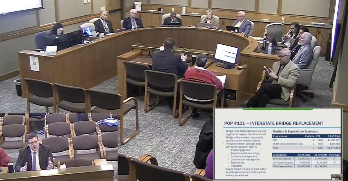
At a meeting of the Joint Committee On Ways and Means Subcommittee On Transportation and Economic Development Monday, Oregon Department of Transportation Director Kris Strickler was asked about the bridge height issue by Senator Bill Hansell (R-29).
“I just heard today… that the federal government had some issue with our design… care to comment on that?” Sen. Hansell asked.
“At the macro scale, the design is pretty well-formed,” Strickler replied. “But when you look at the details of the bridge itself, we are still looking at the movable span portion.” Then, without being asked about the cost, he added, “Would it cost more? Absolutely. I can tell you unequivocally that the cost of a moveable span is more than the cost of a fixed span. We don’t know how much more yet, but it could be upwards of $500 million, just for the bridge portion alone.” (Strickler also took the opportunity to remind lawmakers that a drawbridge that would be raised about 400 times per year would have a negative impact on light rail headways.)
In his comments Wednesday, Strickler tried to keep things lighthearted. “The Coast Guard is one of the federal cooperating agencies that partners with FTA and FHWA through this process,” he said at one point. “So it’s not like we’re in a position where we can tell them, ‘We’re just not going to evaluate your concept’.”
Then Sen. Hansell got right to the point on everyone’s mind: “Does the Coast Guard have veto power?”
And Strickler, always careful with his comments, replied. “I’ll define that by saying yes, because they have a bridge permit that we have to get in order for us to enter into construction. So my hope is that it never constitutes a veto authority, though.”
Tunnel vision
As we’ve covered in the past, Vancouver-based engineer Bob Ortblad has been ardently advocating for the IBRP to consider an immersed tube tunnel connection between Vancouver and Portland for a long time, saying it would be safer and more visually pleasing to the city skylines than a steep, hulking bridge. This idea has received little in the way of institutional support, but last week one person of note joined the tunnel team: Vancouver Mayor Pro Tem Ty Stober.
In a March 10th Facebook post, Stober expressed his disappointment with the IBR program hurdles, saying “the economy of Southwest Washington needs an updated crossing as soon as possible” and urging them to look for alternatives.
“It would be a tragedy to replace one draw bridge on Interstate 5 with another one,” Stober wrote. “I am calling on the IBR team to do a fresh, complete study of a tunnel. The benefit would be to reconnect downtown Vancouver to Fort Vancouver and open the skyline.”
On the Oregon side, House Rep. Mark Gamba brought up the tunnel at Wednesday’s legislative meeting. He asked Strickler why it hadn’t been given more consideration.
After saying one reason they don’t like the tunnel idea is because it would requiring “a significant amount of material waste… we’re talking millions of cubic yards,” Strickler said he doesn’t think a tunnel would provide adequate access to freeway interchanges used by the ports of Oregon and Washington. “… The tunnel idea provides complications in providing access to each of those [interchanges] in a way that makes it something that is technically, relatively infeasible,” he said.
What’s next?
The IBR planners don’t want a moveable span bridge, and they really don’t want a tunnel. But they’re not going to get the federal support they need for the project if they don’t play ball with the Coast Guard. Now they have to hope the additional review goes quickly and comes out in a way that proves a lift-span isn’t a good option.
“I feel pretty confident that we’ll get a fair evaluation and we’ll come up with what’s right for the community,” Strickler said.
IBRP Administrator says now that a movable span is officially in the NEPA review process, the public will get a chance to provide public input once the EIS comes out later this year.
On the advocacy side, in a press release from Just Crossing Alliance (JCA), a coalition of organizations who want a “right sized” project, member Brett Morgan with 1000 Friends of Oregon indicated this is a moment for the IBRP to make things right:
“One ‘alternative’ is not really a choice,” Morgan wrote in a statement. “And isn’t responsive to partners. The JCA has been saying since the early days of the project reboot that we need to bring along multiple alternatives.”




Thanks for reading.
BikePortland has served this community with independent community journalism since 2005. We rely on subscriptions from readers like you to survive. Your financial support is vital in keeping this valuable resource alive and well.
Please subscribe today to strengthen and expand our work.
A tunnel’s the obvious solution. I sketched it out here: https://twitter.com/jakz092/status/1636108939195711488
Wow. One (and occasionally two) bridge lifts per day, which can almost certainly be pushed to off-peak hours or even the middle of the night by operating agreements with river users. Somehow, I think transit riders will cope.
As for the freeway crossing: don’t build a drawbridge that needs to be raised 400 times per year. Put a six-lane freeway bridge next to the current bridges and line up the lift spans. But have the freeway bridge lift span rest at maybe 100 feet high, rather than the 40 feet of the current bridges. (Basically, whatever height keeps freeway bridge lifts down to once a week or less).
Re-use the existing two-bridge crossing for local traffic, light rail, and pedestrian/bike crossing. From memory, it wouldn’t cost that much more to rehab the bridges than to tear them out. They could pay for it with the money saved by putting only three lanes each way on the new bridge, without the added costs of bike lanes and light rail.
Of course, this is basically the “common sense alternative” that project critics have been pushing for the past decade. It’s one of the many options that mega-project-focussed ODOT has essentially refused to even acknowledge, let alone seriously consider.
Yeah as far as I can tell, half the justification for this project seems to be “we are sick of maintaining a lift bridge”. They really strongly emphasize how it costs “millions per year” to maintain, staff, and lift the bridges now. It’s obviously money well spent – if there is enough travel demand between SW Washington and Oregon to spend $7.5 billion on a new project, saving even $500 million by putting peds/bikes/transit on the newer older span would easily save money over the lifespan of the new bridge.
Any project that removes the existing bridges should be dead in the water, in my opinion.
The other half of the justification for the project seems to be a desire to widen freeway interchanges in Clark County.
blumdew: good point “IF” the national infrastructure finding system in the US were logical…the feds (and states) love to structure (prioritize) grant funding for building new capital projects over funding operations or even maintenance of existing. So the argument of the tradeoff for saving $10 in construction over 1 dollar / year more spent on operations does not work for the local agencies.
A tunnel is so obvious here.. like the Columbia is the most important waterway in the Northwest. And I do not buy that the interchanges would be “technically infeasible” for a tunnel. At least on the Oregon side (the ship channel is on the Washington side of the river), so a mild grade would still be possible to reach a bridge from Hayden Island to the mainland. It looks a little trickier on the Washington side, since there is less space, but no chance a highway engineer couldn’t design an interchange from the end of the tunnel to WA-14. It might be a little more expensive than that single interchange would have been otherwise but it would definitely be less expensive in the overall scheme of things still.
A tunnel with no interchanges and keeping the newer of the two current spans for local access and transit is an obvious, low cost choice. But ODOT/WSDOT want freeway widening, and they will get it any cost.
I think the “issue” is the interchange with WA-14, since there is a fair amount of industrial off Columbia Way. It seems simple enough to construct an interchange there though. It’s not like there isn’t enough room to the east of the exchange for longer approach ramps to a tunnel. Plus, if they bridge is 178 feet tall to accomodate the coast guard, far steeper grades/longer approaches would be needed to reach that (remember, the shipping channel is near the WA shore, so there wouldn’t be much room to dip below that between the bridge and the interchange). The shipping channel is ~40 to 50 feet below water level, so to maintain a 1% grade, they would really only need 400-500 feet. Doesn’t seem to onerous to me.
Full disclaimer, I am a Bob Ortland twitter follower though (you should be too).
A freeway widening project dressed up as a seismic hardening and public safety project.
No more freeways! Not one more vote for even one more ton of CO2e in the atmosphere!
100% agree, the immersed tunnel is the bet choice- safer, cheaper and much more attractive. It would be a bit rough on a bike, but so would a bridge.
When the IBR folks analyzed their own tunnel concept, they assumed that the shipping channel would remain close to the north bank. However, back in 2002, the US Army Corps of Engineers stated that relocating the navigation channel toward the middle of the river would likely result in reduced channel maintenance costs. Would this allow a tunnel to make the freeway connections that the IBR straw-man tunnel can’t? The full facts need to be set forth in an Environmental Impact Statement that looks at both a tunnel and an opening-span bridge. These alternatives need to be designed to work, rather than be phony alternatives with built-in flaws. Truly independent engineers (these are hard to find) should be engaged to explore these options.
A relocated shipping channel would be reconstructing the swing span of the railroad bridge, as well as dismantling the existing I-5 bridges. I would certainly prefer to keep the I-5 bridges as they are, with the newer one becoming a transit bridge and the older one becoming a bike/ped bridge. And I think maintaining the existing bridges is a pretty significant benefit of the tunnel option (I much prefer biking, walking, or taking transit over a bridge than a tunnel).
I think the IBR straw-man tunnel is bogus on its face. There is no way there isn’t enough room to make connections to WA-14 as it stands now. They may need longer approaches than they have now though
The Glen L. Jackson (I-205) bridge crossing the Columbia River has a vertical clearance of 144 feet above the river to accommodate ships. The new CRC bridge should at least match this 144 foot clearance and probably more to support Vancouver industrial and ship building facilities located between the two bridges.
There is no height that is simultaneously compatible with the Ft. Vancouver Airport, MAX, and river freight. We learned this in the the last iteration of CRC, and it’s astonishing that anyone thinks that the geometry has changed since then.
The downfall of a tube is that you can’t build a big, aerial megaproject with seamless exits to Hayden Island and SR14. That, and it will be much harder to expand when they get itchy to induce a little more demand.
Why does Hayden Island even need direct freeway access? Build a local bridge to the mainland by the Expo Center.
The most recent CRC plans showed ramps to Hayden from the Washington side, but not from the Oregon side. The more you dig, the more it feels like this project is just catering to Clark County commuters/shoppers and freight interests.
Hayden doesn’t need an interchange.
Sounds like a feature, not a bug to me.
I’d like to also throw out that “technically, relatively infeasible” really translates to “we don’t really want to do it”. There are a ton of places that have made tunnels beneath deep bodies of water that are important for navigation. The Brooklyn-Battery tunnel in NYC (plus the Lincoln and Holland tunnels).
And concerning the material waste “problem”, and immersed tube (ala Transbay Tube) would have much less material waste. And while “millions of cubic yards” sure sounds like a lot of material, there is no way to know exactly how that figure was arrived at. What tunnel? How deep? The IBR documents about a tunnel are pretty slim in the way of details – and don’t discuss an immersed tunnel at all.
I’d head off earthquake concerns too by talking about how the Transbay Tube in the Bay was operational within a day after the 1989 Loma Prieta earthquake while the Bay Bridge had a partial collapse. But I’m not a seismologist.
Near Vancouver BC, in Delta, is the Fraser River tunnel, 2 lanes in each direction, under a navigable river. Earthquake-resistant apparently.
https://www.google.com/maps/@49.1173093,-123.069947,3a,75y,90t/data=!3m7!1e1!3m5!1sMPzkJqWcFbuIq9aOoq-tIA!2e0!6shttps:%2F%2Fstreetviewpixels-pa.googleapis.com%2Fv1%2Fthumbnail%3Fpanoid%3DMPzkJqWcFbuIq9aOoq-tIA%26cb_client%3Dmaps_sv.tactile.gps%26w%3D203%26h%3D100%26yaw%3D11.439998%26pitch%3D0%26thumbfov%3D100!7i16384!8i8192
Hey that’s cool. They even offer a FREE shuttle for bikes, as they’re not allowed in the tunnel.
George Massey Tunnel Shuttle for Cyclists – Province of British Columbia (gov.bc.ca)
I am glad that the tunnel concept may actually have a real evaluation. (I just got back from another trip to Seattle and riding the new subway around downtown and from/to to the airport was a quick relaxing pleasure. And the removal of the Alaska Way Viaduct*, a vertical barrier to the waterfront was equally fabulous…just like the Embarcadero viaduct removal* and rebirth 20+ years ago.)
Yes, the connection to SR-14 is more complex with a tunnel (let a future enhanced SR-500 take the future SR-14 load). May be it is best to de-prioritize the western access of SR-14 to I-5…as most peak hour folks are currently avoiding it for I-205 if they are on SR-14 now AND this would reclaim a lot of land downtown and re-connect Vancouver to its national park (Reserve) and more of its waterfront- thus reversing a 70 year mistake*. [I used to live and work next to the the SR-14/ I-5 interchange.]
Also a tunnel – SR-500 / Kiggins Bowl to Delta Park – may also be an easier work zone for staged construction by allowing Vancouver´s downtown and Interstate Bridge zones to function fully until the tunnel segment is complete versus living through a 2 to 5 year hell. Hayden Island would keep its existing access from the south once the 2 steel bridges are removed.
The Coast Guard *ABSOLUTELY* has veto power over any bridge design that they deem obstructs a navigable waterway of the United States. And the Columbia River is one of the most important navigable waterways in the US.
If they require a lift, that bridge will have a lift – which puts us right back where we are currently.
The planners need to think outside the box here. The tunnel option should be on the table, along with moving the interstate to St. Helens and crossing the river on a high bridge up there. May need to rip up the design and start over.
Here is something I wrote in 2005…
Columbia River Crossing…a tunnel, a “Burnside Bridge” with MAX, and a freight arterial with added passenger rail capacity…Let’s call it the “4-4-2.”
Deliberations have begun on different options for a Columbia River Crossing. A tunnel under the Columbia River (including Oregon Slough/Portland Harbor) may offer a simple…even elegant, data based and cost effective solution to this transportation challenge…separating through trips from local ones. Then the fun begins…
The I-5 Task Force recommended 10 total lanes… freeway/auxiliary/arterial… and a pair of lightrail tracks between Oregon and Washington; data shows that at least 1/3, if not more, of all trips across the existing Interstate Bridges are of local origin with local destinations. ”4-4-2” addresses the growing demand for local access across the Columbia River by creating a variety of options for those trips.
Four (4) through freeway lanes in a tunnel, going to six (6) lanes at Columbia Blvd. in Portland and Mill Plain Blvd. in Vancouver. (Columbia and Mill Plain are key E/W freight arterials)
Four (4) arterial lanes for local traffic on existing twin Interstate Bridges with dedicated light rail alignment in what are now the inside lanes.
Boulevard type arterial with traffic signals and/or circles for traffic distribution replaces existing freeway between River and Mill Plain; redevelop old freeway ROW between downtown Vancouver and Historic Reserve.
Boulevard type arterial with traffic signals and/or circles for traffic distribution replaces existing freeway from River to Denver Avenue/MLK and Marine Dr; redevelop vacated ROW and adjacent property between Columbia and bridgehead.
Upgrade & widen sidewalks on Interstate Bridges; add bike bridge in space between bridges supported by existing structures.
The Tunnel option simplifies construction logistics, has fewer impacts on river traffic, water quality, fish or air traffic. The conversion of the existing Interstate Bridges, retains historic structures, re-using them in new ways to accommodate local vehicle and transit trips. Removal/conversion of existing freeway segments captures valuable land adjacent to transit, arterials and the River for re-development…commercial, industrial or residential/retail.
Original Interstate Bridge, built in 1917, had four traffic lanes with streetcar tracks…you could take the Union Avenue streetcar to downtown Vancouver! With the construction of I-5 through North Portland and across the River, a second bridge was built and together the twin bridges became I-5…the arterial and transit connections were lost!
“4-4-2” restores the arterial/rail connectivity between Portland and Vancouver.
Lenny Anderson, Member, Governors’ I-5 Task Force
Brilliant. Let’s launch an initiative petition so we can all vote in this plan!
Lenny: don’t forget to remind the “kids” that Union Avenue was MLK. 😉
The Coast Guard makes for a strange ally in opposing the current IBR project, but I’ll take it if it means stopping the absurd freeway lane expansion for five miles up and down I-5.
A tunnel would be great, especially if it killed some interchanges near the bridge. It’s those very interchanges that create so much bottleneck right at the bridge. We can keep the lane count the same, remove the merge conflicts right at the bridge, and probably eliminate much of the round-the-clock gridlock there. Sure, it would always back up at commute time, but we should not be building freeways for commuters as much as we should for average throughput and freight. Otherwise, induced demand behaves just like digging in wet sand: It will always fill in again.
Comment of the week!
When was the last time something that tall traversed the bridge zone? The earlier CRC argument was based on an oil driling rig fabricator, and was much lower. Due to the channel depth restrictions, we aren’t going to see mega-container ships(Triple-E) Port of Portland/PortVan, much less, above I-5.
Another interesting trend that may shape the IBRP is the IJJA…depending on our DoTs and states’ leaders…as Bette Davis, that film noir diva, once said, ‘fasten your seat belts, its going to be a bumpy …’…as the Houston community advocates just found out with their new improved highway…
“[Steve] Davis added that at the end of the day, Buttigieg and his colleagues don’t really have much of a say in whether bad highway projects go forward — because under the Infrastructure Investment and Jobs Act, Congress guaranteed states the right to build pretty much whatever they want with the bill’s $110 billion in funding. That money will distributed over five years according to a formula, rather than based on the U.S. DOT’s discretion, and can be used on new lanes even when states have existing roads that are badly in need of repair or life-saving redesigns.” – Kea Wilson, Streetsblog USA
“When states follow the widely-accepted standard measures and models, FHWA really has no substantial power to stand in their way,” he said. “[That’s true] even when we know that their project is destructive, that it will increase emissions, that it will disconnect communities and primarily serve the needs of people who move through a place over the needs of the people who live there.” – Streetsblog USA
*Steve Davis, assistant vice president for transportation strategy at Transportation for America.
https://usa.streetsblog.org/2023/03/15/secretary-pete-cant-save-you-fhwa-oks-houston-highway-expansion-after-pause/
Hopefully, the various factions can keep delaying this until The Big One eliminates it completely.
Wasn’t there a thing called the “common sense alternative” back in the day, which said that if they rebuilt the railroad bridge downstream to make the tallest part in line with the Interstate Bridge tallest part, then ships wouldn’t need to use the lift span? Something to do with how the current works.
Atreus, sorry one would think so, but railroads in the US are very entitled due to rules and laws developed in the 19th Century before the 1st Progressive era when the US Congress worked for the trusts and railroads. BNSF wont budge for rebuilding it unless someone buys BNSF or the bridge falls / fails to open.
I don’t understand, why do you think they would object to rebuilding the bridge if someone else pays for it? To be clear the new bridge could be build alongside it before tearing down the old one, so it wouldn’t disrupt their operations.
If someone pays for most of the cost of a new railroad bridge, the Coast Guard has full authority to order the current one be replaced as a hazard to navigation, which they declared it is back in 2002.
Did they already declare the Columbia span as a hazard to navigation? I know that the Willamette span was replaced in 1989 (swing -> lift) after a collision from a ship, and it was replaced mostly with a federal grant. If it’s a matter of funding, it would seem that the IBR project with a $10 billion could spare some of that to replace part of a railroad bridge
Another bridge in another location is required. We and I mean the groups I belonged at the last iteration stopped the last replacement. To have only two major transport routes across the Columbia is inadequate. Doesn’t matter how many lanes they all come down to 3 on either side. Build in a different location or a tunnel. it will cheaper and more effective to travelers and cargo movement.