
Note: This report was submitted by longtime BikePortland reader, supporter (and recently co-owner!) Mike Perham.

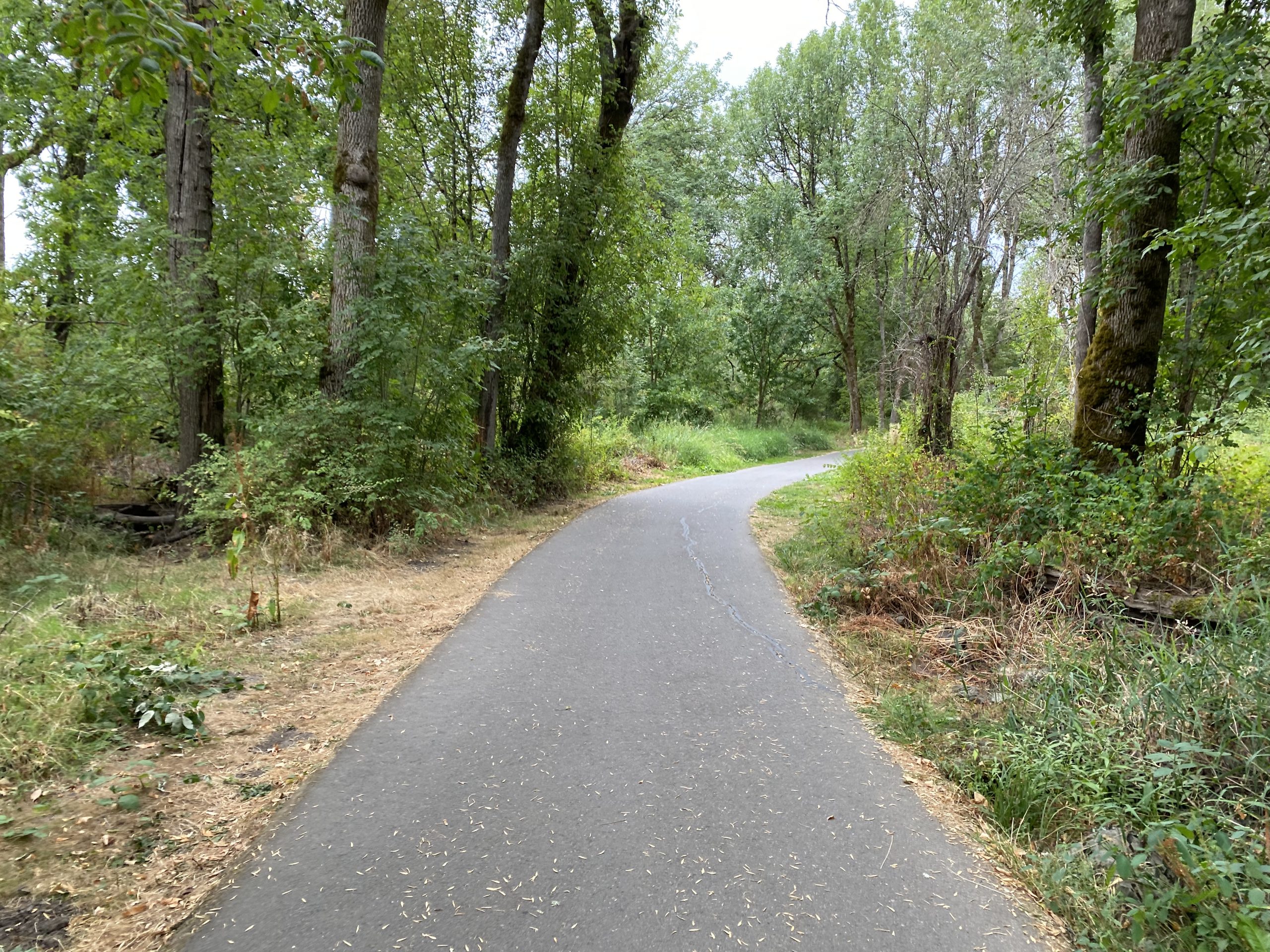
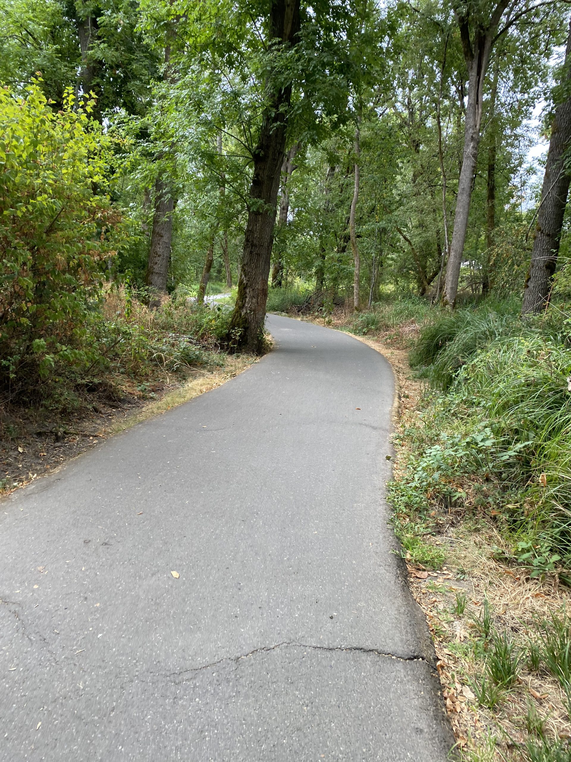
I recently learned of the Fanno Creek Trail, a car-free bike/ped path running about 4 miles in length between Tigard and Beaverton. This trail is wonderful, flat and easy to ride for all ages.
I started on Main St in Tigard, got some coffee at Symposium Coffee (12345 SW Main Street) and started riding on the Heritage Trail next to it. What I didn’t realize is that this trail is not technically part of the Fanno Creek Trail (imagine the problem of having too many high-quality trails, woe is me!) and so when it ended, the connection to the Fanno Creek Trail (FCT) was a bit daunting.
If you do this ride, please learn from my mistake and either start at the Tigard City Library (map) or at the Fanno Creek crossing on SW Main St (look for the bright floral mural on the side of the building).
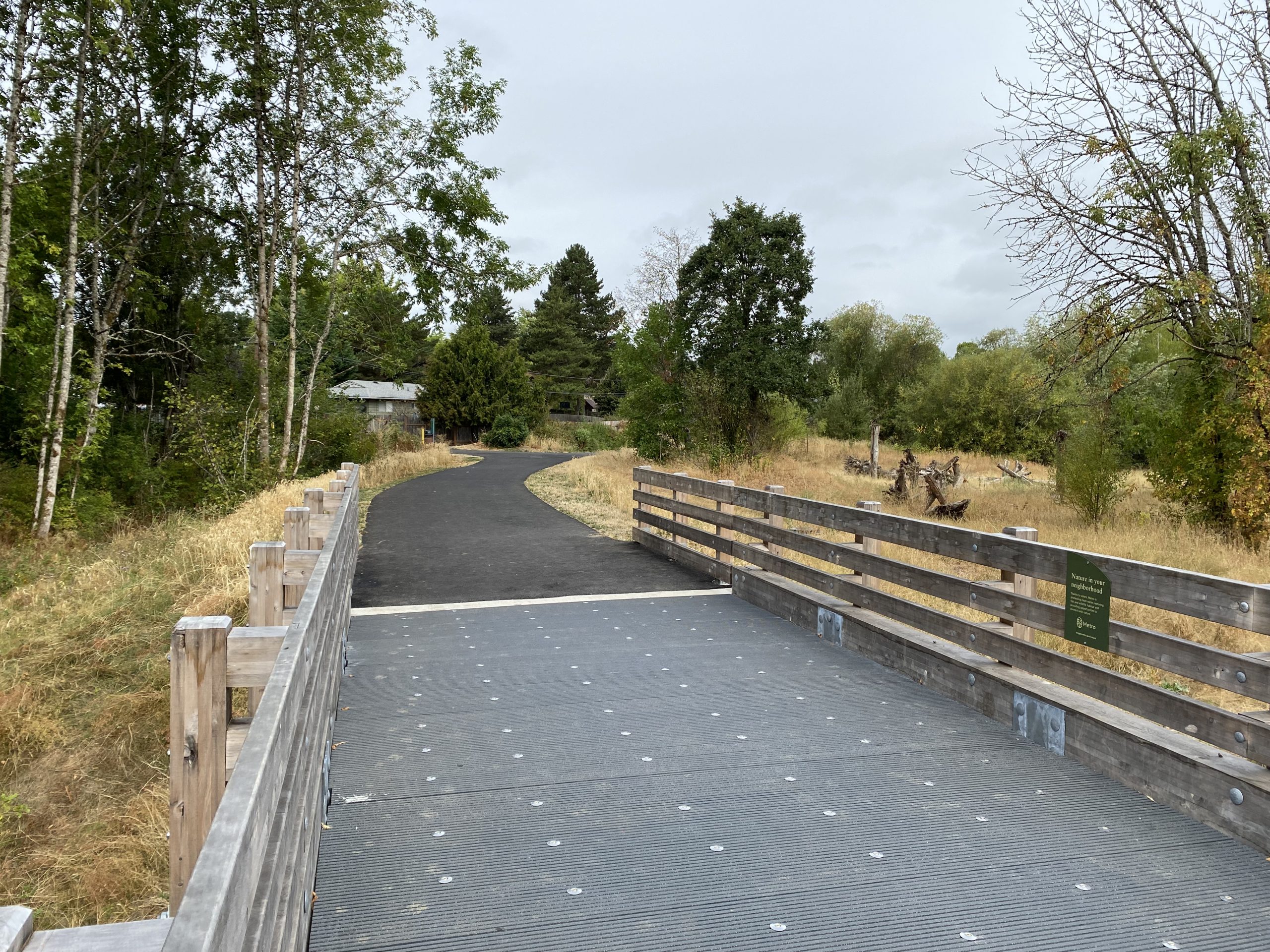
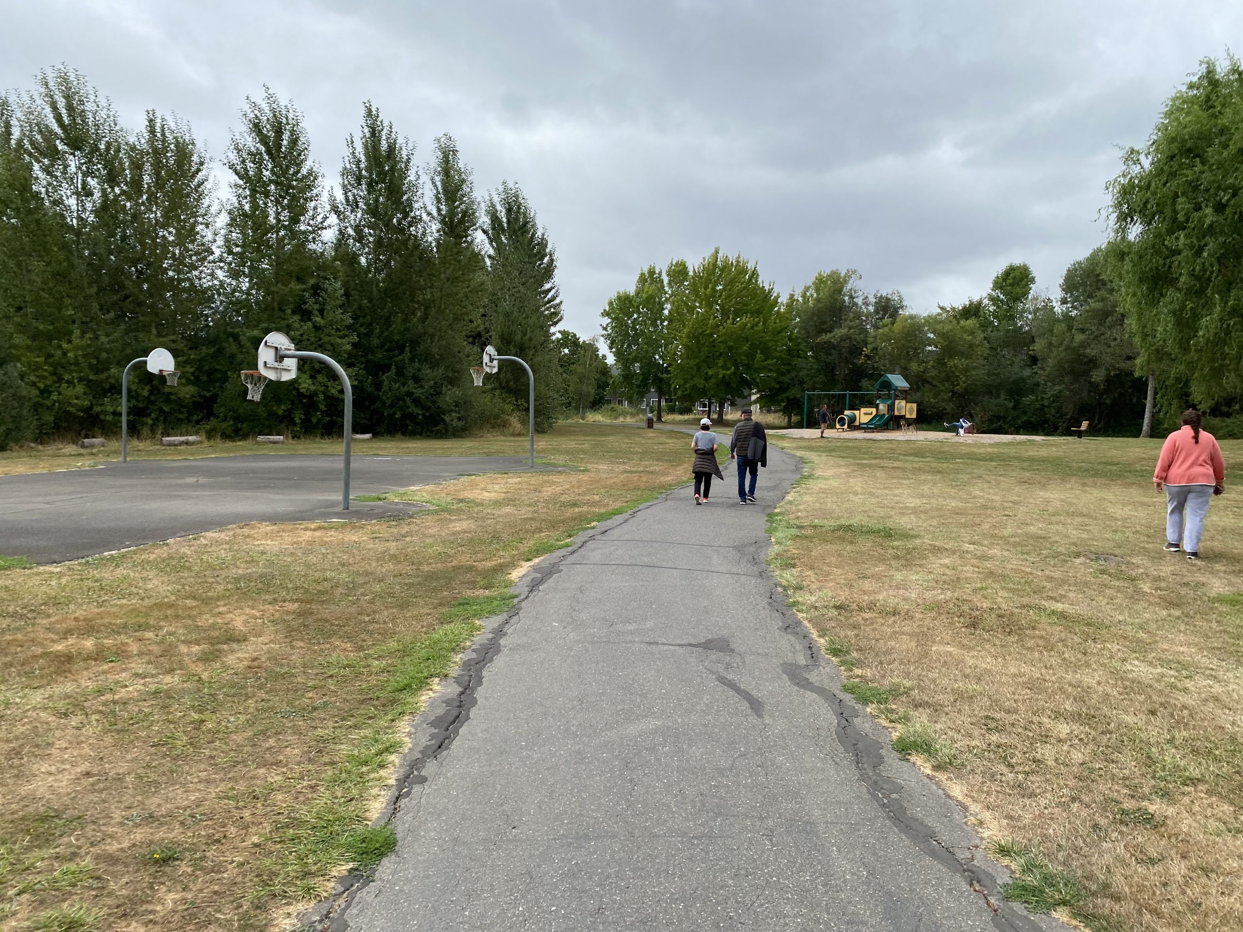
From there, the Tigard portion of the trail is amazing: plenty of woods in Woodard Park and Dirksen Nature Park with a newer, natural-style playground for kids. After two miles you’ll transition into Beaverton and follow alongside Fanno Creek. The trail has several basic playgrounds and basketball courts but no parking lots or immediate car access to any of it (the trail does have good connectivity with local neighborhoods so you can park on the streets nearby).
Advertisement


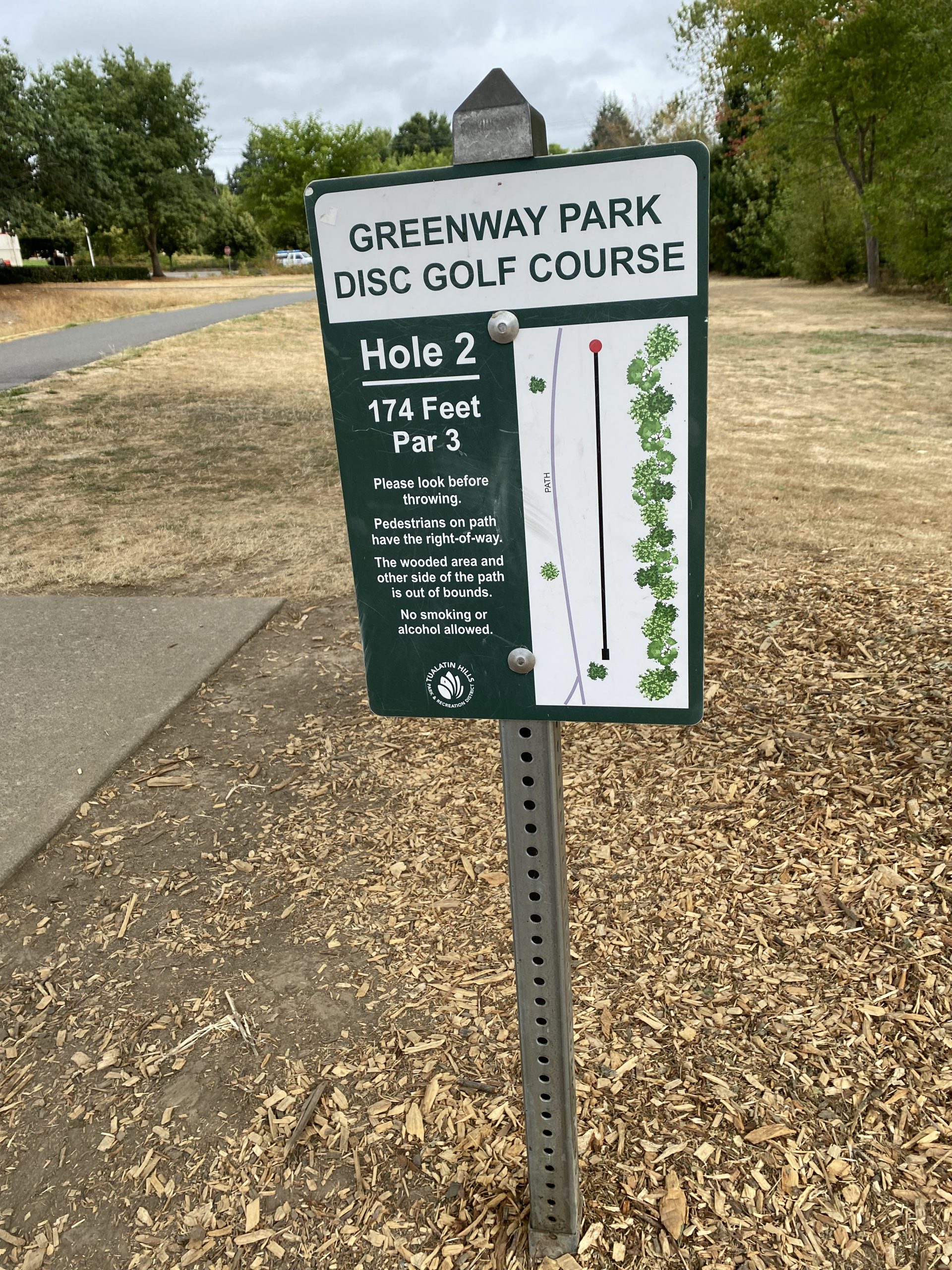

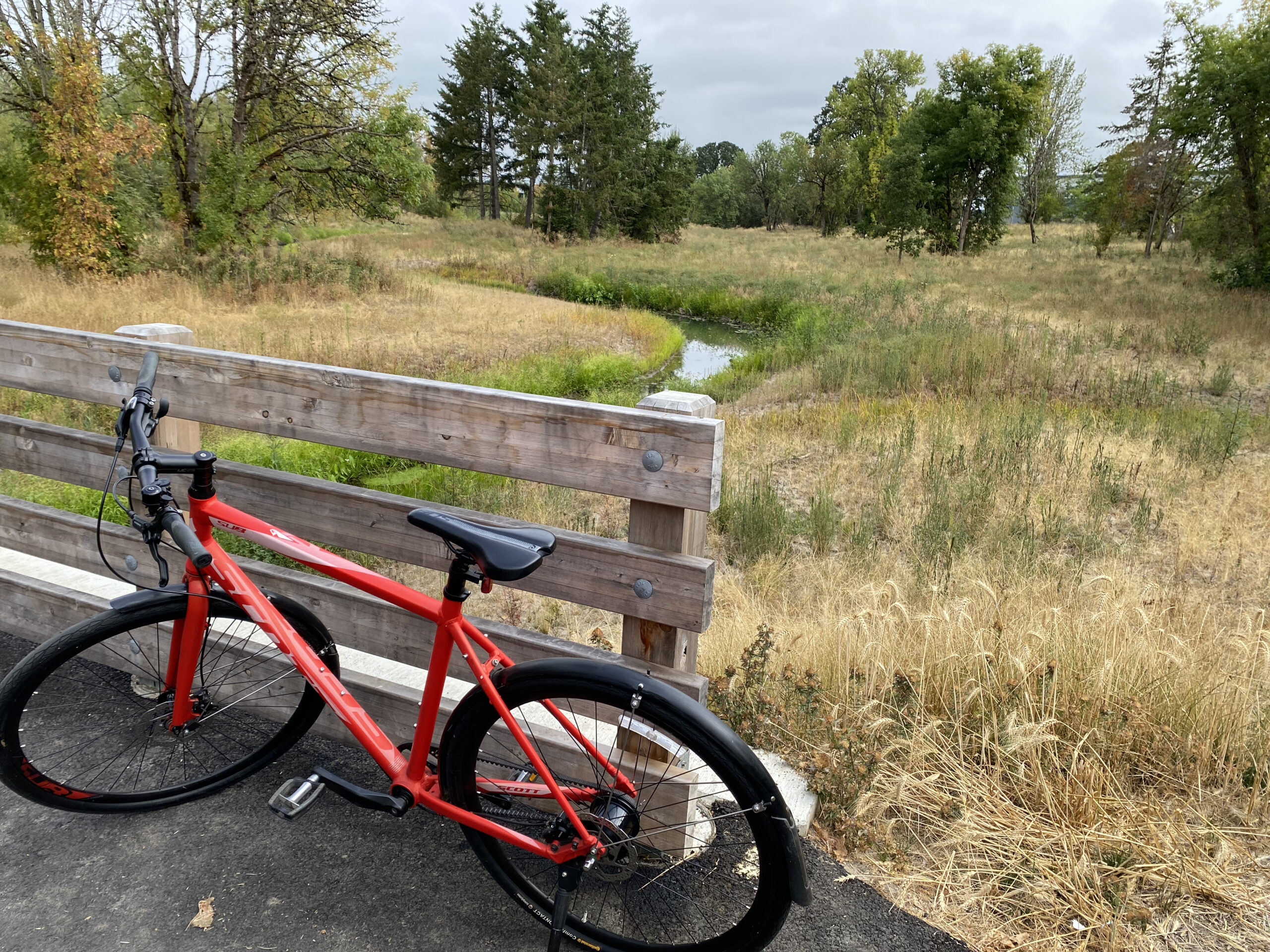
On the north end of the trail, there’s a disc golf course and serene wetlands. I think I enjoyed that the most: just 15-20 minutes of easy, stress-free riding in nature. My GPS app showed about 8 miles roundtrip, mostly flat. It’s been months since I’ve been on a ride this relaxing.
Any issues? The trail does cross several arterials (large streets with fast traffic) but each has a very clear crosswalk and warning lights for car drivers. I noticed the north side in Beaverton has very few amenities: no benches, restrooms or water fountains. If you need those, Dirksen Nature Park in Tigard has them. Since the trail is mostly asphalt, the ride can be bumpy due to frost heave (note to self: look into a suspension seatpost).
But in the end, these are minor quibbles. The Fanno Creek Trail is one of the best trails in the Portland Metro area and an amazing asset for Tigard and Beaverton. If you’re on the west side and haven’t ridden it yet, get over there while the weather is still good.
Thanks for sharing Mike! If you’d like to submit a report, please send text and photos to Jonathan Maus (who is recovering from a broken clavicle and not able to work as much as usual) via maus.jonathan@gmail.com.
— Mike Perham, @getajobmike on Twitter
— Get our headlines delivered to your inbox.
— Support this independent community media outlet with a one-time contribution or monthly subscription.


Thanks for reading.
BikePortland has served this community with independent community journalism since 2005. We rely on subscriptions from readers like you to survive. Your financial support is vital in keeping this valuable resource alive and well.
Please subscribe today to strengthen and expand our work.
Thanks for the article! Looks really nice. I can tell it’s not in Portland by the lack of garbage, graffiti and discarded drug needles and paths that aren’t blocked by encampments.
Refreshing isn’t it? I remember we used to be able to have things like that in Portland.
Marvin, I agree with you 100%. We desperately need to have adequate temporary shelter beds so we can end the inhumane practice of allowing public, unsupported camping.
After many tent cleanups, shelter beds are offered and in most cases the campers refuse to take up the offer. More shelter beds isn’t the solution.
But if there are adequate shelter beds available, one can enforce no public camping bans.
It’s a Catch-22 of the homeless being the actual problem due to character, but bleeding hearts never admitting it.
I first noticed Portland’s safety decline with an increase in dangerous homeless people in 2016 along the Springwater Corridor, which was named “The Avenue of Terror.”
Then, the loud anti-police movement sealed the deal in 2020 by misidentifying the true bad guys. Portland has a chronic inability to identify root causes, always reverting to naïve “compassion” for people who ruin things. The newsworthy drop in bike ridership was hardly coincidental to crime!
Nice!
Would the author be willing to expand on precisely WHY the connection between the Heritage Trail and the Fanno Creek Trail was so daunting? I know nothing about this area. Any tips on advance would be appreciated!
Do you mean by the section that is adjacent to the Portland Golf Club or the one by downtown Tigard?
The Heritage Trail is an old railroad route that was removed when WES was built. It was never intended to connect to Fanno. Having said that, you can easily connect on Katherine Street, a dead end street that ends at the Fanno Creek trail. It just needs signage. Someday!
The Heritage Trail has too many white-shaming placards for my liking, but it’s an easy ride if you want to veer left (southbound) at Woodard Park..
I love the Fanno Creek trail; used it many, many times. WashCo and THPRD really know how to do their trails right, between this, the Westside Trail, the Rock Creek Trail, and more!
It also goes on for much longer than this, actually. On the north end, after a slightly-stressful but not terrible crossing 217 at Denney, the trail picks back up on the other side and runs all the way to the Oleson/Garden Home intersection. On the south end, it continues all the way to Bonita.
Good to know, I will need to explore the ends more next time. Thanks for the info!
The 217 crossing is due to be upgraded as part of the 217 auxiliary lane project. Supposedly it’s supposed to be very bike friendly. We’ll see.
Great trail to ride with my 4 year old. He loves all the playgrounds
I did a longer version of this ride with my dad last year. It is one of many great rides profiled in Ayleen Crotty and Lizann Dunegan’s falcon guide book Best Bike Rides Portland, Oregon.
Many parts of that trail need to be put on an elevated boardwalk so that the rainy season flooding will not block the trail. Plant more trees to block, too. The whole crossing of SW Denney Road needs more narrow car lanes to give more room for actual bike lanes.
This is great – I live so close to this, but never ride it (always viewed it as more of a walking trail and was wondering if cyclists would be… not unwelcome, but maybe out-of-place). Next time I’m out for a ride, I’ll try it out. Thanks!
Is this the same path (or part of it) that was involved with the nationally-known notorious Dolan case? https://en.wikipedia.org/wiki/Dolan_v._City_of_Tigard
Yes
I stopped using this for commuting as it often floods in winter. Also gets very busy with walkers, strollers & joggers in the afternoon so you gotta go slow. But it is a nice ride if you’re not in a hurry.
Flooding has been mitigated. The beavers still win, but they were able to re-route water.
Just an FYI / Fanno Creek trail update – the Fanno Trail connects at the South end through Tigard’s Cook Park and across the Tualatin River via the re-purposed/re-furbished Ki-A-Kuts Bridge to the Tualatin bike – ped system, ultimately a connection to Wilsonville and the Metro Park @ Graham Oaks Nature Park. ( Using the Trimet’s WES train to travel either way, to-or-from Wilsonville, can add to the experience by altering the north start/end point to either: Beaverton,Tigard or Tualatin. This is only available AM or PM commute times Mon-Fri , only.) The North and East end of the trail connects with the Portland South-West trails network in the Garden Home – Multnomah Village area near the (THPRD) Garden Home Rec Center Trader Joes ( under construction) @ the Oleson Rd-Garden Home Rd intersection, and from there to Barbur Blvd – Corbett – West Bank of the Willamette River, and connections to the Tilikum and Sellwood Bridges over the Willamette, and then into the rest of the Portland bike/ped network. There are a few gaps and glitches in the Tigard section, north of the Ki-A-Kuts Tualatin Bridge as well as South of Scholls Ferry Rd,which is the boundary between Tigard and Beaverton/THPRD responsibility for the Trail. I would recommend using the extra-wide sidewalk along Denney Rd to connect across HWY-217 to the continuation of the trail toward the Garden Home Rec Center. Also, the bike/ped trail connection through the Scholls Ferry-Allen Blvd-SW 92nd intersections is slated for an up-grade by the City of Beaverton, at present suggest crossing Scholls and Allen via signalized crosswalks and use the sidewalk along Allen ( East-West ) to 92nd’s crosswalk to re-connect with the trailhead ( when East-bound, reverse when West-bound). More detailed infomation are available from either Metro or the Tualatin Hills Park & Rec. District (THPRD), the Park District ( and separate from the city of Beaverton and Washington Co.) for most of Beaverton and most of Eastern Unincorporated Washington County.
The elephant in the room, this trail is amazing because it does not double as a housing space
There have been sketchy homeless getting high under the Scholls Ferry Rd overpass. They just don’t make themselves too obvious out in the open. Advise not going there after dusk. Image shows female jogger (in middle) who took a risk.
Thanks WM for the details on the other sections of the trail and the planned changes. The thing that was missing from the original article was that the Fanno Creek Trail is on transportation planning maps for Portland, Beaverton, and Tigard. These cities see it as transportation not necessarily recreation.
As such, some aspects of the trail are simply inadequate. Flooding that prevents the trail from being used in the winter months is one. Frost heaves, actually more likely tree roots given that we are in Oregon, should not occur if the trail was built correctly. Think they are hard on a bike? Try a walker or wheelchair. The section between Garden Home Rec and the Portland sewer pumping plant has sections that are barely an arms width apart, have places where there are exposed fence posts with the open end parallel to an inches away from riders, a lip to the entrance of the parking lot will take down the unwary cyclist, and a sharp drop off in the narrowest section of the trail.
The Fanno Creek trail is better than nothing. But if THPRD is going to be in the transportation business, they need to up their game.
I agree fully and completely with Vince on his comments, both to THPRD & Washington County Dept of Land Use and Transportation ( DLUT ).
I should add a clarifying note that THPRD is not, by their mission in the Transportation business. They have, however, been drafted and co-oped into that function by Wash Co DLUT. That said, THPRD does need to ensure the facilities it manages are up to the standards of any typical public bike/ped facility.
If only this trail were longer! But mostly safe roads can take you all the way to Durham & Tualatin from it.
Look into the story of how beaver dam floods were accommodated along Fanno Creek, especially in the area south of Hall Blvd where some side trails dead end in water. The bridge tunnel under Scholls Ferry Rd also floods a lot, but is passable at low speed.
Homeless are increasingly congregating in certain places but it’s a lot nicer than what became of Springwater Corridor around SE 82nd Ave, etc.
I love this trail. If you want to make it a longer more scenic route. Hang a right on Hall Blvd towards Tigard (huge bike lane). That deadends into Cook Park. You can take Cook Park all the way to Tualatin Park.