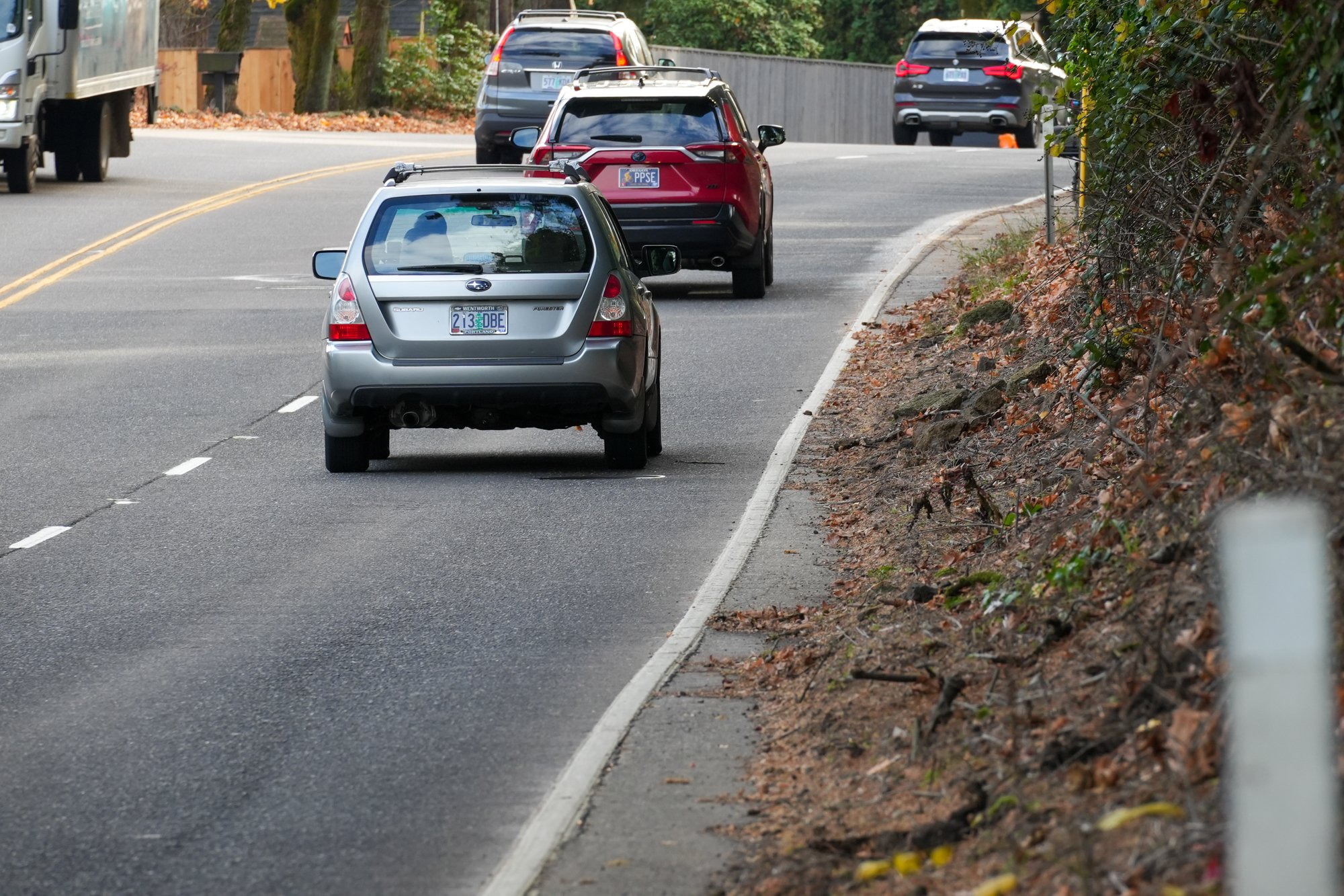
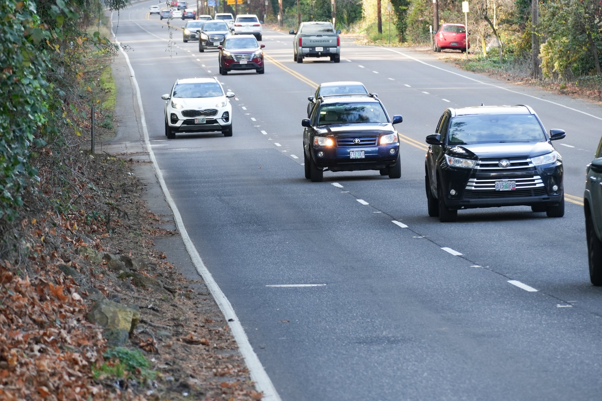
I’ve visited many fatal crash sites over the years, but the one where 68-year-old Rutilo Jorge was hit and killed one week ago may be the scariest yet. I had never biked on Highway 43 south of the Sellwood Bridge before Saturday, so I wasn’t sure what to expect. When I rolled up and saw the horrible conditions, a chill raced through my body as I nervously pedaled to reach the safe harbor of a residential driveway where I could take a breath and gather my thoughts.
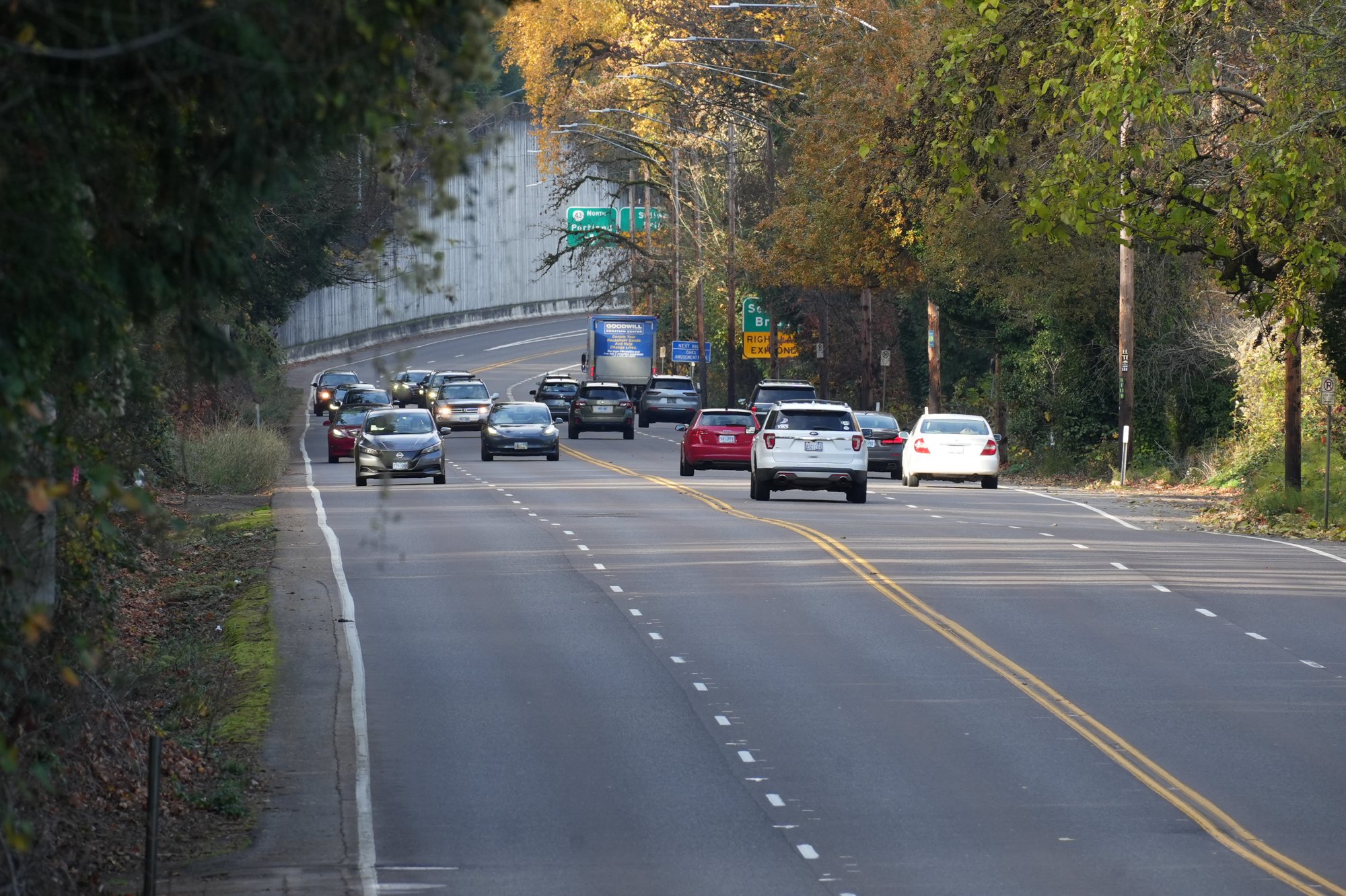
The Multnomah County Sheriff’s Office (MCSO, the lead agency because it happened just outside Portland city boundary) says Jorge was hit around 5:30 pm. According to their statement, Jorge was riding southbound just north of South Radcliffe Road. That location is just under one mile from the Sellwood Bridge and has a 45 mph speed limit; but people often go much faster because there are no cross streets or visual or physical obstructions. Adding to the danger is the fact that it happened around 5:30 pm, so imagine what my video and photos would look like in the dark.
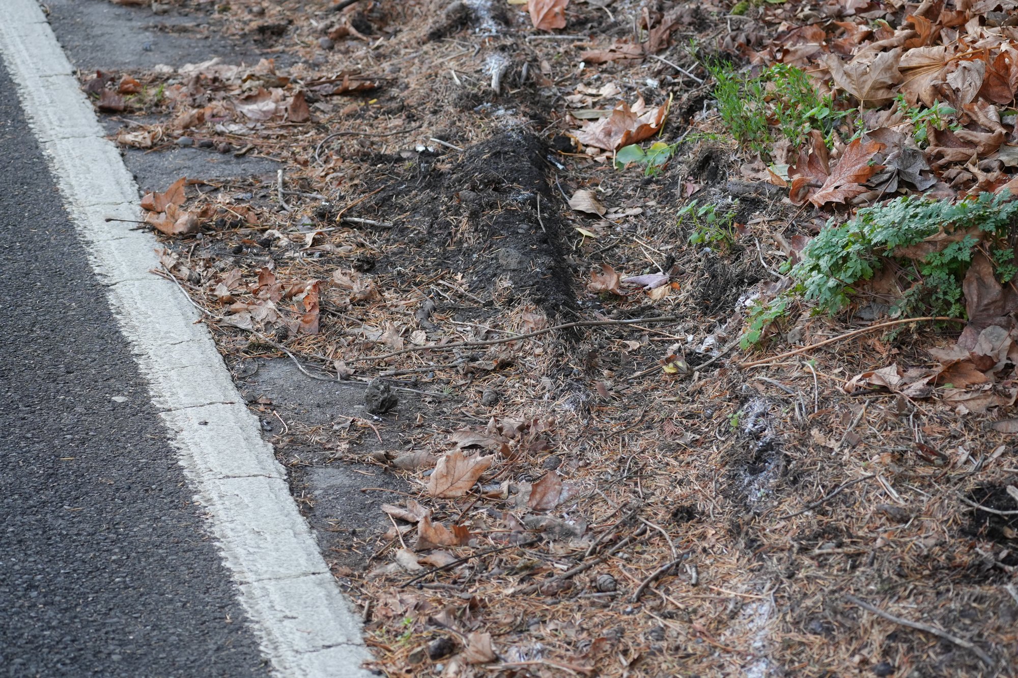
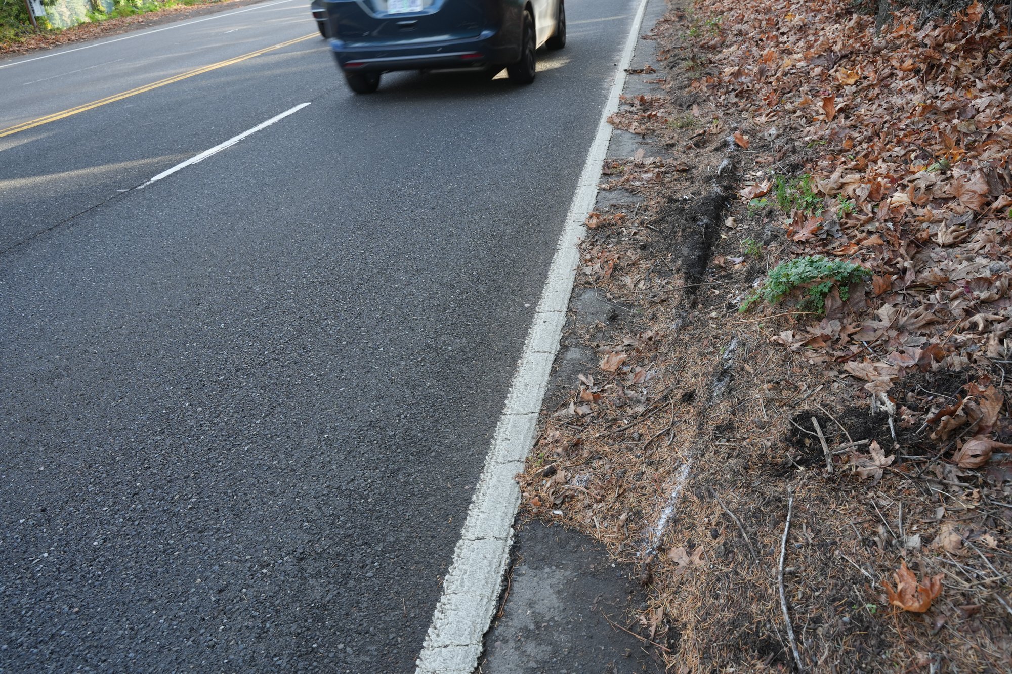
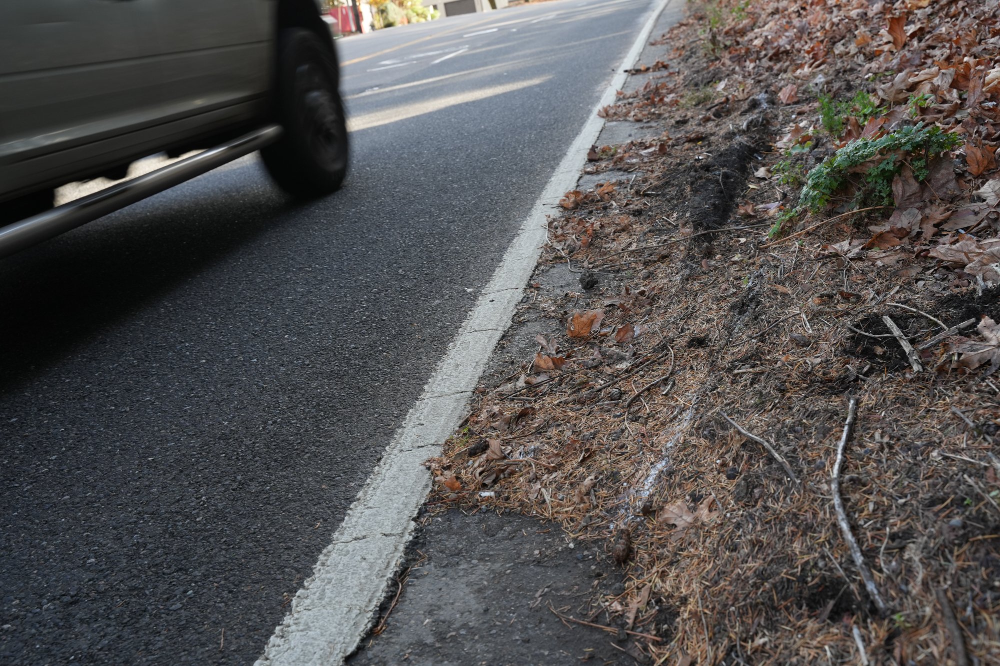
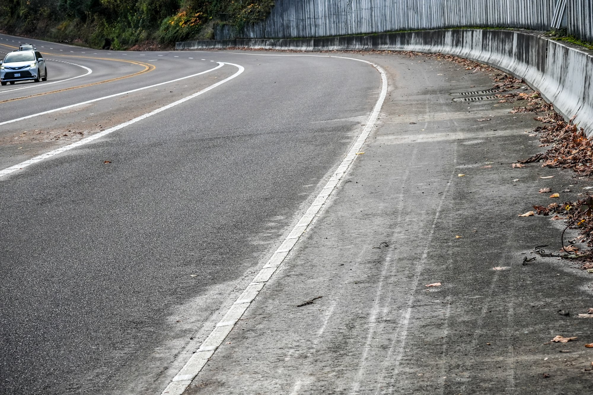
The only sign of a collision I could see on Saturday was the white spray-painted outline of a car’s wheel track that veered into dirt and pine needles that stand several inches thick almost all the way up to the fog line (see photos below). There are several large, sharp rocks in the shoulder. MCSO says they have reason to believe Jorge hit one of those rocks prior to the collision. Jorge, “lost control of his bike after potentially hitting a rock on the shoulder of the roadway, fell, and was then struck by an SUV traveling south,” the MCSO statement says.
Oregon’s bicycle passing law (ORS 811.065) states that if a driver overtakes a bicycle rider on a highway without a bike lane and with a speed limit over 35 mph (both conditions met in this case), they must give the bicycle rider enough room so when they pass there is space, “sufficient to prevent contact with the person operating the bicycle if the person were to fall into the driver’s lane of traffic.” MCSO has made contact with the driver and they have not announced any traffic citations or criminal charges in the case. Once they’ve completed their investigation, they’ll hand it off to the District Attorney’s office and that’s where decisions about any charges will be made.
While I was out there on Sunday, I was overcome with frustration, fear and sadness. Drivers flew by so fast that leaves in the shoulder flew off the ground and I worried my bike would blow over. I couldn’t imagine what it must have been like on that dark night.
I know a lot of folks will wonder why Jorge would ever be on this stretch of road at that time of day. But let’s remember that we don’t know what he was going through or why he made that choice. When Martin Greenough was hit and killed while biking on a scary stretch of NE Lombard that had a gap in the bike lane in 2015, many people wondered why he put himself in that position. We learned later that he was new to town and likely had no idea what he was getting into until it was too late.
As I demonstrate in the video, if the gate into River View Cemetery was closed at dusk (which has been common lately), Jorge might have felt he had no other choice but to take the highway. And if it was his first time, he might have pointed his bike south at the Sellwood Bridge, where there’s a wide and smooth shoulder. By the time he realized how narrow and sketchy the shoulder had become, he might have already committed and was just hoping and praying he could make it through safely.
I’ve been in that position myself many times. And I’m sure many of you have been too. No one deserves to die in those situations.
This gap in our system cannot stand. Regardless of how dangerous it is, it’s legal to ride on Highway 43 and plenty of people do it. It’s also currently the only feasible way for bike riders to get between the Sellwood Bridge and the Dunthorpe/Lake Oswego area when the cemetery gate is closed. And with River View’s board growing tired of the legal burden that comes with public access through their private property, we might be forced to find alternate routes sooner than we think.
I know there have been studies and discussions about building a multimodal connection in the past — either along the river and trolley rail right-of-way, a new bridge, or on the highway itself. I can only hope this human sacrifice is enough to dust off those plans and begin those conversations anew.


Thanks for reading.
BikePortland has served this community with independent community journalism since 2005. We rely on subscriptions from readers like you to survive. Your financial support is vital in keeping this valuable resource alive and well.
Please subscribe today to strengthen and expand our work.
WHO OWNS / OPERATES THIS CATASTROPHE?
ODOT ? MULTCO ? PBOT ?
It’s a state highway controlled by ODOT.
However the surrounding land and streets belong to Multnomah County but the land use is controlled by the City of Portland on behalf of the county – the city even has a street master plan for the area.
Thank you, Jonathan, for spending the time to show us what this space is like. Rutilo was a closed friend of my family , hard working man responsible always working 2 jobs . I’m guessing he was coming back from work. His funeral service will be this Sunday Nov 23 . Rutilo family will be sending him to Mexico.
I’m sorry for your loss.
I wonder whether it would be worth adding some sort of wayfinding/warning signs to prevent people from getting stuck biking in a situation they didn’t realize would be as dangerous as it is. Maybe for all segments labeled “Difficult Connection” on http://portlandbikemap.com/. Doing so seems relatively cheap and easy.
Good idea. I ended up on this section once when I was new to town and it was terrifying, I would have really appreciated a warning sign recommending the Terwilliger path.
Informative and empathetic. I have ridden that route a few times, very scary.
Thank you for documenting these conditions, that does look scary.
Thank you, Jonathan, for spending the time to show us what this space is like. Having watched the video, I can imagine seeing that shoulder at the Sellwood Bridge, believing it’s a reasonable southbound route, and then getting stuck partway with no easy way to turn off or turn back, once the rider reaches the place where the shoulder fills with debris.
You may be correct about the driver violating Oregon’s bicycle passing law (ORS 811.065). But I wonder how many drivers know about that law. Not to suggest that absolves them of being bound by it, but to underscore that laws are meaningless if they’re on the books but nobody knows about them. When I lived in San Francisco, it seemed like the question of how to curb your wheels when parallel parking on a hill was ALWAYS on the written test for a driver’s license. What are the chances that most drivers ever learn about or are asked to remember laws like ORS 811.065 *before* they start driving on our roads?
I will note that, although I am keenly aware of the problems with PBOT relying on the private River View Cemetery to provide bicycle access, I’m not sure that lack of access to the Cemetery route would have pushed this bicyclists to this route. I say that only because once one comes out at the top of the Cemetery, there is no easy, reasonable route for getting to Lake Oswego. As you note, Trimet does have a bus line on Highway 43 but no safe place for someone to wait for the bus. All of this is evidence of the expectation that everyone is just going to be driving in a motor vehicle, and that our electeds do not think we need safe alternatives to the dangers of motor vehicle culture.
This is why I firmly believe Oregon needs to repeal the existing bicycle passing law and simply add bicycle riders (or “vulnerable roadway users”) to the list of things folks are required to move over for. Oregon’s “Move Over Law” is very well-known and all we need to do is add bicycle riders to police, first responders, and broken down car users. I think that would be a great way to address this problem.
I can’t see a proposal to extend the move over law to all vulnerable users getting anywhere even if the vulnerability issues are similar. It’s not workable, for multiple reasons, and if it somehow got forced through, my expectation is compliance would be poor — you can’t legislate away reality.
I have no idea of what kind of cyclist Jorge was, but I’d guess he was experienced one who knew what he was doing like others who ride roads in all conditions. It’s hard to ride far without dealing with stretches of road with this level of difficulty.
Most people don’t care about cyclists and/or think we’re crazy. Given that even primo infrastructure is lightly used at rush hour when the weather is good, I also wouldn’t bet on widespread deployment of new costly heat absorbing, drainage interfering infrastructure.
But they might be convinced to support wider shoulders or a breakdown lane for emergencies, and that much provides the lion’s share of the benefit.
I don’t really agree that a lack of knowledge of traffic laws is the reason for the unsafe driving we see on our streets. When I go sit outside the deli across the street from my house less than half of the drivers come to a stop at the stop sign, and if you drive the speed limit you will be passed by people travelling far faster, but clearly all drivers are aware of the concept of stop signs and speed limits.
The big problem with the safe passing law is that it doesn’t apply at all times, largely due to a lobbying effort by trimet because they didn’t want their drivers to be required to leave a safe distance.
At the very least, knowledge of the law is required, if not sufficient, to get compliance.
The point of that law, like most traffic laws, is to assign responsibility and blame after a crash occurs. Drivers don’t need to know about ORS 811.065 they need to know that it’s not safe to pass that closely. This road isn’t so busy that it’s difficult to change to the other lane and give enough space to pass safely. Drivers passing too closely here are, more often than not, doing it out of complacency and ignorance.
The problem is most drivers don’t understand how dangerous their actions are not that they’re ignorant of the traffic laws.
I think it would be super helpful if there are any lawyers out there who understand how the safe passing rule is interpreted if they could explain specifically what the law requires drivers to do in the situation highlighted by Jonathan.
Yes! It comes up often, and the stakes are high. I also don’t think law enforcement people have consistently correct interpretations of it (not sure if they all even know it exists)–and that goes double (or 10x) for drivers. That makes it more important for people to be able to advocate knowledgeably for themselves and others. The expert legal opinions here are always among my favorite topics.
Such an informative post. Unfortunately due to an extremely sad situation. Cleaning up that shoulder and building some sort of barricade for a bike lane would be so helpful!
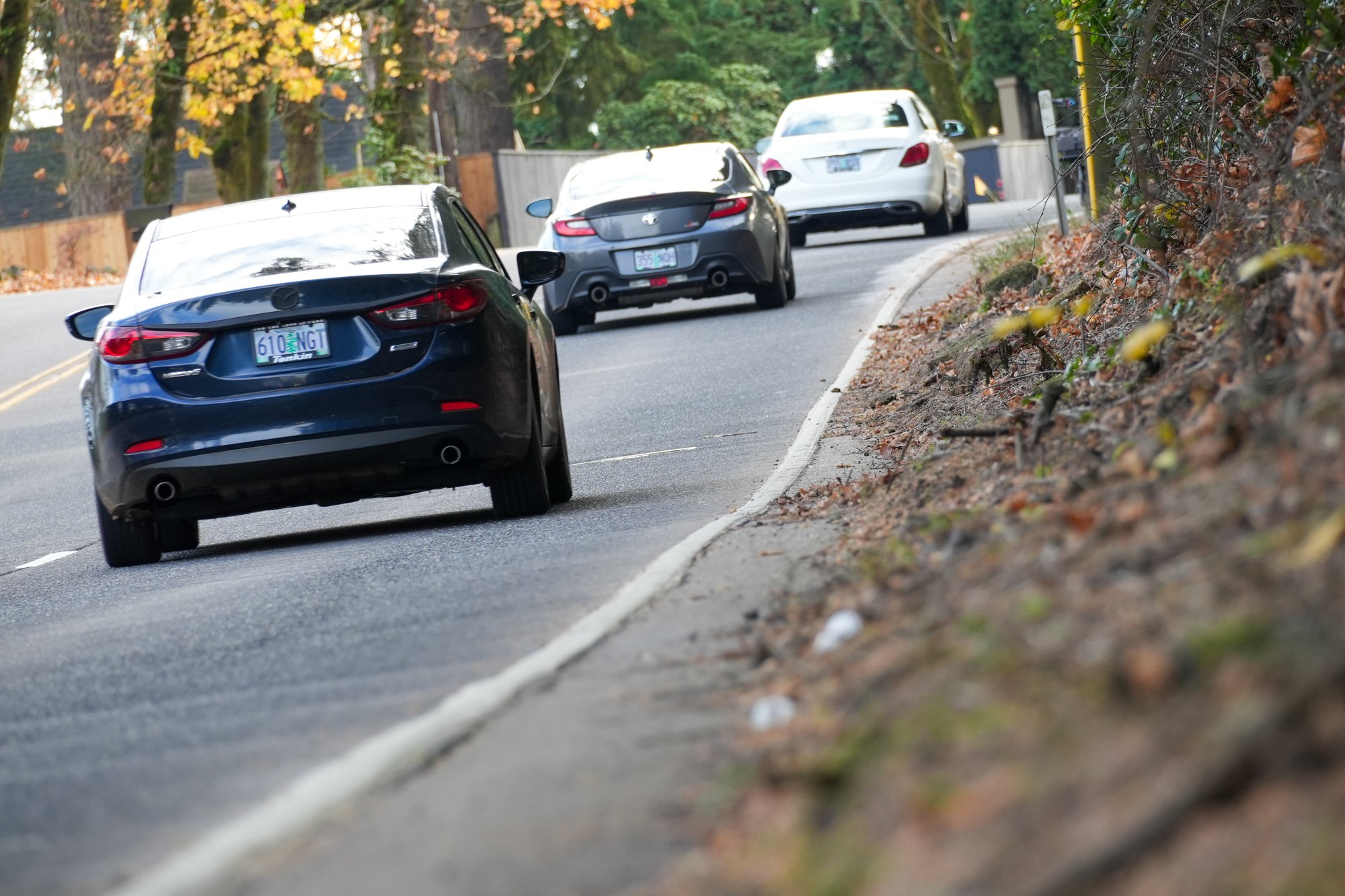
The number of people passing you too closely in this video alone is wild. A lot of them even have an empty lane to move into to give you more space.
Pretty shocking that so many people could save a life with a small hand movement and they choose not to.
Drivers can’t be trusted, so the lanes must be reconfigured here. The traffic counts do not justify 4 lanes.
I would like to see bike lanes put on 43 – this could be an immediate treatment and could be a ‘we’re taking this space until there is another safe path’ condition.
I actually don’t think there is enough traffic on this stretch that it would make a big difference in vehicular traffic on this corridor. At least I’ve never seen it being that bad. The road narrows to one lane farther down anyhow, so there really isn’t a great reason for 2 lanes in this stretch.
My friend who lives along this section between LO and Portland would bike to work if this section was safe.
A 2-way bike facility on one side of the road might feel more comfortable than traditional bike lanes, but might be difficult to get done in some sections due to driveways
My thoughts go towards the sharrows on the St Johns, similar four lanes of fast traffic and no shoulder. Ever since they went in I feel like drivers give a lot more space and move to the left lane earlier
In all honesty, I’ve always believed the sharrows to be useless.
My problem isn’t with individual drivers not willing to move over per se. Rather it’s that they tailgate each other so they don’t even know there’s a cyclist there — the net effect is that they get closer and closer.
The ironic net effect is some of the better riding conditions on the bridge correlate with higher driving speeds — i.e. traffic is light but drivers can easily see you and change lanes
I ride far left to shove them over because the only bail option is crashing over the high curb.
Mt Scott Blvd from the max station up the hill has a similar issue.
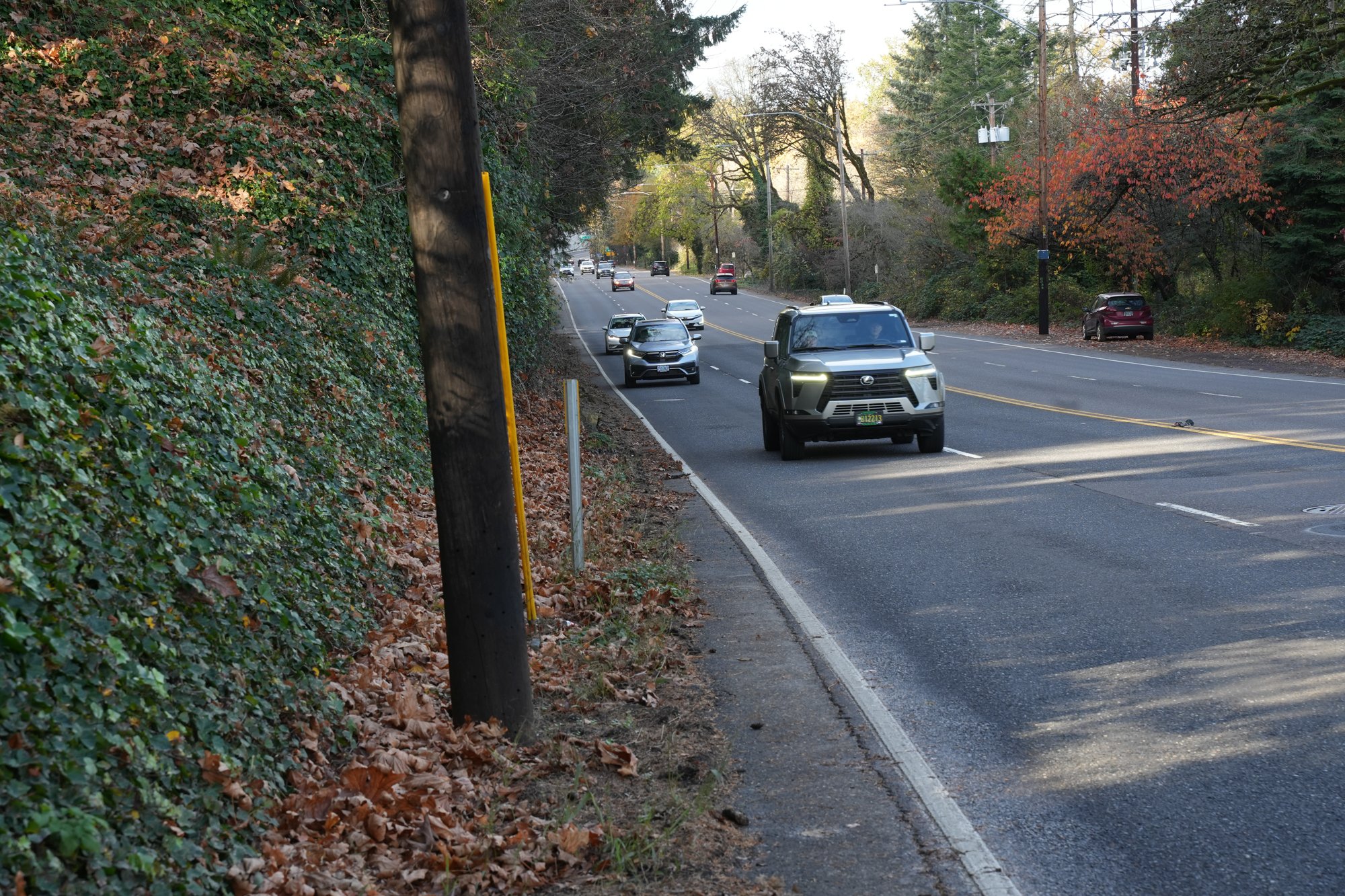
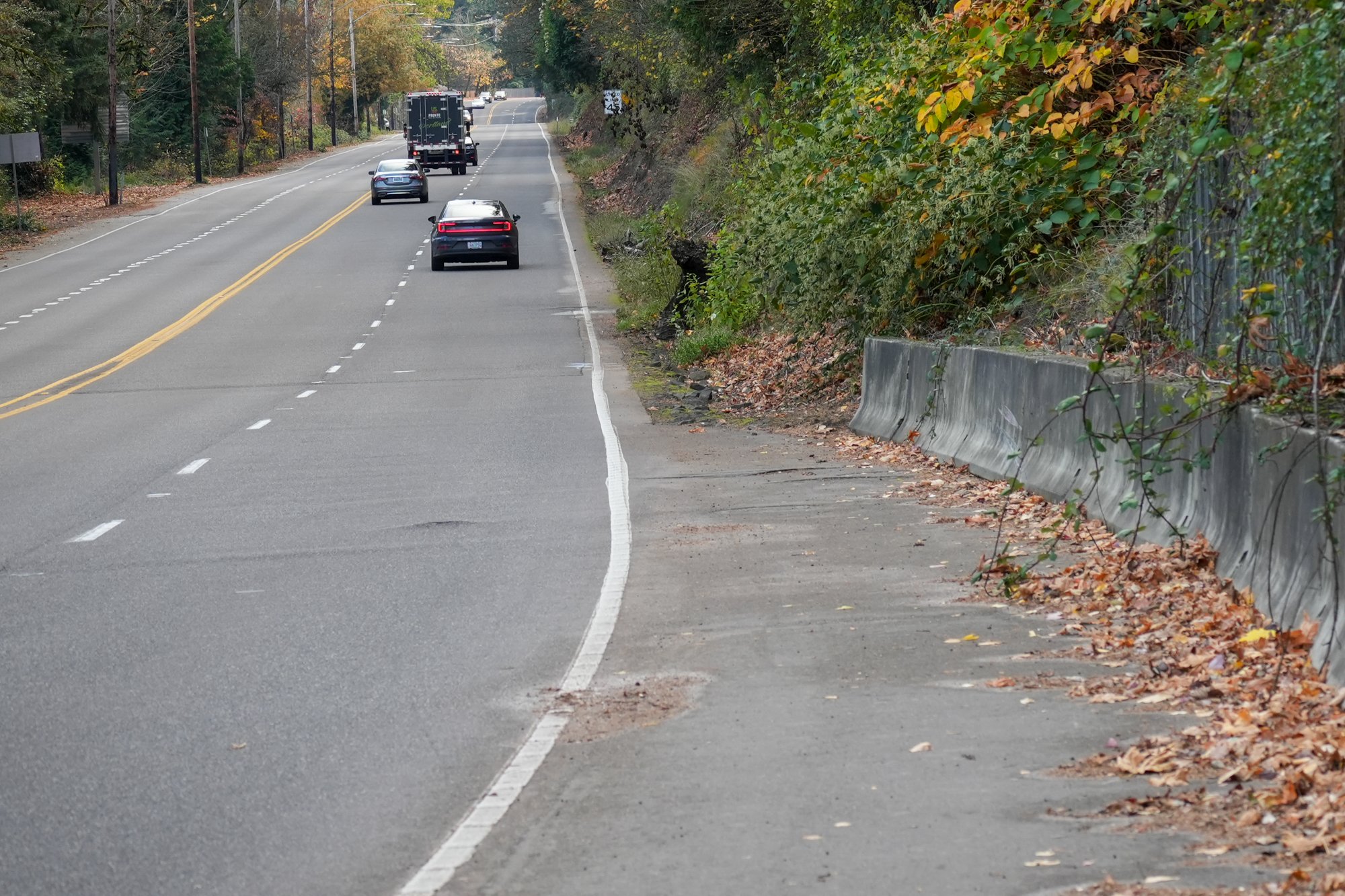
There’s plenty of asphalt and space to the right of the fog line to ride, but it’s covered with ivy and dirt at this point. Feels like the proper equipment would make quick work of it. My hunch is that mobilization and traffic control would take longer than the actual job.
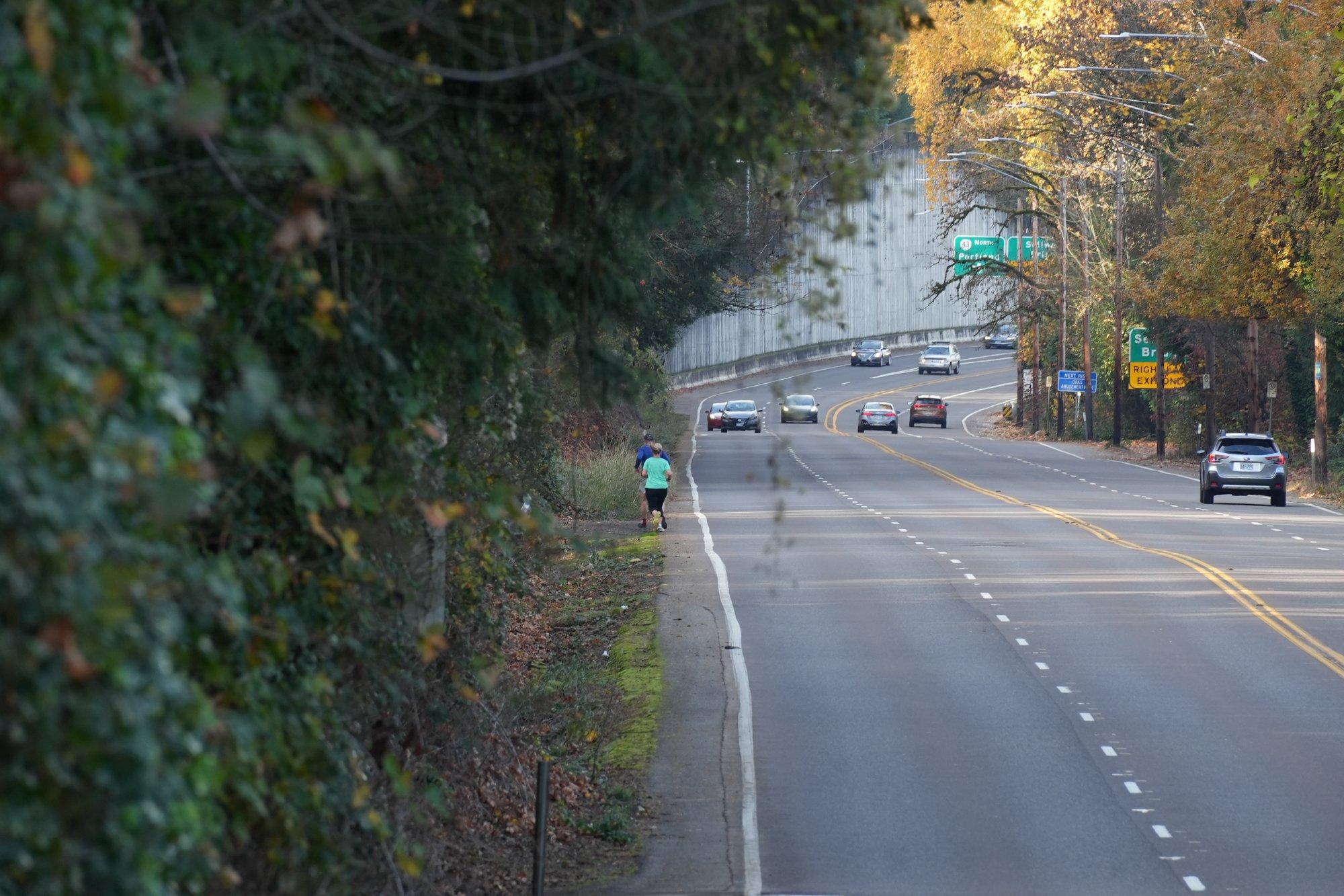
I agree, and the right-hand car lane is unusually wide and could be narrowed up a bit to provide another 2-3 feet of asphalt on each side, enough space maybe for occasional temporary curbs for a bit of protection for a bike/ped lane – note the runners in the photos.
I drive this stretch on occasion, I find it hard to drive the posted speed limit but I do. Not once has anyone NOT passed me 10-20 miles per hour faster. Let’s get a camera here!!
let’s design the streets better instead of punishing people for acting like their animal-brains want them to.
I love this strong towns take on the issue:
https://archive.strongtowns.org/journal/2025/2/7/speed-cameras-are-not-a-permanent-solution-to-dangerous-streets
Very good question asked in this article as Portland taxpayers are spending millions on traffic cameras.,,,,
“While speed cameras can ticket drivers, their impact on reducing speeds and preventing crashes is uncertain. The key question remains: Do they actually make roads safer, or are they just another enforcement tool that fails to address the underlying design issues that cause speeding in the first place?”
I used to drive this stretch of Hwy. 43 every day to work and back, and often on weekends. There ARE signs that say “Traffic speeds photo enforced.” I had no idea what that meant and ignored them until one of them got a good picture of me traveling south at about 60 mph on a sunny Sunday afternoon and I got a significant traffic ticket. MY BAD. For years after that I made myself drive the speed limit (45) or below on Hwy. 43, McLoughlin Blvd past Westmoreland Park and wherever I drive.
I have driven sub-compact cars for over 50 years. I stopped riding bicycles in Portland in my twenties because it was too dangerous and, for me, it still is. I totally believe “Cars are there to kill you.”
I care about cyclists. I have seen car v. bike crashes happen in front of me and they are gruesome! I don’t even pass cyclists unless I can move over with plenty of room. I often stay behind them and turn on my emergency flashers so cars behind also have to slow down.
People who oppose the new Transportation Law and bike lanes specifically are just selfish and entitled.
Thanks for your insightful comment.
Too bad we didn’t build a streetcar parallel to that road that you could put your bike on.
The unused railroad and right of way, located between Hwy 43/Macadam and the river, is publicly owned by Metro. Twenty years ago this right of way was proposed for an expansion of the Portland Streetcar from Portland’s south waterfront to Lake Oswego. This didn’t happen.
Repurposing the railbed as a Rails to Trails opportunity might have found its moment.
Agree this would be an EXCELLENT trail and has been on lots of people’s minds for a while. Those tracks are owned (leased?) by the Willamette Shore Trolley which is…infrequent
Is there any reason why this highway is not a 3-lane cross section? That would leave enough asphalt for 5′ shoulders (not ideal but a hell of a lot better that the current design) for bikes and pedestrians to use, and a center left turn lane for drivers. Yes drivers would have to go at the speed of the slowest vehicle, which from the sound of it is not a terrible thing. Traffic would still flow (I think there’s only one signal between Sellwood Bridge and Terwilliger?), just at a slower pace.
Of course ODoT would dismiss such a design out-of-hand.
Based on the video, it seems like 5-ft shoulders are already there, but they require maintenance to keep clear.
That doesn’t mean a road diet wouldn’t be a good thing. I’m just saying that the situation can be easily improved with the maintenance that should already on-going.
There are highly variable shoulder widths on that road. There are places where there is a five foot shoulder (which may or may not be cleared and maintained), but it squeezes down to nothing in places.
exactly my observation. But, yes, maintenance to keep what shoulder there is clear would help.
And Maintenance is a lot of what the new Transportation Law is all about. “It’s too expensive” is BS. Lighting, crosswalks, bike lanes, stupid lanes, so many dangerous roads that are used by everybody, not just ALL kinds of motor vehicles. They cost money and they save lives.
Hah. Maybe 5 inches in spots. This roadway does not have 5ft shoulders.
The drivers would very likely misbehave and use a painted bike lane to pass slower cars, like they already do on outer Powell. For such a fast road, you basically need a barrier-protected bike lane to prevent such passing.
Using a ~5′ shoulder to pass a slower vehicle? Maybe…but if we’ve reached that level of insanity, I surrender.
YES to this. Like Barbur this stretch of “highway” is isolated between two sections of single lane road and it is easy to find yourself going 55mph or faster without realizing it, because it is never congested. No reason for 2 lanes in each direction.
I used to drive on Highway 43 every day, and it is kind of crazy how fast people drive. Given the design and relative lack of traffic, I supposed it shouldn’t surprise me. It seems like converting the rail line to a bike path is the most attractive option here. Other than the NIMBYs, what are the legal hurdles to making that happen?
Really, this is a bigger issue than just Highway 43. We have hundreds of roads all over the state that link built-up areas that are close together but serve nobody but car users. It would be good to see some kind of initiative toward building safe bike and walk routes adjacent to state highways like 43. IMO every human should have the right to get around using their own two legs (or prosthesis, mobility device, etc) without the risk of getting killed by a car.
Reading the linked article about the Oak Grove – Lake O bridge debacle was… depressing, to say the least. Would’ve been a slam dunk for residents and businesses on both sides of the river.
SW Scholls Ferry Road between SW Beaverton-Hillsdale Highway and Sylvan is worse than that section of Highway 43 due to blind corners, no shoulders (a retaining wall is there in some places), and no bus service except TriMet bus 55 twice per day on weekdays.
Thanks for the coverage, Jonathan.
Solutions are available if we find the resources and have the will. Two examples: eliminating one vehicle lane (which could allow variable two lanes in one direction, based upon rush hour demand), or your suggestion of a two way protected bike path on the north side of the highway.
I have ridden this route a couple of times, especially when I am in a hurry. While the cemetery + tryon creek route is safer, it takes an additional 20 minutes (it takes me about 40 minutes instead of 20 minutes). It is very tempting to save that time, but the conditions are pretty awful, as the video highlights. You can see in the video multiple times that people are riding this route. Time for a change!!
An alternate but no less steep and rigorous route between Portland and Lake Oswego on the west side of the river:
From Willamette park, go west on Nebraska Street.
At Corbett Ave., turn left.
At Custer Street, turn right.
At Brier, brief dogleg to rejoin Custer, which becomes gravel-ish.
After going under the freeway, fork left.
At 4th Ave., turn left and quick right to join 5th Ave.
At Troy St., turn right to Terwilliger.
This is a pretty badass alternative! If I’m starting from the Sellwood bridge (i.e. cemetery is closed) I go a half mile north (i.e. out of the way) to Nebraska, climb Corbett (which is daunting) and then at the end of Custer take an unmarked trail & climb a set of stairs under the freeway onramp to get to 4th ave. (The water bureau was doing work there last year & I haven’t been back, so maybe they have added a better connection to 4th?) I’m the kind of masochist who finds that sort of thing “fun” but maybe not after pulling my second shift
There are other alternatives off Taylor’s Ferry like LaView and Fulton that avoid most of Corbett, and you can take Brier to Barbur then loop back to Terwilliger to avoid Custer.
HOWEVER the point is: the fact that we need this level of local knowledge shows how crucial the cemetery is for transportation
Ironically, at evening rush hour, you have to deal with cut-through vehicle traffic speeding down some of the back-street routes. Taylors Ferry gets backed up all the way up or close to Terwilliger at the top of the hill then, and homebound drivers get aggressive on the cut-throughs.
It seems that if you did find yourself on this road at 5:30 pm on a mid-November evening, it’d be very difficult to see and avoid those large basalt blocks without a relatively high-end light. Hell, they might still be hard to detect with powerful lights. But I bet they’re all but invisible among the soil and rotting leaves with a “be seen” blinky.
I don’t have any clue what kind of lights the deceased may have been using. I’m just piecing together how perilous this section of road could become to an unsuspecting rider.
My condolences to his friends and family.
Running over a person and a bike is not going to cause an SUV to appreciably change direction. So I can only conclude from the tire mark that the driver swerved TOWARDS the victim. He probably didn’t even fall over as claimed.
Man. Bold claims. Most likely scenario to me is swerving away while slamming on brakes and then over-correcting.
Taking the police statement at face value is also a bold claim.
If the driver swerved hard enough to the left to initiate a skid that could motivate overcorrecting by swerving to the right, there would be skid marks on the pavement.
Your credulity is showing.
Since the police have more information than anyone here, I would trust their statement more than rank speculation from the peanut gallery. That said, it’s probably better to wait until we learn more before concluding what happened.
Thank you for your reporting! I checked google street view historical photos to see how the shoulder has changed over the years. The last time it was really clear was August 2016, with about 4-6 inches of asphalt to the right of the line. Centrally not a comfortable amount, but perhaps enough to save a life. I’d support a long-term solution to this route, but a quick sweep could buy some time to plan.
This will get worse with the strict hours in the cemetery. What are people doing to get over the hill early or late hours these days?
Not to mention that the section JM highlights going Southbound is way better than a mile further South where the shoulder is essentially nothing with some blind turns.
The trolley trail mentioned here can and should be ridden now. Granted you bypass the trestle and have good lights for the tunnel. But I say start poaching this and make it a byway.
One huge help would be to construct the proposed bike/ped bridge between Oak Grove and Lake O. I will keep banging this drum until I die of drum banging.
I ride this route all the time. It is dangerous, and the each of time they have done maintenance (like after a snow/ice storm) the shoulders in some spots become less narrow.
I white knuckle it until the pull out on Palantine Hill Road at which point you can take a steep hill into Dunthorpe/Riverdale Elementary and then take Breyman/back roads all the way to the path next to Tryon Creek on Terwilliger.
In rush hour it is like putting your life in your hands just for the 10 minutes from the bridge until Palantine road.
The safest I have ever felt was when I biked home one time at 12:30 am and there was no traffic and I was able to simply take the 43 all the way into downtown Lake O…in retrospect that was very dumb but I lived.
no one in Government cares to make cycling safe in Oregon. So many people die for no good reason while the authorities shrug their shoulders and waste our money on exuses, awareness while refusing to punish the killers. Vision Zero!
What about walkers on highway 43 south to lake Oswego…and bus service?!?
There are two lanes going south and would be safe for a bus to stop!