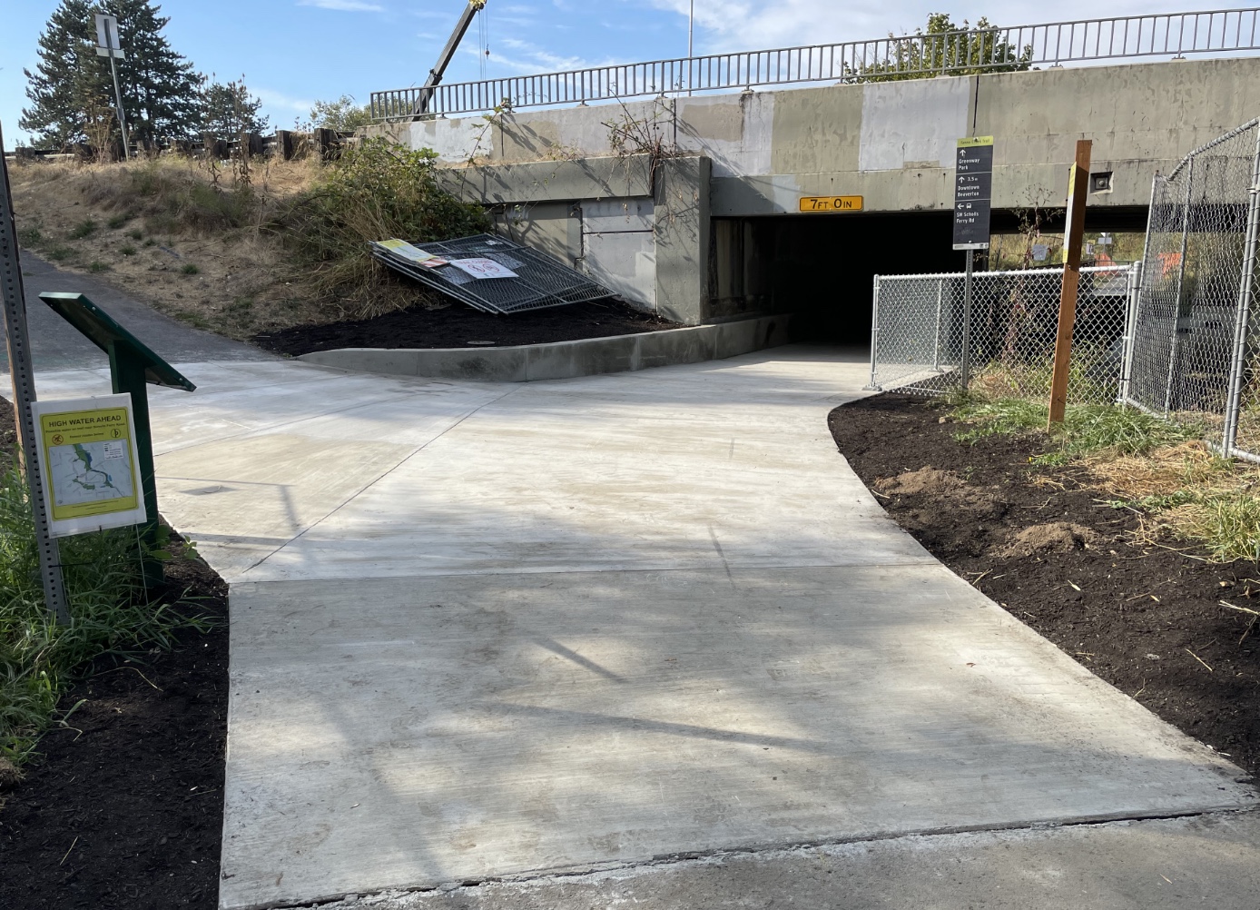
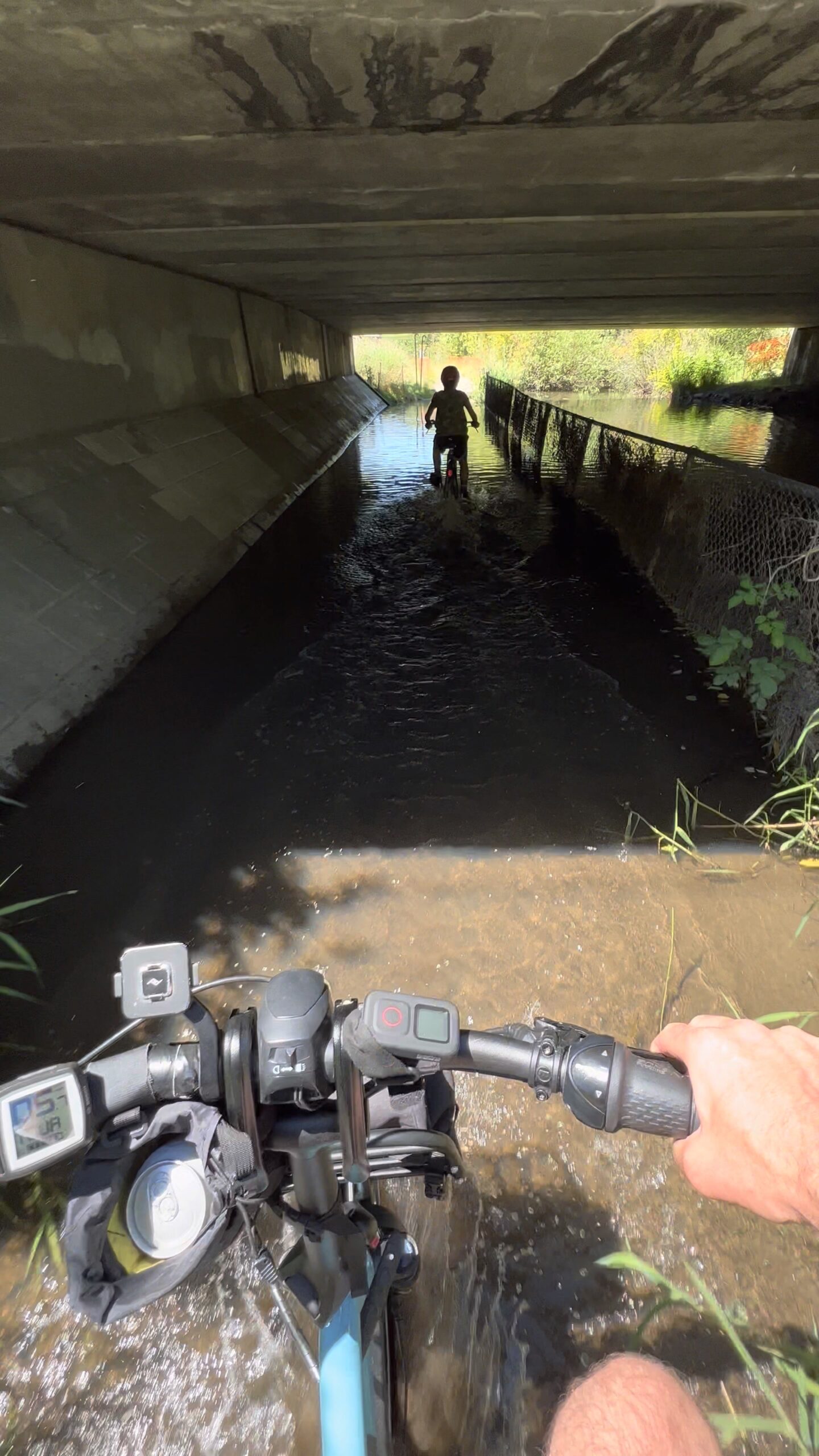
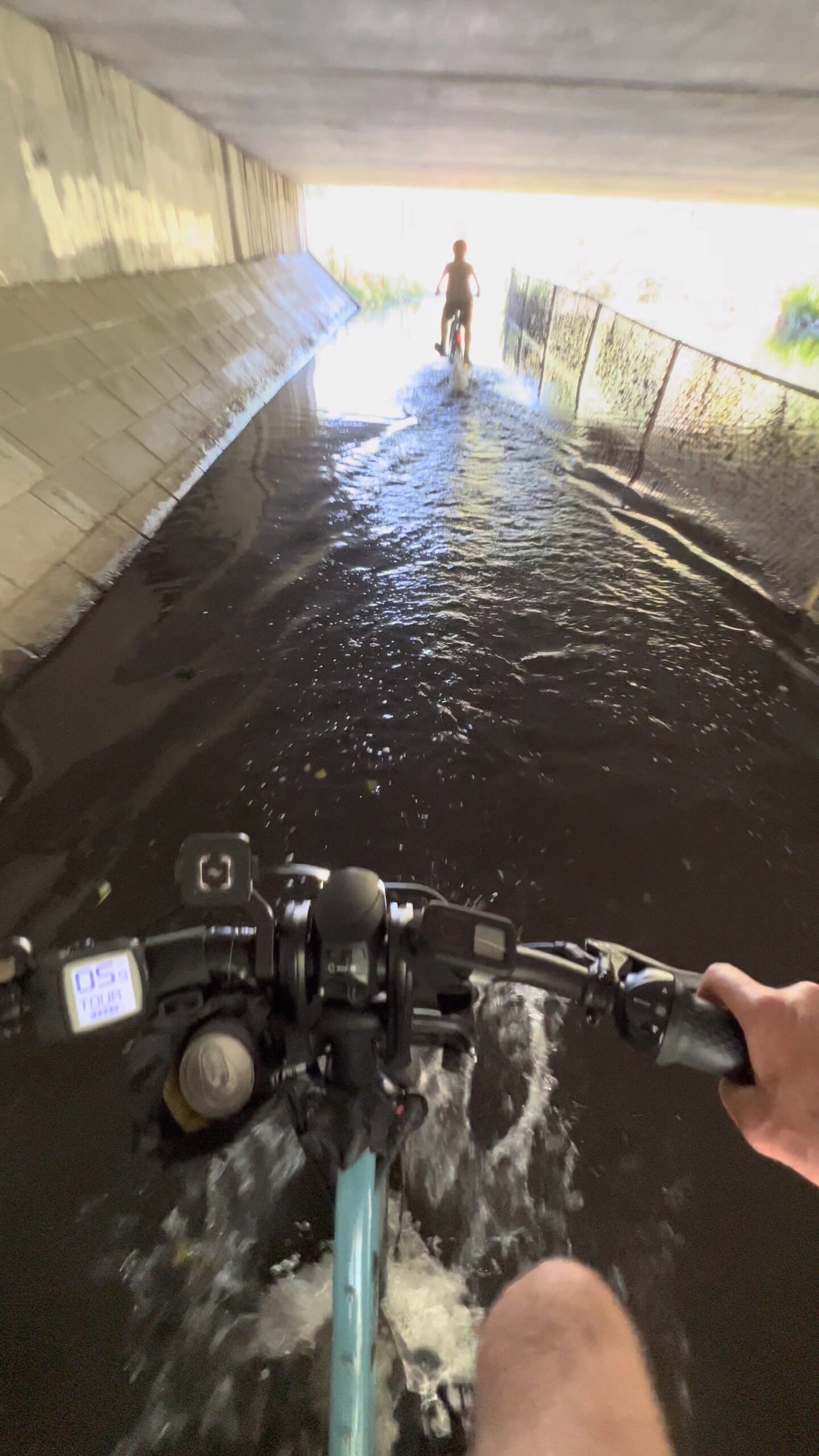
You won’t have to worry about getting wet while riding a section of the Fanno Creek Trail in Beaverton any longer. But you might have to worry about hitting your head.
Persistent flooding of the path where it goes under SW Scholls Ferry Road had become such a problem that Clean Water Services, a utility, recently completed a project that raised the path about 10 inches.
The causes of the flooding are threefold: the path is adjacent to natural wetlands where seasonal floods are normal; record rainfall has made the problem worse lately; and successful conservation efforts have led to a booming nearby beaver population.
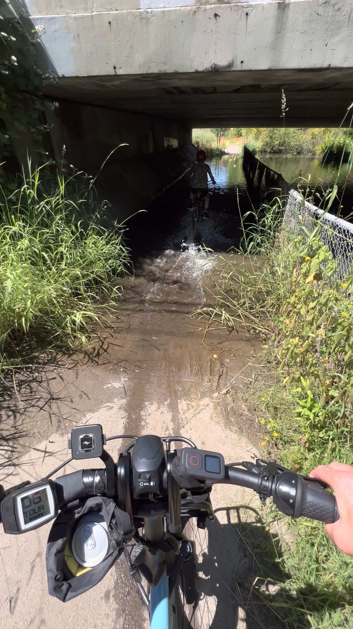
As we reported in 2020, there are five beaver dams in a one-mile stretch of the trail between SW Hall and Scholls Ferry Rd. In a statement about the project released this week, CWS said they, “attempted to help reduce impacts in the short term by lowering the beaver dam downstream from Scholls Ferry Road twice in July, but the beavers quickly rebuilt the dam.”
The resulting floods on the path (which can also include thick mud) are more than a minor inconvenience because the alternate route is inconvenient and requires crossing of a very busy road
The newly raised path means the trail will remain rideable through the winter (for now at least). Unfortunately, because Clean Water Services (who collaborated with City of Tigard and Tualatin Hills Parks & Recreation Department on the project) didn’t raise the level of the road, the new overhead clearance is a scant 7 feet! This is well below the 10-feet vertical clearance recommended by the national nonprofit Rails-to-Trails Conservancy and the American Association of State Highway Transportation Officials (AASHTO) guidebook. AASHTO says if an area is “constrained,” the minimum can go down to 8 feet.
We hope the top of the underpass is well-marked with something reflective and lit so that no one is hurt riding under it.


Thanks for reading.
BikePortland has served this community with independent community journalism since 2005. We rely on subscriptions from readers like you to survive. Your financial support is vital in keeping this valuable resource alive and well.
Please subscribe today to strengthen and expand our work.
Kudos to CWS for getting the project done inexpensively! (And not doing something silly like trying to get rid of the beavers). I see from their release that they had trouble with getting affordable bids, so doing it in-house seems like good solution.
It doesn’t look they raised other sections of the path though? Unless I’m missing something? While this section underneath Scholl’s Ferry was certainly a pain (and more often flooded than other areas) there are several other sections that also get flooded in winter. At least at this section one could go up and play Frogger with traffic on Scholl’s to avoid the flooding (good luck finding a curb cut though). I’ve waded through water above my knee in more than one spot. I eventually just gave up using the path in winter.
What other sections flooded that bad for you? I used it for commuting last spring and the worst part was this underpass. I could coast through the rest of the puddles slowly with a tolerable amount of splash on shoes.
Going to try as much as I can through this winter. It’s a really nice way to start/end the day.
The section of the path over by the old Albertson’s floods regularly in winter and needs a raised bypass.
Just cycle here during one of our really rainy winter weeks and you’ll find all of the flooded sections – there are several.
Like Karstan, I avoid the path during very rainy weeks in winter.
I believe you are talking about the section near 99 Ranch (South of Hall Blvd). You can take a mulch alt path on the west side up to the playground to bypass the worst of that flooding now. The only other flooding I ran into never passed 6” deep, which is coastable in my book. I don’t know about east of 217, since I don’t commute on that.
I tried on a whim on Tuesday and had the pleasure of riding it right after it reopened! This will make getting to/from Beaverton from where I live in Tigard much easier for a longer period of the year.
Some points:
Looking at the 2040 TSP, they mention on raising other parts of the trail that commonly flood
Thanks for all of the info. So gross that they’re planning to widen Scholls, it’s already such a disaster.
This was much needed, but as Karstan notes above there’s plenty of other sections that flood regularly. The trail is an incredible resource…when it’s actually usable, which isn’t the case a good portion of the time. Really the entire section between Hall and Scholls Ferry needs to be raised somewhere.
Good points, NoName. The FCT is a good example of how stand-alone bike infrastructure is often inconsistent and downright unusable, whereas bike lanes and other infrastructure that is part of the street network is much more reliable.
As we who ride bikes know all too well, transportation infrastructure built for cars and trucks is always prioritized.
Don’t stand up too tall on your pedals to ride through deep water under the bridge, that could hurt. 7′ isn’t much room when you’re standing up on a bike and have a helmet on!