The Portland Bureau of Transportation will take a big step forward on a key biking route they see see as a viable alternative to 82nd Avenue. The $4.5 70s Neighborhood Greenway has been in the hopper since at least 2015 and this week City Council will authorize a contract with a construction firm to finally get it built.
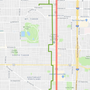
The funding will build what the city expects to be a bike-friendly route on about five miles of streets just to the west of 82nd Avenue between NE Sacramento and SE Flavel. Using a variety of streets between 72nd and 78th, the route will have over two dozen turns and comes with a host of major enhancements that are intended to slow drivers down, make it safer to cross busy streets, reduce driving volumes, and encourage bicycle use. Here are the highlights according to PBOT:
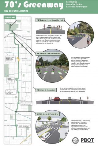
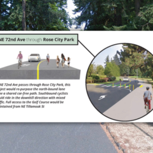
NE 72nd Ave through Rose City Park
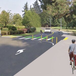
From NE 72nd Avenue through Rose City Park, this project will re-purpose the north-bound lane to be a shared car-free path. Southbound cyclists will ride in the downhill direction with mixed traffic. Full access to the Golf Course will be maintained from NE Tillamook Street.
NE 74th Ave at NE Tillamook St
New high-visibility marked crossings at the intersection of NE 74th Avenue and NE Tillamook Street will help people walking and rolling safely cross the street. These markings also assist in general wayfinding as one travels along the 70’s Greenway.
Advertisement
NE Halsey Street Connection
As the 70’s Greenway intersects NE Halsey St, new protected bike lanes will make the brief transition on this busier street safer and more comfortable.
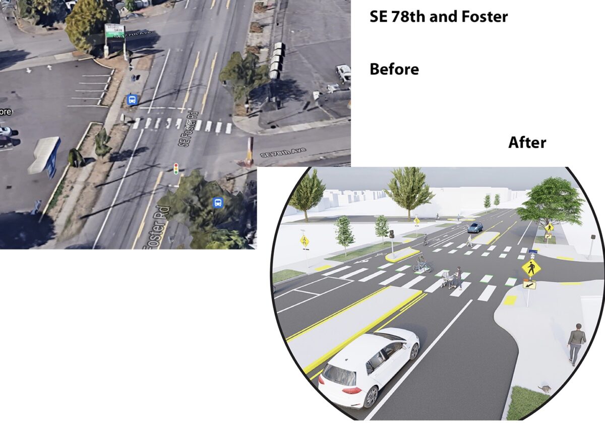
SE 78th Ave at SE Foster Blvd
This project will include a major crossing improvement at SE 78th Avenue at SE Foster Boulevard. This intersection improvement will include a two-way cycle track connection, curb extensions, new median islands, and high-visibility crosswalk markings.
In total PBOT says they’ll build 11 “enhanced crossing treatments such as curb extensions, median islands, rectangular rapid flashing beacons, cycle tracks, multi-use paths, etc,” at busy streets and near schools.
Funding for the project is a mix of a $2 million federal grant (administered through ODOT) and $2.2 million in transportation system development charges. Construction is expected to begin this fall.
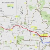
Check out the PBOT infographic below for more route and design details (click to enlarge):
— Jonathan Maus: (503) 706-8804, @jonathan_maus on Twitter and jonathan@bikeportland.org
— Get our headlines delivered to your inbox.
— Support this independent community media outlet with a one-time contribution or monthly subscription.


Thanks for reading.
BikePortland has served this community with independent community journalism since 2005. We rely on subscriptions from readers like you to survive. Your financial support is vital in keeping this valuable resource alive and well.
Please subscribe today to strengthen and expand our work.
I live near the Rose City Golf Course and ride in that area all the time. The route from the golf course to the 74th Avenue viaduct is weird. Using Jonesmore to go between 72nd and 74th would make much more sense than using Tillamook. Less traffic, gentler slopes, and more space for bikes when approaching the viaduct.
Yep, I take 72nd to jonesmore to 74th (or reverse) 99% of the time. Been riding that for years, either commuting daily, or biking with kids in a cargo bike. Jonesmore is a nice break from the traffic on 74th.
Interesting, I’ve never tried that. I’ll have to check it out.
Going northbound on 74th, the left turn onto Jonesmore seems a bit dangerous as you can’t really see southbound traffic coming up the hill until very late and northbound car traffic coming over the bridge can’t see the intersection at all as they speed up and over the bridge. I can imagine moving to the left at Jonesmore, waiting for a southbound car to pass on 74th and being right in the path of a northbound car cresting the bridge.
https://www.google.com/maps/@45.5356038,-122.5871802,3a,68.415367y,359.944672h,81.330818t/data=!3m4!1e1!3m2!1sgUeRYVpnOTolF9t4t7t0tw!2e0?shorturl=1
I’d say connecting to the Tillamook bike lanes at 74th also makes more sense for those transitioning to Tillamook. Especially for those going east, but also the turn westbound onto Tillamook is simpler than 72nd because it’s a T intersection.
All that being said, I’ll check out Jonesmore next time I go up through the golf course.
Yep, the proposed route is better for the network, because some people will want to ride north on 74th and then right onto Tillamook, or south on 72nd Dr and right on Tillamook.
In my experience, 74th is both uncomfortably narrow and fairly busy. It’s not fun to ride it, which is why I avoid it whenever possible. So I approach the 74th Avenue viaduct on Broadway, cross the freeway, and turn on to Jonesmore, or vice versa. If I want to connect to the Tillamook bikeway in either direction, I’ll travel on Jonesmore for a block or two, just to avoid 74th.
I get the “lines on a map” appeal of putting the route to Tillamook on 74th, but I personally find Jonesmore to 72nd (or 76th, if I’m eastbound) to be preferable.
Any details about crossing Stark and Washington, and what street it will be on between Stark and Burnside? I assume it uses Burnside to get to 74th.
The route crosses Stark/Washington at 80th, where it will have crossbikes and Rectangular Rapid Flashing Beacons. The route continues north on 80th until NE Everett, where it takes a 90 degree jog onto NE Everett, and then another turn on NE 78th/77th/76th. The connection between NE 74th and 76th will be on NE Broadway, which will have sharrows.
Unfortunately, it’s yet another greenway where if you don’t pay attention to every sharrow indicating a 90 degree turn, you’ll soon find that you’re no longer on the greenway.
Thanks for the explanation. That route is wore than I feared! PBOT gets so crazy with their route making, they just do not value intuitive wayfinding and end up making routes that sound impressive, and have nice short segments, but are not practical or usable enough to actually attract riders or build a functioning network.
Oh, I absolutely agree. I absent-mindedly veer off the greenways all the time. Especially ones I don’t frequent. Maybe give me another 23 years of biking in Portland & I’ll figure it out, ha!
I know, it’s so frustrating that PBOT didn’t fix the platting and make at least one street in the neighborhood go all the way through from Foster to Sacramento.
It’s not the platting’s fault that the route takes lots of odd turns, like veering off 74th immediately south of the bridge. A more direct route might have required removing some parking to provide bike lanes, and that was clearly off the table.
I cross Foster at that current location and its not the worst. I was really hoping to see the same sort of highlighting for what the plan is at Powell. I have been waiting for a crossing since I read it reported on here two years ago in a story about Lilac Meadows. The lighted crossing on Foster works pretty well not sure why they could not have done something similar for Powell sooner. I guess its another “orphan highway” issue?
A better crossing for cyclists at Powell is sorely needed. Where is the one proposed here? 80th? The Foster crossing seems a bit odd, since 78th doesn’t continue across Foster directly (hence the two way cycle path?) I would have chosen 79th (since it connects on both sides), or 80th (because it’s 20 feet from an extant hawk crossing).
TriMet is building a signalized crossing of Powell at 79th Ave. This bike route will cross there, and then a path on the south side of Powell will transition bikes over to 80th Ave.
Pedalpalooza is having a 1970s theme ride that follows the 70s Greenway on July 18, which happens to be the 42nd anniversary weekend of the movie “Breaking Away.” We’re diverting West a few blocks at Powell, Division, and Halsey to make use of existing signalized crossings as the ones for the final 70s project still need construction. And as the other Tom mentioned, the 70s already has a workable crossing at Foster, but the pictures at the top of this article show how much PBOT is going to improve it.
https://www.facebook.com/events/961926494566276/
The contrast between the 100s Neighborhood Greenway, which was first funded a decade ago and is still incomplete, and the speed with which this Neighborhood Greenway went from funding (2016) to bid (2021) is interesting. It’s also worth noting that Montavilla and Foster are among the fastest gentrifying neighborhoods in Portland.
I believe the 100s Neighborhood Greenway already went to bid well before this project, and will be constructed before this one as well.
I’m sure that PBOT is diligently working on reasons to delay finishing the 100s for another 10 years at least.
That’d be my bet too given the history of delay after delay.
It’s also interesting how after I carefully constructed a factual statement about the status of the 100s (e.g. “is still incomplete”) the response is “whataboutism” about the possibility of the 70s being constructed a few months after the 100s. My post was about the 5+ years of delay, not the few months difference in Momo’s hypothetical completion date.
I am wary, a bit, of removing the light at Foster. I don’t mind a beg button when it stops the speeding cars and I can proceed safely across the avenue. Hoping this whole build-out will be so good that this will be moot.
This route does a great job of following 80th for miles, then in classic fashion it twists and turns from Oregon and onto Pacific.
I’m not sure why the route doesn’t stay on 80th all the way up to Multnomah, which is on the bike map and a great east-west route, with a light at 82nd. Keeping this route on 80th keeps it close to businesses on 82nd, and running it north to Multnomah allows for better connections with the Halsey overcrossing project, and 82nd transit station. These routes that twist and turn to slowly jog over in an attempted diagonal maybe make sense to a planner looking at a map on a screen, but never make sense when you’re actually riding.
Pacific is basically a dark alley, with no lighting or sidewalks. Maybe it could be bike only? I know people who won’t walk or ride through here at night.
NE76th & Pacific:
https://www.google.com/maps/@45.5291978,-122.5846564,3a,75y,102.84h,78.29t/data=!3m7!1e1!3m5!1sgTK7IK9g03ZSj7A6onkn7w!2e0!6shttps:%2F%2Fstreetviewpixels-pa.googleapis.com%2Fv1%2Fthumbnail%3Fpanoid%3DgTK7IK9g03ZSj7A6onkn7w%26cb_client%3Dmaps_sv.tactile.gps%26w%3D203%26h%3D100%26yaw%3D272.35062%26pitch%3D0%26thumbfov%3D100!7i16384!8i8192!5m1!1e3
My own inclination would be to put the route on 77th between Broadway and NE Oregon Street, and follow Oregon from 77th to 80th. Every street “jogs” across Halsey in that segment, but 77th offers the shortest jog. (Also, 76th gets kind of skinny between Multnomah and Glisan; it’s safe enough to ride, but not my first choice.)
That may involve repaving 77th between Broadway and Halsey, but that seems like something the city should do anyway.
If anyone is keeping up with this project, it looks as if it is not happening until summer of 2022.
https://www.portland.gov/transportation/pbot-projects/construction/70s-neighborhood-greenway-ne-sacramento-se-flavel
Same link as above, I believe the timeline is now Spring of 2023. We’ll see.