(Photos: Jonathan Maus)
They’re the best bike lanes in Portland that no almost no one has heard about.
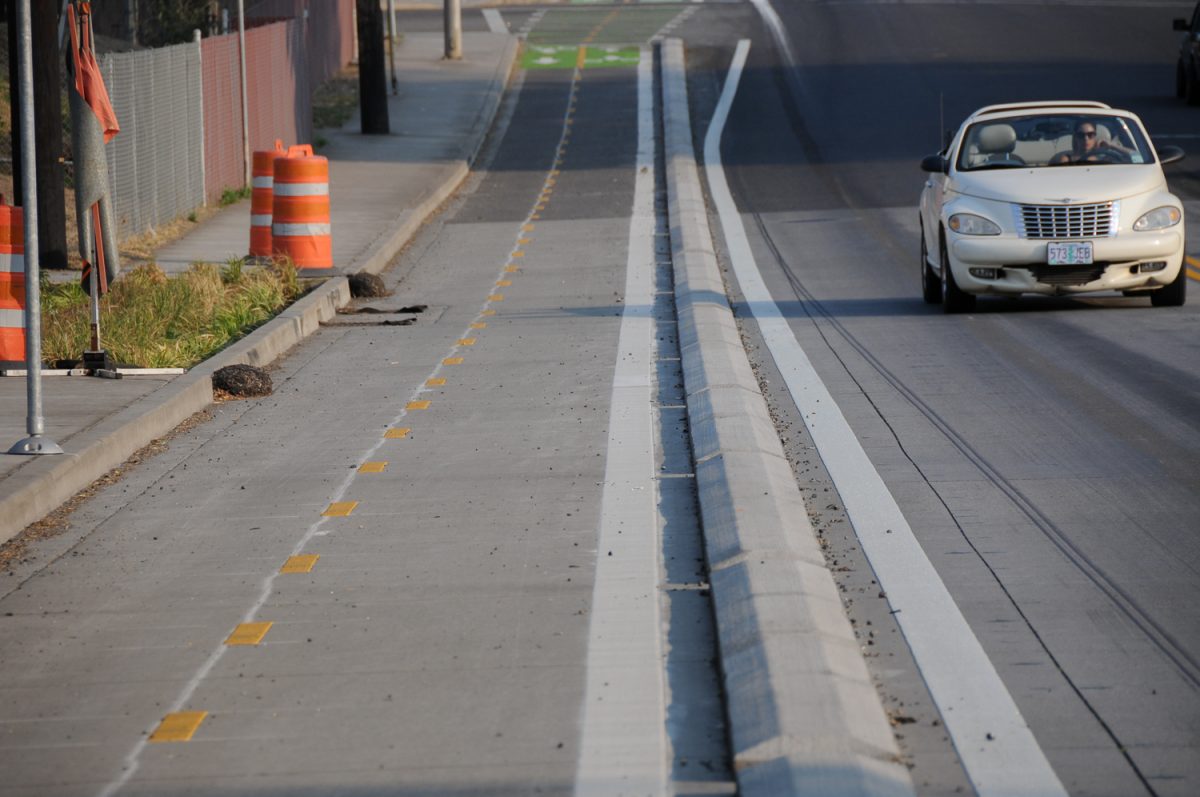
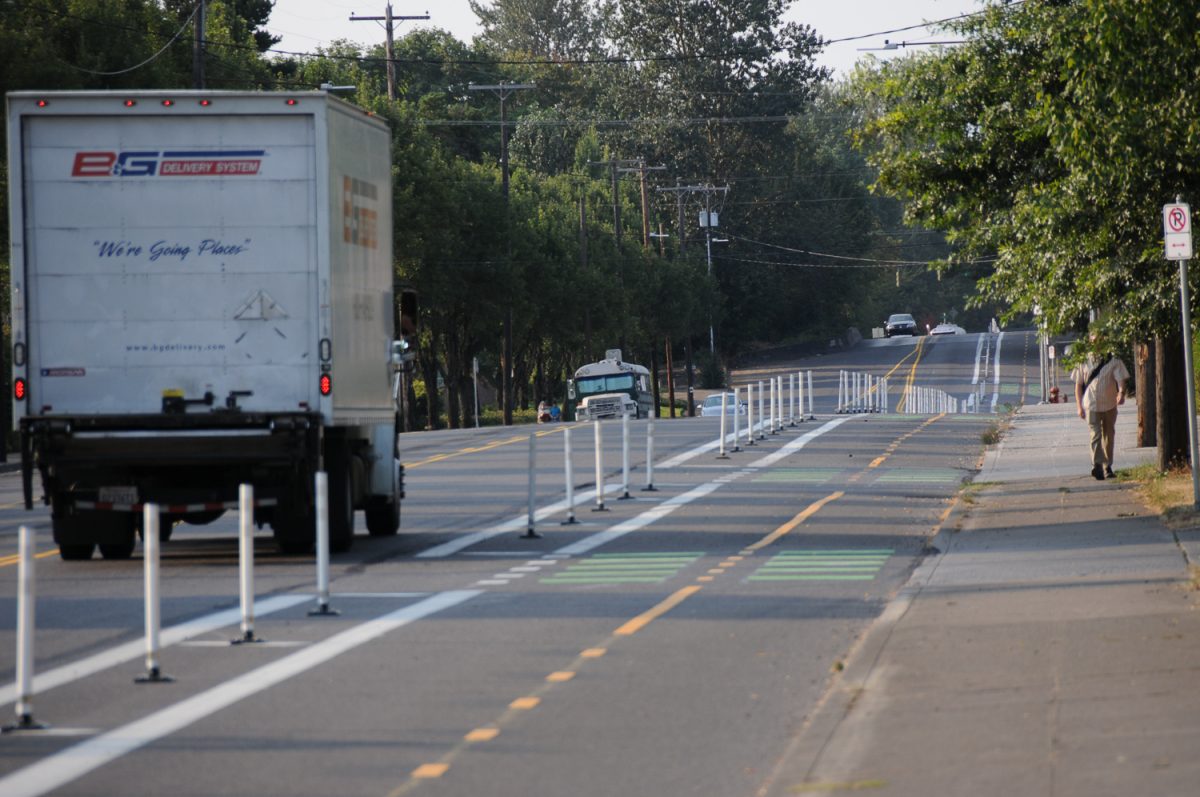
In an opportunistic move, the City of Portland has built one mile of new protected bike lanes on Lombard Street north of downtown St. Johns. PBOT has transformed a 60-foot, two-way road that was previously striped with only a centerline and two very large standard lanes into a road with a large center turn lane, much more sensibly-sized lanes standard lanes, and two bike lanes separated from motorized traffic by a buffer that varies between plastic wands, paint-only, and a concrete median curb. On the northernmost section of Lombard just before the intersection with Columbia Blvd, the bikeway turns into a multi-use path up on a sidewalk that’s separated from walkers by a planter strip.
The impetus for the bikeway was a major paving and road widening project aimed at improving truck and freight access to NW Container Services at the intersection of Burgard and Time Oil Road. (This part of town is heavily industrial due to its proximity to the confluence of the Willamette and Columbia river and corresponding major port terminals.) With the paving and widening planned, PBOT jumped on the opportunity to update the street to current standards, hence the new protected bike lane. They piled on some additional funds thanks to System Development Charges and PBOT’s own “Missing Links” fund to do the bike-related work. Overall the project cost about $2.6 million with the bike-specific elements accounting for about $1 million (my estimate, not PBOT’s).
Intrigued by the location and the design, I headed out to the area yesterday for a closer look.
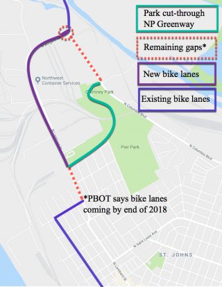
Like most of you, I’ve never ridden this section of Lombard. However, I do ride near hear very often. The route from North Willamette Blvd to Reno, and then through Pier Park to connect to the path that goes to Kelley Point Park is one of my standard training loops. I ride it at least once a week on average. It’s a very cool loop that offers many car and stop-free miles. The worst part is a sketchy crossing of Columbia Blvd north of Chimney Park and the the gap in the bike lane that follows until you reach the intersection of Columbia and Burgard. That gap remains (see map); but in the future there will be a carfree bridge over Columbia Blvd that connects to a new path (part of the NPGreenway project) through the St. Johns Landfill and Kelley Point Park.
Until then, I might be using this new bikeway on Lombard.
Advertisement
The new bikeway begins at N Bruce at the western entrance of Pier Park. It stops just two blocks short of Reno, a street that’s part of the 40-Mile Loop and connects to Willamette Blvd. This is likely due to the high auto parking demand and residential land-use of those blocks. As we’ve seen in the past when PBOT jumps onto already-scheduled paving projects to add bikeways, they can only pull it off if the project demands little to no public outreach. If it does — or if it spurs controversy and lengthy meetings — they’d miss their chance to reconfigure the lanes. I was disappointed by this gap until I learned PBOT plans to add new bike lanes in this section by the end of this year!
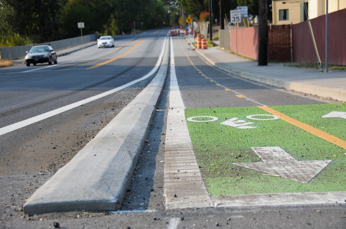
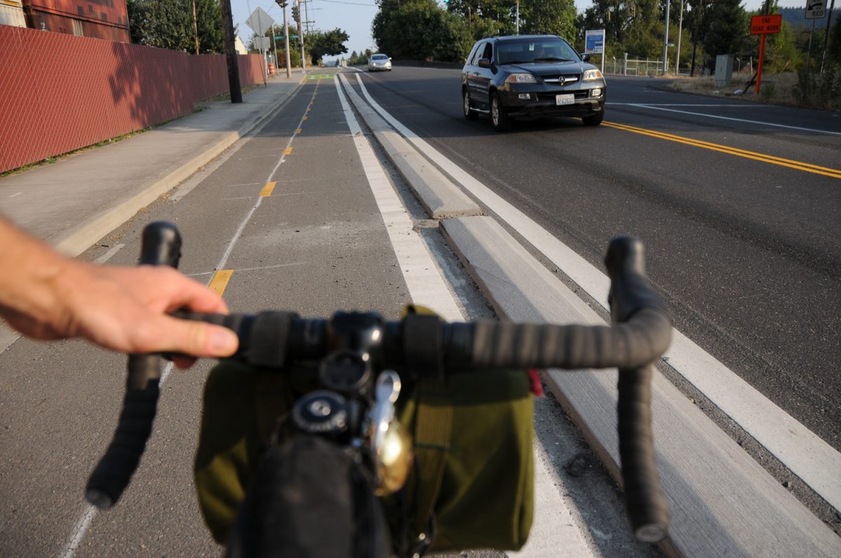
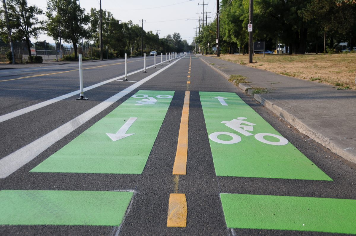
From Bruce to Terminal Rd, there’s a new two-way bike lane protected from other lanes by plastic wands. At driveways where the wands go away, PBOT has striped green rectangles to increase visibility. For a short section between Terminal Rd and the entrance to NW Container Services, PBOT has used a curb to protect the bike lane. I’m not aware of this treatment anywhere else in Portland. It’s nice to see them use this instead of the (rather ugly) plastic wands.
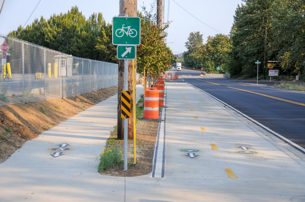
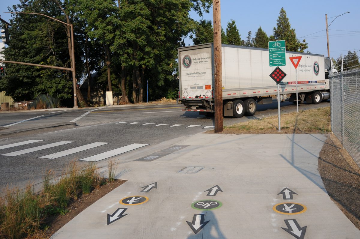
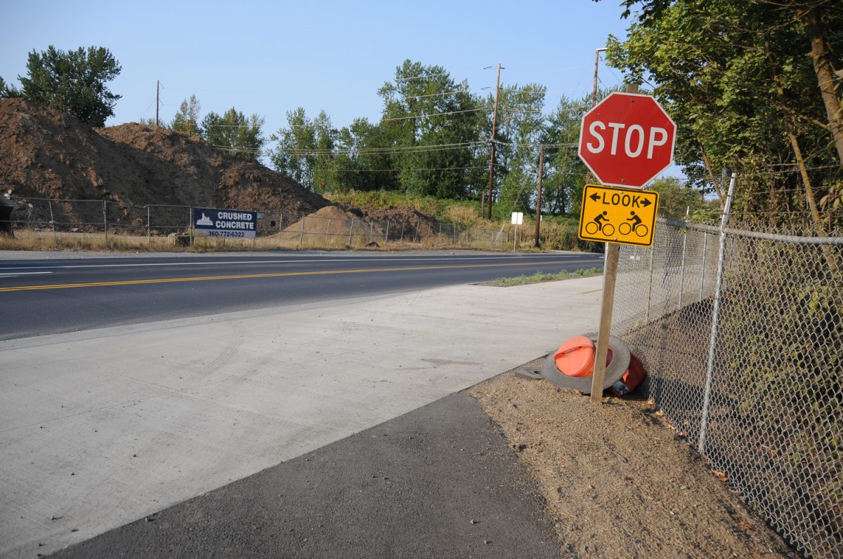
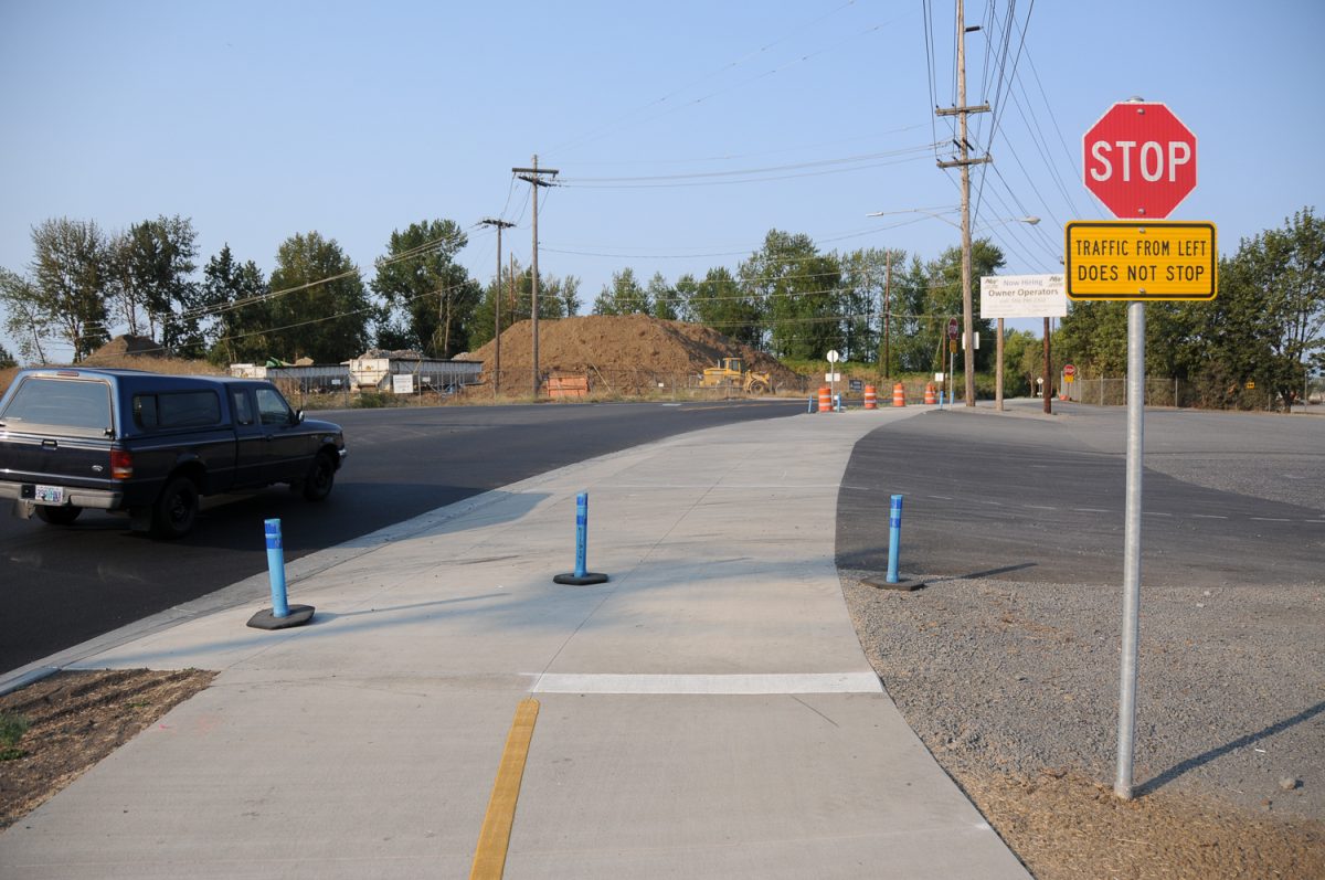
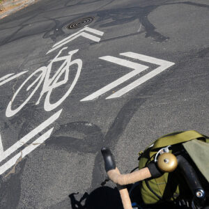
At Sever Road the bike lanes morph into a multi-use path. The path is up on a new sidewalk and there are pavement markings and signs to help on people on wheels and on foot share the space.
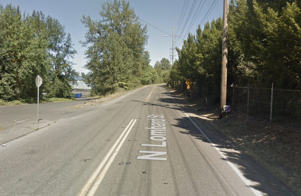
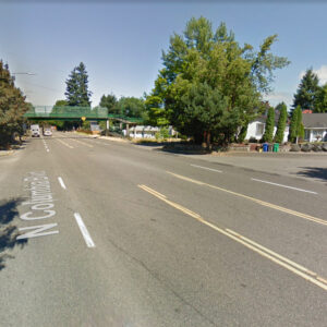
Here’s a before/after of the new path:
After:
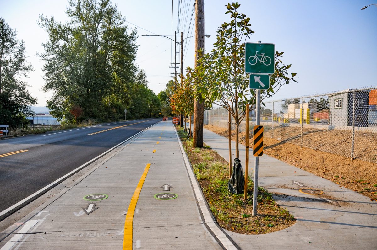
Amazing change isn’t it?
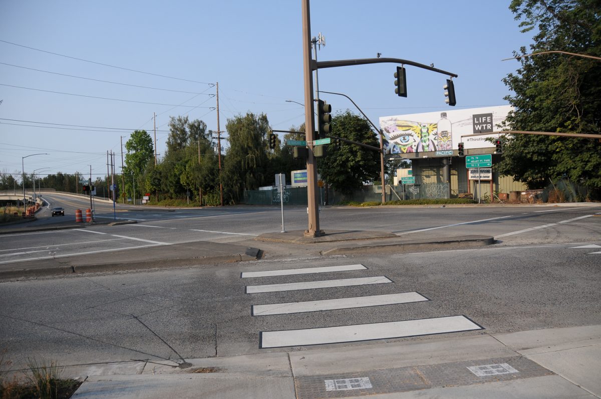
Unfortunately the new path ends abruptly at the Burgard/Columbia intersection.This is a very intimidating place.
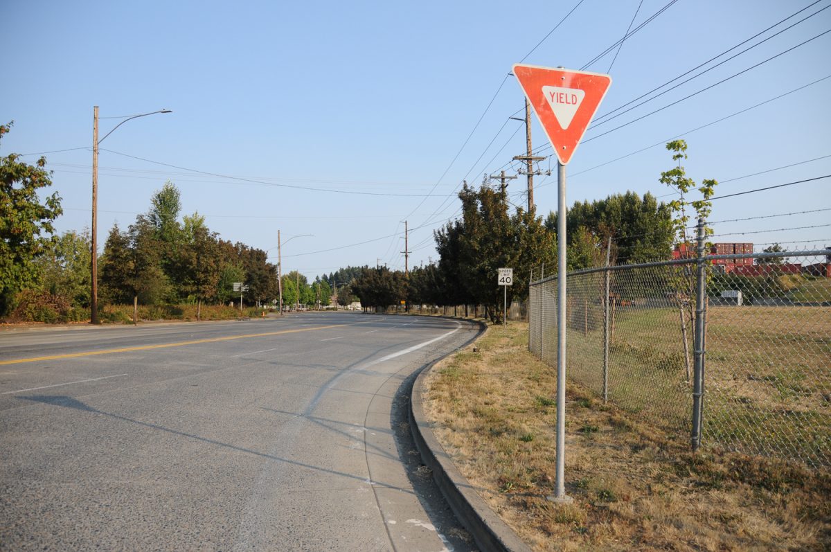
If you want to continue north toward Kelley Point Park, you must negotiate across a slip lane (which many smart cities are doing away with completely) and then deal with high volumes of large truck traffic to reach the bike lanes that continue on Lombard near the Columbia Slough. I’d love to see a bike-only signal at Burgard/Columbia to help get people safely across. Or better yet a tunnel under this intersection might be the best solution. It will also be nice when (not if!) the path continues south onto Columbia to the entrance of Chimney Park — making a very safe and easy loop that would attract a lot of St. Johns residents (there’s already a carfree bridge that connects Chimney to Pier Park).
Overall, it’s fantastic to see PBOT grab an opportunity like this. And it gives me chills to think that physically separated bike lanes are the default treatment whenever they update a street.
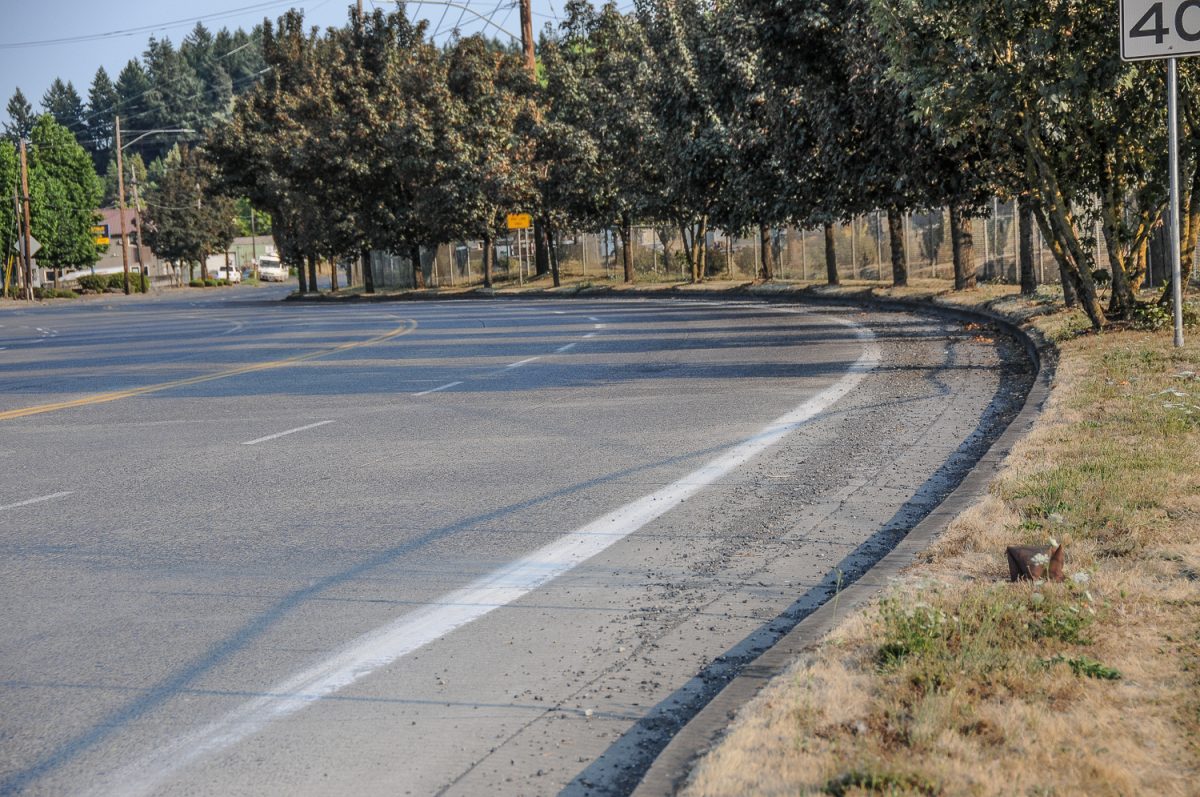
A few minor quibbles: There are a lot of driveways on this bikeway, and with many of the road users driving huge trucks, we might need more aggressive design and/or signage to prevent collisions. I was also surprised at how dirty the new bike lanes were. They are full of glass and gravel and other small bits of road detritus. Maybe that’s from the project’s construction and won’t be as bad in the future. Either way, PBOT needs to keep it clean if they want people to use it.
Once the Willamette/Reno/Lombard/Columbia connection is complete by the end of this year, we’ll have a very welcome addition to the bike network. And when the Burgard/Columbia intersection becomes safer, we’ll have opened up Kelley Point Park and Smith-Bybee Lakes as a cycling option for thousands more people who would never bike in this location otherwise.
Portlander Ben Guernsey is happy to see the changes, even the design has left him scratching his head. Guernsey recalls riding in the “pinch point of no shoulder” in the past. “But my initial impression is it seems a bit over engineered,” he shared with us via message. “Like two bike lanes and a sidewalk would have been just fine.” He also worries about coming off the path into the Columbia/Burgard intersection. “I think I’d feel more visible just in a bike lane.”
Overall though, he likes what he sees. “I’m very glad they’ve done something. I’m sure it’ll be fine. I appreciate the effort in a zone outside of the core of the city.”
Do you ride this location? What do you think of the changes?
NOTE: As of yesterday (8/6) there were two sections of unpaved sidewalk in the portion of new path north of Sever Road. I could ride through the dirt and gravel on my road bike with 32mm tires, but your experience might vary.
— Jonathan Maus: (503) 706-8804, @jonathan_maus on Twitter and jonathan@bikeportland.org
Never miss a story. Sign-up for the daily BP Headlines email.
BikePortland needs your support.





Thanks for reading.
BikePortland has served this community with independent community journalism since 2005. We rely on subscriptions from readers like you to survive. Your financial support is vital in keeping this valuable resource alive and well.
Please subscribe today to strengthen and expand our work.
The Sever Road photo shows dozens of trees removed to add a sidewalk. Why? What kind of traffic justifies the need for a separate sidewalk and bike path versus a shared one?
Frequent large truck traffic, I can only imagine what will happen when the Amazon DC opens.
A decent # of the employees will commute by bike. We have a bunch of bike commuters (including myself) at the FC where I work in NW Industrial. I’m actually really psyched to see this improvement as I’m considering transferring to that facility when it opens. This makes the commute look much more appealing.
I am referring to pedestrian traffic, not truck traffic.
Isn’t the Amazon DC in Troutdale?
1) Looks like those trees might have been owned by the business so they can decide what to do with them.
2) I think it’s more of a design standards question and not a “how much traffic is there?” question.
There was no sidewalk and no space for it. I think whethersit was eparate or cjust a combined sidewalk teither way it would have takenout those trees.
This is pretty awesome as a standard for new paving projects. And wow, PBOT actually implemented curbed separation. I really hope that’s the default with the incoming downtown protected lanes. They do so much more for safety than plastic wands.
“to think that physically separated bike lanes are the default treatment whenever they update a street”
That does sound great. Do we know this to be so?
Hawthorne? Barbur?
That might have been too generous/optimistic of a way to put it. What I mean is that, because former Director Treat issued a memo saying that she wants protection to be the default on all projects (and engineers/planners would have to give an excuse why they couldn’t, instead of the other way around).. this type of treatment is way more engrained culturally at the agency than it was in the past. Of course it’s not ironclad law… But it’s a good step forward when we don’t have to fight for every single project to be done up to modern standards. (that way we can save our energy to fight for bigger things like Hawthorne and Barbur).
Oh, OK. Thanks.
In related matters, why do some comments show up in email after we click the subscribe button, while others (yours above) now don’t?
Ahh crap, just what we need an easier way for people to get to Kelly Pt. Park. 🙂
Serious side note, please, everyone, don’t be one of the Strava chasers on the MUP paths inside the park, those of us who walk there thank you.
I’ve been meaning to ride this section but I’ve only been in the area on weekdays. I’d prefer to maintain my image of peaceful weekend industrial areas instead of dodge truck drivers. The curbs look much nicer than the posts. I like the other paths in the area.
Does anybody know the status of that section of path along the slough that ends in the middle of the woods? It used to be possible to reach the end but it was much more damaged the last time I went down it. Is it ever going to be repaired?
the old Port of Portland/Mikey Jones trail is certainly in sad shape. I understand it will be rebuilt as part of the NP Willamette Greenway trail, but no idea as of timeline. Once the bridge over Columbia Blvd into the old landfill/ SJ Prairie is complete, there still needs to be a bridge from the Prairie across the slough. And remember the Prairie is a superfund site with a soil cap, so any bridges will be complicated and expensive.
I believe the NP Greenway trail will pave the existing gravel road around the north/east side of the landfill. Metro has a permitted and designed bridge to cross the slough, just waiting on funds for the bridge and trail repair. The bridge over Columbia Blvd to the landfill is funded, I think, and should be happening in the next couple of years. I imagine that will put pressure on to get all the way to Kelly Point Park
paved or gravel, the trail around the landfill will still need to cross the slough to Smith and Bybee lakes and connect to the Port of Portland trail ( that crumbling road to nowhere).
Mikey Jones trail..?
Mikey Jones was a railroad guy who noticed the Port and the City illegally filling wetlands around Ramsey Lake. When confronted, the City and the Port ( I am told) did nothing. Legal fun ensued, story I was told is Mikey funded the lawsuit with personal funds. Mikey prevailed.
That now crumbling trail was one of the aspects of that settlement with Port/City. I would love to hear the full story but my few attempts to contact Mikey have failed.
the North Portland Willamette Greenway is planned to cross Lombard at Reno, near this separated roadway project. this will be the transition from Pier Park to the Baltimore Woods.
I do not know if this separated roadway project is considered complimentary or serendipitous to the trail, nor have I explored it yet . But I look forward to trying it out and seeing if/how it improves connections on the peninsula.
My only concern with the new lanes on Burgard Rd./ Lombard St. is that the south bound lanes are on the wrong side of the road! Now I have to cross Burgard Rd., at the nasty intersection and then cross Lombard St. at the end of the bike lane at the south end. This is the biggest reason I do not like this design. With the old layout, I just stayed to the right through the slip lane and then south onto Lombard. Now I have to cross the street twice to get to the same place.
North bound this is Great, Sound bound terrible.
Is the project actually completed? From peripheral vision driving that area, it has looked like there are two sections where concrete hasn’t been poured that would require most to dismount. Those sections have been that way for weeks after seemingly everything else has been done.
The two sections without concrete were still like that as of yesterday. Not sure why.. maybe some utilities or something? I will ask PBOT for an update.
I ride out here all the time, and this new infra is terrible. What a dangerous design. They removed bike lanes and put in a sidewalk that is wholly dangerous to use due to the high volume of perpendicular truck traffic crossing the path at high speeds. I know this area is pretty empty on weekends, but during the weekdays with high traffic volume, the new designs are highly dangerous. It’s very frustrating that the city would remove bike lanes and put in this dangerous and highly technical new “bike” infra – you have to stop every time a vehicle is approaching the bike lane from a side driveway since most drivers are not looking for bikes in these unexpected locations. Cyclists are not given the right of way, forced to stop for all driveway traffic, and the on-road bike lanes are removed, so side path rules are an issue if you don’t want to ride in the danger chute. Two-way counter flow bike paths which cross industrial and commercial driveways should never be used when a traditional single direction bike lane can be installed on both sides of the road. Somebody is going to get killed out here…
I like the bit about the debris on the path and road, this will only accumulate and certainly be forgotten by city maintenance – this is a highly dirty area with all the junk metal and other material haulers with uncovered loads. City can’t design for maintenance – their heavy use of green paint and plastic bollards either creates job security for the green paint crew or will eventually be un-maintained.
Is this the bike lane the loss of which you’re mourning?
https://goo.gl/maps/jZV2SL3wT9T2
That is the one. Note that the crappy bike lane on Google street view starts where you linked to it, than it curves around on Columbia eastbound where it simply and abruptly ENDS! leaving bikes in a terrifying lane with no shoulder and often filled with semi trucks driving over 50 mph. The new design does absolutely nothing to remedy this death trap, in fact, I would argue that the new design lures people into thinking this bike lane will actually take somewhere along a safe route.
Also note that there is another bike lane sandwiched between the right turn lane and the left turn lanes for bike traffic heading north/west. This seems sketchy, but it WAS very simple to get into that lane, and it actually provided a reasonably safe space to wait for the signal and continue on bike infrastructure that connects to Kelly Point Park, Smith and Bybee, etc. The new infrastructure actually makes it more difficult and more dangerous to access this little piece of useful bike infrastructure that allows you to turn left with the signal.
I ride this area all the time – many times a week. This new design is especially dangerous when it crosses all of the industrial driveways with perpendicular truck traffic to the path. The new design routes cyclists into places that drivers, and especially out of town truck drivers, are not used to expecting them to be located. This new infrastructure creates an unnecessary and dangerous situation for cyclists. The city should have used a traditional single lane bike lane (with protection!) on both sides of the road, so there isn’t the unusual counter-flow two-way bike path which puts southbound bikers into a dangerous blind spot for turning drivers (who may not be carefully checking these unexpected locations for cyclists as they turn in and out of driveways and side roads).
Also, lack of right of way is an interesting way to relegate cyclists off the main road way using these separated paths – stop and wait for all turning driveway traffic. I’m not sure this is an improvement. City also removed some previously existing bike lanes to do this road re-alignment, this creates a difficult situation for southbound users.
I’ve ridden this area and along N Lombard for years, long before the improvements. For the first time, today, I used the bridge over the railroad lines from Marine Drive and joined the bike path and new facility until it ends at N Bruce. It is certainly an improvement. A fellow rider and I joined forces to ride from Bybee down to the bridge, then across Burgard to the path. Because of the frustrating gaps, two of them, in the path, she chose to hop on N Lombard and its new, excellent surface through N Portland. I like the contraflow path to N Bruce mostly because you don’t have to cross Lombard at an pedestrian crossing, but the conflicts will always be there with traffic exiting businesses, much of it truck traffic. Yes, as many have noted, it would be ideal to have completely protected bike lanes in all directions, separated by something. But, I’ve ridden out N Lombard without any of that protection all days of the week and have never felt threatened. This area is unlikely to draw casual cyclists and kids, so I’m okay with it for now. My nit is that most of this has been in place for quite some time, yet two sections of the path are not finished. Why?
I really think this is just a freight project. Similar to the proposal at Greelely from Going to Interstate, these projects use freight money to get bikes off the road. A contraflow path is a pretty poor compromise, IMO, and I am surprised at the support it is being given. In a very short distance, this path requires the southbound cyclist to cross Lombard to get on a separated path, then switch to a skinny bike lane on the wrong side of the road creating so many sketchy intersections at each driveway and street, then cross Lombard again and take the lane until you get to a greenway and turn off. There is no way this is safer OR cheaper than simple wand-protected, in-street bike lanes that would also work much better for people biking, but the freight community continues to be very powerful and savvy and they are successfully shunting bikes right off the road. I do not see this as good sign, this looks like bad news to me. I ride the stretch of Lombard between Reno and Columbia a couple of times/month. I think the separation heading north is ok but falls apart at the intersection with Columbia, but the southbound routing is far less than safe than what exists
Astute. Thanks for those observations.
I actually rode this with a friend this past Saturday. I knew something was there but didn’t know how great it was til we got beyond the container yard (traveling back into St Johns). We rode on the north side of the street since the bike path on the sidewalk had two barriers in different locations. Once we came around the curve, it was just wow……a protected two way cycle track. It was nice to ride til it just ended right by the park. So we crossed back over to the west side of Lombard to take Reno to Willamette, you know the rest from there. Overall it was nice. It can definitely be better but I’m not complaining since it’s something.
I came across it last week heading northbound. Initially thought wow this look nice. But then hit the 2 places were its not finished so had to turn around to go back & then go on the road. Got honked at by trucks with that get on your path mentality. I also had the path blocked by a truck sitting where trucks come out from place where containers sit. Then after it ends back to the road filled with typically scree & debris. So all in all while seems neat to so great yet.
This has been one of my regular training routes for the last four years, since moving to Portland. I most frequently ride it on weekends. The two missing bits of concrete are a massive pain, I have 25mm road tires, and I have to divert to the road way before the breaks. When I turn left at the bottom of the hill, I ride on the sidewalk because riding in an unprotected bike lane, full of debris, with motor vehicles passing at 50 mph is suicidal in my view. I greatly appreciate the improved road surface and the protection from the trucks. I have not had an issue with trucks turning out of driveways and not yielding.
Thanks for bringing this up Jonathan, I ride this route with the Tuesday night Wheelman group from Wilshire park. I kind of liked the separated contra bike lane ( we were going north), if just for the novelty, but the consensus of the other 10 riders was a solid thumbs down. The whole thing feels too much like a jumbled amalgam of bike infrastructure and it was filled with debris and broken glass. I don’t think we are going to end up using it on future rides.
Two-way contra flow bike lanes seem great as long as you are moving the traditional direction on the roadway, or if they are in a totally isolated area far from any other traffic – of course they seem great. But, ride them the counter direction, and they are just goofy and simply unsafe when located in normal city conditions with intersections and other types of traffic.
As much as the dream of “separated” bike ways and cycle tracks seem like a high ideal to chase, in reality, and when laid over the existing infrastructure in Portland, Oregon, these are very difficult to make work better than a traditional bike lane. They would be great if you built a new city from scratch,or cut new trails through the hills, then I’m sure they could be done very well. Like it or not, bikes on the road are “vehicles” and they should be placed where they are expected to be – not on sidewalks and not in unexpected reverse flow directions when on the roadway. Look, these are fine for short connectors that bridge a gap around physical obstructions (freeway overpass, railway overpass, and other flyover type infra that are generally off the roadway), but sticking a two-way cycle path right down a curb line of a traditional road is not a good idea.
Let me also remind you of what happens in two-way counter flow bike lanes after the long summer sunny months fade away to 5 PM darkness and headlights coming from bikes and cars. Place yourself on the much discussed and yet-to-be-built N. Greeley downhill between N.Going and N. Interstate after the city installs a controversial and proposed two-way bike lane on the east side of the roadway: you are moving downhill at 5 PM in the winter in a narrow two-way bike chute between the curb and the jersey barrier, there is a long line of rush hour cars and big rigs with their headlights point right at your eyes coming up the hill, just a few feet away from you across the jersey barrier; there are also cyclists coming up the hill at you in the same shared path with their blazing megawatt headlamps going full bore into your eyes – with no separation and just a couple of feet away from you. You need to be able to see to ride down the hill, but you are blinded by opposing traffic headlights on both sides of you – cars and trucks on one side bikes on the other. Of course, as indicated above, the two-way cycle track is never cleaned and has many road hazards and other debris in it, and you have no way of seeing anything. Imagine how great the two-way cycle path is then, and when they build this, they will remove the existing bike lanes located on the correct side of the road for both directions, leaving a cyclist with no safe option but to find another road to use. Again, a poor design, but for reasons that are hard to imagine until you encounter them after it has been built. I doubt the city traffic engineers, perhaps even taking cues from all of the drum-beating on this blog about how great two-way cycle paths are, will consider these types of details, along with all the other obvious short-comings of these designs. It will be much less safe than other options they can design where cycles are allowed to ride where cycles belong, in the roadway, on the right side of the road – add some separation and be done with it.
I rode this contra-flow on-street bike lane again, and noticed another issue that was surprising for riders in the counter-flow direction (south on Lombard). When passing large, fast-moving trucks moving in the opposite direction at close range, e.g. using the two-way cycle path with on-coming 45 mph truck traffic, as is common in this location, a rider will encounter a large and sudden air buffet of wind from the on-coming truck. This was surprising to me, and very unusual to encounter on a bicycle. I am used to these air blasts when getting passed in a bike lane going the same direction as the vehicle, but this is an entirely different experience – when you are riding the opposite direction, the impact of the air pillow to your body is quite different and I think much stronger, and the rider of these two-way lanes is just as close to the vehicle as in a traditional bike lane. These two-way bike lanes put the rider head-on against on-coming traffic with about a 3-5 foot separation, which increases risk and hazards to the rider from headlights, flying debris, and air blasts – each now directly confronting the rider, especially from large, fast-moving trucks, as are common in this area.
I am no lover of bike lanes (I think cars should be slowed down and all lanes should be consciously shared lanes. (I know dream on.)) but this is an excellent place for one. Trucks are bad at sharing and I believe a strong case exists for separate infra for them funded by the industries they support.
Can you add tolling for bikes to help pay for the congestion they are causing region wide?
Interesting suggestion. The bike lobby will put this on the agenda for next month’s meeting, but first we need a better understanding of your plan.
I have some follow-up questions, to get the ball rolling:
1. How are bikes causing congestion? I assume you have some studies you can cite, in addition to anecdotal evidence. This is the first time we have seen this claim, and we would like to know more.
2. Who exactly would be tolled, how would it be collected, and how much in additional fees are required from cyclists to offset the congestion they cause? I assume you are familiar with the external costs of cycling as it compares to driving, as well as how general taxes are used to subsidize road construction & maintenance/gasoline/law enforcement/medical/environmental/military costs associated with each, to help you determine the ‘fair share’ that should be collected. Show your math.
Rode this a couple hour ago, and they have the entire concrete cycle track section closed-off, but it looks like they’re filling in those gravel sections mentioned in the article. Luckily they have the adjacent lane coned off and you can just ride there. Motor vehicles take turns using the other lane, controlled by flaggers.
The south end of Lombard of this section is my commute. I welcome the dedicated bike lanes but I agree with most of the responses that the contra flow seems misguided. I assume they thought it would be less costly to install the poles on one side…? The only benefit I can see to this is that commuters from area business don’t have to cross the road to get onto the bike path (most of them are on the bike lane side of the road). However, I doubt this was the intention. The debris in this area is unavoidable regardless of the design. I’ve had nails in my bike and car tires here. Debris is always going to flow to the curb. The only way to avoid this would be a bike path on the sidewalk, above the curb, which is far more expensive. If you don’t want to deal with it, don’t ride in an industrial area. I would also add that the commuter bike traffic in this area is very very minimal. In the four years I’ve been commuting here, the majority of cyclists are there for training, not commuting, and even that is a low number and perhaps higher on weekends when the truck traffic is nil. The lane is welcome, though I’m not sure it’s a priority.