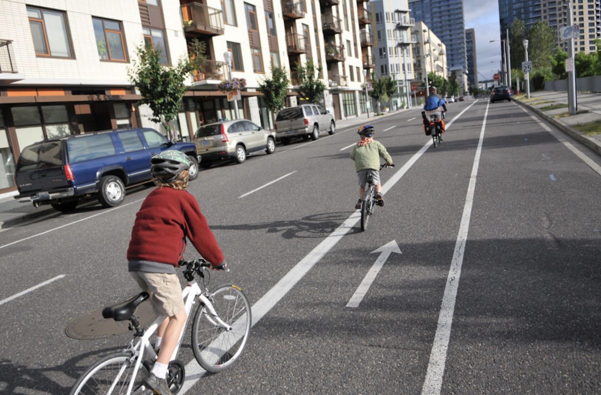
(Photo: J. Maus/BikePortland)
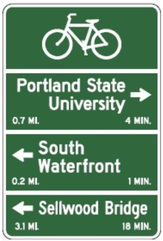
20 new wayfinding signs are coming to South Waterfront. This week the Portland City Council accepted a $13,460 grant from Metro that was awarded through their Regional Transportation Options program in 2016.
“Simple bike wayfinding signs displaying distance and time to key destinations will help current and would-be riders to understand bicycle accessibility to and from the South Waterfront,” reads a project description. “The signs will be strategically placed at intersections throughout the district , with the southernmost signs encouraging riders to venture to Willamette Park along the rail trail, and the northernmost sign displaying information to ride to Downtown and the Pearl District. Additional signs will direct travelers to the Hooley Bridge, Lair Hill access, and the Tilikum Crossing and access to the Central Eastside.”
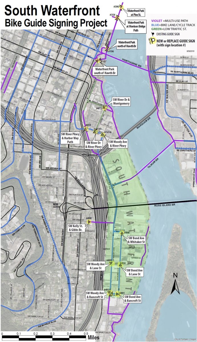
Check out a map of where the signs will go below the jump…
Advertisement
Metro hopes the project will encourage people to get out of their cars and onto their bicycles, resulting in better air quality and less auto parking demand.
A map of sign locations provided by PBOT shows that about half of the 20 new signs will be installed south of the Marquam Bridge, and the other half north of it. The signs will stretch from Waterfront Park at Pine Street in the north to SW Moody and Bancroft in the south.
PBOT says they expect to have all the signs installed by the end of June.
— Jonathan Maus: (503) 706-8804, @jonathan_maus on Twitter and jonathan@bikeportland.org
Never miss a story. Sign-up for the daily BP Headlines email.
BikePortland needs your support.



Thanks for reading.
BikePortland has served this community with independent community journalism since 2005. We rely on subscriptions from readers like you to survive. Your financial support is vital in keeping this valuable resource alive and well.
Please subscribe today to strengthen and expand our work.
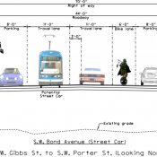
It’s really frustrating that we ended up with these horrible door-zone bike lanes in the South Waterfront. Between the vehicles parked over the line, random doors flinging open, and double-parked trucks/Ubers, the lane is quite hazardous. I hardly ever feel safe using it. Eliminating street parking and creating protected lanes here would be a big improvement.
Don’t you know the 28th amendment (imaginary) says that no entity shall act to restrict the storage of automotive private property in the public right-of-way. Its interesting that if we have extra sporting goods etc. we have to rent a storage unit on private property to put them in, but if we have extra motor vehicles we can stash as many of them as we like along the publicly funded street ( limited by restrictions in a few areas).
It’s also frustrating that PBOT passes by opportunities to get private developers to upgrade substandard infrastructure, such as the door zone bike lanes in South Waterfront.
There’s a large apartment development about to start construction on the west side of Moody, between SW Gaines and Abernethy. I haven’t seen the Public Works Plans, but they will almost certainly include construction of new concrete sidewalks to replace the asphalt sidewalks built (I think) in the 2000s. They almost certainly *don’t* include the creation of a protected lane, which would be so easy to incorporate into the construction of the new sidewalks.
This solution by PBOT/Metro is somewhat hilarious to me. The people mostly using parking here during the week are OHSU workers. It’s a poor use of parking if people are running out every 4 hours to top up the machine for a 10 hour stay. Then there’s the OHSU commuters who park on the street across from Schnitzer Lot and under the Marquam Bridge because there’s no parking meters and low enforcement. Same with Sw Harbor Way near the end of the MUP.
This is fine, to add signage, but the real improvement is for PBOT to stop building new East West roads in the S Waterfront with street parking on both sides and only sharrows. When OHSU redevelops more, there will be a few new roads and the plans only call for sharrows. The roads will connect future Bond Ave extension (adjacent to the river and pending Zidell development). Sure it’s only two blocks but every building here also has underground parking. Why do we need the street to have two sides of parking?
Other issue is that the current Moody bike lane after the OHSU portion is entirely in the door zone and next to streetcar tracks. There’s nowhere to swerve if someone does swing open their door.
The Bond Ave bike lane is also door zone. At Gaines St and Bond, the parked cars create low visibility and E-W drivers either just cross like idiots without looking or encroach significantly into the intersection before gassing it.
What I’m saying is… parking is the problem here… not wayfinding signs. Make the two lane street 1 lane and make the other lane dedicated for the streetcar. The solution is pretty simple but like with most transportation issues, requires leadership.
” It’s a poor use of parking if people are running out every 4 hours to top up the machine for a 10 hour stay.”
You can’t legally stay more than the max listed hours, even if you feed the meter. If the meter on that block has a big number above it then that’s the max time you can stay on that block face. You can’t just feed the meter, you have to move to another block face.
Well, yes, but do you have an army of 1000 parking officers? Parking in the bike lane is illegal but I also see that happen a lot too. This is what happens daily at the S waterfront… feel free to sit at the Moody & Schnitzer Parking Lot intersection at 8am and watch the commuters park for free and hope the parking officer doesn’t come by (once per 2 weeks, a $50 ticket isn’t so bad). It’s $15 per day at ohsu or $150 every two weeks.
Crowdsource it. If anyone with a smartphone can issue citations, violations will disappear fast.
These are horrible signs and don’t give you information on where you’re going or how to get there. They need to have a mini map that shows the path to each of the stated destinations.
These are basically the same signs we’ve had for a decade. No improvement.
…threading fail…
Not discounting the door zone issues that others have pointed out, I find the wayfinding signs around town so very helpful, especially when I’m in a ‘new part of town’. Just last night I was riding in NE and some of the streets had been newly paved (yeah!) but the sharrows were painted over (boo!) and I missed two turns because I didn’t know that’s where I wanted to go :). And there weren’t any wayfinding signs. I don’t like to always need to have Google tell me how to navigate and weirdly the sharrows and signs give me more freedom to ‘roam’ but still get home than others.
Of course in the part of Portland that I ride all the time I rarely pay attention to and often go my own route instead of the designated one, but if you’re not used to a place they are a great help!
Odd that the map doesn’t show SW Bond Avenue, which must be close to opening, or any signage directing people onto it from the Tilikum Crossing.
These are horrible signs and don’t give you information on where you’re going or how to get there. They need to have a mini map that shows the path to each of the stated destinations.
These are basically the same signs we’ve had for a decade. Not an improvement.
I feel like they work well when they’re paired with a good set of sharrows. I have had problems though when sharrows were left out indicating upcoming turns. It’s not particularly helpful to have one after the turn so that you have to be constantly keeping an eye out, especially at night.
That exactly it. They give you a vague direction and then rely on spotty sharrow markings to guide you. There are places where losing the route puts you in hostile traffic areas.
“What did you do, Grandfather, to avert the climate catastrophe?”
Why, I created signs to encourage drivers to ride bikes instead! And it *really* *worked*!! 😉
The project’s description is a bit weird: “…with the southernmost signs encouraging riders to venture to Willamette Park along the rail trail…”
There is no “rail trail”. There’s the Willamette Greenway Trail, along the river, which sometimes is near the rail line, but often not. Walking or riding along the rail line is illegal trespassing.
I had to venture through the south waterfront area recently. Even after checking the route on maps, I still ended up in the middle lane of a busy road, unable to get to the curb because of the tram tracks. Then there was the elevator? That I had to take to get to where I thought I was supposed to go, but ended up going the wrong way as there were no signs visible when I got off. Return trip was a little easier, but I still had to improvise a route after turning off the trail at the wrong spot.
Will signs help? Hope so but as it stands, south water front is a place I will ride only if I have no other choice.
Oh, come on—where’s your sense of adventure? Shouldn’t planning a bike trip of more than 1.4 miles be as much “fun” as planning a backpack trip through SE Asia?