(Photo: Jonathan Maus/BikePortland)
13 years after it was officially identified, the City of Portland plans to finally close a major gap in the Springwater Corridor.

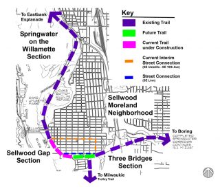
Known as the Sellwood Gap, the popular paved path currently ends at SE Umatilla, forcing bicycle riders into a one-mile detour on surface streets before joining back up with the path at 19th and Ochoco (across from the Goodwill Outlet Store).
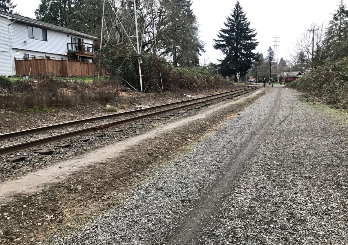
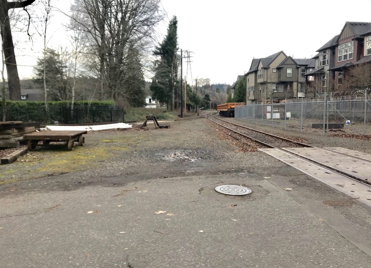
Now the Portland Parks and Recreation bureau is just weeks from breaking ground on a $1.83 million project that will close a half-mile of the gap — the section between Umatilla and 13th. Funding comes from a federal grant and Parks System Development Charges (fees paid by developers). Construction is due to start the first or second week of February and be completed by August of this year. Like other parts of the Springwater Corridor right-of-way, this section is adjacent to railroad tracks owned by Oregon Pacific Railroad. Metro, our regional elected government, acquired easements to build this section of the path in 2010.
Please subscribe or donate today!
The project will make a direct and seamless connection from Umatilla to 13th. Once complete, the new path will end where 13th becomes SE Andover Place, just outside the entrance to a enclave of homes adjacent to Waverley Country Club. Despite the stone walls that mark the entry to this neighborhood, bicycle riders are allowed to use the streets. As some of you may already know, this neighborhood provides a quiet and low-stress way to connect to the path on SE 17th that goes to Milwaukie (but rumor has it they are not fond of “bicyclists” so I won’t be surprised if they make protest noises once this project is completed).

Advertisement
[pdf-embedder url=”https://bikeportland.org/wp-content/uploads/2019/01/springwater-missing-gap-study-2006.pdf”](Springwater Missing Gap Report, Alta Planning + Design – 2006.)
By this August, the remaining gap in the Springwater Corridor will be only 2,000 feet (or 0.4 miles). In 2015, Metro negotiated the easement rights for the segment between 13th and 17th avenues. While there’s not timetable for that section, Parks says the planning process has started. Once it’s built we’ll be a tantalizing 450 feet or so from a full connection of the path. That final section won’t be as simple or cheap as adding pavement next to a rail line because the City of Portland will also have to build a safe crossing over 17th.
You can get a sense of design and planning recommendations for the future connection by looking through the 2006 Springwater Missing Gap Report embedded above.
Once this section is paved — except for a short stretch between OMSI and SE Ivon Street (thanks Ross Island Sand and Gravel!) — you’ll be able to bike on a relatively carfree path for about 8.5 miles between the Rose Quarter and (south of) Milwaukie using a combination of the Eastbank Esplanade, Springwater, and Trolley Trail.
Note that no closures or detours will be required during this project. However, if you this section of path (which is unpaved, but open to the public), expect it to be closed during construction.
For more info, see the project website.
— Jonathan Maus: (503) 706-8804, @jonathan_maus on Twitter and jonathan@bikeportland.org
Never miss a story. Sign-up for the daily BP Headlines email.
BikePortland needs your support.


Thanks for reading.
BikePortland has served this community with independent community journalism since 2005. We rely on subscriptions from readers like you to survive. Your financial support is vital in keeping this valuable resource alive and well.
Please subscribe today to strengthen and expand our work.
Bummer. There goes that fun bit of the Springwater. Guess it was fun while it lasted.
Never fear, the city of Portland will be upgrading 50 miles of dirt and potholes to a network of intermittent gravel trails throughout the city for the benefit of urban gravel fans, lets rejoice.
https://www.oregonlive.com/expo/news/g66l-2019/01/e06812986d2229/portland-will-fill-potholes-le.html
While I’m sure that upgrade of dirt and potholes will be nice for motor vehicle users, as a bicyclist I’ve never met a Portland unpaved street I couldn’t enjoy riding through.
Exactly what I thought!
+2
+3
That was my thought too. I never let the gravel and ballast rocks stop me riding through there, although for the record I support this project.
This section was decidedly less fun on a skateboard.
YESSSS! Increasing all ages, all abilities access to biking and the greater Springwater trail is good for everyone! Despair not for the lose of gravel. Plenty still abounds nearby within Brentwood-Darlington and Woodstock, just north of the Springwater!
What? How does this improve any of that. Currently, the path ends at a greenway on Umatilla and connects to SE 19th also a greenway (with a signal crossing at SE 17th) with direct access to the path. What you’re applauding connects to SE Linn, which from SE 13th to SE 17th is a major cut through route for vehicle traffic and does not have a signal at SE 17th. Of course, one can ride through Garthwick and end up at Ochoco and SE 17th, but that is no longer a 20MPH zone and cars/trucks know it, so have fun crossing with your all ages and abilities there.
Incremental development. Don’t lose sight of the forest while looking at the trees. This is a small step towards a connected Springwater Corridor that eventually will not detour through side streets. It won’t happen this year and the crossing of 17th at Ochoco is a significant barrier that has already been identified in the linked reported in BikePortand’s article. This small piece is not an end but a step towards that all ages and abilities path coming into existence. Chin up!
This is great news. Still a two-putt from completion, but I’ll take it!!
Finally. I’ve been waiting about 12 years for this project.
I’m sure the money is earmarked for projects such as this, but damn that gravel is rideable and where else could $1.83mil be used more effectively? That’s a lot of bikes for tykes at the very least.
I hear you Mike C. But that type of sentiment doesn’t make the best policy/projects. Connected paths are greater than the sum of their parts. The gravel might be fine to you; but we’re trying to get all types of users to be able to benefit from assets like this. Imagine someone pushing a child in a stroller, someone in a wheelchair, someone on crutches, someone afraid of the undeveloped vibe of the current path that’s not nearly as safe as other sections. We must complete these paths. It’s extremely valuable to our community. Let’s not go down that road of zero-sum funding debates. We have the money to do lots of other stuff… And completed path networks — while expensive — will help us create the political will and public constituency needed to spend more money on other good stuff.
I’m all for bike trails and I’m sure this ($1.83m!) extension is needed and will be nice… but I too will reminisce about that bit of gravel. Since there were very rarely pedestrians or other cyclists on that sector it often became a point of attack when riding with the lads. And if I was riding my CX bike with big tires I’d sometimes ride the rough stuff all the way to 13th. Alas, progress surely wants to tame us.
Still plenty of gravel all over the city. The Springwater is a really important transportation corridor, and it should be fully paved with no gaps.
That’s $346.59 per foot if my math is right. I’d love to know what it actually costs just to pave it without all the bureaucracy that ends up adding to the overall cost?
You’re talking about a paved path adjacent to a functioning rail line. There’s going to be more than just a paved path if you want a safe path. Keeping the users from accessing the rail line is going to add to what seems like a simple paving job.
And there are several street crossings. At each street crossing you need bollards set in concrete to keep scofflaw motorists from driving on the path. That adds a lot of cost.
Actually, it crosses Umatilla, Harney, Marion, and ends at Linn. All of those crossings already have bollards and small sections of asphalt already installed. So there goes the need for those…
For just a 12′-wide AC paved path, excavation, base rock and 4″ wearing surface, is about $264 per foot. Add to that crossing treatments, maybe fencing, and that is the right ball park.
That final section won’t be as simple or cheap as adding pavement next to a rail line because the City of Portland will also have to build a safe crossing over 17th.
“Over” 17th? Wouldn’t a traffic light and a wider sidewalk on Ochoco do the trick?
You’d think. 🙂
The path also has to cross over from the west to the east side of the rail line at some point. Might be best to do that at 17th.
Anything that crosses a street is considered ‘over’ it in engineer-speak. Signals start at around $300k each.
$300K for a signal to help close the-second-to-last gap in an almost-continuous trail from the Steel Bridge to Boring seems like a bargain to me.
What’s the over/under on connecting the springwater from where the gravel ends to where it picks back up at 19th? The number of overtly aggressive motor vehicle operators I’ve had to swerve to avoid on Linn st would absolutely blow your mind.
I’ve fatbiked the “gravel” from Linn to 13th, it’s… not passable.
Shoot Andrew, you should try walking your dog(s) on Linn on a daily basis. The stop signs at 15th and 16th on Linn aren’t even viewed as optional. People flat out drive through them like they’re not even there or their cars are the newer models that don’t feature brakes.
Also, my 40s roll just fine through that gravel section from Linn on. Maybe we should do a team ride through there so I can give you some pointers. 😉
I hear a Pedalpalooza ride in the works forming in this comment here! Ride leader, Eric??
On Google Maps it looks like SE Andover Place is one-way going West. Is that the case on the ground? If so, it looks like it will be shortest to divert to SE Linn when going to the 17th Ave. path from the North.
We are so pleased to see another gap being filled! The Springwater Trail is a very important part of the 40 Mile Loop.
There are a lot of entities that have made this possible. Please don’t forget to include all the work that 40 Mile Loop Land Trust has done to push this along and close another gap in the 40 Mile Loop. We look forward to closing more gaps in the near future. (e.g. see recent articles about Marine Drive Trail)
> rumor has it they are not fond of “bicyclists”
I’ve ridden through Garthwick, as that neighborhood is called, thousands of times over the past 13 years and have never had a negative interaction with anyone there. (Well, I don’t like all the leaves in the road during November and December, but that’s off topic.)
So I’m interested to know what evidence leads to such a “rumor.”
I am willing to bet it is possibly from some (lazy) cyclists entering Garthwick from the North and then taking the first left which is actually a (very well indicated and signed) one way street rather than proceeding for another block or two. What is interesting is that going the wrong way one way, is actually a Strava segment and people in the neighborhood haven’t even protested that, so I would also like to know where a rumor like this was started and perpetuated by someone who has ridden through there once in the last year.
That’s probably a good guess. I always go oh-so-far out of my way (that’s sarcasm) to use the correct eastbound street, so I’ve never encountered anyone who has the audacity (more sarcasm) to suggest that cyclists honor the one-way designation.
Well, since I live like 3 blocks north of Garthwick and ride through there on a weekly basis (in the correct direction) I can tell you that they added a nice little sign under the Do Not Enter sign that says something to the effect of “this includes you bicyclists”. It isn’t an official sign, but it sure looks like it. Google maps image from the Andover/Exeter intersection is from April 2016, so it has been added since then.
It seems the work has started. There is a trail closed sign where the gravel section begins after Umatilla.