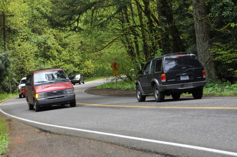
(Photo: J. Maus/BikePortland)
Everyone’s buzzing about the opportunity to tell Multnomah County what to include in their 20-year Roads Capital Improvement Plan (RCIP). OK, maybe it’s just all the activists in my feeds and inbox. Either way, they know a good thing when they see it.
 The County is a sleeper agency. Even though they manage only about 1/8th the road mileage of the City of Portland, the County’s roads happen to be some very important bike routes. And as an agency, they’re much more accessible than their larger cousins at the city, region, or state level. For those reasons alone, the RCIP is ripe for input and we should embrace the opportunity to influence it.
So: What does the RCIP include? It doesn’t include the County’s bridges over the Willamette River; but it does include some of the most popular streets for cycling on the west side. Ever ride up NW Cornell and Thompson to Skyline? That’s the County. Ever climb NW Newberry or McNamee? County. And the beloved Sauvie Island loop? Yep, that’s their jam too. They also own lots of the great backroads surrounding Corbett and Troutdale near the Sandy River.
Here’s a detailed map of the roads included in the RCIP.
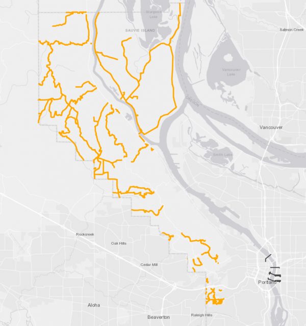
Why is this on the BikePortland Front Page? Because the County is putting together a project list and we are their eyes and ears as to how they can make these roads better for bicycling. “This is the first time in decades that the County is really digging in to understand its roads and make an in-depth plan,” states the County website. “Many more people live here now than 10 or 20 years ago, and more get around without a car.”
Advertisement
The type of projects that the County says could be included in the RCIP are things like, “widening shoulders for people walking and biking”, intersection safety projects, or new multi-use paths.
Personally, I’m going to request that the County designate sections of Skyline Blvd (between Thompson and Old Cornelius Pass) as a “Bicycle Safety Corridor”. As such, I want them to add: more signage calling out the designation, paved bicycle turnouts every few miles, and I’ll even mention my hope for a new policy of doubling traffic fines inside the corridor boundary.
Jessica Engelman, former Chair of Bike Loud PDX said she asked the County to include: separated biking and walking paths from the Springwater/Blue Line MAX Station to Oxbow, Dodge, and Milo McIver Parks; and a separated bike/walk loop around Sauvie Island.
Jessica also had these positive things to say about the online open house itself: “I’m really impressed with whomever at Multnomah County composed this survey, since they already ask a lot of questions about active transportation and safety priorities; it implies the county is poised to do some great things with the right public support. This is a vision-setting survey, so be creative and bold!”
What are your ideas? Please let them know or you lose your right to complain later.
If you’d like to learn more and talk to County officials about the RCIP, swing into the offline open house coming up at Skyline Elementary School on Tuesday (4/10) 6:30 pm.
The County will finalize the project list by end of this year. Check the RCIP fact sheet for more info. And don’t forget to take the online open house before April 15th.
— Jonathan Maus: (503) 706-8804, @jonathan_maus on Twitter and jonathan@bikeportland.org
Never miss a story. Sign-up for the daily BP Headlines email.
BikePortland needs your support.



Thanks for reading.
BikePortland has served this community with independent community journalism since 2005. We rely on subscriptions from readers like you to survive. Your financial support is vital in keeping this valuable resource alive and well.
Please subscribe today to strengthen and expand our work.
Several streets in Gresham and East County are also Mutnomah County. Are they also in the RCIP?
I think Gresham was given control of many streets in the city many years ago. However, there are several main roads on the east side that Multnomah County owns and maintains.
Multnomah County does have many roads in east Multnomah County that are part of this plan. We do not have any roads in Gresham or Portland.
Jonathan,
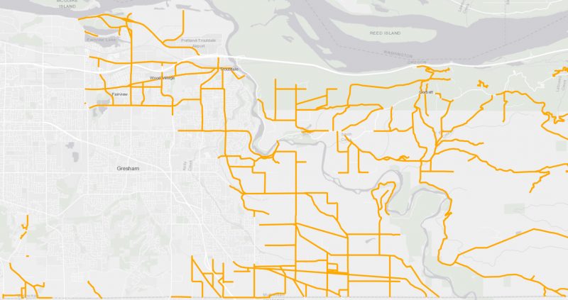
If you have time, it would be great to add another image showing the county roads east of Portland. While the county roads in NW Portland and Sauvie island are important for recreation, many of the county roads north of Gresham are major suburban transportaiton routes, as well as routes to recreation in the Gorge and rural Multnomah county.
Just open the map that was linked in the story:
http://multco.maps.arcgis.com/apps/webappviewer/index.html?id=1c2b65c9a8f547f490783374cb7244b0
First of all, fill the potholes.
This questionnaire does not ask for the maintenance requests. Preserving Oregon Roads calls for the ban of metal studded tires, though.
Rick,
Good point. This plan is for capital projects, not maintenance projects. Maintenance projects are generally small work that we do ourselves and does not require an engineered design. If a road has many maintenance issues, it could be so bad we need a capital project to design and repair it. So if you want to report a county road that has very poor pavement, feel free to share that for this plan.
1) get a few cycliq cameras
2) just take the lane
3) if others get upset, kill them with kindness
Have you tried this out in Corbett during rush hour?
I rode Corbett every day in rush hour for a couple years.
My experience is that being considerate and being assertive are not ideas in conflict. I personally find Corbett easier to ride uphill in heavy traffic than downhill when I can easily pace any motor vehicle but need to watch out for hooks, threats from the sides, debris, etc — especially in the darkness and wet.
I’m generally a “take the lane” type of rider, but that’s not reasonable when slowly grinding up a hill in traffic that should be moving much faster than me. Rather, I ride in a way that pushes traffic over so I have sufficient clearance, but drivers also can get through.
I’m a confident, assertive cyclist. However, “take the lane” is a pretty stressful strategy going up Cornell during rush hour.
Agreed on Cornell.
There are no silver bullet strategies — I adjust depending on a wide variety of factors. Having said that, I find there are few circumstances where maintaining a calm, assertive, and considerate mindset isn’t a good way to go.
Cycling has no chance of expanding its appeal if people can’t ride where they need. Given how much energy it takes to get even paint on the roads here, that if we want more people riding, they need to be able to do it on the roads we have.
If someone consistently has trouble on a road where others don’t, there is most likely and adjustment they can make that will make the experience better.
Chris’ reply indicates to the previous message indicates he thinks taking the lane on that Corbett at rush hour is a bad idea — and I agree (at least for uphill). So Brad, what do you think would have been an appropriate reply to Chris? You seem offended that I shared a strategy that I’ve successfully used hundreds of times in an area that he clearly finds problematic.
If you have a constructive suggestion that differs from mine and works for you on Corbett at rush hour, please do share.
Jonathan – thanks for daylighting this opportunity to a larger audience
Where is the Springwater/Blue Line MAX station? Maybe Green Line was meant? Shows that somebody doesn’t use them enpough to know.
I think she was referring to the Gresham Max station, which IS the blue line? Although the springwater corridor isn’t technically along the blue line, the part that runs through Gresham is pretty close to the station, and it would be nice to have a walking and biking connection from that area to the three parks that she listed. Oxbow park is probably the most realistic since the county controls more of the roads around it.
I believe that refers to the Gresham Central TC MAX Station, about a half mile from the Springwater Corridor, and a way to eliminate around a dozen miles of cycling to get from central Portland to the outer reaches of that path.
Hmm. Gotta disagree with this reading of the suggestion. I read it as biking and walking paths from both the Springwater Corridor and the eastern terminus of the Blue Line MAX station (i.e. Cleveland Ave MAX Station and possibly Gresham Central TC MAX Station). With that said, I agree that both would be extremely appreciated and needed for weekend bikecamping trips with my family!
A great opportunity for the county to focus on north / south roads !
Aren’t Dodge and McIver in Clackamas County?
Jonathan: Your Skyline proposal seems quite timid. Why not a multi-use path or something? Is that a ROW issue?
Something on Sauvie would be a game changer for me. I really want to enjoy the island by bike with my family, but there’s just no way I’d do it as things currently stand.
Some have left new comments on the County map lately about installing uphill bike lanes on Skyline Blvd in strategic areas. A lot of NW Skyline Blvd by Forest Park is under the control of Portland and a PBOT map shows possible indication of a future, lower speed limit.
Cornell Road and Skyline Blvd in “Forest Heights” should have been upgraded with bike paths at least 20 – 30 years ago when they started building all those houses up there. I grew up biking these roads since the 1970s, rarely seeing a car and even getting caught behind the occasional tractor. The roads have hardly been improved since then, even though the traffic has increased at least a hundred fold and the speeds of the traffic has gone from 20 – 30 mph to 40-60 mph. I avoid Cornell like the plague and only occasionally bike Skyline now. I consider myself an assertive bicyclist, but I don’t want to surprise some car or cement truck by being on the road as they come around a blind curve at 50mph (and perhaps meet another vehicle coming the other way at the same speed.).
What changes do you want on county roads ?
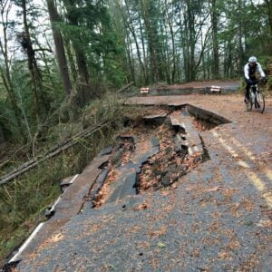
Applies to the entire West Side pretty much (Thompson, West Union, Springville, etc.etc.etc.). But if they can’t even reopen Newberry road more than a YEAR after the mudslide, I’m really wondering how all these improvements get funded.
And before you all say it, yes, I know most of my complaints are for Washington County roads… 😉
Why should Newberry Road be repaired?
I saw the 1990 Mulnomah County Bicycle Master Plan shows SW Scholls Ferry Road as a planned bikeway. That is a long time to wait. Just make NW Newberry Road as a walk / bike / skateboard-only road by the landslide and spend that $1,900,000 on outer Halsey and SW Scholls Ferry Road.
Why should Newberry Road be repaired? There are less than 30 homes on that road and no known businesses.
Cover the ditches on Cornell and Skyline to make bike paths on the shoulder/widen the road.
Portland’s sewer department did that while working with PBOT on SW Maplewood Road and SW Garden Home Road. Even Washington County did that on SW 92nd Ave by Garden Home Road.
I live along Haines Road in Corbett area. Other than fixing potholes, I don’t see what the county would want to change in the area east of the Sandy River. I regularly ride both weekdays and weekends on various roads; pretty light traffic just about anytime. Obviously the HCRH is a different issue; hordes of tourists and bicycles on warm season weekends. I never ride that on weekends except before 10am.
Would you like a change on outer Halsey ?
Wider shoulders at least on uphill sections and lower speed limits on roads like Cornell, Skyline, Springville, etc. would be fantastic. As another mentioned, it feels seems that absolutely nothing has been done to improve these roads since they were farm roads, and now there are huge numbers of residents and commuters using them. At a minimum, lower speed limits should reflect the amount of traffic and the high number of pedestrians and cyclists using narrow roads.
Not sure if it’s possible, but bans or limits on heavy industrial trucks on these roads would also vastly improve safety too. With all the construction, there are so many heavy industrial trucks using these narrow roads it’s very dangerous for drivers much less cyclists.
People have been pushing the county to put in a lower speed limit on SW Scholls Ferry Road to match the one from adjacent Washington County. It is possible for change.
Please tell commissioner Sharon Meieran and spokesperson Mike Pullen that Washington County received permission from ODOT to lower the speed limit back in 2009 (or so) for SW Garden Home Road for a county road in unincorporated Washington County (Garden Home) from 30 to 35 mph from near 76th Ave to 92nd Ave. This was for a residential area, but with nearby businesses and a THPRD recreation center.
Bike lanes for climbing on Cornell, perfect world for both directions. Bike lanes and sidewalks for Miller Rd. It’s flat out offensive that Miller doesn’t have even so much as a sidewalk with as incredibly wide as that road is and as much as we have begged for said for decades.
I’m at the point where I’m beyond disgusted with MultCo and their consistent unwillingness to address issues with these roads. It takes us months to get potholes causing people to cross centerline on an arterial like Cornell fixed. Even after they’ve been reported. The massive safety issues fundamental to road design (in 45mph zones!) are even worse. WE SHOULD NOT HAVE TO BEG FOR DECADES FOR SMALL SAFETY IMPROVEMENTS.
NW Miller could be a nice place to ride a bike or walk. Please tell them in the online comment map form.